
.webp?language=en-US)

.webp?language=en-US)
Heat Health: A pre- and 5-year post-occupancy thermal case study

Excellent visualization and transferable results for practitioners. Much-needed data to influence public policy on the UHI effect and the importance of streetscape improvements that include shade trees.
Awards Jury
-
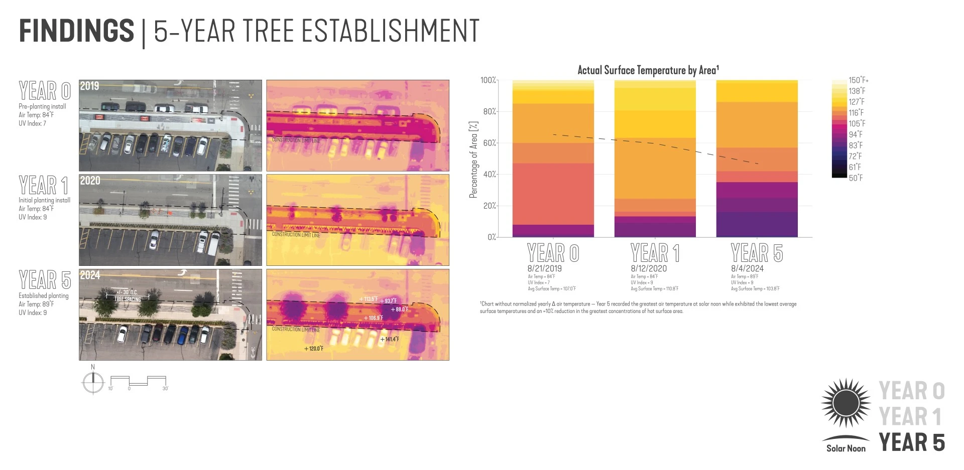
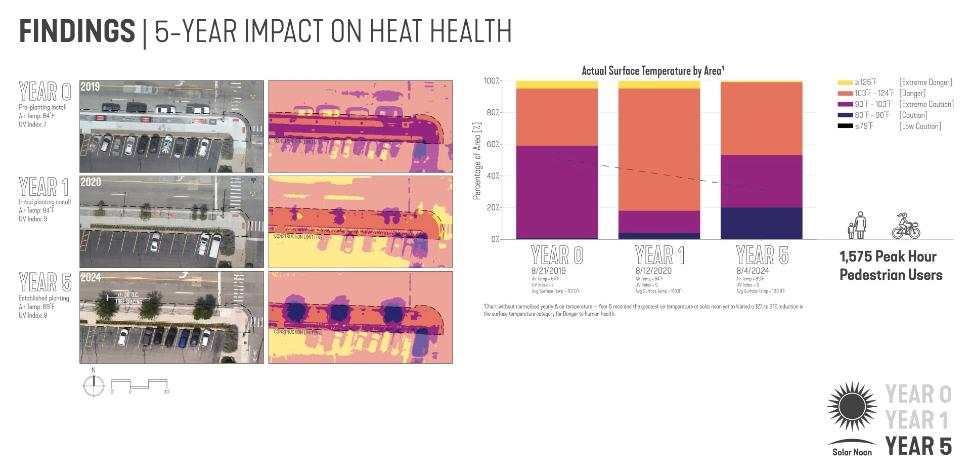
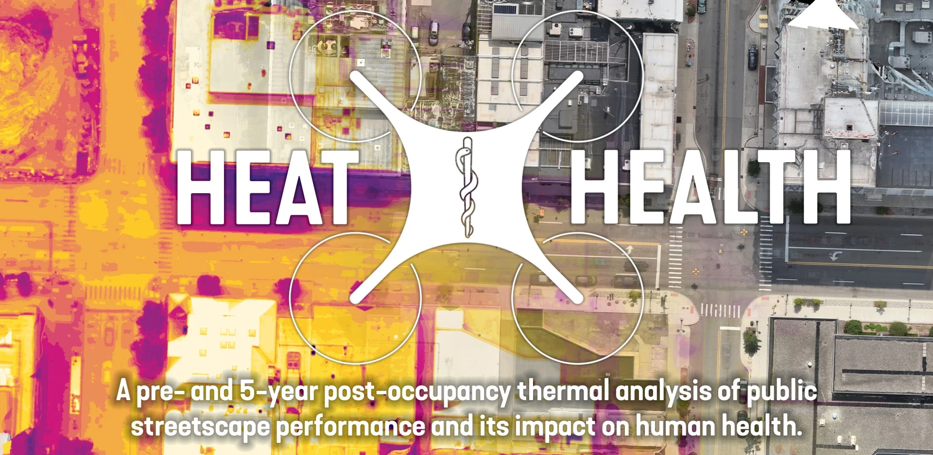
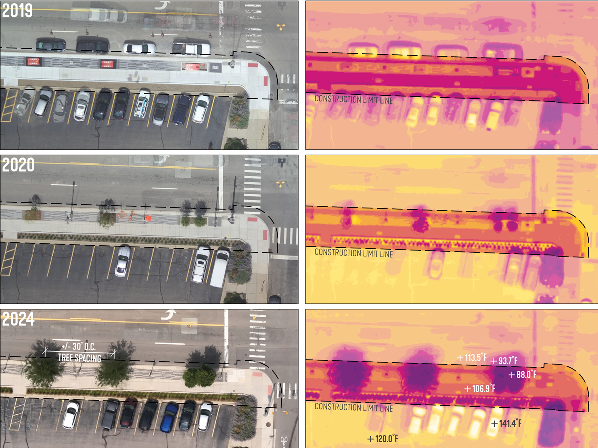
This is not a design solution. It is a case study to inform better design solutions and policy. Novel research uses cutting-edge drone-based thermal visualization to address the heat island effect, which contributes to severe health risks. By combining high-resolution thermal and color imagery, this study reveals how materials and green space impact surface temperatures, offering a precise, scalable method for assessing heat in any setting. It presents a year-over-year analysis of a public streetscape project highlighting long-term effects of green infrastructure on heat reduction. The innovative use of drones for thermal analyses provides a scalable process and reveals critical insights for planning, policy, and environmental justice.
-
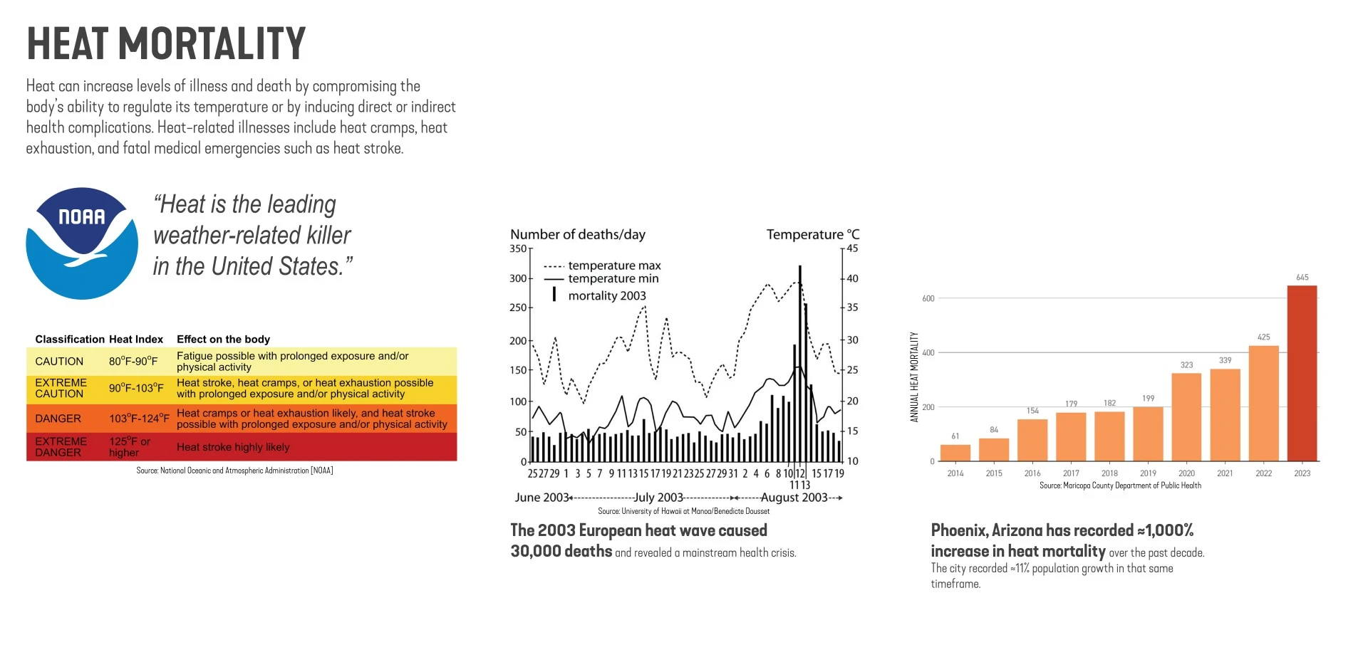
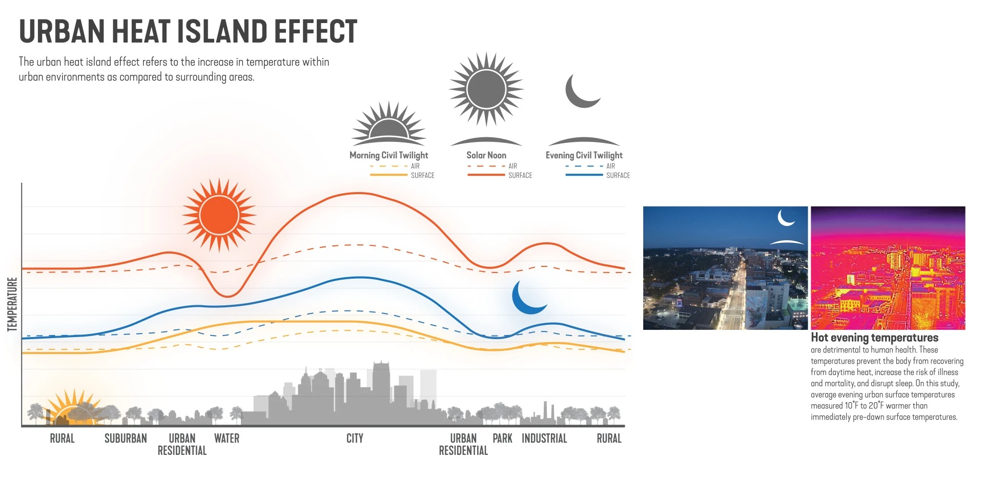
The urban heat Island (UHI) effect is a critical environmental challenge contributing to adverse health outcomes. The UHI is exacerbated by specific human-made surfaces that absorb and retain heat. The 2003 European heat wave resulted in 30,000 deaths and established the dire need for effective heat mitigation strategies. Extreme heat has since become the leading cause of natural disaster-related mortality in the US. This novel research investigates the use of drone-based thermal visualization to address the UHI.
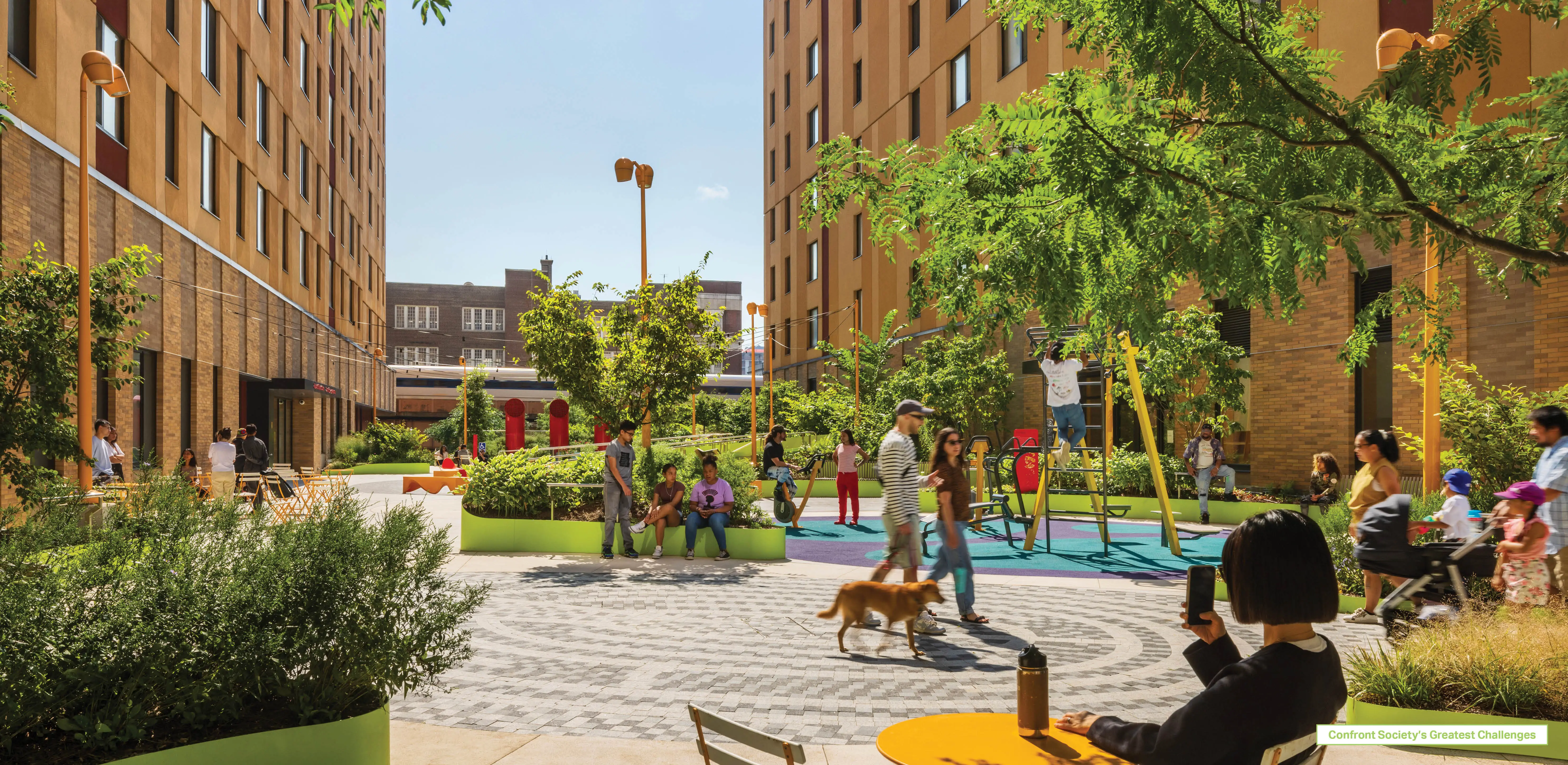
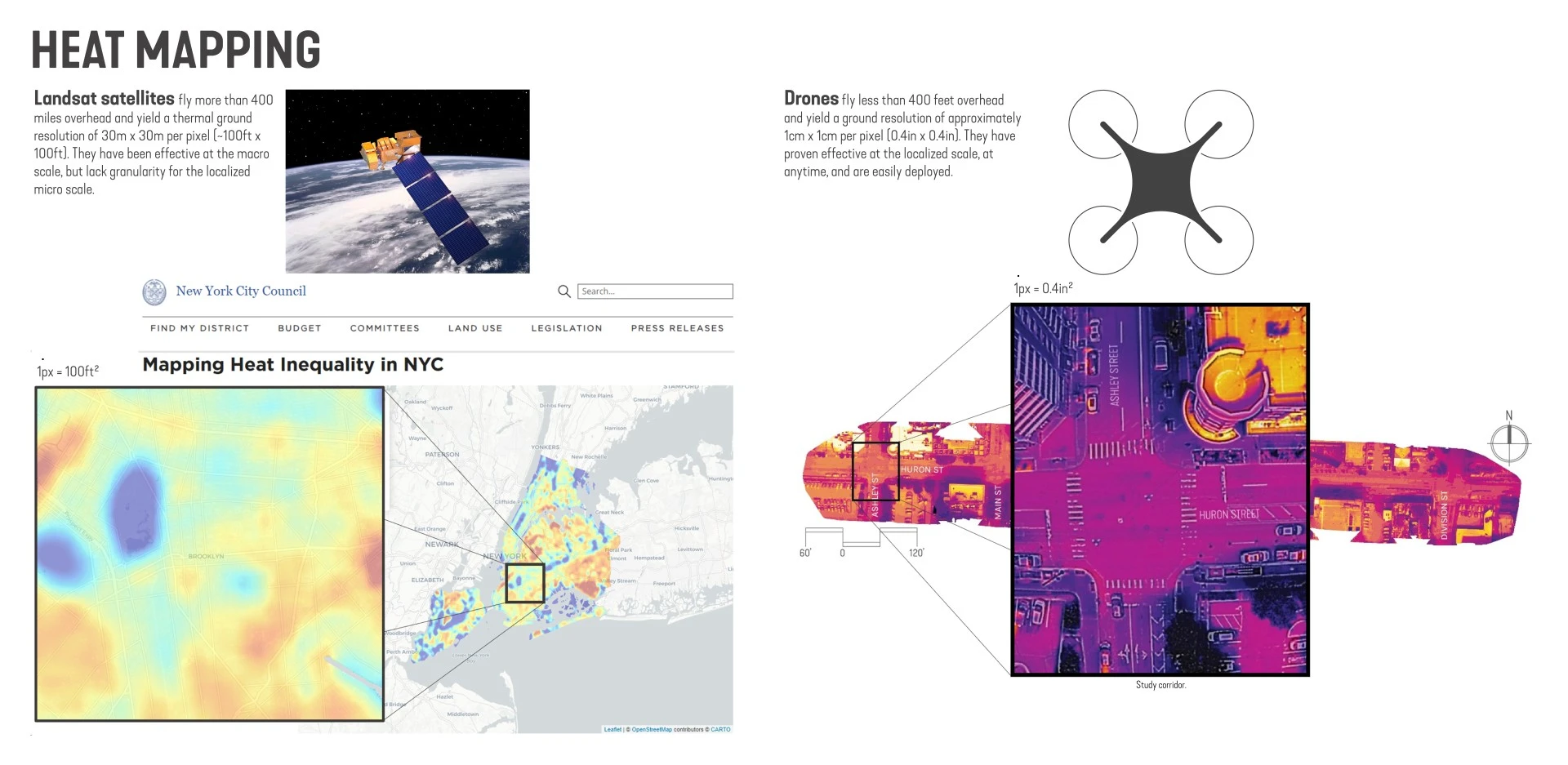
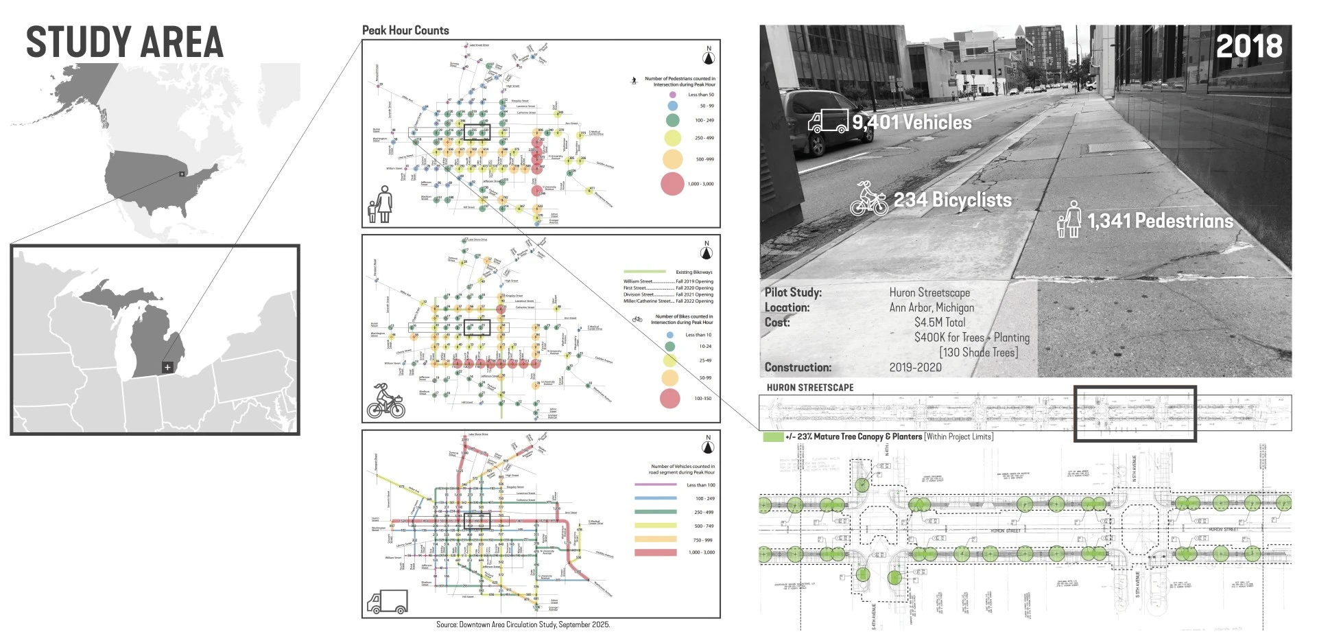
The research focuses on a streetscape revitalization project in the greater Detroit metropolitan area of Ann Arbor in southeast Michigan, which aimed to reconstruct a pedestrian right-of-way (ROW) and thoroughfare while introduce 130 shade trees. Applying unmanned aerial vehicles (UAVs or drones) equipped with high-res thermal and color cameras, this research maps temperature variations in the landscape at both macro and micro scales. Unlike conventional satellite-based thermal imagery which has limited resolution, drones offer a resolution of up to 1.5 cm per pixel enabling precise thermal mapping of localized areas.
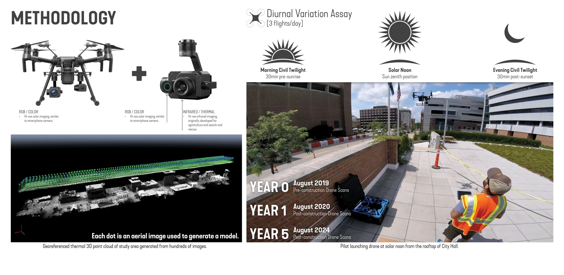
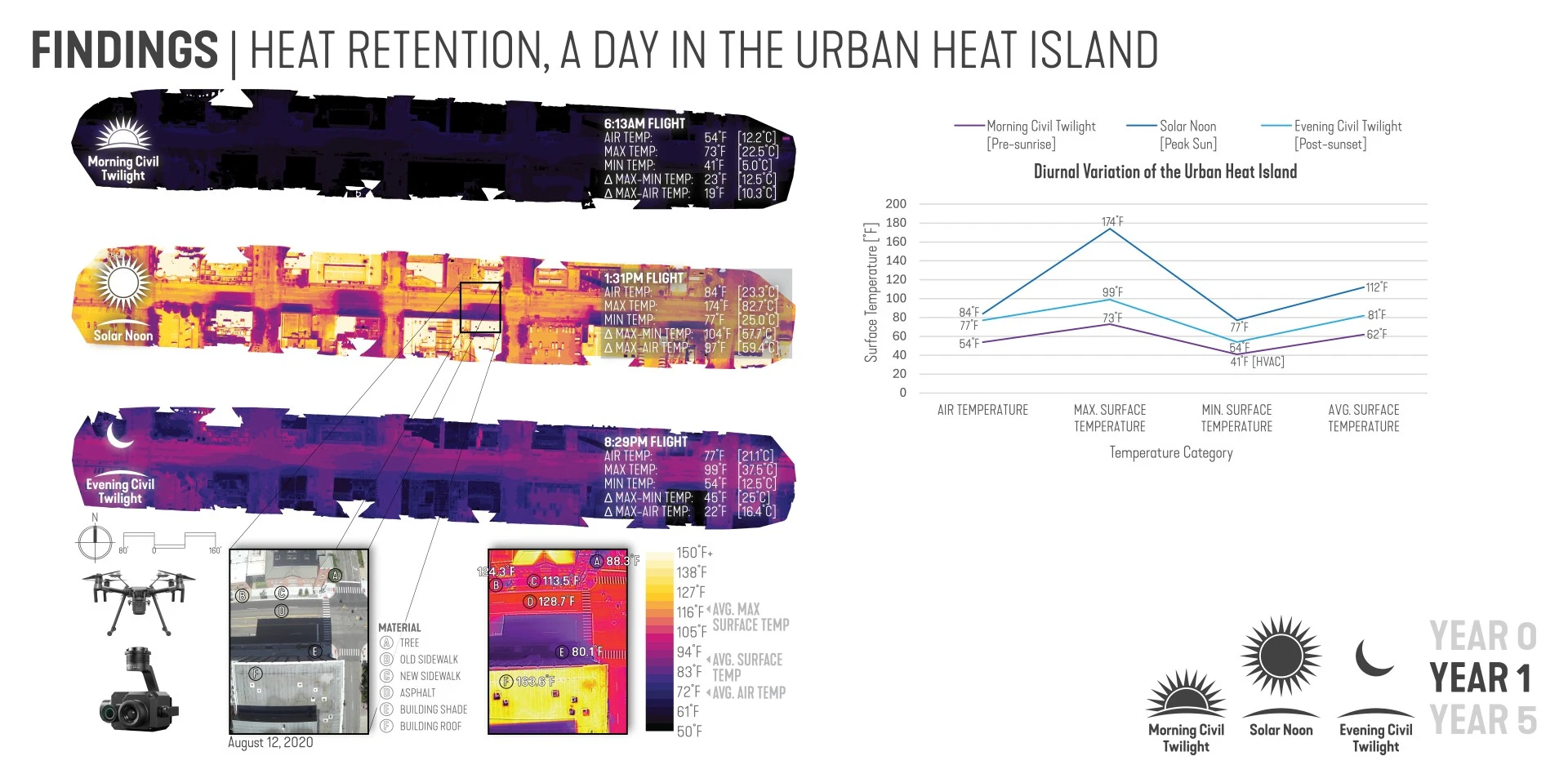
This study combined aerial imagery to generate georeferenced 3D models providing high-res data for analyzing heat distribution. The method enabled comprehensive thermal analysis of materials, surface temperatures, and diurnal variation of the UHI. It involved capturing thermal scans of the project corridor during multiple timeframes, including one-year pre- and post-construction, and again five-years post-construction following tree establishment.
Key findings included:
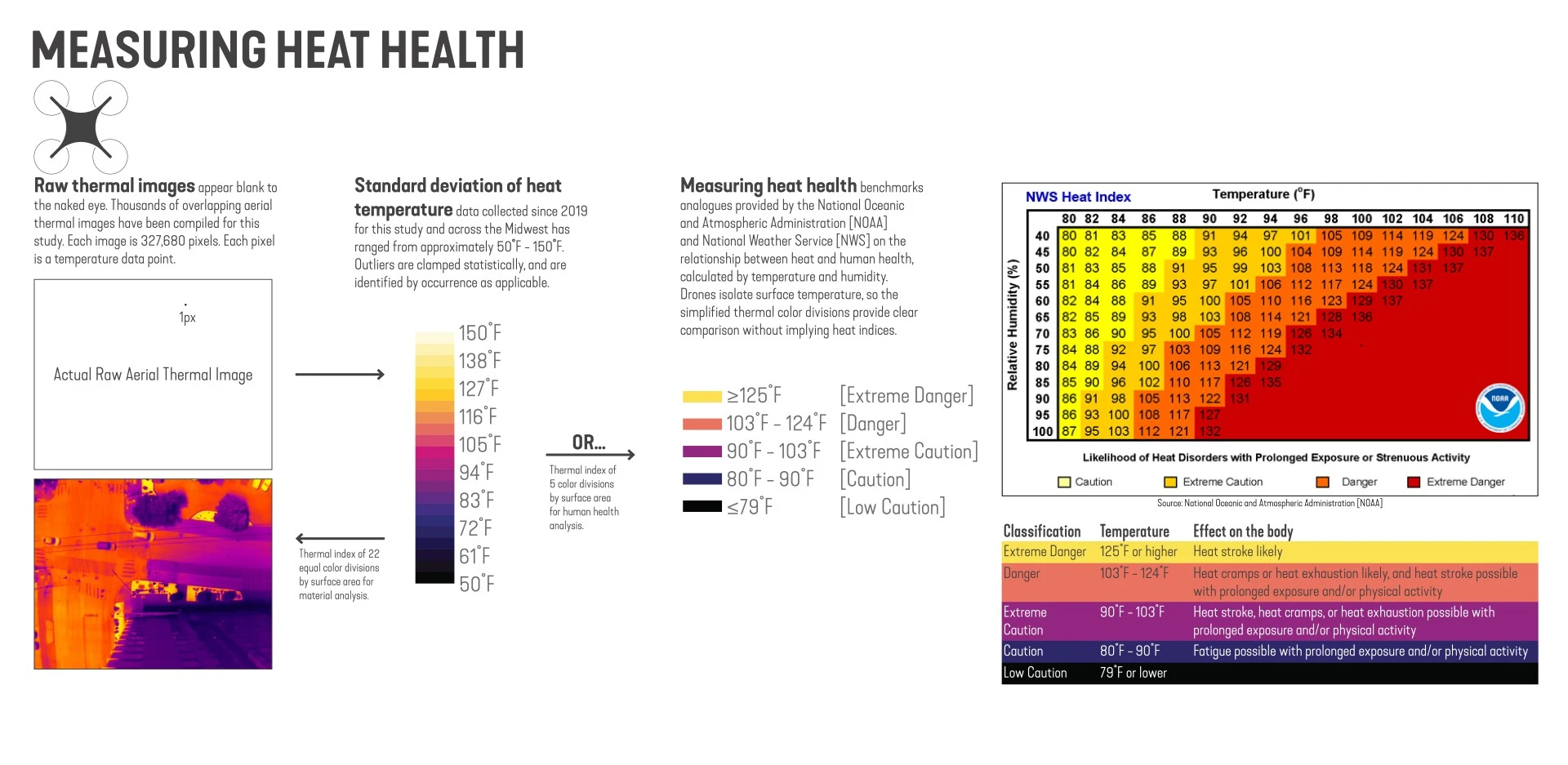
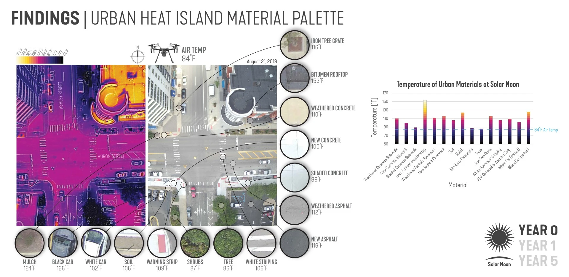
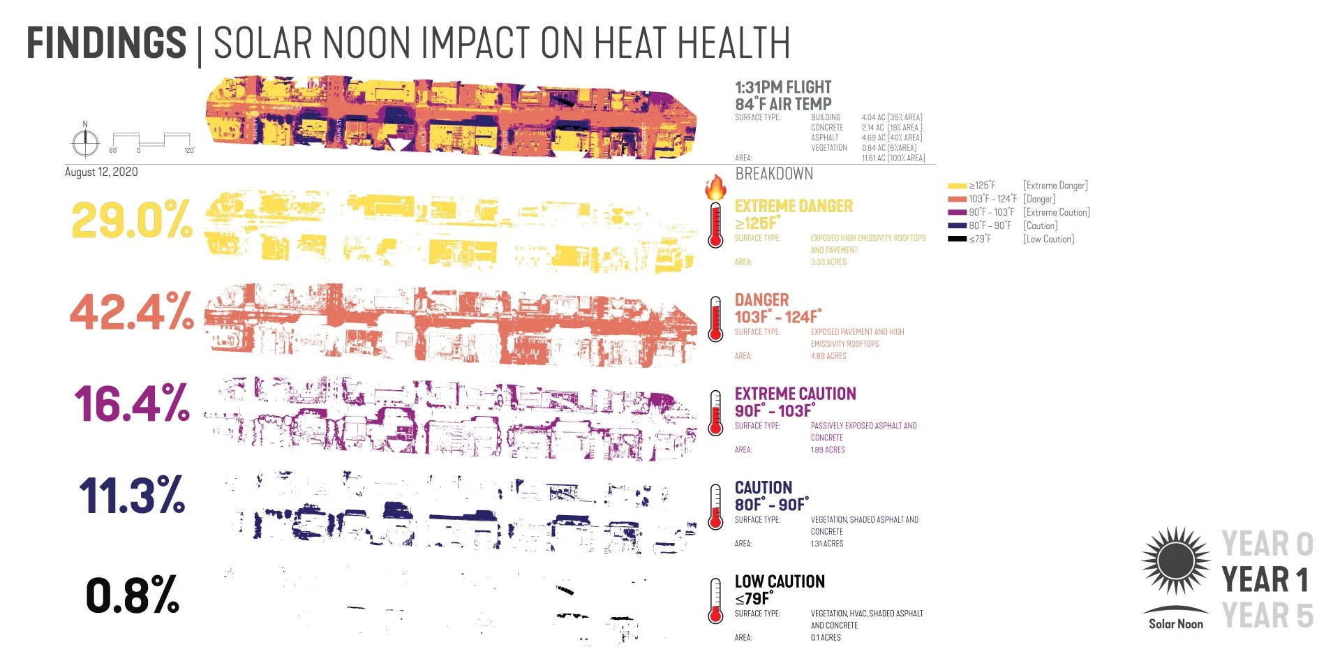
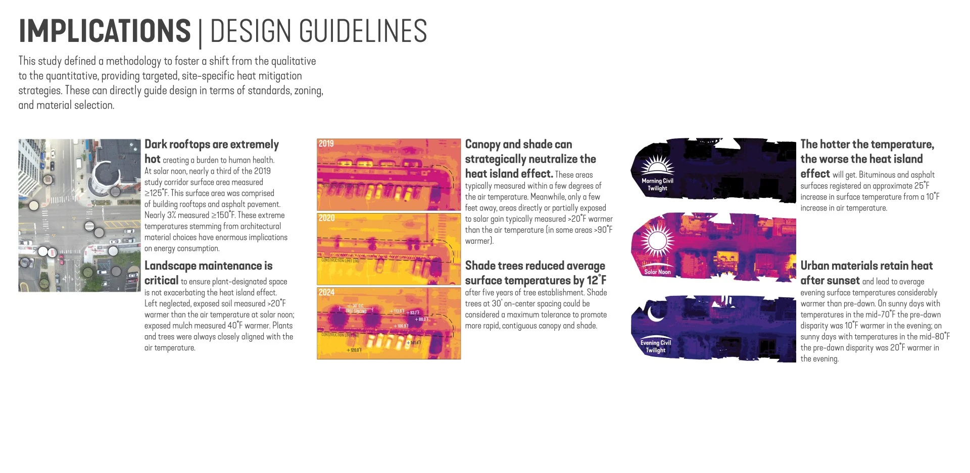
- Surface Temperature Variations: Exposed materials such as asphalt and concrete recorded temperatures up to 40°F higher than surrounding air, with some areas >150°F. In contrast, shaded areas, particularly those under trees and buildings, remained within a few degrees of ambient air temperatures.
- Impact of Shade and Green Space: Trees and green spaces, particularly those with established vegetation, were found to significantly reduce surface temperatures. Unplanted and exposed areas, however, exhibited high temperatures emphasizing the need for long-term maintenance.
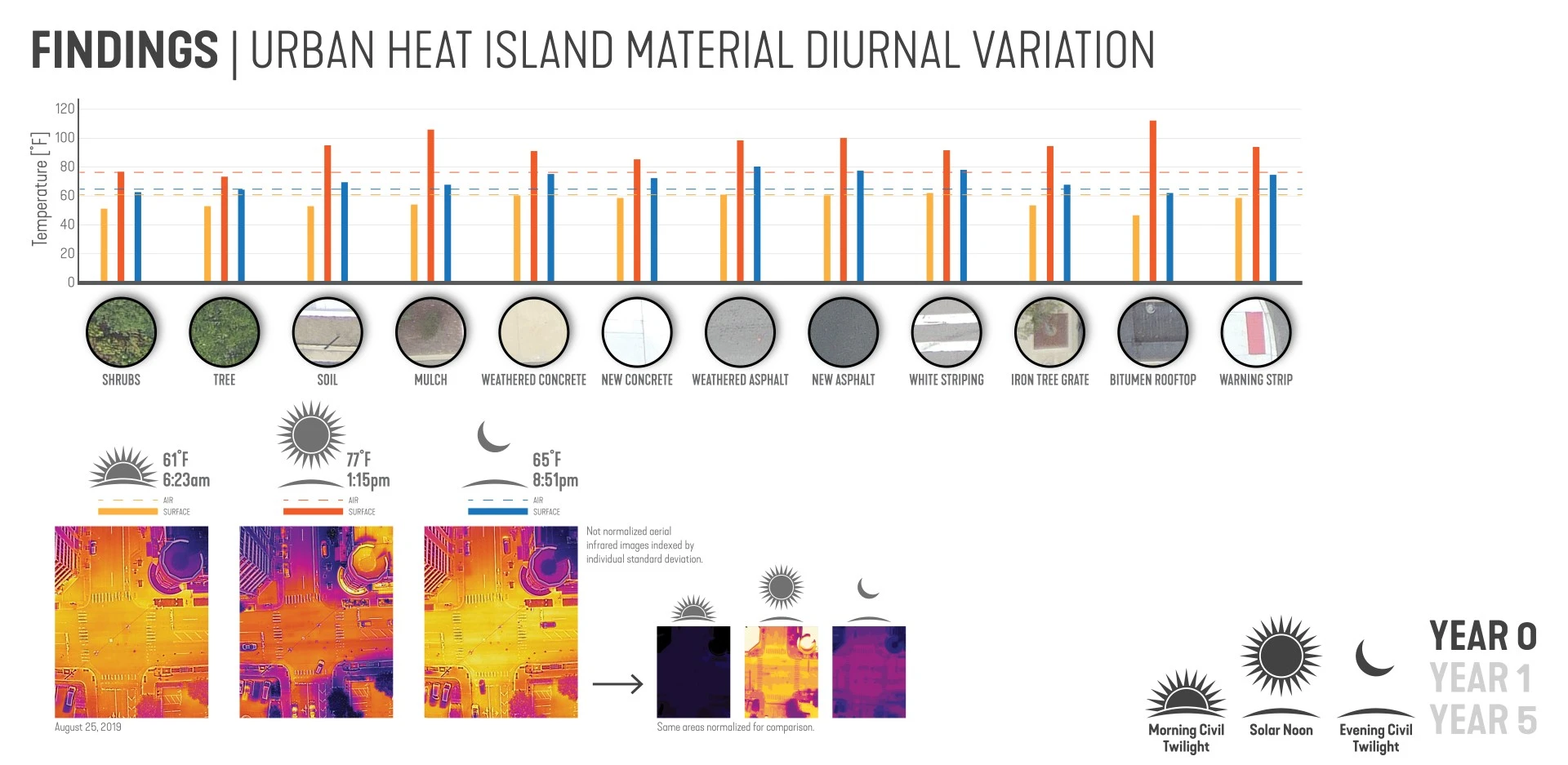
- Diurnal Thermal Behavior: The UHI showed post-sunset remained significantly warmer than pre-dawn temperatures, identifying how materials like pavement retain heat after the sun sets.
- Increased Heat on Hot Days: On warmer days, the temperature difference between urban surfaces and ambient air was exacerbated, particularly in areas with dark-colored materials like bituminous rooftops.
Research calls for further investigation, particularly studies that track the effects of infrastructure improvements over time and integrate demographic overlays to identify inequities in public ROW facility that perpetuate systemic prejudice and environmental injustice. Additionally, rapid advancements in drone technology, such as lower costs, smaller units, and longer battery life, make this approach more accessible for widespread use in heat studies.
Findings underscore the importance of emissivity, integrating green space, and shade in projects to combat the UHI and improve thermal comfort. This study demonstrates the growing potential of drone-based thermal imaging to provide actionable insights into the UHI and offers a framework for integrating thermal analysis into design, planning, and zoning—the goal of creating more resilient cities while reducing human mortality and energy consumption.
-
- Keenan Gibbons, Official Entrant
- Liz Vandermark, Director of Research, SmithGroup
- Nick Blatt, Producer, CNN
- Salvador Lindquist, Assistant Professor, UNL College of Architecture
- Elizabeth Rudd, Social Science Analyst, US Department of Housing and Urban Development
- Sara Higgins, Director of Operations, City of Ann Arbor
- Derek White, Chief Information Officer, SmithGroup
Advertisement
Related Awards
Honor Award, Research
Heat Health: A pre- and 5-year post-occupancy thermal case study
This is not a design solution. It is a case study to inform better design solutions and policy. Novel research uses cutting-edge drone-based thermal visualization to address the heat island effect, which contributes to severe health risks. By combining high-resolution thermal and color imagery, this study reveals how materials and green space impact surface temperatures, offering a precise, scalable method for assessing heat in any setting.