
.webp?language=en-US)

Houston Resilience Hub Network Master Plan
-
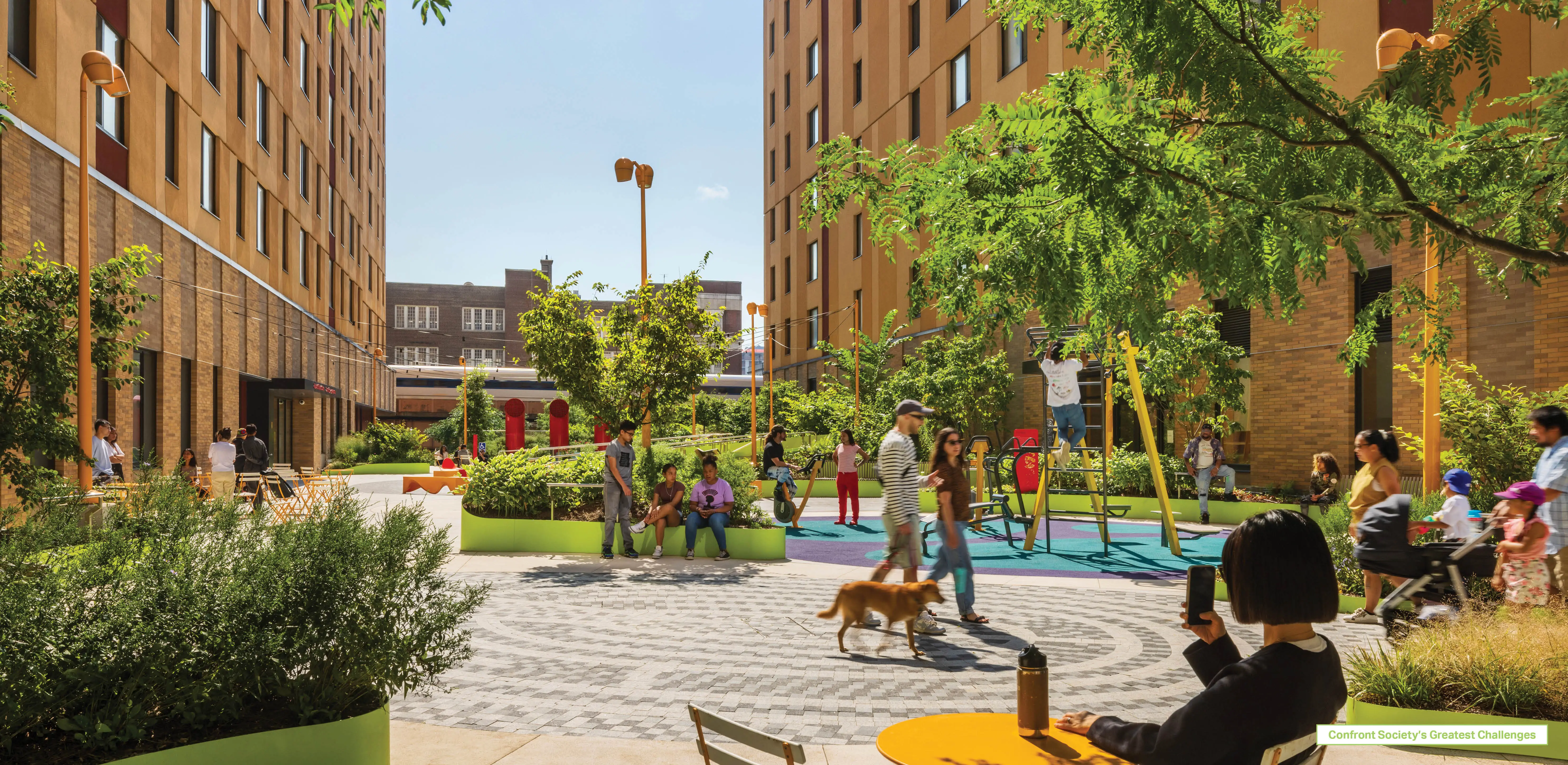
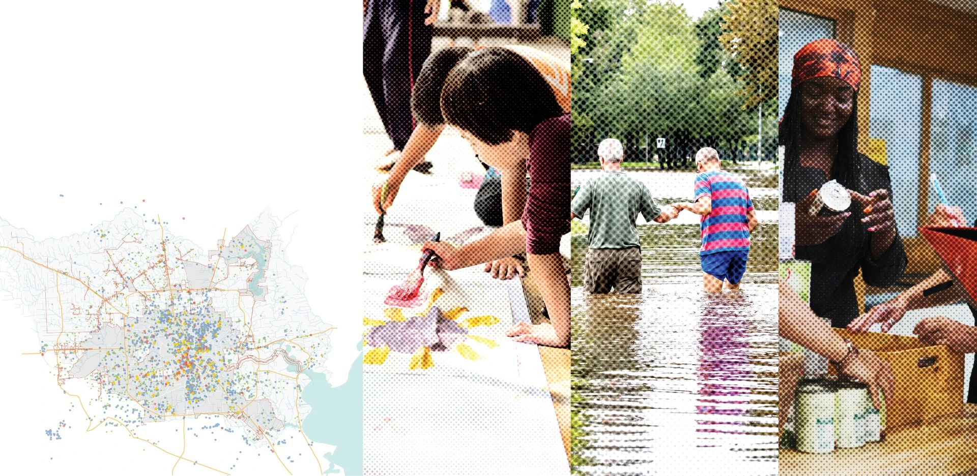
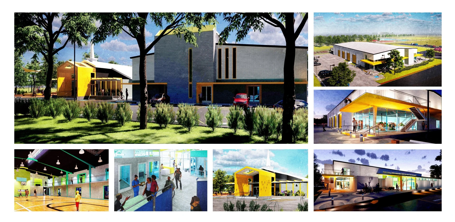
Across Houston’s vast multicultural geography, vulnerable communities disproportionately encounter stressors and unmet needs following natural and man-made disasters. The Houston Resilience Hub Network Master Plan provides aid to marginalized areas with a series of community-serving facilities that coordinate resources for residents during daily operations, disasters, and recovery periods. Utilizing a landscape architecture lens of a site-inclusive approach to facility network planning, the project focuses on providing access to community preparedness training, capacity-building programming and services, and climate-ready buildings and sites. The plan acts as a national model for increasing community resilience in the face of future threats.
-
The Houston Resilience Hub Network Master Plan aims to create community-serving facilities that coordinate resources and services for residents during everyday operations, disasters, and recovery periods. Led by landscape architects for the City of Houston’s Mayor’s Office of Resilience and Sustainability, the project team drew upon expertise in place-based design, GIS analysis, emergency planning, environmental resilience, financing strategies, and public engagement. The plan provides a useful precedent for other cities engaging with this new model for increasing community resilience in the face of current and future threats.
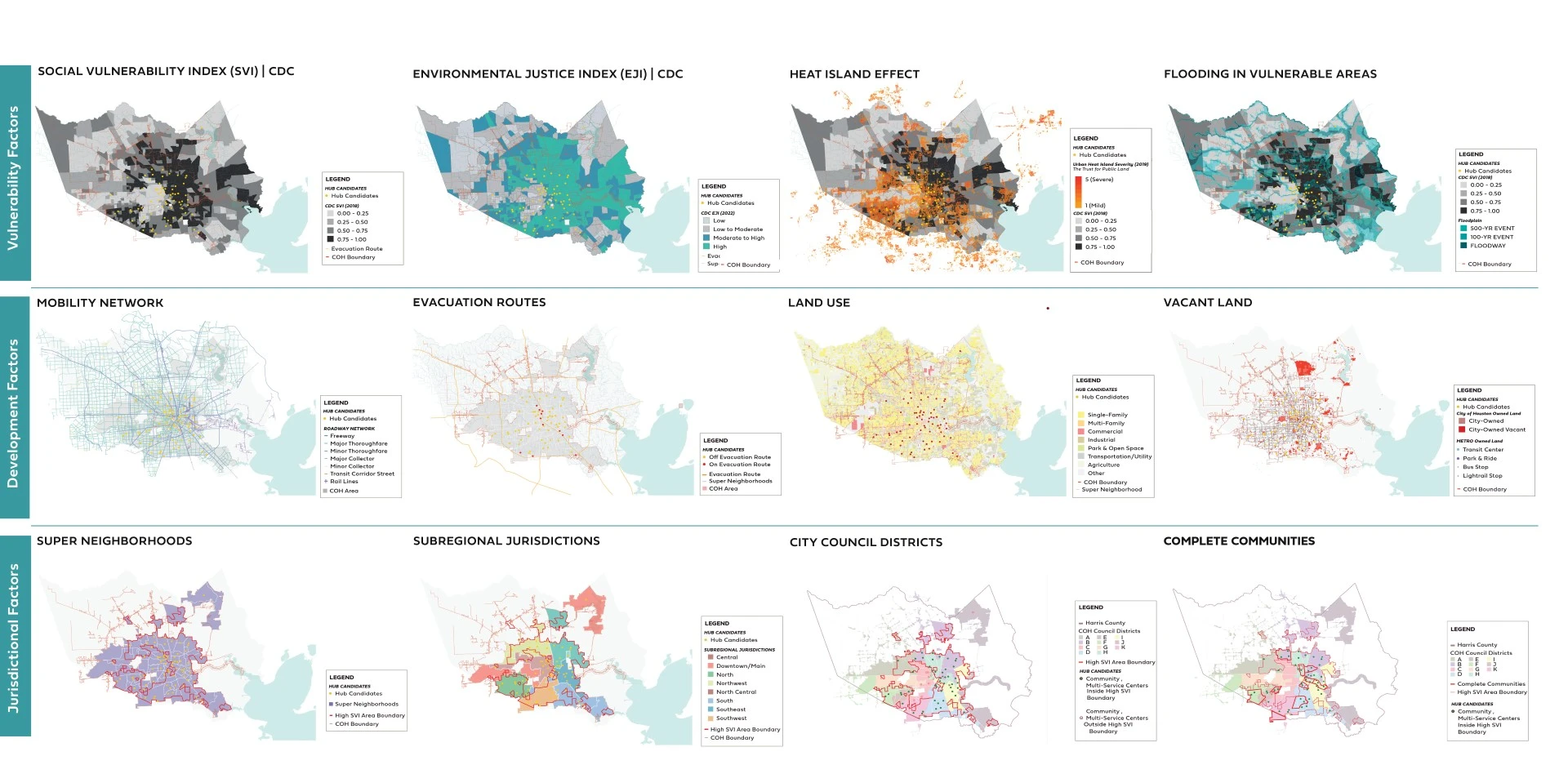
In the analysis of vulnerability factors, Houston is nationally ranked within the highest percentile category of the CDC's Social Vulnerability Index(SVI), with the majority of its communities scoring within the upper half. When overlaying additional factors such as the heat island effect, theCDC’s Environmental Justice Index (EJI), and flooding, it is evident that vulnerable communities face greater challenges during disasters such as hurricanes, pandemics, inclement weather, heat waves, or other unforeseeable threats. When it comes to the spatial urban organization, Houston’s flat terrain and exposure to Gulf Coast hurricanes are compounded by its bayou, freeway, and industrial development barriers to connected pedestrian infrastructure and protective tree canopy cover. When comparing development factors such as mobility networks, evacuation routes, land use, and vacant land, clear divisions in community resilience across the City are evident.
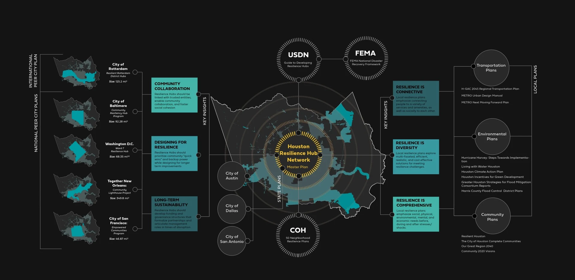
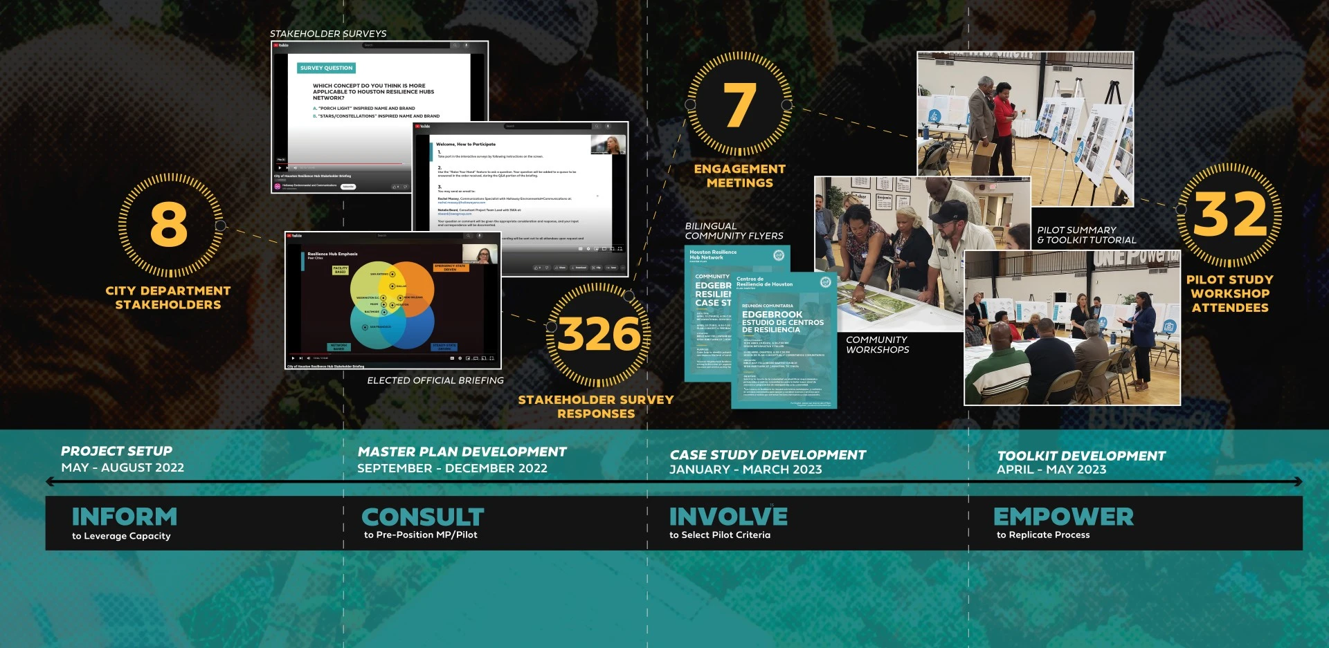
The plan draws upon lessons learned from cities abroad, around the nation, and developing plans across the state. The plan development team engaged the Mayor’s Office, multiple City of Houston departments, the Office of Emergency Management, the USDN, adjacent resilience and hazard mitigation planning teams, neighborhood leaders, and non-profit stakeholders, as well as a community pilot partner to create a new grass-roots model for providing access to critical services.
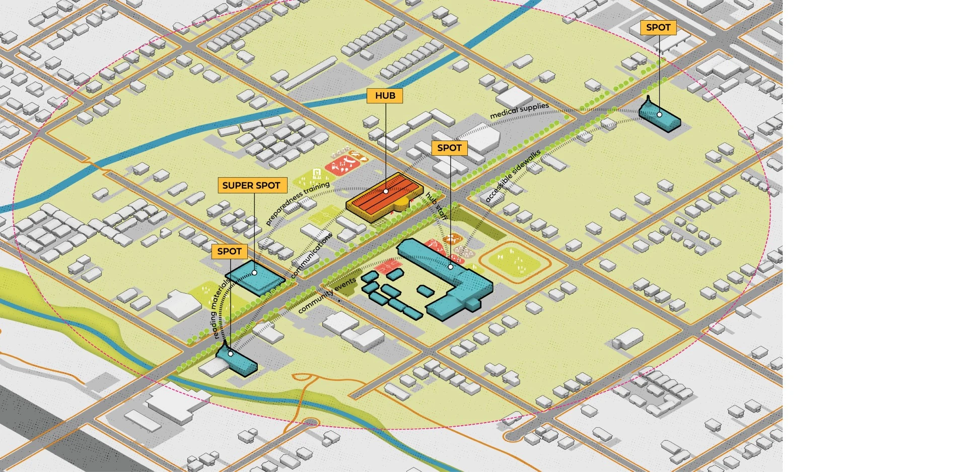
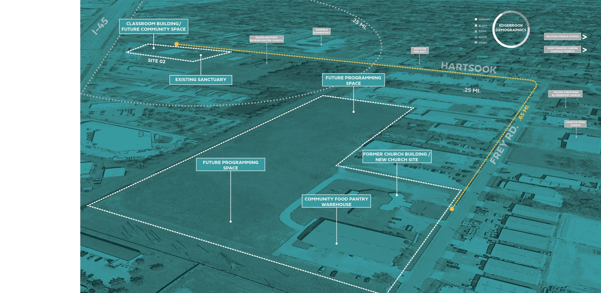
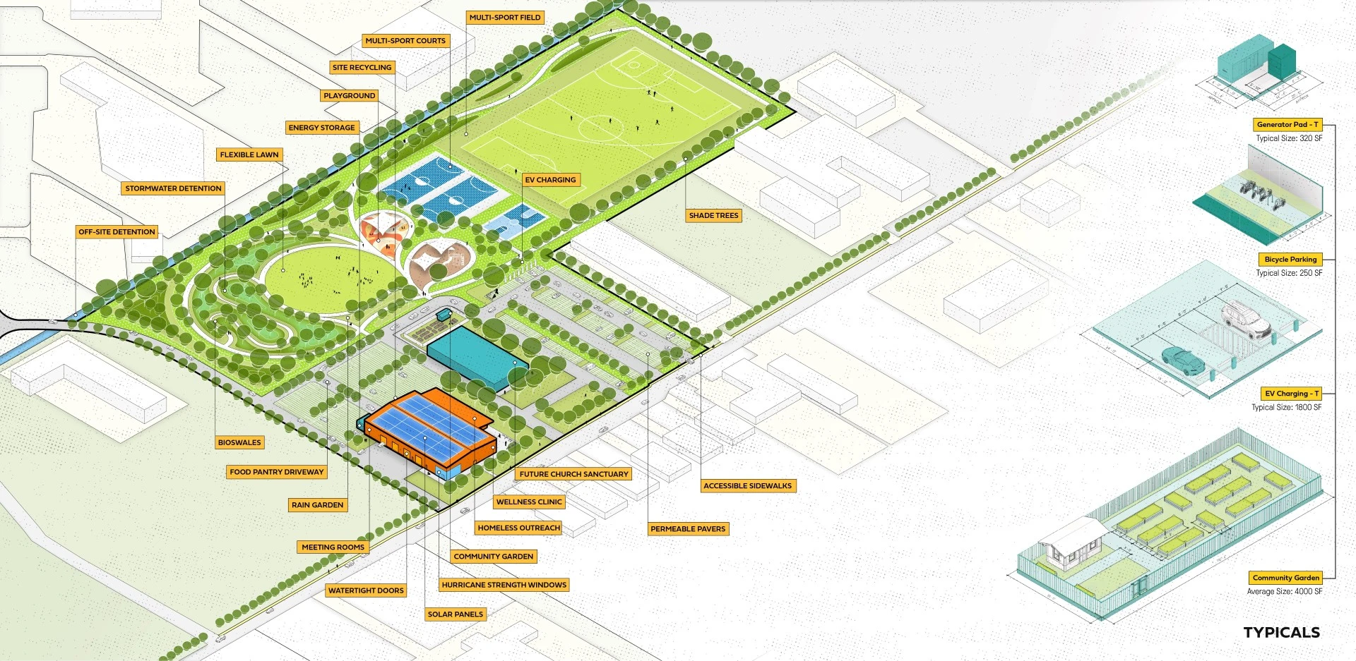
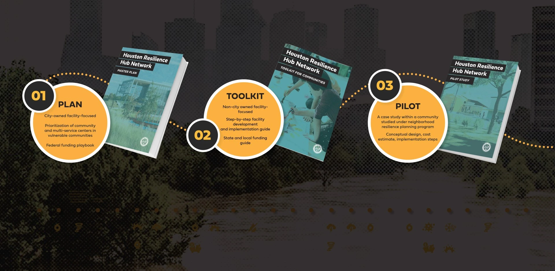
Due to Houston’s vast geographic expanse and wide variety of stressors, this plan takes a hybrid approach to Resilience Hub development—primarily operating through municipal-owned facilities while partnering with community-led facilities to maximize collective efforts and network-wide impacts. The Houston Resilience Hub Network relies on four components: Resilience Hubs (city-owned facilities), Super Spots (community-owned and operated facilities that perform similarly to Resilience Hubs), and Spots (community-owned facilities that are primarily functional during steady-state periods).
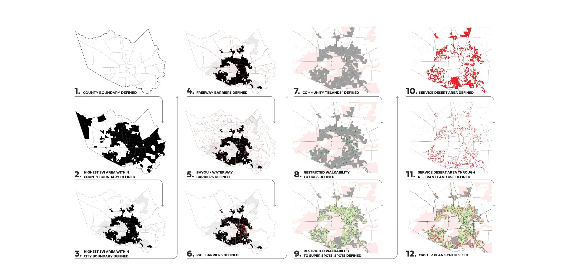
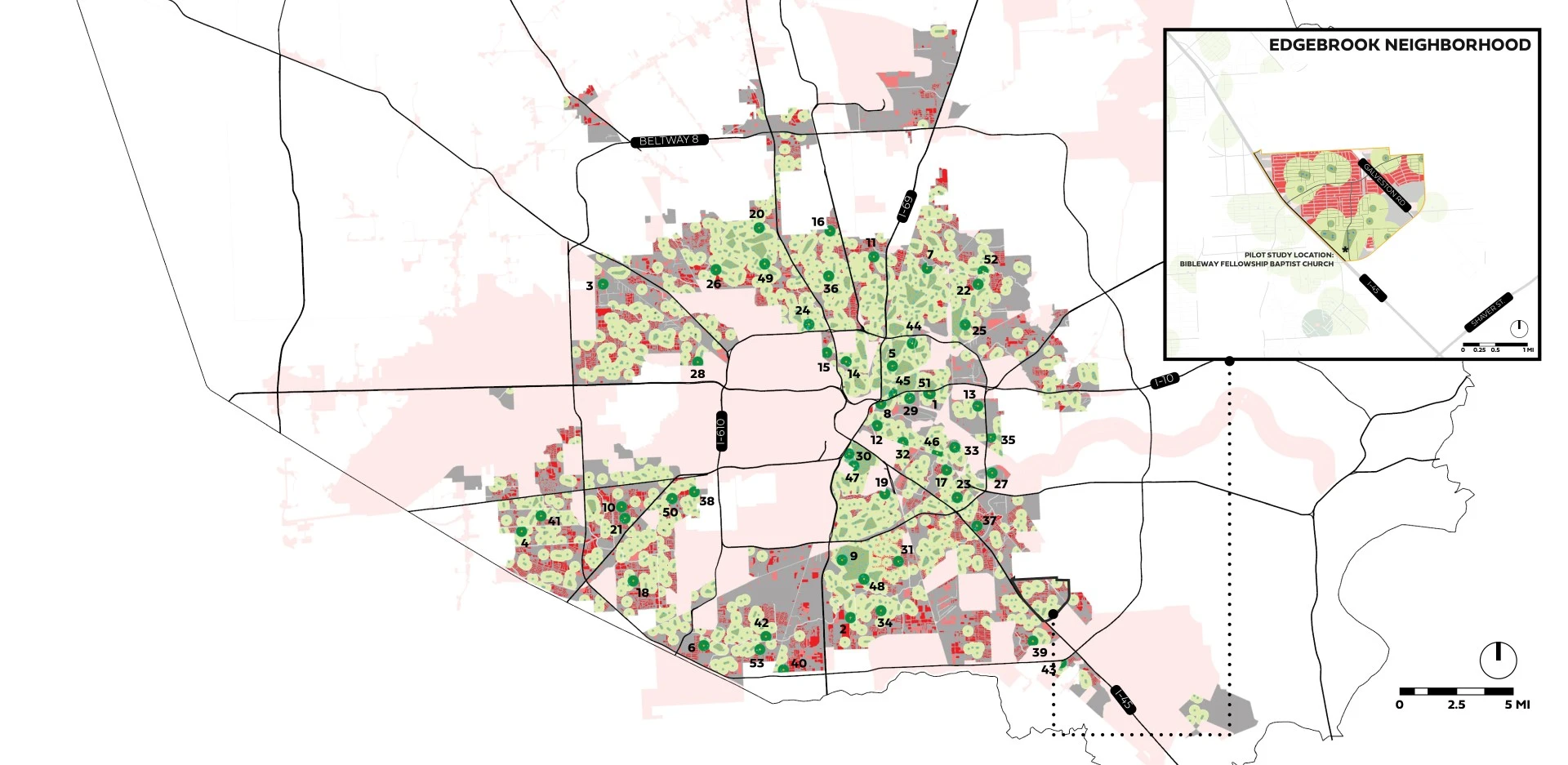
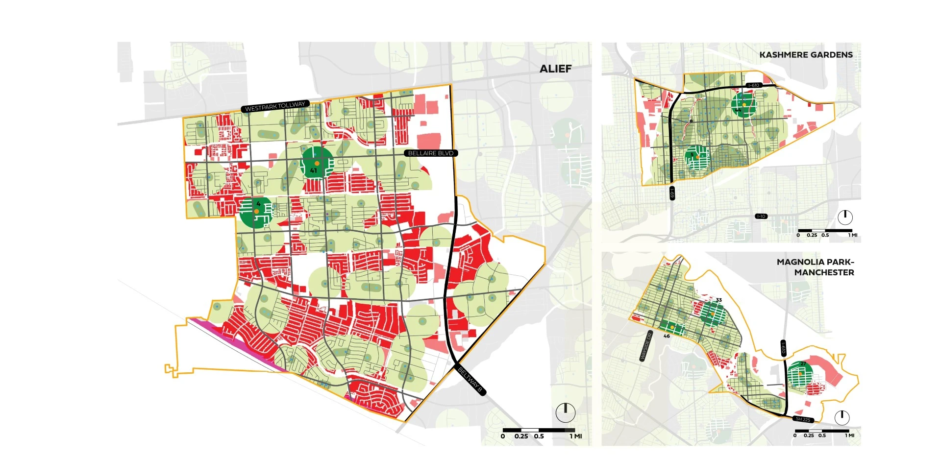
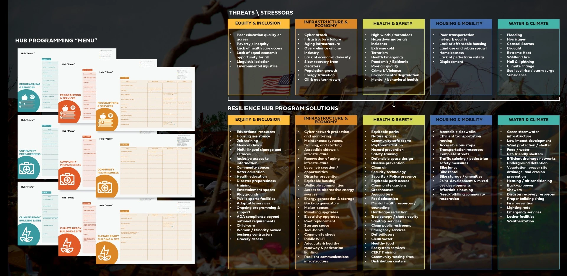
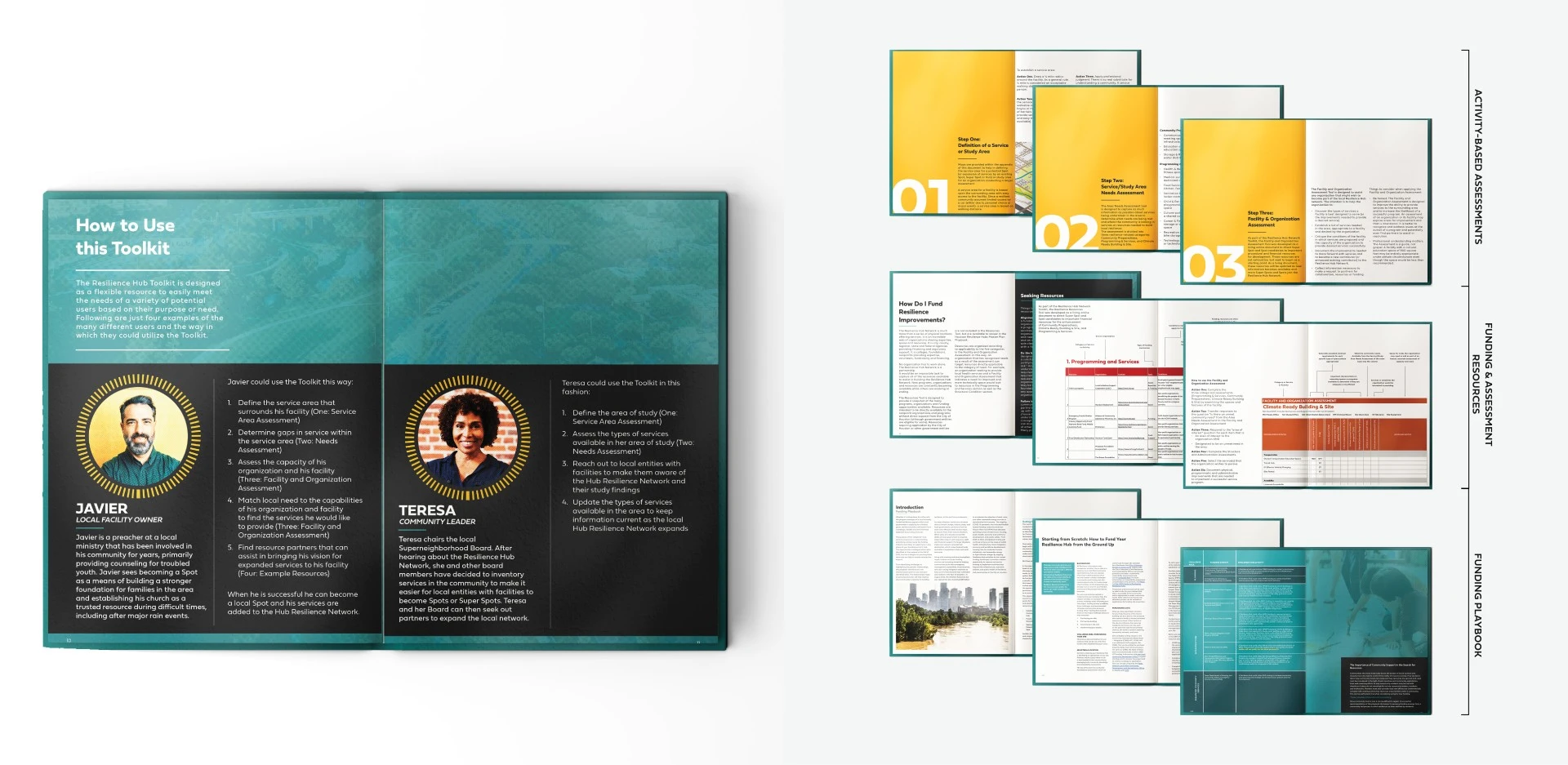
The landscape architects utilized parametric modeling scripts and GIS software to identify geographies of need and service deserts -- identifying community "islands" isolated by freeways, bayous, and infrastructure as the most vulnerable areas. A synthesized map was developed as an interactive data tool for planners and communities to make decisions regarding hub and infrastructure development at both city and community scales. With stakeholder input, the planners prioritized a list of existing City of Houston facilities for Resilience Hub retrofits and created a series of checklists for facility evaluation, a Hub “Programming Menu”, an order-of-magnitude cost database, and a Funding Playbook to help implement improvements.
-
- SWA, Landscape Architect and Planning Lead
- RDLR Architects, Architect
- Resilient Cities Catalyst (RCC), Resilience Strategies Lead
- Hagerty Consulting, Federal Funding Resources
- Hawes Hill Associates, State and Local Funding Resources
- Hollaway Environmental, Engagement
- Infrastructure Associates, Civil Engineering
Advertisement
Related Awards
-listing-img.webp?language=en-US)
ASLA / IFLA Global Impact Award, Analysis & Planning
The Four Coasts Project
The US Army Corps of Engineers is responsible for the bulk of the nation’s water resources infrastructure. USACE’s Engineering With Nature program works to align that infrastructure with natural processes and support a broader range of benefits to the nation’s economy, local communities, and ecosystems. Four Coasts is a three-year effort by landscape architects and engineers working with EWN Proving Ground districts to identify and advance nature-based coastal infrastructure projects.
Related Articles

Landscape Architecture Magazine
LAM Wins Five ASBPE Awards
Landscape Architecture Magazine earned national and regional honors for editorial excellence, publication design, and profile.
Jun 1 2026