

.webp?language=en-US)

.webp?language=en-US)
ASLA 2026 in Review: The Historic American Landscapes Survey (HALS)
The Historic American Landscapes Survey (HALS) documents historic landscapes through the creation of measured drawings, photographs, and historical reports. Documentation created through the program is archived in the Library of Congress and is available to the public.
The HALS Challenge competition was created in 2010 to engage landscape architects, students, and others in the documentation process. Currently, the National Park Service Heritage Documentation Programs division has suspended all competitions, but the ASLA HALS Leadership Team went forward with an open call to encourage continued engagement in this important work.
2026 ASLA HALS Open Call: This is America at 250
In recognition of the 250th anniversary of the founding of United States, we encouraged HALS reports that broadly address the theme of landscapes of liberty and freedom.
Across the nation, the idea of liberty is expressed in battlefields and memorials, public squares and protest sites, trails of migration and emancipation, parks of public gathering, and landscapes that have borne witness to both oppression and liberation. These places reveal the complex and ongoing pursuit of freedom in all its forms—political, cultural, environmental, and personal.
Through this year’s optional theme, we seek to honor the diverse stories of freedom that define the American landscape and to recognize that liberty, like the land itself, is both a heritage and a living pursuit.

2026 HALS Submissions
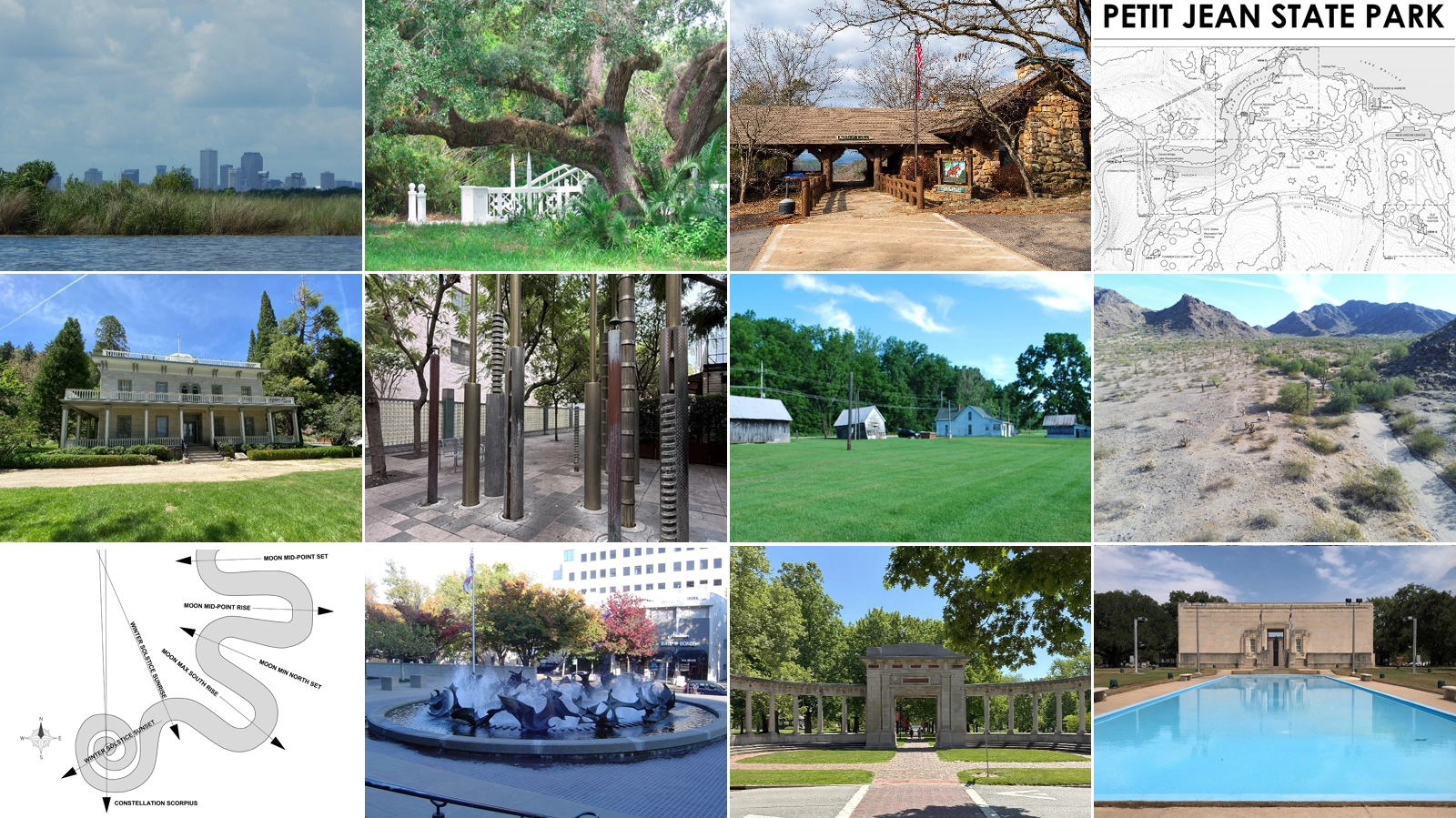
Eleven HALS histories came in from nine states:
- Arizona
- Arkansas
- California
- Florida
- Indiana
- Louisiana
- Nevada
- Ohio
- Texas
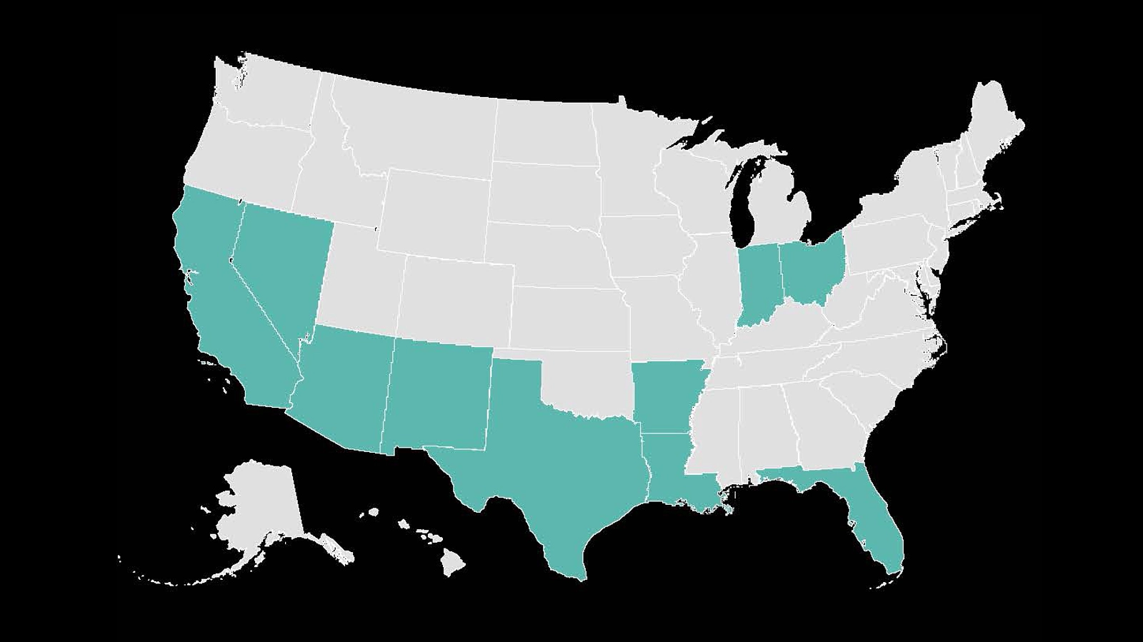
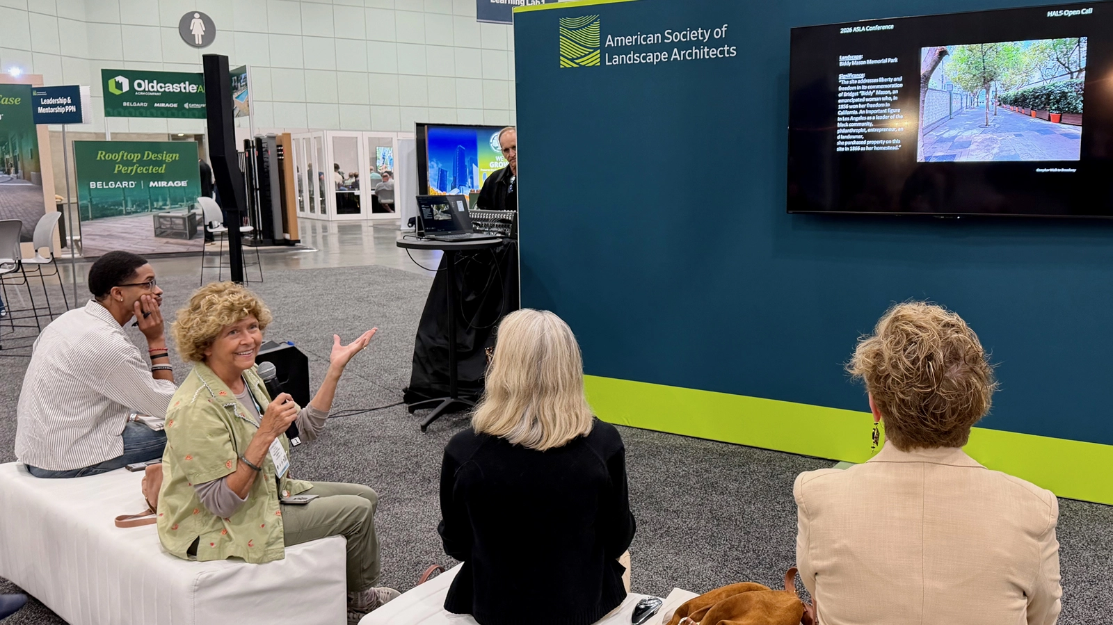
After celebrating all the submissions at the ASLA 2026 Conference on Landscape Architecture in Los Angeles last week, we are also highlighting them here on The Field, along with excerpts from each HALS report. The full reports will be added to the HABS/HAER/HALS Collection of the Library of Congress.
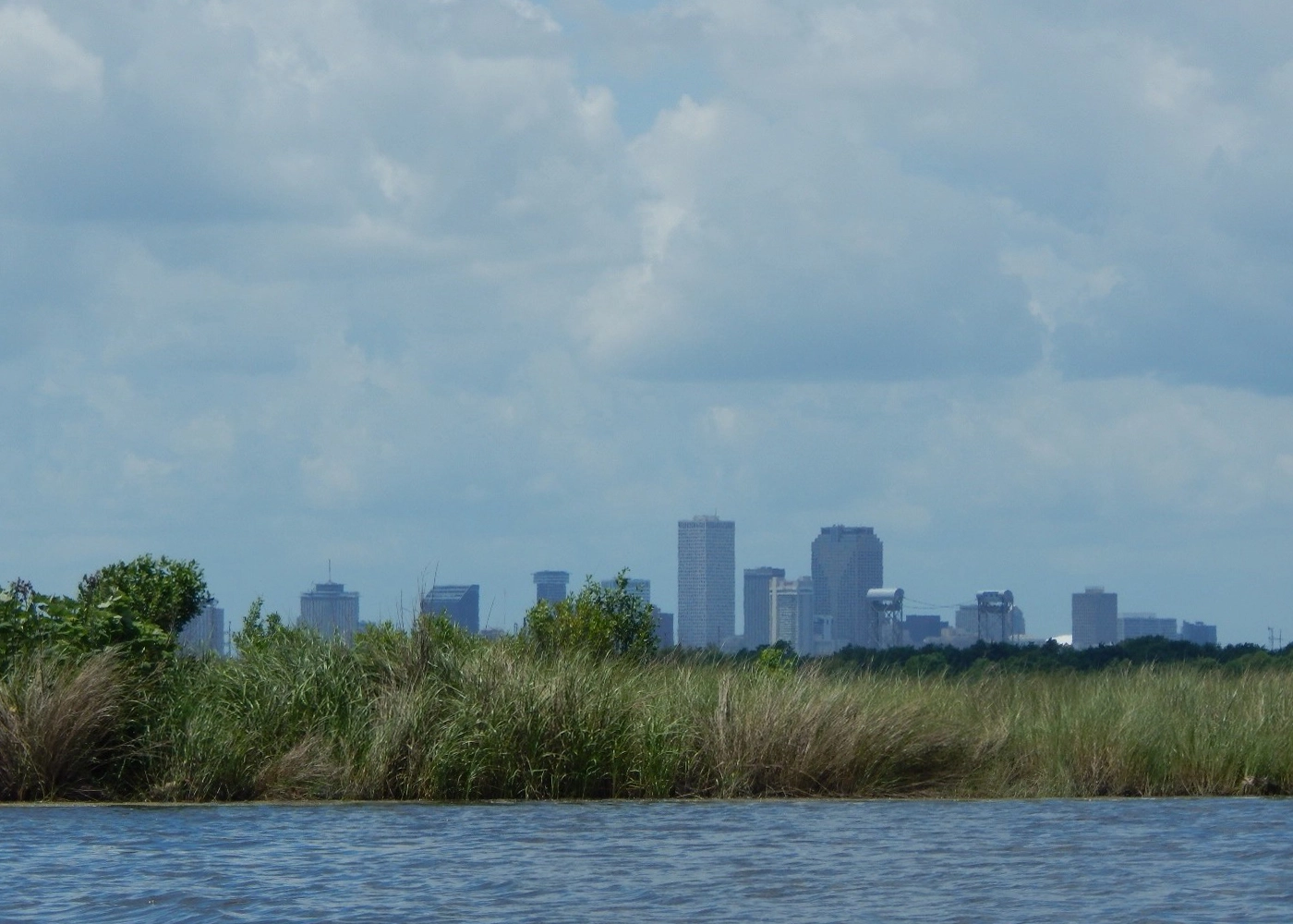
Bayou Bienvenue Central Wetland (Bas du Fleuve)
Louisiana
Diane Jones Allen, D.Eng., PLA, FASLA, FCELA
Significance: As in the time of the Indigenous and Maroon communities that lived in this landscape, understanding the Bayou Bienvenue Central Wetland today could mean literal survival. In The Story of the American Maroons: Slavery’s Exiles, Sylviane Diouf defines the “Maroon Landscape” as a secret landscape of liberation, whose settlers sought not only freedom but self-determination. Given the current concern for protecting our coastal environment, especially after recent climatic events, this landscape and the culture it contains have fostered new approaches to environmental resilience. The historical significance of this landscape, which now consists mainly of cypress apparitions, with only their stumps holding on precariously in the material world that were once real, substantial, living, transpiring trees, is that it provided an ecosystem that protected, enriched, and sustained the adjacent community. The wetland ecology of this site provided a unique opportunity to live unbonded and in a manner that, for a time, sustained those practicing self-determination and the landscape mutually. The resources of these wetlands and their fluid nature facilitated the development of unique cultural practices, often developed and shared between the groups that dwelled there. It truly was a landscape of freedom.
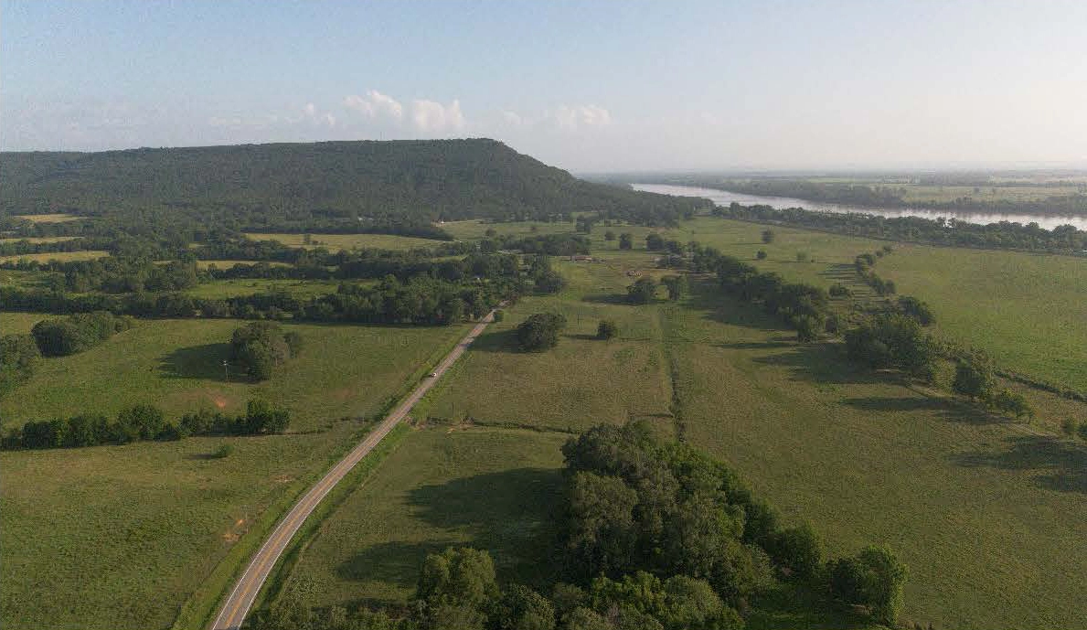
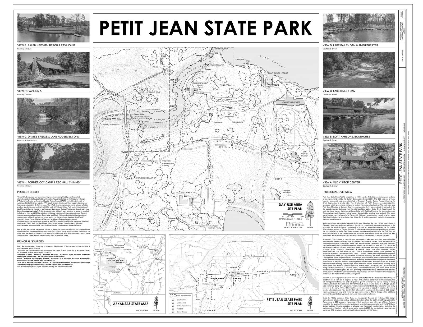
Day-Use Area, Petit Jean State Park
Morrilton, Arkansas
Esta Hasa and Kimball Erdman
Significance: Petit Jean State Park, established in 1923, was the first state park in Arkansas and one of six planned and built by the Civilian Conservation Corps (CCC) from 1933 to 1941. The CCC was established in 1933 as one of Franklin Delano Roosevelt’s New Deal programs to boost the economy during the Great Depression. As with other state and national parks of this period, all human-built elements in the park, including buildings, roads, trails, bridges, dams, signage, furniture, and many other features, were designed in the National Park Service Rustic style. World War I veterans that comprised CCC Company 1781 undertook a multi-phase development of the park’s infrastructure and facilities. Despite decades of physical and functional transformation, the park’s foundational spatial framework and numerous structures built by the CCC continue to define its character, serving as an example of this formative period in state and national park history.
This HALS report and accompanying measured drawings were completed by a professor-led, student-assisted, staff-supported team from the Fay Jones School of Architecture + Design (FAY) and the Center for Advanced Spatial Technologies (CAST), both at the University of Arkansas. Graduate research assistant Esta Hasa was the principal author of the report, under the direction of Kimball Erdman and with additional assistance from Dr. Robyn Lane, ASLA.
Archival research and fieldwork were provided by students enrolled in Erdman’s 2024 and 2025 Introduction to Cultural Landscape Preservation classes. Student research assistants Zeac Brown, Student ASLA, Esta Hasa, and Elijah Willis conducted significant additional research and fieldwork and were principal authors of the report and drawings. CAST staff members Angie Payne, Malcolm Williamson, and Bryce Drachenberg conducted photogrammetry, terrestrial laser scanning, and GPS mapping on which the measured drawings were based. CAST staff member Manon Wilson spearheaded the collection of historical documentation with assistance from students Shaylee Luedders and Benjamin Pierce.
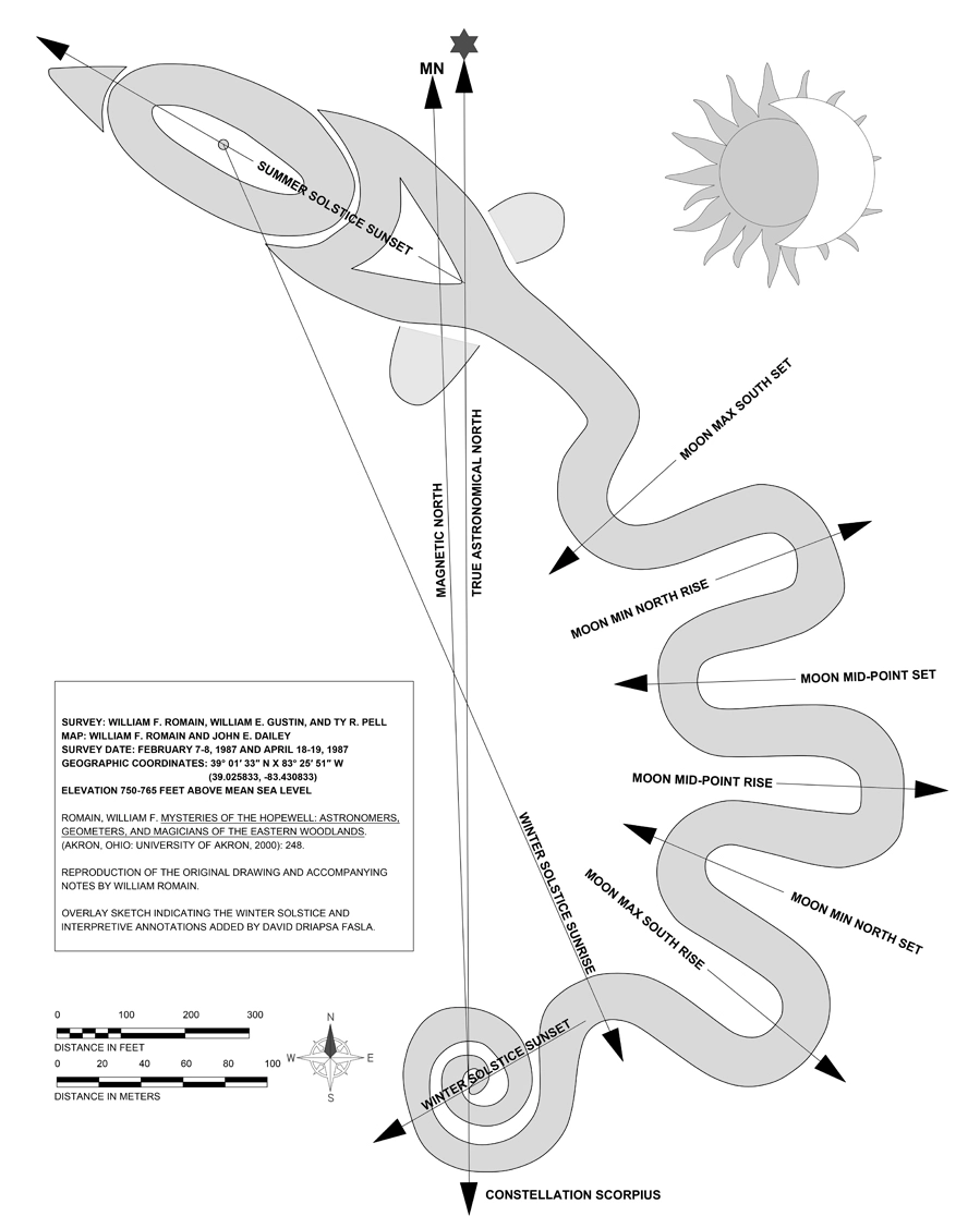
Serpent Mound (Serpent Mound National Historic Landmark)
Adams County, Ohio
David J. Driapsa, FASLA
Significance: Serpent Mound is a world-renowned prehistoric earthwork and the largest known serpent effigy in the United States. Nineteenth-century archaeological surveys brought it to scientific attention and contributed significantly to the emerging study of ancient peoples and their cultures in North America. Recognized for exceptional importance, it was designated a National Historic Landmark. The precise age, identity of its builders, and intended purpose and meaning remain subjects of ongoing research and debate. While these questions remain unresolved, there is no doubt that this fascinating monument represents an extraordinary achievement of symbolic earthwork construction, site planning, landscape design, and enduring mystery.
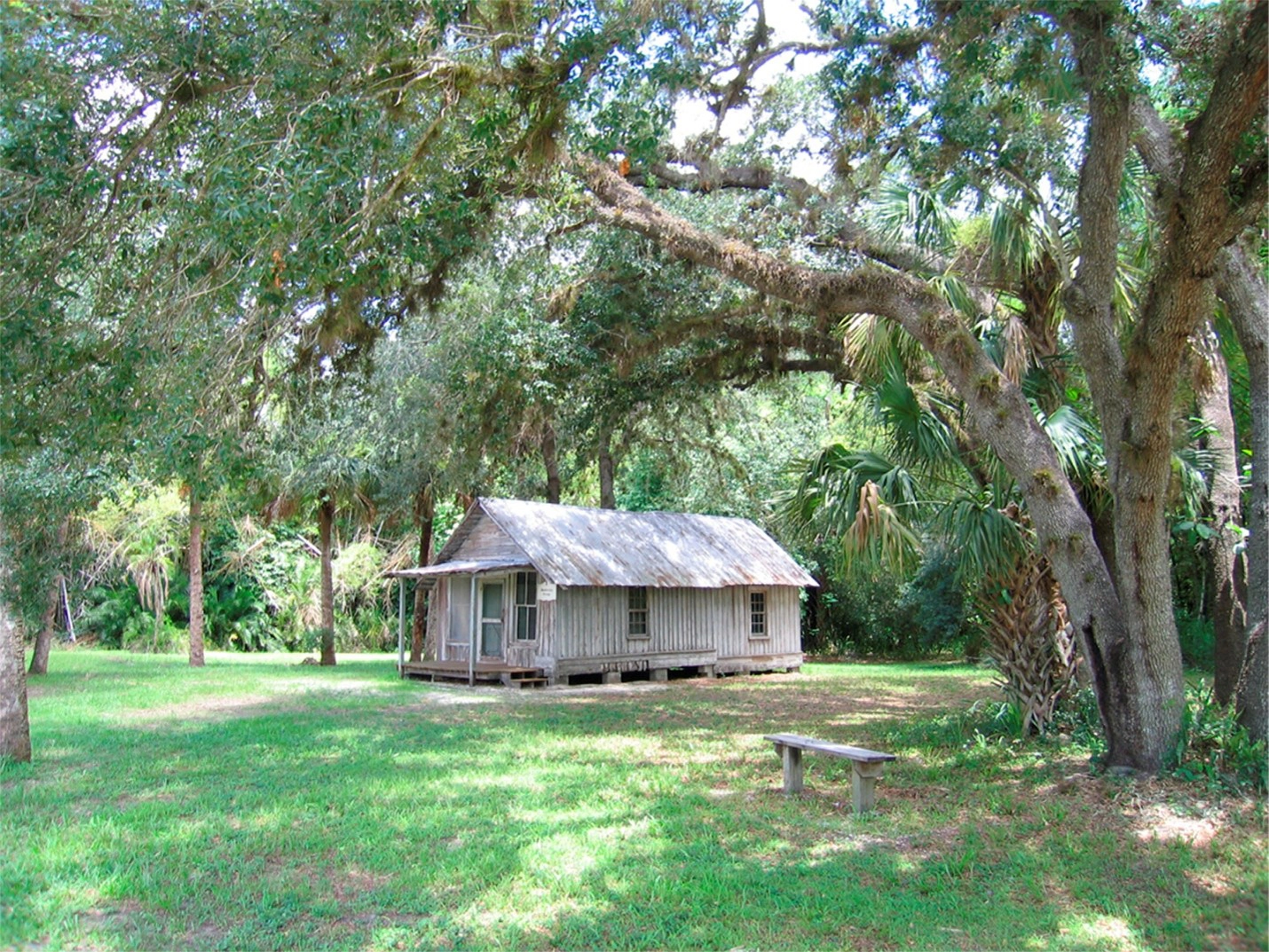
Koreshan Unity Settlement (Koreshan Historic District)
Estero, Florida
David J. Driapsa, FASLA
Significance: The Koreshan Historic District survives as a palimpsest of a late nineteenth- through early- to mid-twentieth-century utopian religious community—an intentional village—in which religious belief shaped spatial organization and land use for ordering and sustaining communal life.
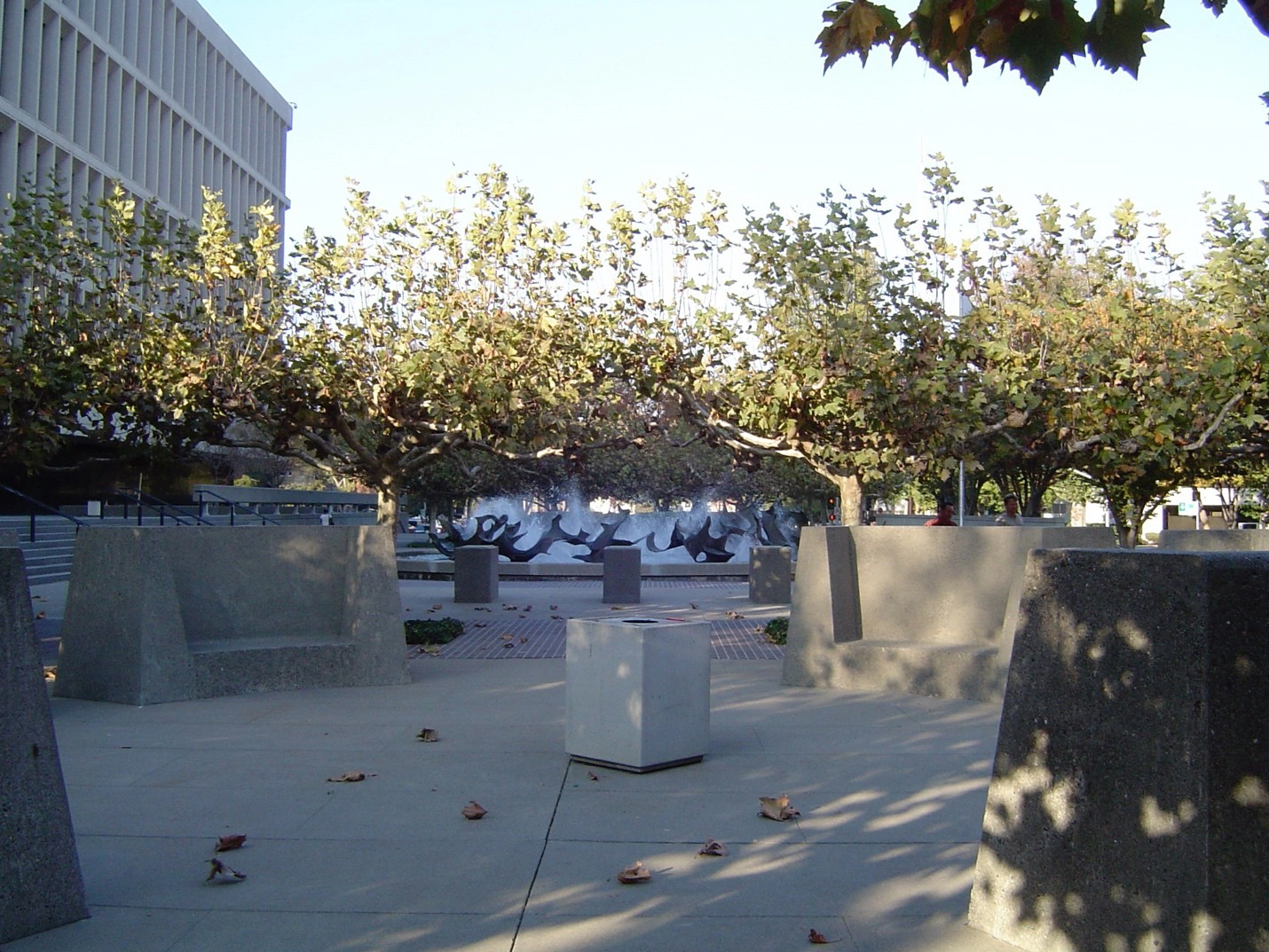
Gordon D. Schaber County Courthouse Plaza (Sacramento County Courthouse)
Sacramento, California
Melissa Mourkas
Significance: The Gordon D. Schaber Sacramento County Courthouse was listed as a Landmark on the Sacramento Register of Historic and Cultural Resources in 2018. It has been recommended as eligible for the National Register of Historic Places (NRHP) under Criterion C and the California Register of Historic Resources (CRHR) under Criterion 3. The Sacramento County Courthouse was constructed in 1965. The landscape of the courthouse building was designed by Hideo Sasaki and Peter Walker prior to them forming the SWA Group. Hideo Sasaki was Dean at the Harvard Graduate School of Design and at the forefront of the modernist movement in landscape architecture. Peter Walker was his student. Both are extremely high-profile landscape architects and have a deep and rich portfolio of landscapes in the United States. The building was designed by the Sacramento firm of Starks, Jozens & Nacht. Both the landscape and the building reflect the typical character-defining features of the Mid-Century Modern architectural style known as Brutalism. The centerpiece Proteus Fountain designed by sculptor Aristedes Demetrios livens up the static brutalist plaza landscape with moving water and abstract bronze sculptures evoking images of aquatic life. The building, landscape, and fountain were designed to work together as a seamless whole.
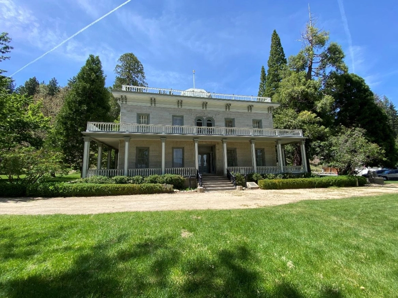
Bowers Mansion (Bowers Mansion Regional Park)
New Washoe City, Nevada
Jung-Hwa Kim, PhD
Significance: Bowers Mansion illustrates how a woman and a Scottish immigrant pursued economic and civic freedom in the American West, in the wake of the 1859 Comstock Lode discovery. Built with a Comstock mining fortune, the year before Nevada statehood, the mansion of Eilley Bowers (1826-1903) and her husband Lemuel Sanford “Sandy” Bowers (1833-1868) is an early example of the estates raised by the newly rich of the hard-rock-mining West. Listed in the National Register of Historic Places in 1976 for its architecture, the site holds further significance in its grounds, a landscape of freedom. They supported Eilley in her pursuit of economic independence, which she sought by running the mansion as a resort. The grounds were also the setting of one of the earliest gatherings for women’s suffrage in Nevada, and they long served the community as a place of picnics and public gatherings, when later held in common as a public park.
Adam King, Student ASLA, and David Taloma, Student ASLA, both students at the University of Nevada, Las Vegas School of Architecture, assisted with archival research and produced the photographs. King produced the maps, and Taloma proofread the narrative. Amanda Rookey, ASLA, PLA, Nevada HALS Liaison, and Melinda Gustin, ASLA, Nevada HALS Co-Liaison, measured the site, and Rookey produced the measured drawing.
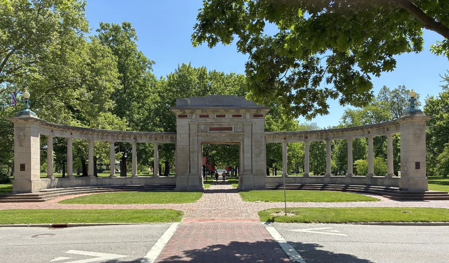
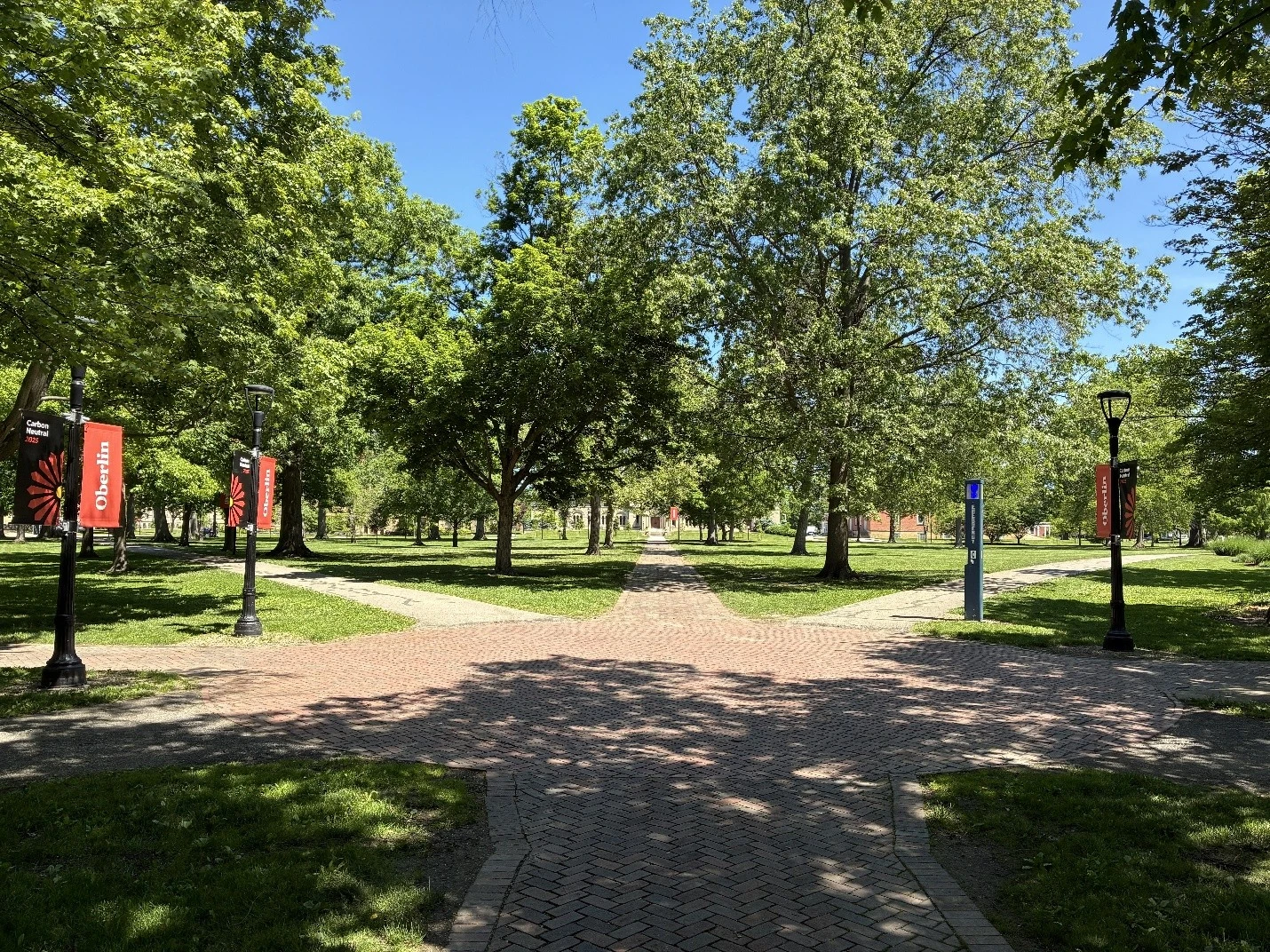
Tappan Square
Oberlin, Ohio
P. Jeffrey Knopp
Significance: Tappan Square has a history dating back to the traditional Village Green of New England during American Colonial times. The rectangular surveying system utilized to define the Western Reserve of Connecticut is responsible for its shape. It was inspired by the religious convictions of one man and built by the work and generosity of many into a college campus. Currently, its park-like beauty is the direct result of landscape architects and administrators who embraced the ‘City Beautiful’ movement. And its future is ensured by the wealth of an inventor whose extended family connection to Tappan Square dates to the time of its creation.
The people associated with Tappan Square had different motives and aspirations for its use. As a result, it has a history of being:
- a Wilderness of untainted land,
- a Village Green,
- a College Campus,
- a Town Square, and
- a Permanent Sanctuary of open space.
Each of these phases of its history built upon previous phases, resulting in a unique public open space with multiple functions. The overriding theme of all these uses has been to “do good to men to the utmost extent of their ability.”
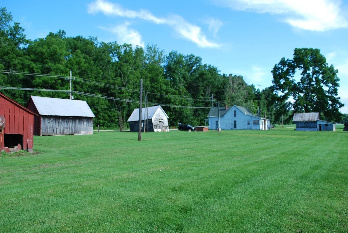
Esther and Richard McNiece Farmstead
Brownstown, Indiana
Riley Meier, Student ASLA
Significance: The McNiece Farmstead is significant an example of the formation and evolution of nineteenth century Midwest farmsteads. The farm’s creation embodies the intersection of culture and landscape.
The house, barn, and outbuildings were clustered together within walking distance of one another. The house is oriented to a main road and would have historically included pathways, fences, a garden, and an orchard. Plowed fields, pastures, and woodlots surrounded the property. The farmstead’s buildings, especially the log house and English barn, are textbook examples of Midwestern folk/vernacular forms and construction techniques
Advisors:
- Sarah Malone, Hanover College
- Darrin Rubino, Hanover College
- Christopher Baas, Ball State University
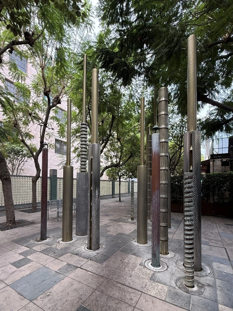
Biddy Mason Memorial Park
Los Angeles, California
Stephanie Psomas, ASLA
Significance: The site significantly relates to the 250th anniversary of the founding of the United States and particularly addresses liberty and freedom in its commemoration of Bridget “Biddy” Mason, an emancipated woman who in 1856 won her freedom in California. An important figure in Los Angeles as a leader of the black community, philanthropist, entrepreneur, and landowner, she purchased property on this site in 1866 as her homestead.
Biddy Mason Memorial Park opened in 1991 as one of the first urban infill parks in Downtown Los Angeles. Although modest in size at 7,645 sq ft, the park has become a cultural landmark that honors the mighty resilience of one person’s life and spirit.
In the late 1980s woman-owned Burton & Spitz Landscape Architecture (Pamela Burton, FASLA, & Katherine Spitz, ASLA) was commissioned by the Broadway Spring Center developers to provide a landscape architectural design that would meet many criteria required by the City: create a park space that would give mid-block pedestrian access between South Spring Street and Broadway, and between West Third Street and Fourth Street; accommodate four art elements including two tributes to Biddy Mason; include a water feature that would not encourage public bathing; design gates at Broadway to limit entry to designated days/times; and provide paving, planting, irrigation and lighting design for the park. The resulting urban park design honors Biddy Mason while also celebrating iconic physical attributes of the City.
Betye Saar’s assemblage, Biddy Mason: House of the Open Hand, 1990, is significant in its commemoration of Mason’s day-to-day life in Los Angeles with artifacts salvaged from the site on display in a faux window, her descendants standing behind a picket fence, and a photograph of Mason.
Sheila Levrant de Bretteville’s Biddy Mason: Time and Place, 1991, traces Mason’s journey and accomplishments by way of an 80-foot-long bas relief timeline that conveys the struggles and resilience of Biddy Mason with impressions of objects, narrative texts, and images, that give physical resonance to the park’s significance.
Juan Bautista de Anza National Historic Trail
Maricopa County, Arizona
Aaron M. Wright, PhD, Caryn Logan Heaps, ASLA, PLA, Steve Venker, ASLA Emeritus, and Giovanni Barberio
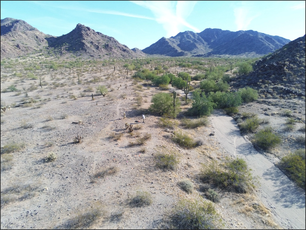
Significance: The year 2026 marks the semiquincentennial—the 250th anniversary—of Juan Bautista de Anza’s overland expedition from Sonora to the Pacific Coast to establish the first Euro-American settlements in Alta California (“upper California”). Seeking freedom, liberty, and opportunity, Anza and approximately three hundred settlers and soldiers, representing thirty families, walked more than 1,800 miles from their homes in the war-torn region of northwestern New Spain, in what are now the Mexican states of Sinaloa and Sonora, to begin new lives in what would become the United States’ thirty-first state. This historical milestone coincides with the United States’ semiquincentennial, which is being commemorated through America250 and Freedom250 events across the nation. The expedition’s historical significance was formally recognized in 1990, when federal law established the Juan Bautista de Anza National Historic Trail.
Recent archaeological surveys expand the significance of the Anza route by demonstrating that it represents a millennia-long history of transcontinental transportation through the inhospitable Sonoran Desert. Indigenous trails aligned east-west across a waterless overland stretch of the Gila River known as the Great Bend of the Gila River in south-central Arizona. These trails form the foundation of a multilayered history of travel, communication, and trade.
In the late eighteenth century, Spaniards traveling from missions and presidios (“forts”) in Sonora to new outposts in Alta California used these trails. A historian of the Anza Expedition described the route as the Jornada de las Estrellas (“Journey of the Stars”). The trails continued to be used throughout the nineteenth century by Spaniards, Mexicans, and, ultimately, American explorers, military forces, fur trappers, gold-seeking forty-niners, mail-delivery services, immigrants, and railroad builders. They thus played a critical role in the settlement of the American West, as the ethos and excitement of Manifest Destiny encouraged the expansion of the United States’ democratic and capitalist ideals from coast to coast.
During the twentieth century, portions of these routes became part of the Arizona state highway system and later the Interstate Highway System. Today, the legacy of these trails is preserved within the Sonoran Desert National Monument.
Gonzales Amphitheater and Reflecting Pool
Gonzales, Texas
The Texas ASLA HALS Committee – Sandra Chipley, ASLA, RLA, Chair
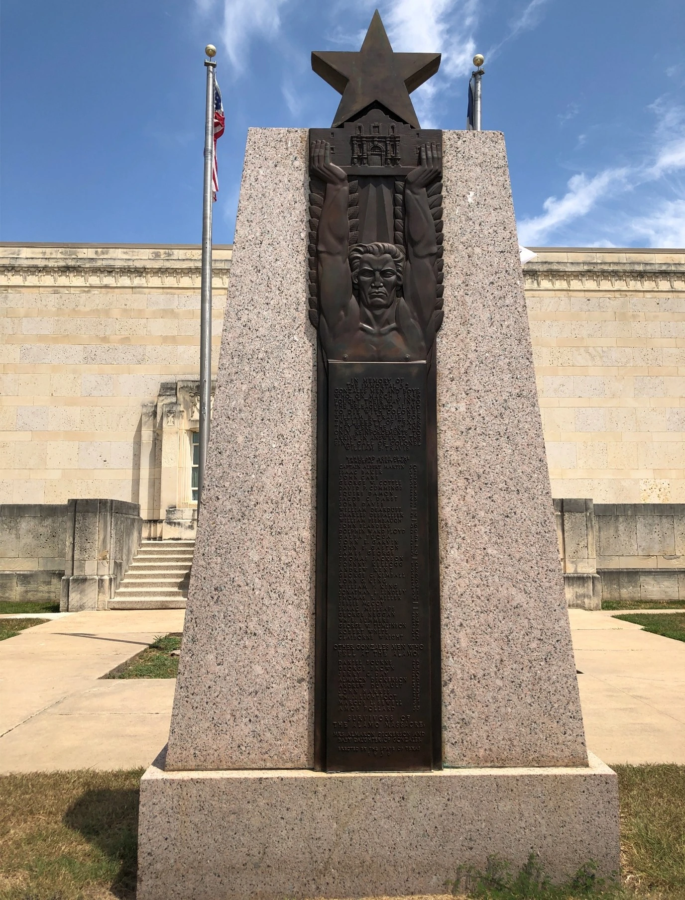
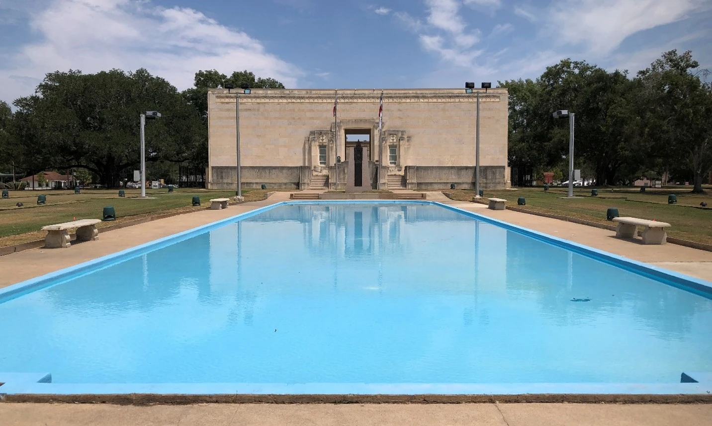
Significance: The Gonzales Amphitheater and Reflecting Pool were recognized and significantly included in the “Gonzales Museum and Amphitheater Historic District National Register Nomination” listed on January 13, 2004. These represent a significant example of the Texas Centennial’s commemorative landscape design in Texas as incorporated into Centennial memorial building complexes constructed throughout the state, and, in particular, the limited number of those complexes which included reflecting pools and amphitheaters. Constructed in 1937 with state and WPA funds, these memorial landscape features were built by the citizens of Texas to honor the memory of the Gonzales citizens who not only fired the “First Shot” of the Texas Revolution, but also were the only Texians who responded to Travis’ infamous letter from the Alamo requesting aid. Designed on a dominant central axis, the promenade-like parallel sidewalks begin a solemn, memorial processional leading from reflecting pool, to monument terrace, to elevated terrace, to museum central passageway, to marble memorial tablet and, ultimately to the amphitheater. The tablet states, “At this battle was given to the world a new battle flag and new war cry “Come and Take It” and was started the successful Texian revolution.” This historic cultural landscape is one of the most significant tourist pilgrimage destinations in Texas.

2027 ASLA HALS Call to Action
Stay tuned—the theme for the next open call for HALS report submissions will be shared here on The Field very soon! [This post has now been published: Genius of Place: Regional and Vernacular Landscape Architecture.]
About the Historic American Landscapes Survey (HALS)
In 2000, the National Park Service (NPS), Library of Congress (LOC), and ASLA established HALS. HALS builds upon earlier NPS documentation programs, the Historic American Buildings Survey (HABS) and Historic American Engineering Record (HAER), to record significant landscapes in the national collections of the LOC.
ASLA’s HALS Leadership Team and the HALS Chapter Liaisons Network provide support on identifying, selecting, and documenting historical landscapes.
The HABS/HAER/HALS Collection of the Library of Congress
Since 1933, all documentation created through the program has been archived in the HABS/HAER/HALS collections of the Library of Congress.
There is currently documentation of over 46,000 properties in the collection. This includes:
- 70,000 drawings
- 330,000 photographs
- 270,000 pages of history
Most of the collection is digitized and can be viewed online.
Sources of Documentation in the HALS Collection
Documentation in the HALS collections comes from three primary sources:
- federal agency mitigation,
- National Park Service in-house projects, and
- donated work.
Of the three, donated work is currently the largest source of new documentation. This includes work donated by qualified design and preservation professionals, student projects, and entries to various calls for submissions.
The Historic American Landscapes Survey (HALS)
Explore More from HALS
Historic American Landscapes
The Historic American Landscapes Survey (HALS) documents historic landscapes in the United States and its territories to serve as tangible evidence of our nation’s heritage and development.
Celebrating the Plurality of Place: Takeaways from ASLA’s 2026 HALS Webinar
As the United States marks its 250th anniversary, ASLA's Historic American Landscapes Survey (HALS) Leadership Team encourages landscape architects, students, historians, and preservation advocates to help document the nation’s rich cultural heritage through HALS.
Genius of Place: Regional and Vernacular Landscape Architecture
Highlight the significance of your community’s local landscape architecture works as contributions to a recognizable local or regional style.