
.webp?language=en-US)

.webp?language=en-US)
Saxis 2090: From Resistance to Resilience through Dredged Landscapes
Shuai Yuan, Associate ASLA; Sean Alberts; Sachida Pradhan


This is an important topic in the built environment. I wish more people were talking about. Your design solutions were reasonable and inspired. I want to commend you on making a complicated subject legible.
Awards Jury
-
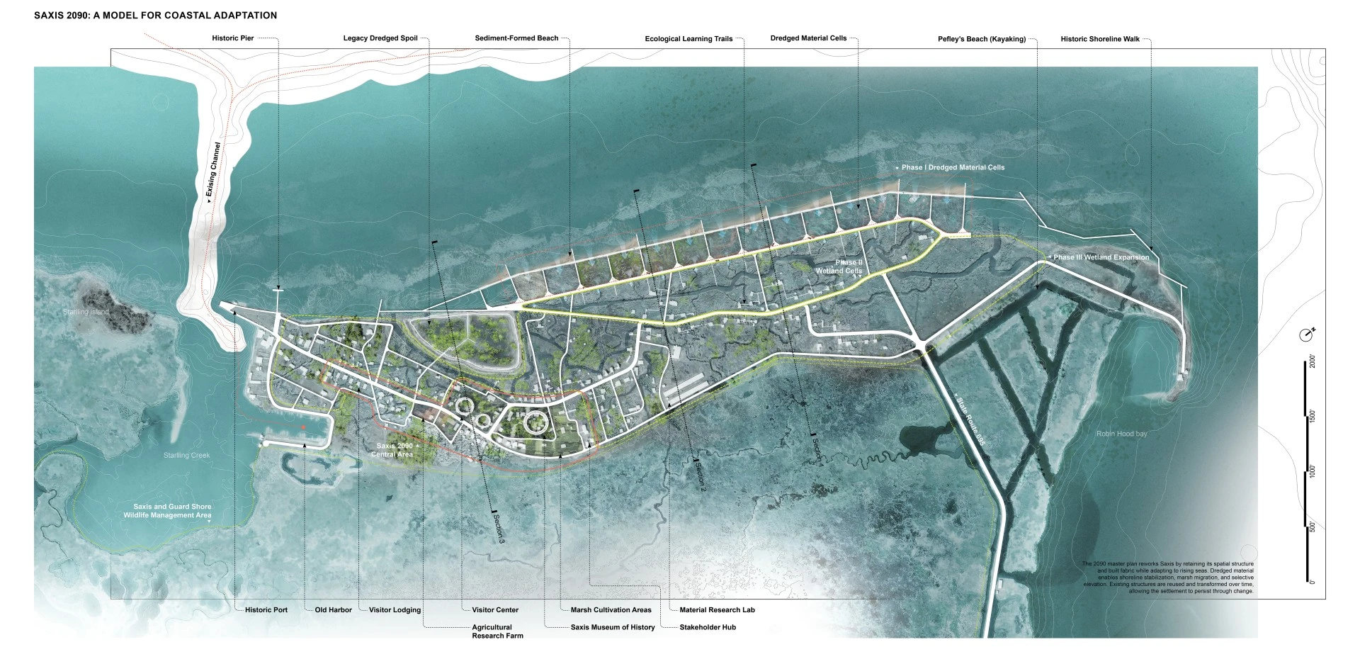
Saxis 2090 proposes a phased coastal adaptation framework for Saxis, Virginia, by reframing dredged sediment as a design medium in response to sea-level rise. At the fragile edge of the Chesapeake Bay, Saxis faces accelerating flooding and erosion that threaten its future. The project redirects sediment from navigation channels to slow erosion, support marsh migration, and reshape the ground over time. Moving beyond static defense, it links landscape transformation with managed retreat, creating time and flexibility for relocation decisions. Coordinated across stakeholders, this transformation sustains community continuity while reimagining Saxis as both a model for sediment-driven coastal adaptation and a living maritime-cultural archive.
-
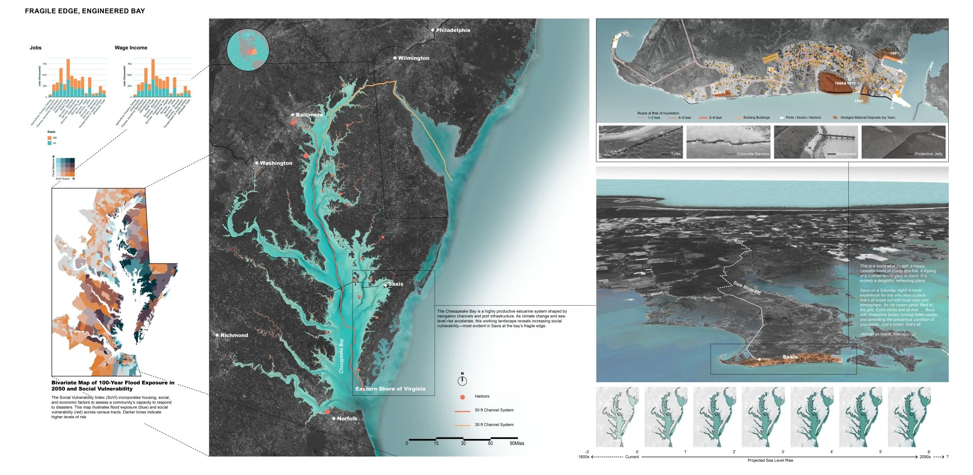
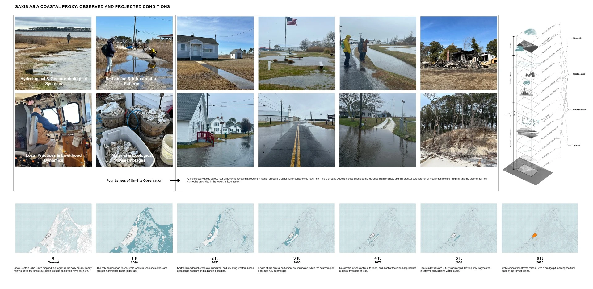
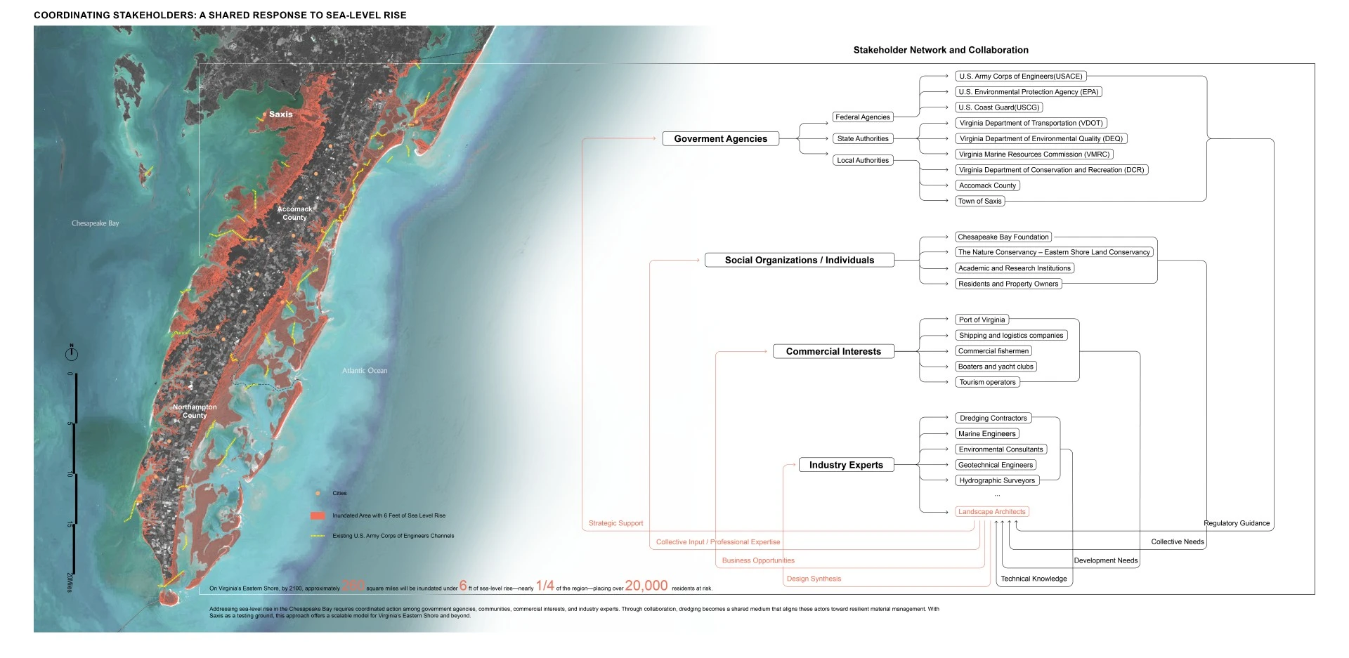
At the frontline of sea-level rise in the Chesapeake Bay, Saxis, Virginia, faces the erosion of its land, livelihood, and identity. As a highly engineered estuarine system, the Bay depends on dredging to maintain navigation channels, generating sediment that must be placed within coastal landscapes. With much of Saxis less than two feet above sea level, accelerating shoreline loss and recurrent tidal flooding expose the limits of conventional protection methods, situating the town within broader environmental and infrastructural transformation.
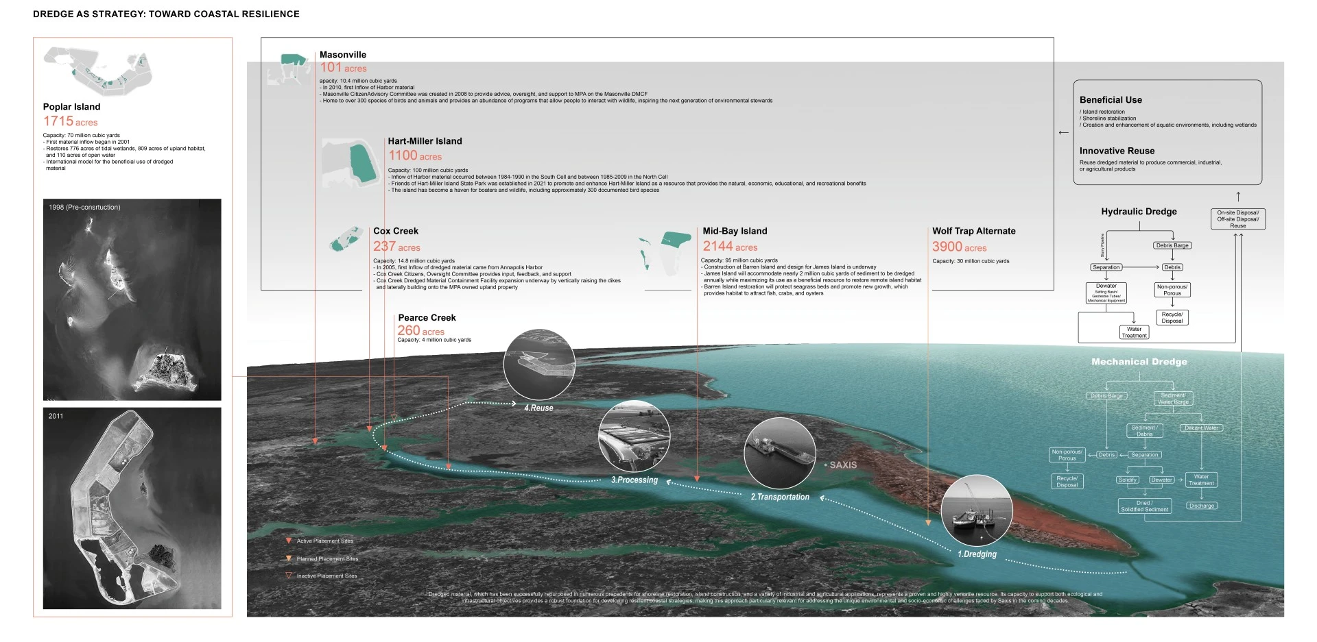
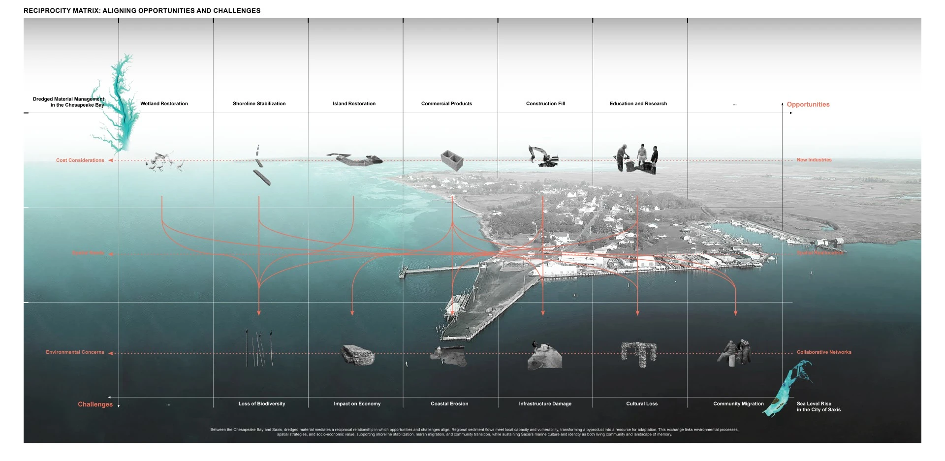
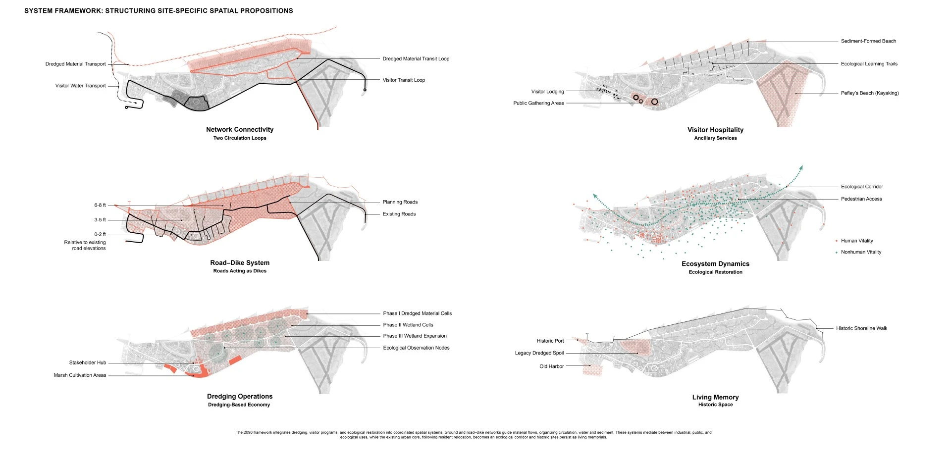
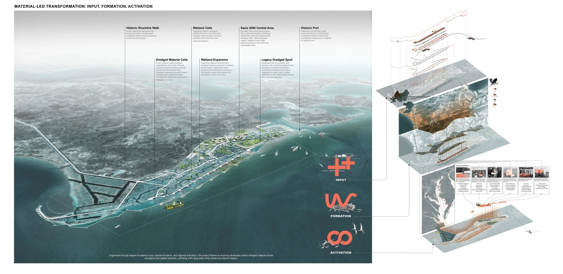
This project positions dredged material as both a design medium and adaptive infrastructure for coastal resilience. Rather than relying on static defense, it frames Saxis as a dynamic system shaped by sediment flows, hydrodynamics, and socio-political conditions. Mapping, modeling, and material testing inform site-specific interventions, where simulations and dredged-material cells evaluate landscape performance under shifting conditions. Ground and infrastructure direct sediment movement, shaping landforms that mediate between human and ecological processes. Building on existing practices in the Chesapeake Bay, the project leverages both the logistical demand for sediment placement and the economic value of dredging. Coordinated across agencies and stakeholders, these flows generate spatial and financial capacity to support phased relocation and guide Saxis's gradual transition from an inhabited town toward an adaptive marsh landscape.
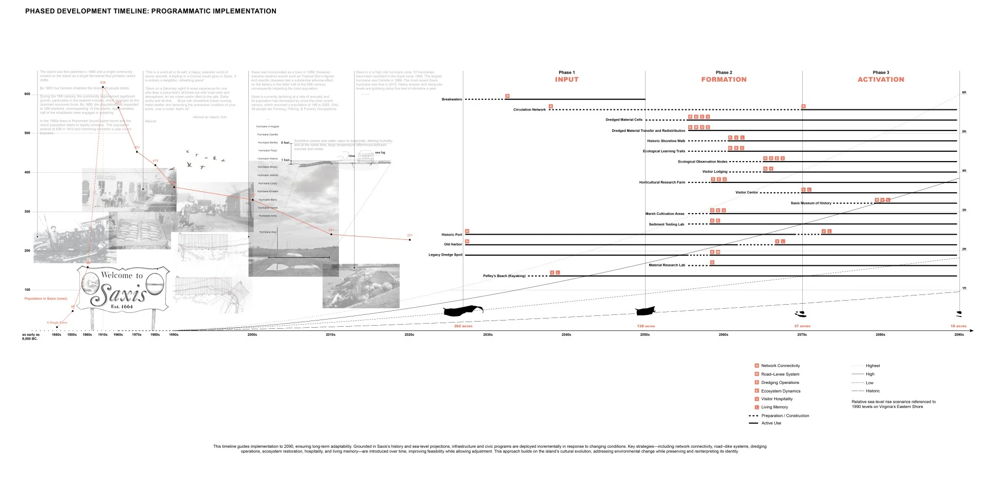
A phased framework transforms dredging into adaptive infrastructure, with landscape operating as an evolving medium.
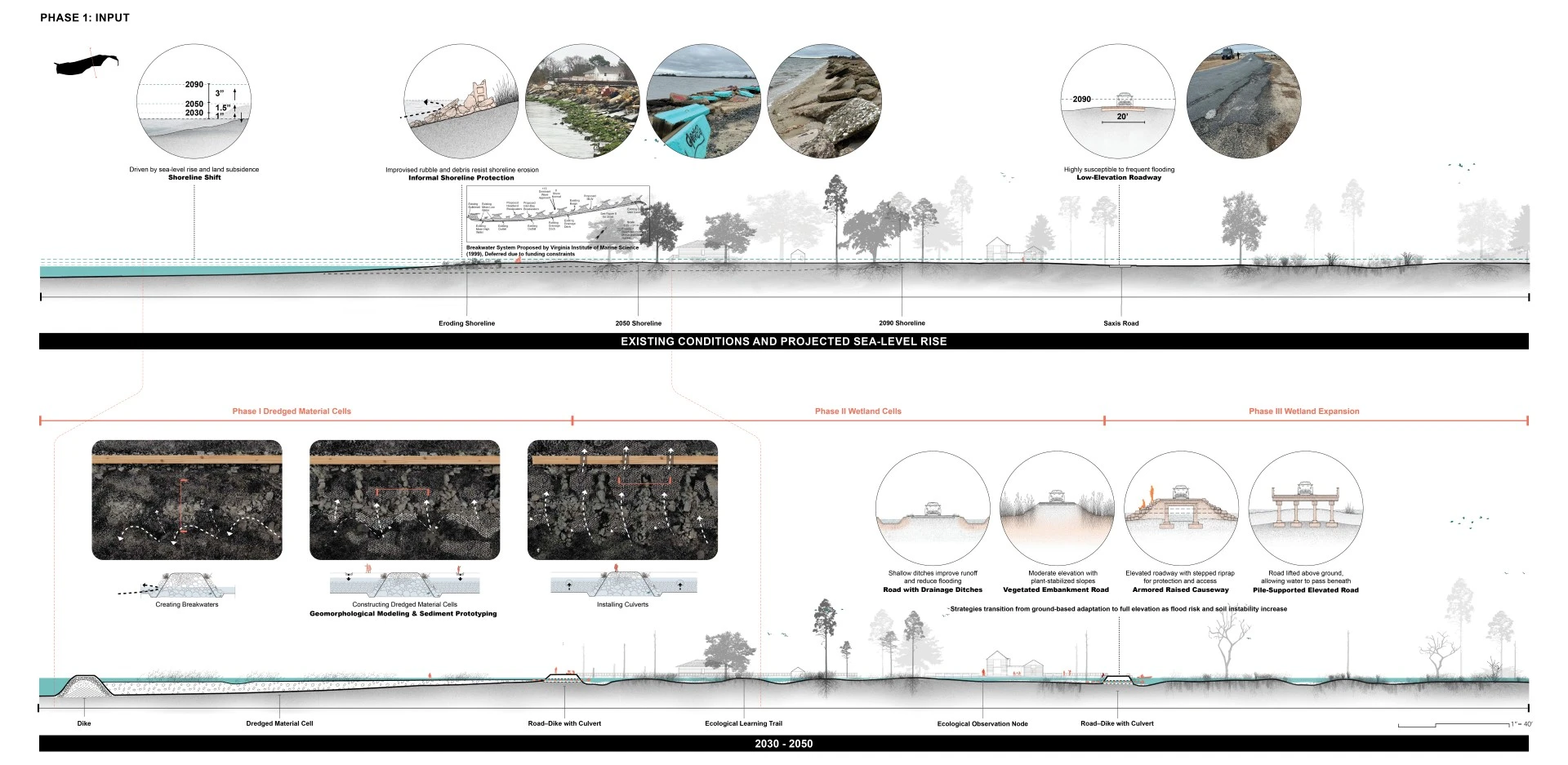
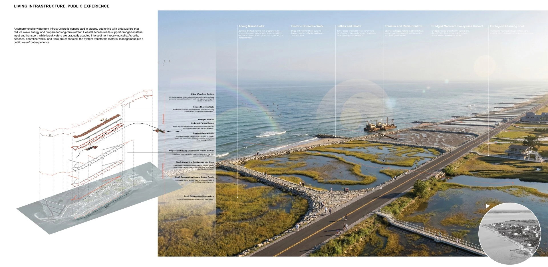
Input 2030–2050: Installed breakwaters reduce wave energy and are adapted into dredged-material cells. Structured with dikes and culverts, these systems regulate tidal exchange, receive sediment from navigation channels, and initiate controlled land formation, slowing erosion and extending time for relocation.
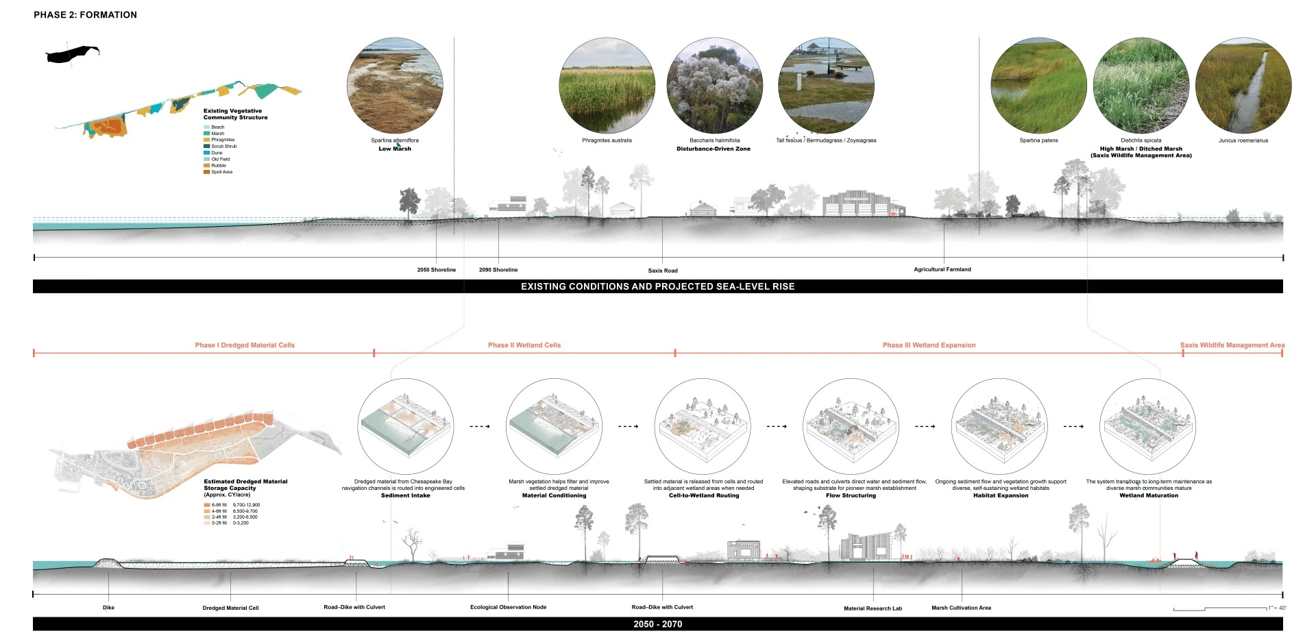
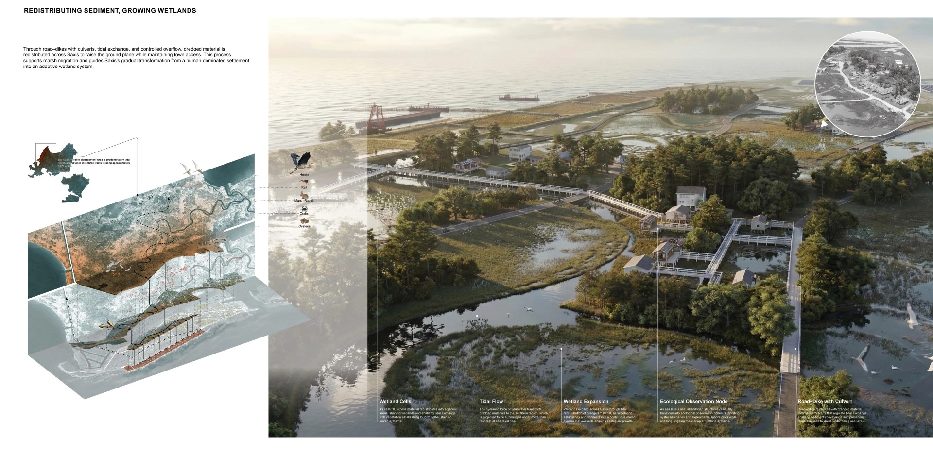
Formation 2050–2070: As sea levels rise and residents relocate, systems shift from containment to redistribution. Filled cells release sediment inland through tidal exchange and engineered connections, elevating the adjacent ground plane, supporting marsh migration, and forming an adaptive wetland gradient.
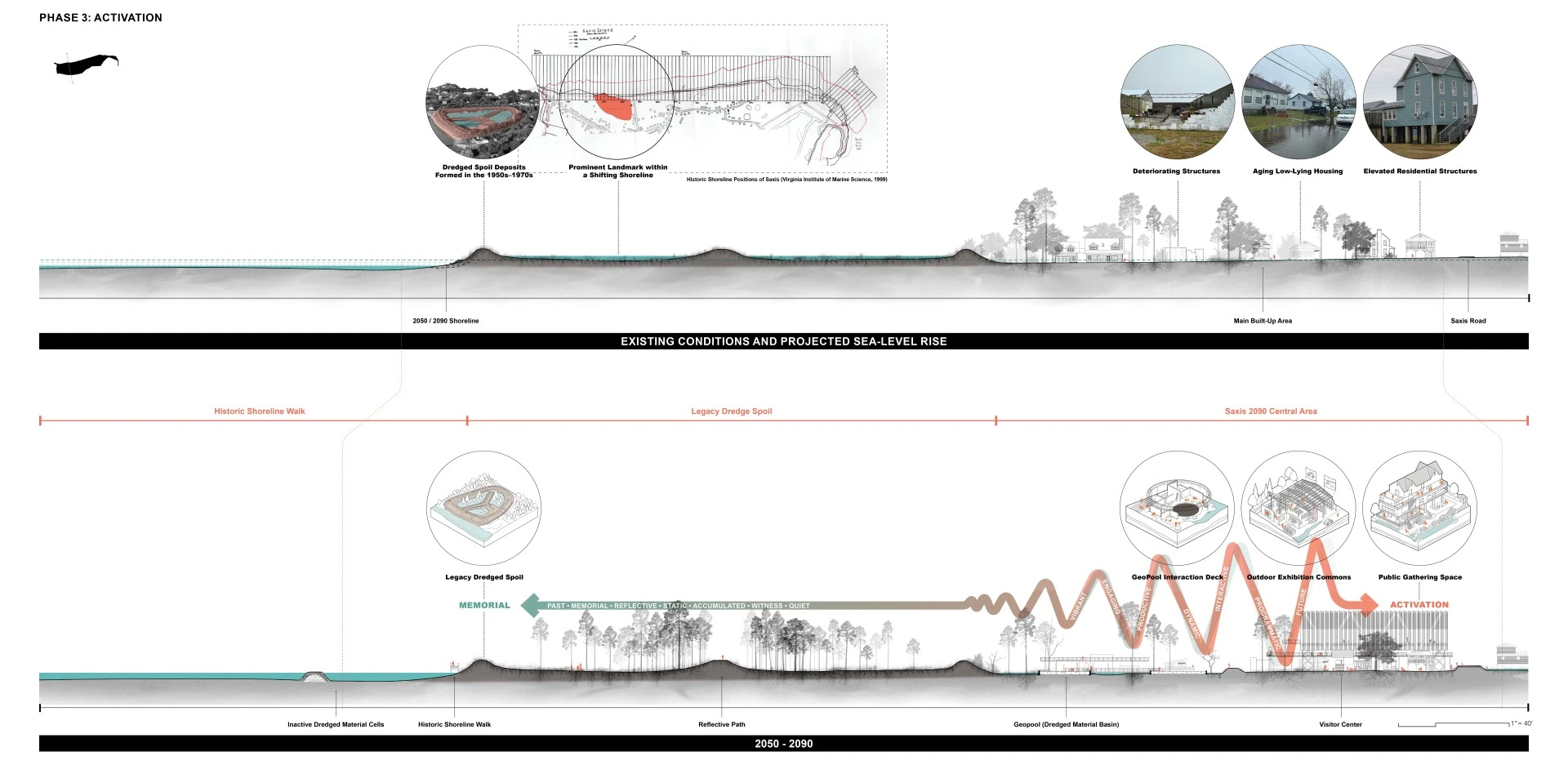
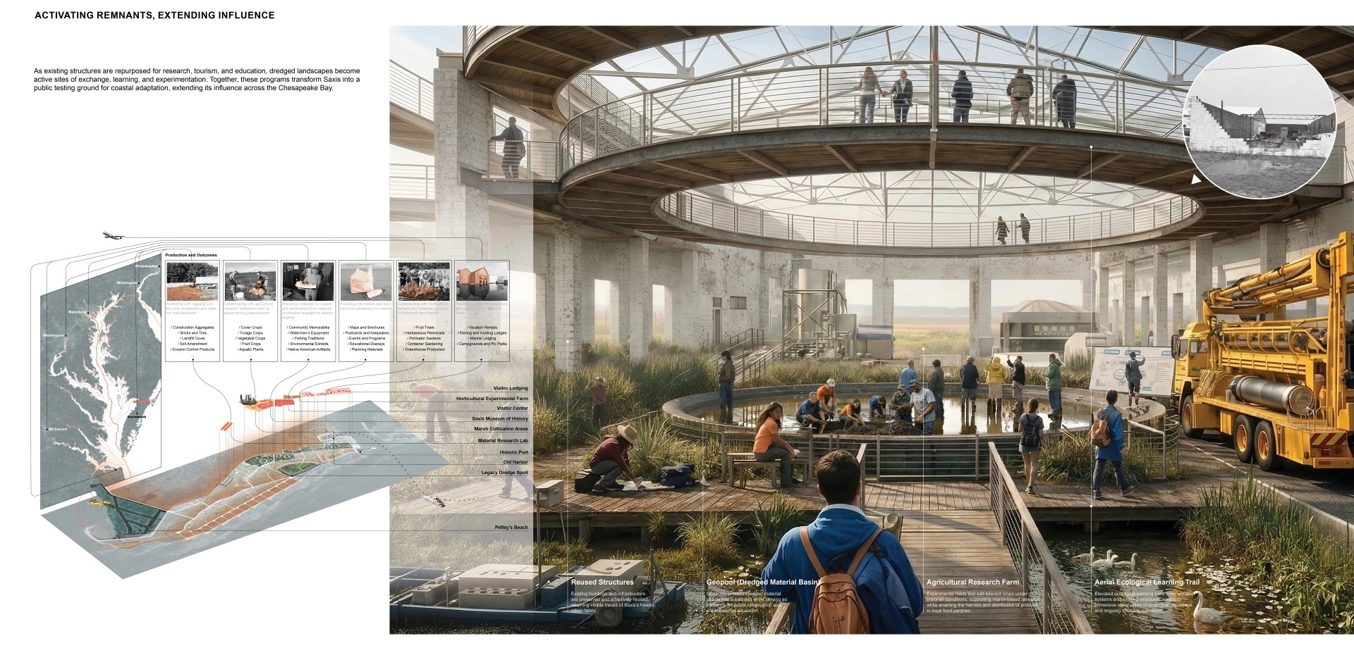
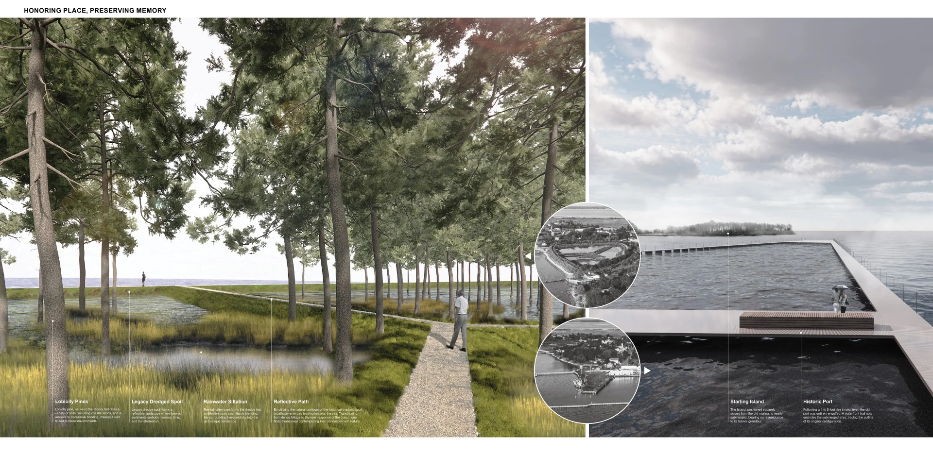
Activation 2070–2090: With much of Saxis submerged, a remnant urban core and historic dredge spoil persist above water. These remnants anchor the site's presence. Recast as a memorial landscape and research site, they sustain identity while supporting experimental programs within the Chesapeake Bay.
Saxis 2090 reframes coastal resilience in Saxis as adaptive rather than defensive, shifting from static protection toward evolving landscape systems. By coupling sediment management with design, it transforms dredged material into an active ecological and spatial process. Ecologically, it enables marsh migration and habitat formation; socially, it supports coordinated relocation while maintaining continuity; culturally, it carries memory through evolving landforms. As both a testing ground for climate adaptation and a living maritime archive within the Chesapeake Bay, the project positions landscape as a mediator between environmental change and human response, offering a transferable model for coastal transition under uncertainty.
-
- Spartina alterniflora
- Juncus roemerianus
- Bolboschoenus robustus
- Spartina patens
- Distichlis spicata
- Limonium carolinianum
- Salicornia virginica / Salicornia spp.
- Solidago sempervirens
- Ammophila breviligulata
- Pinus taeda
- Juniperus virginiana
- Morella cerifera
- Morella pensylvanica
- Baccharis halimifolia
Advertisement
Related Awards
Award of Excellence, Analysis & Planning
H2Oquirrh: Regional Water Reform for a Resilient Salt Lake Valley
Location: Salt Lake City, UT
Firm: Design Workshop
Client: Wasatch Front Regional Council, Salt Lake County
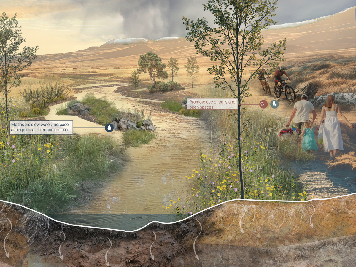
Water flowing from the Oquirrh Mountains is a critical contributor to the Great Salt Lake. Severe drought and human-caused decline threaten the lake’s viability, with cascading impacts on ecosystems and public health. This regional collaboration of seven jurisdictions, the H2Oquirrh Vision Plan, undertakes a large systems analysis of hydrologic cycles, land cover, and land-use decisions to identify site-specific interventions across nine creeks and washes. Led by landscape architects and water resource engineers, the study advances a deeper understanding of localized drivers of water loss and proposes innovative solutions through integrated landscape infrastructure design and policy.
-listing-img.webp?language=en-US)