
.webp?language=en-US)

Form Follows Forest: A Tree Driven Urban Design for Charlestown, MA
Michael Rahtz, Student ASLA
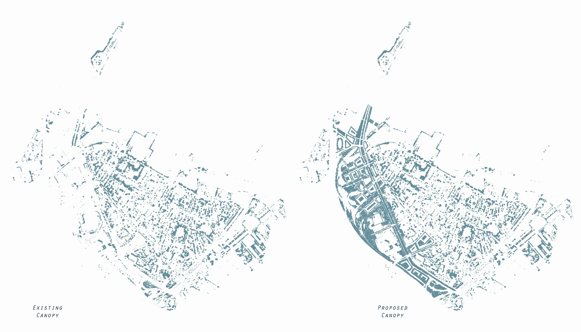

Stunningly detailed and beautifully realized graphics, scale of design solutions also particularly impressive
Awards Jury
-
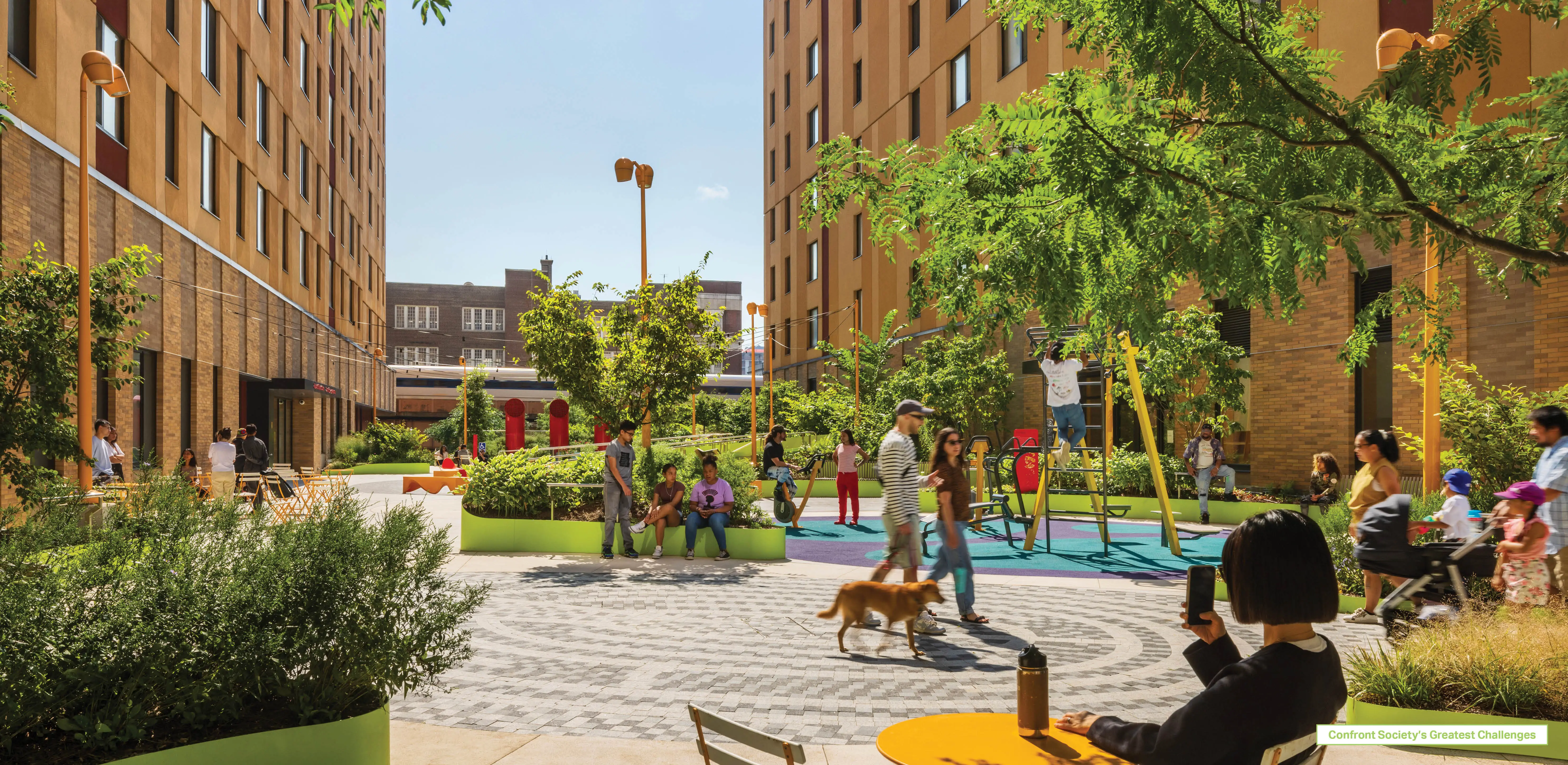
Form Follows Forest is a landscape-led urban design proposal for Charlestown, Massachusetts, that reframes redevelopment through the lens of the urban forest. Addressing heat islands, flooding, and car-dominated infrastructure, the project replaces impervious surfaces with interconnected coastal, wetland, and upland forests that manage stormwater, cool the city, and support biodiversity. Buildings, streets, and public spaces are organized around continuous soil and canopy systems. Adding 2,500 housing units while de-paving 70 acres, the proposal aligns density with ecological performance. Phased over time, it transforms infrastructure into living systems, creating a resilient, climate-adaptive urban forest.
-
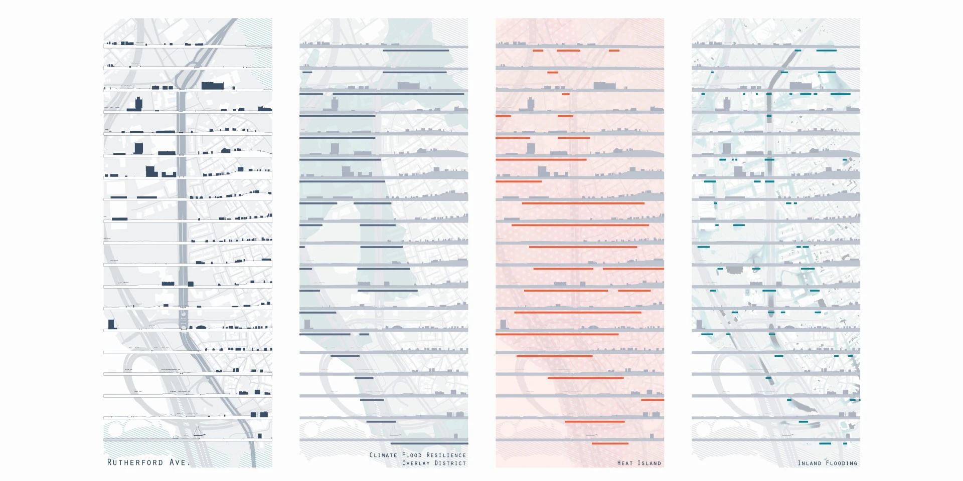
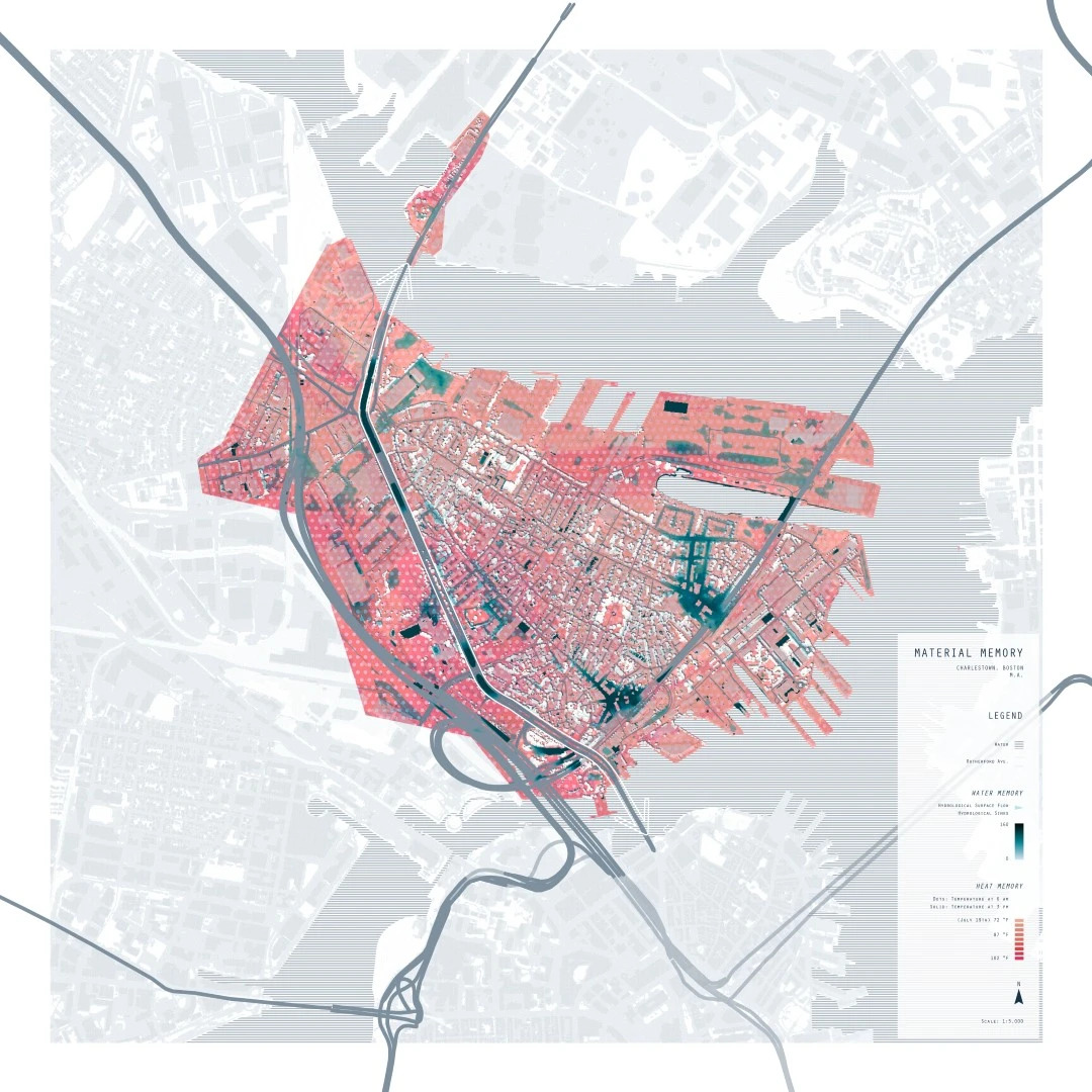
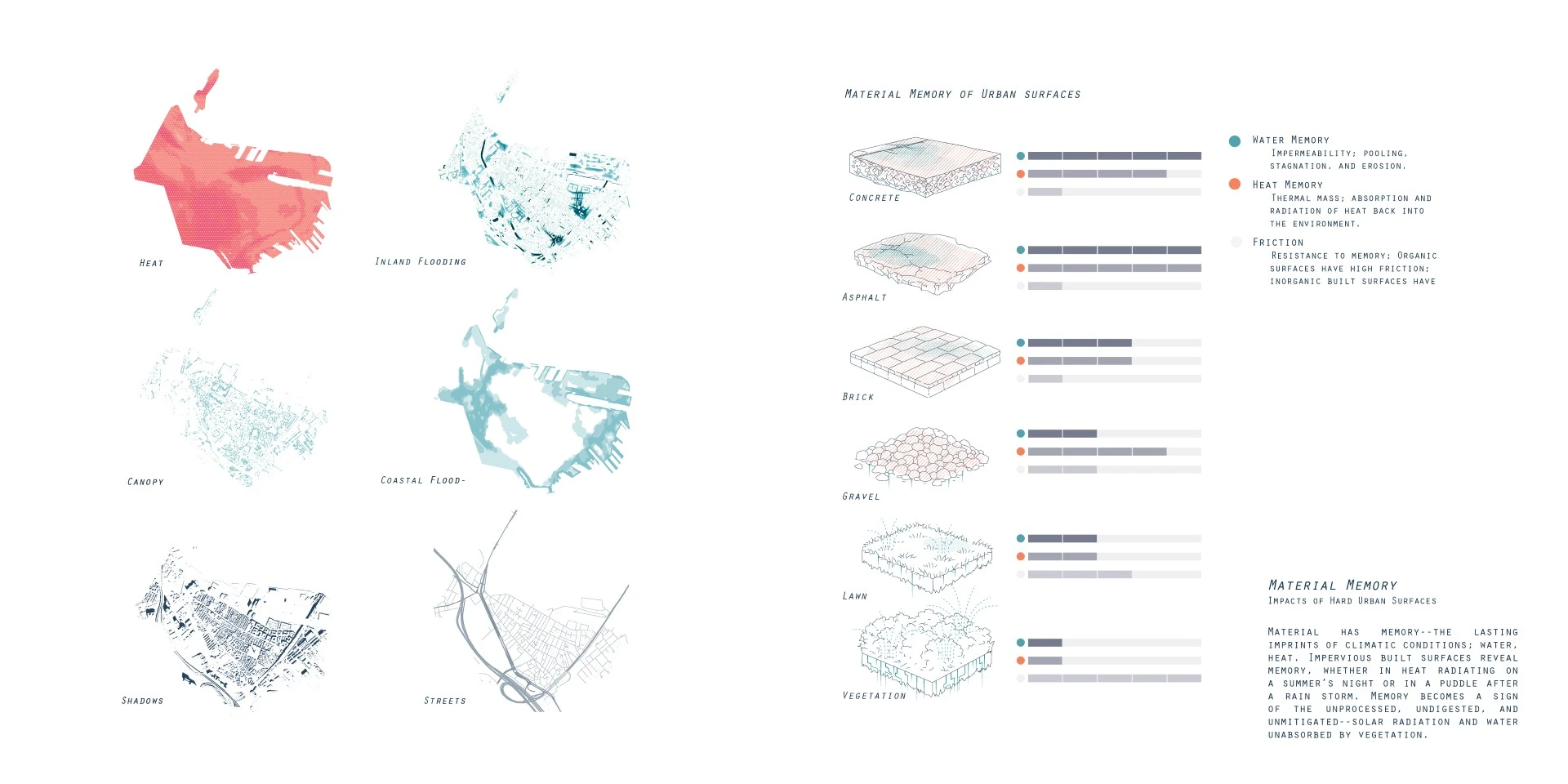
Form Follows Forest is a landscape-led urban design proposal for the Charlestown neighborhood of Boston, Massachusetts that reframes redevelopment through the lens of the urban forest. The project begins with an analysis of existing conditions along the Rutherford Avenue corridor—an area defined by low housing density, car-oriented infrastructure, extensive impervious surfaces, a lack of green space and canopy, urban heat island, and both inland and coastal flood risk. Mapping these factors reveals a landscape where conventional urban form amplifies climate vulnerability.
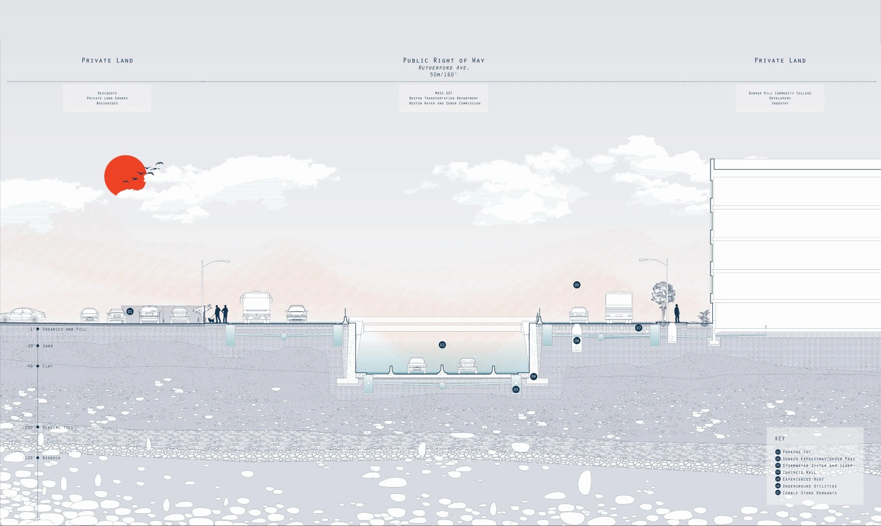
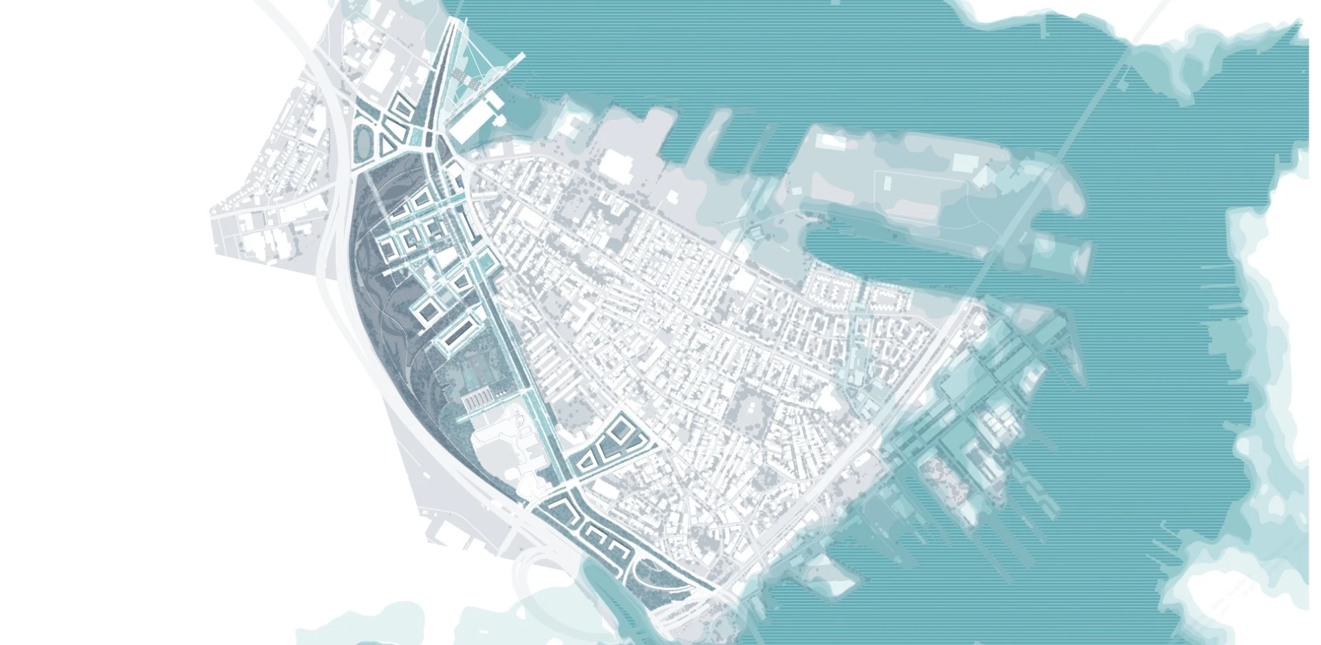
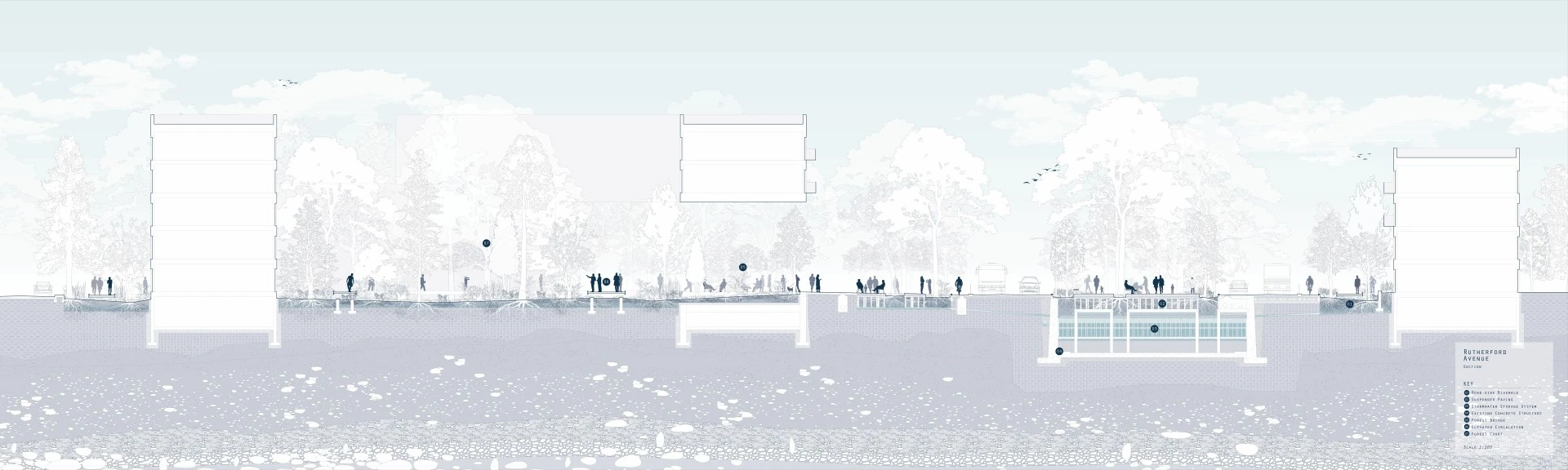
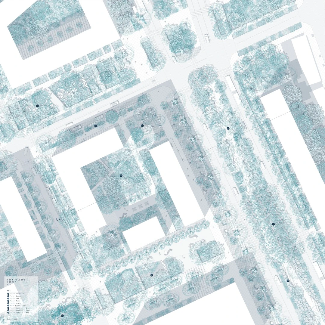
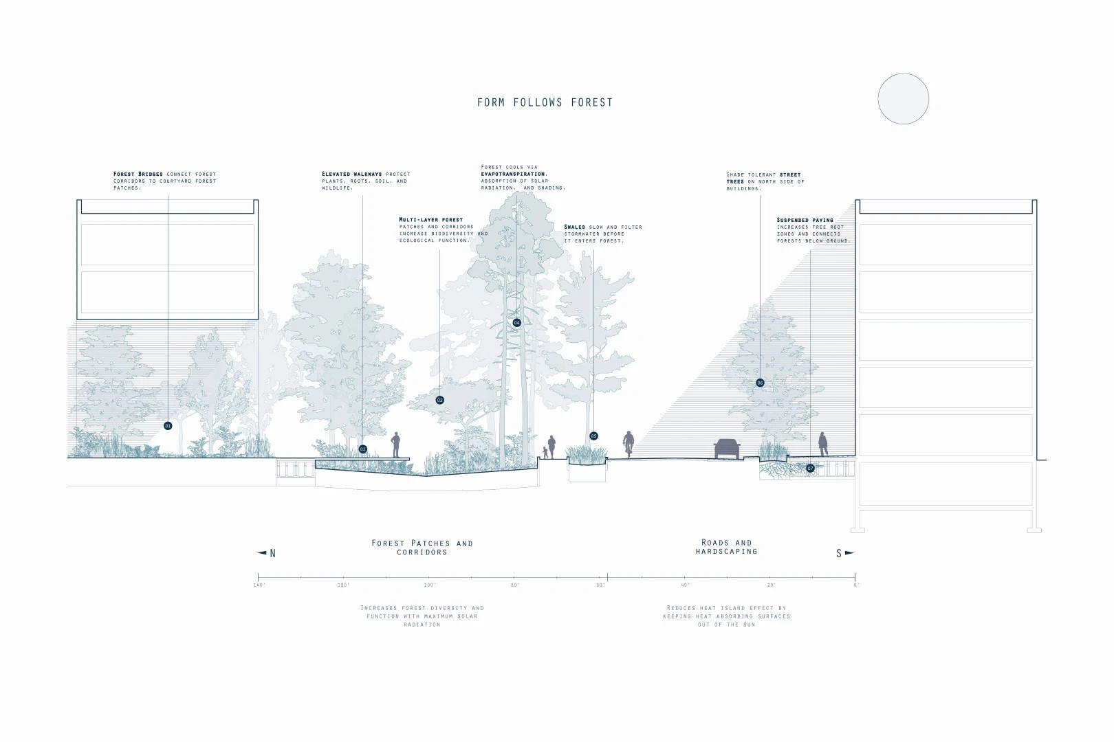
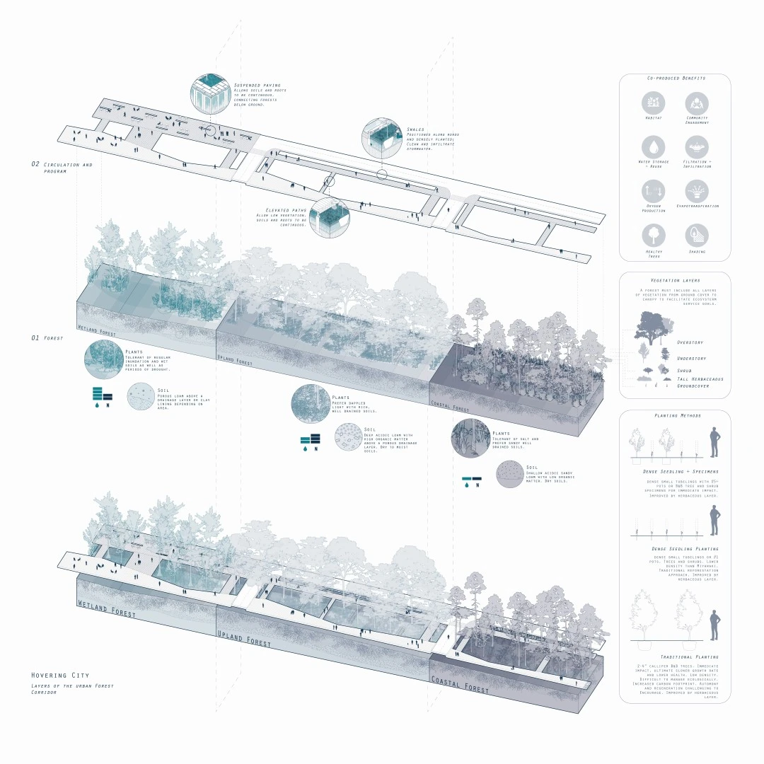
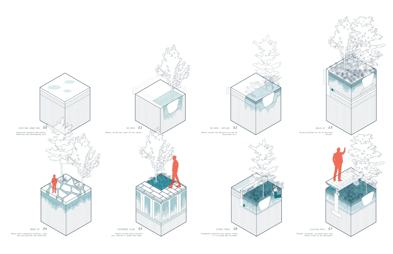
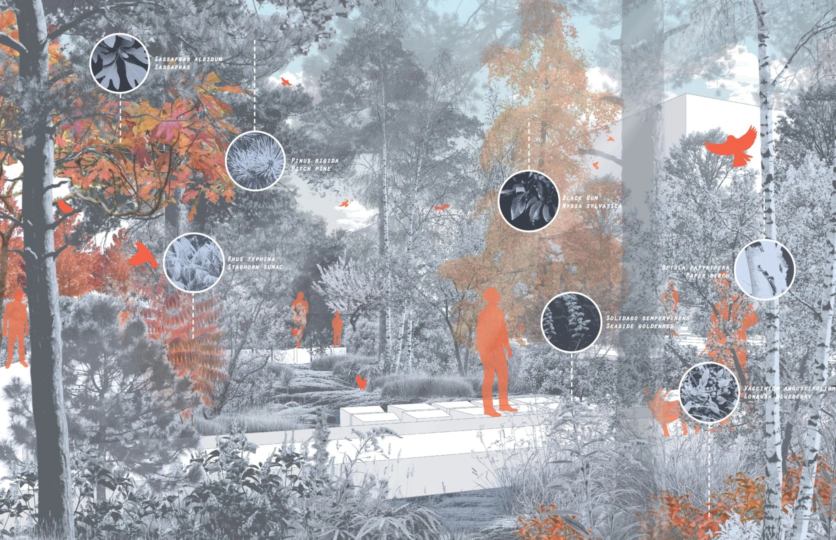
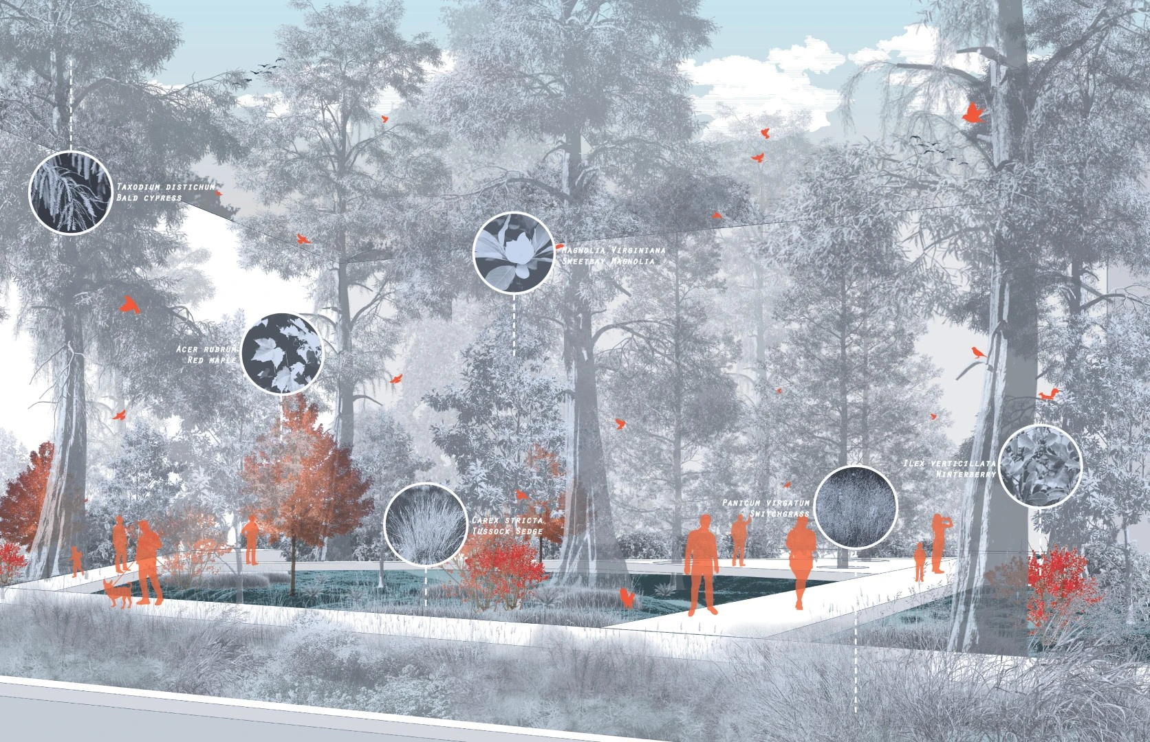
In response, the project establishes the urban forest as primary infrastructure, overturning conventional urban design by prioritizing landscape systems over built form. Instead of inserting trees into leftover space, it establishes a continuous urban forest first, and then organizes infrastructure, housing, and circulation around it. This framework directly addresses climate change by reducing ambient temperatures through shade and evapotranspiration, while also managing stormwater through infiltration, storage, and filtration. Formerly impervious areas are de-paved and regraded to create forested swales, a floodable meadow, and subsurface water storage systems, including the adaptive reuse of existing underpasses on Rutherford Avenue as stormwater infrastructure. Coastal, upland, and wetland forest types are matched to existing and desired urban conditions.
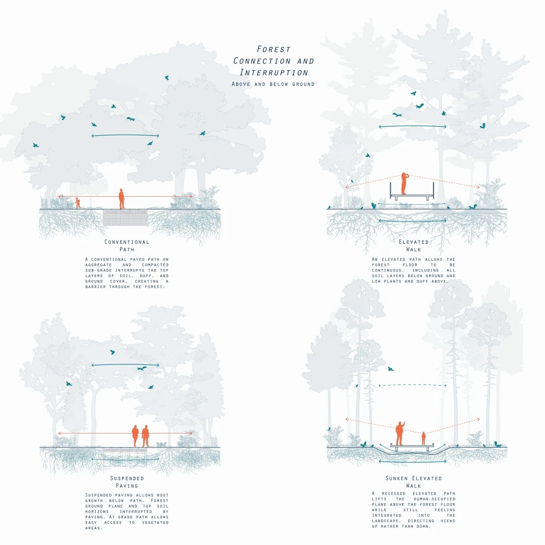
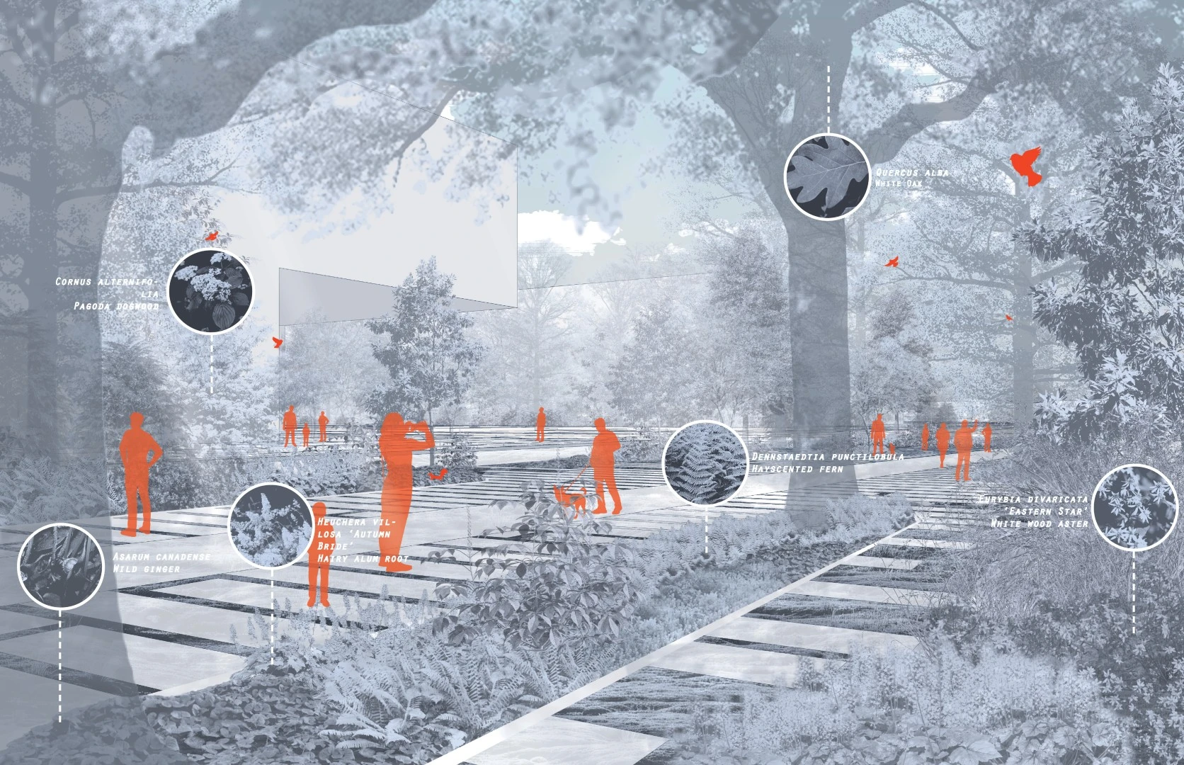
The planning strategy integrates resilience at multiple scales. At the district level, forest corridors form a cohesive ecological network that manage stormwater and support biodiversity. At the site scale, soil continuity is prioritized through techniques such as suspended paving and elevated walkways, ensuring long-term tree health and maximizing ecological function. At the building scale, massing and orientation are coordinated with forest growth patterns, allowing solar access for vegetation while shading streets and reducing heat gain.
Sustainability is embedded through both environmental performance and land use planning. The proposal accommodates approximately 2,500 new housing units, increasing density while simultaneously converting over 70 acres of land to permeable forest. This dual approach challenges the assumption that urban growth and ecological restoration are mutually exclusive. Instead, it demonstrates how compact development can coexist with, and even depend upon, high-functioning landscape systems. Rather than the typical "3-30-300" urban forestry rule, Form Follows Forest uses the 50-50-50 rule; residents can see 50 trees from their home, their block has at least 50% canopy coverage, and they are no more than 50 feet from the closest green space.
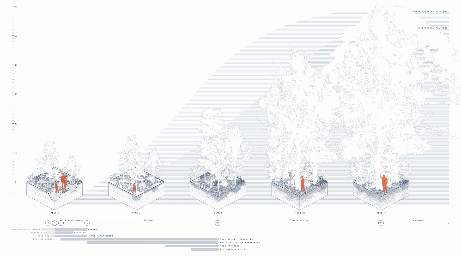
A phased implementation strategy guides the transition from present conditions to a long-term vision extending to 2060. Early phases establish a tree nursery, flood protection, and infrastructural retrofits, allowing ecological systems to establish before full build-out. Later phases introduce mixed-use development aligned with the evolving forest structure.
Ultimately, Form Follows Forest advances a planning framework in which climate adaptation, resilience, and sustainability are not layered onto the city but fundamentally shape it. By positioning the forest as both driver and organizer of urban form, the project offers a replicable model for transforming vulnerable, car-dominated landscapes into resilient, climate-responsive urban environments.
-
- Bald Cypress
- Red Maple
- Sweetbay Magnolia
- Swamp White Oak
- Black Gum
- River Birch
- Canadian Serviceberry
- Inkberry Holly
- Winterberry Holly
- Buttonbush
- Summersweet
- Arrowwood Viburnum
- Red Twig Dogwood
- Black Chokeberry
- Golden Alexanders
- Blue Flag Iris
- Swamp Milkweed
- Hollow Joe-Pye Weed
- Switchgrass
- Fox Sedge
- White Oak
- American Elm 'Valley Forge'
- Tulip Poplar
- Yellowwood
- Hayscented Fern
- Wild Ginger
- Bottlebrush Buckeye
- Pagoda Dogwood
- Foam Flower
- Heuchera villosa 'Autumn Bride'
- White Wood Aster
- Staghorn Sumac
- Pitch Pine
- Sassafras
- Bayberry
- Sweetfern
- Lowbush Blueberry
- Seaside Goldenrod
- Purple Lovegrass
- New England Aster
Advertisement
Related Awards
Award of Excellence, Analysis & Planning
H2Oquirrh: Regional Water Reform for a Resilient Salt Lake Valley
Location: Salt Lake City, UT
Firm: Design Workshop
Client: Wasatch Front Regional Council, Salt Lake County
Water flowing from the Oquirrh Mountains is a critical contributor to the Great Salt Lake. Severe drought and human-caused decline threaten the lake’s viability, with cascading impacts on ecosystems and public health. This regional collaboration of seven jurisdictions, the H2Oquirrh Vision Plan, undertakes a large systems analysis of hydrologic cycles, land cover, and land-use decisions to identify site-specific interventions across nine creeks and washes. Led by landscape architects and water resource engineers, the study advances a deeper understanding of localized drivers of water loss and proposes innovative solutions through integrated landscape infrastructure design and policy.
-listing-img.webp?language=en-US)