
.webp?language=en-US)


Fantasy Island: The Galapagos Archipelago
The Galápagos faces a paradoxical challenge in that the archipelago’s natural bounty draws financial support from eco-tourism that simultaneously threatens to destroy it. Yet while its natural environment has been studied since the landing of Charles Darwin, its constructed landscapes have received far less attention, and, as a result, its populated areas suffer from both flooding and poor sewage. Detailed topographic information was collected in this study for consideration and mitigation of future flooding, including sea-level rise. In addition, water quality testing is underway to assess contamination levels and sources before ultimately addressing them, so that the islands’ inhabitants can continue to thrive within their unique ecosystem.
Awards Jury
-
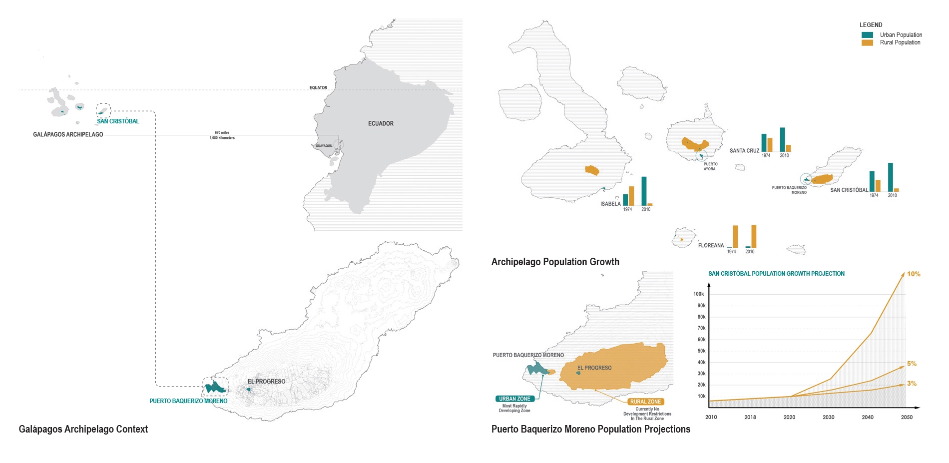
The Galápagos archipelago is one of the most important conservation sites in the world. 97% of its land is protected in the National Park and 95% of its native biodiversity is intact. However, the Galápagos is not just home to giant tortoises and blue-footed boobies - a rapidly growing population of ~34,000 people are concentrated on four of its thirteen islands.
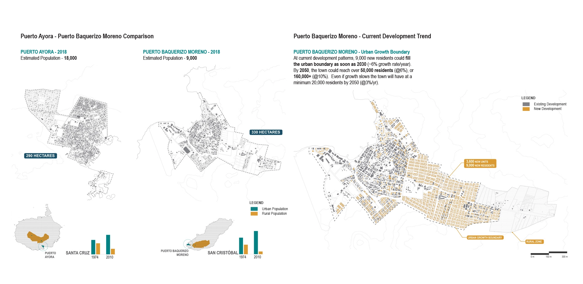
Our work on San Cristóbal Island focuses predominantly on Puerto Baquerizo Moreno, a town of 9,000 residents. San Cristóbal is the only island with a fresh water source. At recent growth rates of over 6%/ year, compared to 2% on the mainland, San Cristóbal’s population will double in just over ten years, and could fill its urban boundary in 15-20 years. This would both threaten the ecological resources it relies upon while locating residents in precariously low-lying, flood prone locations. With little urban planning, San Cristóbal lacks a strategy for protecting its most vital resources: water. Our project addresses this gap through three strategic and ongoing parts: urban growth; topographic mapping; and water sampling. -
Background/ Challenges
Today, there are roughly 34,000 residents living on four islands (Santa Cruz, San Cristóbal, Isabela, Floreana). Most growth has occurred in the last forty years due to the creation of a market for ecotourism as a means to “preserve” the Galápagos. This has resulted in what is referred to as the “Galápagos Paradox.” The islands are promoted as a pristine place to visit, thereby increasing the flow of goods and tourists, which introduces new species and requires an increasing population to supply labor. Conversely, tourist-generated revenue provides funding to protect and maintain the national park, and is the primary source of income and employment. Immigration to the islands (other than through marriage) was banned in 1998, while tourism has not been successfully limited even though the pressures on the local environment and people originate from developing the Galápagos as a tourism destination. As a consequence, water demand and building have increased dramatically, causing major challenges in water management, both in terms of drinking water and in terms of topography (i.e. water flow from the highlands into the lower-lying towns).
As the famed site of Charles Darwin’s first landing spot and the second most populous island, San Cristóbal (where this phase of our work takes place) plays an important role in understanding how an isolated community in the middle of the ocean can sustain a good standard of living while protecting biodiversity and adapting to climate change. It is surprising that in one of the most scientifically studied and important nature sites in the world, there is little attention to the landscape itself.
Project:
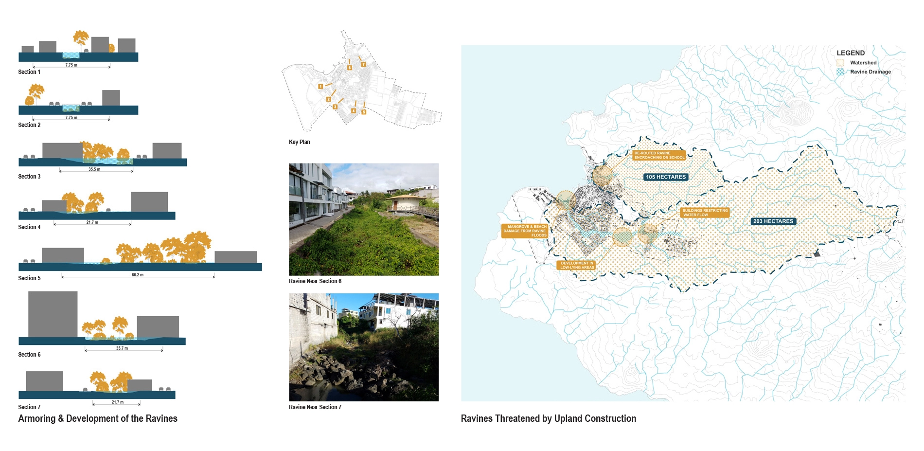
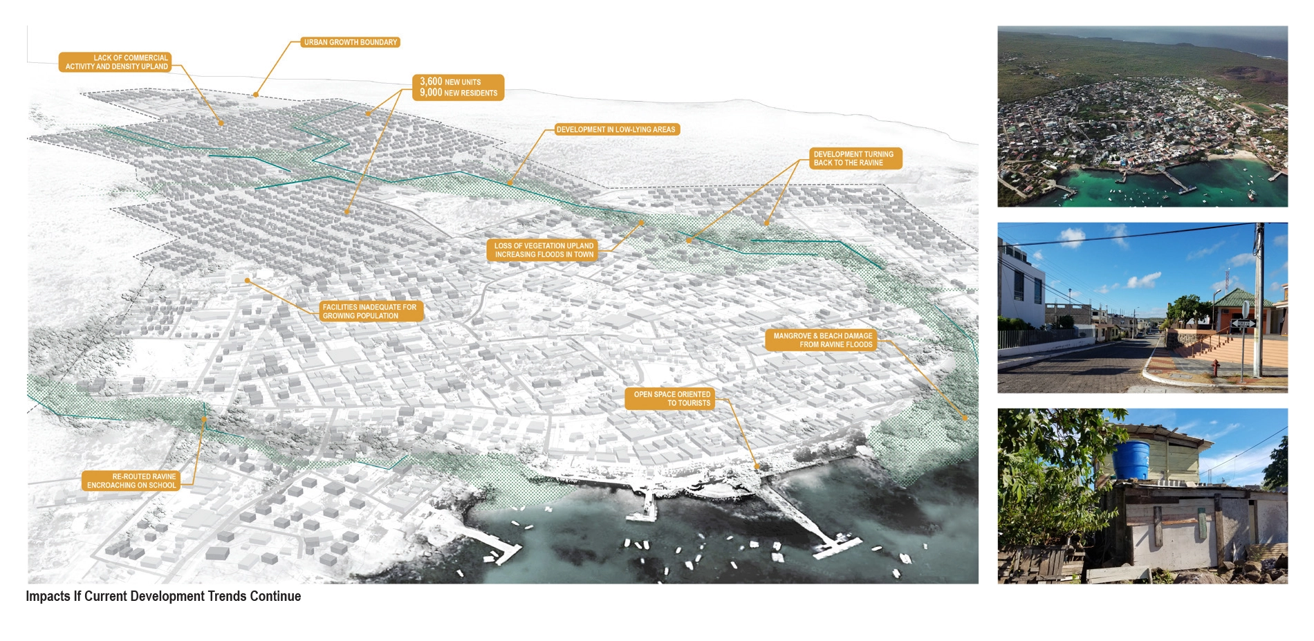
The enormous amount of attention given to the natural environment of the Galápagos has not been extended to the urban areas. There is little to no planning and residents suffer from lack of clean water and limited access to the nature for which the islands are famous. The town continues to develop upland without consideration of the topography and ravines, which are critical for rainfall flowing from the highlands. Increased development into these zones will exacerbate town flooding and put people in harm’s way. They also have limited sewage treatment, and are discharging directly into the beach areas; leaking sewage pipes are possibly a source of drinking water contamination. Our team set out to address the risks and opportunities related to the town’s water. This process included: studying the topography for identifying major water flow areas; a topographic survey to accurately determine tide levels and thereby evaluate flooding vulnerabilities related to sea level rise/tsunamis; and testing drinking water to benchmark water quality. This projected included the participation of many key partners including residents and schools in Puerto Baquerizo Moreno, the Galapagos National Park, the Mayor’s office of San Cristóbal, the Charles Darwin Foundation, and the Oceanographic Institute of the Navy (INOCAR). Through this work, we hope to inform as many Galapagueños as possible so that they can be empowered to protect their health, and the health of the unique and fragile place that they call home.
Process:
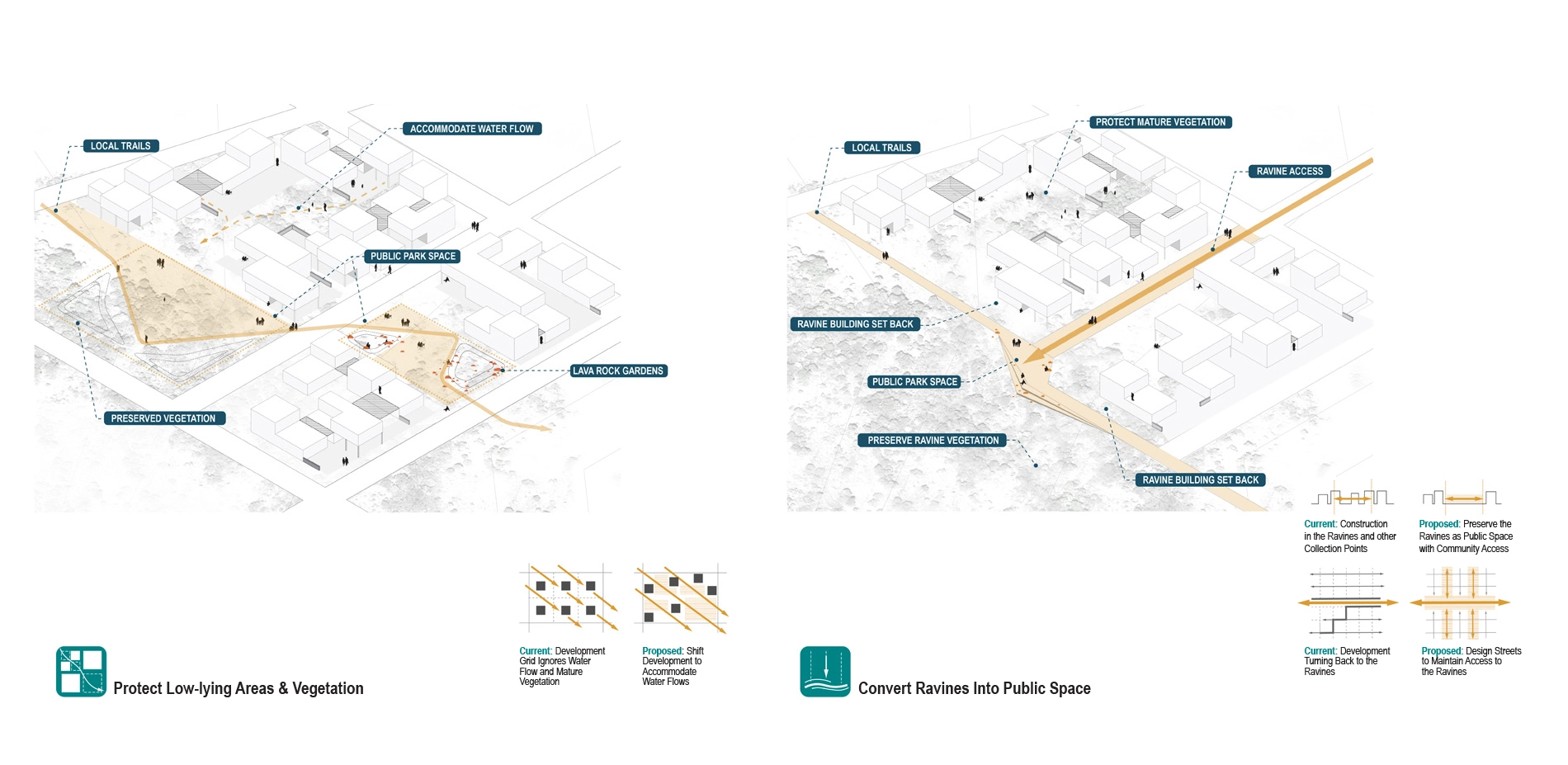
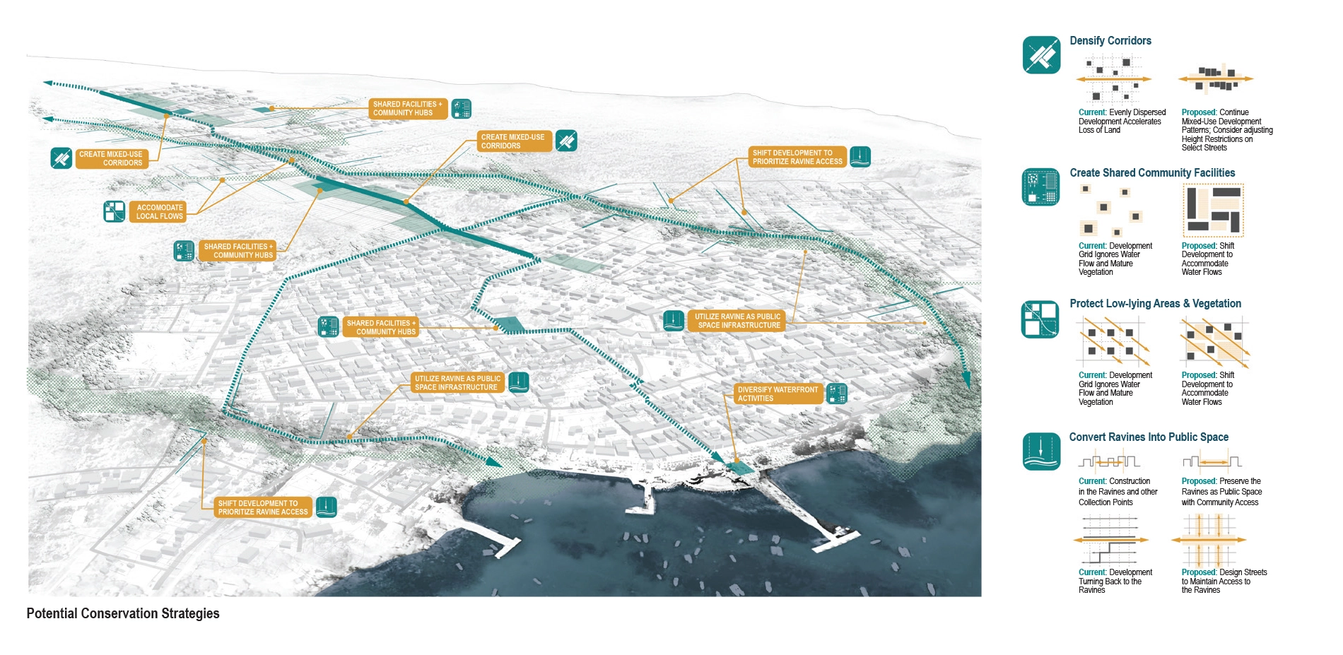
Protecting (Urban Growth)
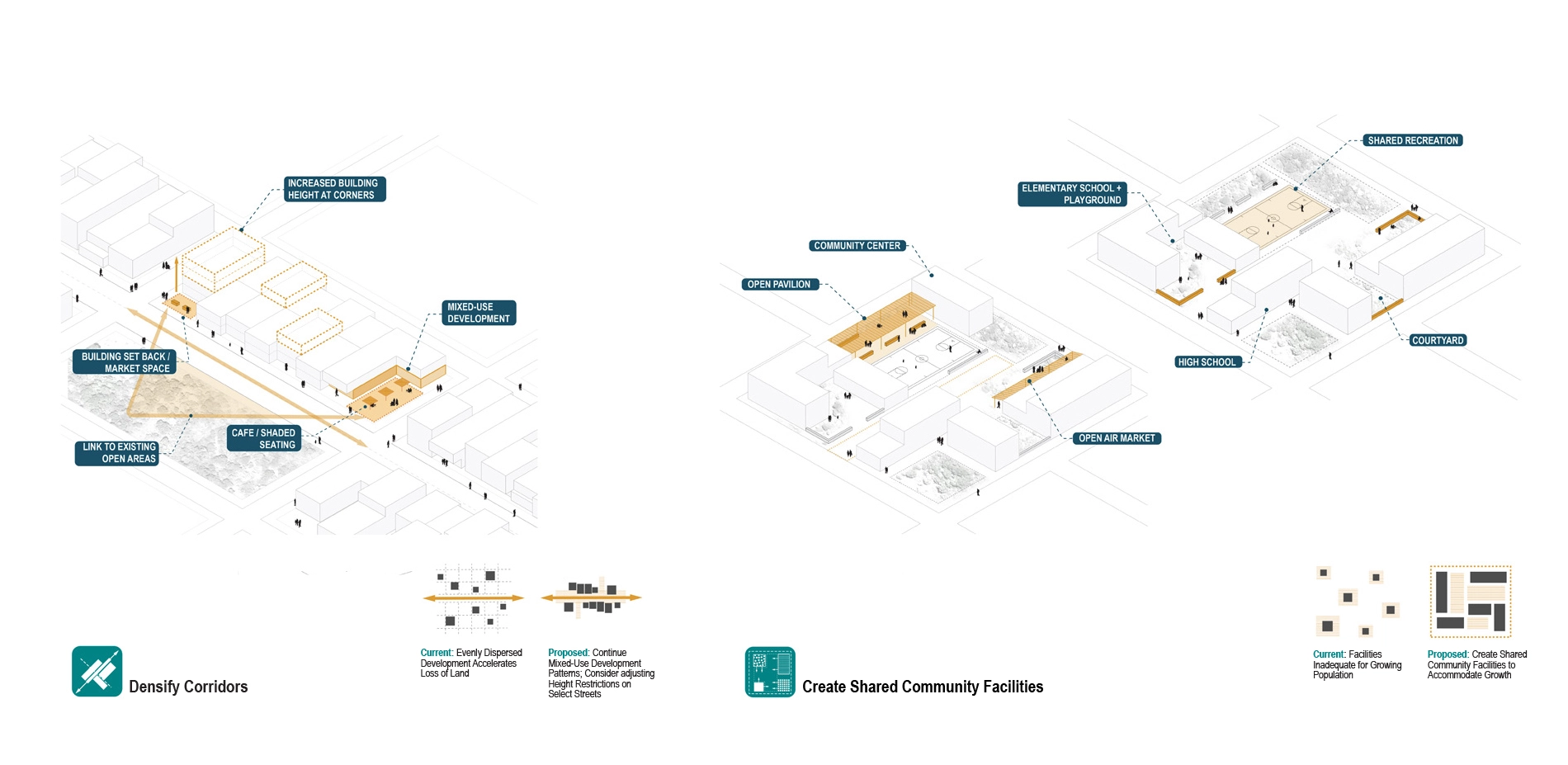
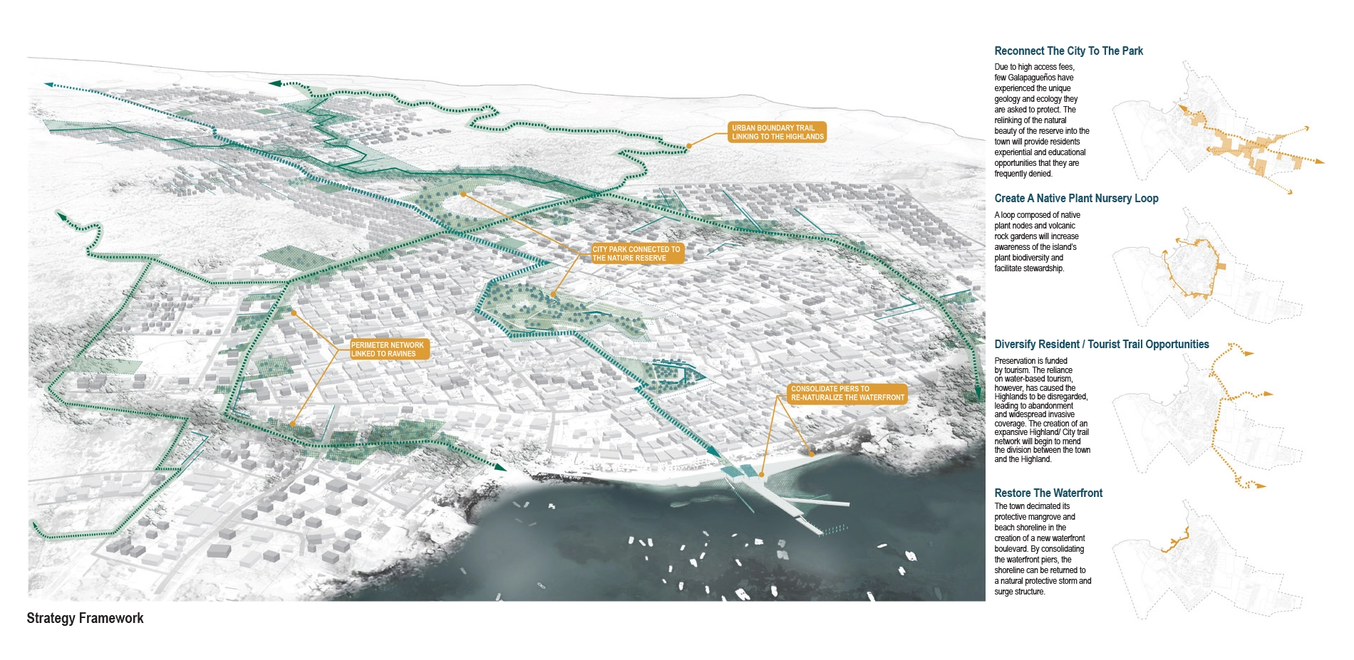
The protection efforts in the National Park are not applied to areas within the urban boundary. Thus, the existing open areas of Puerto Baquerizo Moreno are disappearing quickly. Our landscape strategy concentrated primarily on the yet to be developed areas, and emphasized four principles: 1) continuing mixed development and more density upland, which follows the pattern of the oldest areas of town, rather than a “single house on a lot” model that is now prevalent; 2) the creation of multi-use community spaces within development blocks; 3) accommodating existing water flow patterns and significant vegetation patches; 4) establishing a ravine set back and envisioning it as a new connective corridor that will bring the natural beauty of the national park into the town, thus experientially and ecologically enriching the quickly densifying town. Our hope is for residents and local leaders to support a strategy for directing development away from low-lying areas and use this landscape framework as a vital social and ecological resource.
Measuring (Topographic Mapping)
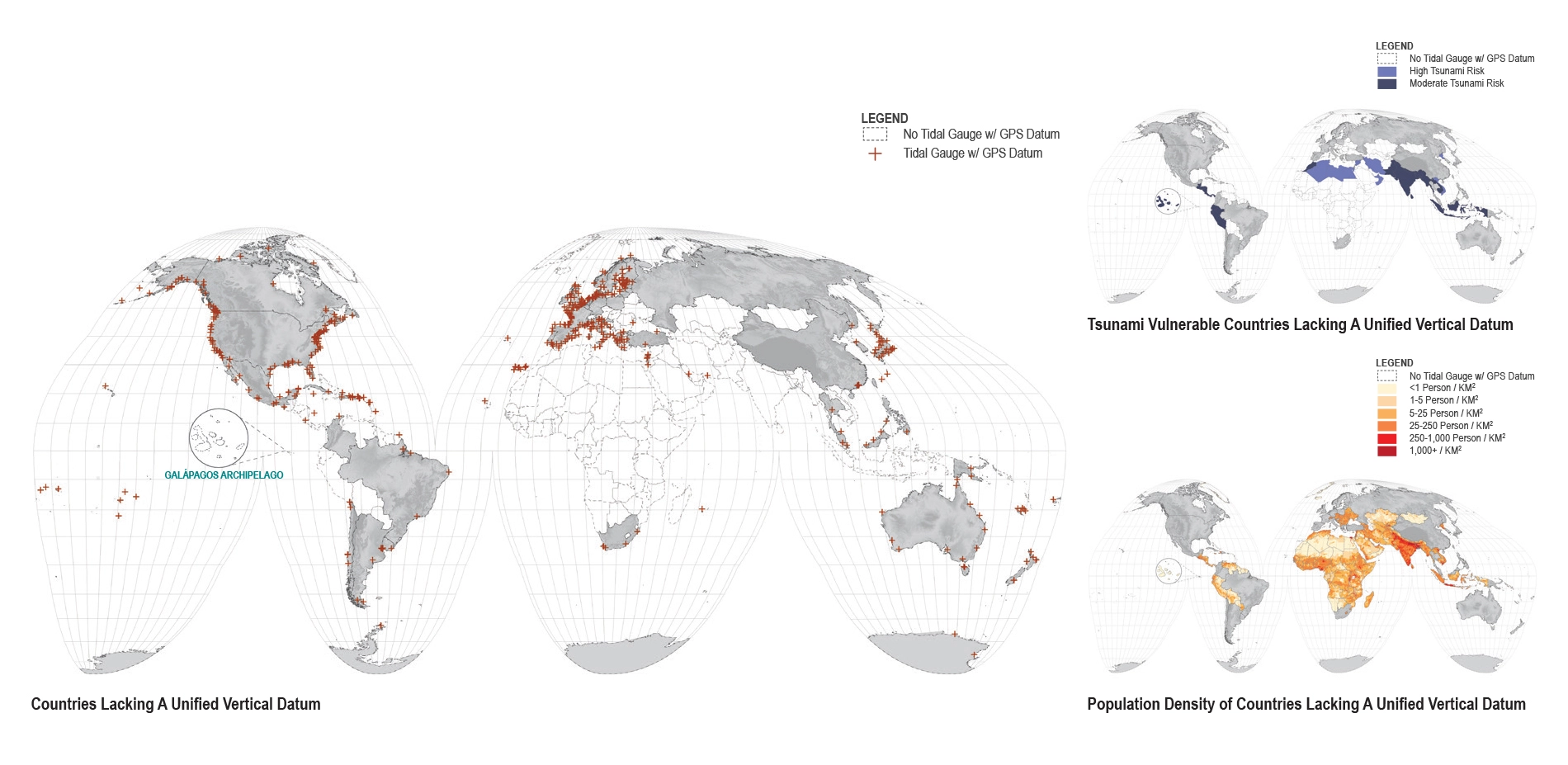
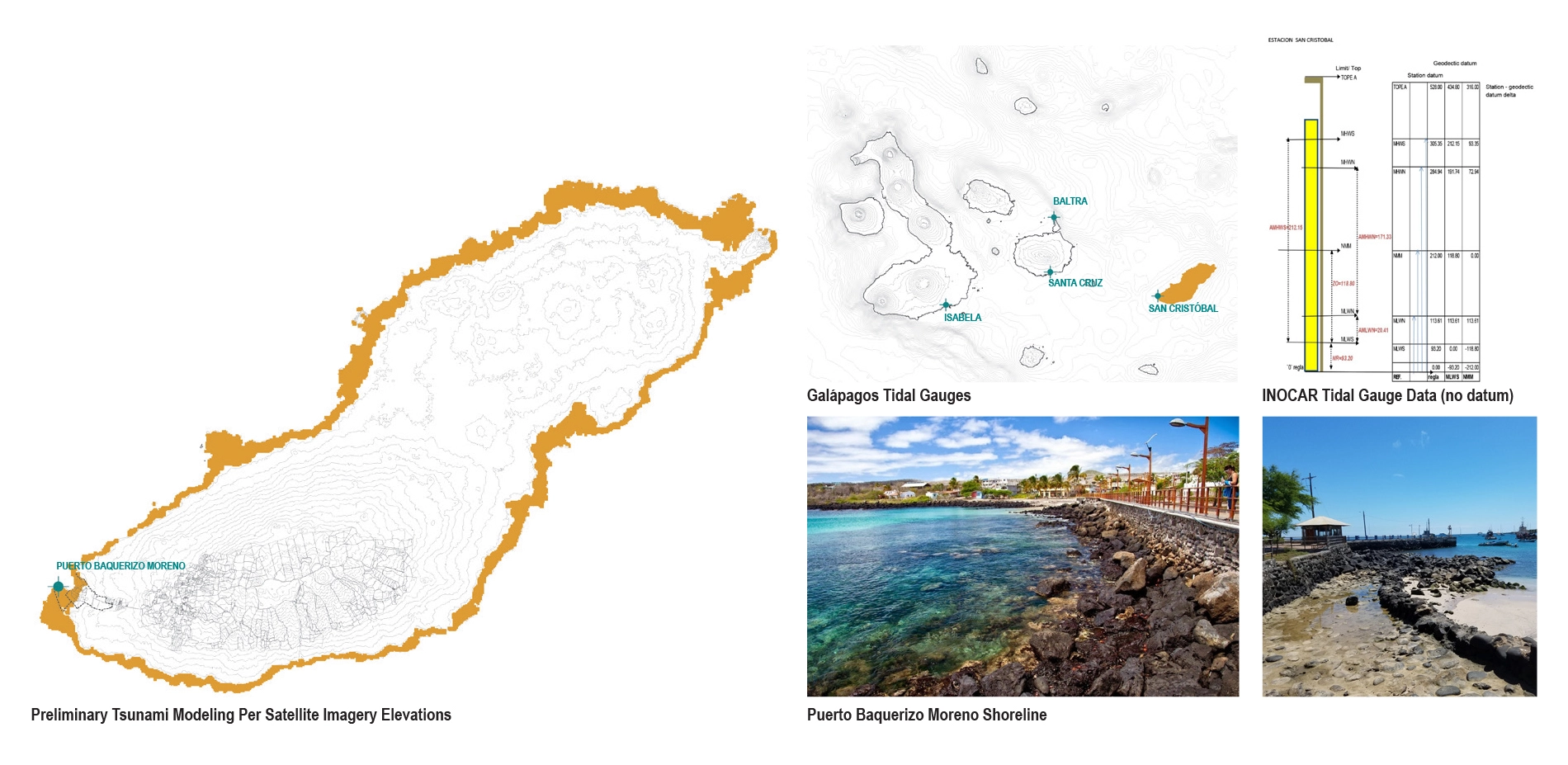
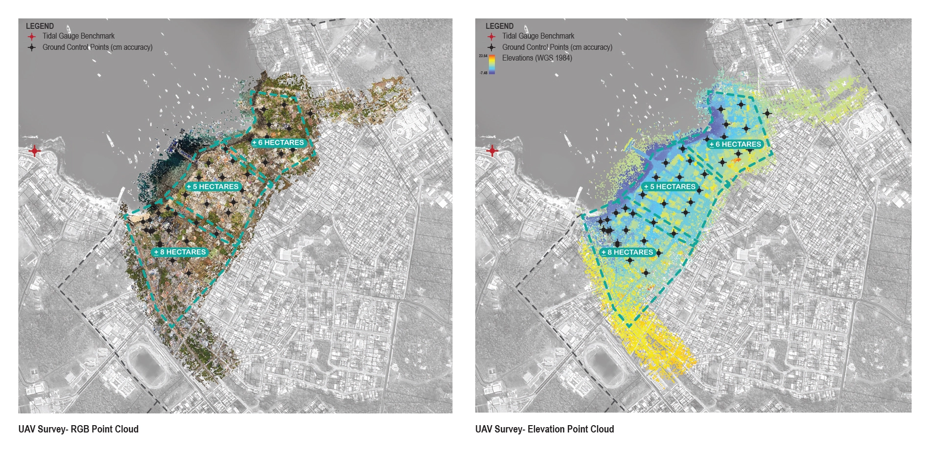
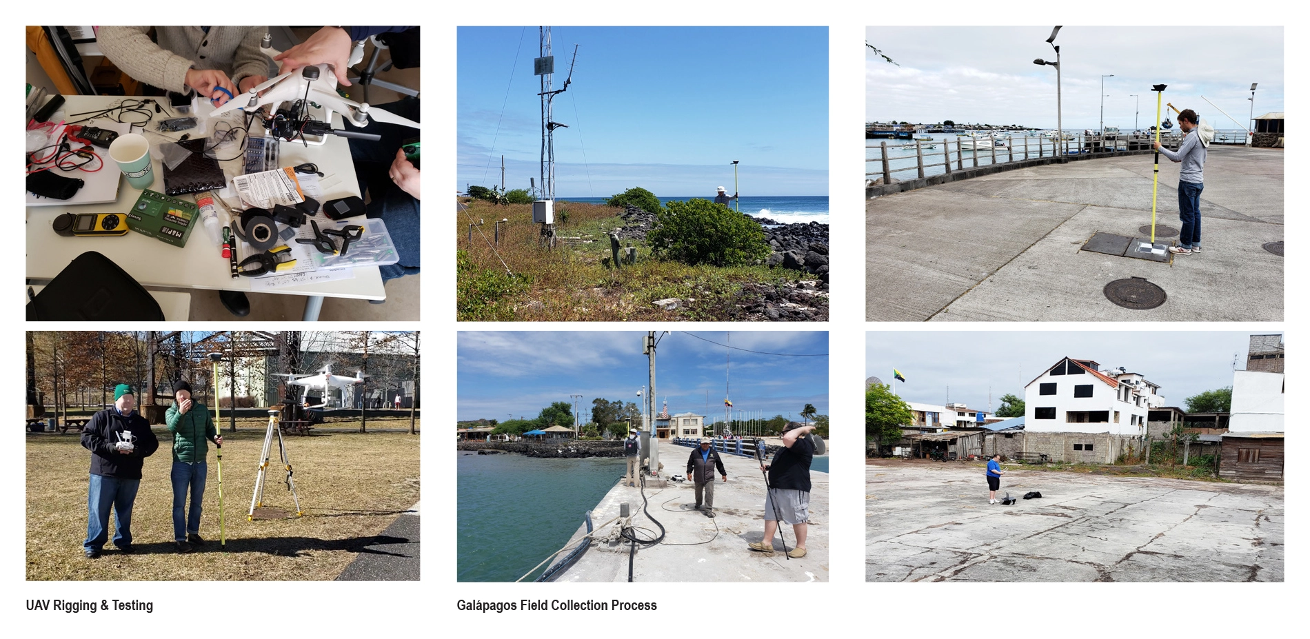
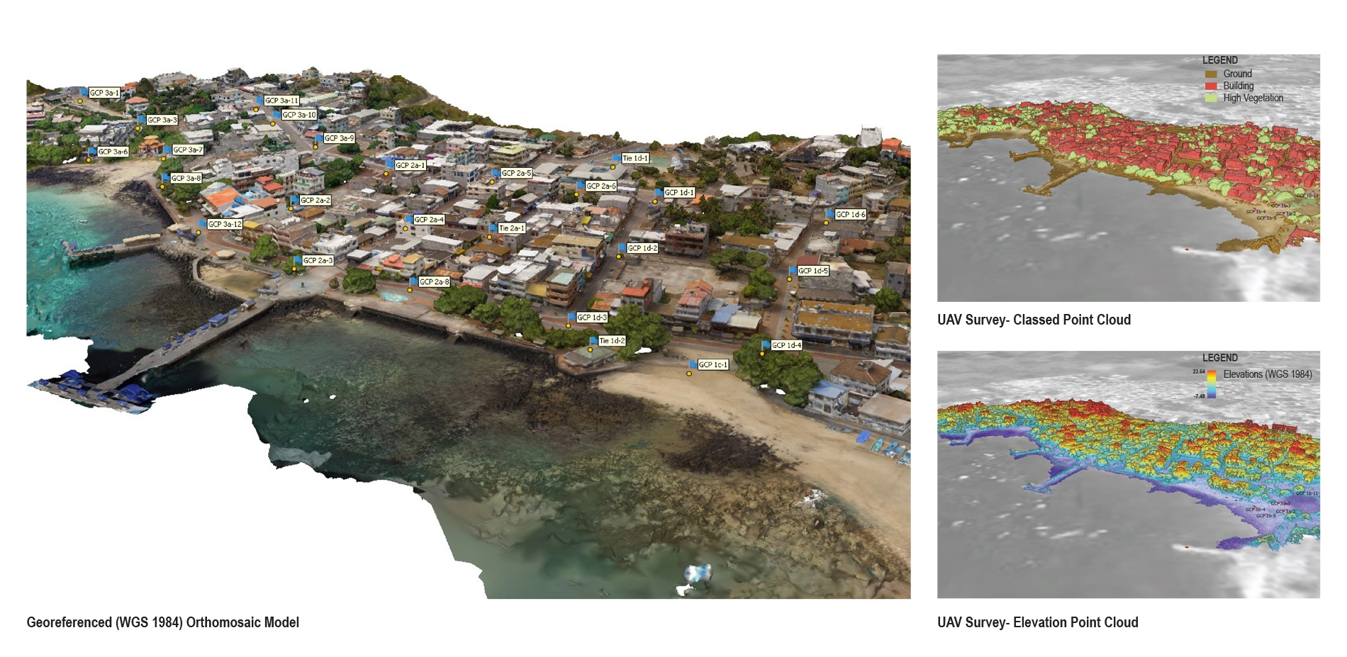
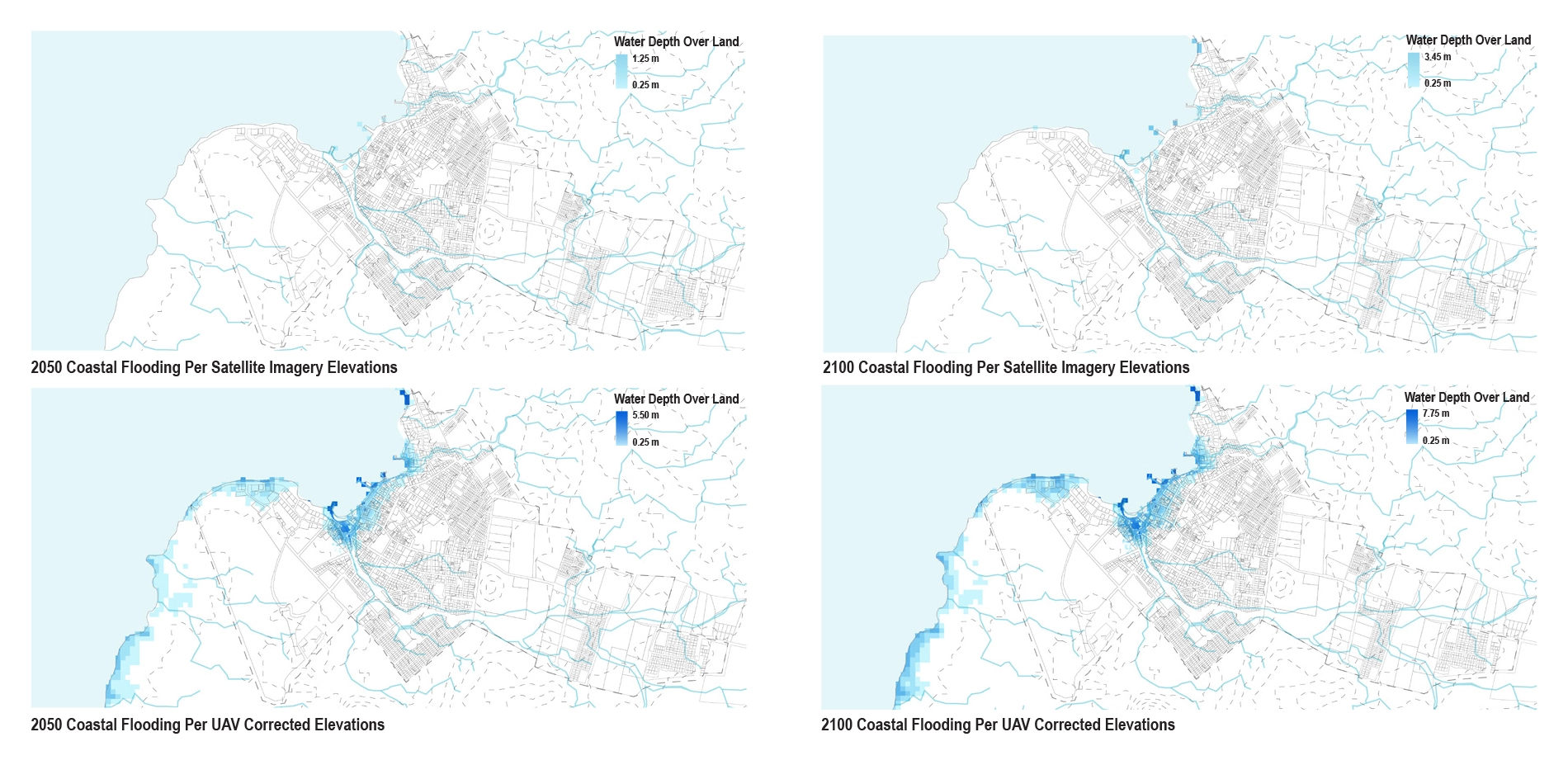
Accurate surveys are foundational to the analysis, planning, and management of landscapes. As a discipline, we have normally outsourced this crucial component of the planning process by hiring surveyors or relying on existing surveys, topographic maps, or publicly available satellite imagery. While Earth observation data has increased dramatically in the last few decades, this information is not equally distributed. Surprisingly, the Galápagos Islands—one of the most scientifically studied sites in the world—lacks such data. Without a consistent and unified vertical datum, tides cannot be accurately referenced to the land. When we reached out to INOCAR (The Oceanographic Institute of the Navy in Ecuador, similar to the USA’s NOAA) to request this information for developing the urban growth framework described above, they instead asked for our assistance in the collection and registration of the gauge.
Our team used off-the-shelf UAVs (drones) and GPS/ GNSS site survey equipment to record aerial survey information of Puerto Baquerizo Moreno’s shoreline and ravines. Over the course of a four-day collection period, our team collected approximately 20 hectares of high accuracy, high resolution survey data, including the tide gauge location and elevation. Ground control points (GCP) were distributed throughout the town before the collection periods. Each GCP was recorded with the GPS/ GNSS survey equipment to locate its exact location in geographic coordinates at centimeter-level accuracy. The array of overlapping digital aerial imagery collected was stitched together using photogrammetry software (Agisoft Metashape) and used to create a complete topo-bathy model of the shoreline. This model was delivered to INOCAR in the fall 2019. This information will be essential for modeling both past and future storm surge, sea-level rise, and tsunami scenarios as it relates to the island’s urban growth and wildlife conservation.
Our team, with assistance from INOCAR, will return this summer to complete the surveying of the remaining two tide gauges and shoreline on the most populous island (Santa Cruz).
Monitoring (Water Sampling)
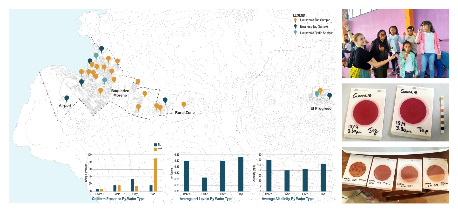
Despite undergoing treatment at a local plant, San Cristóbal’s water is not potable due to bacterial contamination that is occurring post-treatment, perhaps due to cistern contamination or sewage pipes leaking into the ground near the water distribution pipes. In order to mitigate worsening conditions for residents, our team initiated a community-based outreach—LAVA (Laboratroio para la Vida y el Ambiente) Aqua—which aims to monitor water quality in San Cristóbal while engaging the community in scientific research and education. The first phase tested for coliform generally (not e. coli specifically). Using simple water quality test strips and coliform test broth, our team began hands-on training on proper scientific techniques for testing and recording water quality data at the Charles Darwin Foundation’s Center for Environmental Education in San Cristóbal. With the team’s assistance, residents and middle-school children took samples of tap water in their homes and businesses. Next steps will involve protocols for getting larger numbers of samples and residents involved. The results will be added to a central database and mapped to begin to identify patterns in water quality and contamination across the island. This data will be critical for understanding the effects to water quality related to development, population growth, and seasonal rainfall. With this project, we hope to encourage the communities on San Cristóbal to take initiative in monitoring their own water. -
- Michael Luegering - Collaborator
- Michael Tantala - Collaborator
- Dorothy Jacobs - Intern
- Andrew Ward - Researcher
- Lucy Whitacre - Researcher
- Yini Tang - Researcher
Advertisement
Related Awards

Honor Award, Analysis & Planning
A Cultural Approach: The Fort Peck Tribes Hazard Mitigation Plan
In collaboration with the Fort Peck Assiniboine and Sioux Tribes, EPA, and FEMA, the Fort Peck Tribes Hazard Mitigation Plan (HMP) adopts a culturally responsive approach to hazard mitigation planning that features connection to place.

