
.webp?language=en-US)


Remediation Infrastructure: A Comprehensive Development Strategy for the Remediation of the Gowanus Canal
Heather Fuhrman, Associate ASLA
The remediation infrastructure is fantastic. This project got into the actual small-scale problems and connected them in a believable way. We liked the way they included gradations, not just black and white solutions. We could see this presented at planning commission meeting.
Awards Jury
-
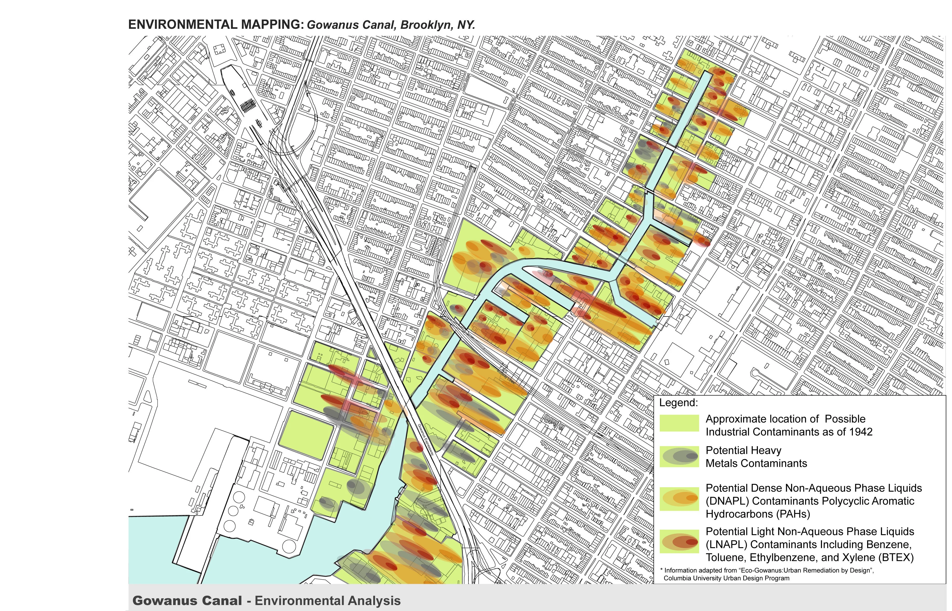
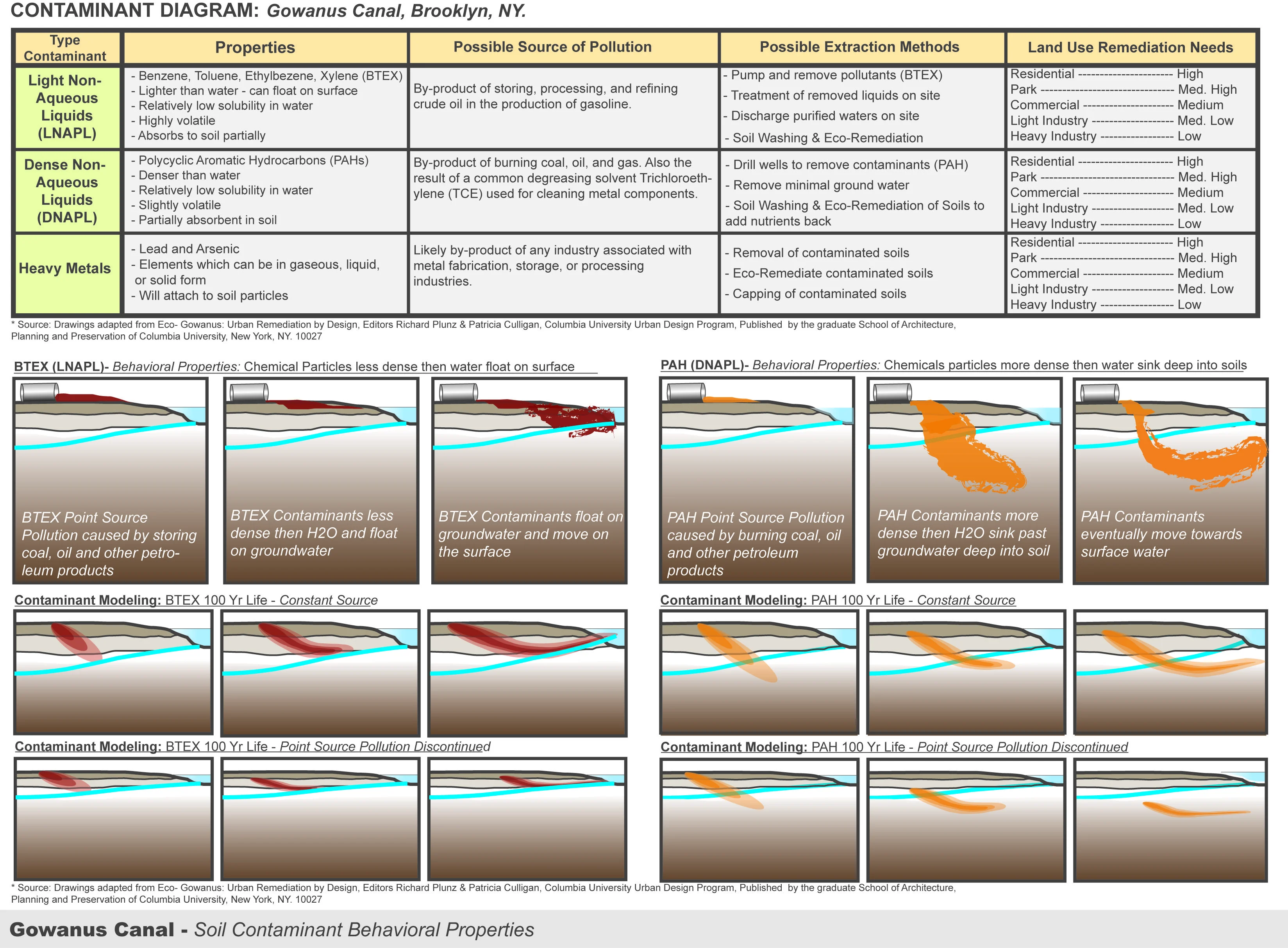
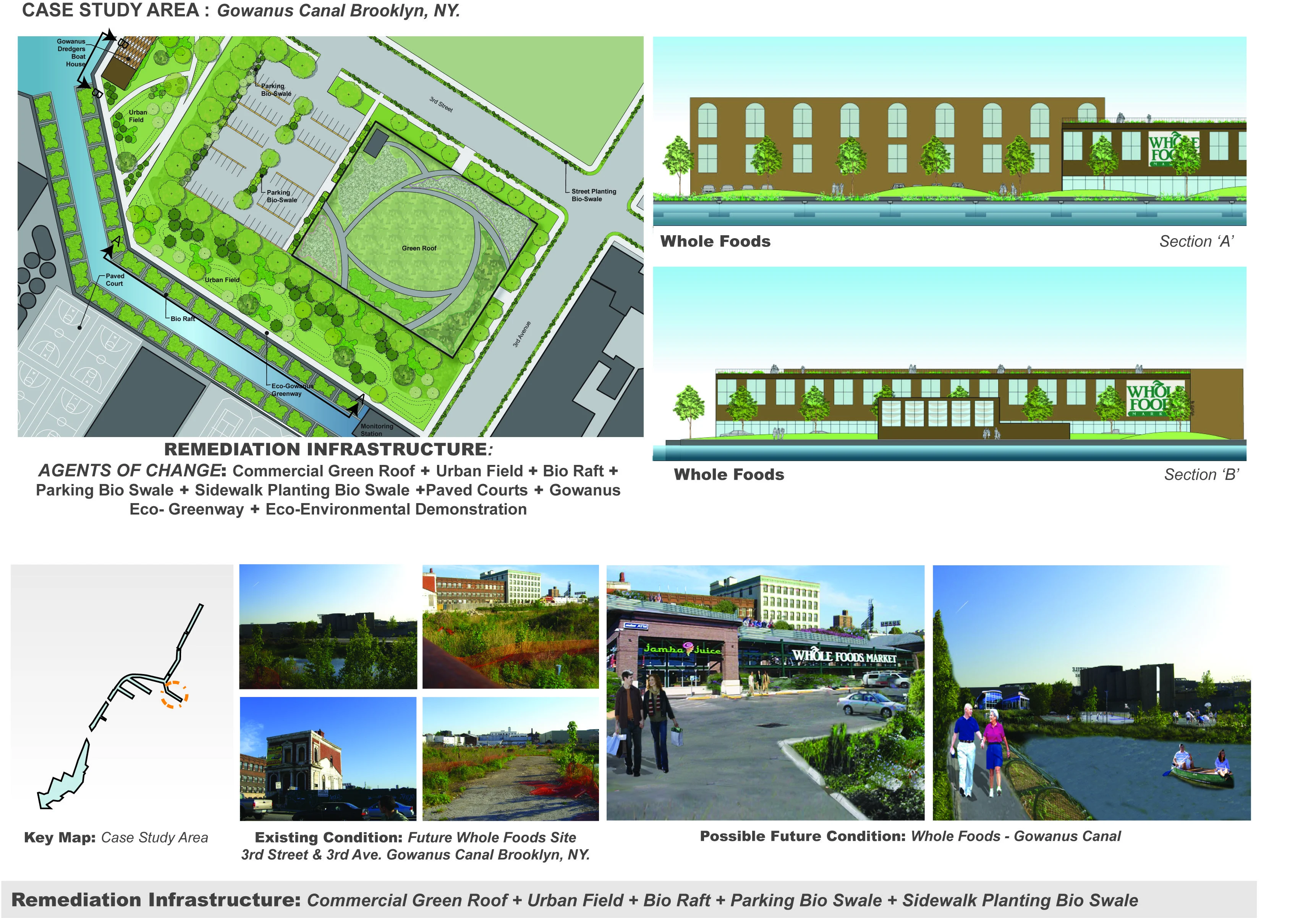
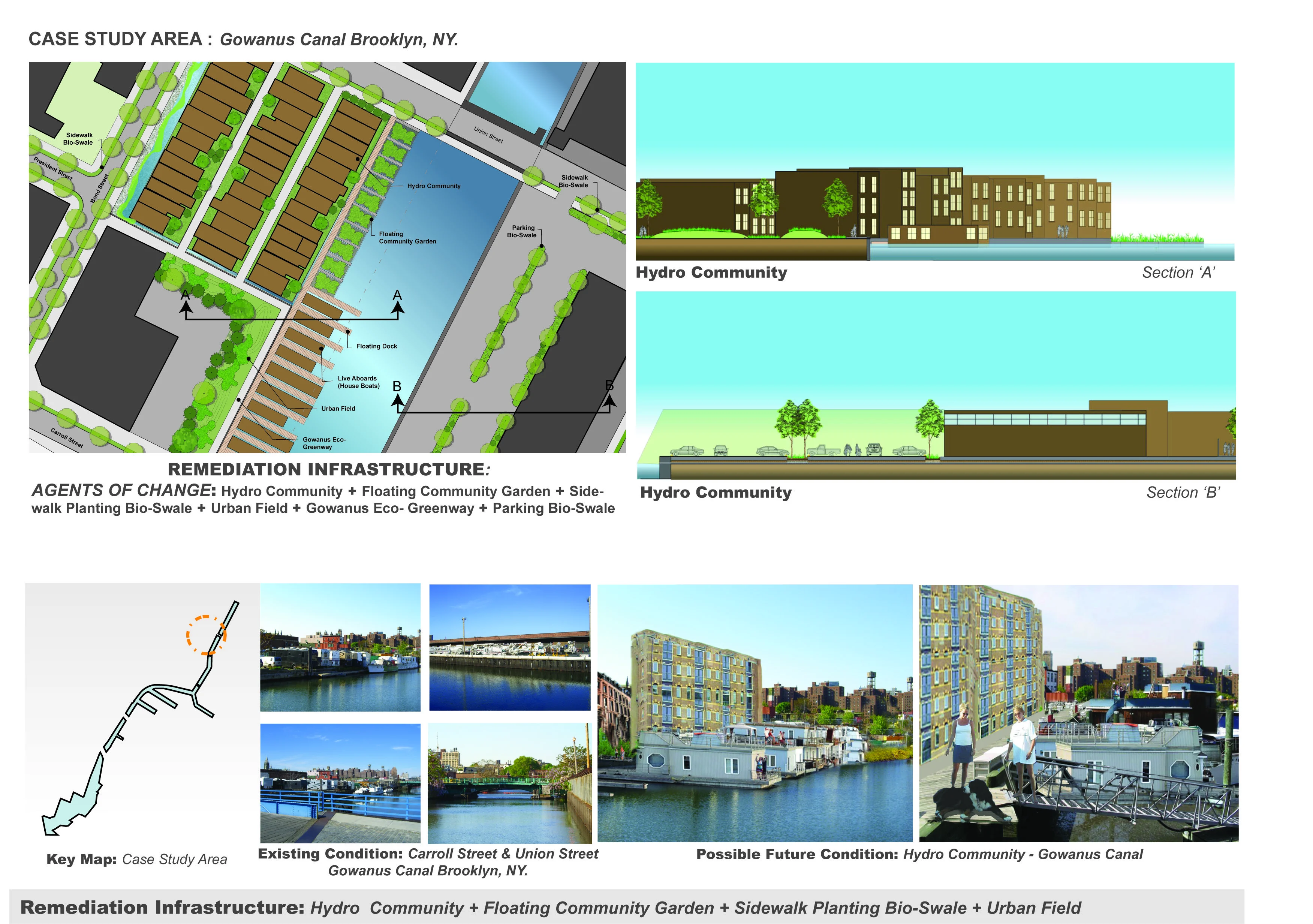
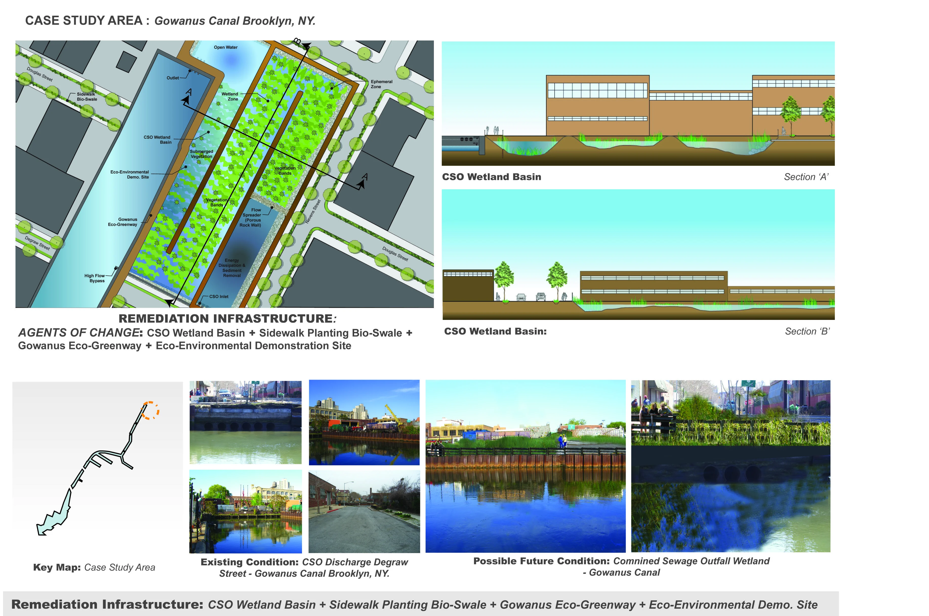
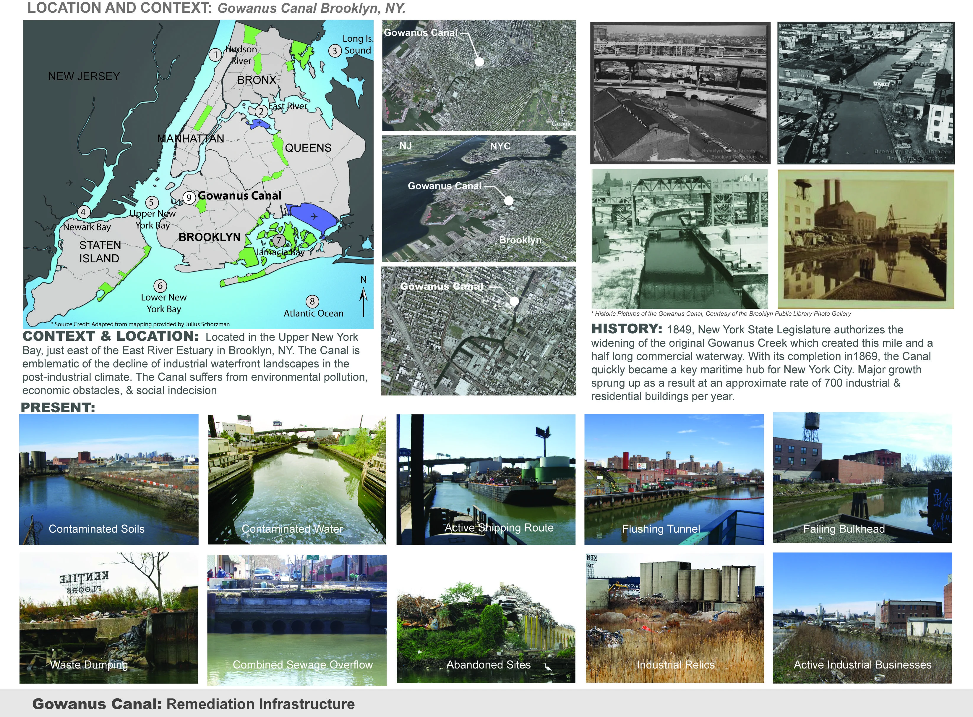
The topic of redevelopment also creates controversy among a variety of community based groups lacking a single overriding political mechanism creating social indecision. As recent as May 2008, the New York City Department of City Planning proposed a redevelopment strategy for this area. This draft re-zoning proposal included a strategy for mixed-use zoning, public waterfront access, affordable housing, and clean-up as a condition for redevelopment. However, a variety of community based groups involved in the process, including the Gowanus Development Corporation, The Gowanus Dredgers, and Community Board 6, have all expressed concern with the proposal, lending to the social indecision with the redevelopment and clean up of the site. Residents in the area remain concerned the proposed plan does not directly address the issue of clean-up or the associated cost. Additionally, the current plan does not address the pollution in the canal itself including the on-going pollution due to the combined sewage overflow system (CSO) in conjunction with the currently defunct "Flushing Tunnel". This continues to be a point of contention among the various groups associated with the canal. Compounding the issue is the proposal to designate the entire Canal as a "Superfund" site, which could jeopardize current development proposals. However, the clean up of individual sites creates a situation in which "spot clean-up" occurs. Meaning if 'Site A' is cleaned while 'Site B' an adjacent site is not, there is the potential for leeching to continue as the chemicals move through the soil and along the water table. Studies of the sites including historic business use of the canal begins to reveal the potential chemicals and materials which may still be present on site. The chemical make-up of these materials falls into one of these categories: Light Non-Aqueous Liquids, Dense Non-Aqueous Liquids (DNAPL), or Heavy Metals.
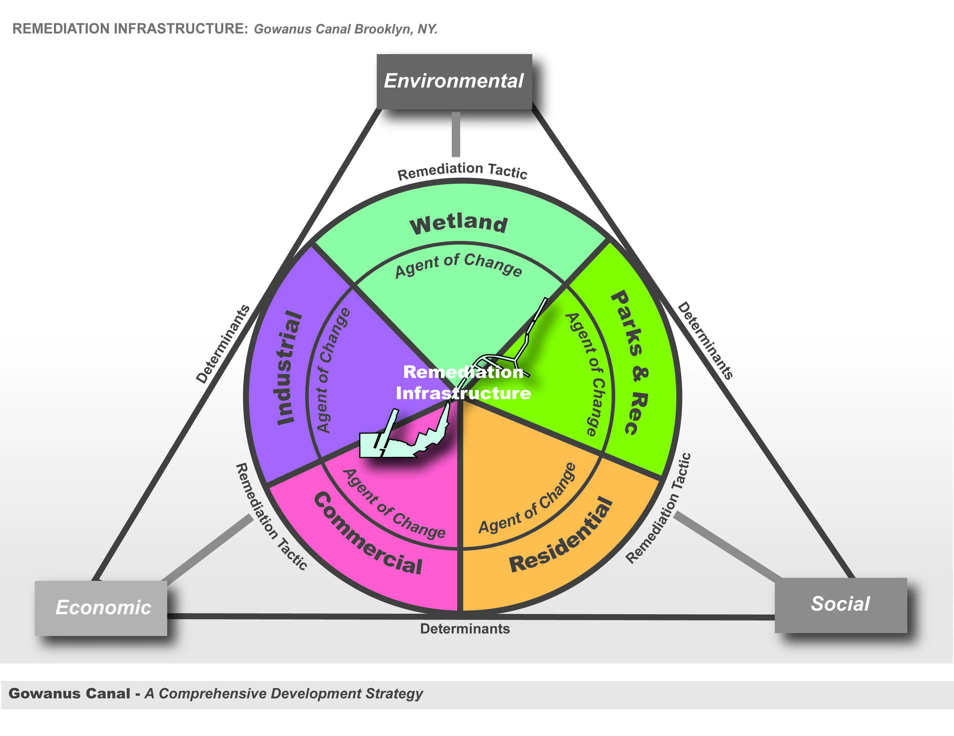
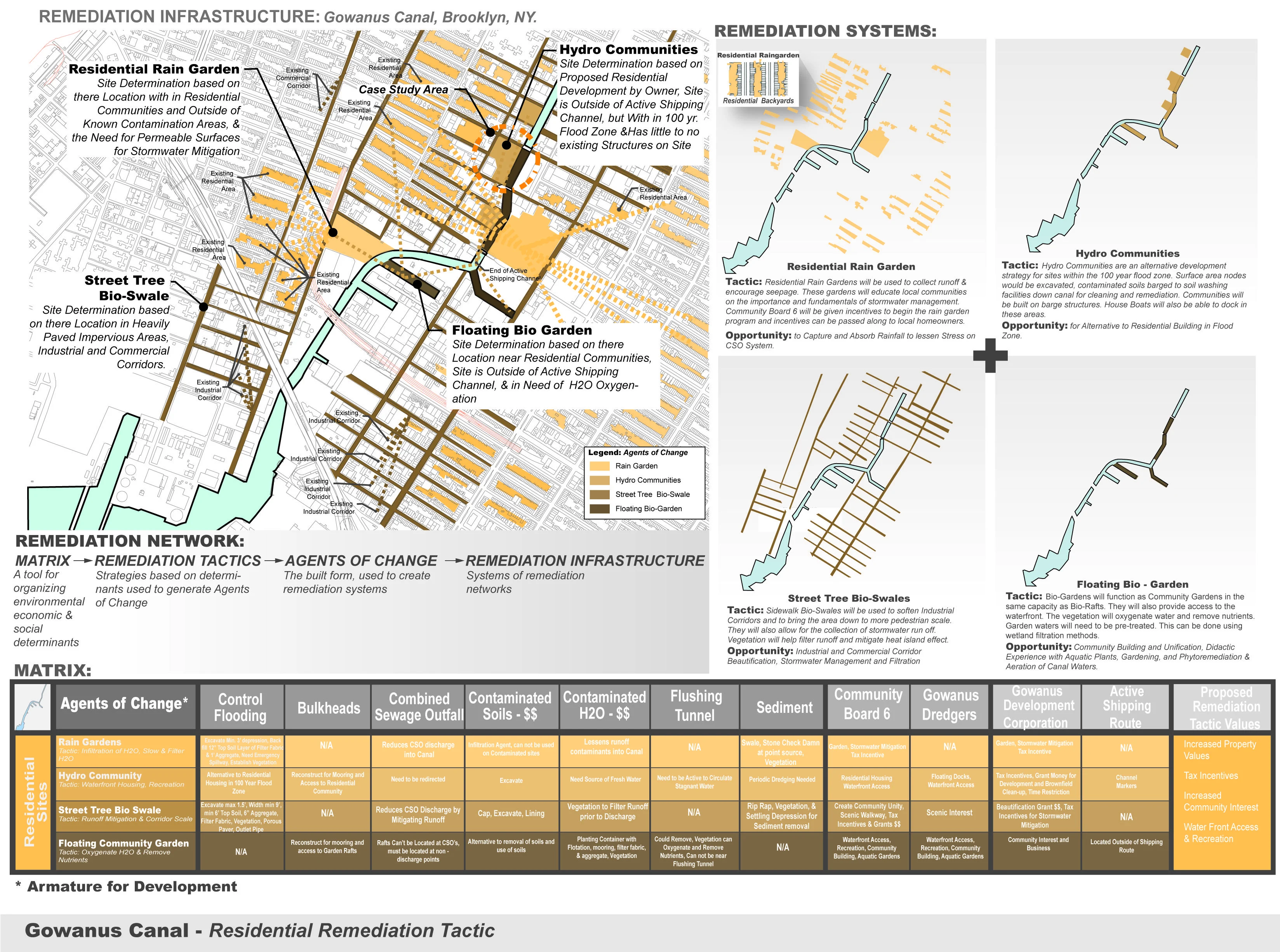
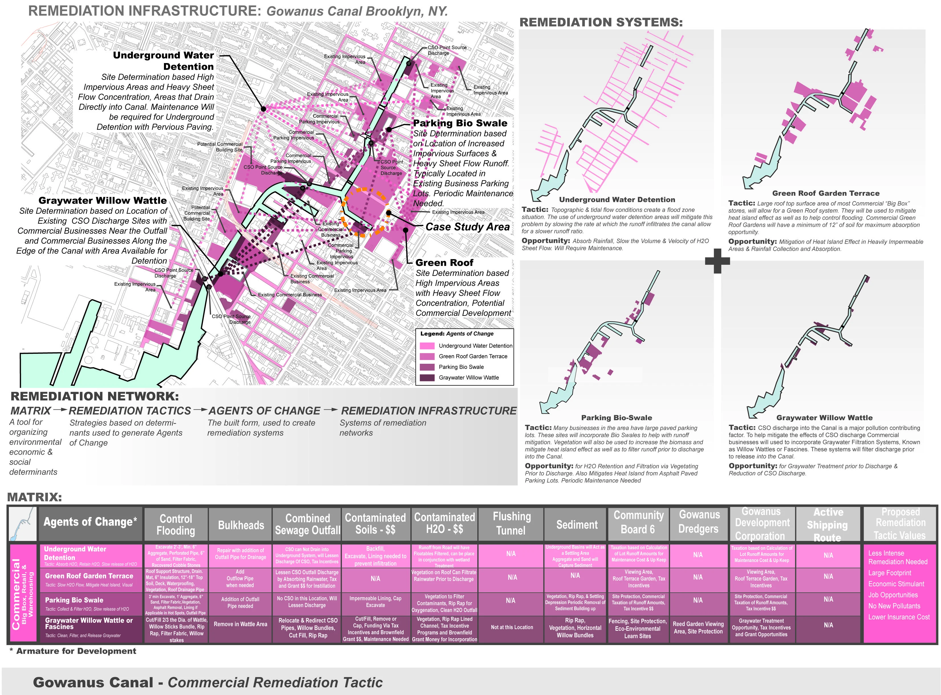
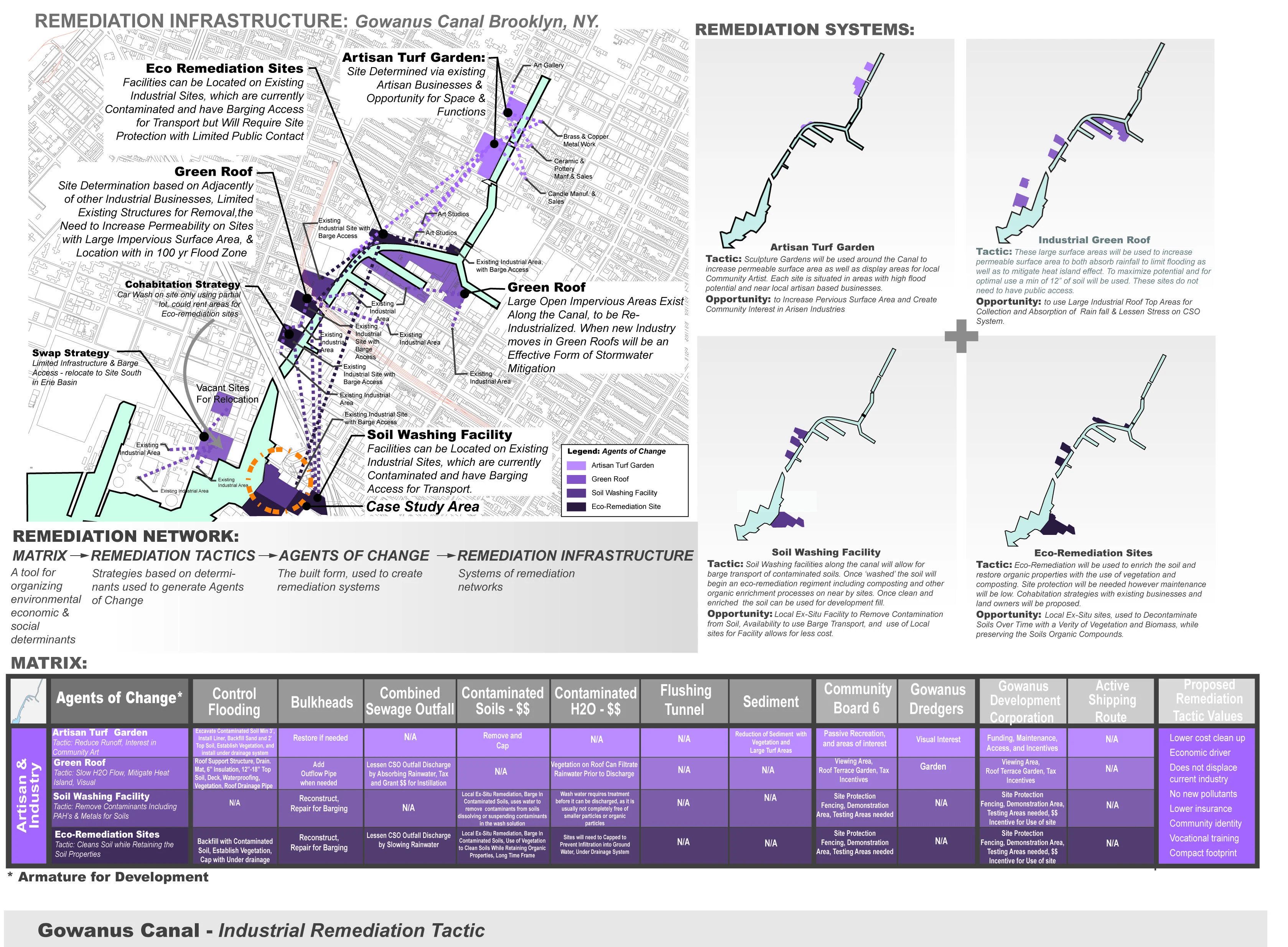
While these pollutants have methods of remediation they need to be associated with a comprehensive strategy allowing for a successful remediation. This comprehensive strategy must address the environmental, economic, and social components. This project looks to accomplish this by developing a remediation infrastructure.
Project Goals & Objectives
The project's goal is to create a remediation infrastructure for the Gowanus Canal. This will be accomplished by taking an analytical "bottom-up" approach to design. Using environmental, social, and economic criteria as a basis for analysis the objective is to develop a tool that will provide a comprehensive understanding of the site, organize and align community interest groups, and assist in the development of solutions for the remediation and future redevelopment of this site.Environmental & Social Data Collected & Analyzed
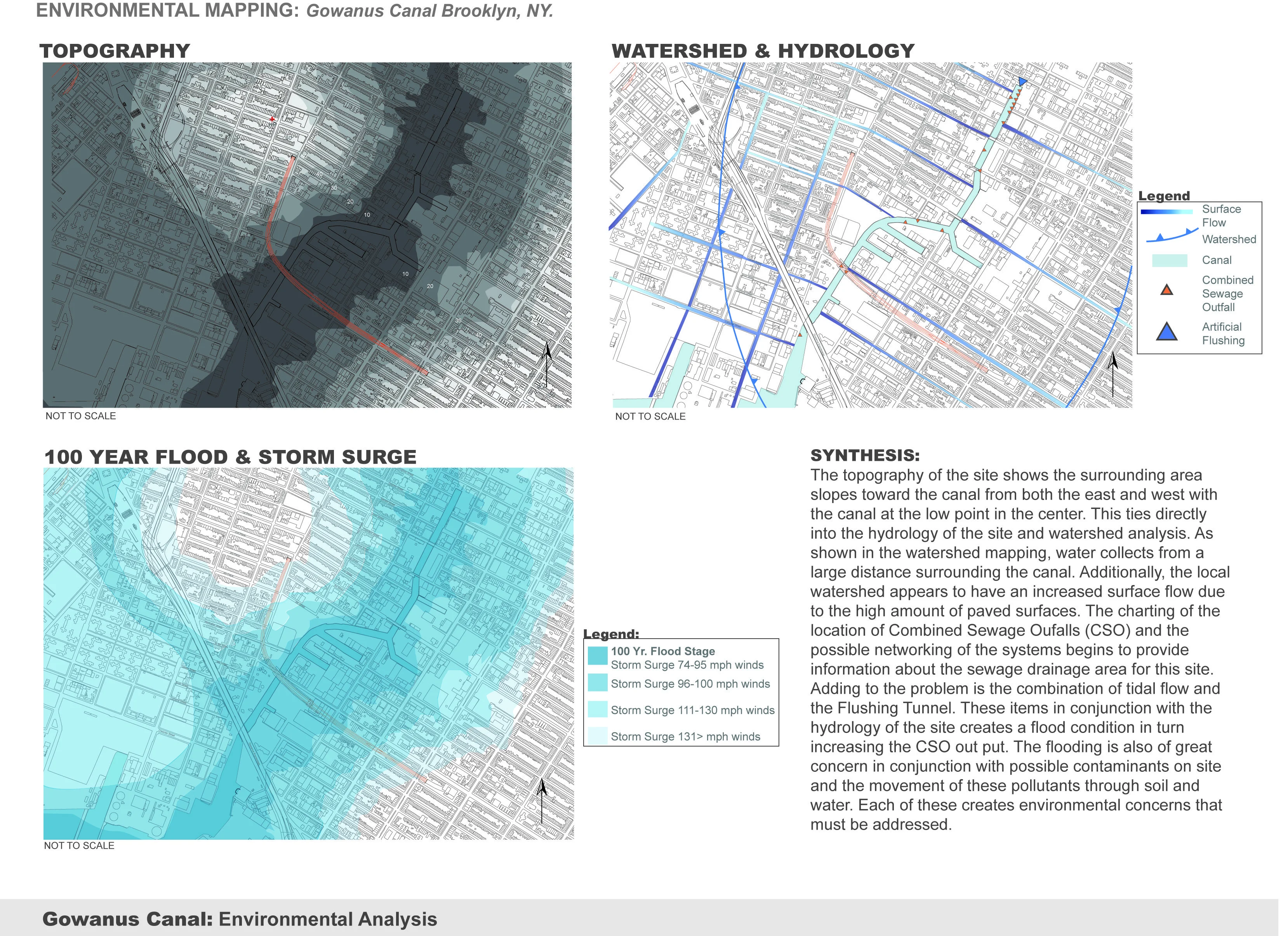
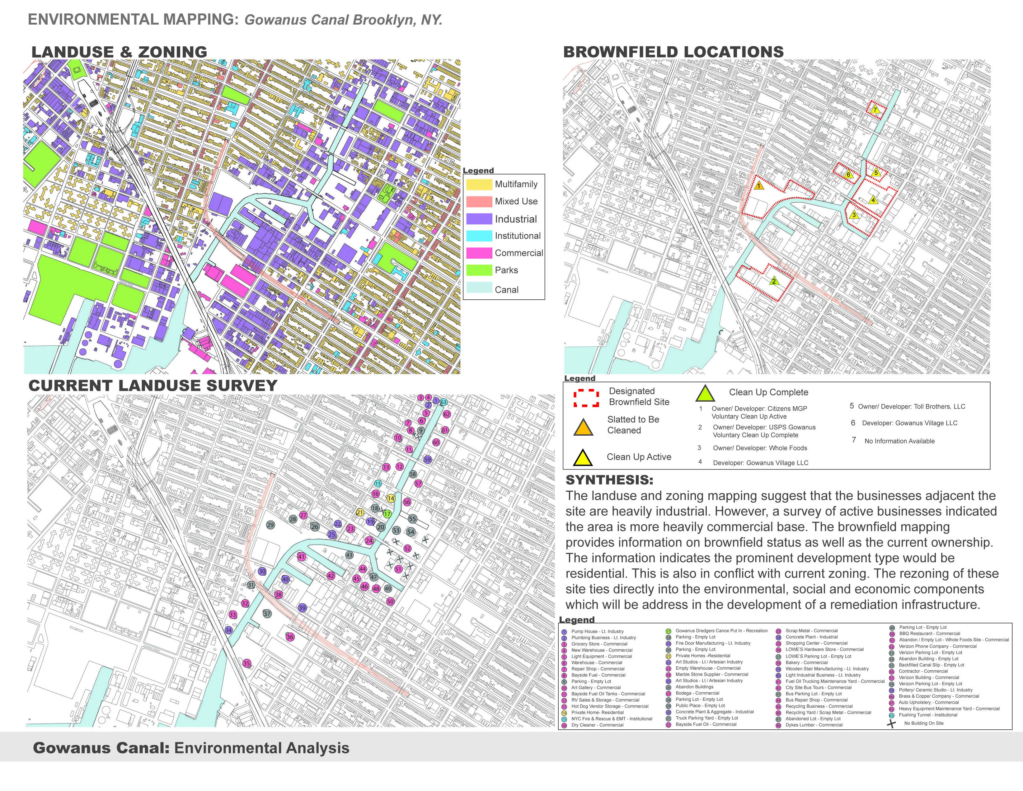
Environmental mapping on both the local scale and case-study scale includes: hydrology, topography, tidal flood areas, flood plains, storm surge, watershed, combined sewage overflow, local collection networks, possible toxins, contaminated sites, land use, and designated brownfield sites mapping. Project area Local-Scale social data collected includes: information on local community boards, independent neighborhood preservation non-profit groups, 'grass root' (volunteer) neighborhood groups, and community planning areas. A sampling of current development proposals and initiatives were studied at both a local scale and case-study scale. Historic land use designations were reviewed using current business type charting and historic maps showing former land use and business types to determine possible incompatible land use conditions. Site visits and interviews with neighborhood residents were also conducted. A survey of local residents was performed to analyze the community perception of the site as well as to gauge local interest and expectations for the site. A local documentary was also reviewed for information pertaining to the history of development proposals over the years and previous failed attempts to redevelop the site.Methods of Analysis
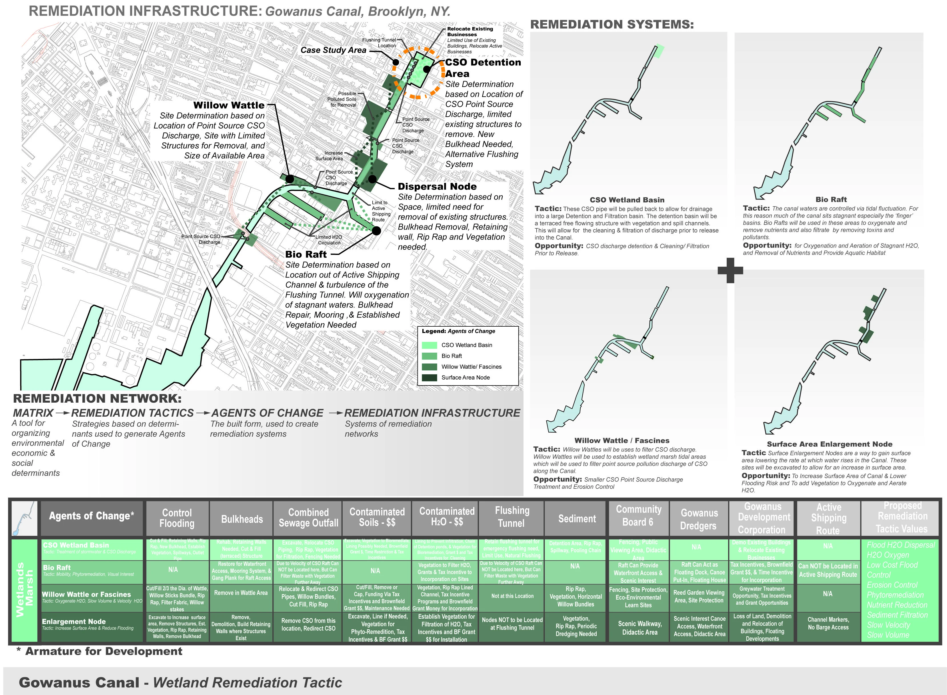
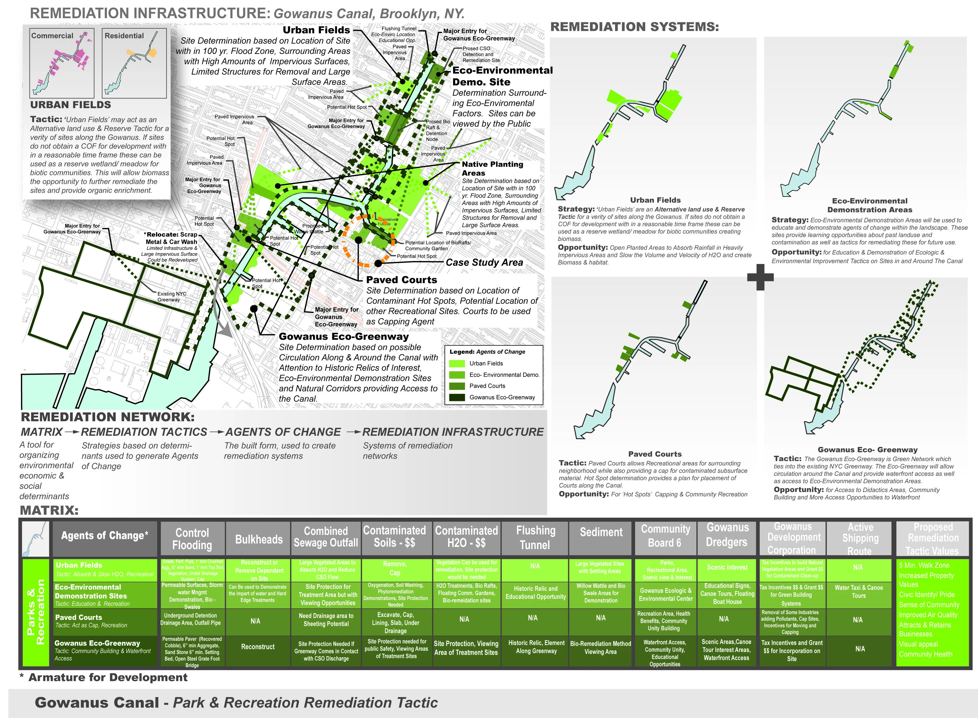
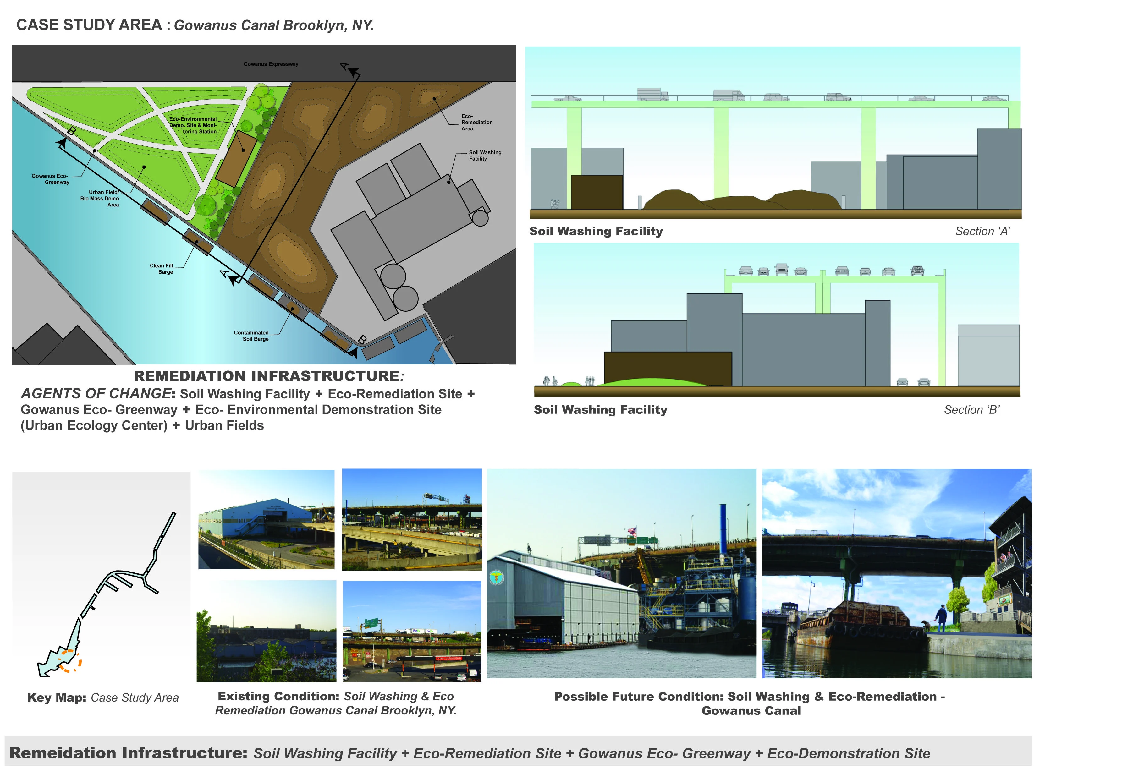
The analysis process began with environmental mapping and data collection. These maps were used to develop a complete understanding of the over all site conditions. The next phase of the process involved the development of a Matrix. The Matrix served as the organizational component for creating a variety of remediation systems. These systems were then mapped out to study possible links created by the systems in turn developing a framework for remediation networks. The remediation networks were then analyzed as case study sites to further develop an understanding for the design and implementation process.How Options were Considered
At the case-study scale consideration to the deployment of remediation tactics was given to proposed redevelopment and rezoning plans in conjunction with current and historic land use data collected. Additionally, site contaminate types and locations where used to determine best practices for remediation. Community concerns, environmental conditions, and restoration of ecologic systems where also used in the development of the social, environmental, and economic determinants.How Interested Parties were Involved
A variety of parties and stakeholders are involved in the redevelopment of this area. However it is not entirely clear what political mechanism is overseeing the process. Community stakeholders and other parties were interviewed as a component of this project however the product here has not been presented formally to these groups. The premise of this project has been discussed informally with a several key players and the intent would be to present this analysis and the associated matrix for consideration as a tool to drive the remediation process of the site.How Design was Used in the Process
The Matrix helped to develop a clear analytic approach to organizing determinants and tactics and possible applications. Design at the case-study scale was used to aid in understanding possible sites and deployment methods. This design also drove the process by highlighting opportunities for a multi-scale approach for deployment of the various tactics while providing a clear understanding of the intrinsically linking networks of remediation.How the Project Would be Implemented
The introduction of the Matrix as a tool would begin the discussion uniting and organizing concerns allowing for the evolution of remediation tactics for the site. This would generate a framework for the development of remediation tactics and deployment methods. As these multi-scale tactics are deployed a system of networks would be generated. These networks would become a remediation infrastructure for the site and the comprehensive plan for redevelopment.How the Project Could be Administered and Monitored
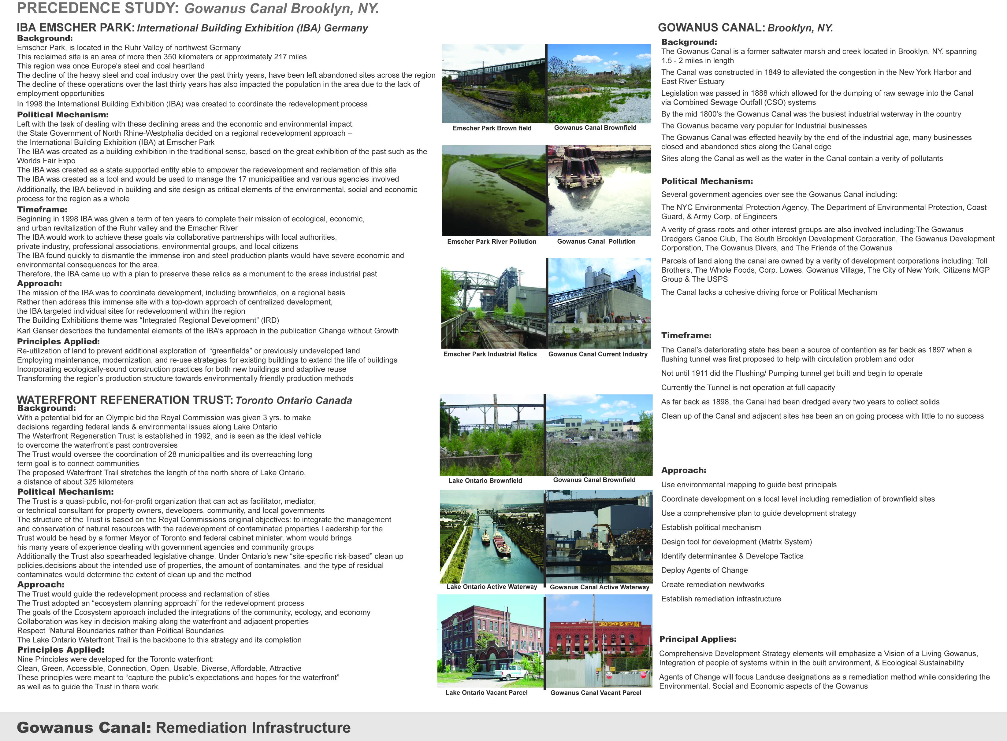
An analysis of precedence projects, including IBA- Emscher Park and the Lake Ontario Waterfront- Regeneration Trust, provide an understanding of the essential nature of a political mechanism in conjunction with an organizing element for administration and monitoring such projects. A political mechanism would be proposed in conjunction with the use of the Matrix as tool for future success in developing a remediation infrastructure.
Advertisement
Related Awards

Honor Award, Analysis & Planning
A Cultural Approach: The Fort Peck Tribes Hazard Mitigation Plan
In collaboration with the Fort Peck Assiniboine and Sioux Tribes, EPA, and FEMA, the Fort Peck Tribes Hazard Mitigation Plan (HMP) adopts a culturally responsive approach to hazard mitigation planning that features connection to place.

