
.webp?language=en-US)


Designing for Resilience: Reshaping Purdue University's Campus for an Ecologically Sound Future
Camille Mahan, Assoc. ASLA; Lana Merrill, Student ASLA
-
As a major contributor to the values, health, and wellbeing of society, universities have a responsibility for leading in environmental stewardship on their campuses. This plan preserves the unique character of our University's landscape while lessening its environmental imprint via stormwater management. Specific objectives are chosen where the University can significantly reduce its imprint. These objectives result in a self-sustaining landscape that reconnects people with their environment and awakens them to the beauty of nature surrounding them.
-
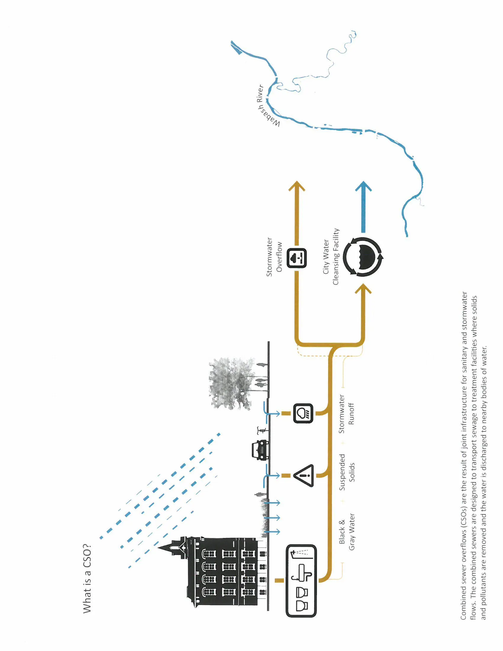
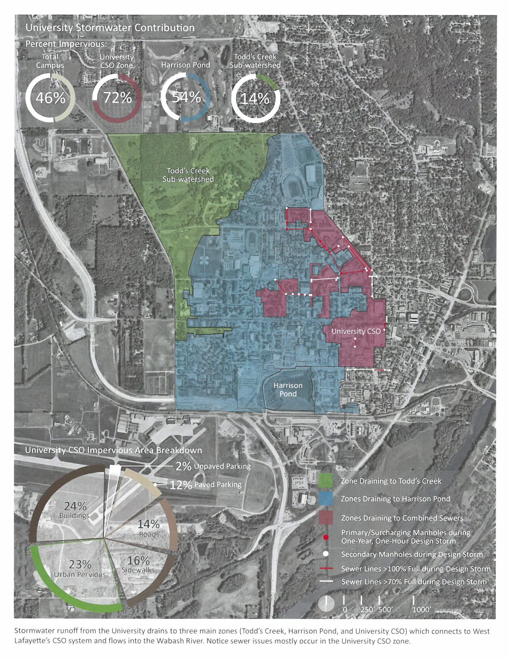
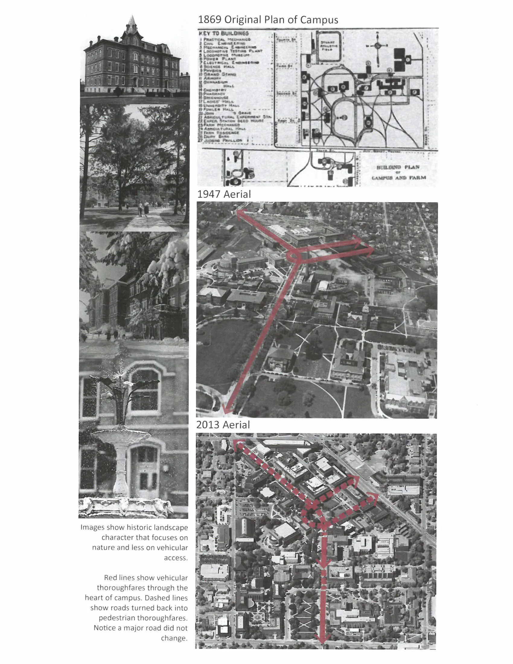
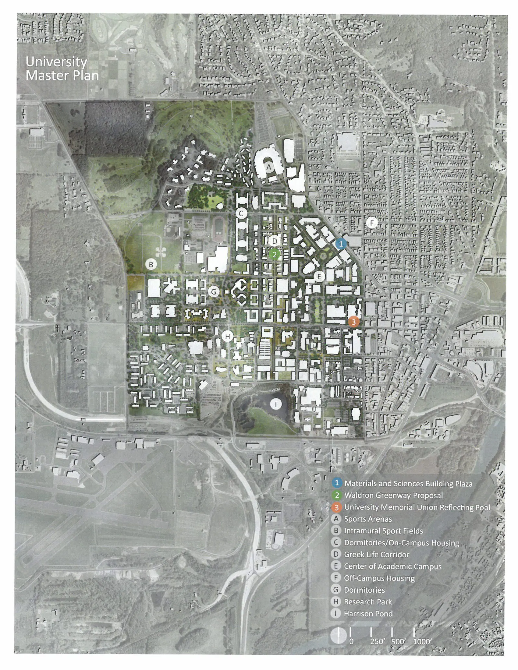
The University is located in West Lafayette, Indiana, along the Wabash River. When it was built in 1869, combined sewers were designed to transport wastewater and stormwater directly to the Wabash River. In the early 1900s, a wastewater treatment center was built to filter water before sending it into the Wabash. In the 1950s, new storm sewers were created separately from sanitary sewers to transport water to Harrison Pond, where it naturally percolates into the soil. Since the 1950s, campus designers have looked for ways to redirect stormwater from combined sewers to Harrison Pond.
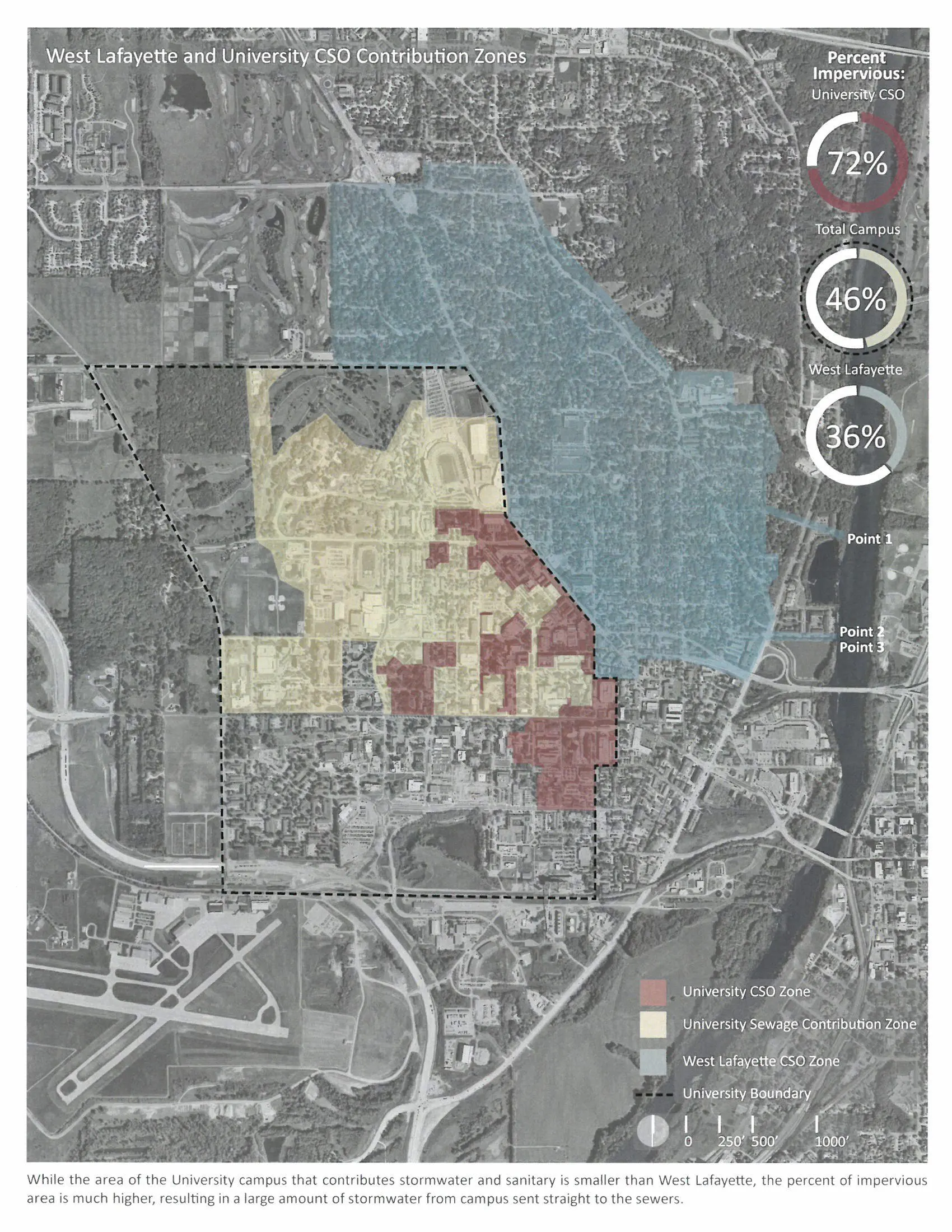
Today, 124 acres of the University's campus is still tied to combined systems. These areas, referred to as the University CSO Zone, are located in the oldest, most dense portion of campus. Along with the CSO Zone, 677 acres of the City of West Lafayette significantly contribute to the problem. Neither the University, nor the City of West Lafayette have attempted to determine how much runoff comes from each other's land area; Both have pursued solutions independently.
Again, solutions proposed thus far have been fragmented. Neither the institution nor the city has attempted to determine the respective contributions of stormwater runoff. In addition, the city's long-term control plan does not currently involve the University, despite its high concentration of impervious surfaces.
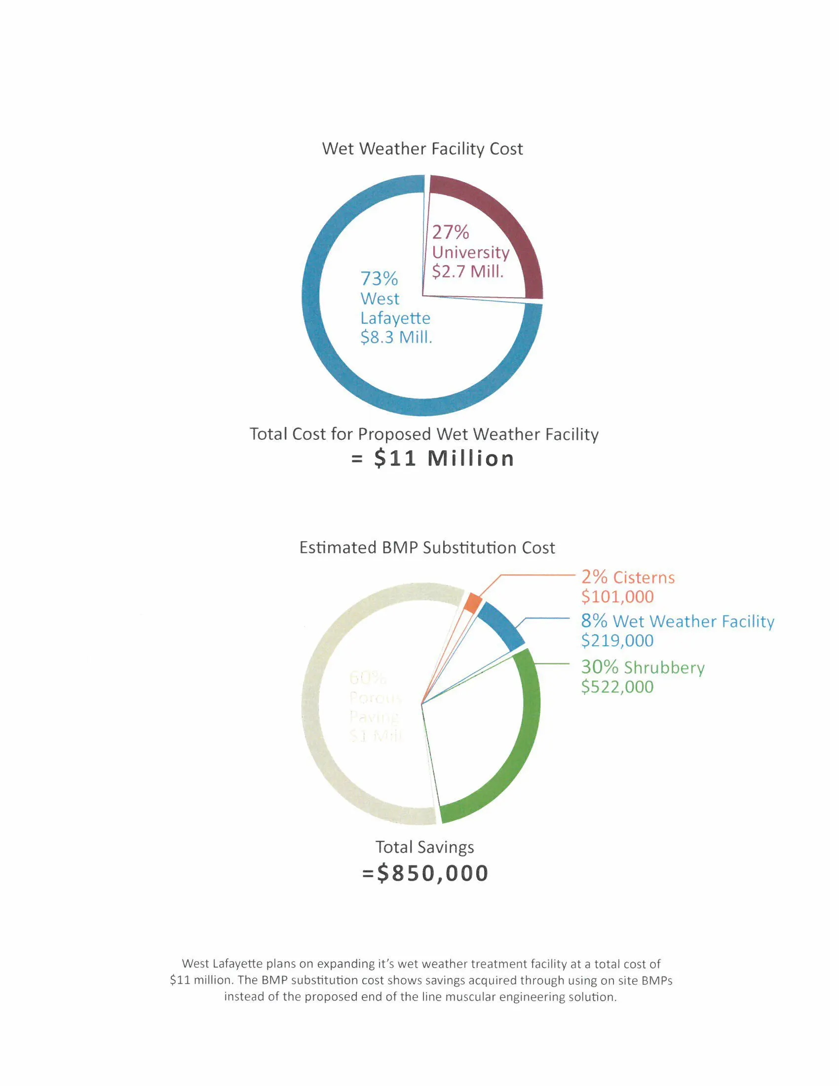
This project brought stakeholders and studies conducted by the University and West Lafayette together to evaluate runoff contributions of both parties. The result was an estimate that 27% of the total runoff to combined sewers comes from our University, while 73% comes from West Lafayette.
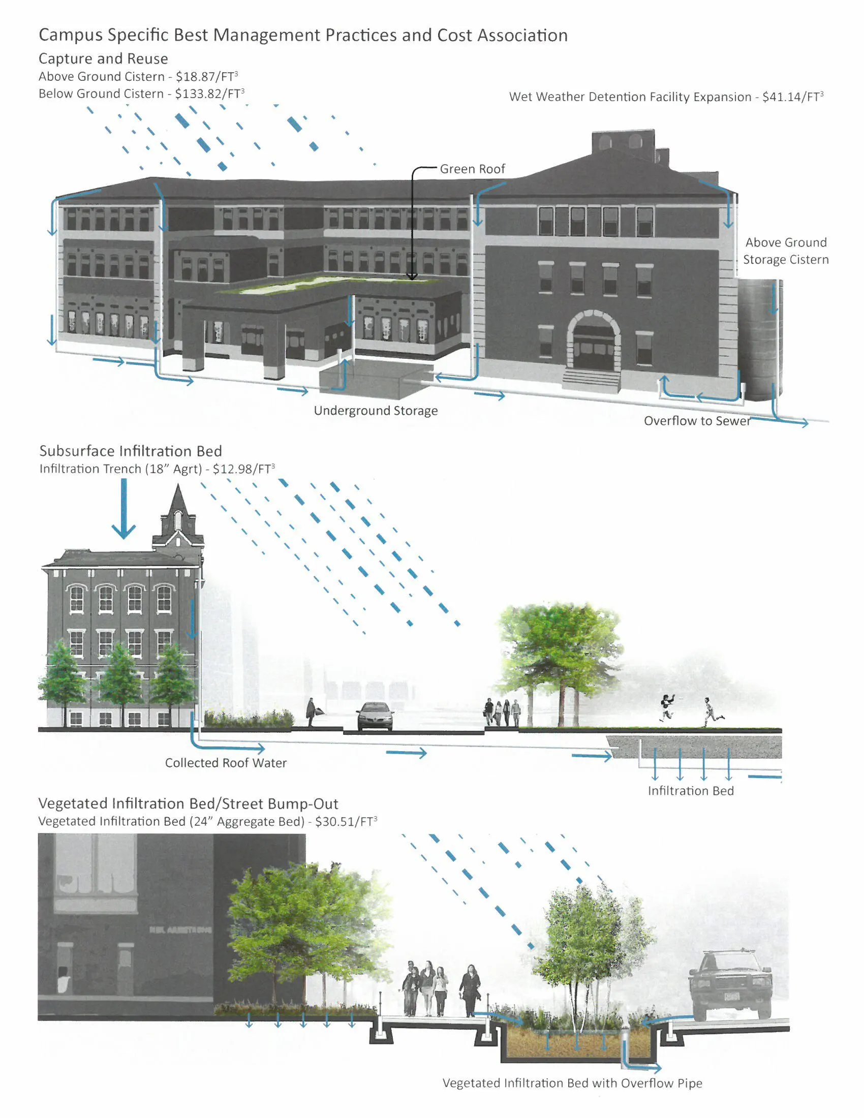
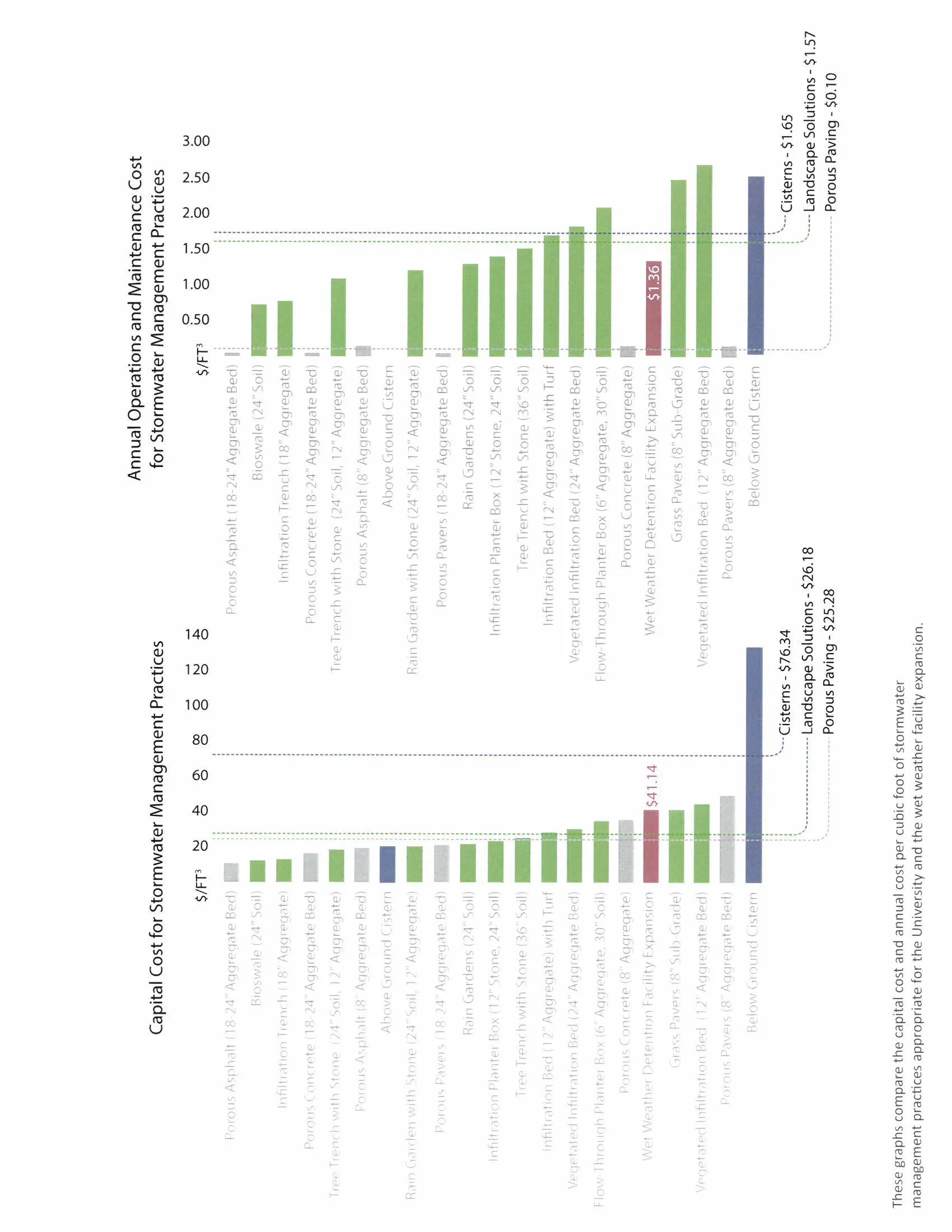
The City of West Lafayette is planning to solve a majority of CSOs by expanding the ability to transport and treat combined sewers as part of Phase II of the Indiana Department of Environmental Quality and US EPA CSO policy. By 2027, the city plans to upgrade its wet weather facility (WWF) to enable storage for the "one-year, one-hour design storm" and further transportation and treatment up to the "ten-year, one-hour storm." This infrastructure adds two mil lion gallons of capacity to the WWF at a cost of $11 million (West Lafayette CSO Long-Term Control Plan, 2011). If the University is contributing 27% of stormwater runoff, then it should be responsible for $2.7 million of the expansion. Through best management practice analysis, it was determined that the University could save $850,000 if the majority of stormwater was dealt with on site via porous paving, cisterns, and landscape solutions.
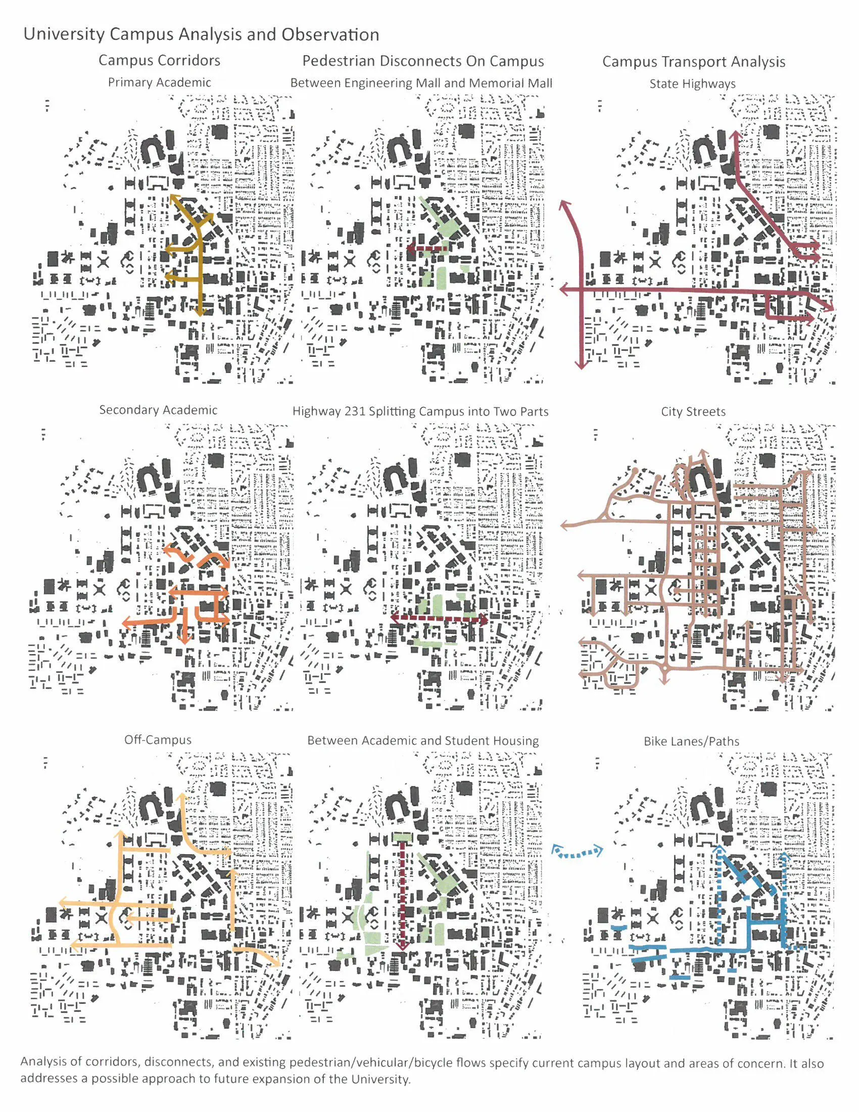
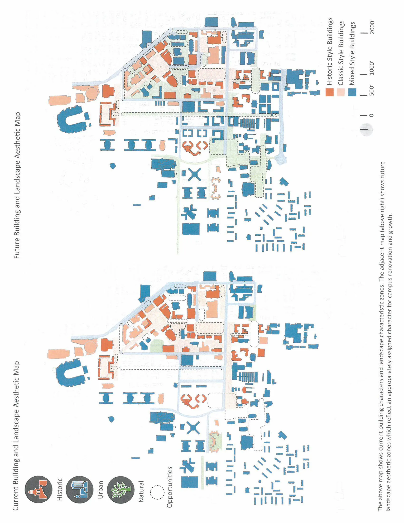
Based on this analysis, a master plan was created for the University to guide stormwater management on site. This proposal seeks to preserve the unique value and character of the campus landscape while addressing the need to lessen its environmental imprint. The overall special structure and hierarchy of the University's landscape is composed of many interconnected spaces. An understanding of the structure is necessary to create new places and sustainable landscapes that preserve the identity of the University while connecting and supporting existing places.
The key landscape initiatives are presented as clear guidelines for development that contribute to best practices in connecting education and research with sustainable campus operations. Specific objectives are chosen in areas where the University can significantly reduce the campus contribution to the number of combined sewer overflows and promote an organized transformation to a sustainable campus cultu re. Specific goals of the plan are achieved by evaluating the basic elements of landscape architecture-planting, water, and paving when making design decisions.
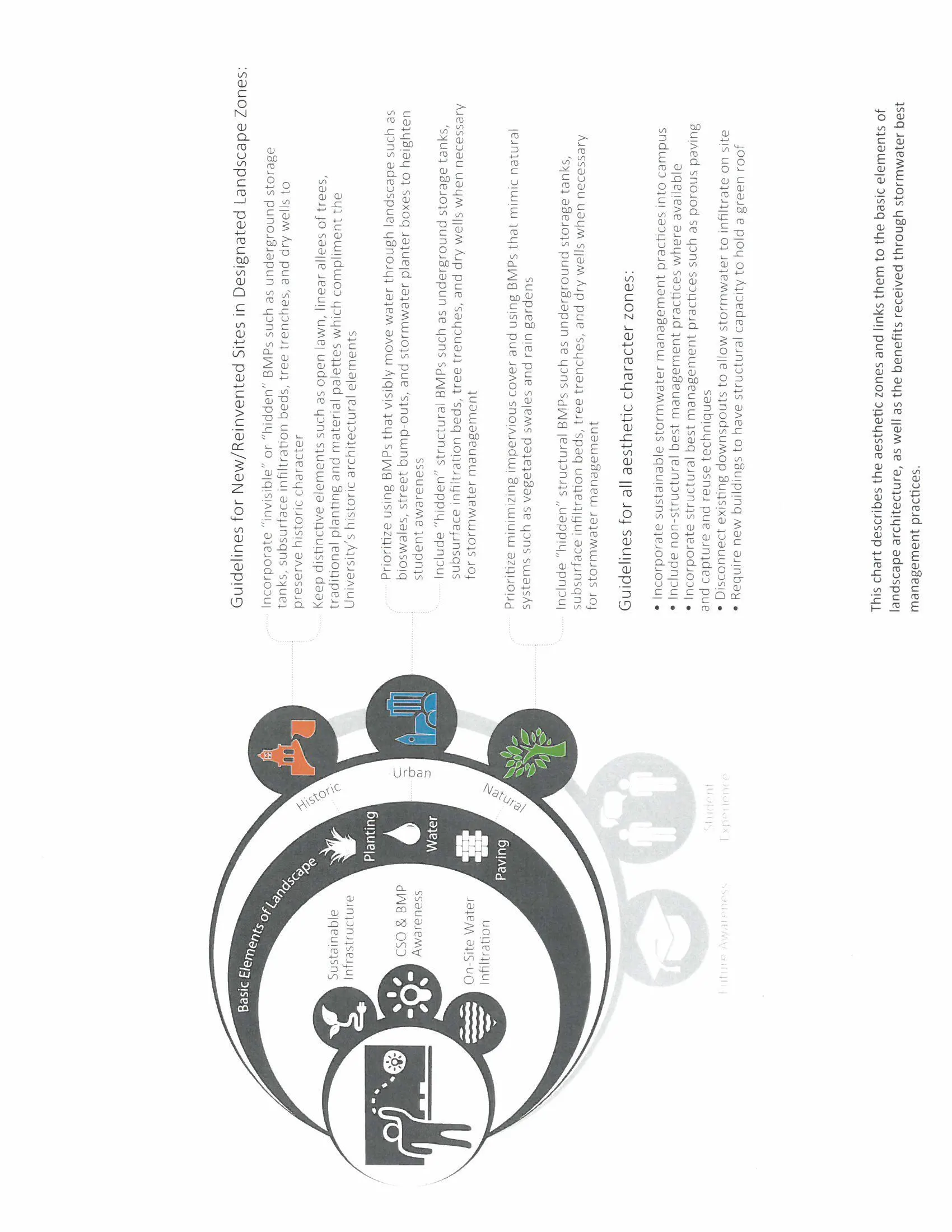
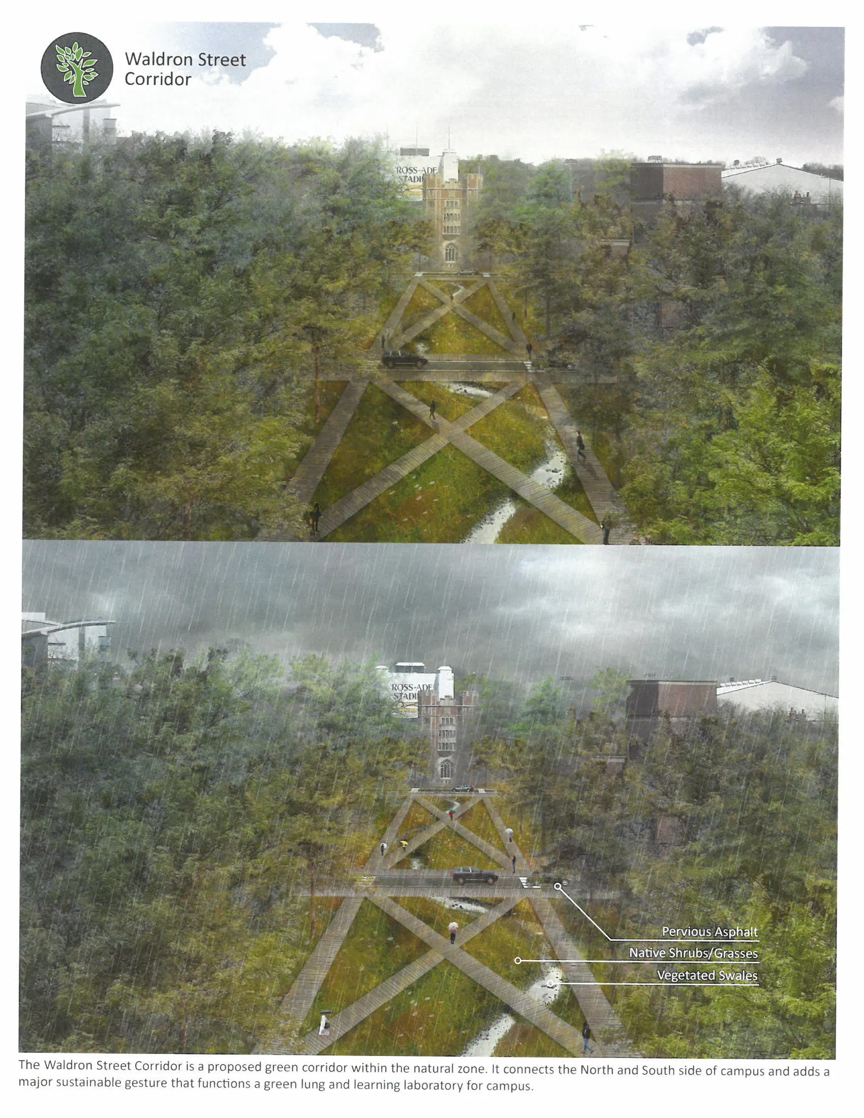
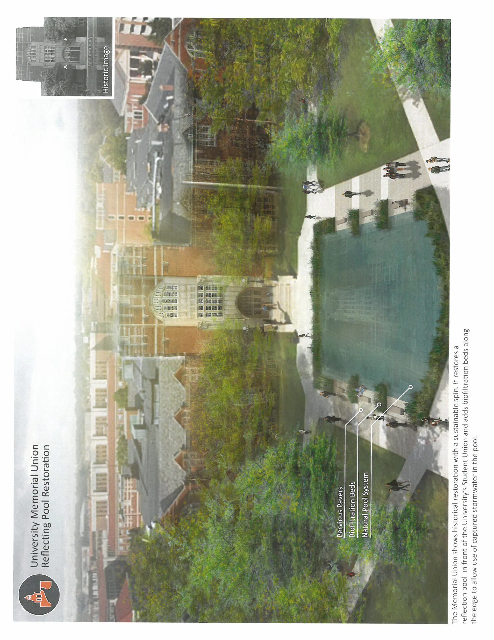
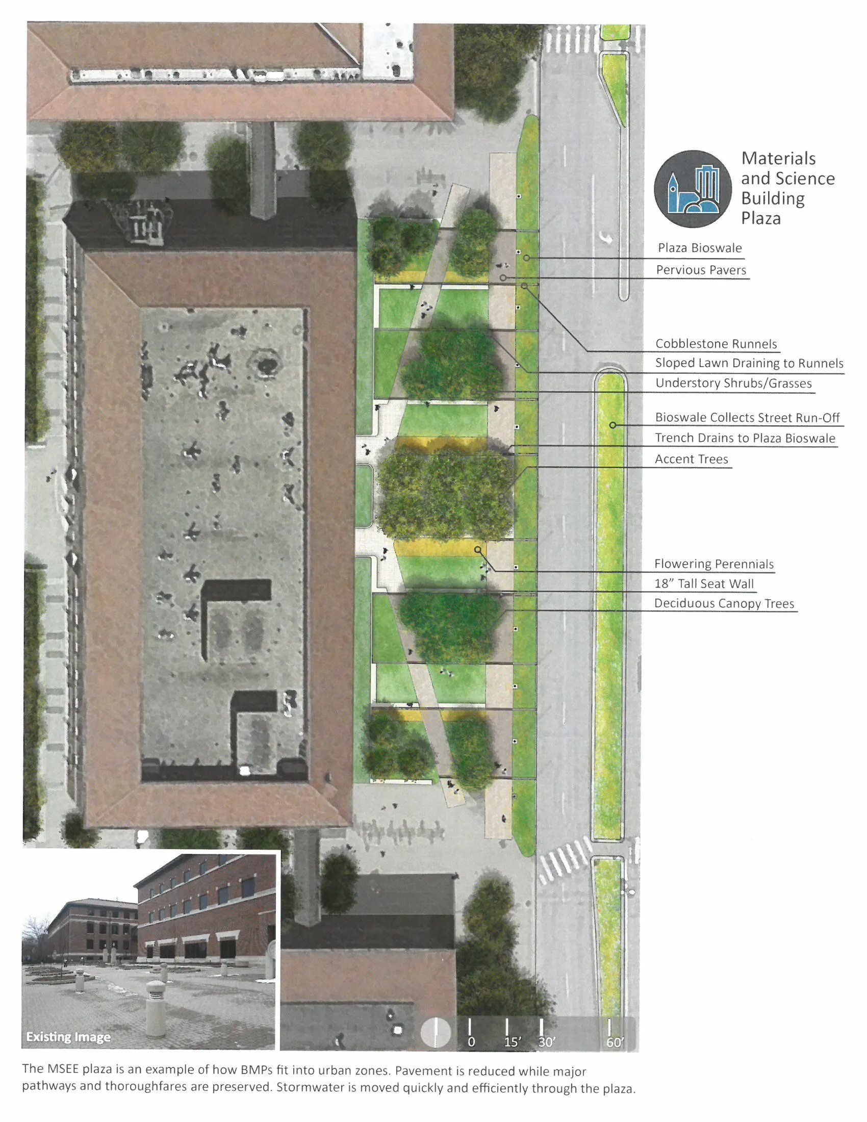
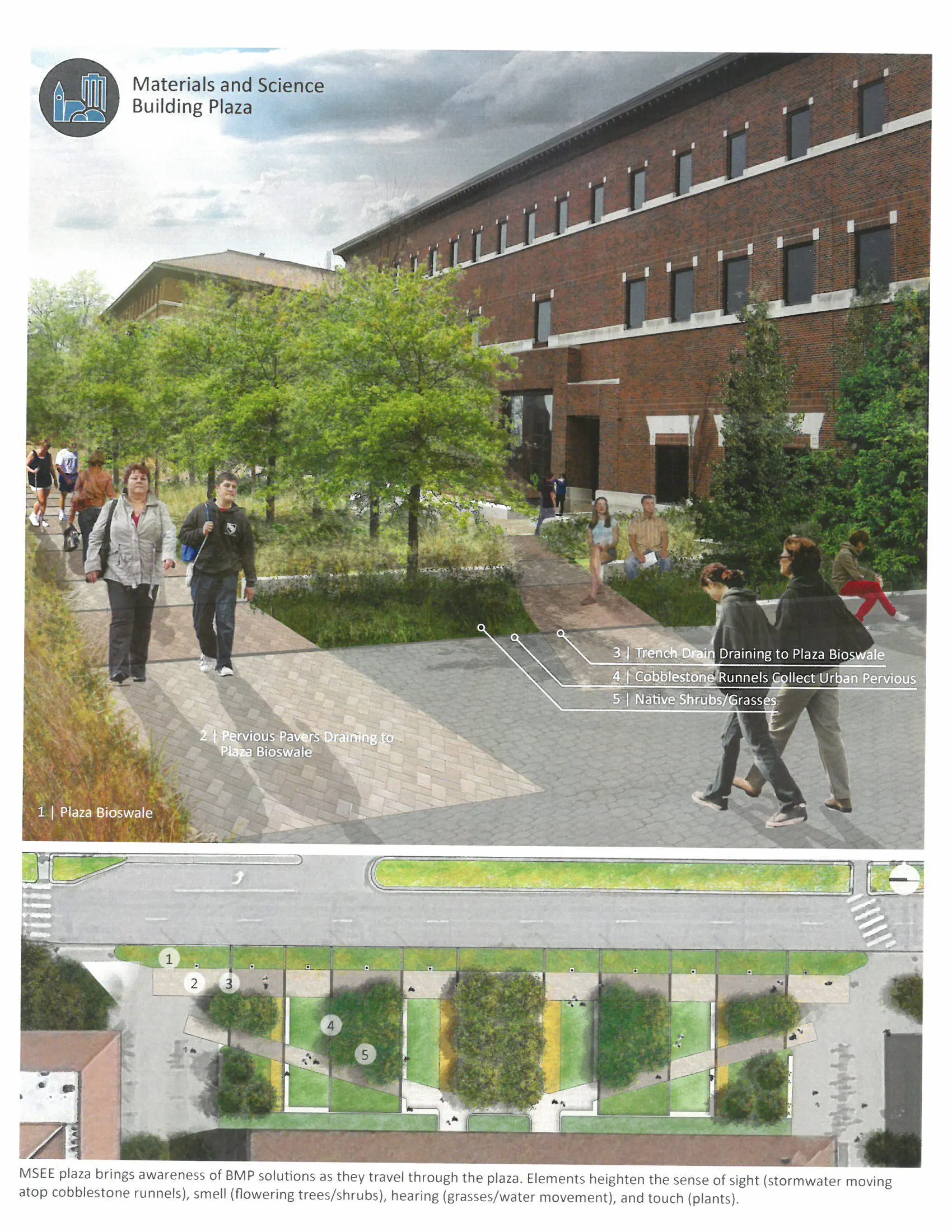
The original buildings on the University's campus preserve a characteristic limestone and brick facade accented with a park-like landscape made of evergreen trees and open lawn space. By identifying three aesthetic landscape characteristics (historic, urban, and natural) based on their surrounding building types, the unique value and character of the campus landscape can be preserved while removing stormwater from the combined sewers. Stormwater best management practices that complement landscape aesthetics are identified for each category. The historic zones include core academic malls and distinctive elements of campus that are recognizable to multiple generations of those affiliated with the University. For example, hidden sustainable best management practices (BMPs) such as underground storage tanks below turf should dominate these areas in order to not disrupt the historic aesthetic in these spaces. Urban zones are outside of the core historic campus and characterized by high density and traffic. Stormwater management within this zone focuses on visibly moving water through the landscape by using BMPs such as runnels, bioswales, and stormwater planter boxes. Natural zones are characterized by low traffic, residential, and open spaces. These spaces mimic natural systems by allowing stormwater to percolate into the ground through BMPs such as rain gardens, bioswales and pervious paving. Urban and natural spaces must use sustainable design in a highly visible manner, so that it becomes something those on campus can interact with on a daily basis. This defined system of implementing sustainable BMPs on campus removes stormwater while creating new places and sustainable landscapes which keep the identity of the University.
The resulting proposed master plan reflects environmental stewardship and progressive thinking, which is taught at the University. The campus landscape becomes one that works with natural systems, instead of suppressing them. Students and faculty will be immersed in an environment that integrates sustainability into campus lifestyle and contribute to educating future generations about the importance of preserving nature. Considering the long-term leverage if University faculty and students conduct research for and help to implement sustainable practices on campus that will preserve our environment and enhance human health and wellbeing. Graduating students can then bring the knowledge, values, and familiarity with these sustainable practices to their future employment, life style decisions, and to the improvement of the communities in which they live.
-
Don Staley, ASLA, Leed® AP, Senior Landscape Architect at Purdue University
Michael Gulich, AIA, Leed® AP, Director of University Sustainability at Purdue University
Meliora Environmental Design, Andropogon Associates, Element Engineering, and Enginuity Management and Consulting. 2009. Purdue University Campus-Wide Sustainable Stormwater Modification Design
Purdue University, 2012, Sustainable Landscape Plan: West Lafayette Campus
Wessler Engineering, 2012, CSO Long Term Control Plan, Amendment No. 2
West Lafayette, 2011, Wastewater Treatment Utility
West Lafayette, 2012, Combined Sewer Overflow Events
Advertisement
Related Awards

Honor Award, Analysis & Planning
A Cultural Approach: The Fort Peck Tribes Hazard Mitigation Plan
In collaboration with the Fort Peck Assiniboine and Sioux Tribes, EPA, and FEMA, the Fort Peck Tribes Hazard Mitigation Plan (HMP) adopts a culturally responsive approach to hazard mitigation planning that features connection to place.

