
.webp?language=en-US)


Ningbo Eco-Corridor - 3.3 km Living Filter


The scale is astounding. What sets it apart, is the reality of the analysis. It is carefully considered, realistic, technically sound, and exciting. The rationality is clear and the design makes sense.
Awards Jury
-
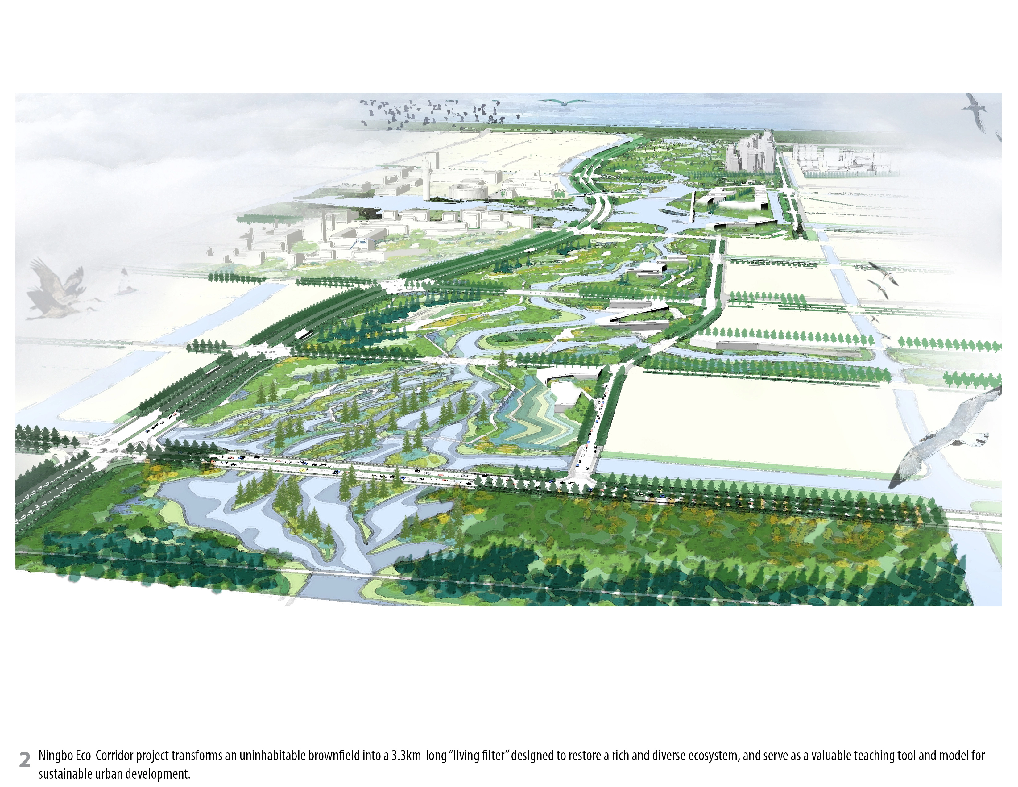
Through the innovative synthesis of topography, hydrology and vegetation, the Ningbo Eco-Corridor project transforms an uninhabitable brownfield into a 3.3km long “living filter” designed to restore a rich and diverse ecosystem, create synergy between human activity and wildlife habitat, and serve as valuable teaching tool and model for sustainable urban expansion and development in China's rapidly advancing economy.
-
Background
Situated on China's eastern coastline in the heart of the Yangtze River Delta, with an urban population of 3.49 million (2010 Census), the city of Ningbo is one of China's oldest and best-known cities, a key port for foreign trade, and an important economic center. As with many other cities across the country, phenomenal population growth in recent years has put an enormous strain on infrastructure, posing a monumental challenge for the local government to accommodate urban densification while minimizing negative environmental impacts.
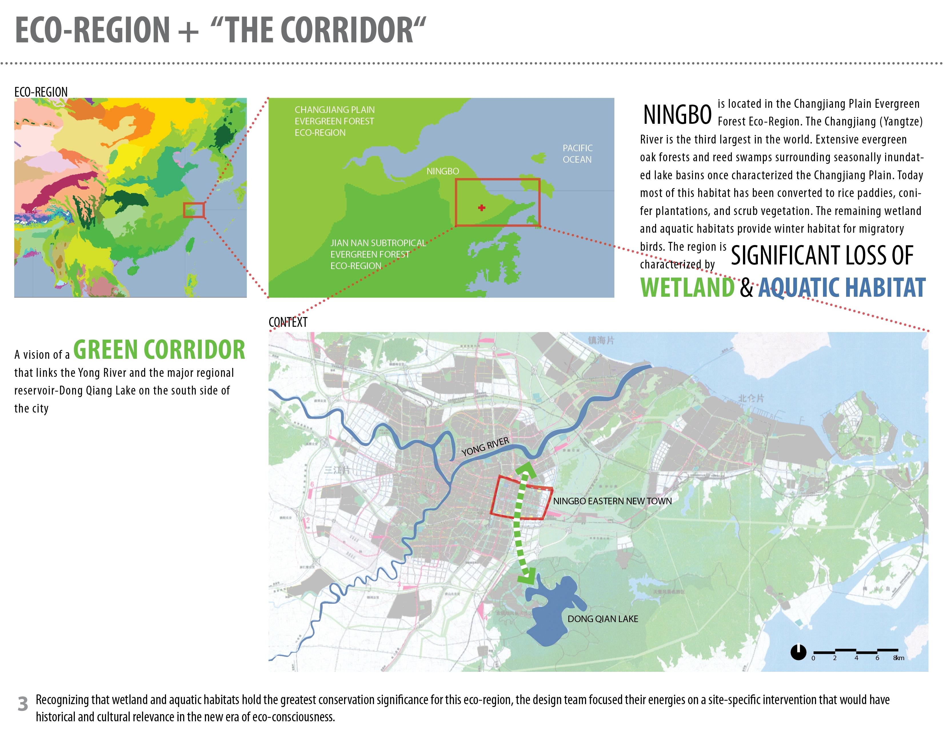
In 2002, with the intention of alleviating pressure on the Old City while setting a precedent for a balanced, ecological approach to urban expansion, the Ningbo Planning department called for a master plan for the creation of the “Ningbo Eastern New City.” The plan would include 6 square miles of mixed-use urban development organized around a signature “Eco-Corridor,” comprised of a linear network of green spaces in which humans, wildlife and plants could inhabit, co-exist, and thrive.
Eco-Regional Context
Ningbo is situated in the southern part of Changjiang Plain Evergreen Forest Eco-Region within the low-lying Changjiang (Yangtze) River delta. This eco-region was historically characterized by extensive evergreen oak forests and reed swamps surrounding seasonally-inundated lake basins. Centuries of agriculture and recent urban development have resulted in a significant loss of wetland and aquatic habitat. The few wetlands that remain provide vital habitat for migratory birds such as oriental white storks, swan geese, and Siberian and white-naped cranes, and aquatic animals such as Yangtze River dolphins, Yangtze alligators, Chinese water deer, and otters.
Recognizing that wetland and aquatic habitats hold the greatest conservation significance for this eco-region, the design team focused its energies on wetland restoration as the impetus for a site-specific intervention that would have historical and cultural relevance in this new era of eco-consciousness.
Site Investigation
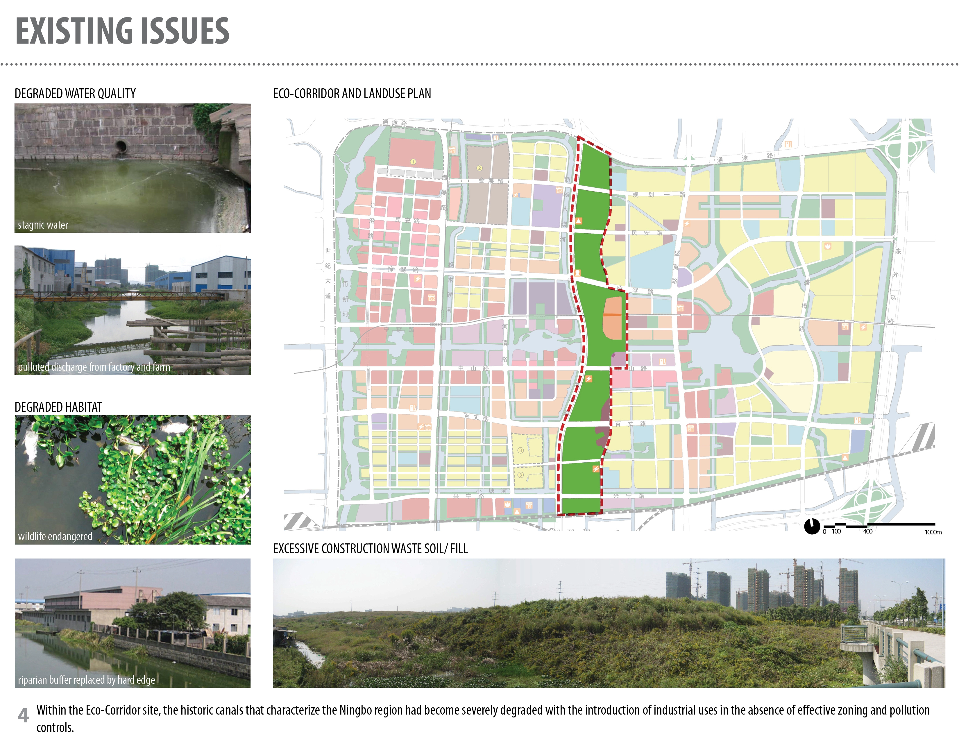
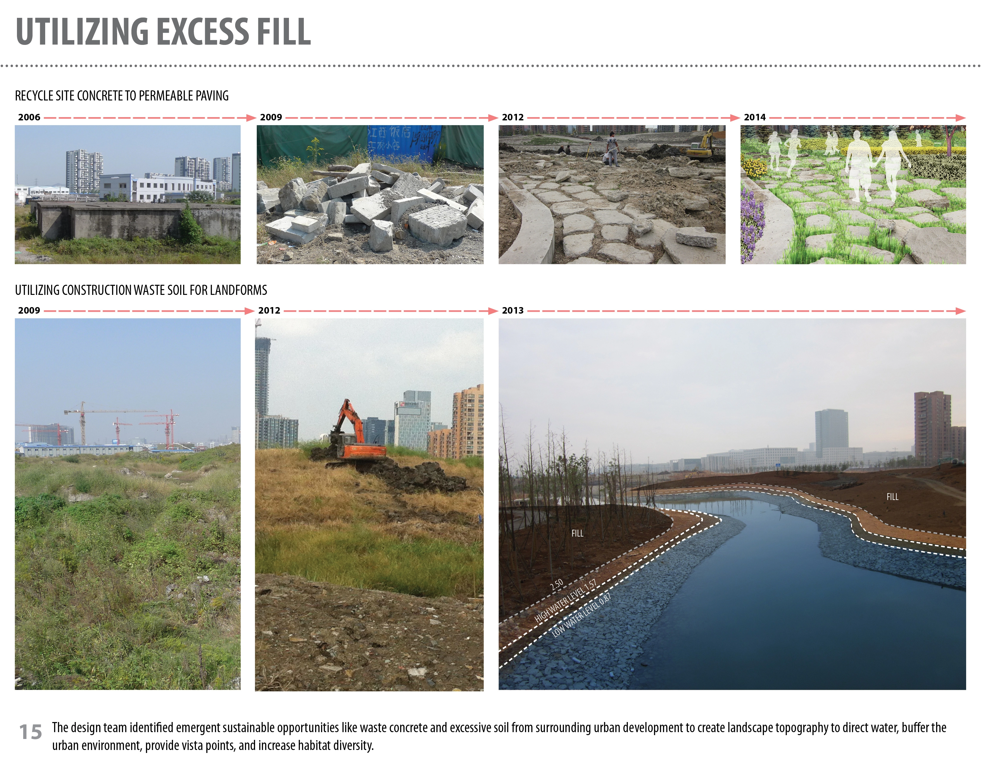
The Ningbo region is characterized by a canal system that historically performed a set of functions including flood control, irrigation and transportation. Within the Eco-Corridor site, the canals had become severely degraded with the introduction of industrial uses in the absence of effective zoning and pollution controls. As successive generations of factories were built, contaminated soil from construction excavation was dumped illegally and randomly through out the area, with factory sewage and stormwater runoff allowed to flow untreated into the canals rendered stagnant by ad-hoc infill.
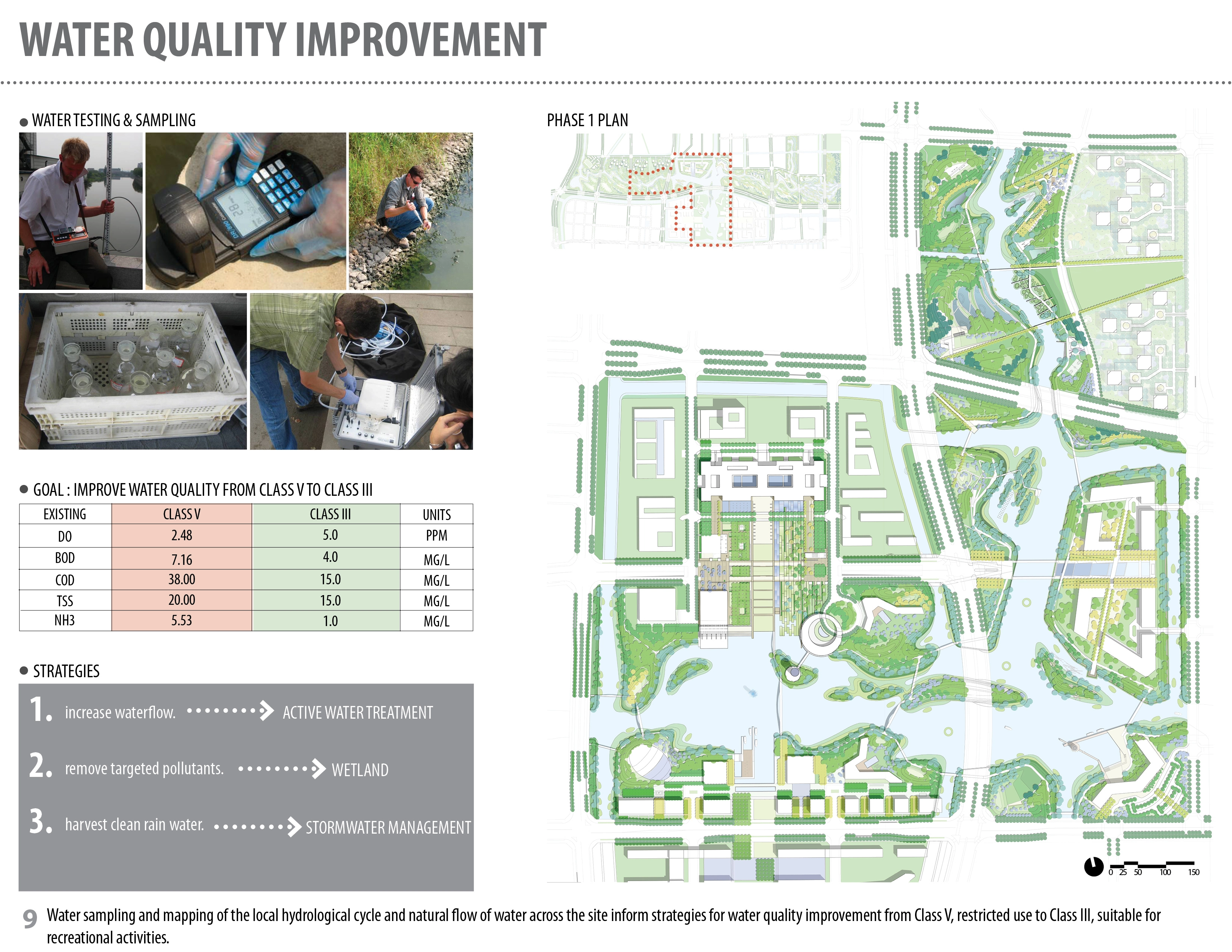
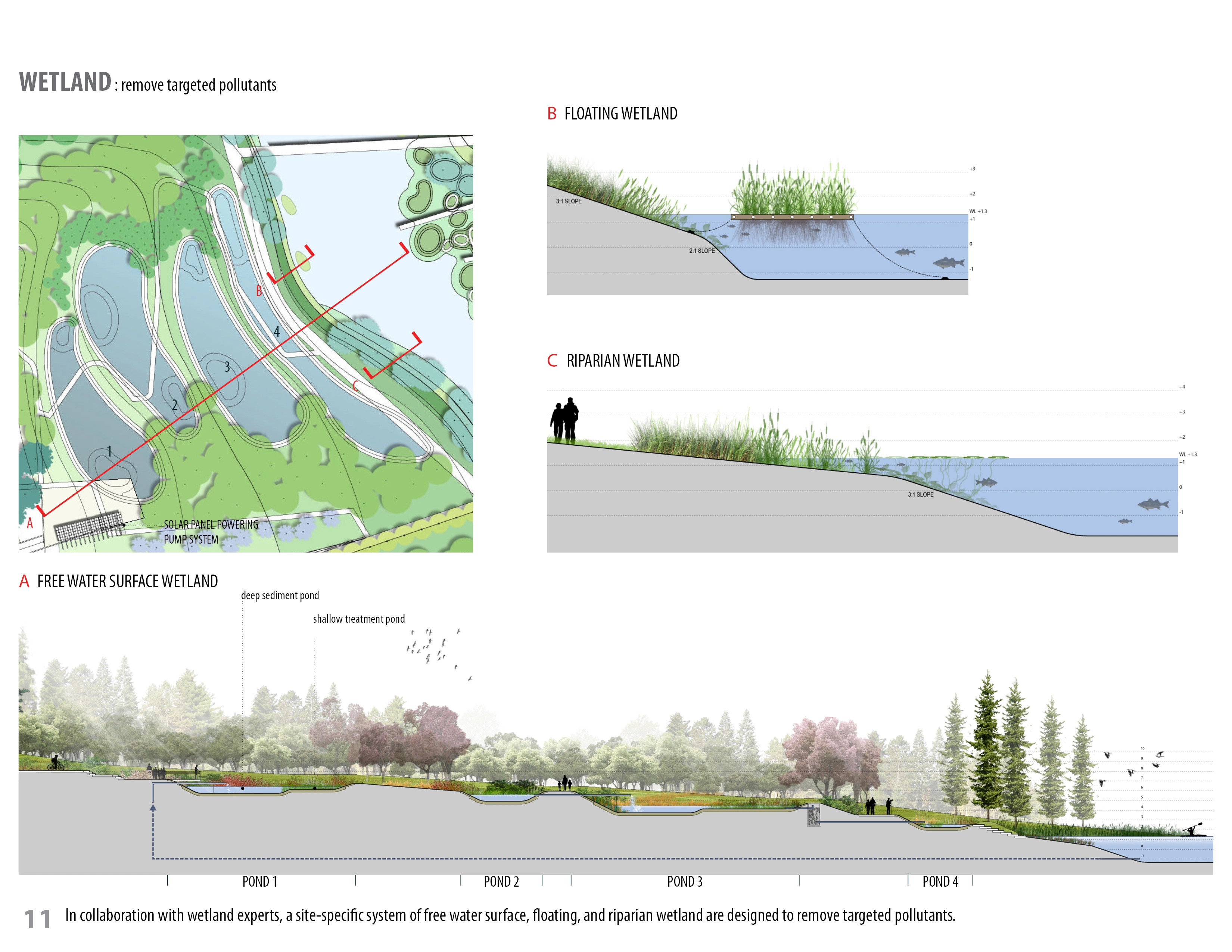
Knowing that an effective and meaningful intervention would require sufficient data about the underlying conditions of the site, a thorough analysis was conducted by the leading landscape architects and affiliated consultants--including water-quality scientists, wetland experts, and hydrologic engineers--in order to fully understand the existing conditions, map the local hydrological cycle and natural flow of water across the site, and identify potential synergies.
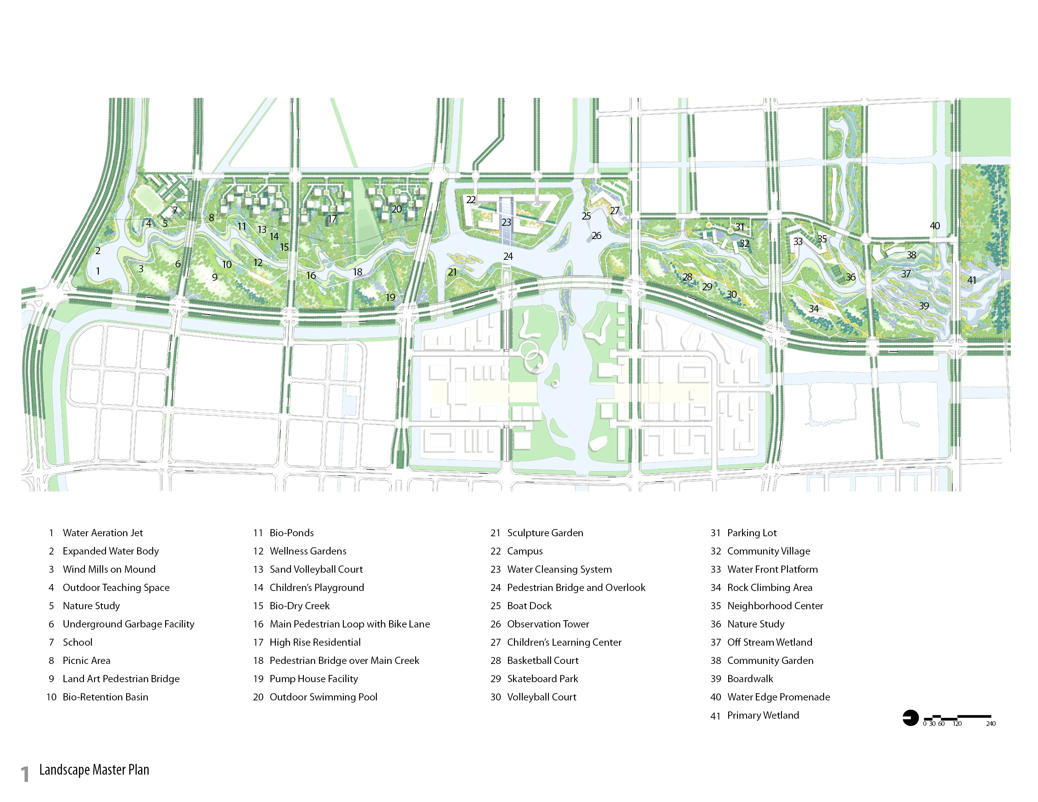
Implementation - Building a Living Filter
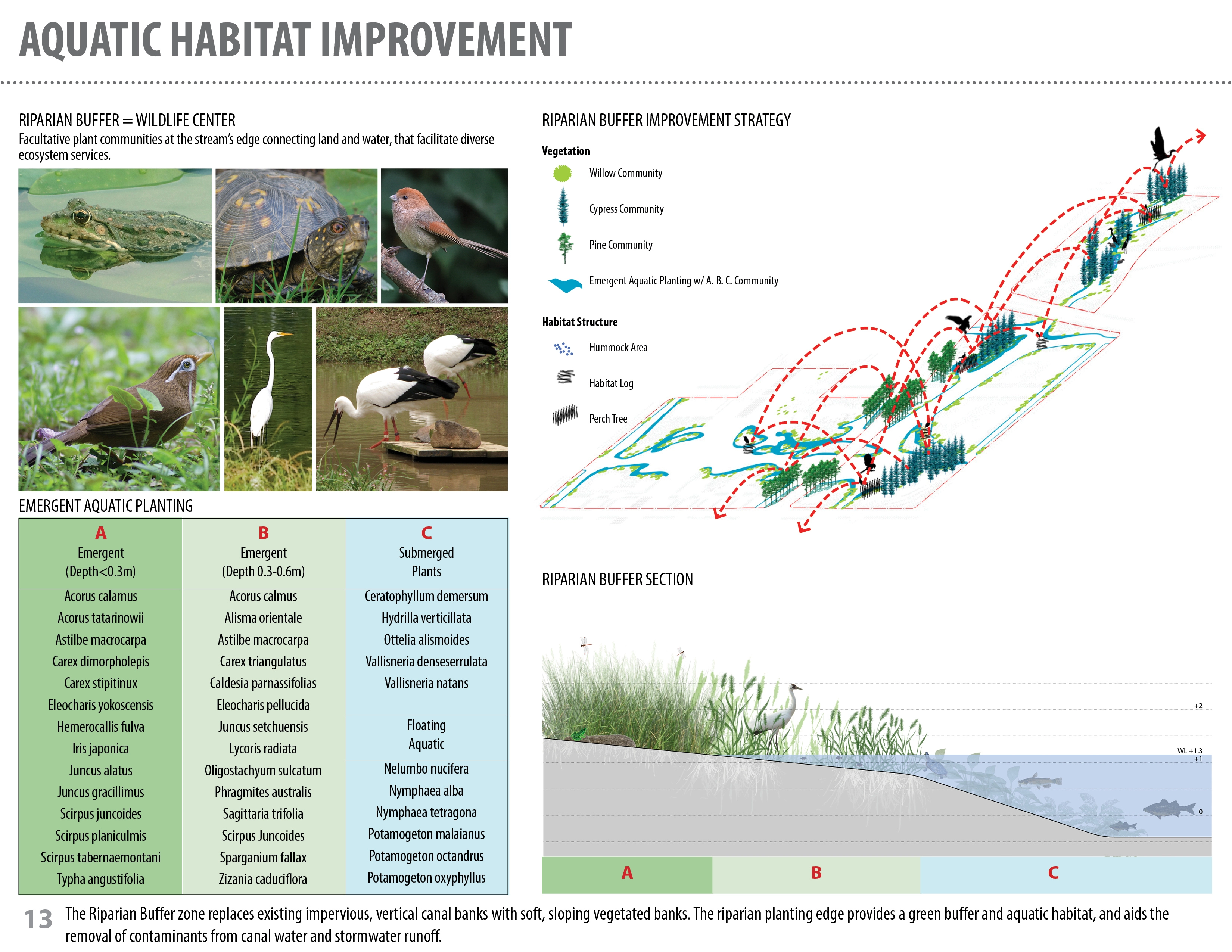
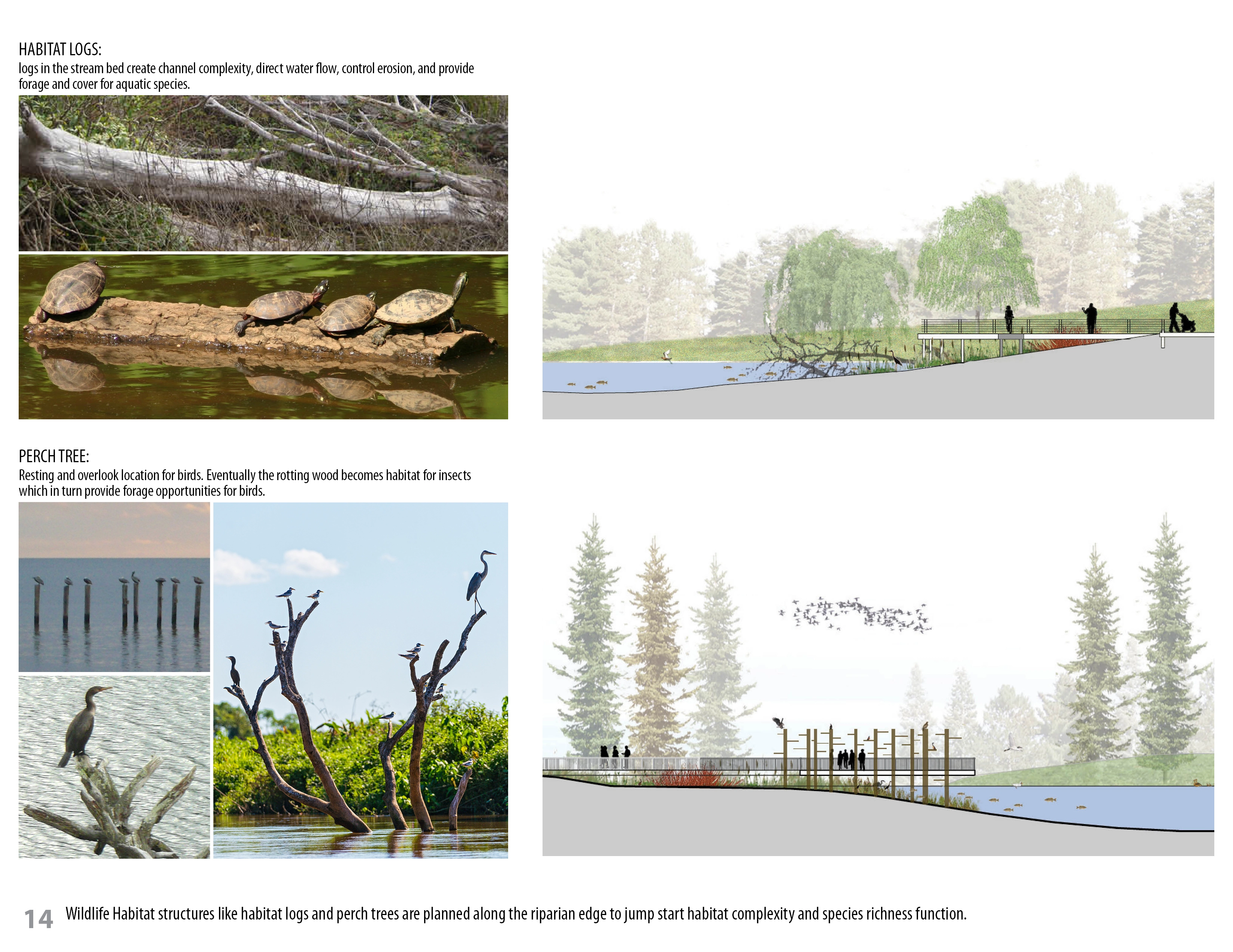
Out of this analysis emerged the concept of creating a microcosm of the Changjiang eco-region. A networked series of waterways organized by low, undulating hills was designed to treat polluted water from the established canal system, manage stormwater runoff from the newly developed areas, establish riparian zones for the restoration of wildlife habitat, and provide recreational and educational opportunities for the new inhabitants.
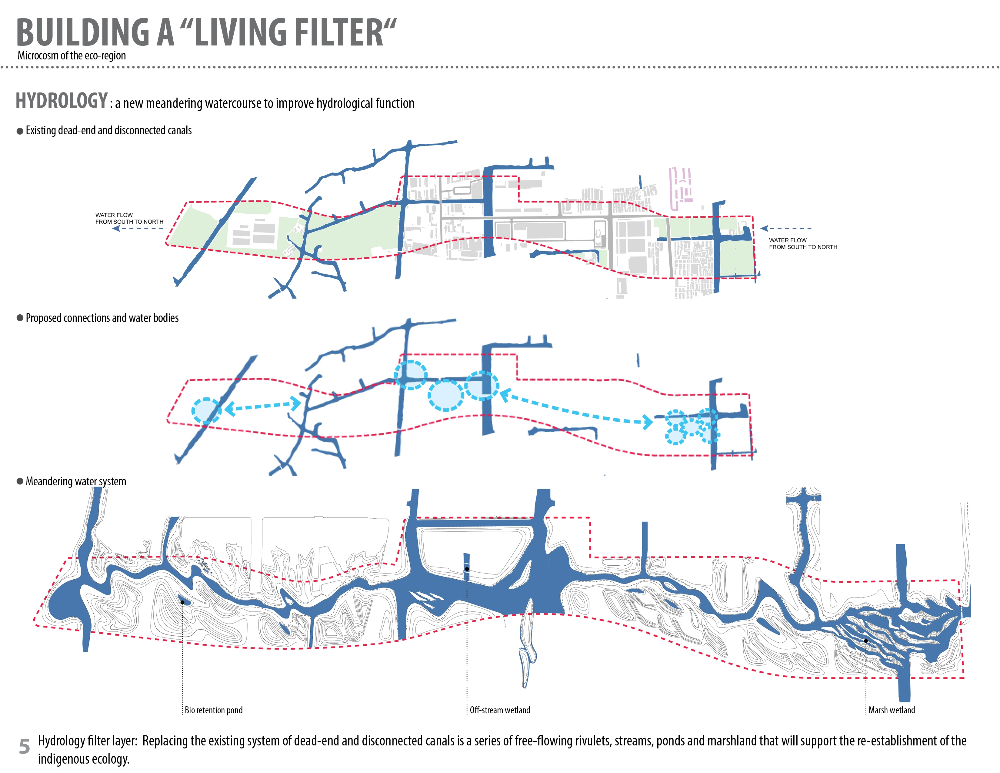
Hydrology: a new meandering watercourse to improve hydrological function
Replacing the existing system of dead-end and disconnected canals is a series of free-flowing rivulets, streams, ponds and marshland. The hydrological flow is designed to be slow and meandering, approximating the original conditions of the lowland floodplain, in order to support the re-establishment of the native ecology.Through innovative bio-remediation technologies that mimic indigenous ecological processes, the newly constructed watercourse improves the existing quality of the canal water from Class V, restricted to industrial and agricultural uses and not fit for human habitation, to Class III, which is suitable for ecological restoration and recreational use.
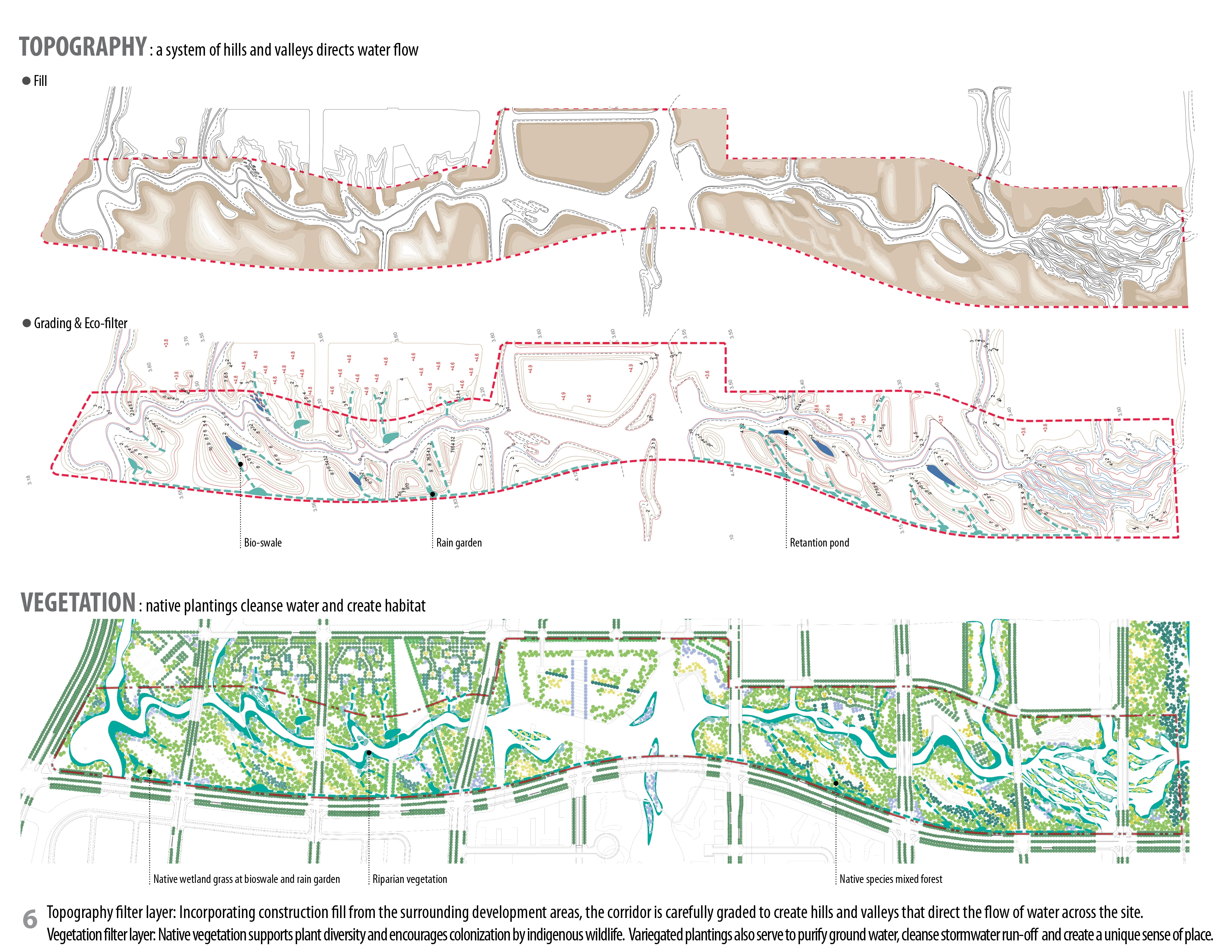
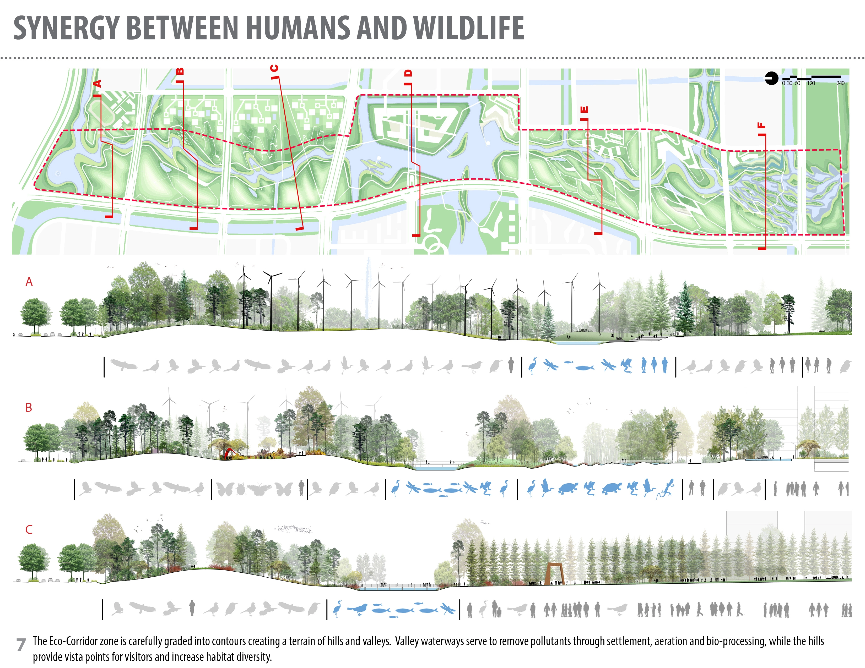
Topography: a system of hills and valleys directs water flow
Incorporating fill from excavation in the surrounding development areas, the entire Eco-Corridor zone is carefully graded and shaped into contours creating a terrain of hills and valleys. The valley waterways serve to remove pollutants through settlement, aeration and bio-processing, allow retention for aquifer recharge, and highlight the different modalities of water as it moves across the site. The hills also serve to buffer the urban environment, frame views to the New City, provide vista points for visitors, and increase habitat diversity.Vegetation: native plantings cleanse water and create habitat
Across this undulating landscape, the strategic placement of deciduous and evergreen species reflects aesthetic, programmatic, ecological, and climatic considerations. An emphasis on native vegetation supports the re-establishment of diverse plant communities along the length of the corridor, and encourages colonization by indigenous wildlife. Plantings along the riparian edge, and bio-swales and rain gardens throughout the site, cleanse stormwater run-off from the adjacent development and other building and hardscape areas. Plant selection also creates a unique sense of place: together with topographical variety, differentiation of species into groupings based on height, texture and color creates distinct spatial patterns.Integration With the Urban Fabric
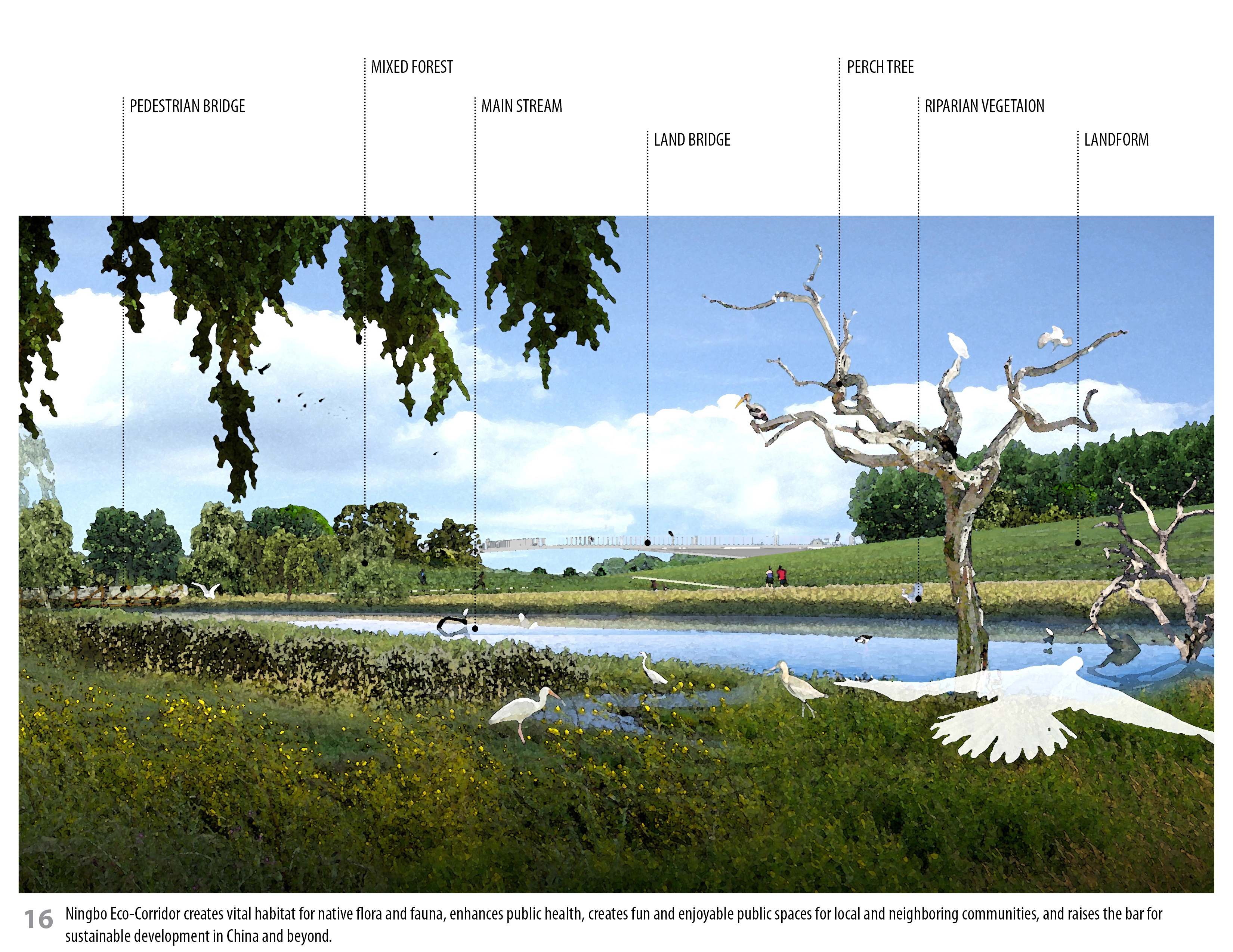
The Eco-Corridor serves as the spine of Ningbo New City's open space system, creating and connecting a variety of land uses. Extending 3.3 km, the Corridor merges seamlessly with the adjacent urban fabric and natural systems, creating a symbiotic relationship between the greenway and surrounding landscape.
By restoring the ecological network in this region, the Ningbo Eco-Corridor creates vital habitat for native flora and fauna, enhances public health, creates fun and enjoyable public spaces for local and neighboring communities, and raises the bar for sustainable development in China and beyond.
-
Lead Designer
Hui-Li LeeSWA Group Team Members
Hui-Li Lee
Roy Imamura
Chih-Wei Lin
Scott Chuang
Jack Wu
Chih-Wei Chang, ASLA
Nancy Coutler
Amity Winters
Luis Kao
Xun Li
Kathy Sun
Huiqing KuangArchitect
OJANEN_CHIOU Architects LLP
Shen-I Chiou
Marc OjanenEnvironmental Consultants
Herrera Environmental Consultants
Mark MerkelbachGalen Fulford
Biomatrix WaterLocal Design Institute
Ningbo Landscape Architecture Design Research College
Advertisement
Related Awards

Honor Award, Analysis & Planning
A Cultural Approach: The Fort Peck Tribes Hazard Mitigation Plan
In collaboration with the Fort Peck Assiniboine and Sioux Tribes, EPA, and FEMA, the Fort Peck Tribes Hazard Mitigation Plan (HMP) adopts a culturally responsive approach to hazard mitigation planning that features connection to place.

