.webp?language=en-US)


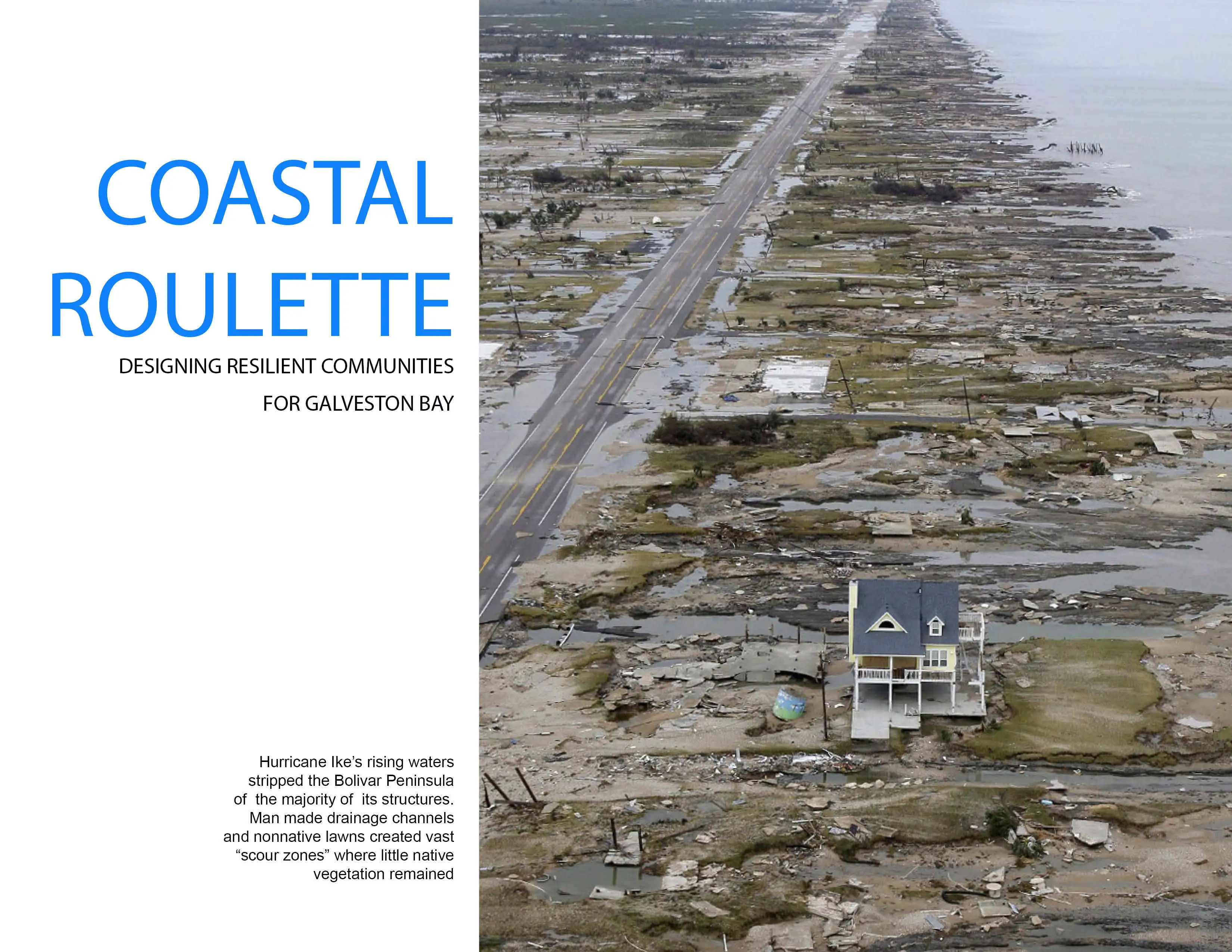
Coastal Roulette: Planning Resilient Communities for Galveston Bay
Resiliency is a job type that we’re increasingly being asked to consider more and more, including water and how planning affects that. The axonometric drawings are compelling and the message is that there is no one solution, it has to be layered and multi-pronged, with both architectural and natural solutions. They lay out their case quite effectively.
Awards Jury
-
Coastal populations worldwide are playing a dangerous game. Frequent hazardous storms along coastlines are a given, and yet we continue to place our heads in the sand when considering the future. This submission focuses on an innovative project in Galveston Bay serving as a model for proactively solving coastal planning challenges. The summary below demonstrates how we can reconnect to these valued landscapes while providing storm protection, economic stimulus, environmental benefits, and sustainable coastal communities.
-
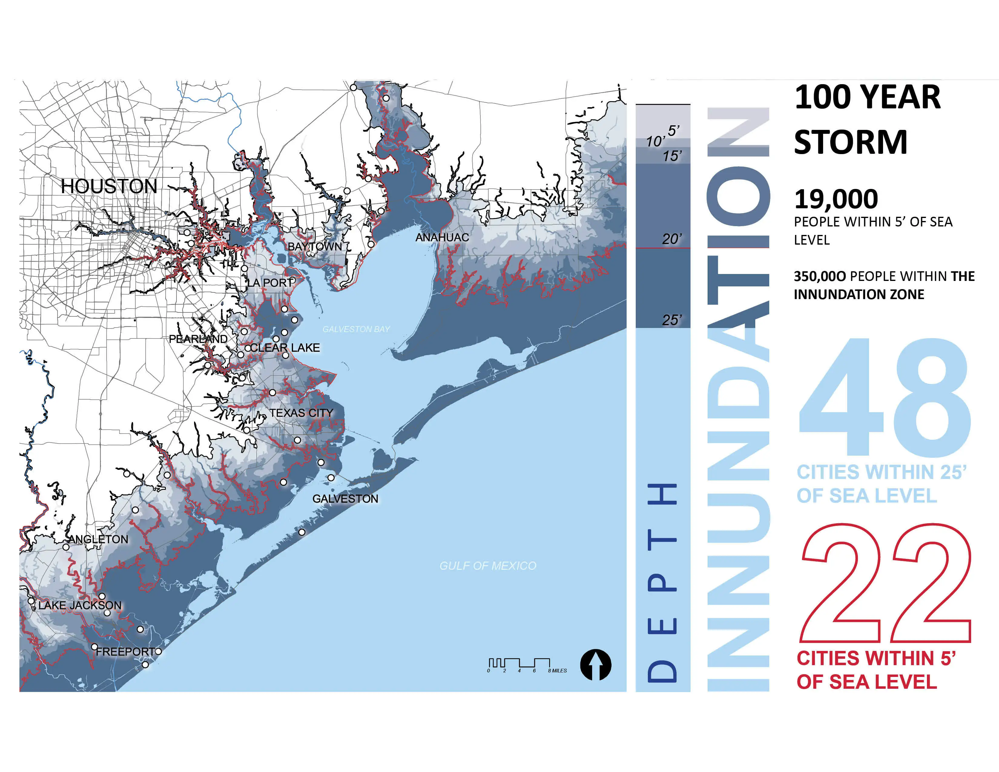
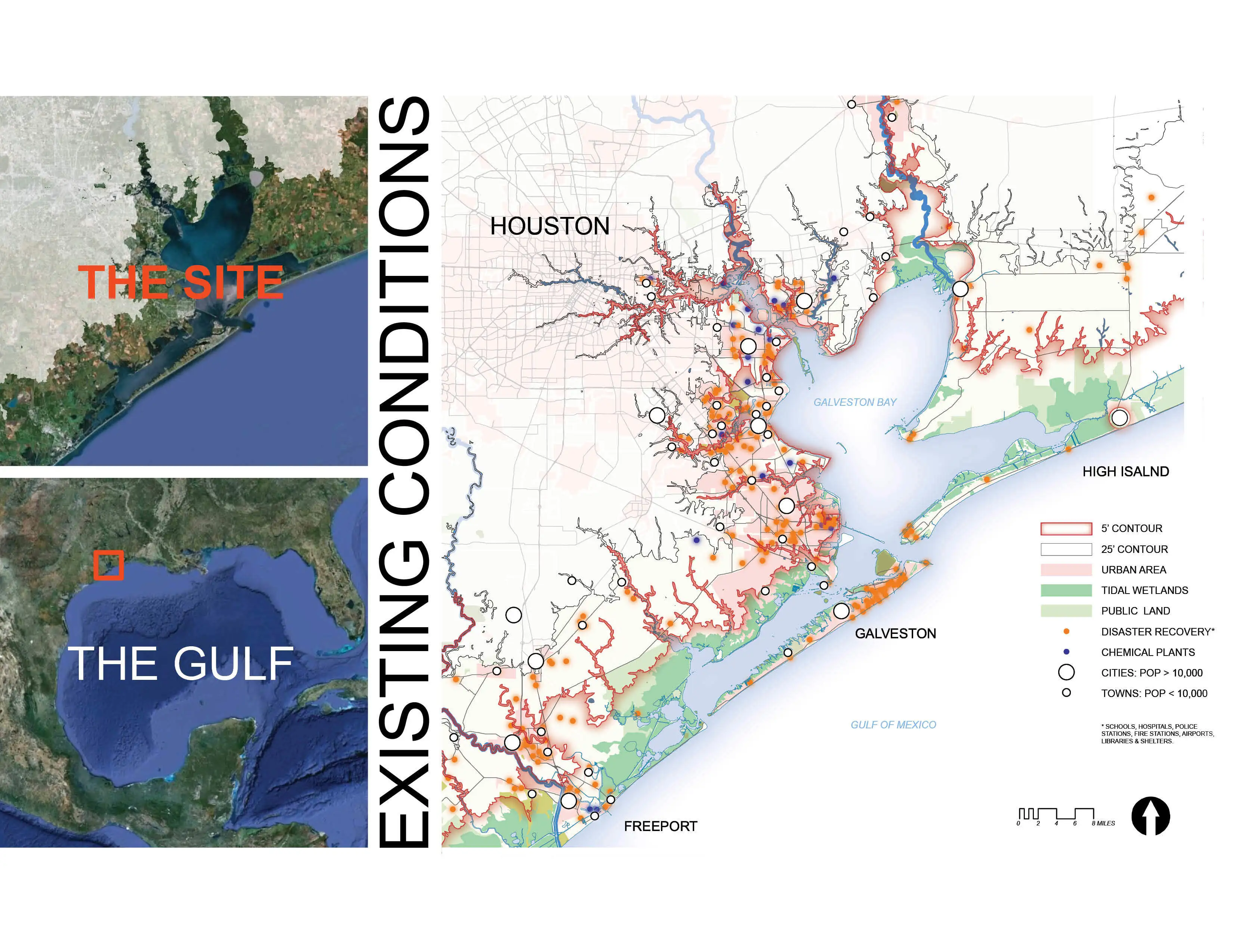
On September 13, 2008 Hurricane Ike struck the Upper Texas Coast, wreaking havoc on infrastructure and washing away entire communities. Labeled as a category two storm by wind speed, Ike surpassed all inundation damage predictions and changed the lives of millions of people in the region. While devastating, the storm was a considerably smaller version of the modeled “worst case scenario” in which bay surge tracks up the densely populated west shore of Galveston Bay and into the heavily industrialized Houston Ship Channel.
Historically, the mitigation of coastal storms has focused on the use of intensive structural solutions — single-purpose engineered barriers designed to protect against often inadequately modeled storms. Once these engineering feats realize their massive physical form, the public develops an attitude of complacency and invincibility against storm events. They are “behind the wall”. The submitting team references this phenomenon as the “moral hazard” where a false sense of security results in more coastal development, subpar construction standards, inadequate policy, and greater public risk.
As expected, shortly after Ike a proposal for a much longer, higher, wider, 100 mile long dike surfaced that would span and isolate all of Galveston Bay. Life defining interactions with the Gulf of Mexico would be severed and the cultural landscape destroyed not by nature, but ourselves.
Galveston Bay Process
The submitting team was engaged with local hydrologists, ecologists, geologists, and a university architecture department to create environmental/social/economic inventories, regional site analysis, proposed planning recommendations, and site specific design interventions.
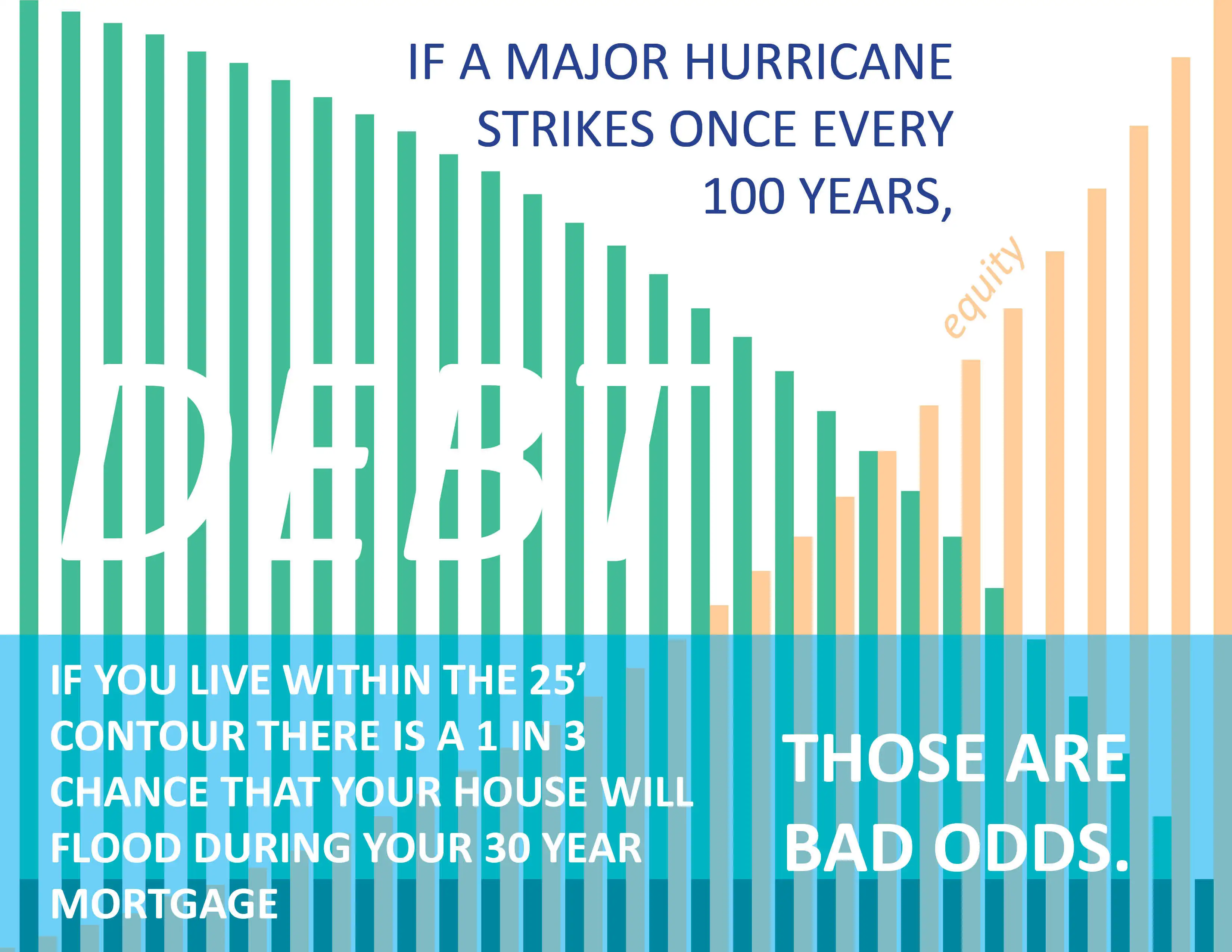
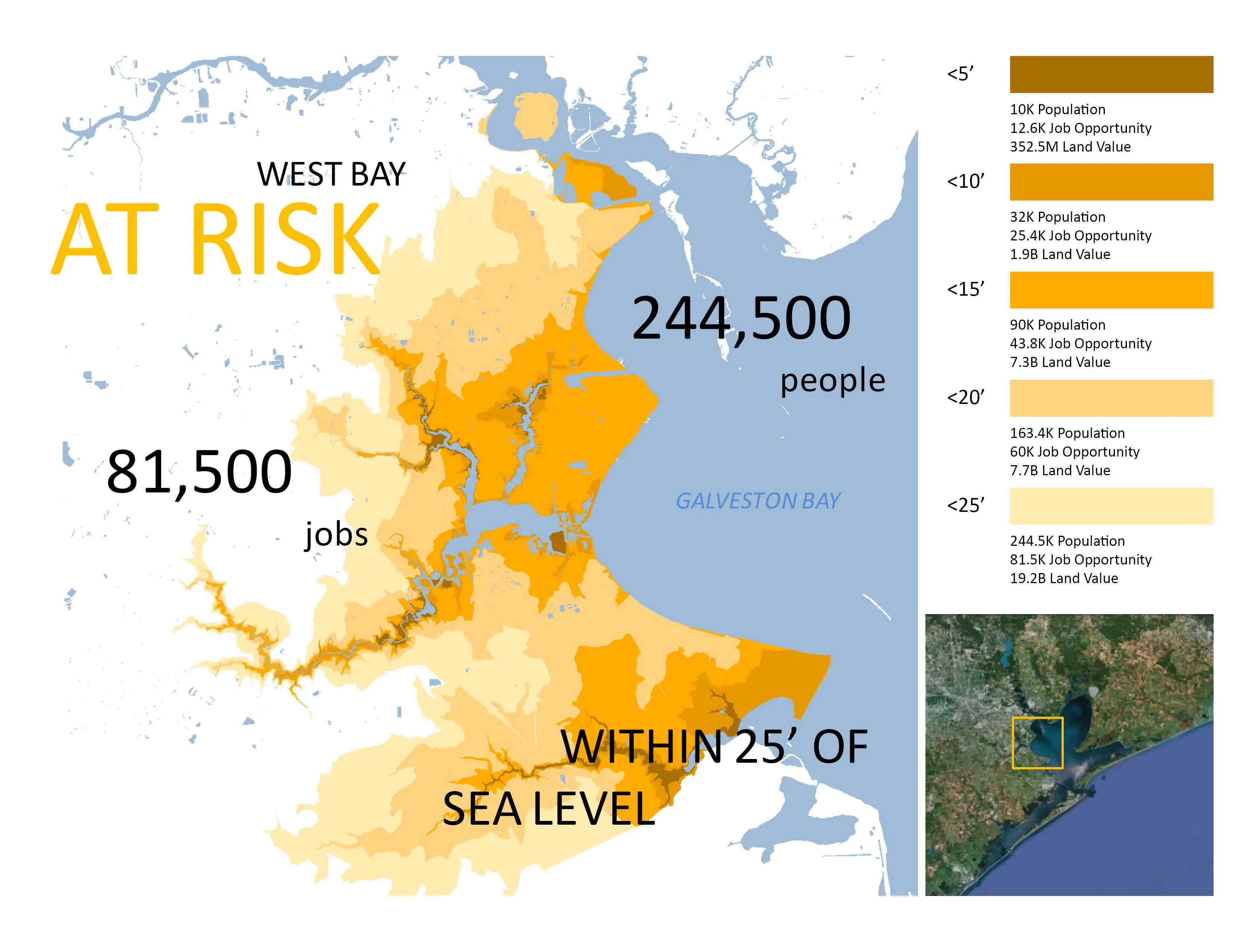
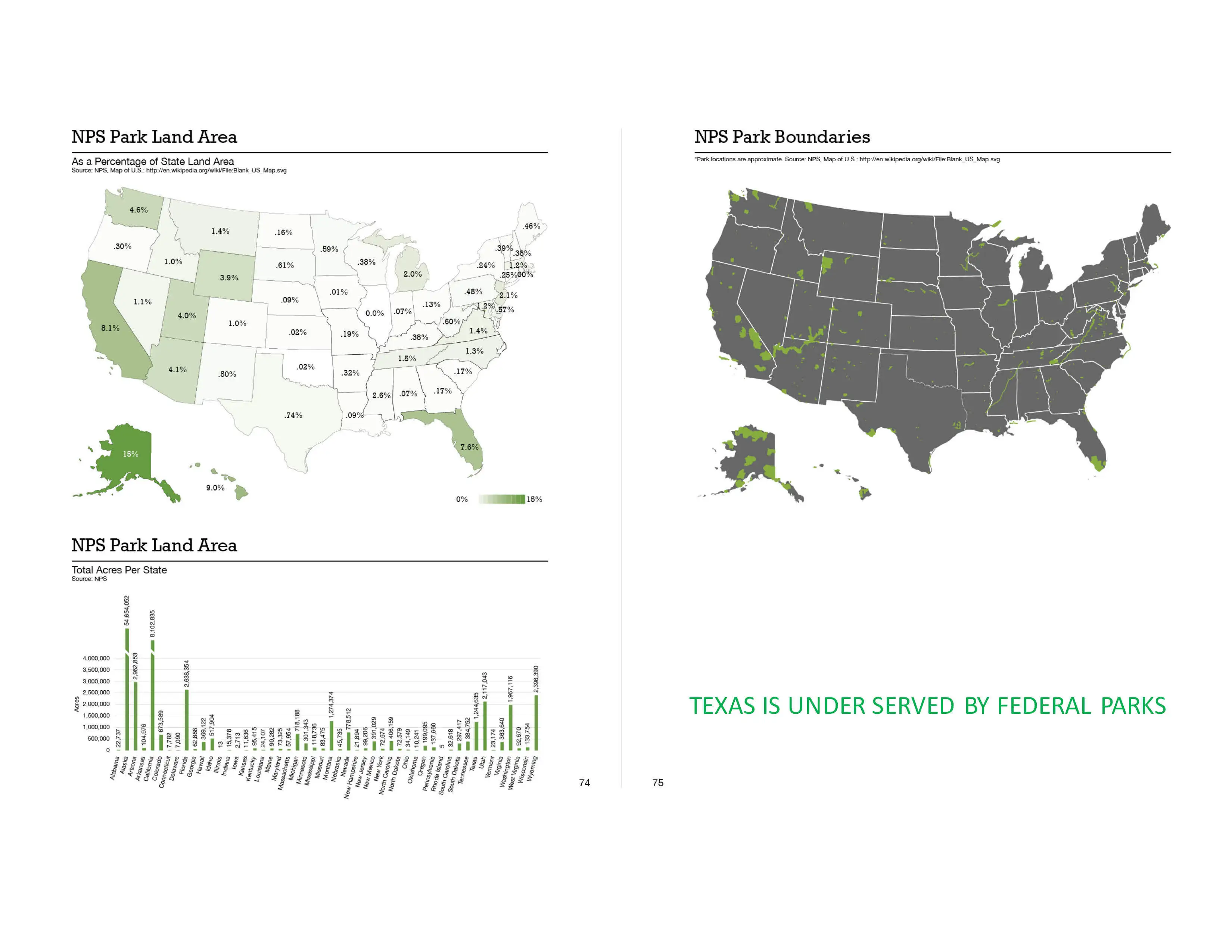
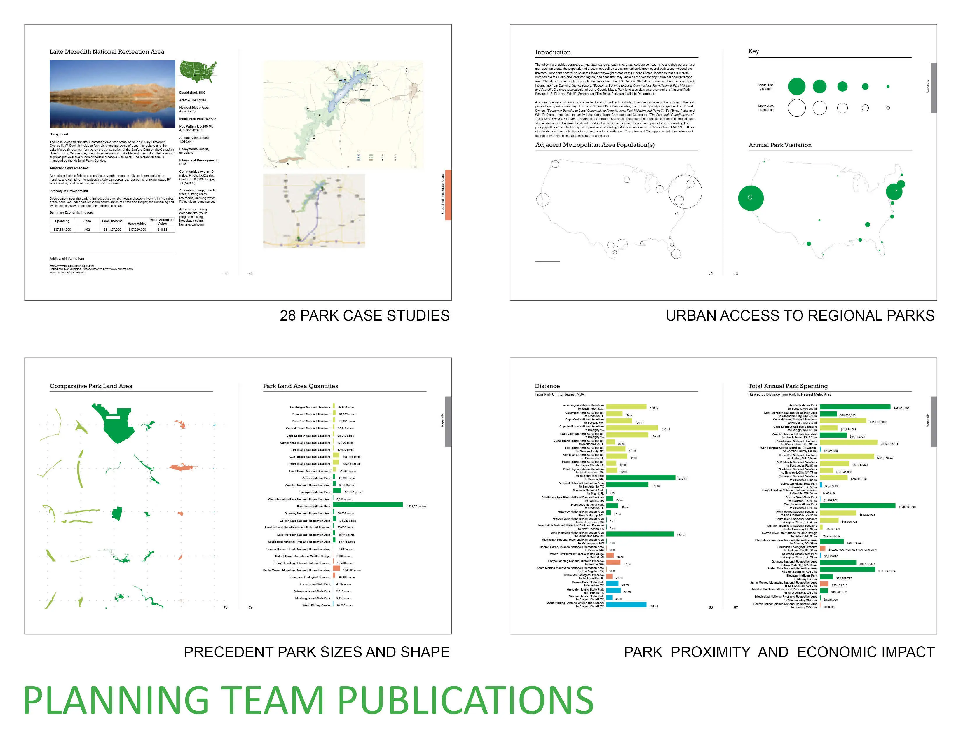
Team hydrologists initially provided revised storm models derived from advanced engineering technologies. The 25 ft. elevation was defined as the limit of the 1% storm event and elevations 0 to 5 ft. were found to be susceptible to frequent inundation. These parameters were used to create a layered approach that responded to 2010 census data, a projected doubling of regional population in 25 years, current land values, emergency service facilities, limited evacuation routes, toxic dispersal potential, natural barrier island migration patterns, public open spaces, primary ecosystems identified by regional, national, and international ecologists, and a published team research report analyzing 28 significant state, national, and international parks relative to their economic sustainability, population proximity, and annual visitorship.
Recommendation 1: Structural and Non-structural Integration
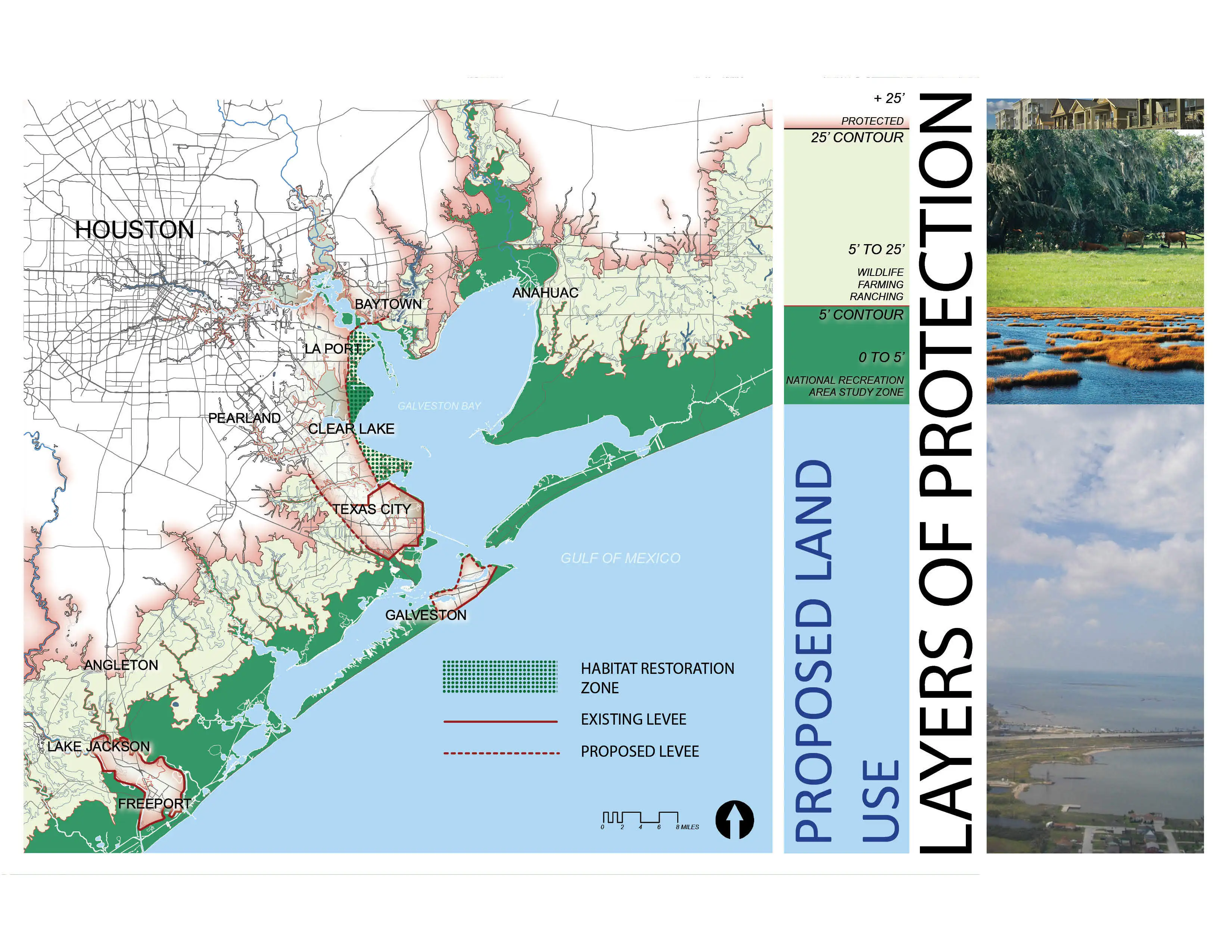
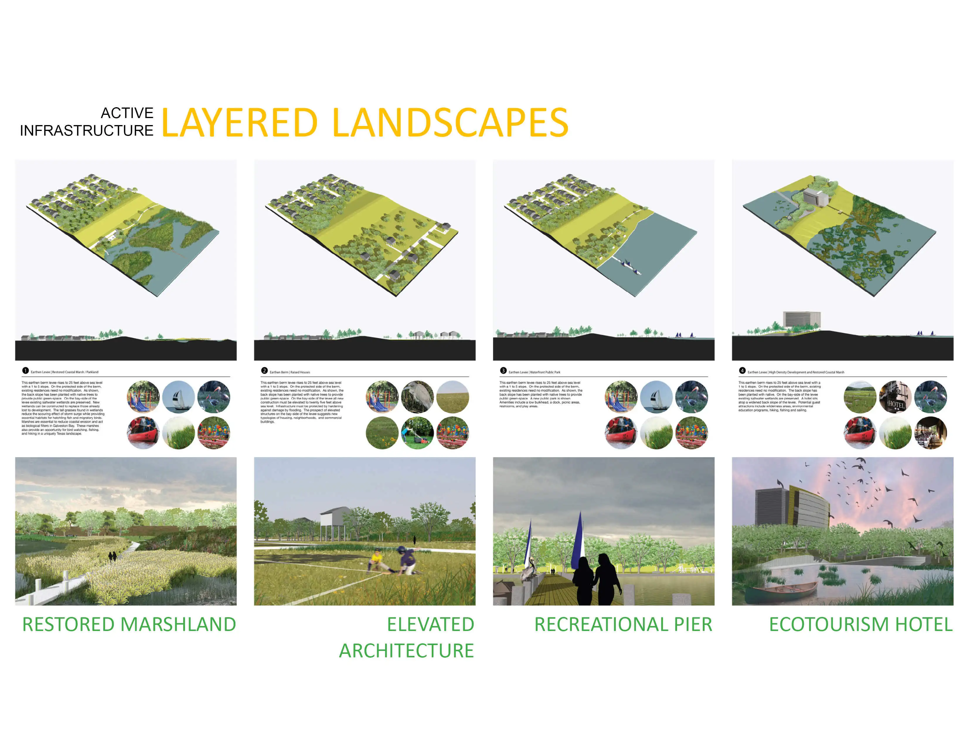
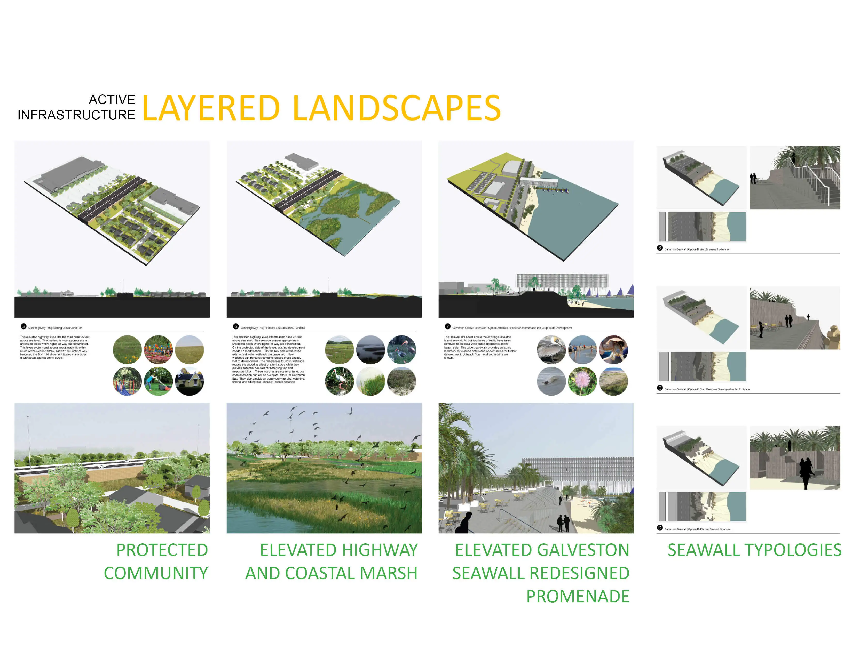
Diverse tools are needed rather than the standard application of monolithic levees. Included in the team’s approach are both structural and non-structural solutions. Structural methods utilize constructed levees, walls, barriers and gates to block floodwaters. Non-structural methods regulate and discourage development in high risk areas and rely on existing and restored ecosystems. These natural systems rebound quickly after inundation and have proven to be significant economic resources for long-term sustainability.
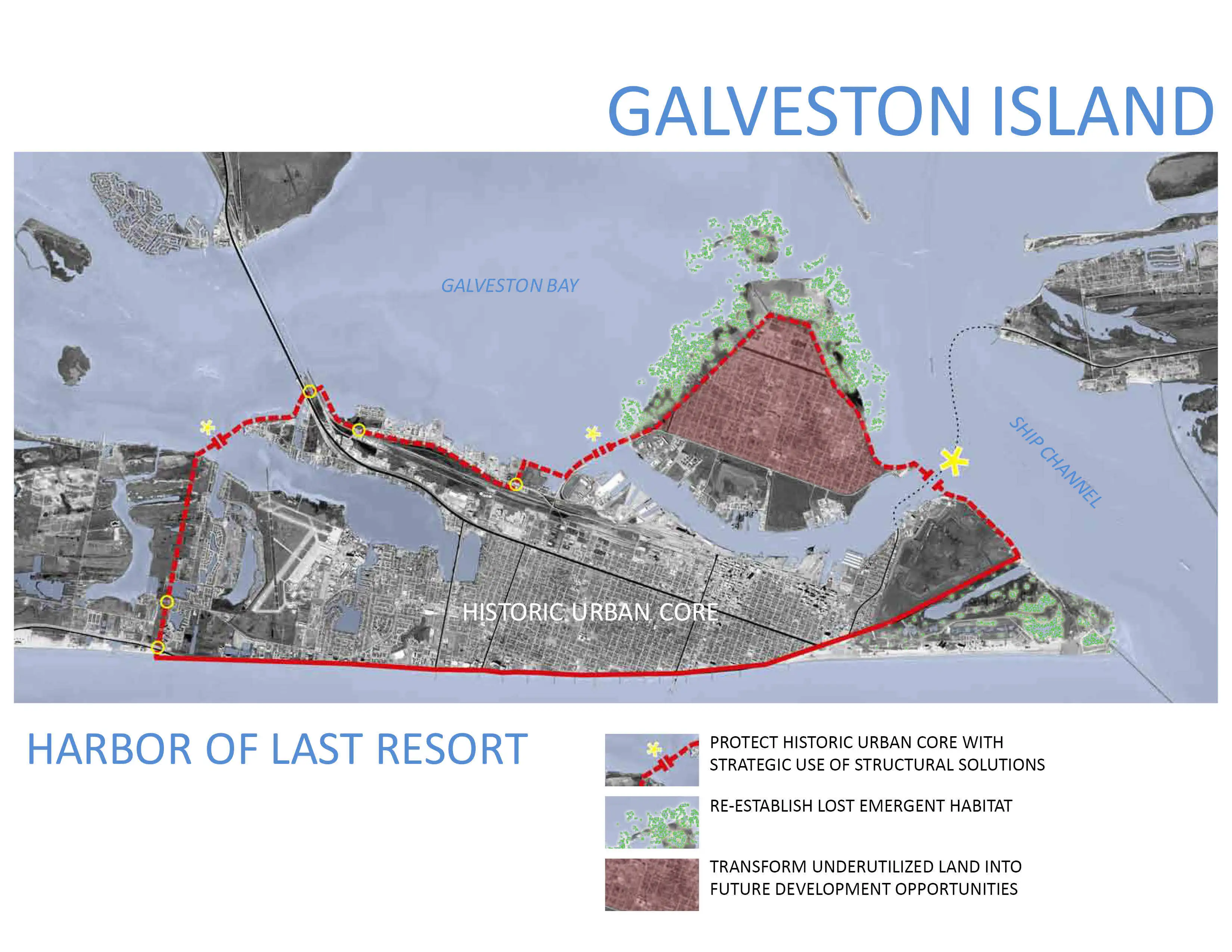
Proposed structures occur where levees exist and protections can tie into existing topography. For example, the plan utilizes narrowing topography at the mouth of the Houston Ship Channel to create a simple gate structure to secure America’s second largest port. Shelters of last resort are identified and surrounded by robust, cost effective structural measures that create small pockets of defense rather than highly vulnerable linear barriers. These pockets all have existing economic bases, significant population centers, emergency service facilities, or historic relevance.
Non-structural elements guide current and future development to mitigate moral hazard concerns. Natural processes that make Galveston Bay one of the nation’s most biologically diverse ecosystems are identified and protected, building codes revised to respond to current storm models, and the existing Coastal Barrier Resource Act (COBRA) is expanded to frequent inundation areas to limit federal protections for high risk development. Public education is also essential and would be best accomplished by creating an online inundation database modeled after FEMA’s 100 year floodplain maps.
Recommendation 2: Utilizing the Public Domain
Existing public lands can be used as a cost effective means for implementation. Rather than purchasing private property, structural solutions are designed to seamlessly occur within public rights of way already in need of infrastructure improvements. For example, the team’s largest structural intervention calls for elevating a portion of coastal Highway 146 to create a West Bay levee protecting large population centers and providing tidal marsh restoration opportunities.
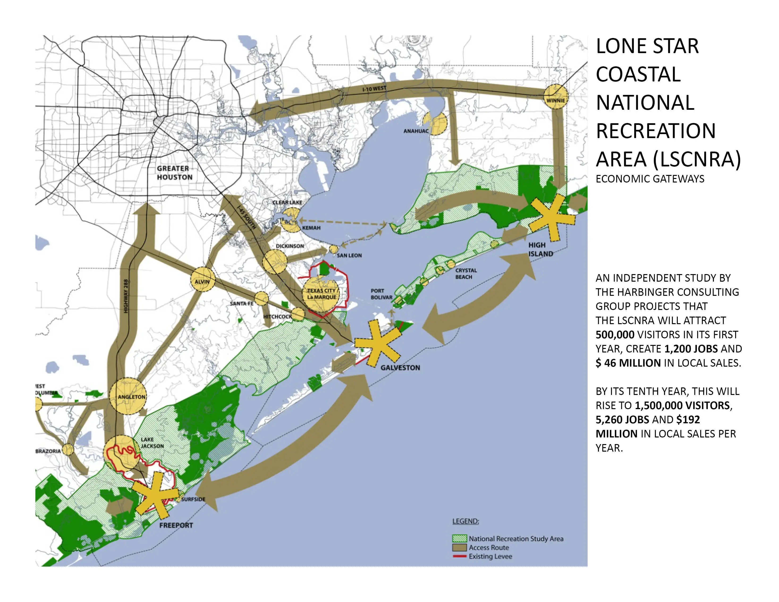
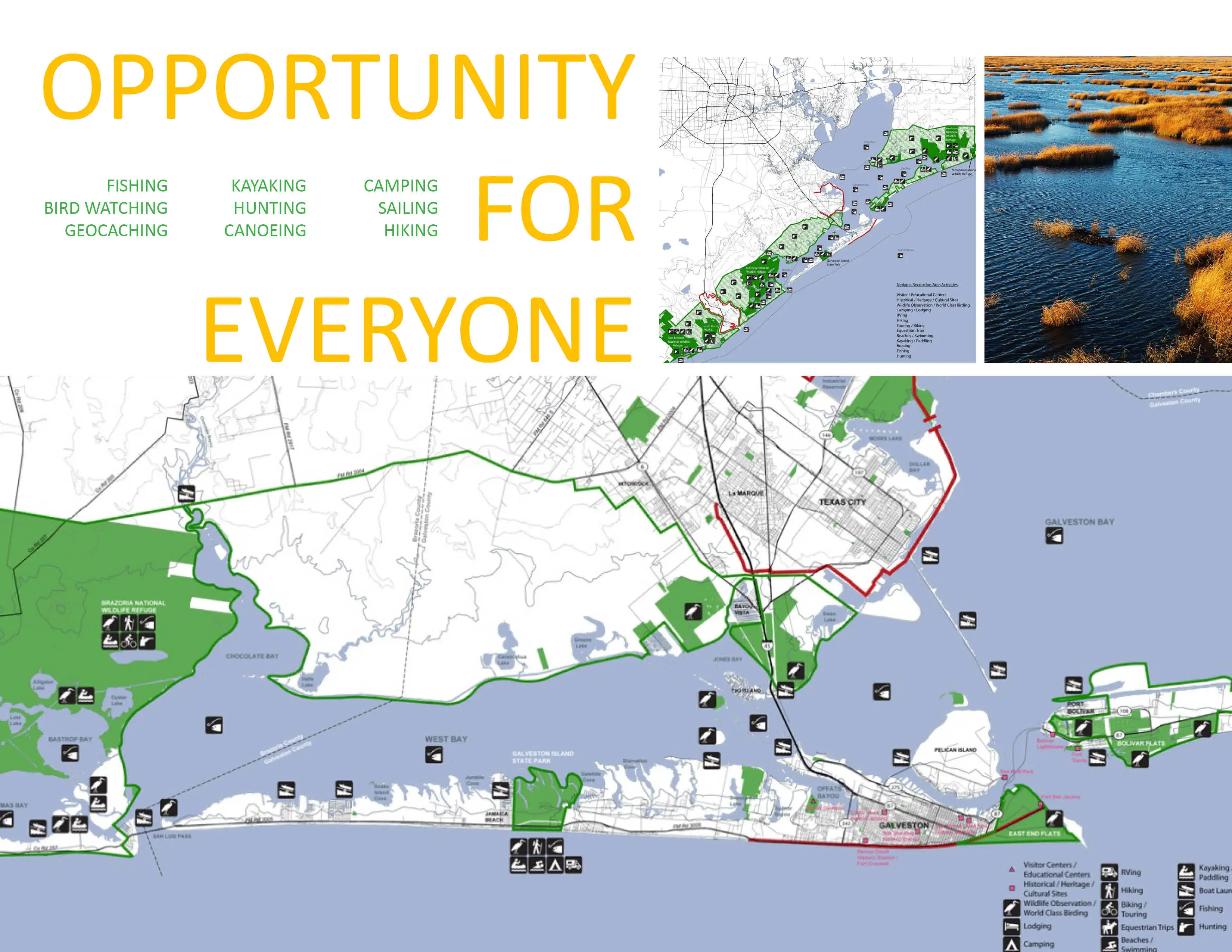
South bay elevations from 0 to 5 ft. contain broad marshlands with considerable parcels under public ownership. This area’s unique biodiversity defines the bay’s established national and international ecotourism reputation. As a result, a major component of the project is the creation of a National Recreation Area (NRA) in this zone. Located within an hour drive of the nation’s fourth largest metropolitan area, an organized framework plan with a sensitive footprint has immense potential. To date, this proposal has been adopted by an organized action committee and has and continues to gain the support with local Galveston Bay communities.
Recommendation 3: Economic Sustainability
Establishing an NRA will have considerable economic impact. Its designation would be an act of congress, require no tax money to create, and all participation would be voluntary. Harbinger Consulting Group estimates that after a decade the NRA would attract 1.5 million annual visitors, create 5,260 jobs, and generate $192 million. Its economic impact would quadruple after 10 yrs. and tourism would triple. The collaborative management structure of the NRA ensures that existing communities will be involved in its development and can profit from its formation.
Implementation
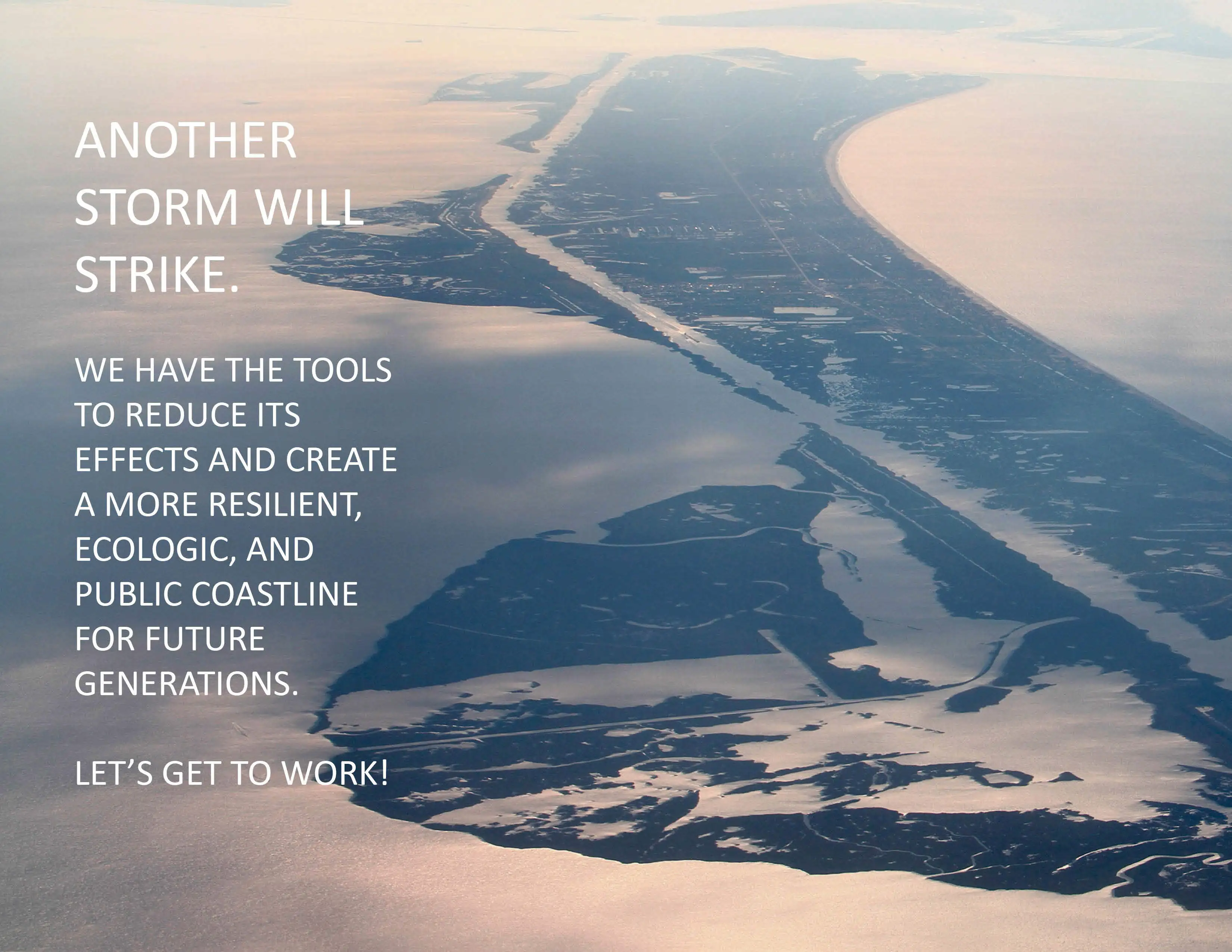
Severe storms are a reality. Recent foreshadowing in Galveston Bay has resulted in a new discourse on its future. This project provides a diversity of pragmatic solutions that are gaining both political and community support in the region. Risk taking? The odds are not favorable.
-
SWA Group
Matt Baumgarten, ASLA; Alex Lahti; and Fangyi LuCollege of Architecture at the University of Houston
Prof. Thomas Colbert, AIA with Jason Honeycutt and Rose Lee as Research AssistantsSSPEED Center at Rice University
Phil Bedient and Jim Blackburn
Advertisement
Related Awards
Award of Excellence, ANALYSIS AND PLANNING
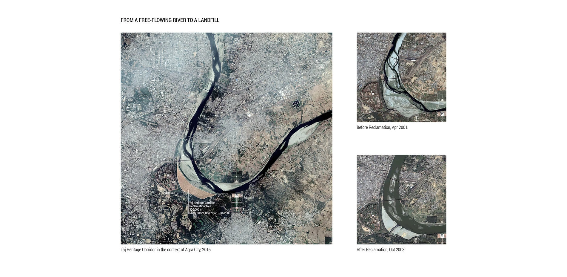
Rethinking Taj Heritage Corridor: A River as Historic Connection
Locates between Taj Mahal and Agra Fort, this proposal on Taj Heritage Corridor aims to reestablish the image of riverfront that was destroyed during the problematic reclamation project in 2002-2003. By creating a recreational water treatment canal along the original river bank, a landscape urban infrastructure is proposed to visually connect the city's scattered historic riverfront monuments and create public space for both tourists and local community. With a full respect of the silently mi