.webp?language=en-US)


-
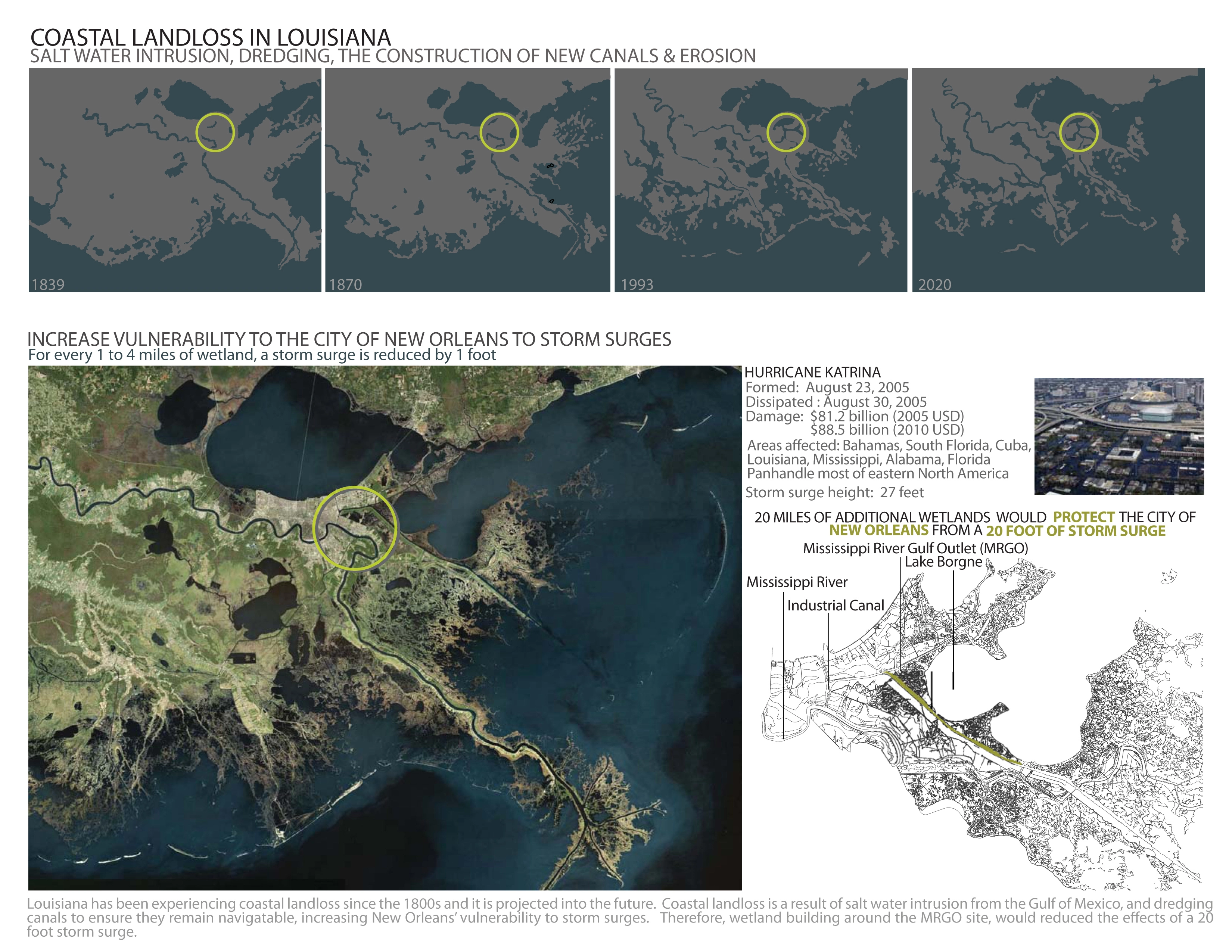
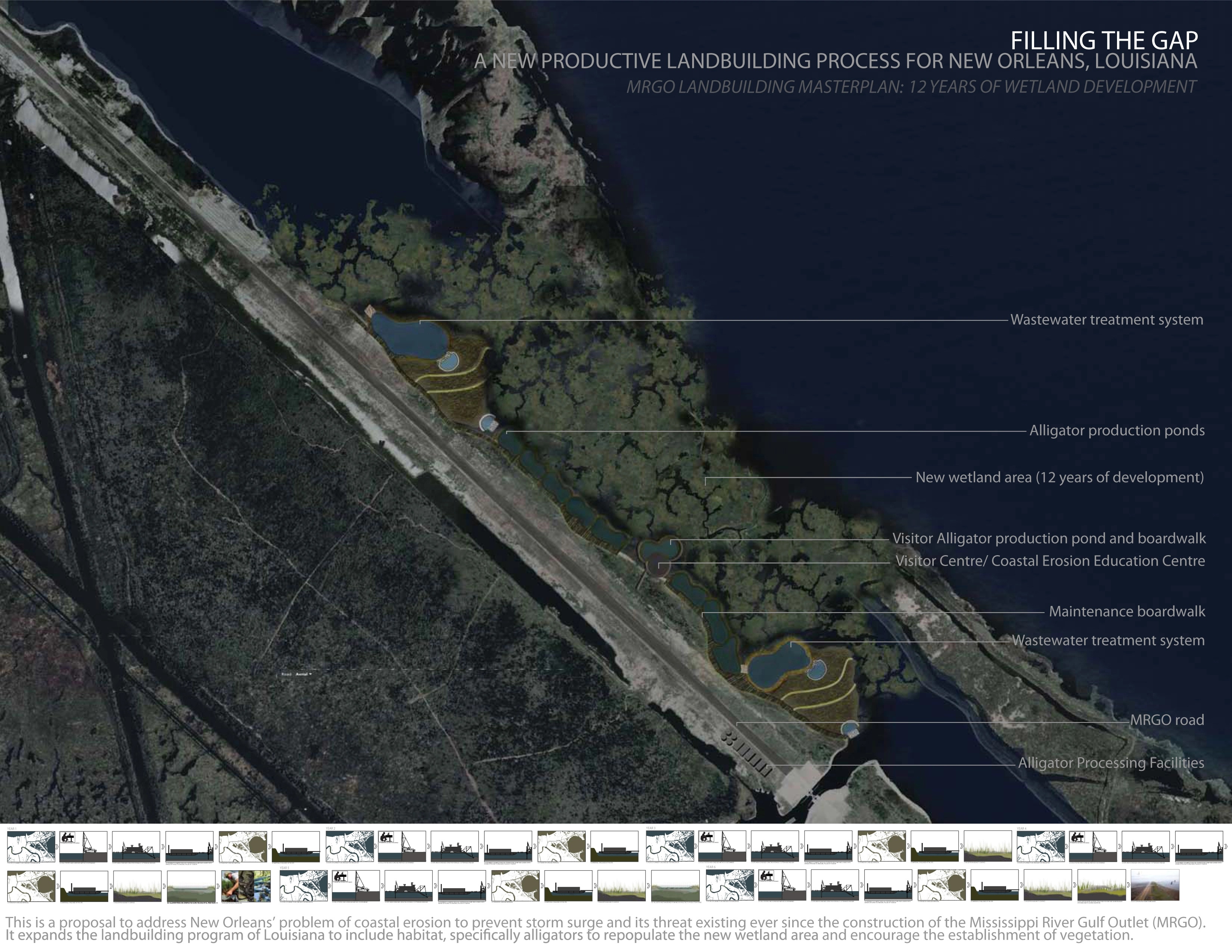
This is a proposal to address New Orleans’ problem of coastal erosion to prevent storm surge and its threat existing ever since the construction of the Mississippi River Gulf Outlet (MRGO). It expands the land building program of Louisiana to include habitat, specifically alligators to re-populate the new wetland area and encourage the establishment of vegetation. Essentially, this project will add 20 miles of new wetland area to the MRGO site, reducing the effects of a 20 foot storm surge, comparable to Hurricane Katrina.
-
According to Louisiana State geologists, approximately 5, 212 square miles of coast line will be lost by 2100. This rate of coastal land loss is a result of the infrastructure implemented along the Mississippi River to control the level and speed of water to maintain it for navigation as well as the extensive dredging of canals and other waterways in Louisiana. Over time, this infrastructure and dredging activities has decreased the sediment load, vital to the health of wetlands which protect coastal communities from storm surges such as that of Hurricane Katrina. This has resulted in coastal land loss, placing cities such as New Orleans to greater risk of flooding.
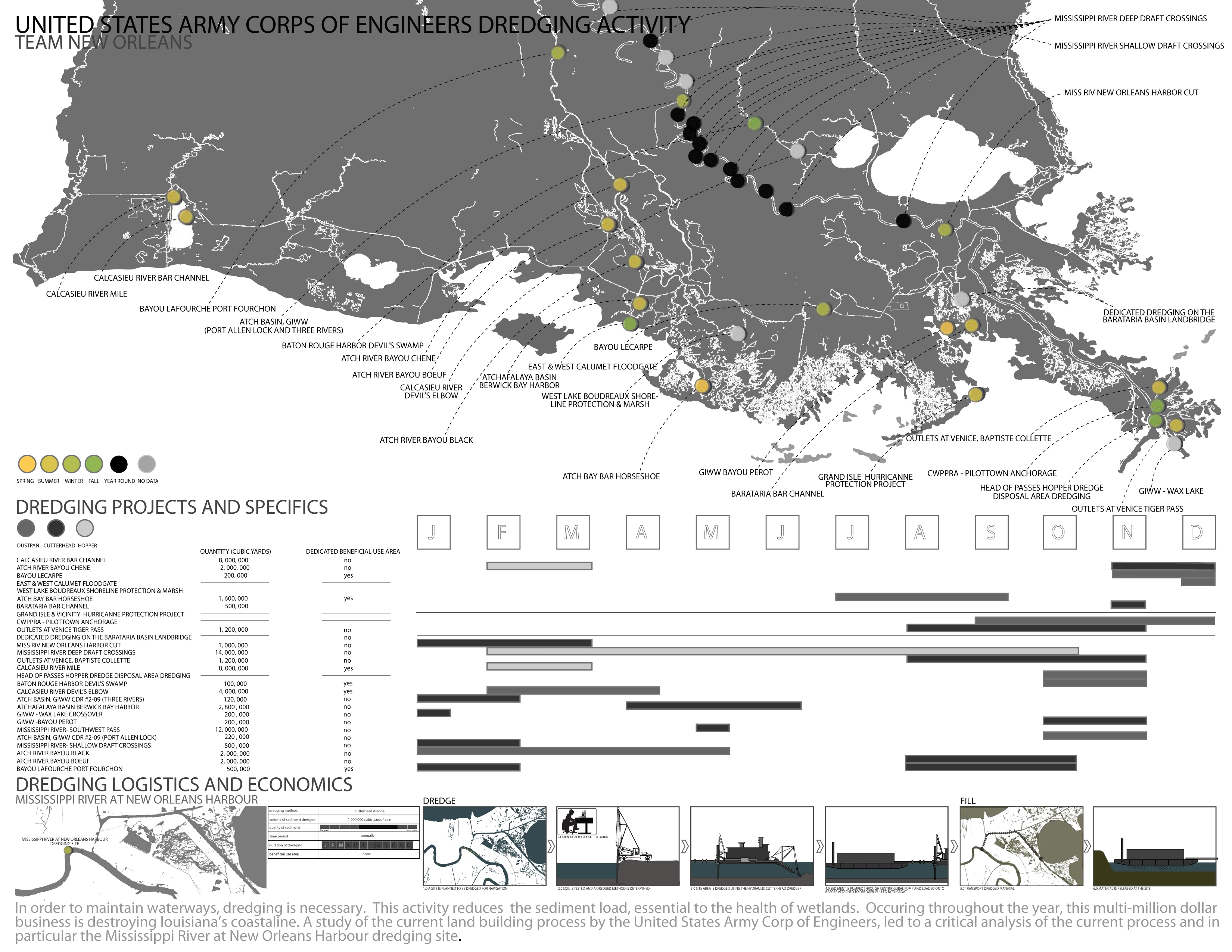
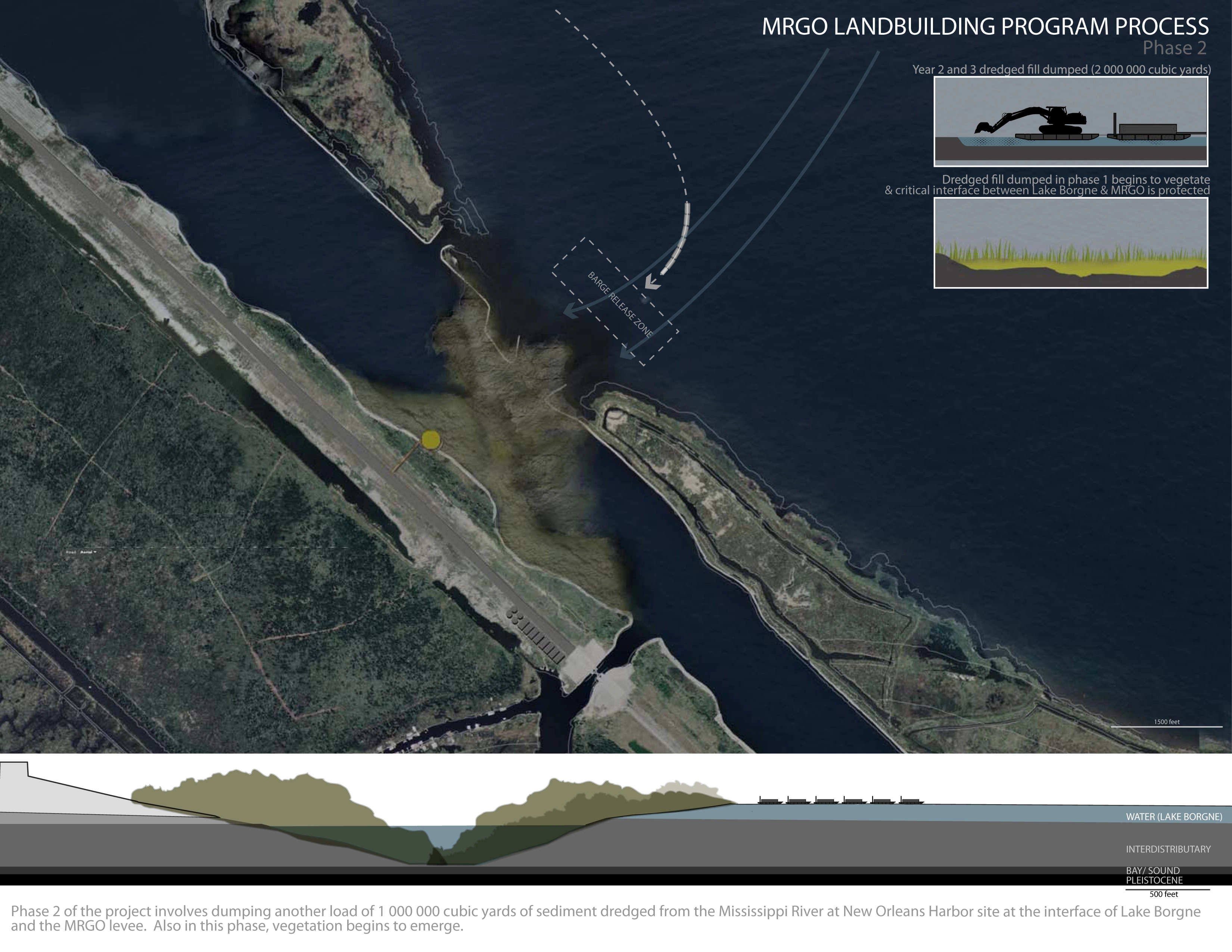
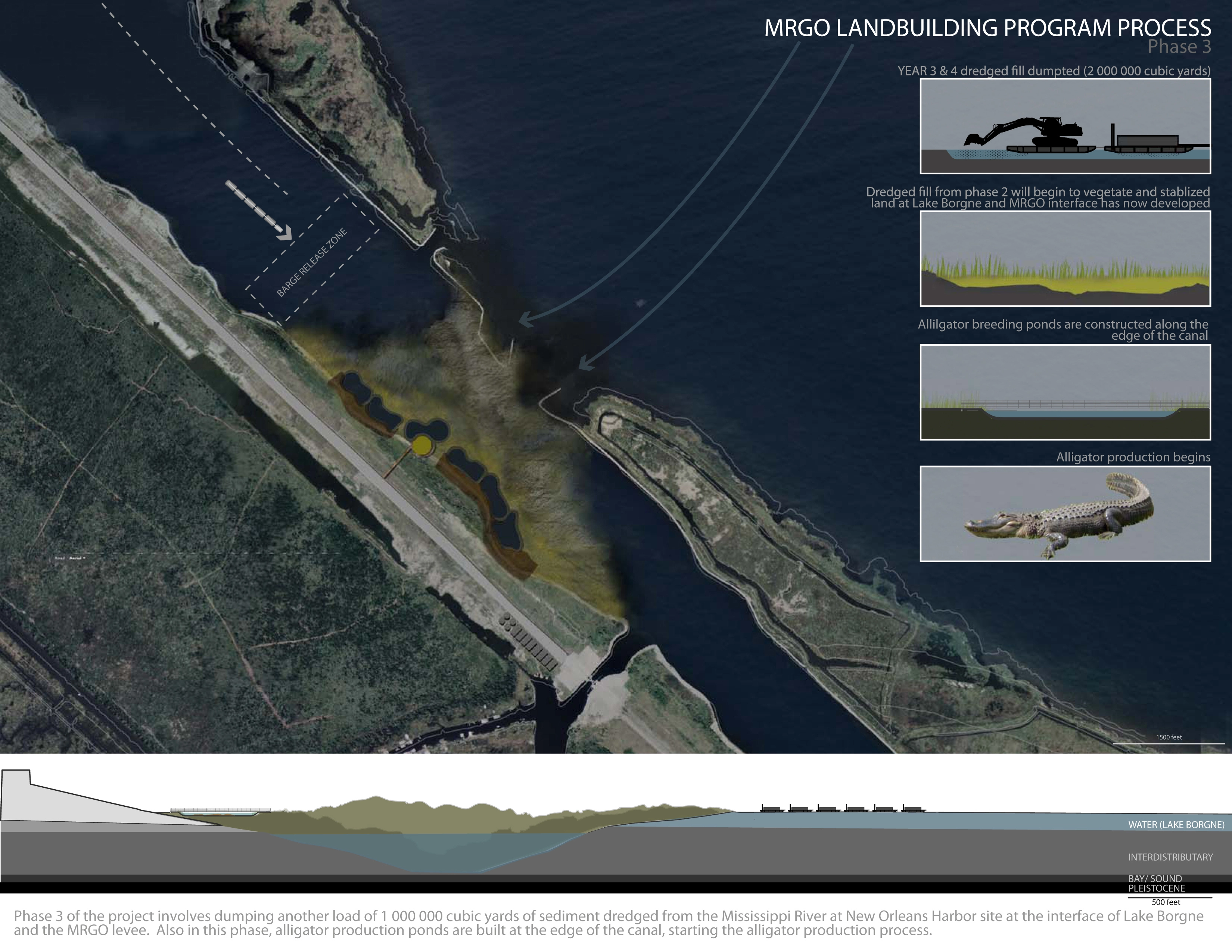
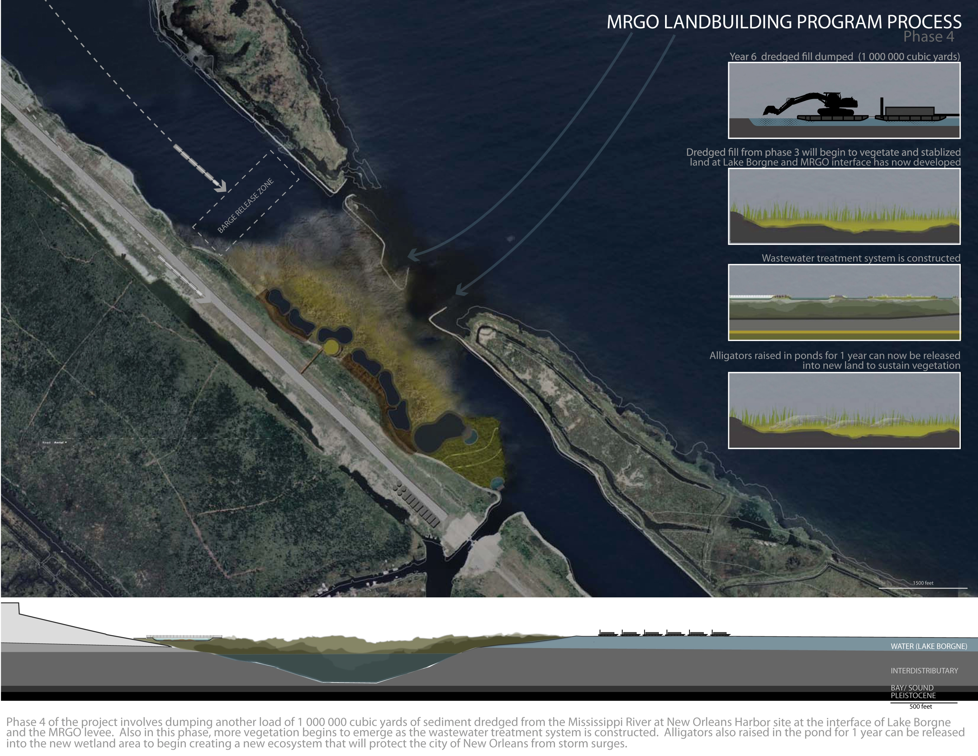
Therefore, this thesis project critically analyzes the current land building process associated with dredging activities by the United States Army Corp of Engineers. Currently, as dredging activities take place across the state, at all times of the year, the Army Corp of Engineers, in association with their land building program, dredge waterways and where possible determine a potential beneficial use area were this material can be used to build wetlands. The material is then transported to the area to be dumped. After it is dumped, the Army Corp of Engineers assumes that wetland area will begin to develop. However, as Louisiana’s coast line continues to deplete, placing pressure on the extremely rich fishing industry, wildlife habitat and reliance on wetland area for storm surge protection, this project introduces a new process of wetland (or land) building. This process will incorporate animal habitat, specifically alligators, as the vital element that will assist in the development and stabilization of the new land and vegetation in the Mississippi River Gulf Outlet (MRGO).
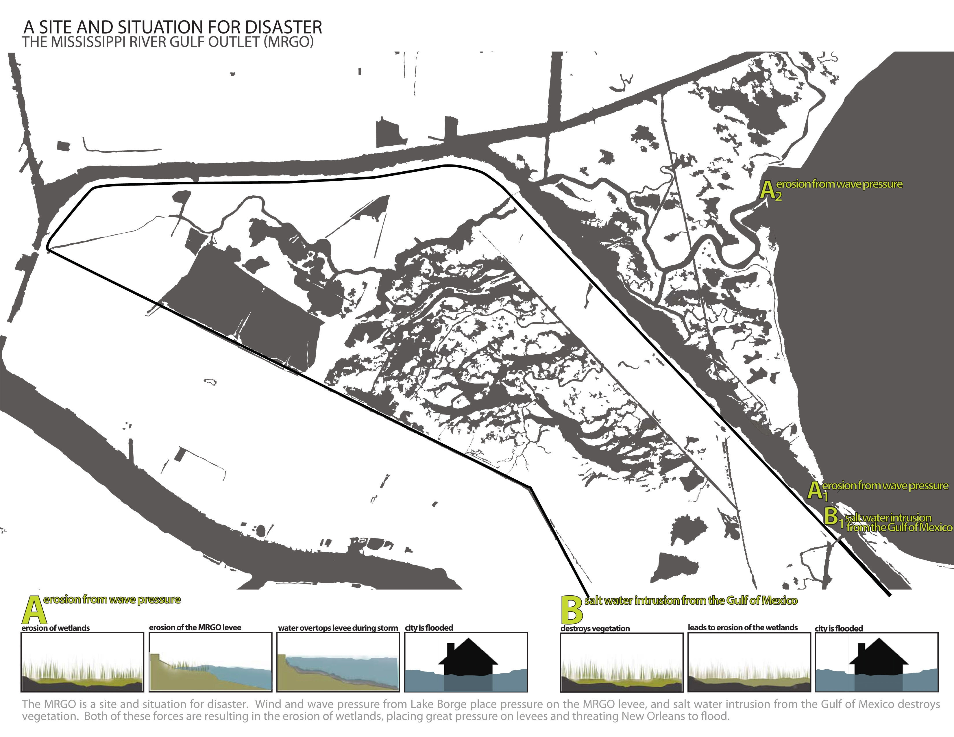
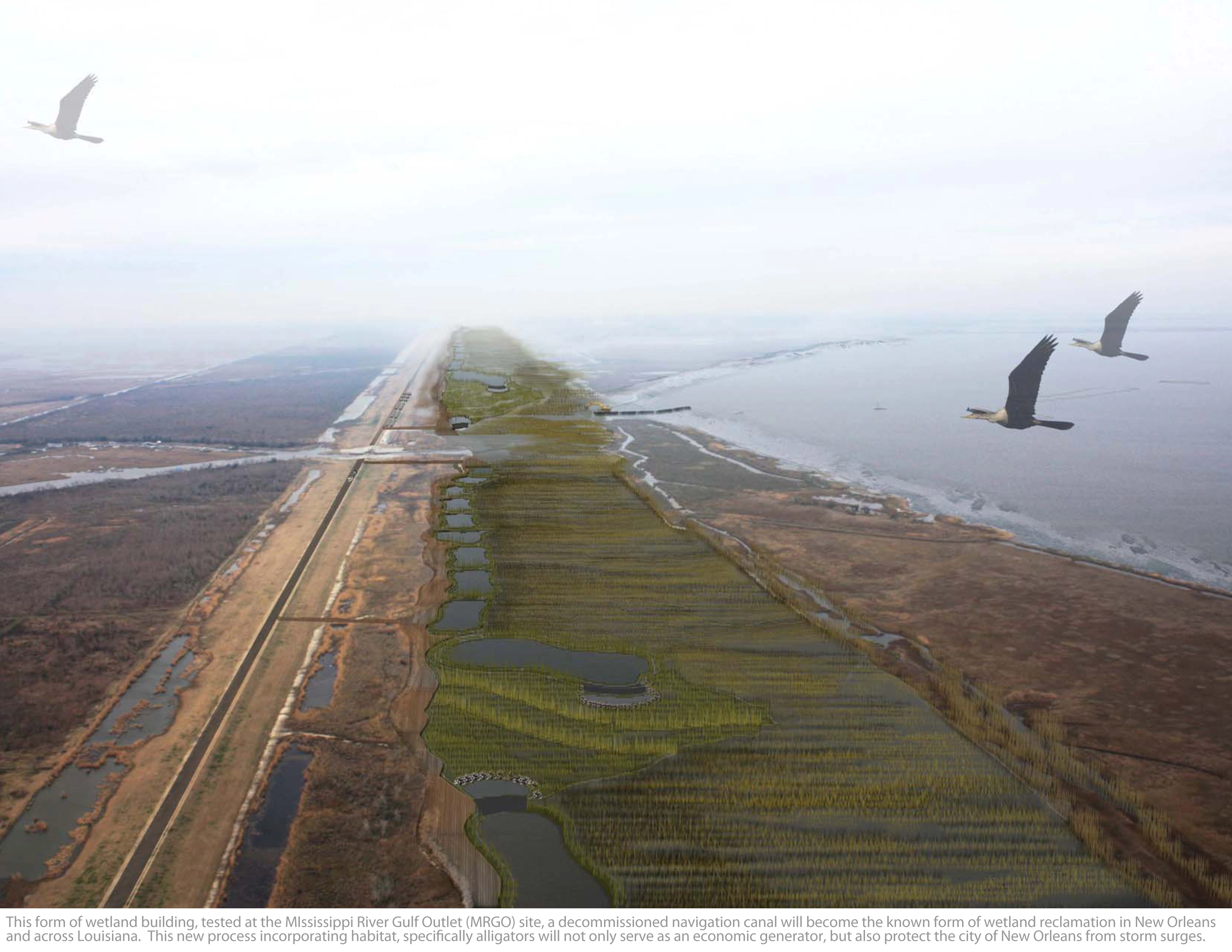
The MRGO is a 76 mile channel constructed by the United States Army Corps of Engineers in the mid 20th century that provided a shorter route between the Gulf of Mexico and New Orleans’ inner harbor industrial canal through the Gulf Intercoastal Waterway (GIWW). In 2005, the MRGO channeled Hurricane Katrina’s storm surge into the city of New Orleans, contributing to multiple engineering failures, resulting in catastrophic damage. Since then, the channel has been closed and a permanent storm surge barrier has been constructed. However, salt water intrusion and wave erosion are still contributing to the loss of wetlands surrounding the MRGO, adjacent to the city of New Orleans.
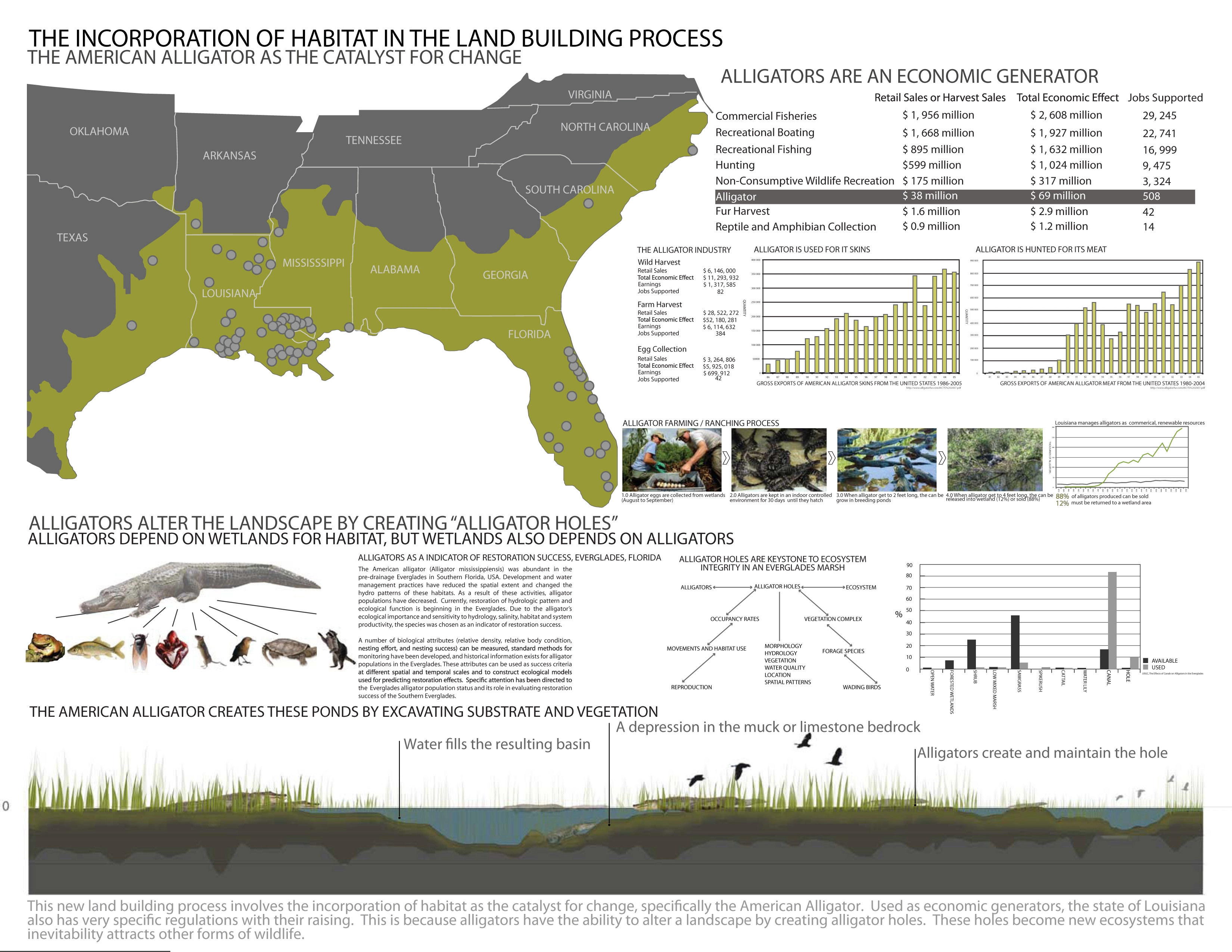
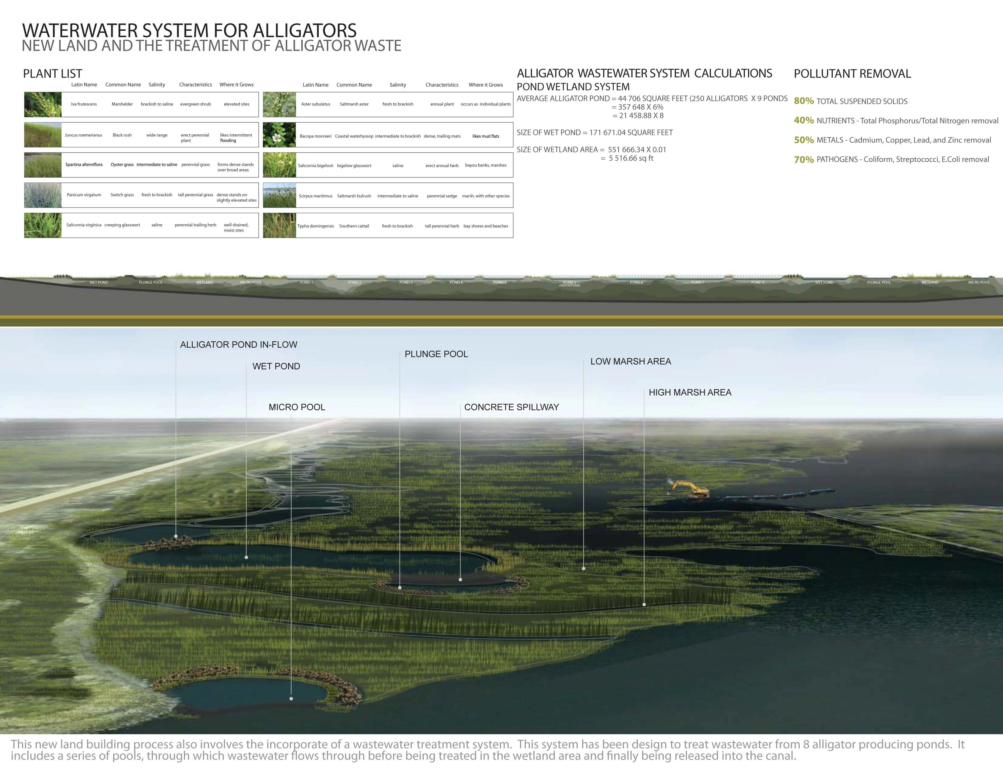
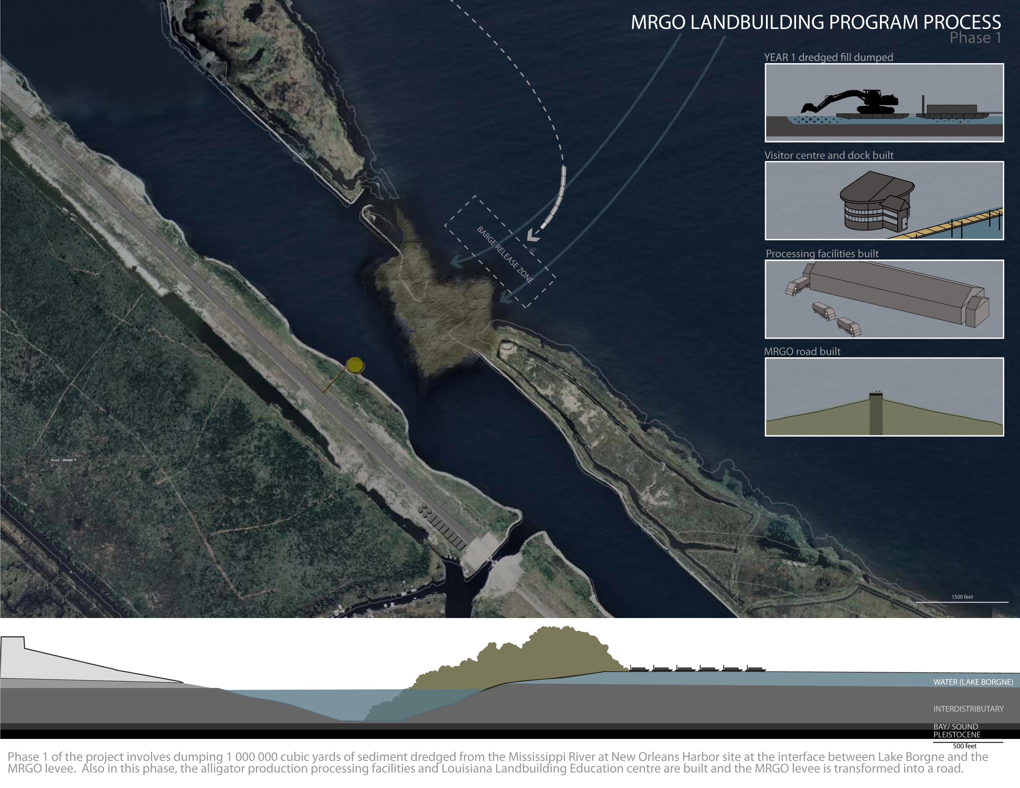
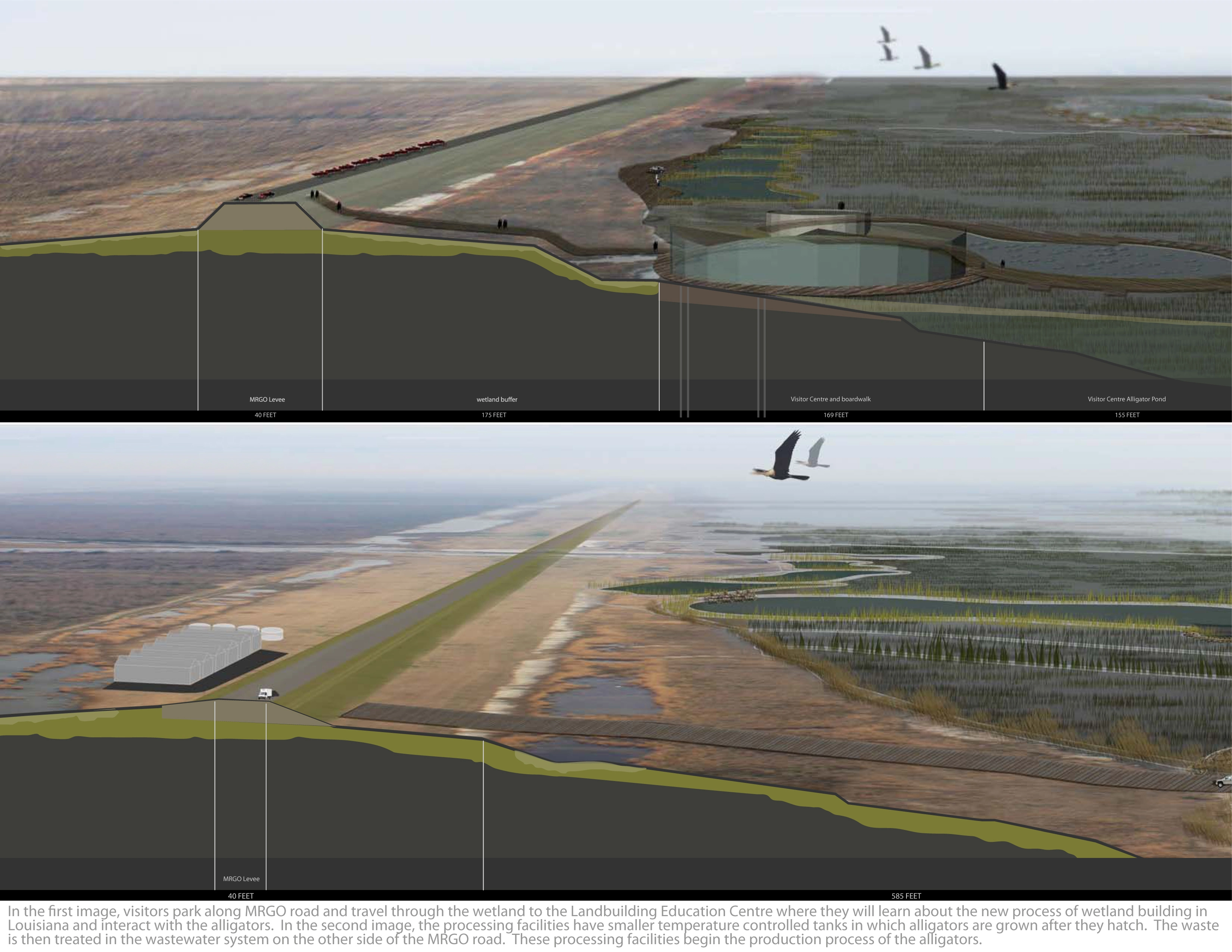
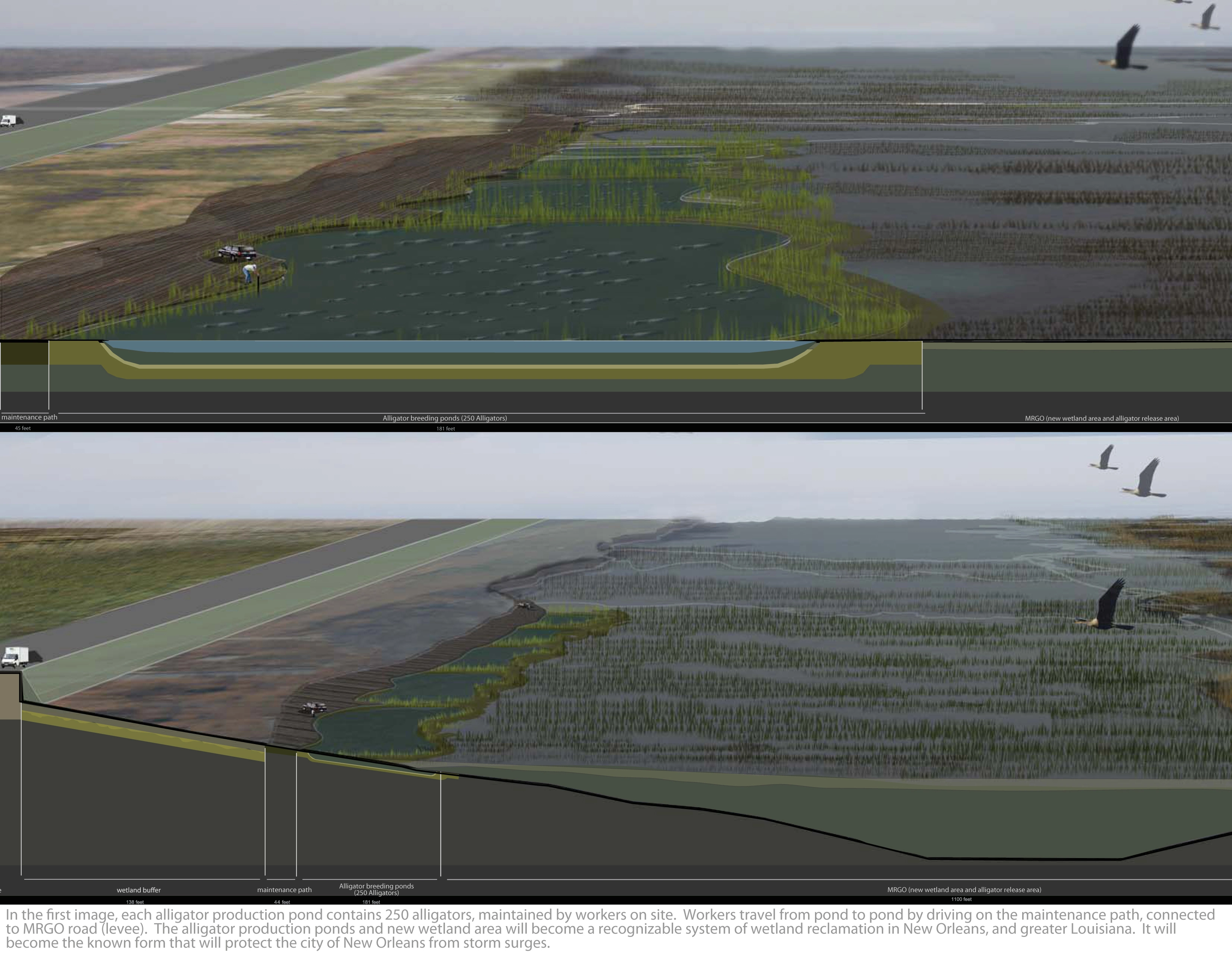
This new land building process involves using the material dredged from a current site, the Mississippi River at New Orleans Harbour and transporting it to the MRGO as its beneficial land use area. Therefore, the sediment will be dredged at this location, transported by barges to the site, where it is estimated that it will take one to two years for vegetation to begin to develop. At this time, alligator processing facilities (for the production of alligators) and the Louisiana Land Building Research Centre are built and the MRGO levee is transformed into a road to gain access to the site. After four years of dumping dredged sediment into the MRGO and as vegetation begins to develop, alligator production ponds are constructed at the site. After the fifth year alligator production begins as they are transported from the production buildings located on site, to the breeding ponds. When the alligators are grown to 4 feet (approximately 1 year), 88% of the alligators can be sold for their meat and hide, while 12 % are released into the new wetland area in the MRGO to help stabilize the land. These percentages have been determined and are enforced by the Louisiana State Wildlife and Fisheries Department to ensure the protection of the keystone specie, while also guaranteeing an economic gain from their production.
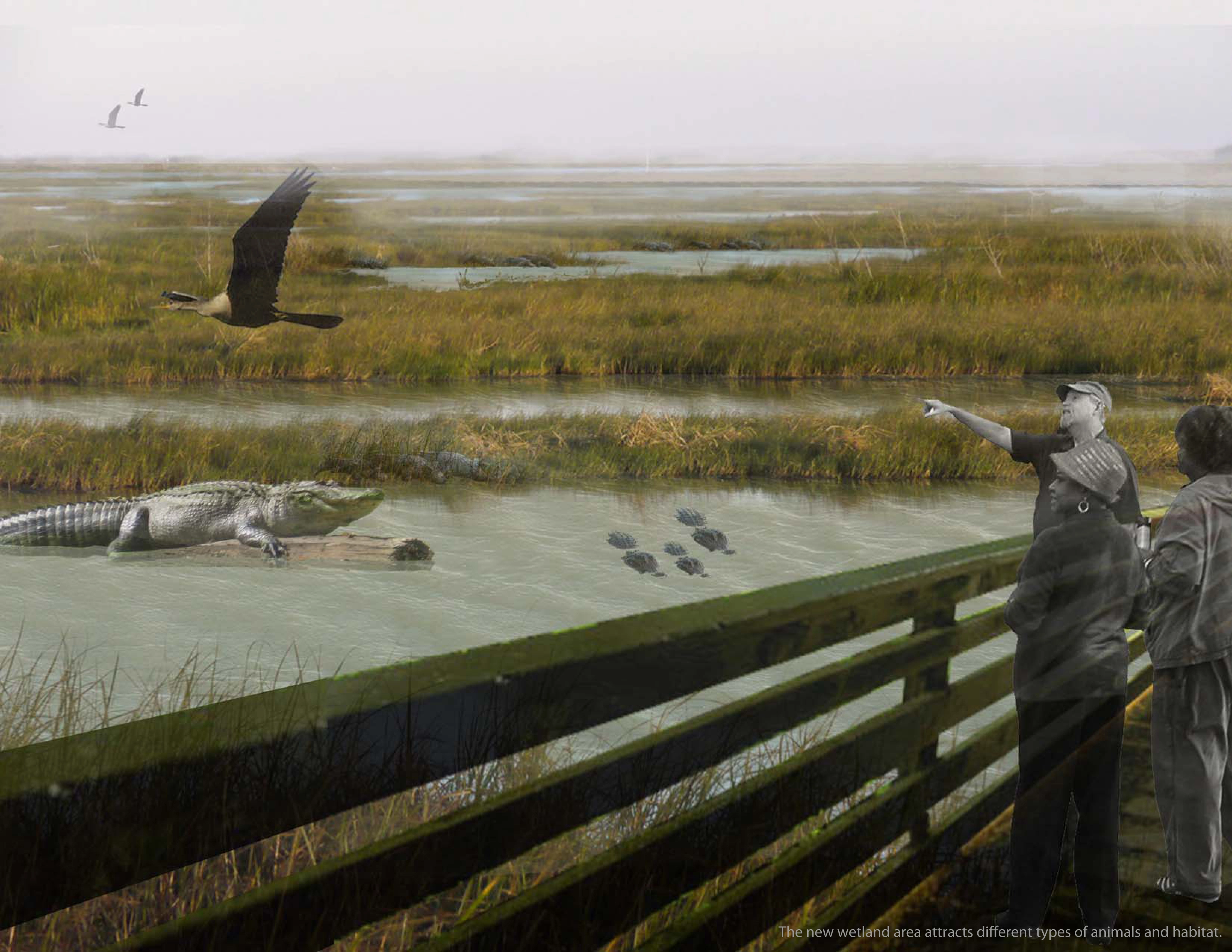
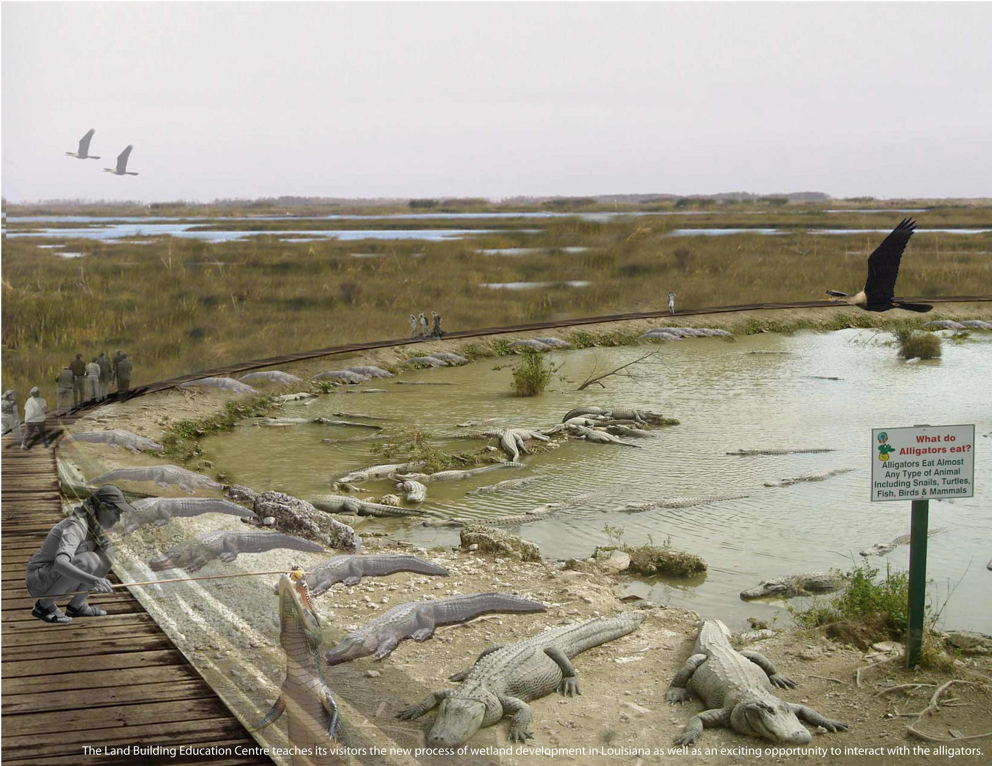
This project essentially utilizes this process to develop 20 miles of new wetland area within the MRGO channel, potentially reducing the effects of a 20 foot storm surge. This is comparable to Hurricane Katrina’s 27 foot storm surge height. This new wetland area would not only protect the city, however has the potential to become an education centre for this new land building technique that can be used across Louisiana. It has the potential to educate the citizens of Louisiana of how to protect their coast in building new wetland area, while also ensuring the stability of the fishing industry, protection and enhancement of wildlife, and the development of a new economic wetland building process involving alligators.
Therefore, this new process and form of wetland building in New Orleans, Louisiana will not only protect the city of New Orleans from future storms, but also become the recognizable form of wetland reclamation in Louisiana. It will use landscape as an economic generator to help re-establish the wetlands that have become depleted and introduce habitat for alligators as the crucial and vital component to the land building process in restoration efforts.
-
Many thanks to Jane Wolff for her patience and guidance during the development of this thesis project. To Elise Shelley and Robert Wright for their practical design advice and support. To Ruth Elsey of the Louisiana State Department of Wildlife and Fisheries for her help with research on alligators and their growing environments. Jennifer Bukovec and Marc Hardiejowski (MLA 2011) for their help with research and detailed design drawings. The Mariotti family for their great support, advice and understanding over the past three years and the MLA class of 2010 for their incredible friendship.
Advertisement
Related Awards
Award of Excellence, ANALYSIS AND PLANNING
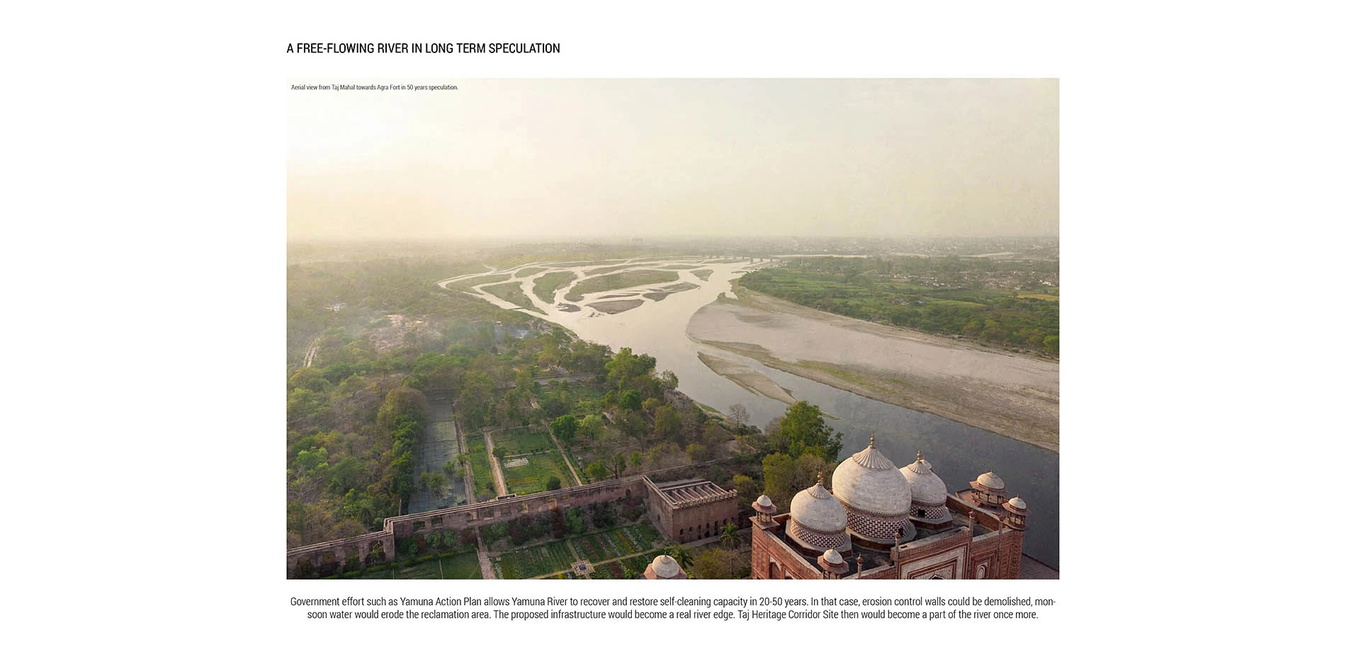
Rethinking Taj Heritage Corridor: A River as Historic Connection
Locates between Taj Mahal and Agra Fort, this proposal on Taj Heritage Corridor aims to reestablish the image of riverfront that was destroyed during the problematic reclamation project in 2002-2003. By creating a recreational water treatment canal along the original river bank, a landscape urban infrastructure is proposed to visually connect the city's scattered historic riverfront monuments and create public space for both tourists and local community. With a full respect of the silently mild image on Yamuna River in Agra, the design proposed an educational space that highlights the inherent dialogue between environment and history. Through analysis in different scales with the understanding of extreme site conditions, political background, and feasibility potentials, the design demonstrates the strong capacity of landscape intervention in resolving the complex contradiction between modernity and historic environment conservation.