.webp?language=en-US)


Lehigh Valley Catalyst: Reconnecting Communities to the Lehigh River’s History and Ecology
Melita Schmeckpeper; Shengyuan Zheng, Student ASLA; Shuyang Wang; Xiaofan Wu, Student ASLA; Margarida Gomes Mota; Lucy Whitacre; Josh Ketchum; Elisavet Kiretsi; Cari Krol, Student ASLA; A. L. McCullough, Student ASLA; Farre Nixon; Linghui Liao

This project excels at both the overarching treatment of the Lehigh River and at micro-scaled interventions along it, proposing holistic unifying improvements as well as redevelopments of specific sites with potential for broad impact. A drained canal, when re-watered, becomes a wetland habitat capable of retaining and filtering stormwater; an existing development plan gains additional public recreation space and increased connection to through trails. Along the riverbanks, pedestrian and cycle trails benefit from distinct identities while connecting to larger, regional trail networks, expanding the reach of these Lehigh River enhancements to the communities beyond.
Awards Jury
-
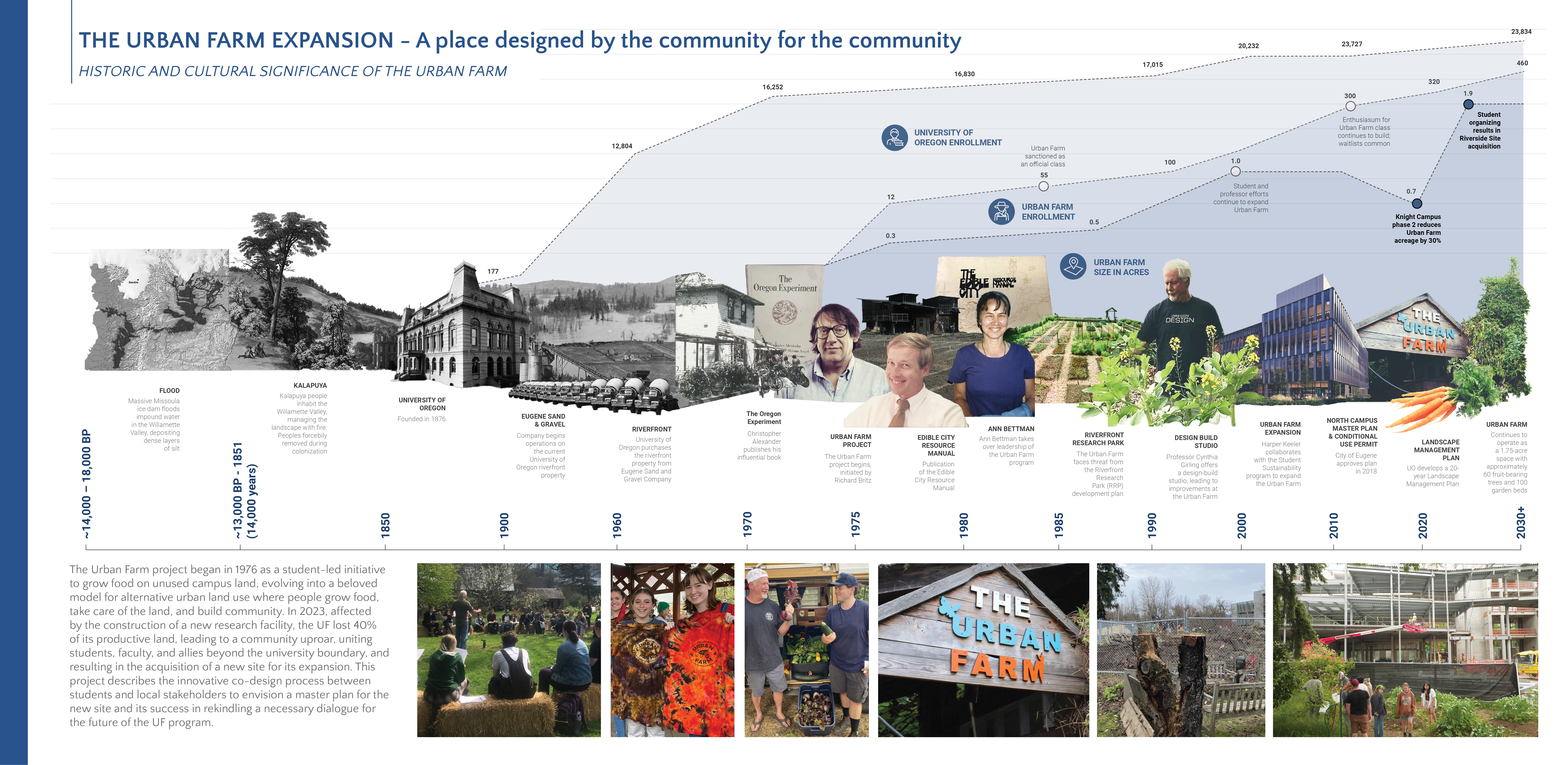
The Lehigh Valley Catalyst is a multi-year collaborative effort which extends the Delaware and Lehigh National Heritage Corridor in Pennsylvania and reconnects communities to the Lehigh River thorough a system of multi-use trails and recreational assets, which also doubles as multi-municipality green infrastructure. To support the local economy and enrich the experience of trail users, a series of parks and mixed-use developments grounded in the region’s history and ecology were proposed to complete the trail along its length. The project was designed by a team of landscape architecture, architecture, and city planning graduate students in collaboration with client organizations, design consultants, and local communities across a span of two years. This project demonstrates the ability of multi-disciplinary student teams to create urban design projects that highlight the history and character of a region, activate local economic development, and create a guiding framework, and catalyst, for future development, health and wellness and community connection.
-
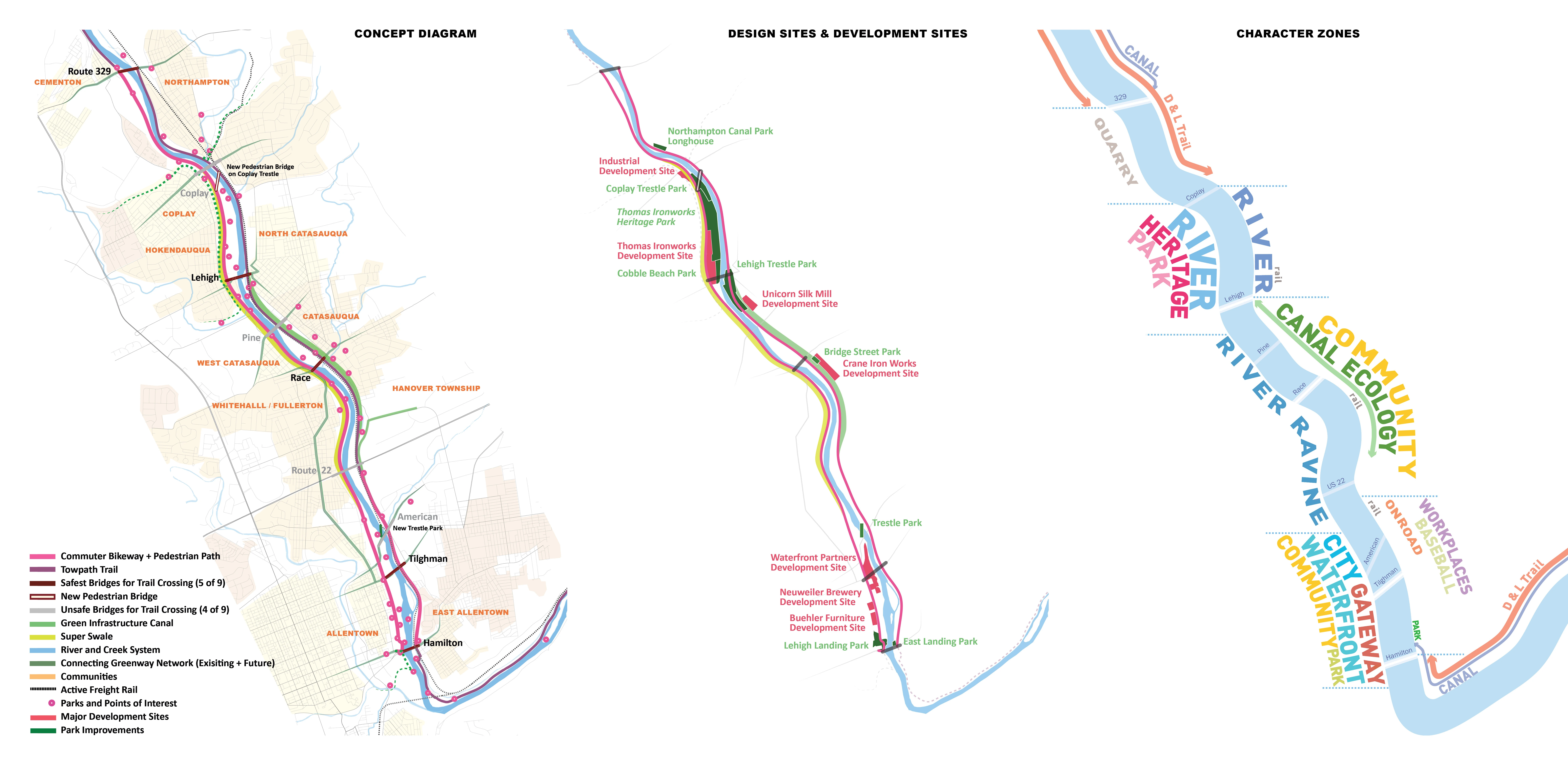
The Lehigh Valley Catalyst closes a 7-mile gap in Pennsylvania’s Delaware and Lehigh (D&L;) National Heritage Corridor, activating a broader network of trails, public amenities, and green infrastructure. Located in the most populated area of the D&L; Corridor, the Lehigh Valley Catalyst recenters the adjacent communities around enjoyment of the Lehigh River, which forms the essential backbone of the region's history and culture, but is not always acknowledged as such. By developing parallel path systems on both banks, which are connected to heritage destinations, points of interest, ecological improvements, and inviting riverfront spaces, the Lehigh River Catalyst offers a range of routes and experiences for both residents and visitors, enlivening the region and stimulating the local economy. To create a vision that emphasizes the unique character of the Lehigh Valley, the design team addressed the project on scales ranging from the design of the regional transportation network to the development of distinctive material palettes that create place-specific experiences.
A team of twelve graduate students, spanning two years, collaborated to complete this project for the Delaware & Lehigh National Heritage Corridor, the Lehigh Valley Planning Commission, and the Wildlands Conservancy. The team worked together to conduct site research and develop an overarching concept for the trail system, and then pairs or individual team members created detailed designs for key sites. The team consulted an environmental engineering and planning firm about the design of the project’s green infrastructure. They also worked with historic preservation specialists to identify important sites and enrich their designs’ ability to interpret the region’s history. The students participated in meetings and presentations with the client organizations, local government, and community members to iteratively develop a project that was grounded in the region’s character and supported local communities’ development goals.
A mix of disciplinary backgrounds strengthened the team’s ability to work effectively at multiple scales. The majority of team members were graduate level students in landscape architecture, with additional team members studying architecture or city planning, many with previous degrees in architecture. The city planning student’s strength in demographic research and urban design helped inform the project’s large-scale strategy. The architecture students’ ability to design structural elements that activate the identity of specific sites and to create reuse strategies for historic buildings became a key part of many catalytic spaces within the broader system. All students collaboratively drew on their knowledge of landscape architecture to create a lively and coherent network of public spaces that connect the region.
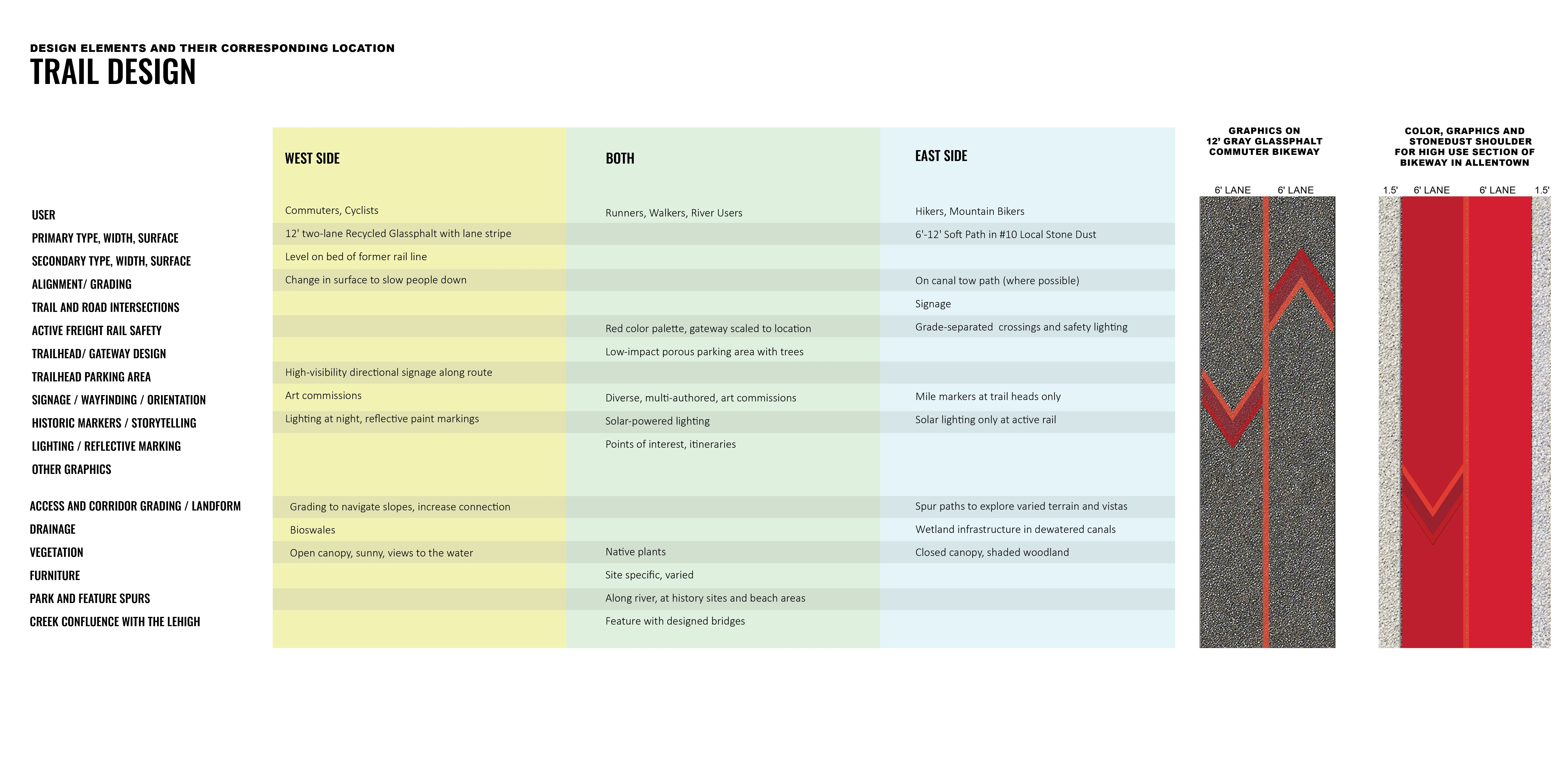
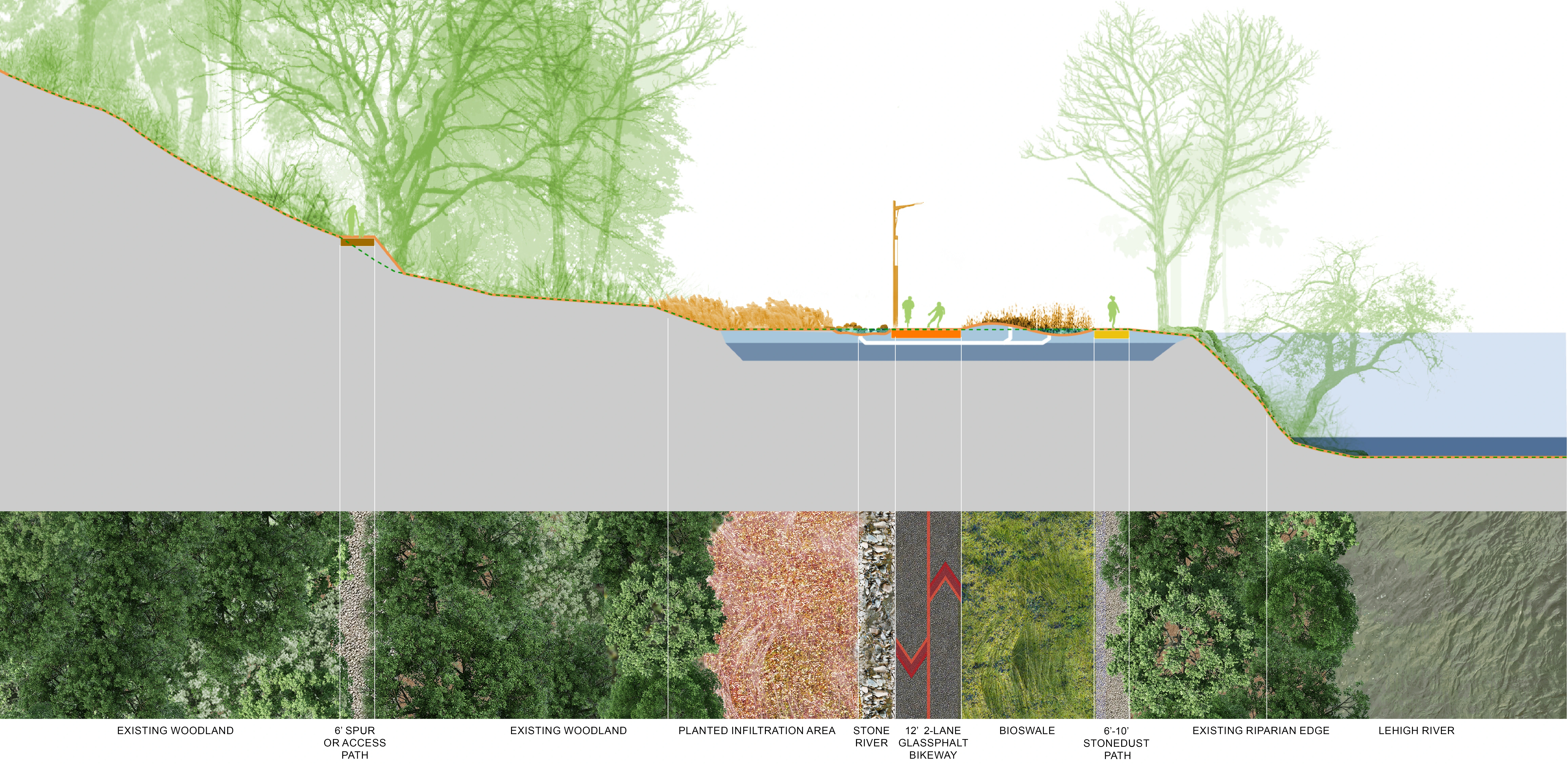
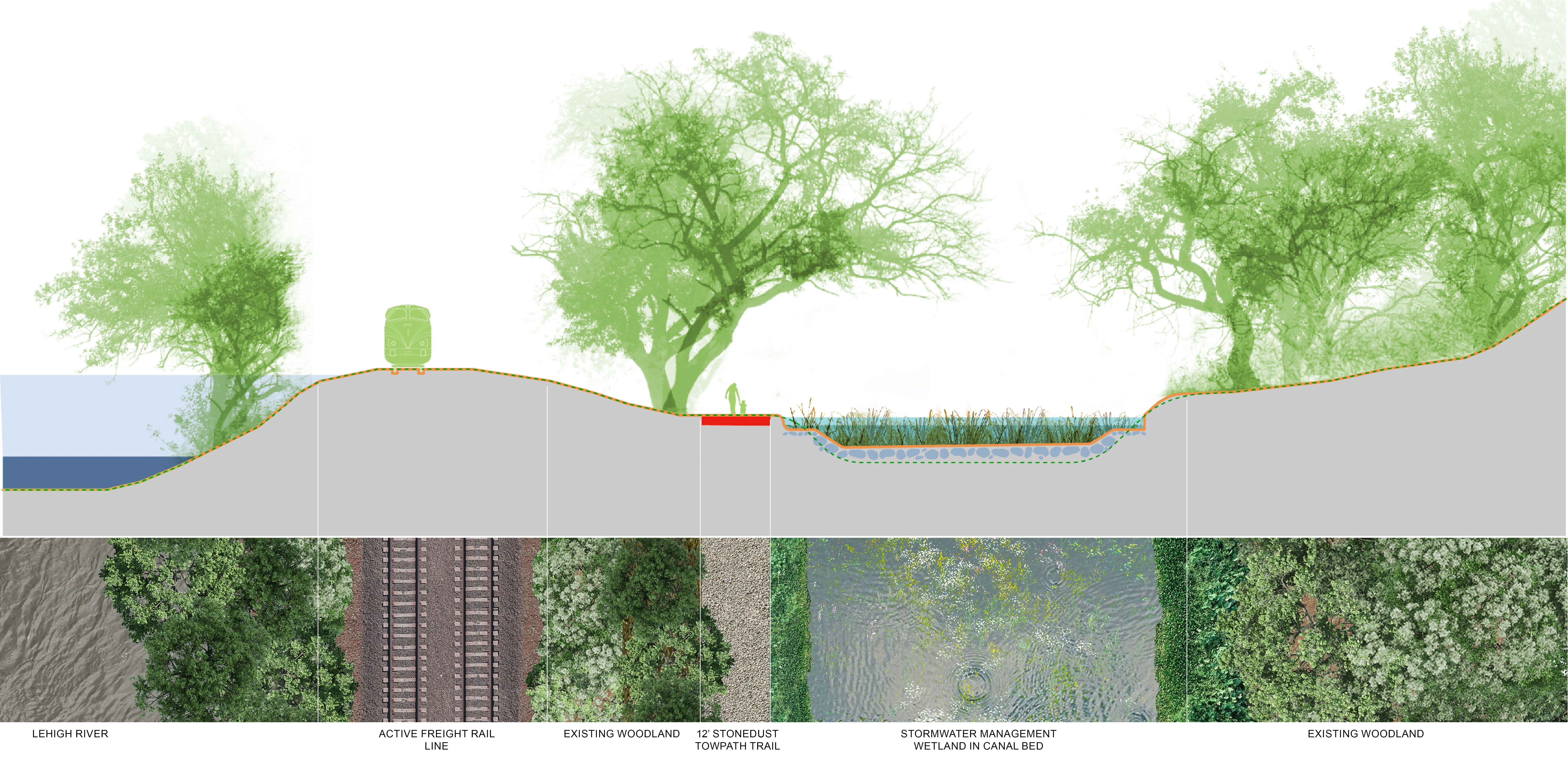
The Lehigh Valley Catalyst project is structured around a mobility network that frames the Lehigh River and connects to adjacent communities. Although the two sides of the river are connected in multiple locations and can be traveled as a loop, they are distinct in character to support a wider range of users. Long-distance travelers will find that many elements of the east side towpath trail are designed for continuity of experience with the 165-mile D&L; trail. Locals will find a wide, smooth bikeway and parallel walking and running trail on the west side of the river, which allow for faster travel suitable for both commuting and recreation. Both sides will also greatly expand access to the water trail on the Lehigh River. This wide range of transportation options and connections makes the river the center of a wider territory, reconnecting local communities with the river that has shaped so much of the region’s history.
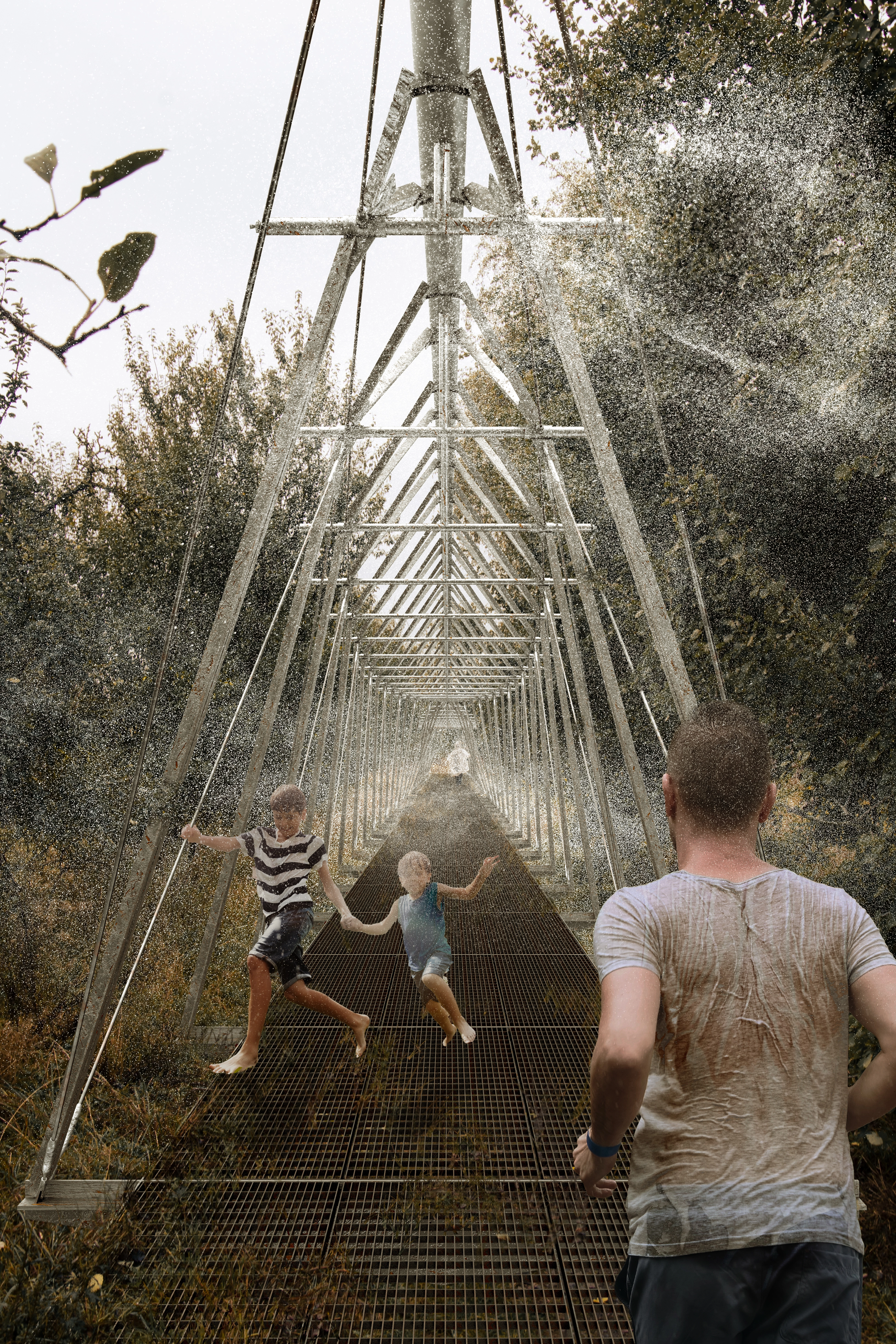
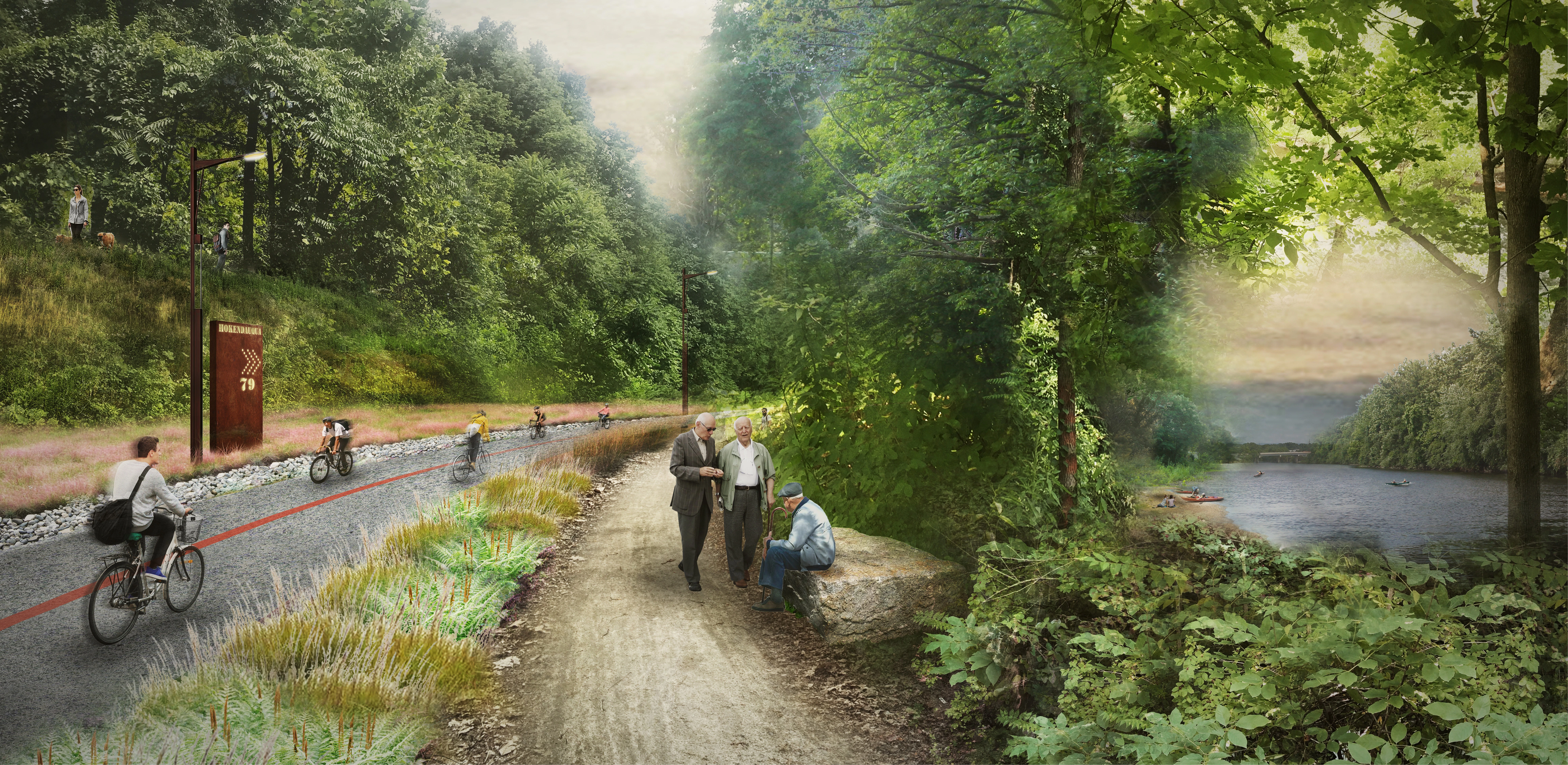
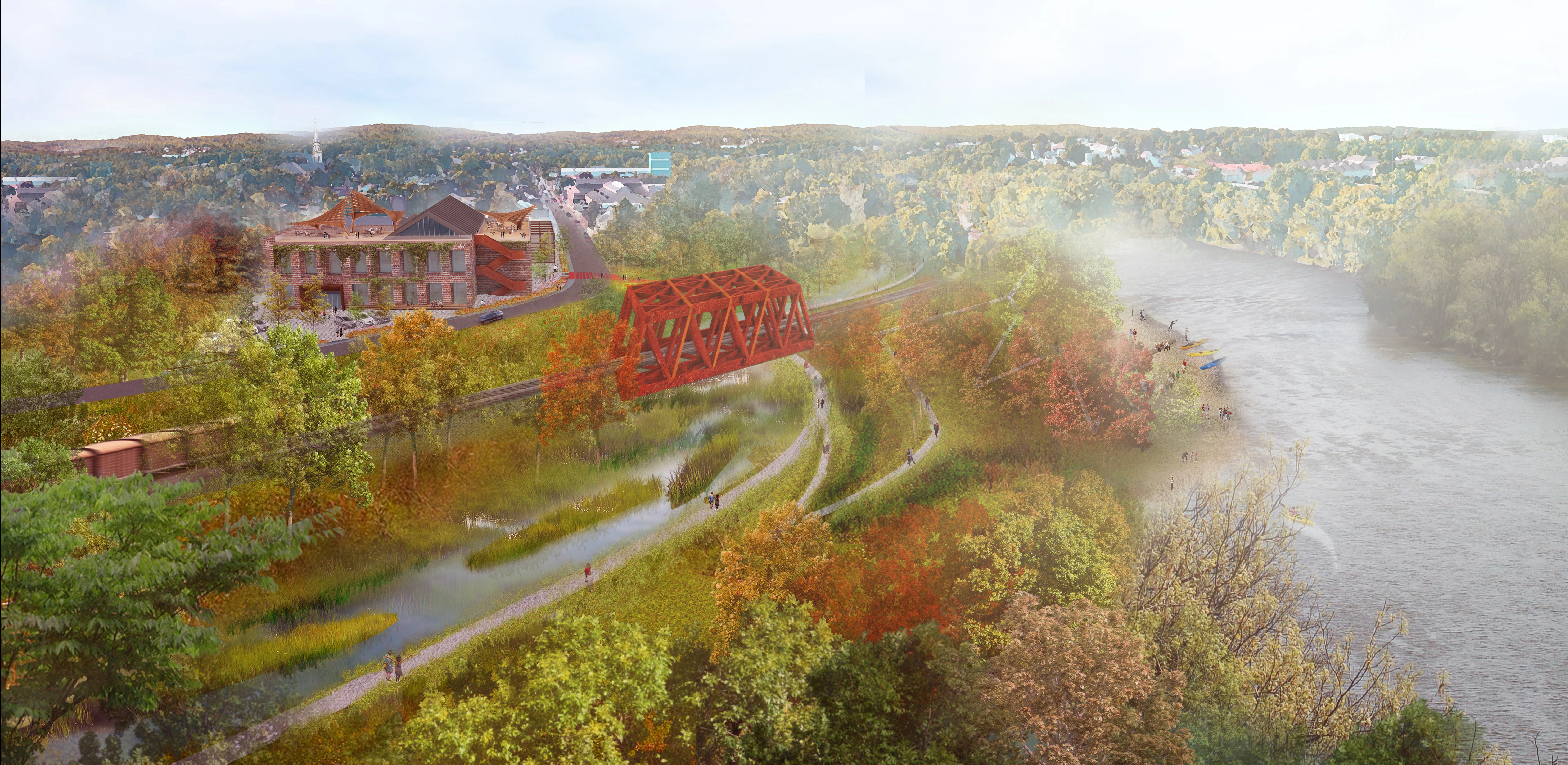
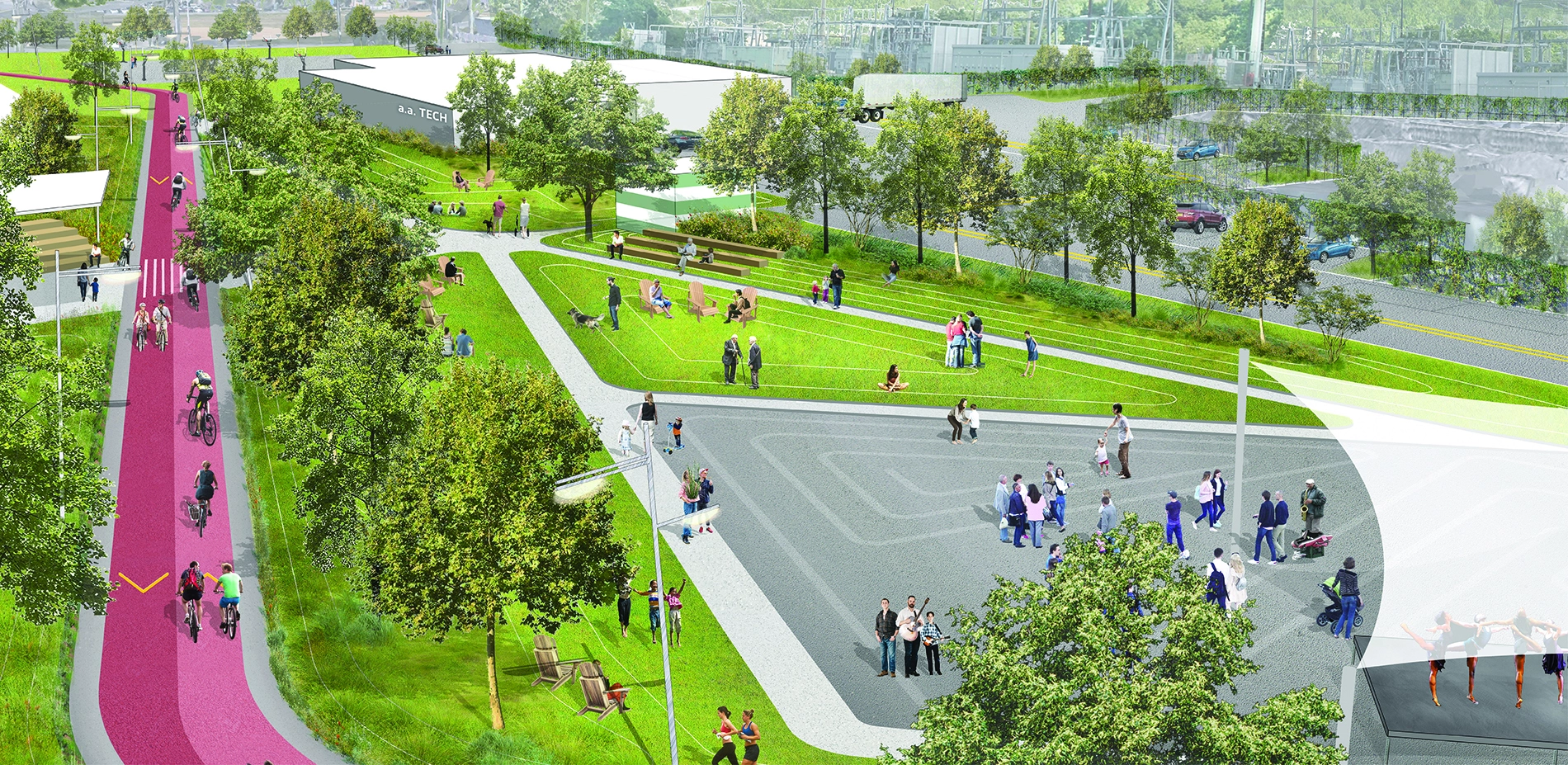
To create a variety of experiences within a cohesive transportation system, the design team considered aspects of the mobility network at a variety of scales. They assessed existing bridges to identify those most suitable for forming safe east-west crossing for pedestrians and bicyclists and proposed a new pedestrian and bike bridge on the Coplay Trestle, offering a more generous crossing with room to stop and enjoy the Lehigh River. After establishing the overall structure of the transportation network, the team identified seven character zones along the river, with varying challenges and assets, relationship to the river and neighborhoods, and different dimensions of the right-of-way. This allowed the team to design typical trail sections for each zone, building on the uniqueness of each zone while providing continuity between them. Throughout, the team considered how the material palette, wayfinding markers, character of the plantings, and other attributes would give the east and west side trails distinct character while making their role in the overall trail system legible to users. They also developed material, planting, and lighting concepts to give trailheads a distinct identity as gateways to the D&L.;
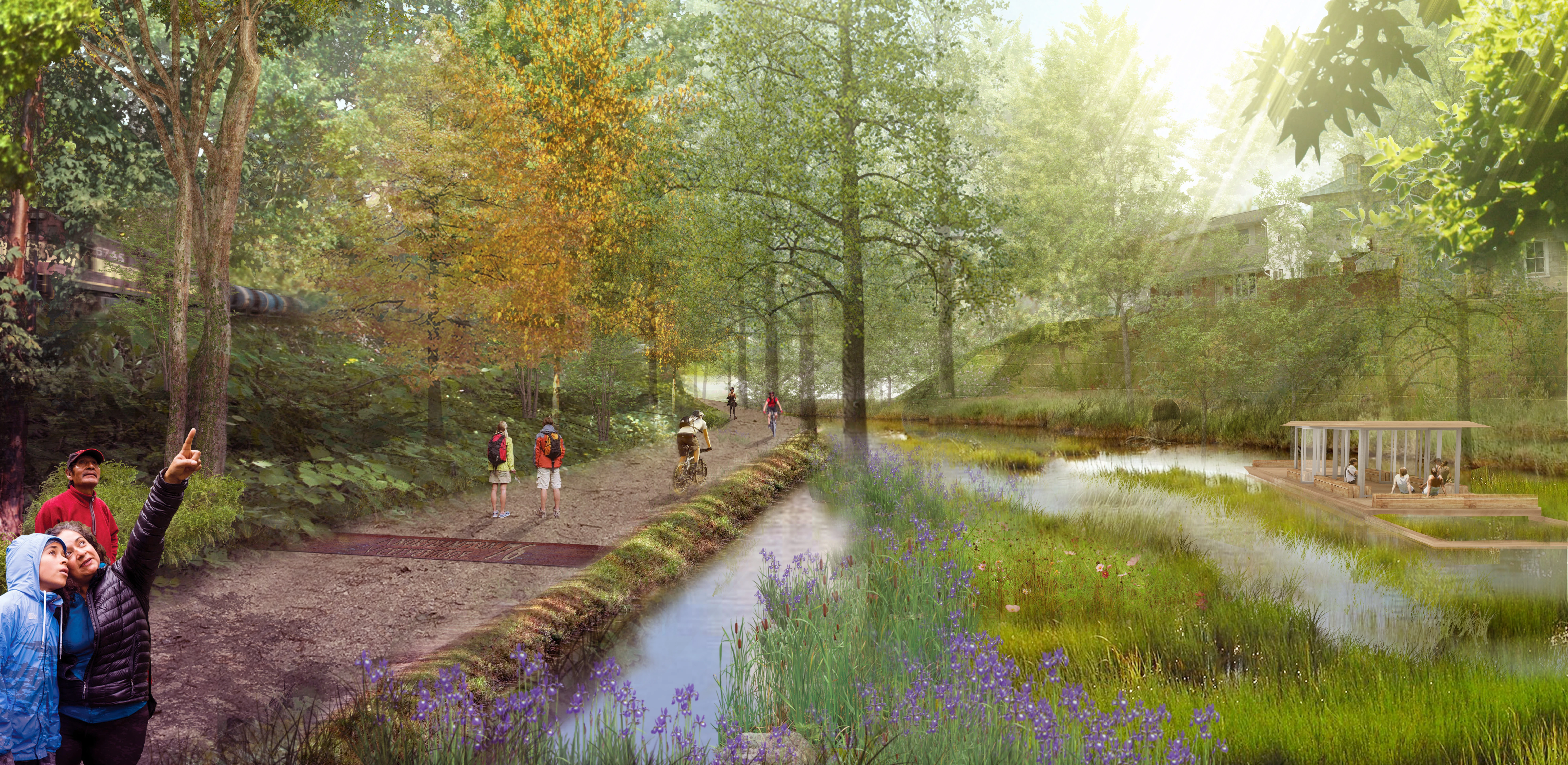
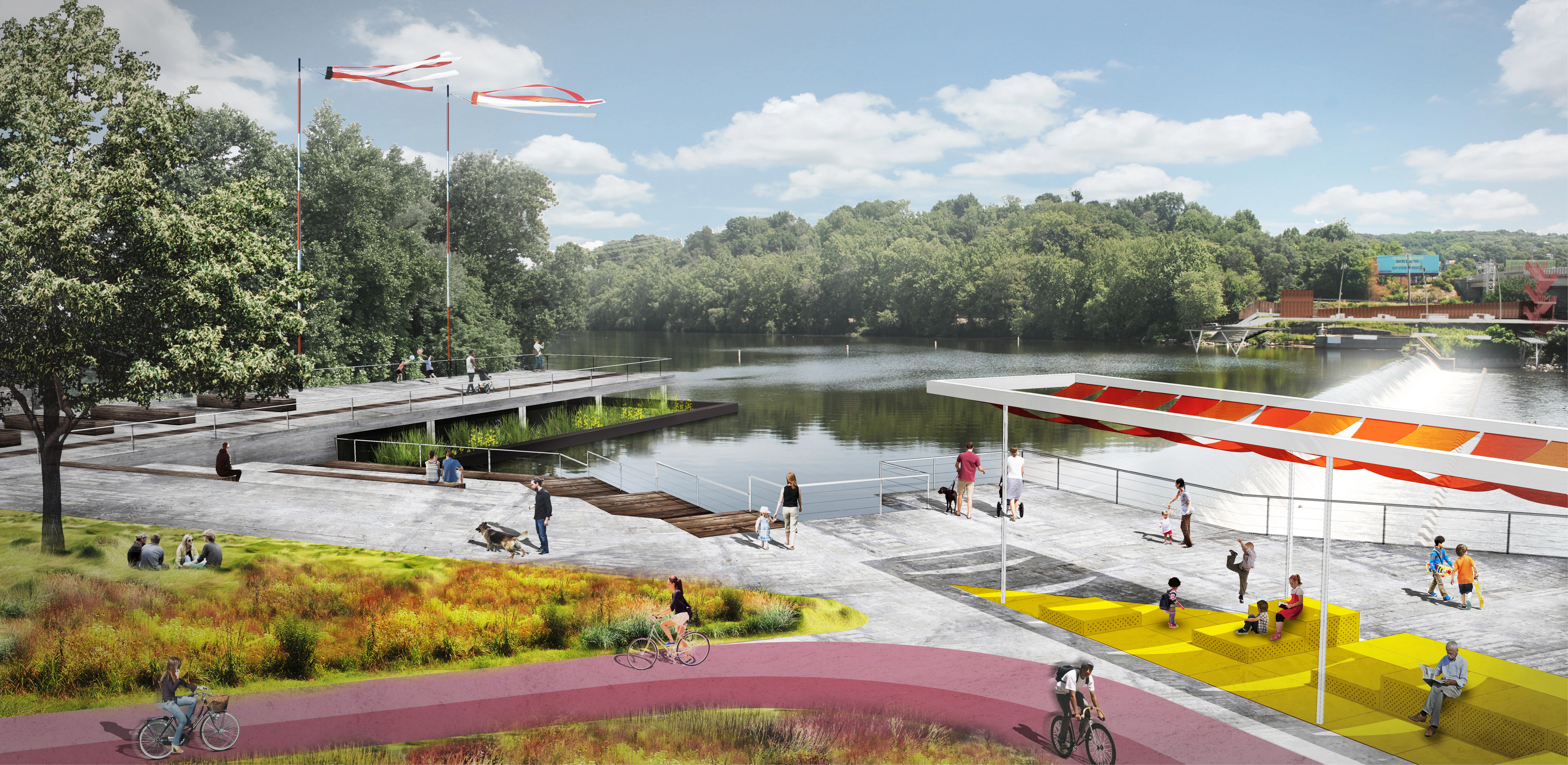
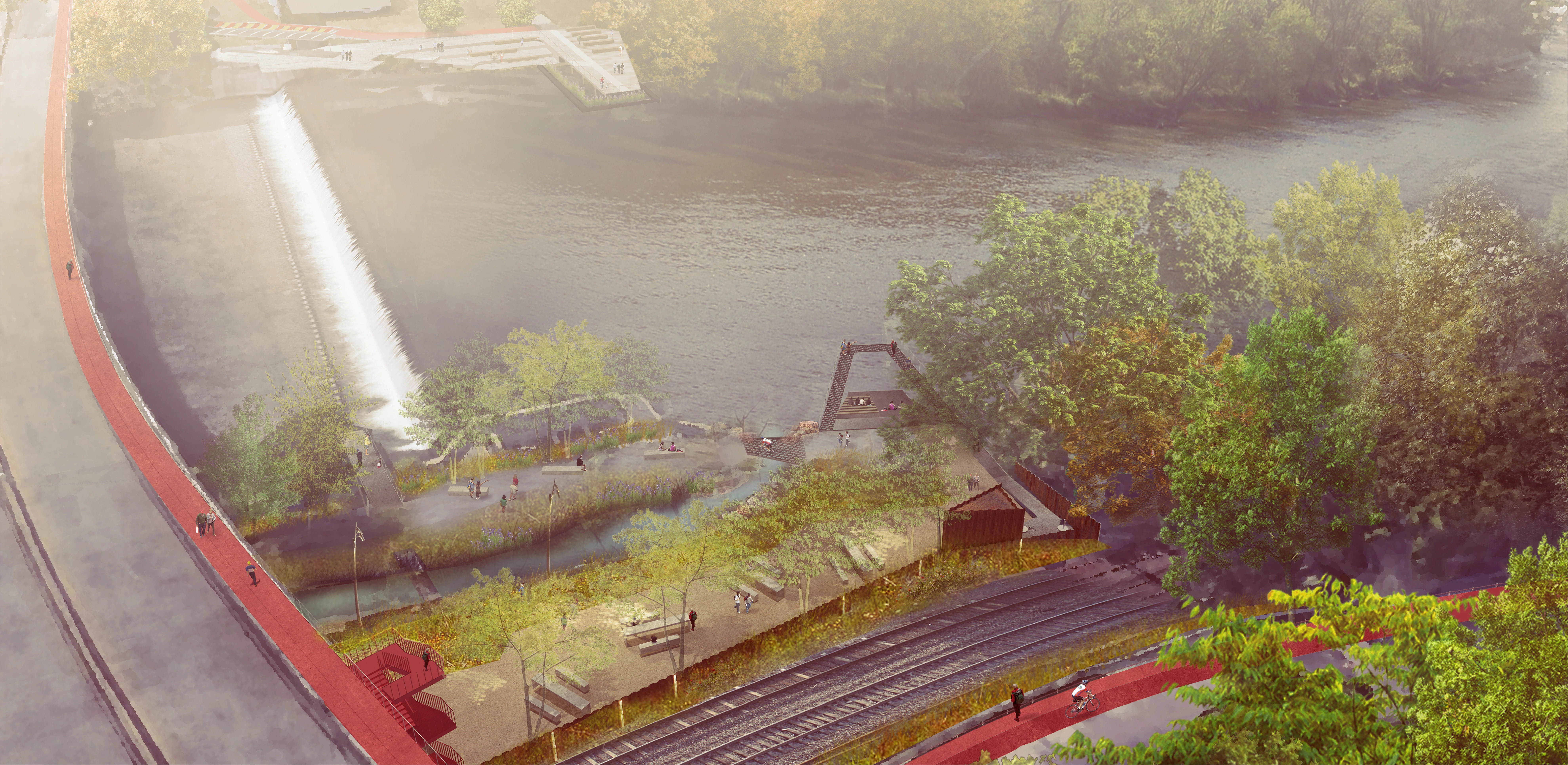
To improve water quality and provide experiences that connect people with their natural environment, green infrastructure elements were integrated throughout the project. On the west side, large-scale water treatment and holding is integrated into the trail experience in the form of a 4.25-mile-long planted “super swale.” On the east side, water management is combined with adaptive reuse of the historic canal running alongside the Lehigh River, now drained but formerly the route for canal boats bringing coal and other goods to support the industries of the Lehigh Valley. The design team proposed that 2.5 miles of the canal be rewatered and planted with native wetland plants. This allows the site to manage a large volume of water while improving the experience of trail users and connecting them to the region’s history. Both the super swale and the rewatered canal will absorb, filter, and infiltrate runoff from uphill, improving water quality in the Lehigh River, reducing the severity of flooding during storm events, and helping the region’s municipalities take concrete steps towards collaboratively improving their stormwater management. Meanwhile, native planting and in-channel modifications were also proposed to improve the habitat quality of the Lehigh River, which throughout its history has been modified by the construction of dams, bridges, and other structures. Through these approaches, the Lehigh Valley Catalyst forms a greenway that improves regional water management and habitat quality, creates car-free connections between communities, and helps people connect to and enjoy the riverine ecosystem’s beauty.
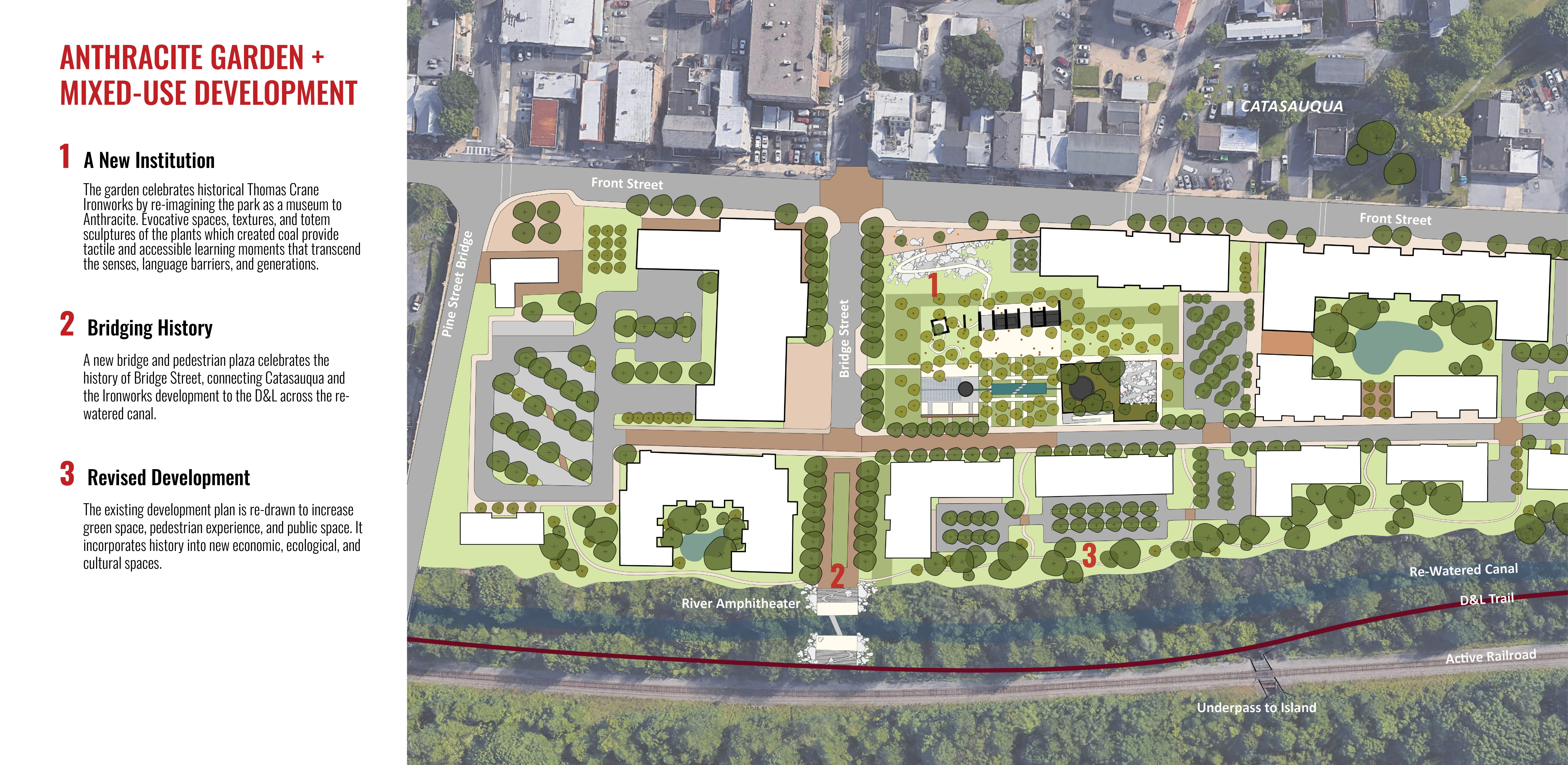
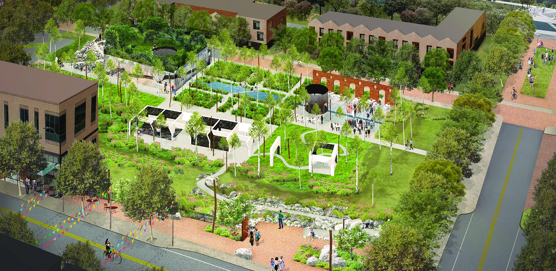
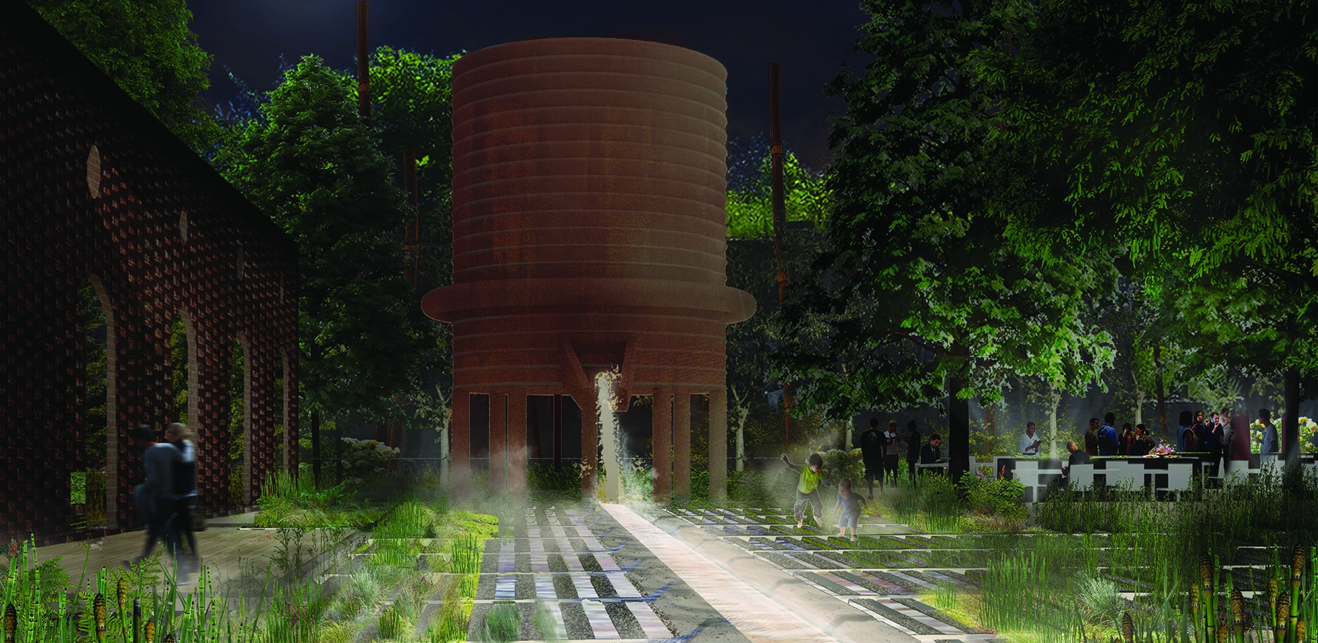
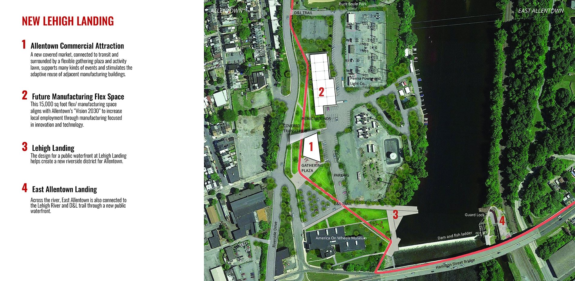
The new mobility network that the Lehigh Valley Catalyst creates will also spur public and private development of many sites along the trail. The design team developed conceptual designs for a constellation of points of interest along the trail, aiming to stimulate historic preservation, economic revitalization, and place-making. Some of these sites are post-industrial areas that were cleared and have been awaiting redevelopment for years. Others still have rich heritage buildings and cultural landscapes that can be incorporated into parks and amenities for residents and visitors. The students designed public spaces at several post-industrial and trailhead sites, aiming to deliver satisfying, complex experiences of the area, and introduce people to the layered heritage of the region. Proposals include a park that draws attention to the rewatered canal’s history through planting design and that proposes adaptive reuse of the adjacent silk mill; a mixed-use trailhead development that centers around public spaces inviting reflection on Pennsylvania’s history of iron and coal; and a riverfront district connecting Allentown to the D&L; trail. By adding sites like these to the many existing points of interest, the Lehigh Valley Catalyst creates clusters of sites that offer a great day trip experience, increasing use and enjoyment of the trail system and strengthening the local economy.
By drawing on their backgrounds in landscape architecture, architecture, and city planning, the students were able to create a landscape framework that relinks the urban areas lining the Lehigh River. By visualizing a connected and legible regional trail system anchored by exciting public spaces, the team contributed to local residents’ and leaders’ continuing exploration of the kinds of places they would like to see animate the D&L; corridor. The Lehigh Valley Catalyst inspires local development efforts to prioritize a future where local communities are invigorated and connected through their region’s history and natural environment. -
- Acer saccharum Sugar maple
- Quercus rubra Northern red oak
- Nyssa sylvatica Black gum (Tupelo)
- Osmunda cinnamomea Cinnamon Fern
- Eragrostis spectabilis Purple love grass
- Andropogon gerardi Big bluestem
- Monarda Beebalm
- Liriodendron tulipfera Tulip poplar
- Amelanchier canadensis
- Sassafras albidum Sassafras
Advertisement
Related Awards
Honor Award, Student Collaboration
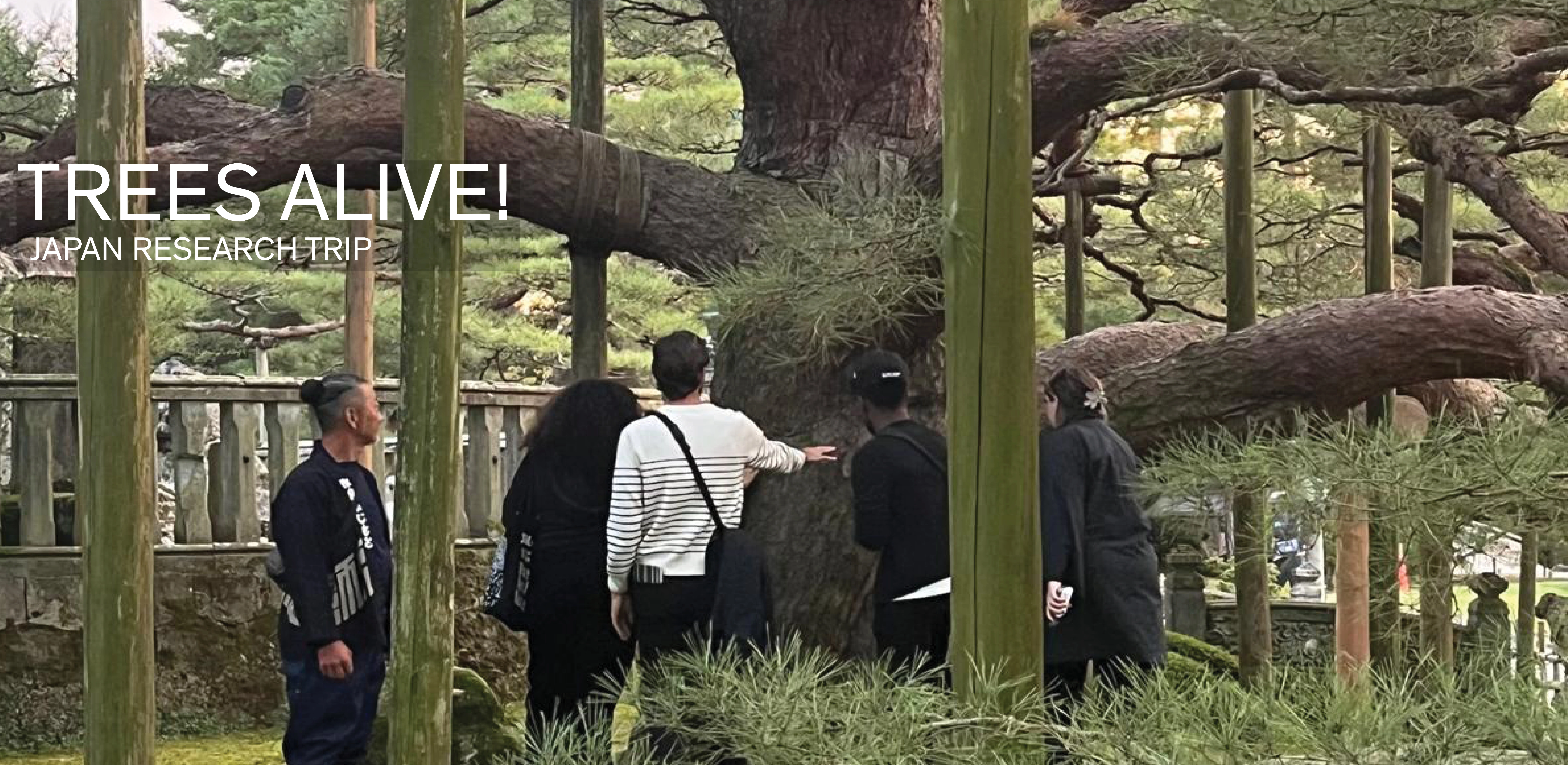
TREES ALIVE!: Techniques, Details, Traditions
TREES ALIVE! is a collaborative research and travel exchange between American and Japanese landscape architecture programs to study the techniques, details, and cultural traditions for trees in contemporary urban landscapes. Students participated in collaborative technical workshops and visits to significant gardens and landscapes to investigate urban tree planting and legacy tree conservation in Tokyo, Kanazawa, Chicago, Columbus (Indiana), Philadelphia, and New York. Two technical