.webp?language=en-US)


-
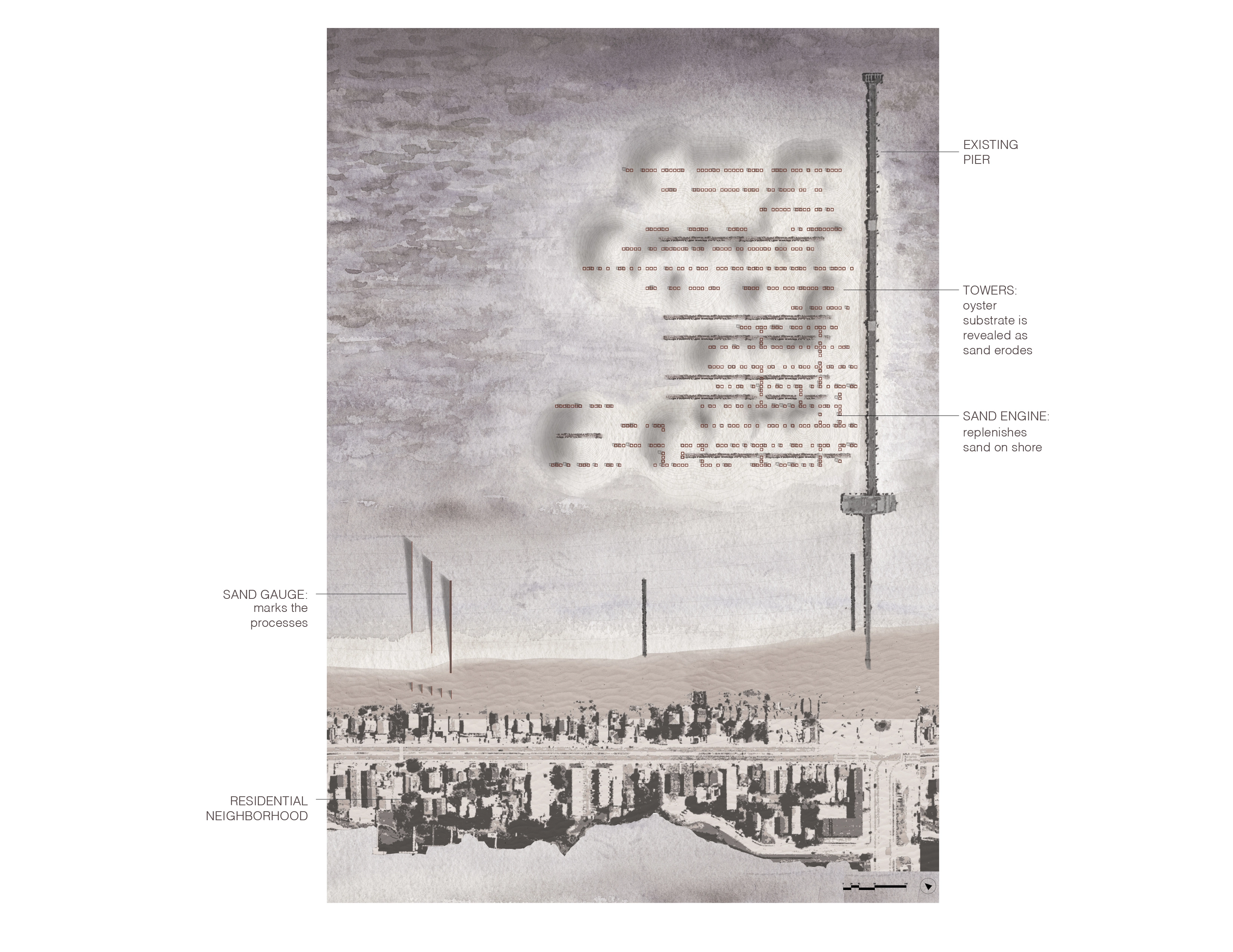
This proposal layers three systems: a “sand engine” that thickens the beach over time, scaffolding structures that serve as substrate for oyster growth and support a network of walkways, and a “sand gauge” on the shore that registers the accretion of sand and the cycle of coastal processes.
-
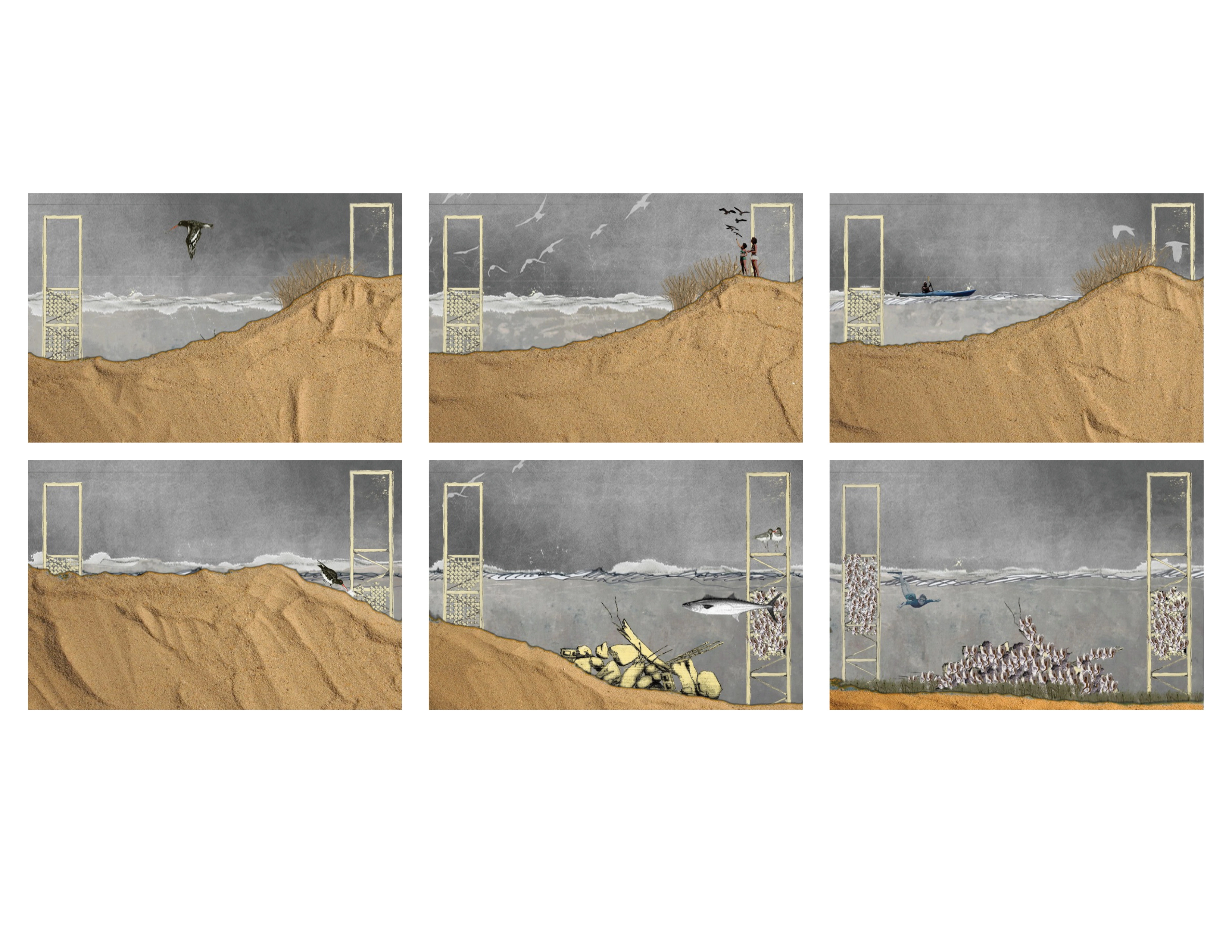
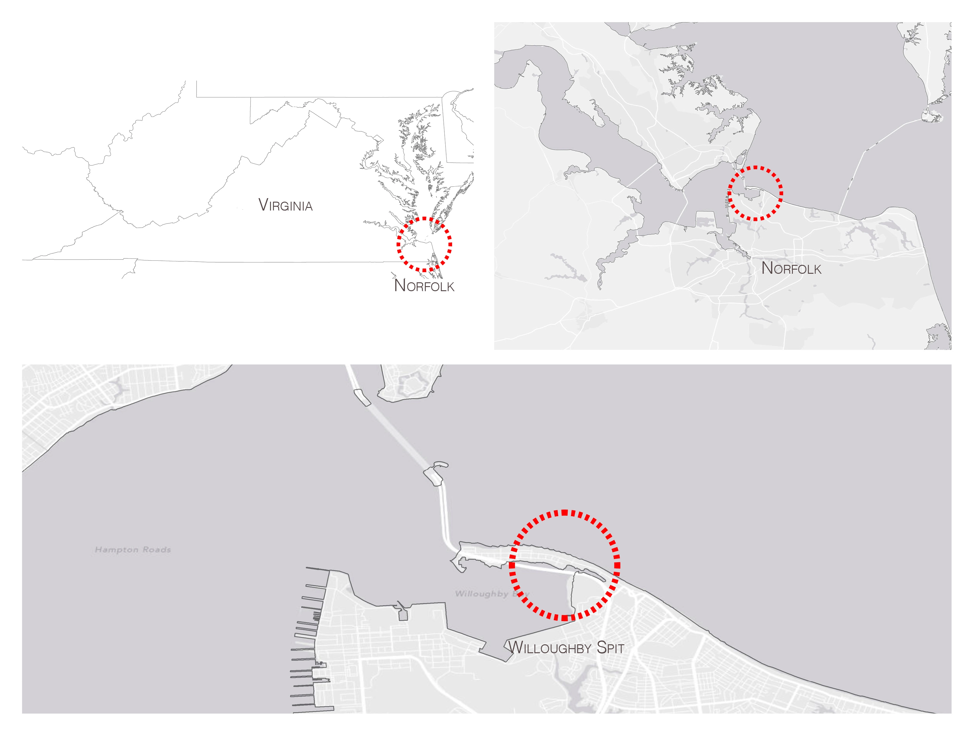
Sited at Willoughby Spit in Norfolk, Virginia the project aims to buffer the coastline and to address Chesapeake Bay’s water quality issues by catalyzing the growth of oysters and other mollusks that filter excess nutrients and suspended particles from the water, improving conditions for sea-grasses, and providing a food source for marine birds and animals. As the sand erodes from the sand engine and accumulates on shore, a set of structures, the sand gauge, on the beach marks the process. They register the horizontal and vertical growth of the dunes and the shoreline, as well as the daily fluctuations in water levels.
At the southern end of the Chesapeake Bay, the Norfolk coastline faces many environmental challenges. Nitrogen and phosphorus pollution from agricultural runoff, sewage, stormwater and air pollution in combination with rising water temperatures are causing algae blooms and dead zones that kill fish and submerged aquatic grasses. Mollusk reefs provide a food source for marine birds and animals, filter excess nutrients and suspended particles from the water, improve conditions for sea-grasses, and buffer the coastline from storm events and sea level rise. However, globally, over 85% of oyster reefs have been lost due to human impacts such as dredge fishing, overharvesting, and habitat loss.
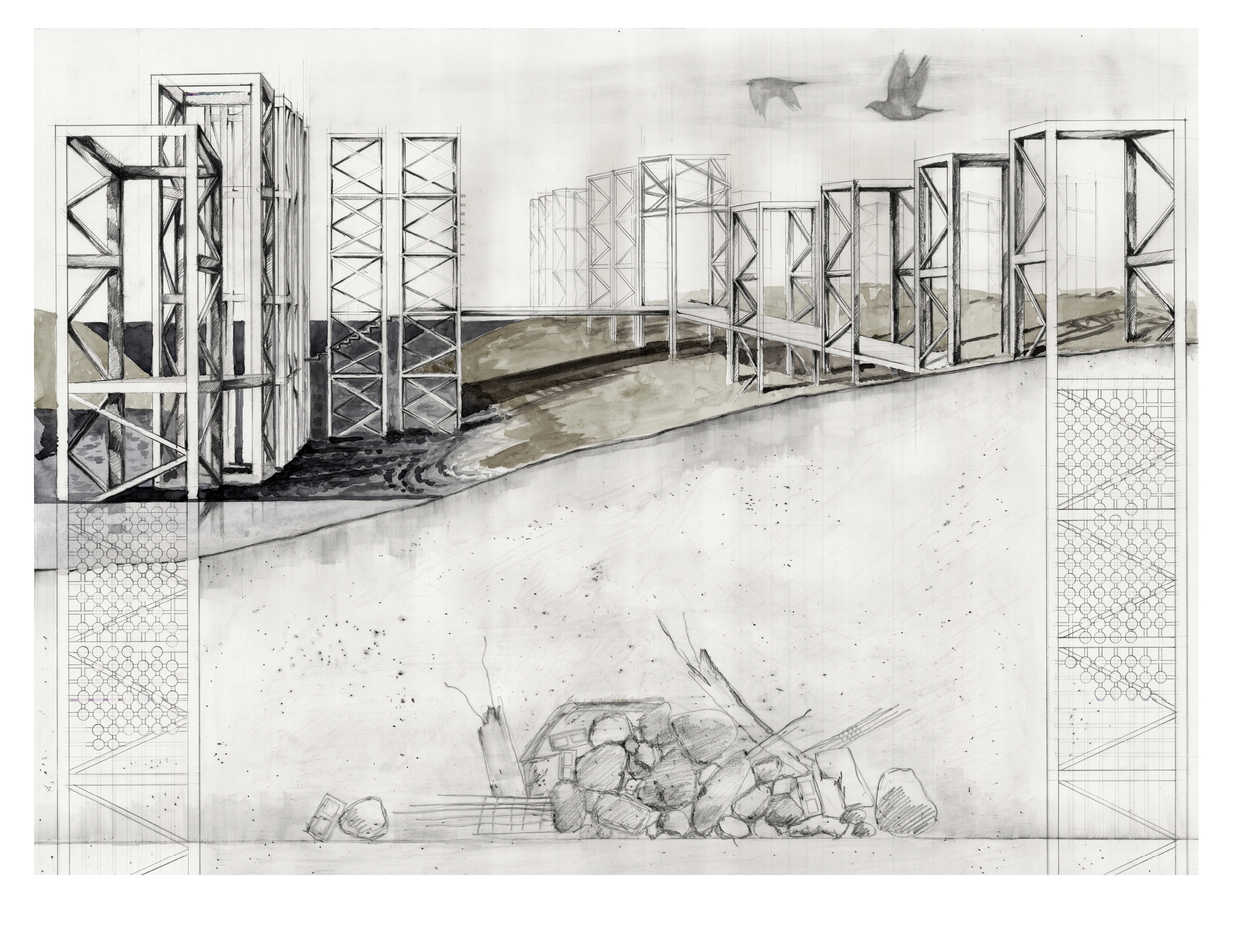
To address these challenges, this design layers three systems: a “sand engine” that will replenish the sand on the beach, scaffolding structures that serve as substrate for oyster growth and support a network of walkways and towers for recreation and, on the shore, a “sand gauge” of steel insertions that marks the accretion of sand.
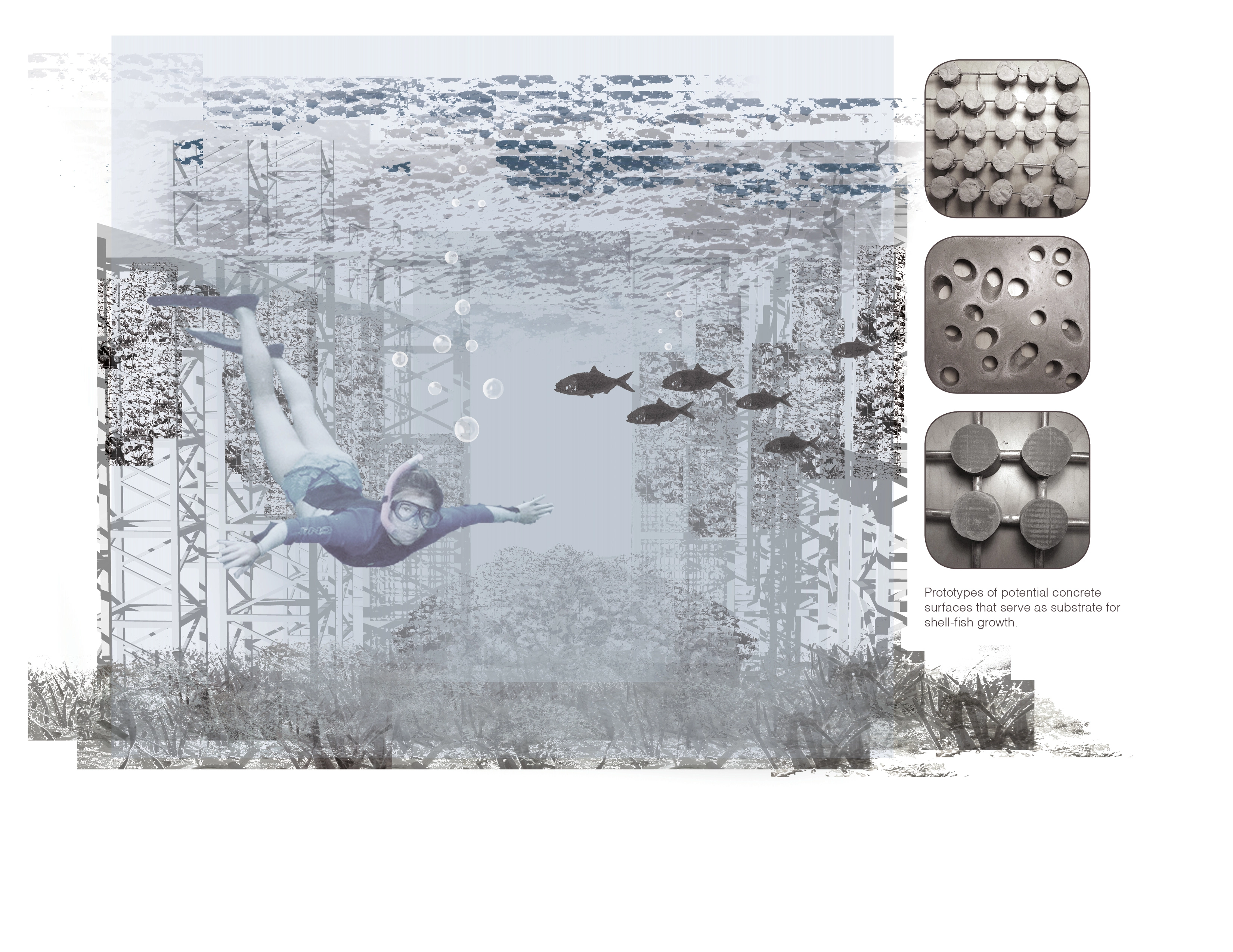
Current reef restoration techniques aim to provide a surface for oyster spat to attach to, including piles of bags filled with oyster shell, bundled wood, bamboo covered in cement, gabion baskets filled with shell and rock, oyster shell mats, and modular concrete structures. Some are also combined with Fish Attractant Devices (FAD) that provide shelter for small fish.
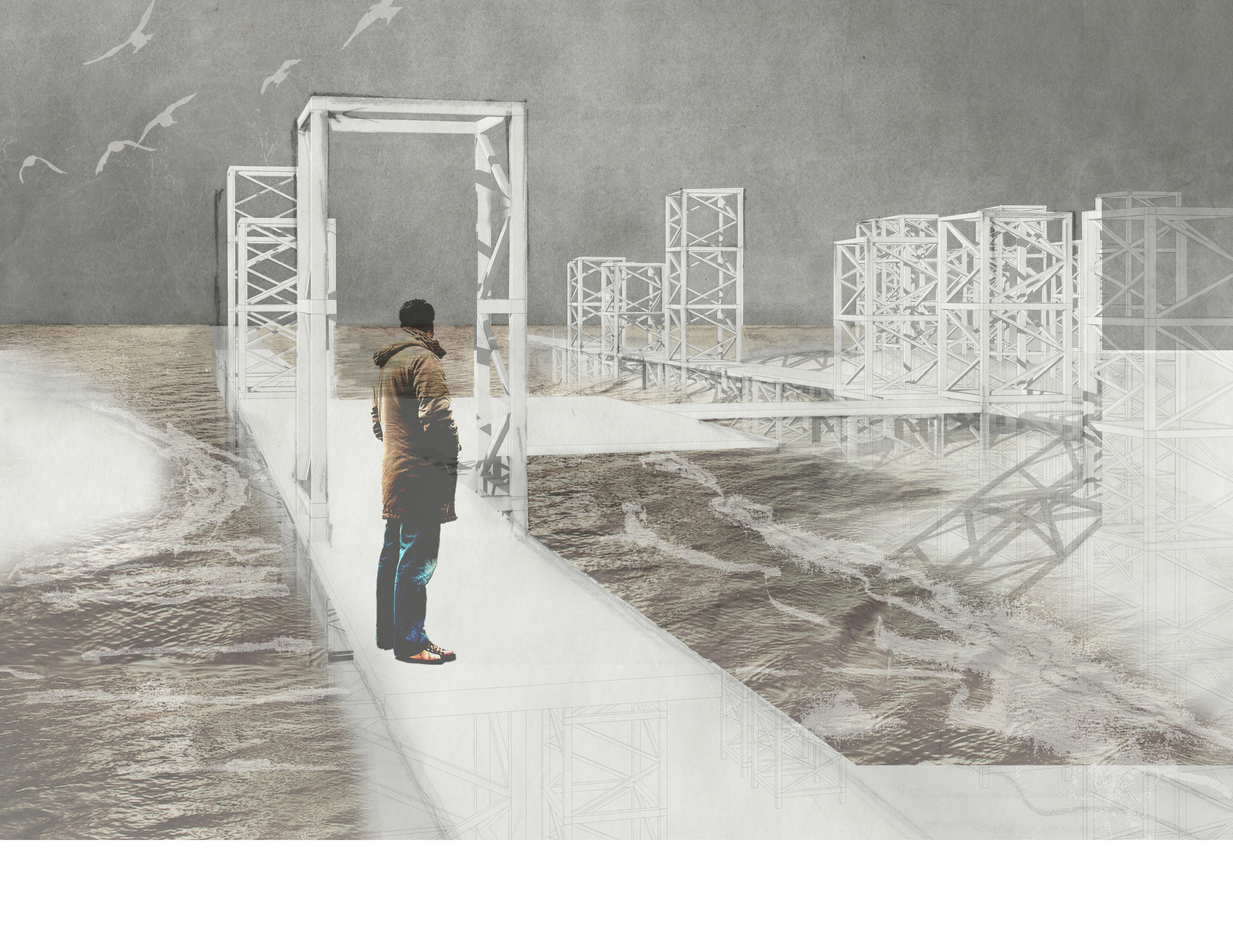
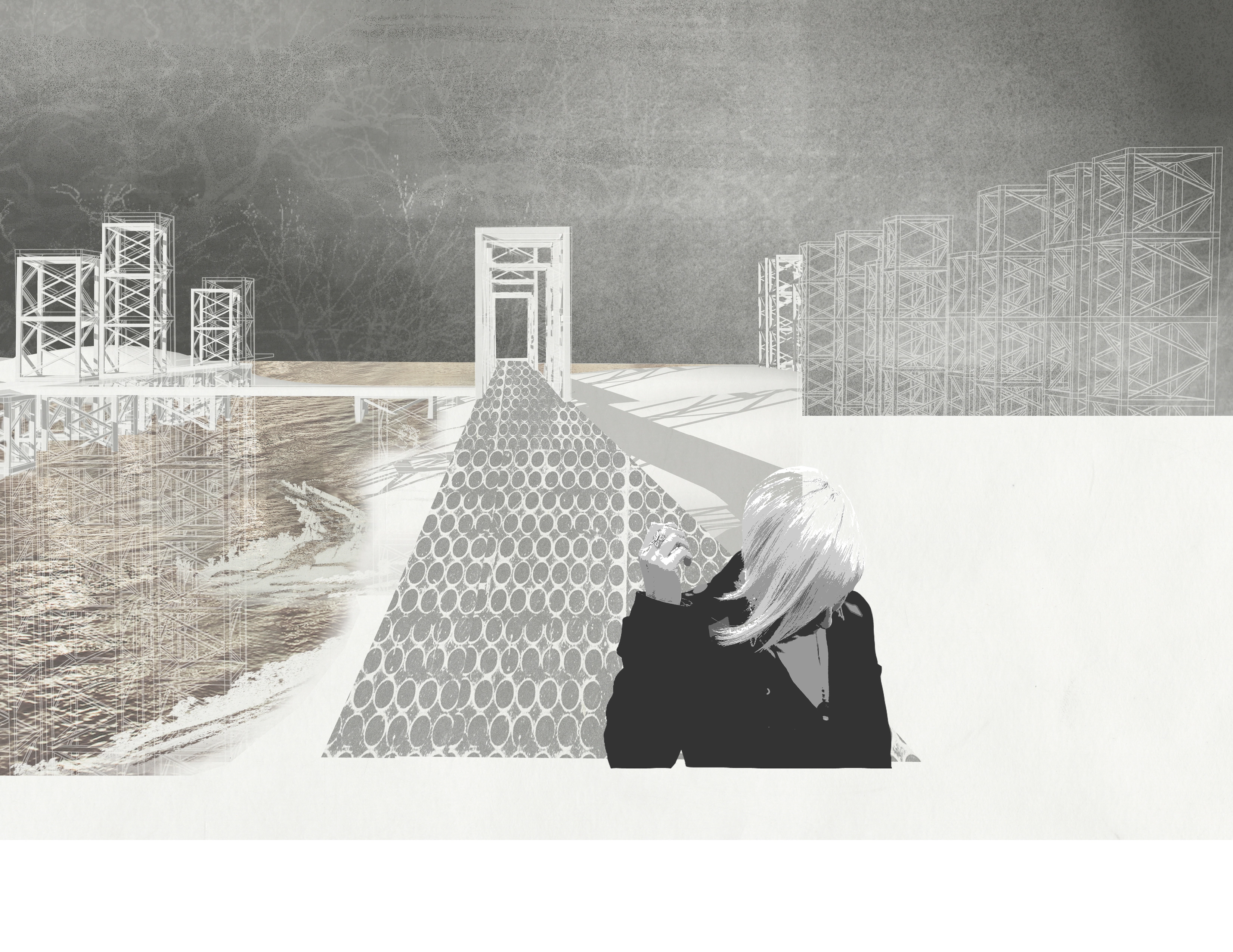
The porous, concrete scaffolding proposed in this project is designed to function as an artificial reef that will catalyze the growth of oysters and create protected habitat for submerged aquatic grasses and fish. A network of towers built using repurposed shipping cranes from the area’s ports support this concrete scaffolding underwater. Sand from the area’s dredging activities is piled between the structures to form the sand engine. Over the course of fifteen years the sand slowly erodes, exposing the concrete oyster substrate. This system is continually changing and allowing people to experience the shore up close and in different ways. The islands shift with the wind and the tides, human access becoming, at times, partially restricted, depending on the fluctuations of water levels and the accretion and erosion of sand. As portions of the sand erode, the underwater scaffolding blooms with sea grasses and mollusks, attracting birds and animals and allowing people to observe them from walkways or kayaks.
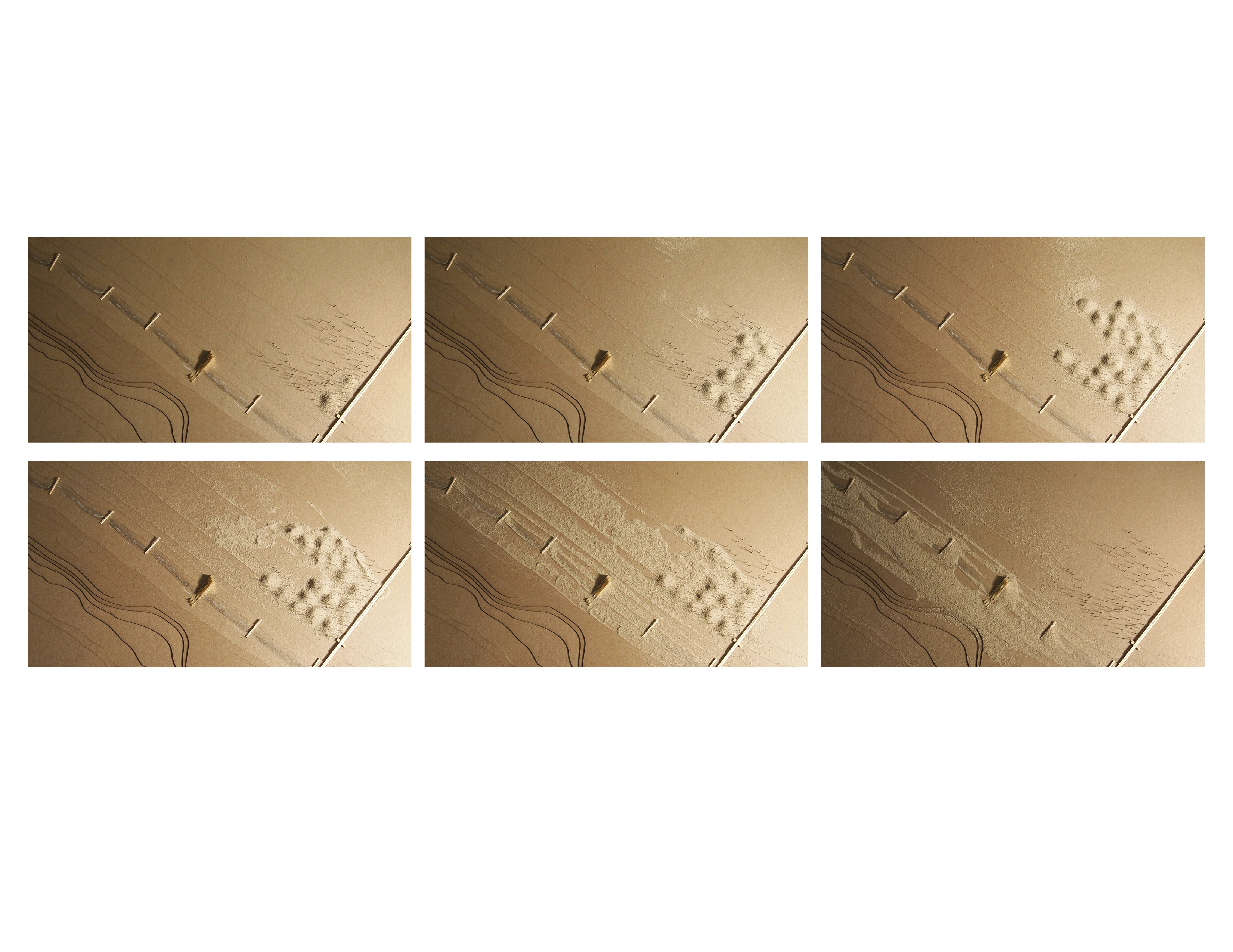
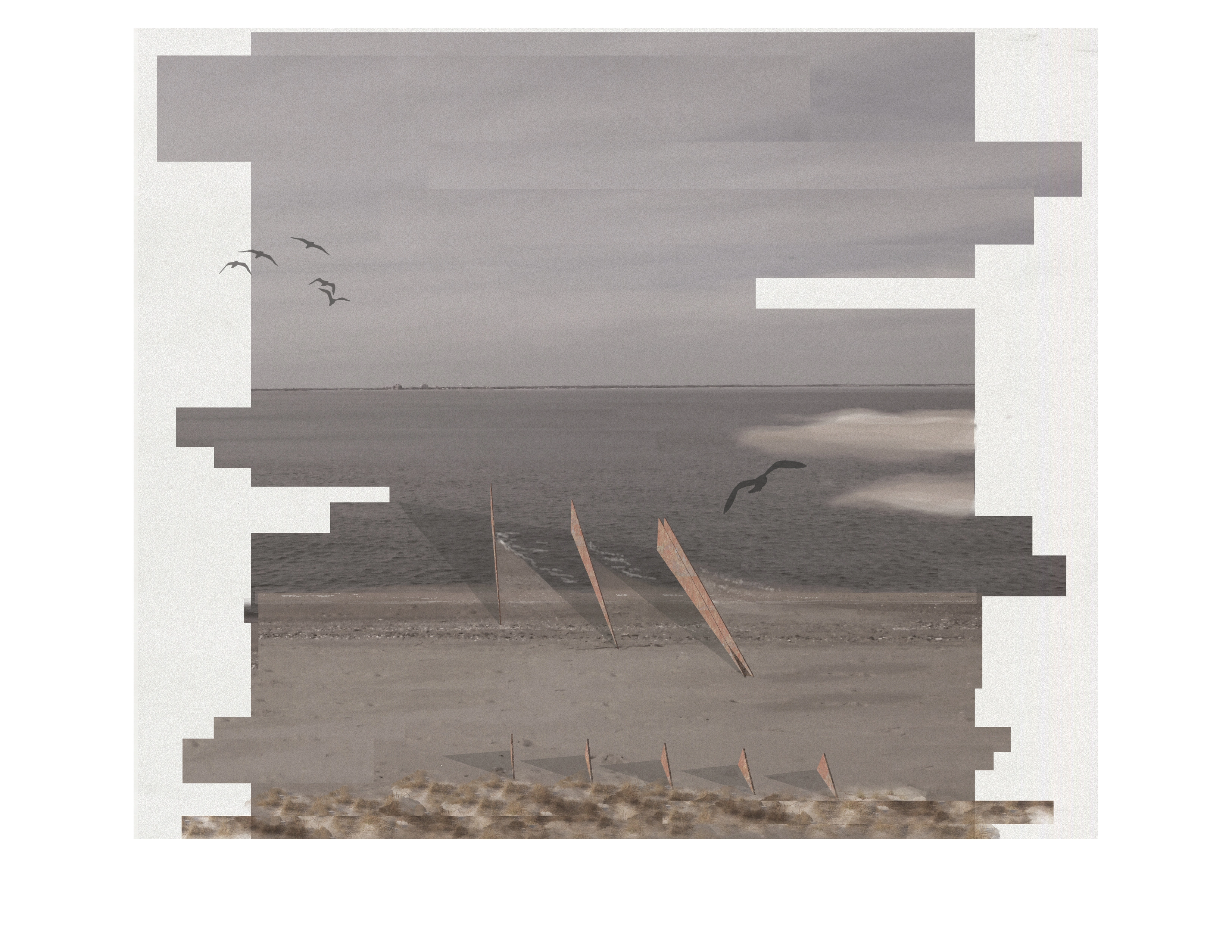
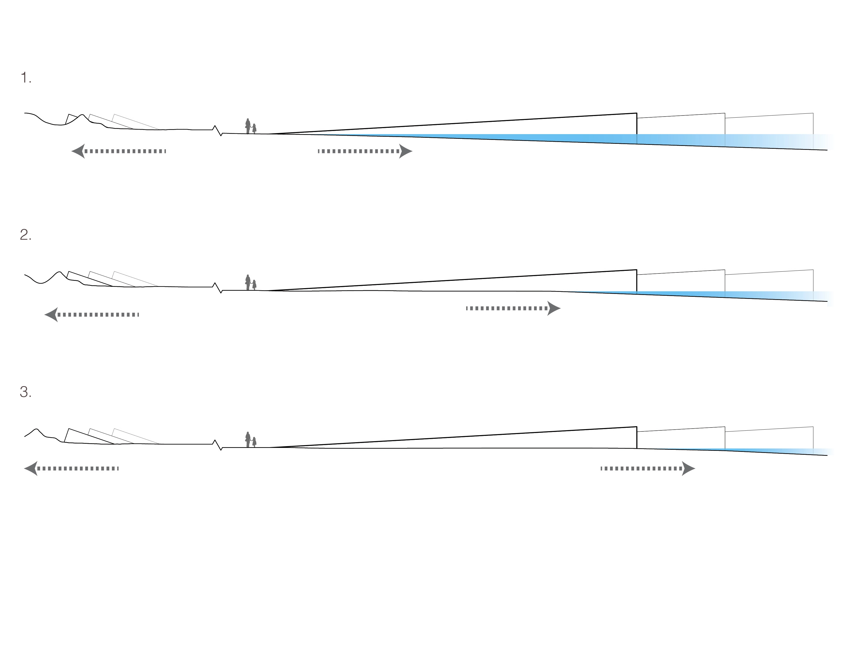
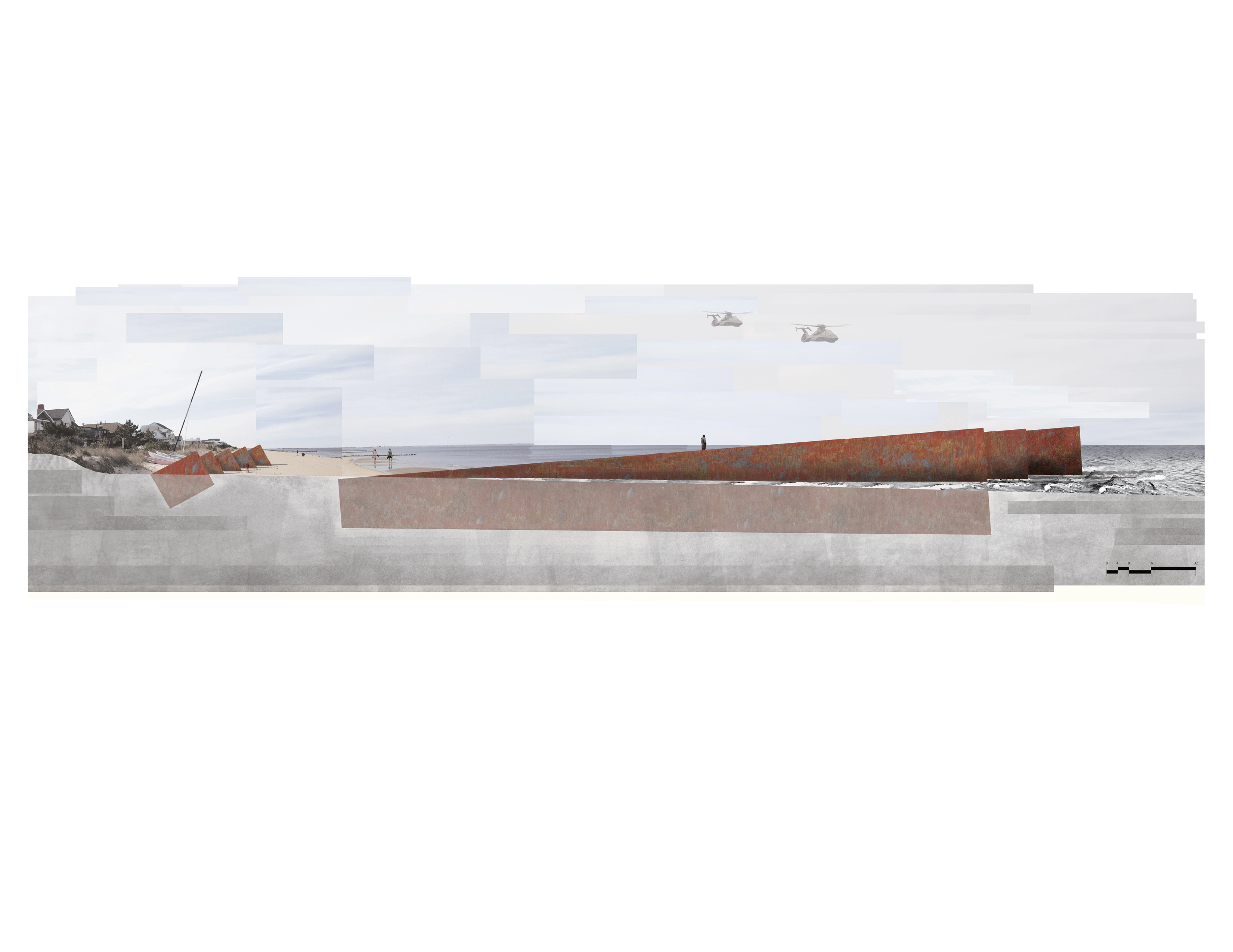
As the sand erodes from the sand engine and accumulates on shore, a set of structures on the beach marks the process. Steel insertions are placed at the water’s edge and a corresponding, smaller set at the dune line. These steel walls are spaced so that as the beach thickens, the change can be registered horizontally, as the water recedes out to the furthest structure, as well as vertically, as the sand and tidal fluctuations leave marks on the steel surface. The set of structures at the back of the beach similarly registers the growth of the dunes. These installations serve as a marker of time and natural processes, provide shade, and break up the continuity of the long beach line.
The combination of these design elements not only ameliorates some of the environmental issues facing the coast of Norfolk, but also alters the way visitors to this area experience the coastal processes around them. By registering change and focusing attention on otherwise unnoticed processes, such as the erosion and accretion of sand, the growth of mollusks and aquatic grasses, and the formation of dunes, people begin to understand this ecosystem more closely and develop a sense of stewardship for it.
Advertisement
Related Awards

Award of Excellence, General Design
A Floating Forest: Fish Tail Park in Nanchang City
In Nanchang, within the Yangtze River floodplain, we revitalized a heavily degraded 126-acre landscape into a floating forest that manages stormwater, restores habitats, and provides diverse recreational spaces—all within a limited budget and a short timeline. This innovative urban nature model strengthens the district’s identity and spurs surrounding development. Fish Tail Park offers a scalable solution for flood-prone regions, seamlessly integrating flood resilience, ecological restoration