.webp?language=en-US)


With or Without Water: Building Resilient Livelihoods in the Lake Chad Basin
Christina Milos, Student ASLA
Visionary in tackling the big issue of water conservation in Chad. This approach is comprehensive, intelligent, and, best of all, it involves the local people in the solution. The scale and detail are amazing and informative. It will work and it's environmentally sensitive.
Awards Jury
-
The rapid shrinking of Lake Chad — by over 90 percent in the past 40 years — is emblematic of increasing global water insecurity. With or Without Water considers how technologies used to prevent desertification and sustain livelihoods in the Lake Chad Basin can be designed to succeed where they have failed in the past. Shelterbelt plantings are paired with transportation infrastructure and incrementally deployed as Lake Chad's shoreline recedes. The system provides a resilient scaffold for future rural development—with or without water.
-
Context
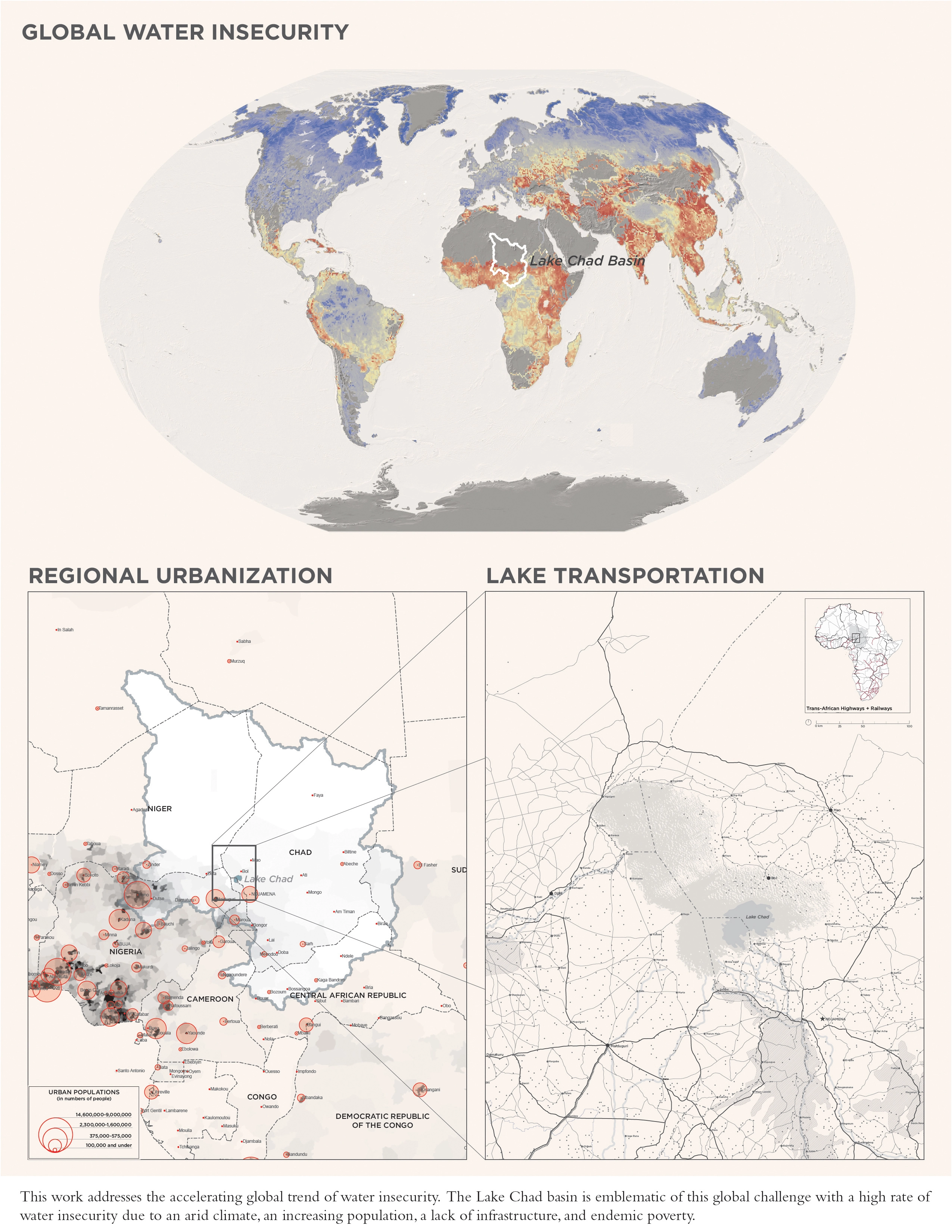
Lake Chad has declined by more than 90 percent—from 25,000 square kilometers to less than 2000 square kilometers in the past 40 years. The Food and Agriculture Organization calls the shrinking of Lake Chad an "ecological catastrophe" and warns of an impending humanitarian disaster without a radical change in water management practices. The Lake Chad Basin is shared by 7 countries and managed by the Lake Chad Basin Commission (LCBC). This work is intended as a proposal the LCBC could undertake.
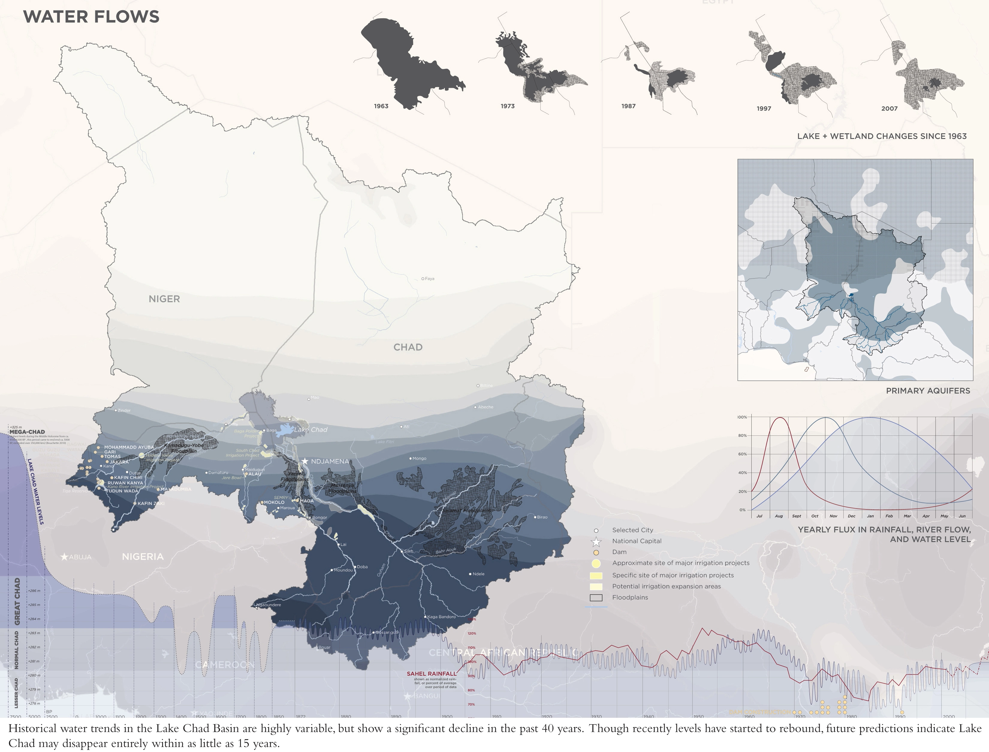
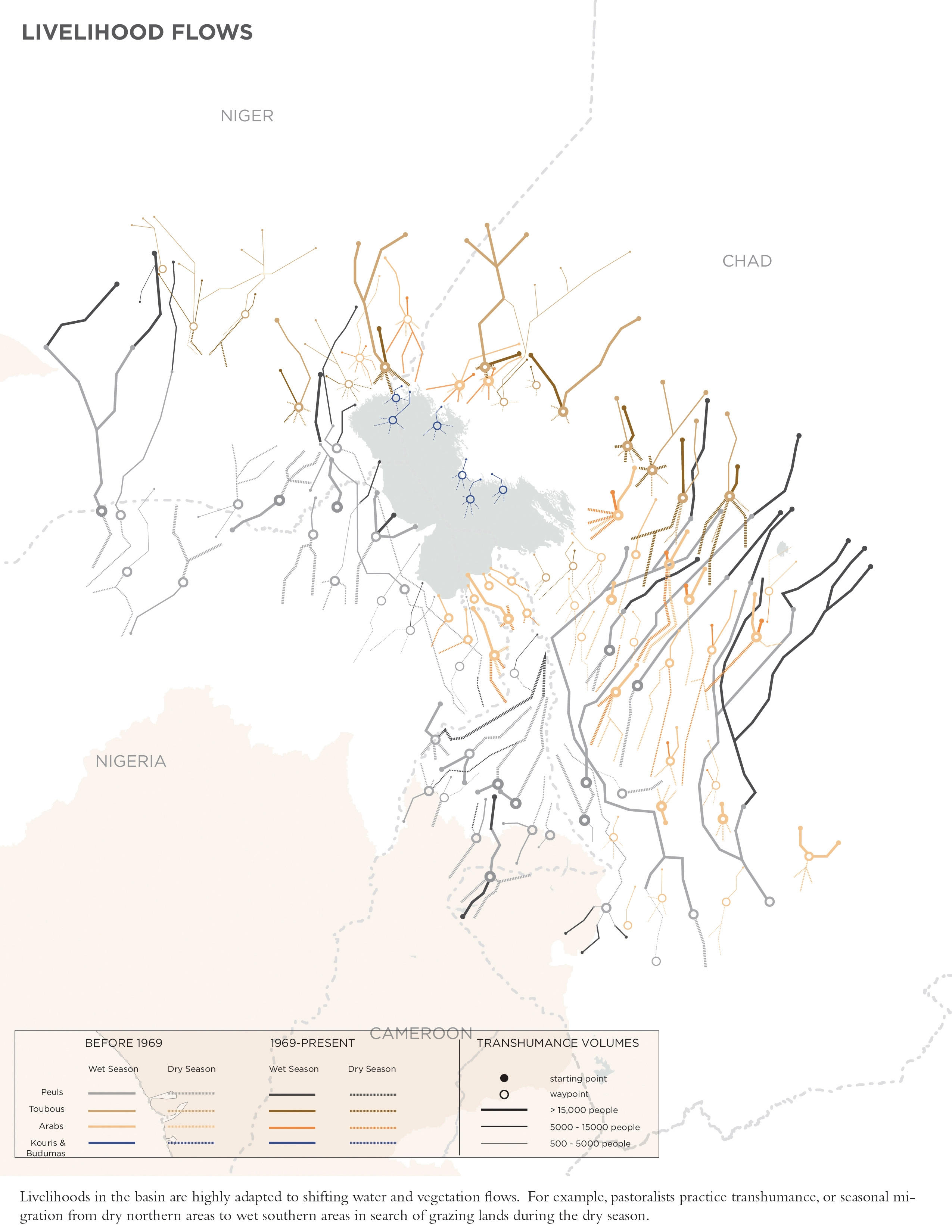
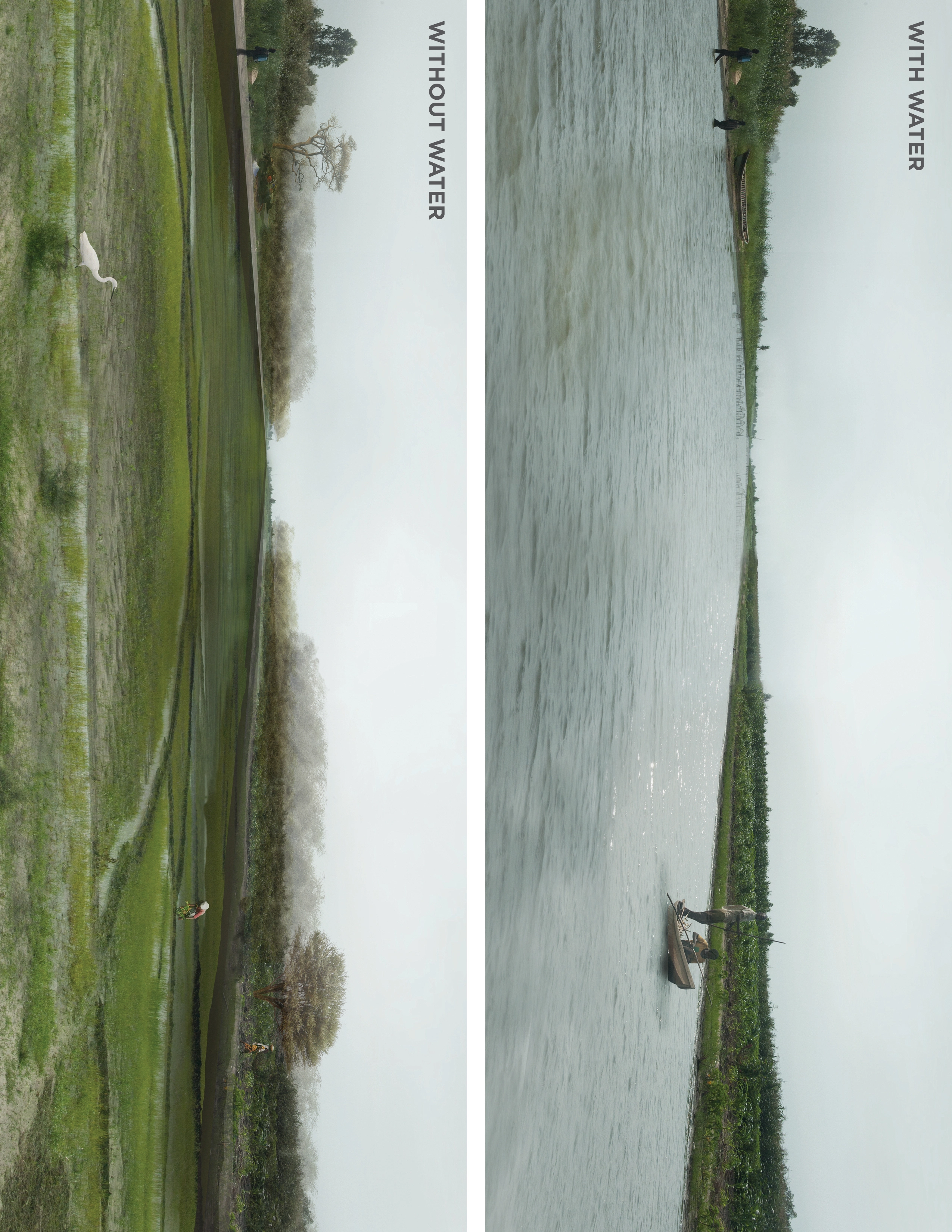
The landscape of the Lake Chad Basin is constantly changing due to the shifting availability of water. Historical water trends are highly variable but show a significant decline in the past 40 years. Though recently levels have started to rebound, future predictions indicate Lake Chad may disappear entirely within as little as 15 years. Livelihoods in the basin are highly adapted to shifting water and vegetation flows. Pastoralists practice transhumance, or seasonal migration from dry northern areas to wet southern areas in search of grazing lands during the dry season. Farmers practice rotational and recessional agriculture—adapting their crop locations and cycles to water and nutrient availability. The ability of basin farmers and pastoralists to sustain themselves under spatially and temporally unpredictable rainfall conditions testifies to the resilience of their techniques. Large-scale irrigation projects stand in sharp contrast to the flexible, micro-scale pastoralist and farming techniques employed in the basin. In the case of the Baga Polder project in northern Nigeria, the lake receded past the point of the intake channel two years after construction—rendering the entire project useless.
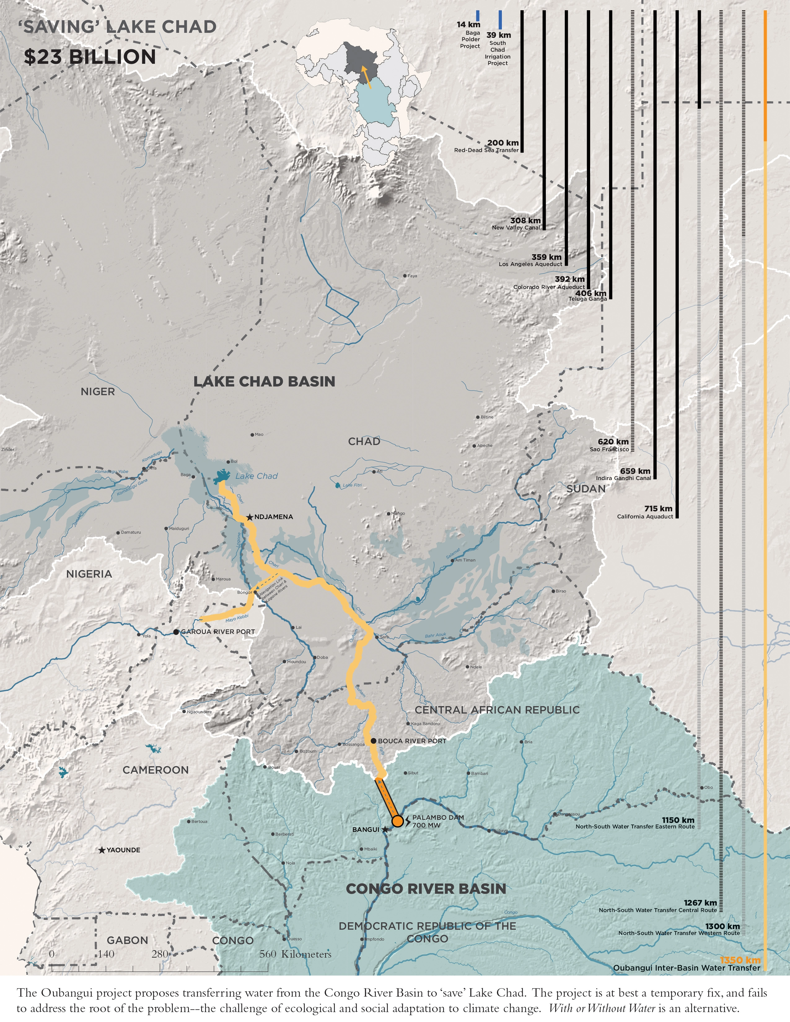
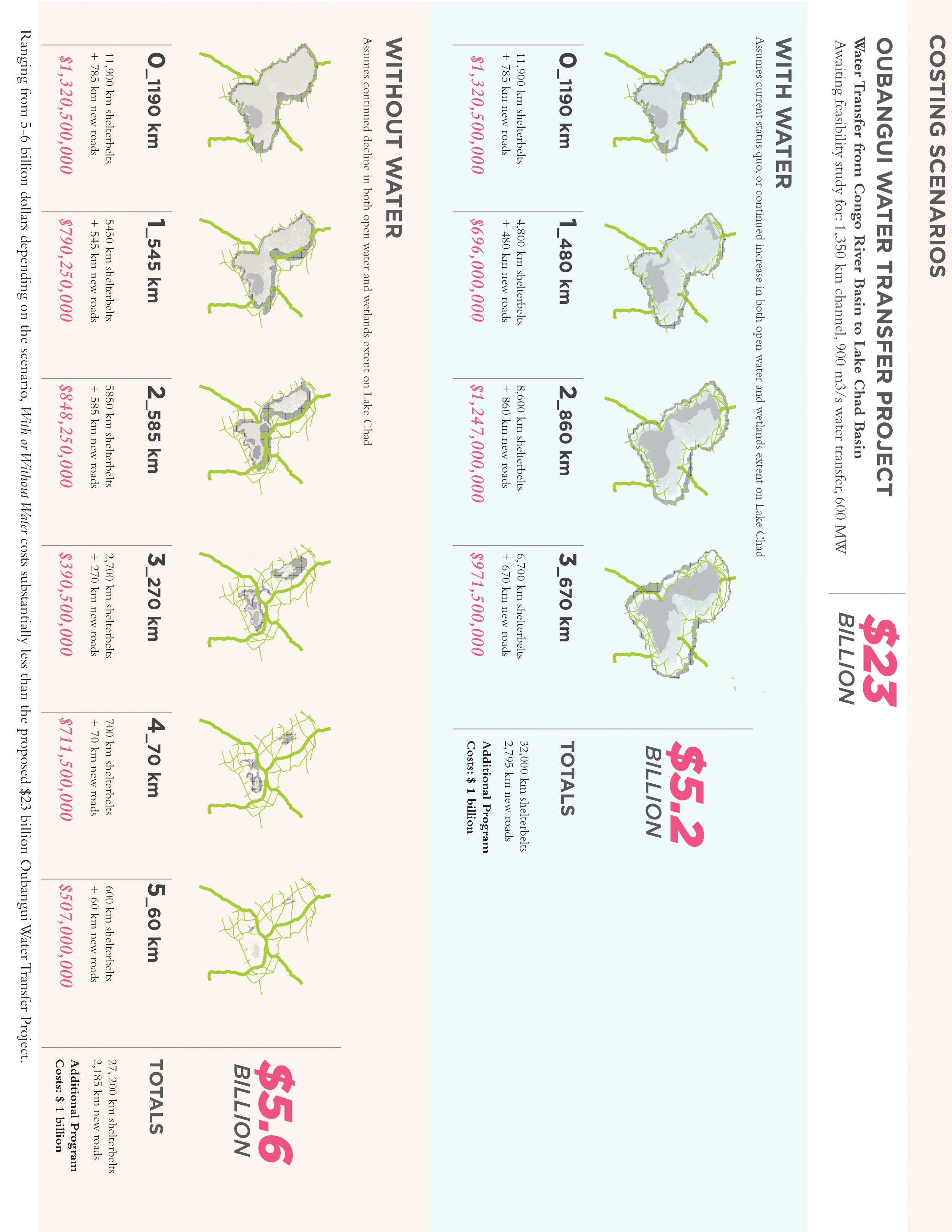
The Lake Chad Basin Commission is currently exploring ways to 'save' the Lake. The most dramatic of these projects, the $23 billion dollar Oubangui Water Transfer Project proposes to transfer water 1350km from the Congo River Basin in the Central African Republic to the Chari River in Chad, which feeds Lake Chad. The Oubangui Water Transfer Project would at best be a temporary fix, and fails to address the root of the problem—the challenge of adapting ecological and social systems to climate change.
Framework
This work does not try to 'save' Lake Chad. The combination of an increasing population, a legacy of poor water management practices, and climatic pressures likely mean it is too late to do so. Instead of wasting the growing drive of both local and international communities to 'save the lake' on another large-scale water infrastructure project doomed to failure, this work proposes an adaptive infrastructural scaffold to build the resilience of ecosystems and populations to water scarcity and desertification.
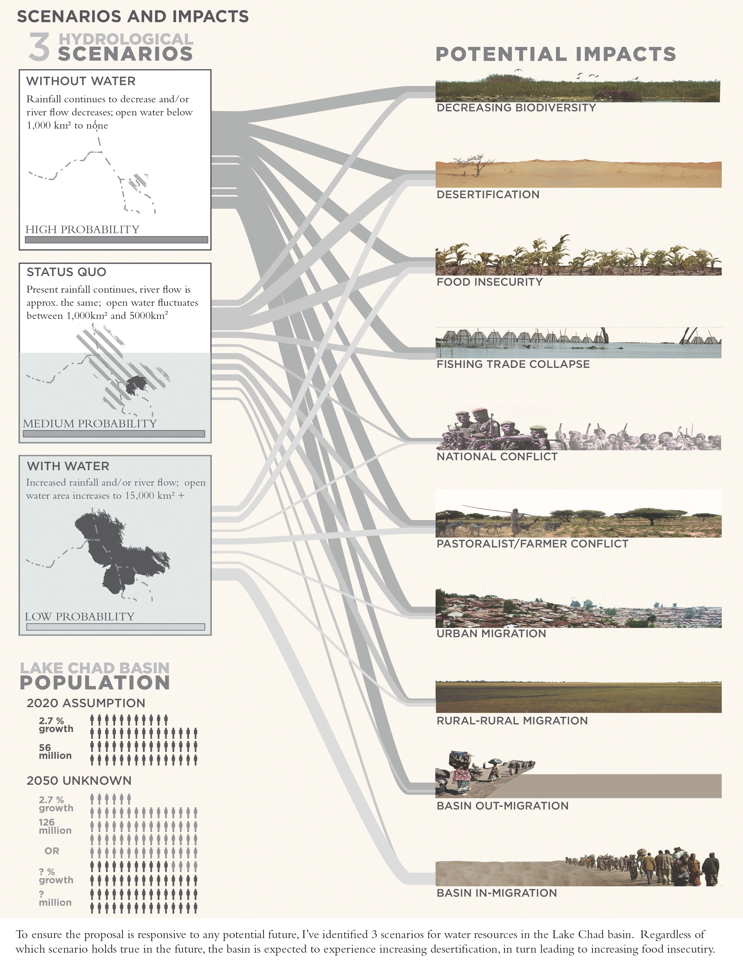
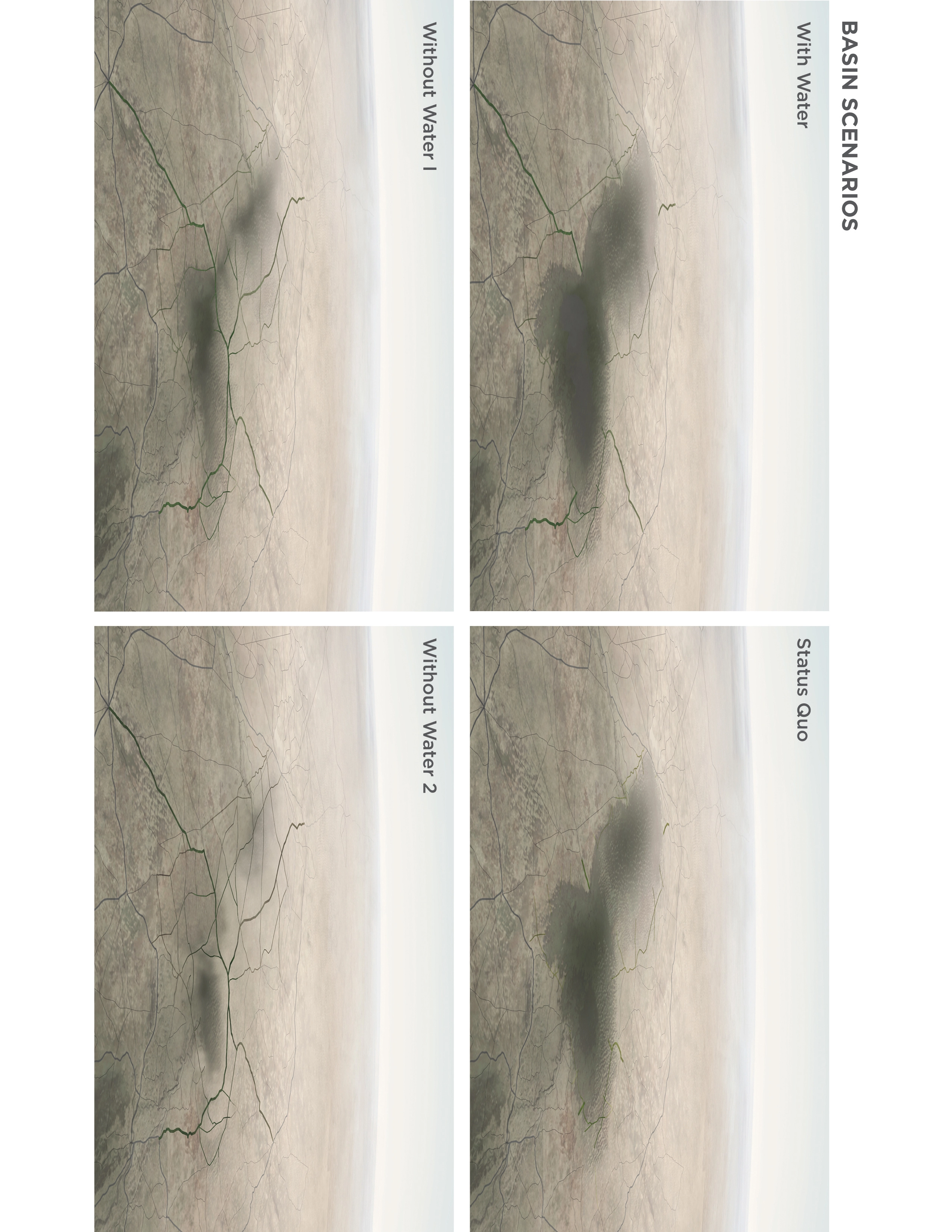
With or without water works at three different scales—the scale of the lake, the scale of the town, and the scale of the linear system. To ensure the proposal is responsive to any potential future, I've identified 3 scenarios for water resources in the Lake Chad basin: (1) with water, assumes an increase in lake levels; (2) status quo, assumes present day levels; and (3) without water assumes lake levels continue to decline. Regardless of which scenario holds true in the future, the basin is expected to experience increasing desertification, which in turn is likely to result in increasing food insecurity.
Technologies and Typologies
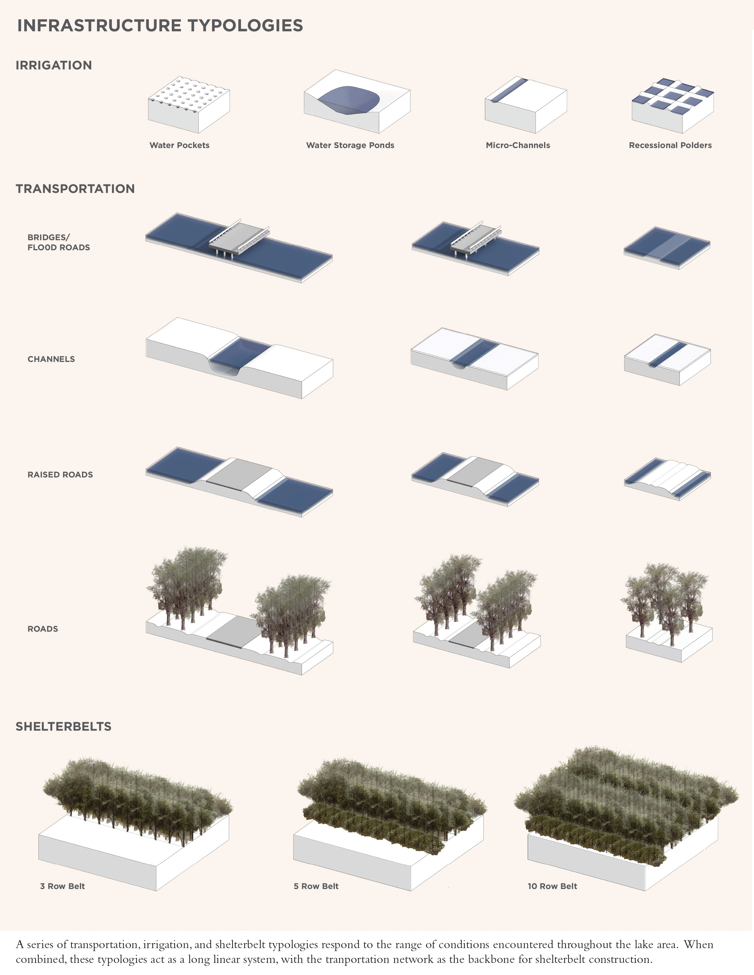
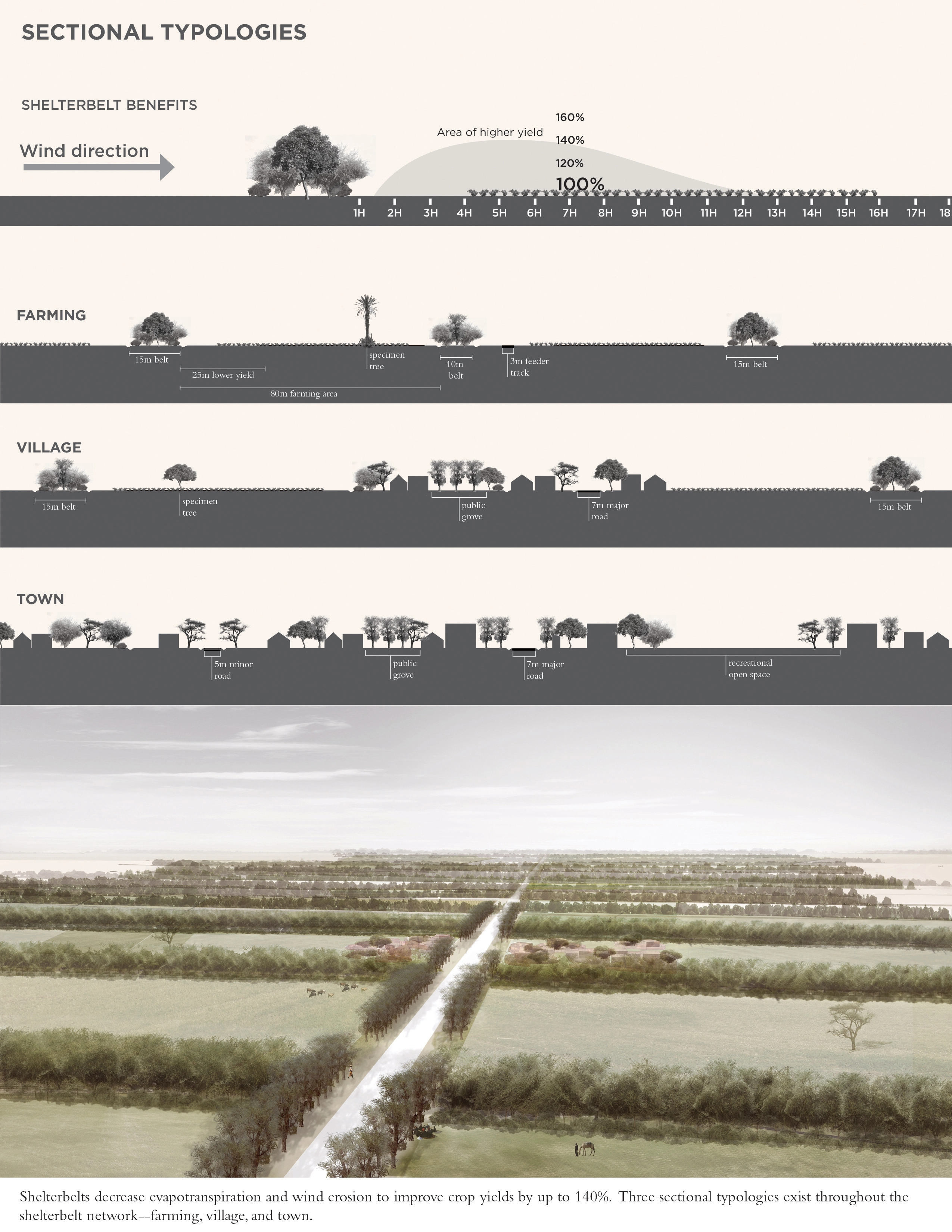
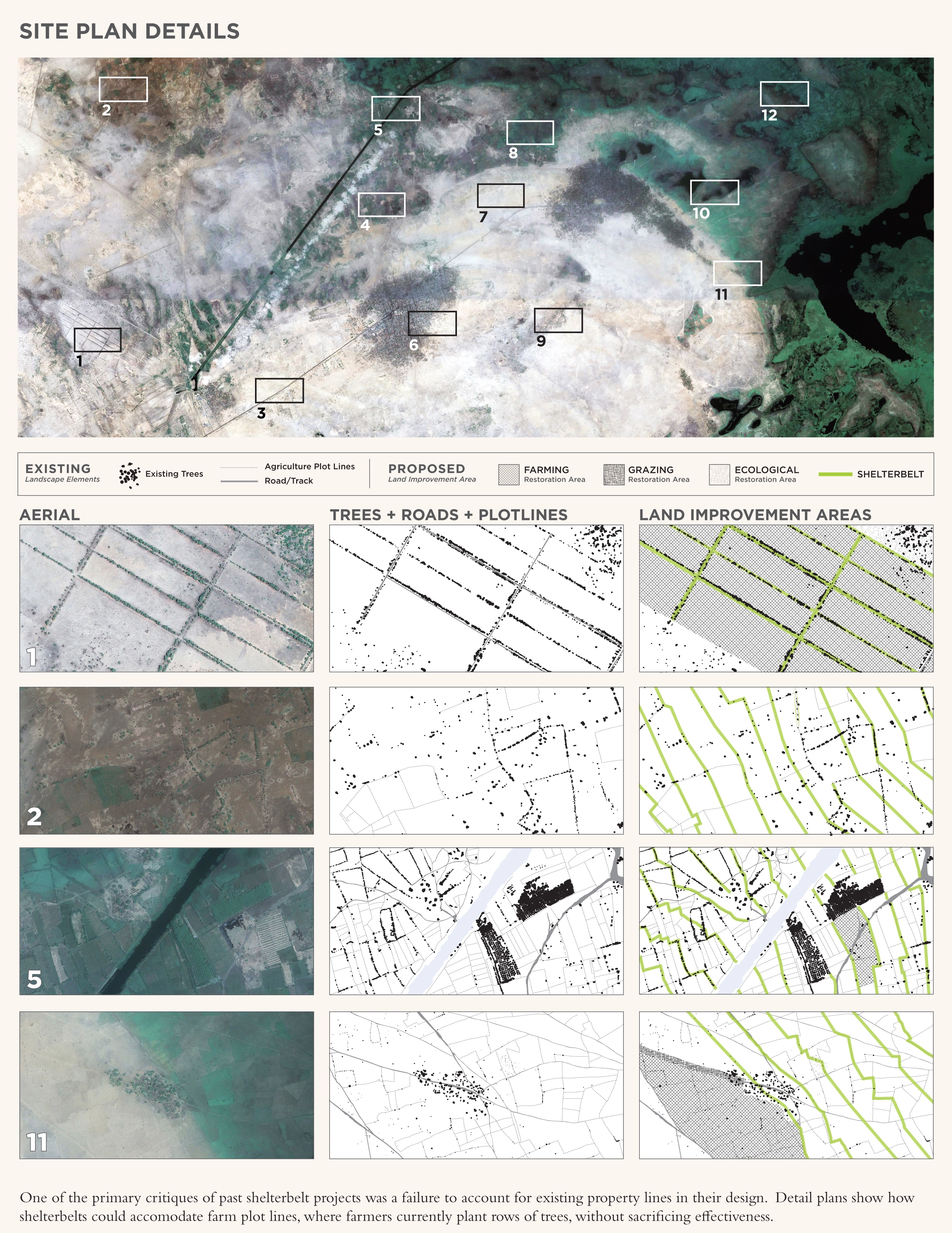
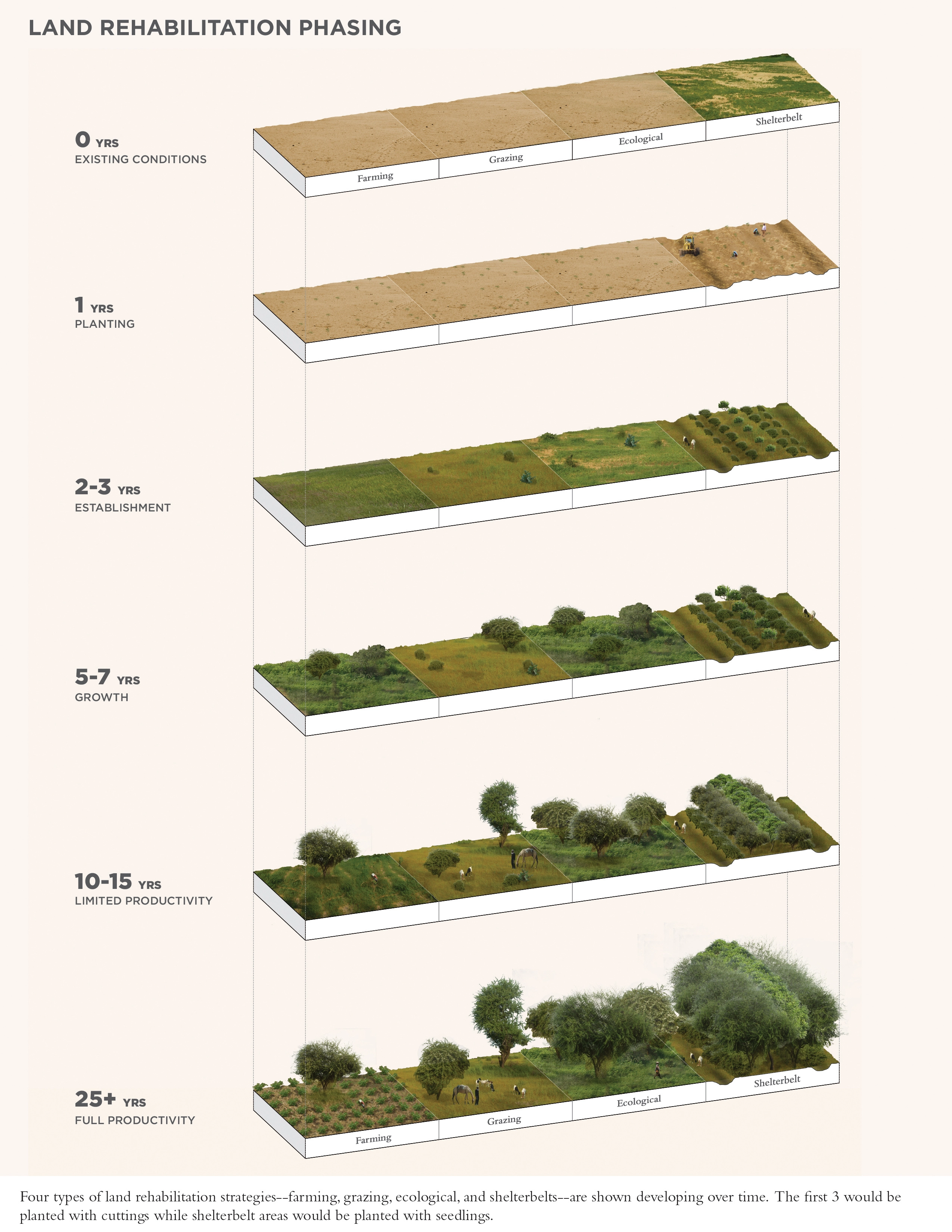
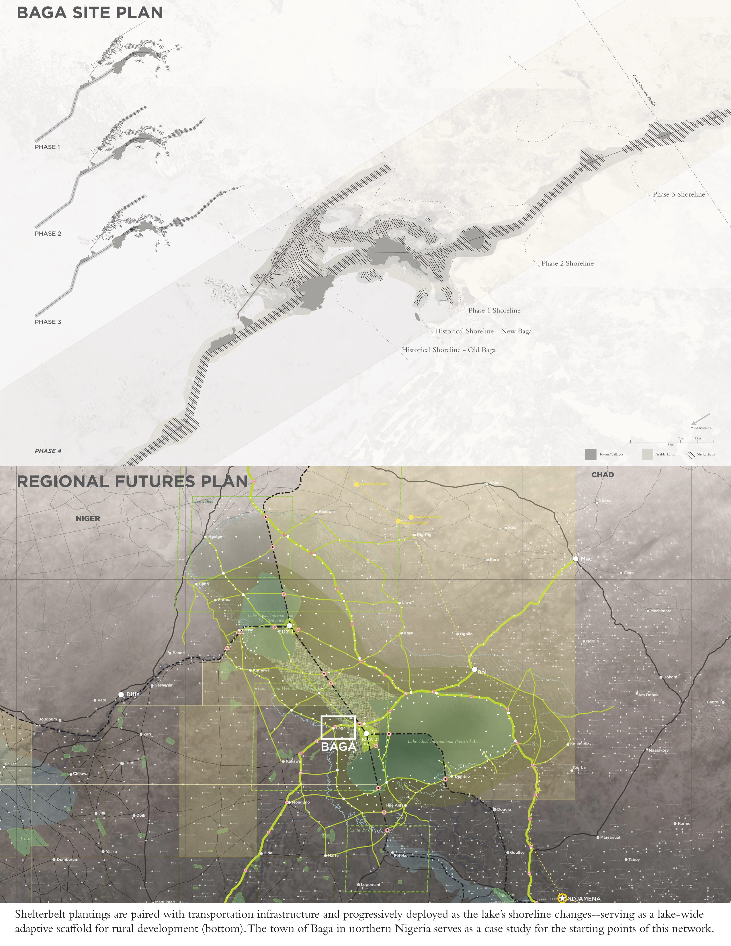
The primary technology currently employed to prevent desertification across the Sahel region of Africa is shelterbelts. Shelterbelts decrease evapotranspiration and wind erosion to improve crop yields by up to 140 percent. In the past a series of physical design and program flaws contributed to project failure. After studying these past projects, I applied a series of physical and program design lessons learned to develop a new methodology for planting shelterbelts in the Lake Chad Basin. Program design lessons learned include local participation in the design phases, as well as 50/50 partnership schemes on agro-product proceeds between local populations and project implementing agencies. In addition to basic orientation and spacing lessons learned, one of the most successful shelterbelt projects paired planting with road infrastructure to develop both simultaneously. Inspired by this model, my approach responds to two needs on the lake—the need for better transportation infrastructure and increased crop production.
A series of transportation, irrigation, and shelterbelt typologies respond to the range of conditions encountered throughout the lake area. When combined, these typologies act as a long linear system, with the transportation network as the backbone for shelterbelt construction. In plan, the shelterbelts expand and contract along the road based on village location and size. In section, the shelterbelts concentrate and disperse based on the condition in which they are located—rural farmland, small village, or town.
A Resilient Network
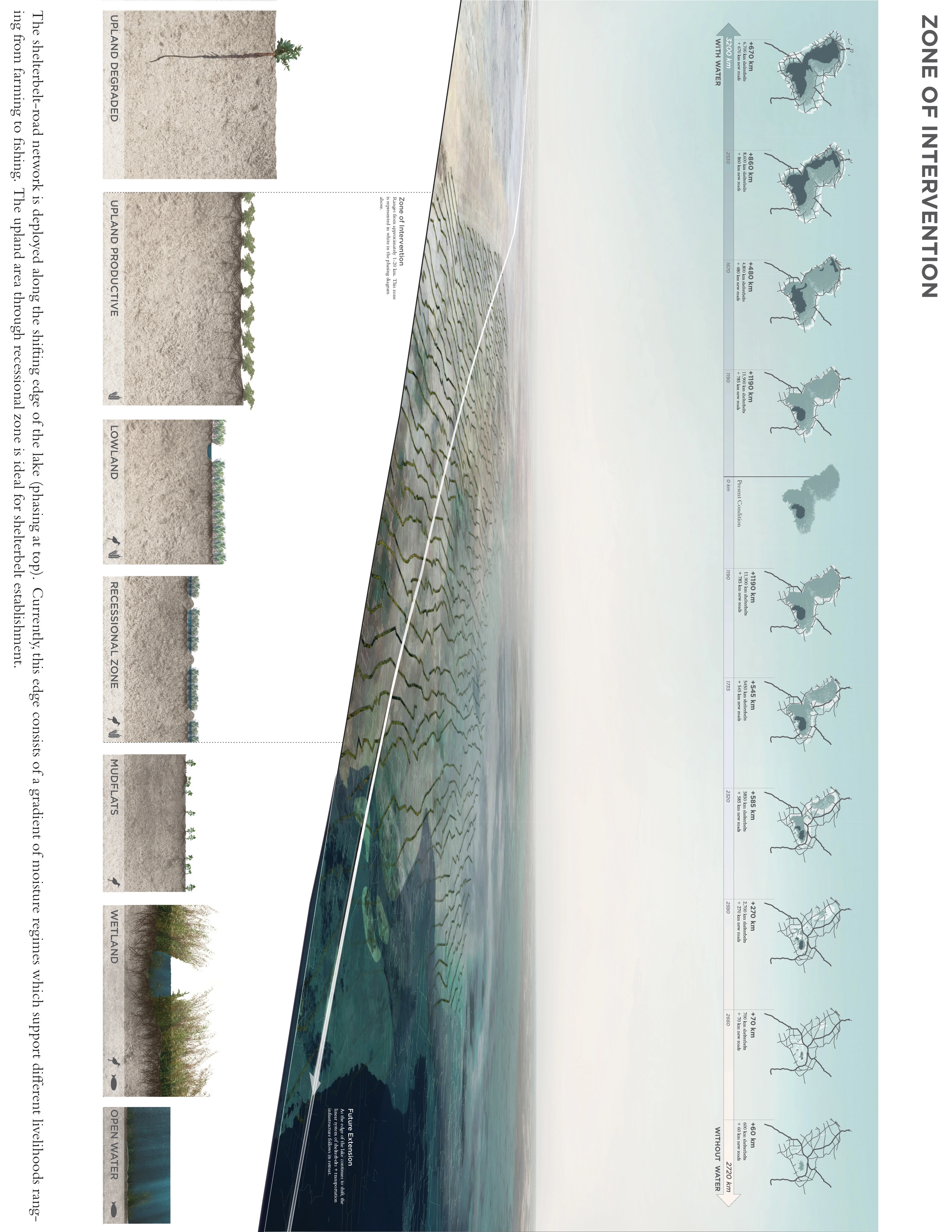
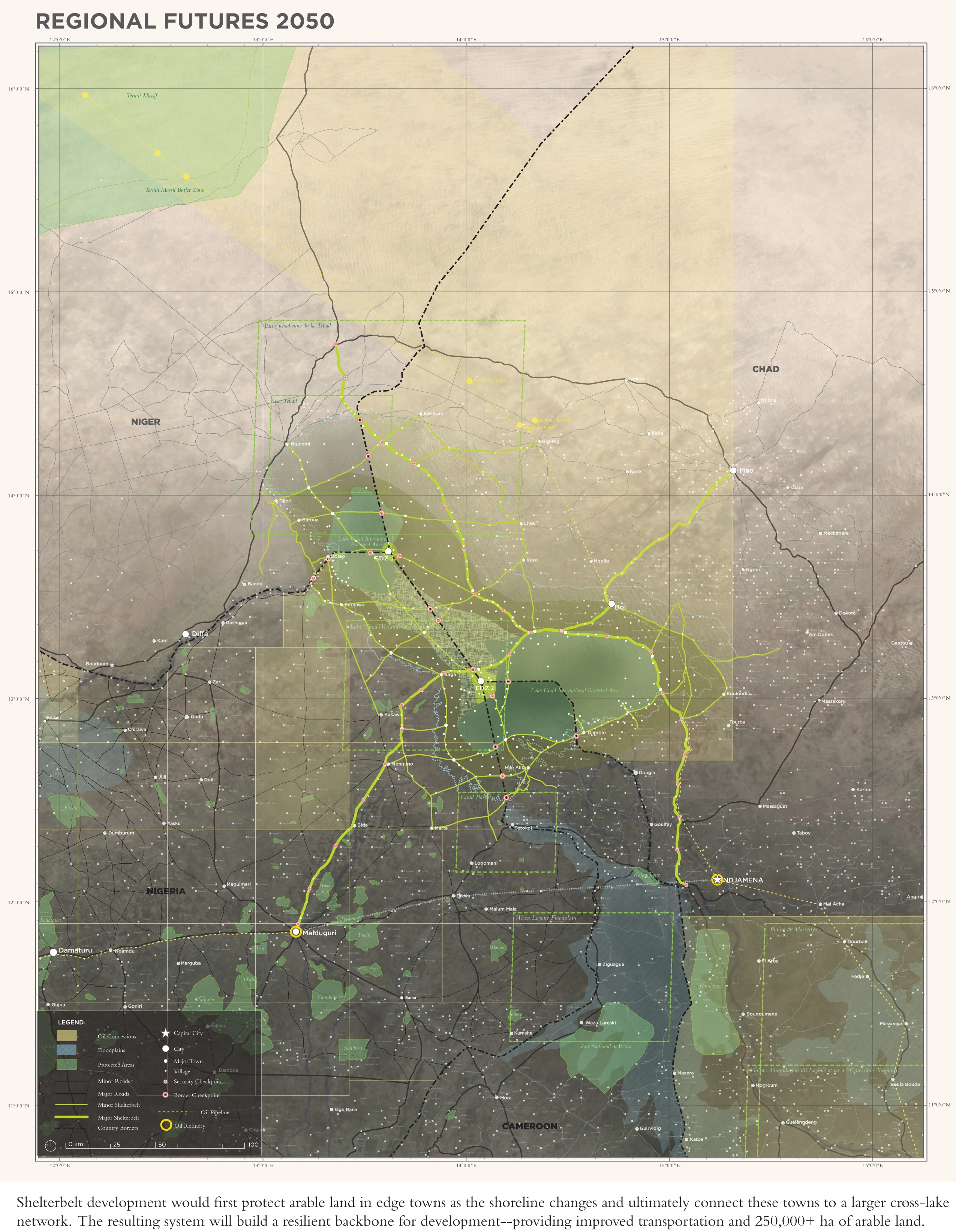
To deploy this joint shelterbelt and transportation system, I focused on the shifting edge of the lake moving in response to changing climatic conditions. Currently, this edge consists of a gradient of moisture regimes supporting different livelihoods ranging from farming to fishing. I've identified the upland area through the recessional zone, which fluctuates between approximately one and 20 km, as the ideal zone to establish shelterbelts due to good soil quality as well as sufficient water to establish seedlings.
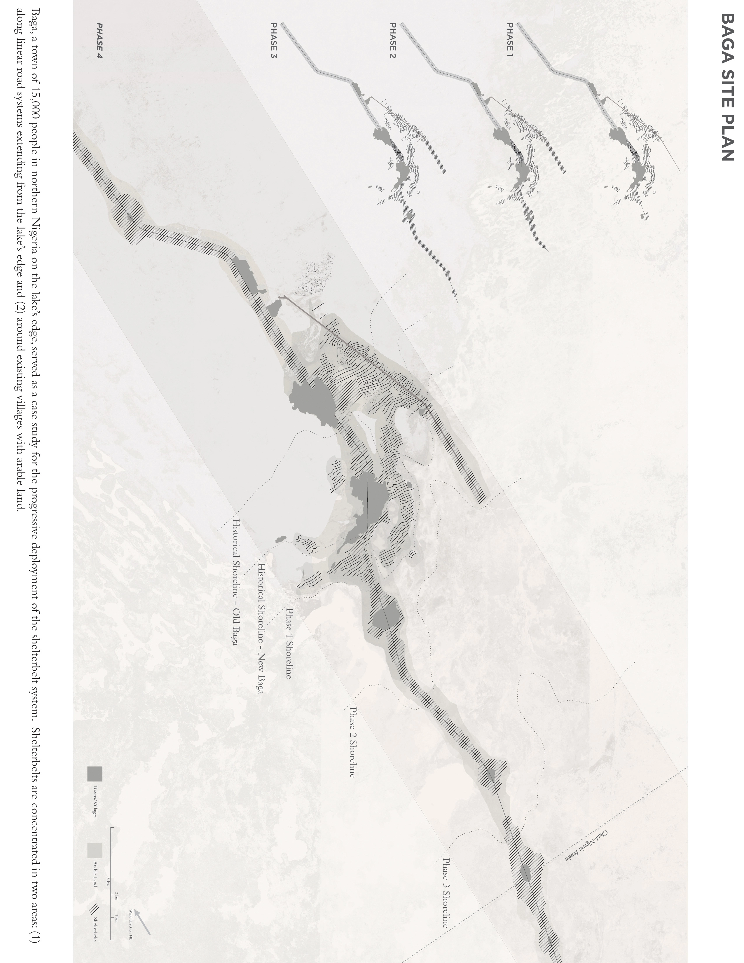
Baga, a town of 15,000 people in northern Nigeria on the lake's edge, served as a case study for the deployment of the shelterbelt system. The town has moved several times in the past to follow the lakes changing shoreline. One of the primary critiques of past shelterbelt projects was a failure to account for existing property lines in their design. In response to this, I looked at a series of conditions where shelterbelts could be established around Baga. I considered how shelterbelts could accommodate existing farm plot lines, where farmers currently plant rows of trees, without sacrificing too much effectiveness. Shelterbelts are concentrated in two areas: (1) along linear road systems extending from the lake's edge and (2) around existing villages with arable land. Though the community may no longer have access to water based resources, preventing future desertification before it can begin will build the resilience of local populations to the unpredictable climate of Lake Chad.
Shelterbelt development along this edge would first protect arable land in a series of edge towns, such as Baga, as the shoreline changes, and ultimately connect these towns to a larger cross-lake network. The system is designed to grow outward in the with water scenario, and then grown inward to form a larger basin network in the without water scenario. I anticipate migration to the lake might increase as a result, spawning new villages and towns along this backbone. The network can also serve as a scaffold for new economies—ranging from the emerging oil industry to solar fields and climate change research and development initiatives. Better access throughout the lake will also assist implementing agencies in monitoring both ecological and security developments on the lake at designated checkpoints. Most importantly, the system would provide these benefits regardless of future lake levels.
The resulting network of shelterbelt-road systems across the basin will provide a solid backbone for development, providing 250,000+ ha of arable land and access to local and regional markets, healthcare, and education. This work envisions a resilient future for the populations living in the Lake Chad Basin—with or without water.
-
Many thanks to Christian Werthmann for his invaluable advice, dedication to teaching and support for this thesis.
A special thank you as well to the University of Maiduguri Department of Forestry and Wildlife, in particular department head Dr. Adeogun, for his generous hospitality and wonderful insights during my stay in Nigeria.
To Sambo Garba, for fascinating conversations and endless gigabytes of GIS data.
To Nicholas Bonard, for many enlightening discussions, assistance in budget analysis and unwavering support.
To Michael Hooper, Pierre Bélanger, ASLA, and John Briscoe, for their expertise and advice throught the thesis process.
Advertisement
Related Awards
Award of Excellence, ANALYSIS AND PLANNING
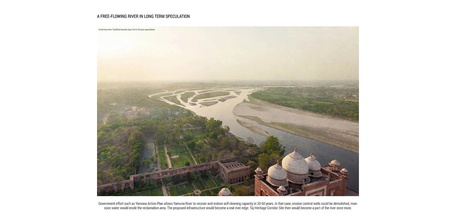
Rethinking Taj Heritage Corridor: A River as Historic Connection
Locates between Taj Mahal and Agra Fort, this proposal on Taj Heritage Corridor aims to reestablish the image of riverfront that was destroyed during the problematic reclamation project in 2002-2003. By creating a recreational water treatment canal along the original river bank, a landscape urban infrastructure is proposed to visually connect the city's scattered historic riverfront monuments and create public space for both tourists and local community. With a full respect of the silently mild image on Yamuna River in Agra, the design proposed an educational space that highlights the inherent dialogue between environment and history. Through analysis in different scales with the understanding of extreme site conditions, political background, and feasibility potentials, the design demonstrates the strong capacity of landscape intervention in resolving the complex contradiction between modernity and historic environment conservation.