.webp?language=en-US)


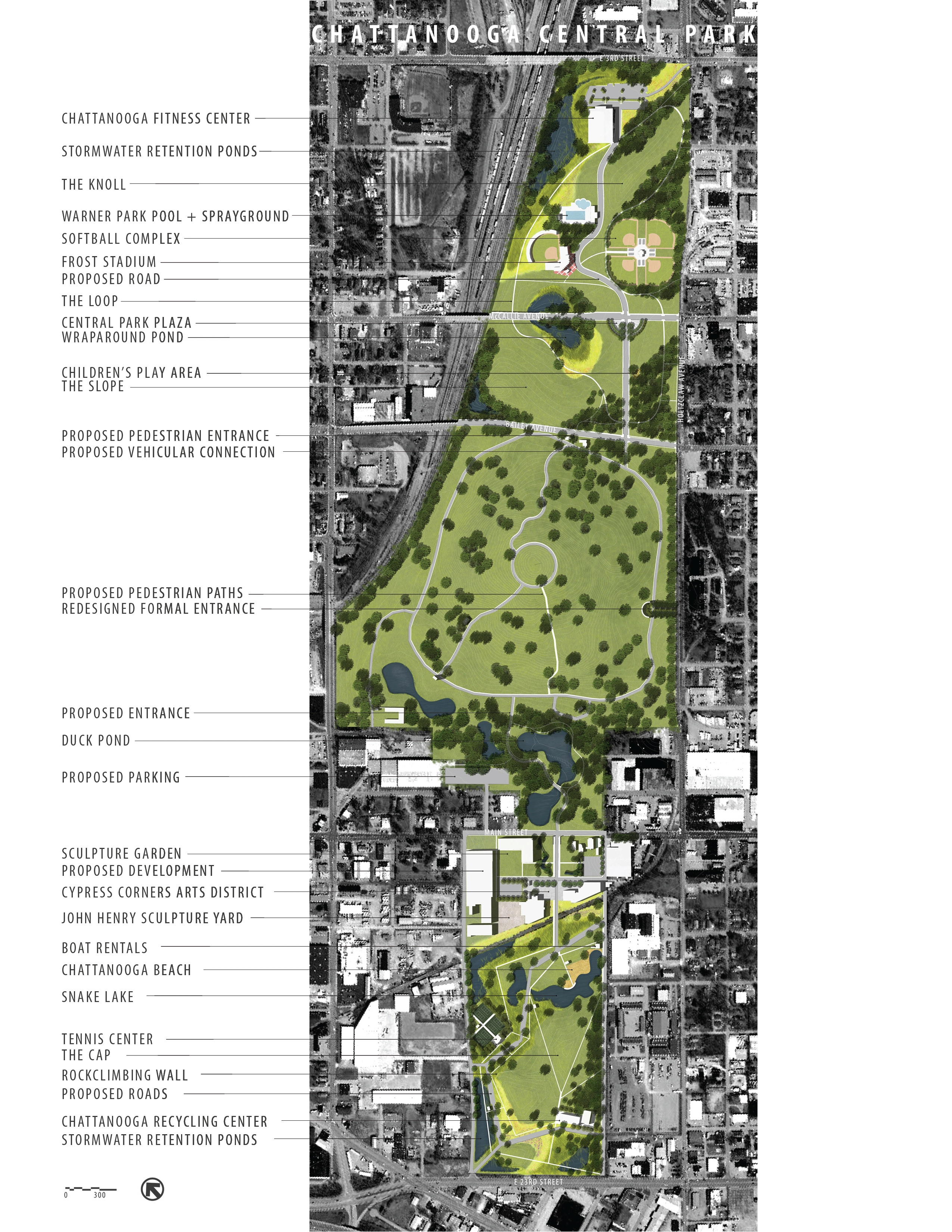
Chattanooga Central Park
Emily Bullock, ASLA; Jessica Carvajal, Student ASLA
The submission is a well-thought-out integration of three existing parks into a cohesive whole, noted the jury. The graphics are clearly presented and the comparison to Austin's park system adds to the convincing presentation.
Awards Jury
-
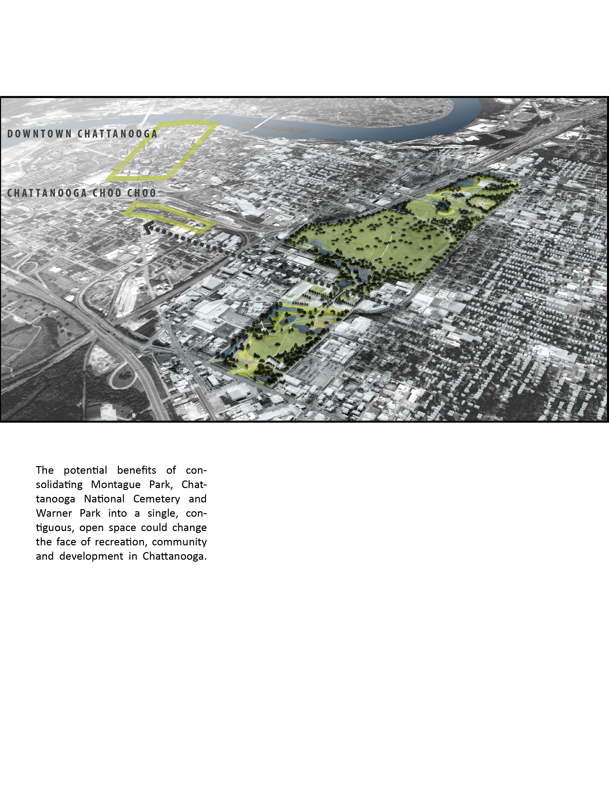
As a 275-acre swath of green in the geographic center of the city, Chattanooga Central Park creates a destination in an underserved area for all of Chattanooga to enjoy. By consolidating three existing, but underutilized open spaces, the new park system would activate the existing sites and the surrounding neighborhoods by providing diverse and flexible programming, establishing ecologically beneficial features and by creating development opportunities outside of the downtown district.
-
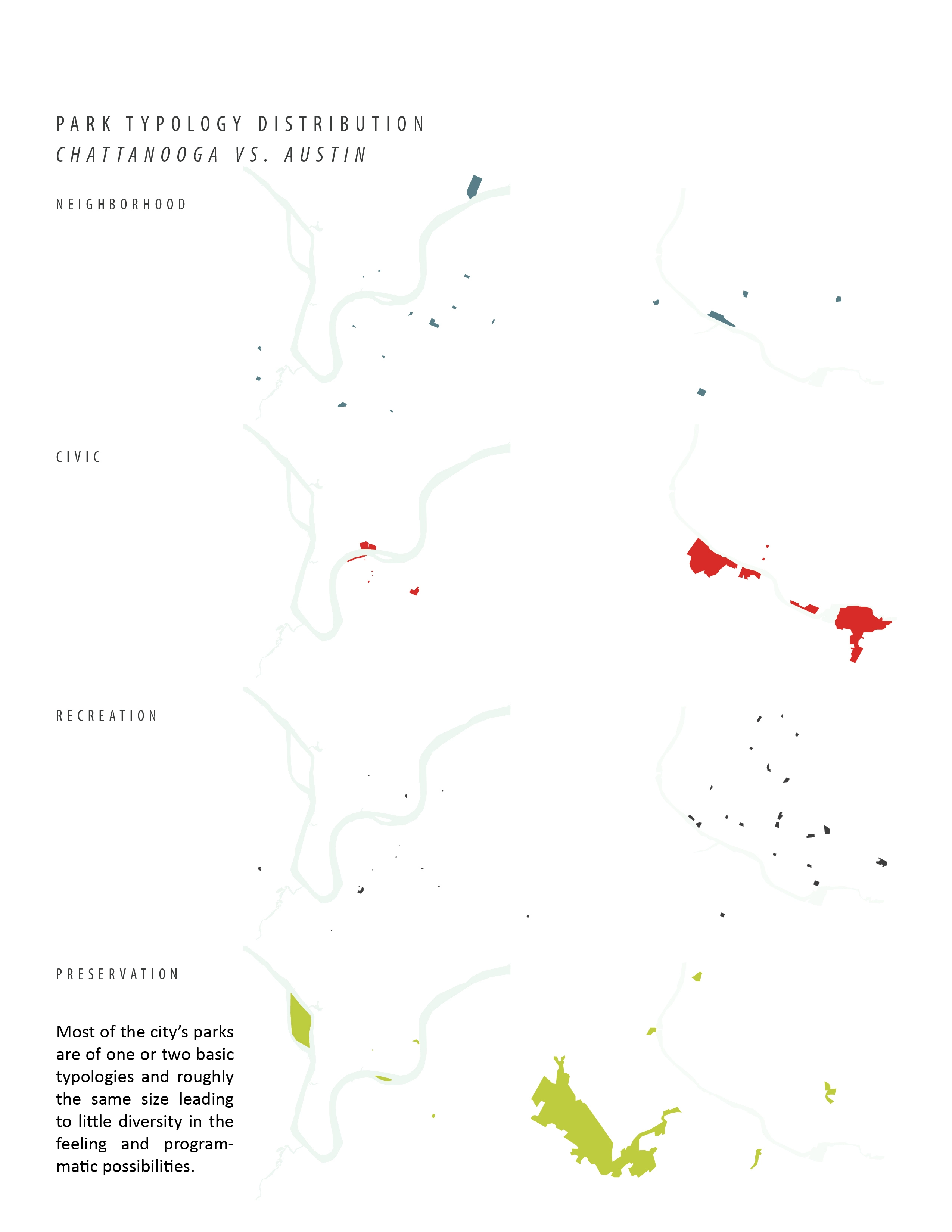
Theories on Open Space
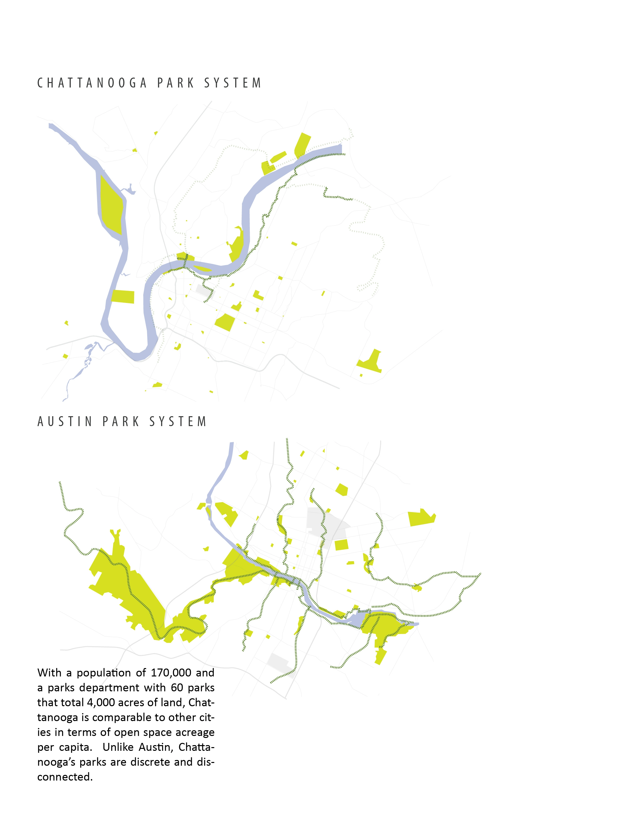
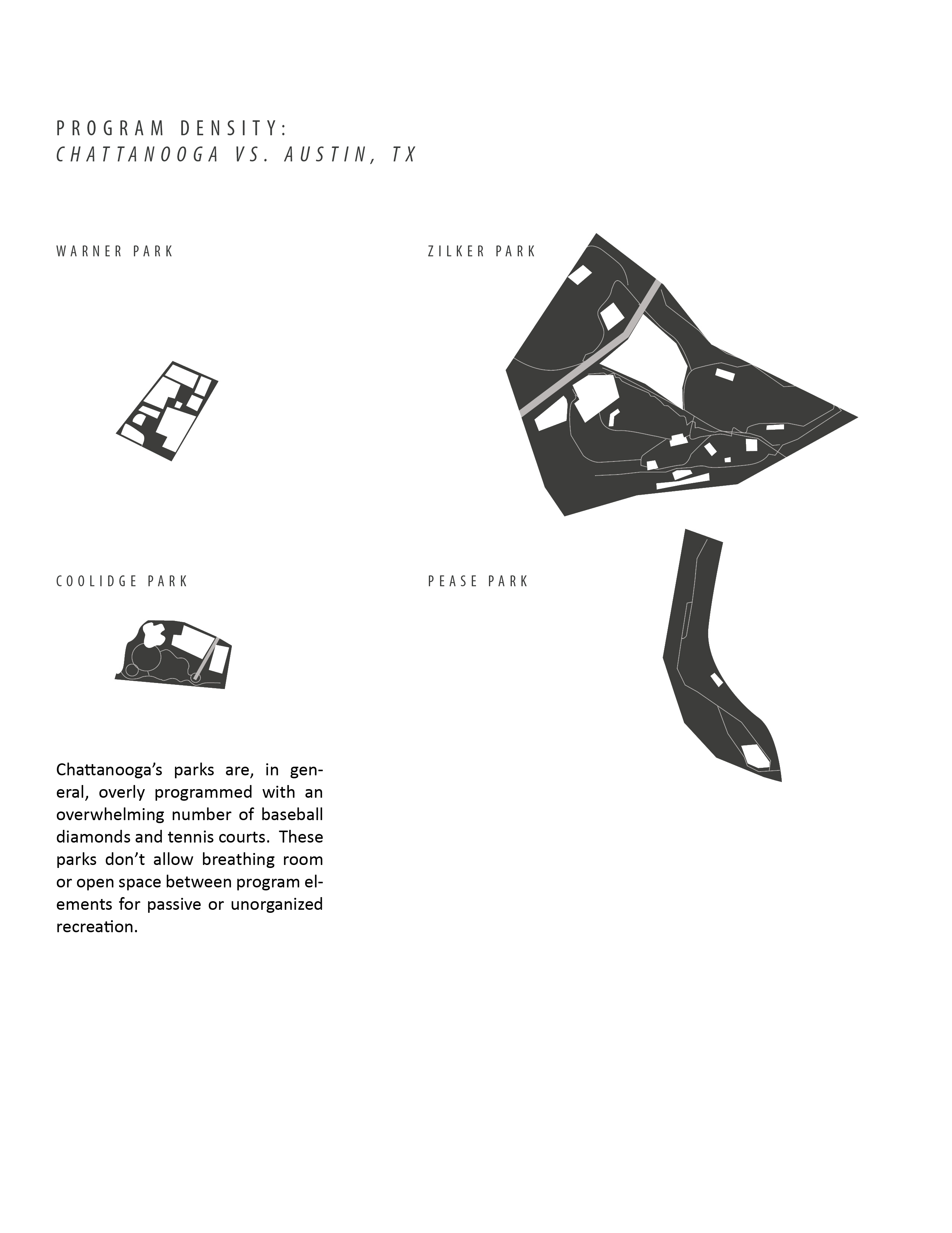
The current wisdom in open space planning purports that every household should be a 10–15 minute walk from a park. In this model, the resources of the community are spread out which can be financially and logistically problematic especially in difficult economic times. Alternatively, a large park observes several advantages over several smaller parks. These benefits can be classified as social, ecological and economic in nature. This proposal provides a green retreat within the densest area of town that allows for a wider range of uses and flexibility of program. The most important social function of a large park is its ability to connect people by creating a sense of community and citizenship. Large, contiguous open spaces facilitate wildlife movement and diverse habitat, stormwater management and mitigate the detrimental environmental impacts of urban life. The consolidation of open space and program in one location also allows for more cost effective maintenance regimes. The large park attracts new development opportunities and increases the value of surrounding properties. By creating a focal point around which the community unites, the large park takes on an identity of its own and fosters a network that will ensure its future through its stewardship.
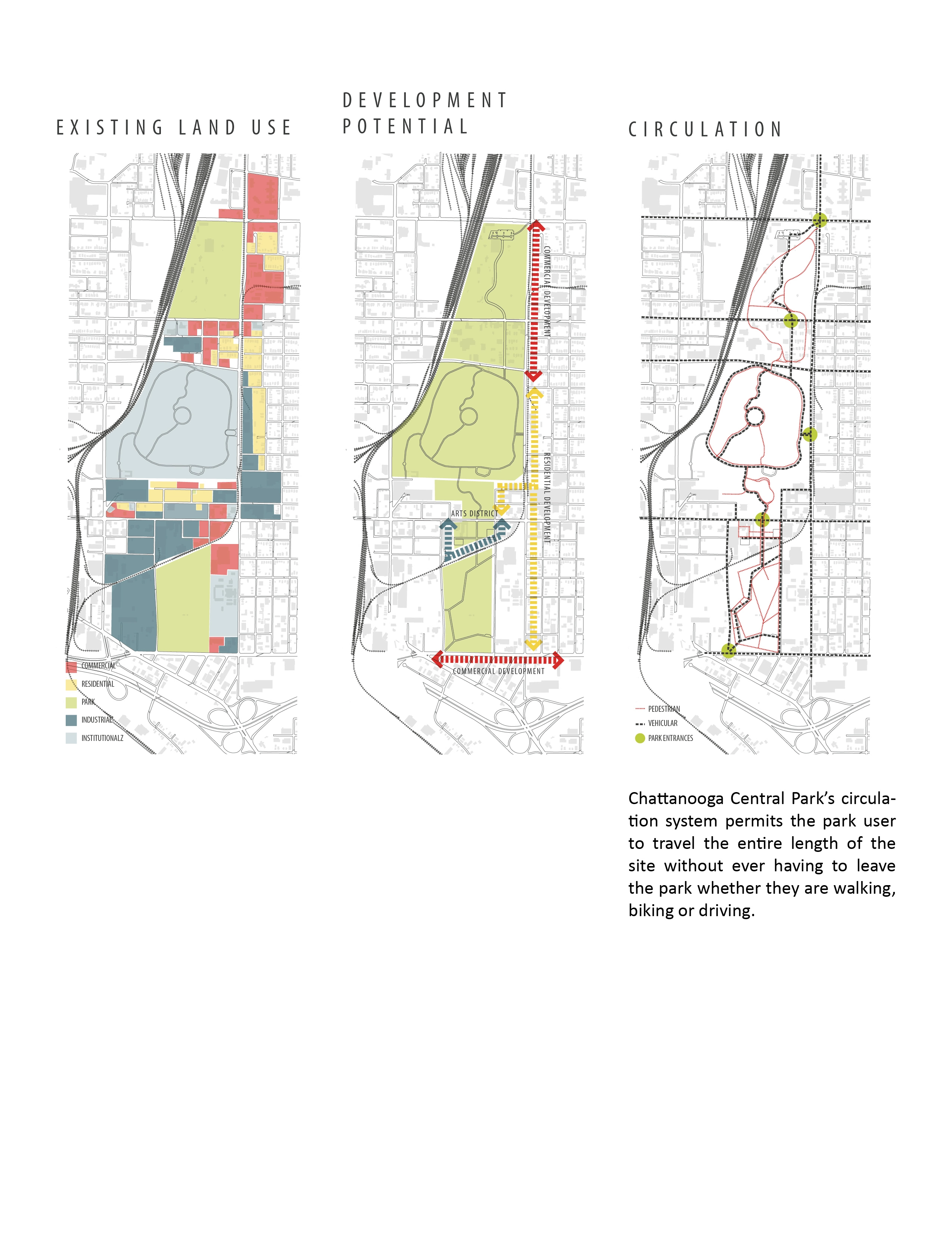
Existing Conditions
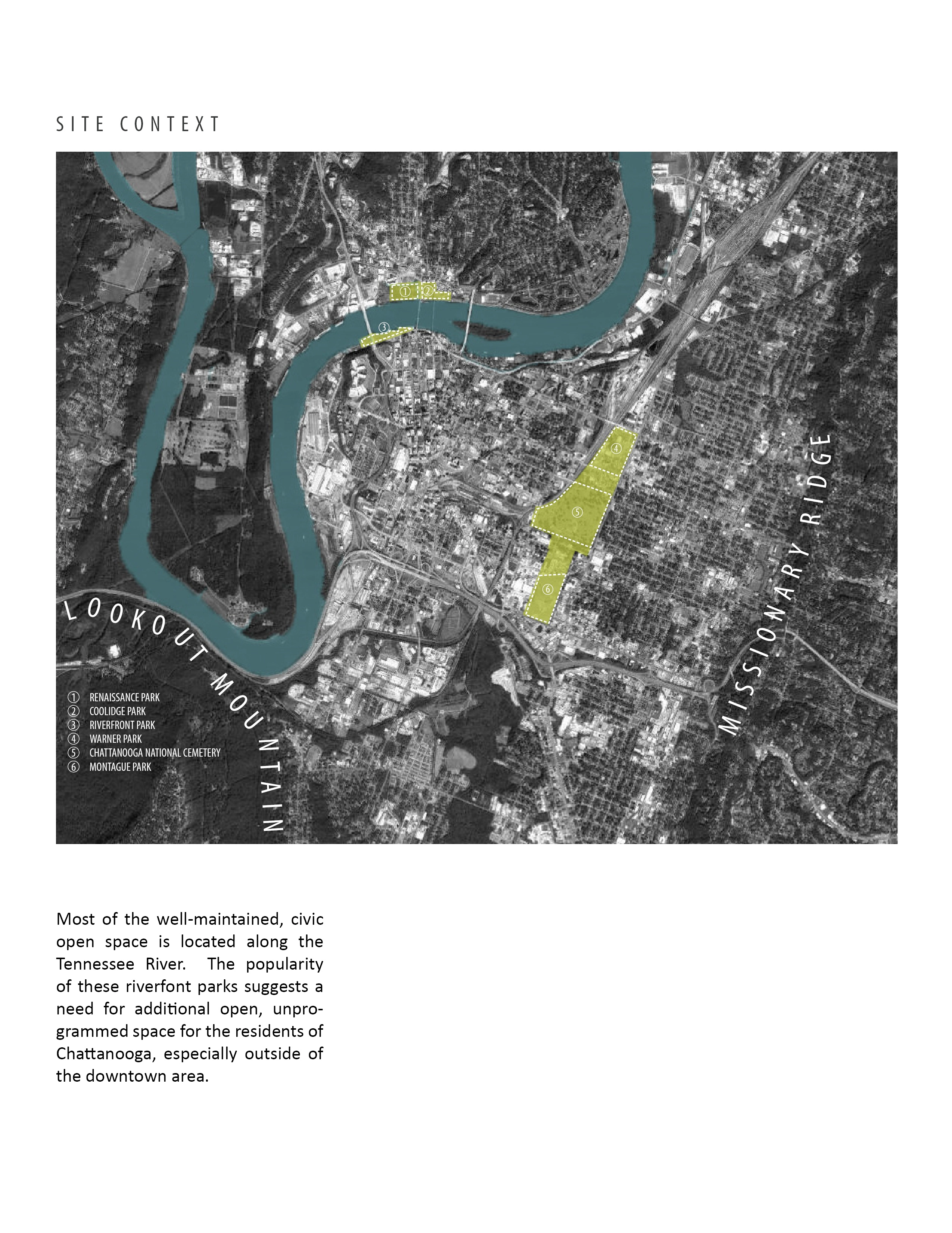
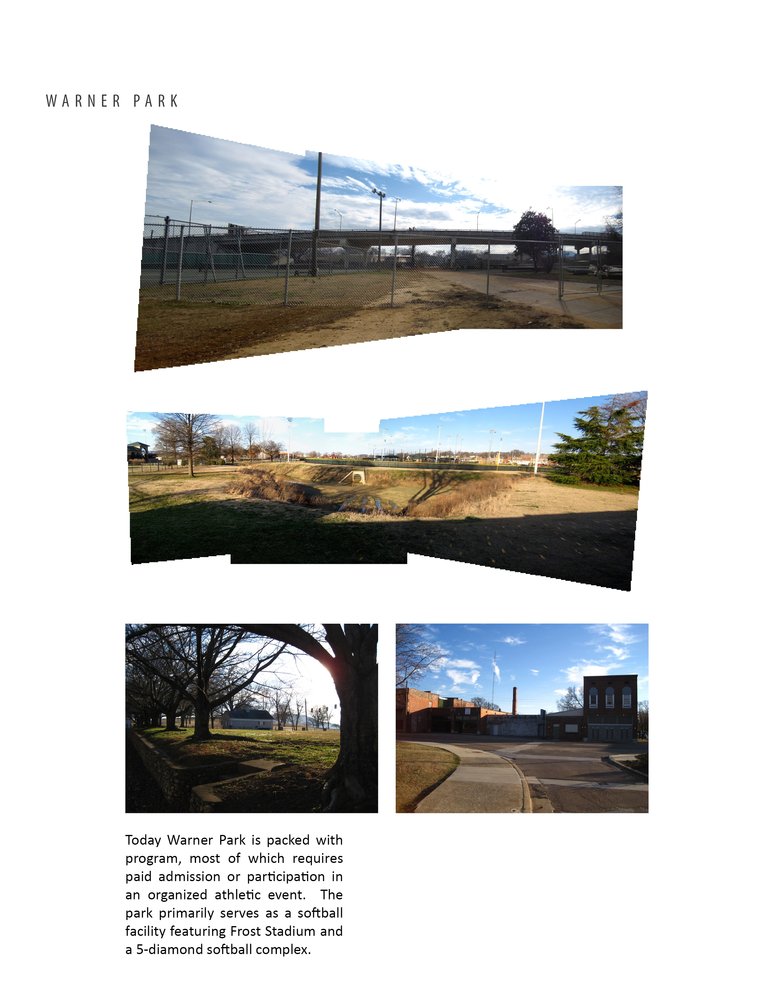
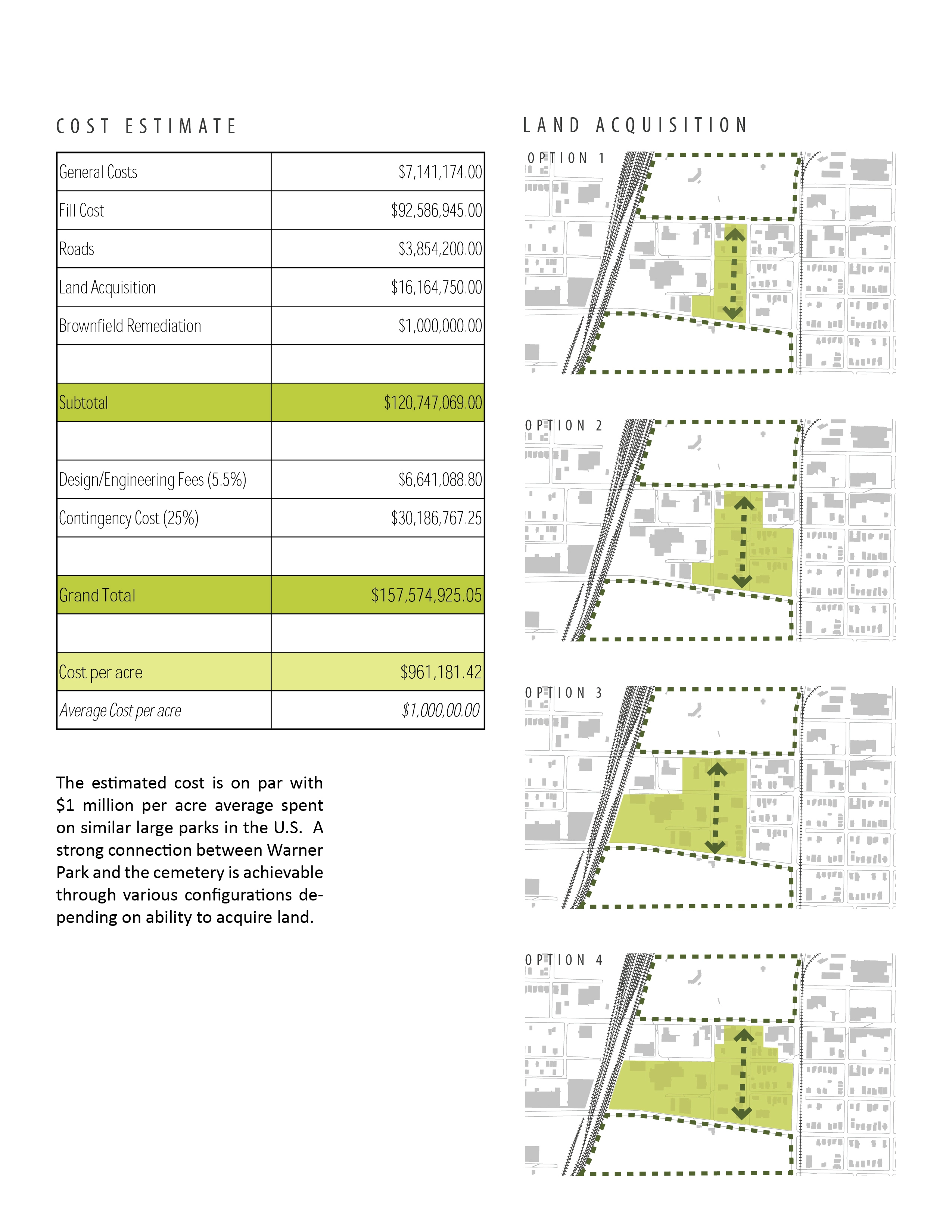
Warner Park is a 48-acre park to the north of Chattanooga National Cemetery that has a long and varied history as a site for recreation. Warner Park is now home to the Chattanooga Zoo which occupies 13 acres of the park and has recently come under investigation by the USDA for a series of animal deaths. Other amenities at the park include softball facilities, a fitness center, a pool and a city recycling center. Recent renovations to the park have added stormwater management infrastructure to help mitigate the overflow of stormwater into the sanitary sewer system during storm events. These facilities are located under several large parking lots and also take the form of three large, deep, detention basins that prevent access to large areas of the site. Warner Park lacks the feeling of a "park" because there are few open, unprogrammed spaces and the scenery is dominated by athletic facilities and hardscape. Warner Park is surrounded by commercial and light industrial operations. The area between Warner Park and the cemetery is a random assortment of commercial and residential uses with several large parking lots and vacant land.
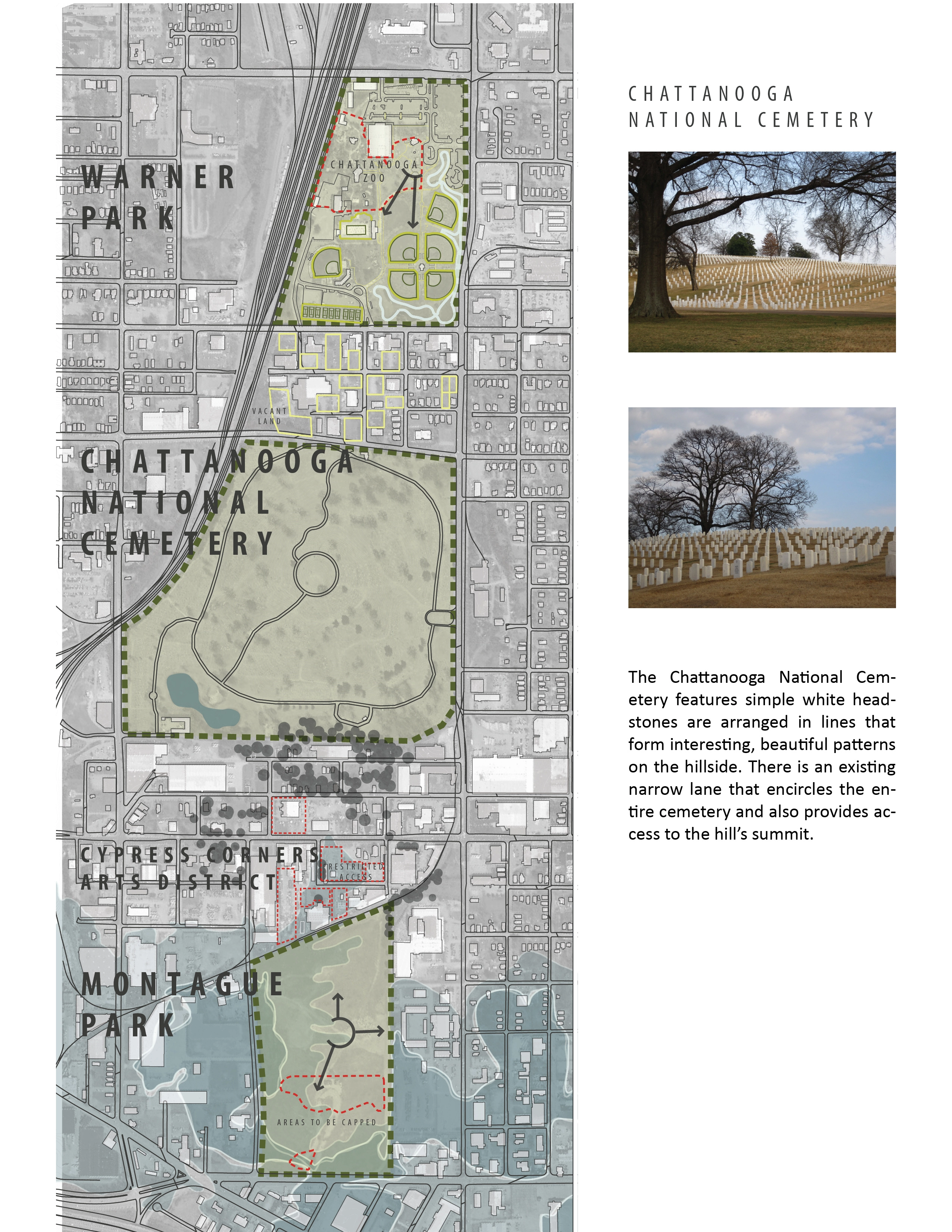
Chattanooga National Cemetery is a 112-acre site that was designated a cemetery after the Civil War. The site rises to a 100 feet in the center with picturesque views to Missionary Ridge, Lookout Mountain and the surrounding neighborhoods.
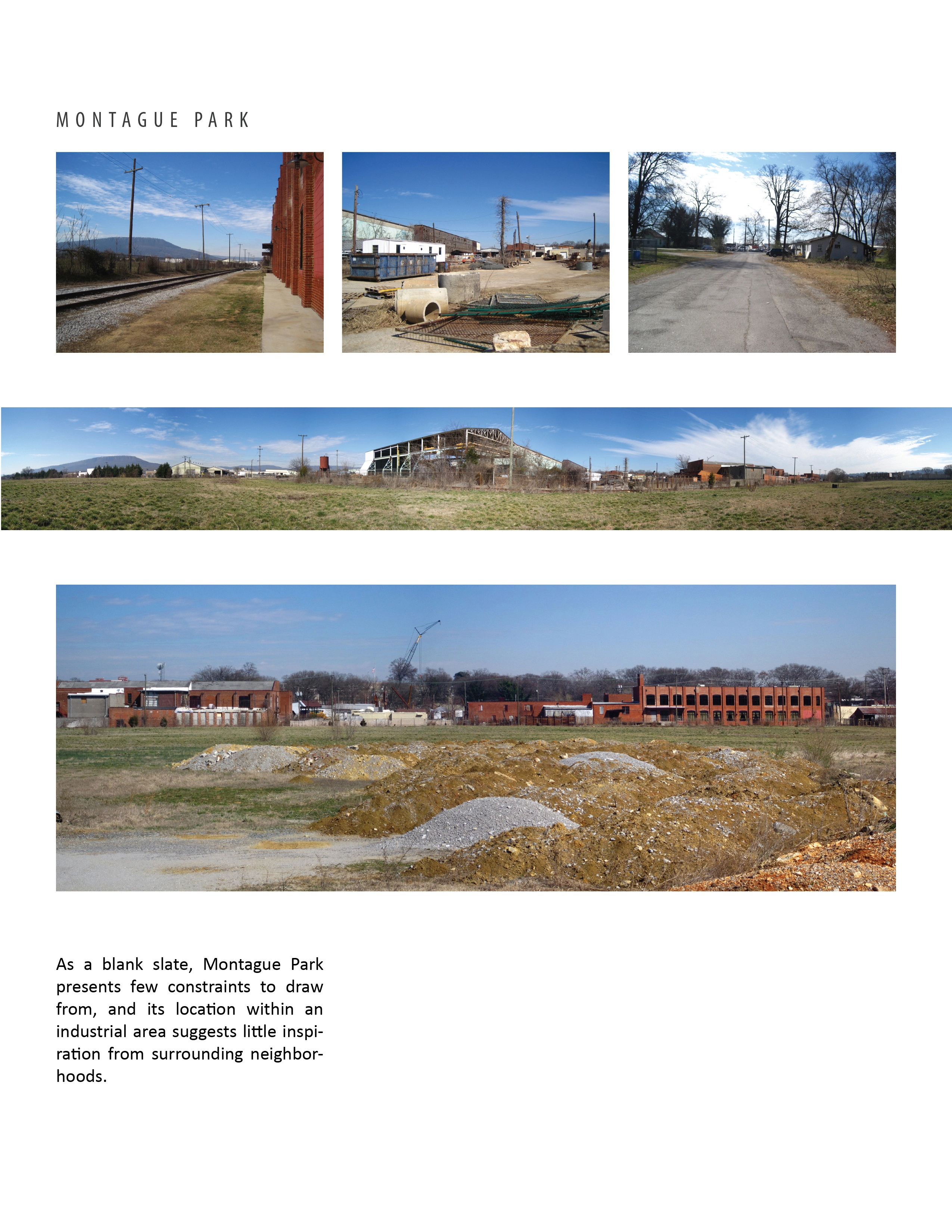
Until the mid-1960's, Montague Park operated as a landfill. From 1975, the 41-acre site existed as a softball park, but closed in 2003 because of leaking methane gas. Several acres of the site will require three feet of compacted soil for successful capping. Currently, the site contains little more than a single tree. It is relatively flat and the scale of the site combined with its openness leave the space completely undifferentiated. The northern edge of Montague Park is bounded by railroad tracks, just south of the Cypress Corners artist complex, industrial and commercial operations on Main Street and patches of residential use.
Challenges
While the proximity of the sites makes this proposal feasible, there are several challenges to uniting three sites with unique histories and site conditions. The primary challenge is to develop a single identity for Chattanooga Central Park while also creating interesting and varied experiences that address the different site conditions in each section of the park. Another concern that must be addressed are several streets that cut through the park and how to create safe crossings for park users as well as maintain the continuity of the parkland despite the street.
Design Solutions
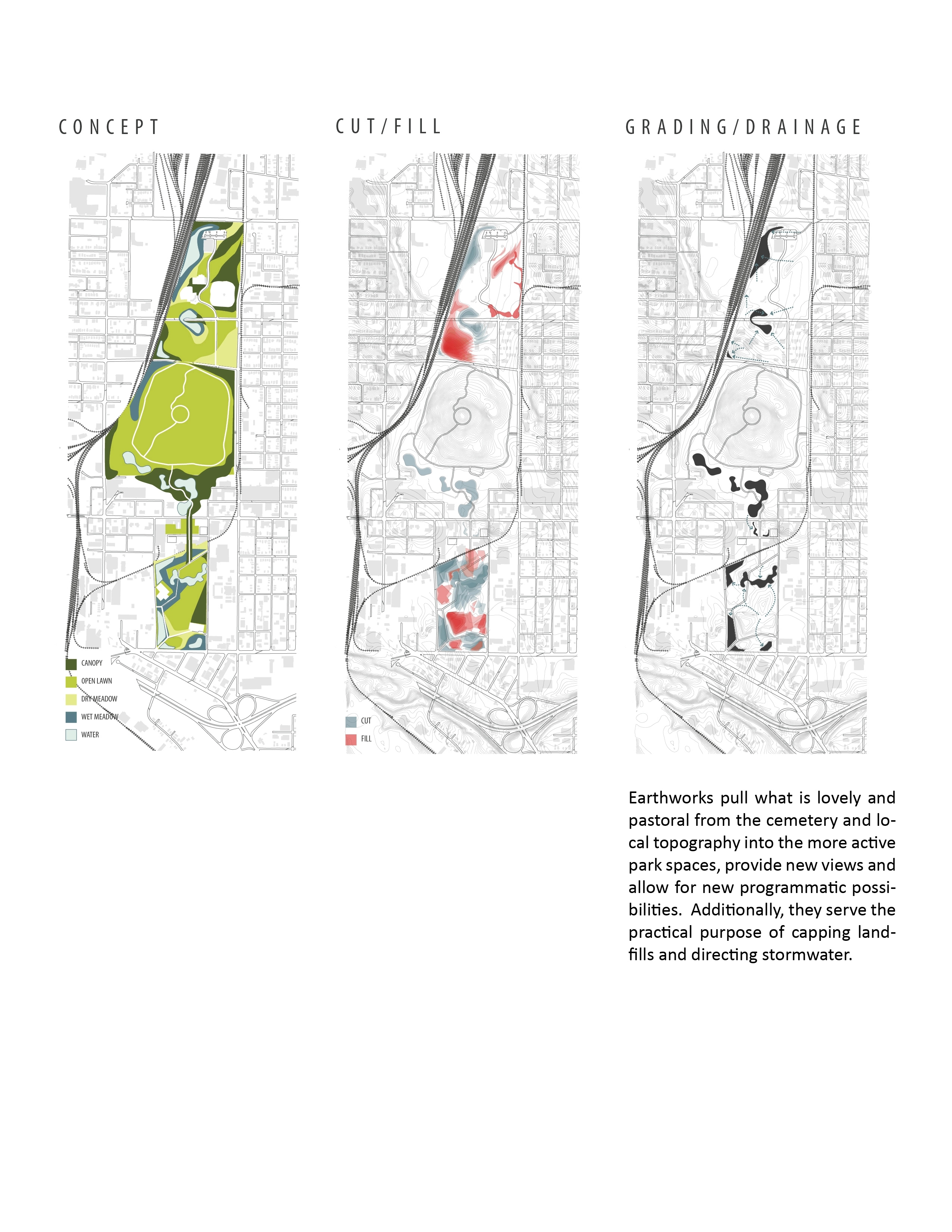
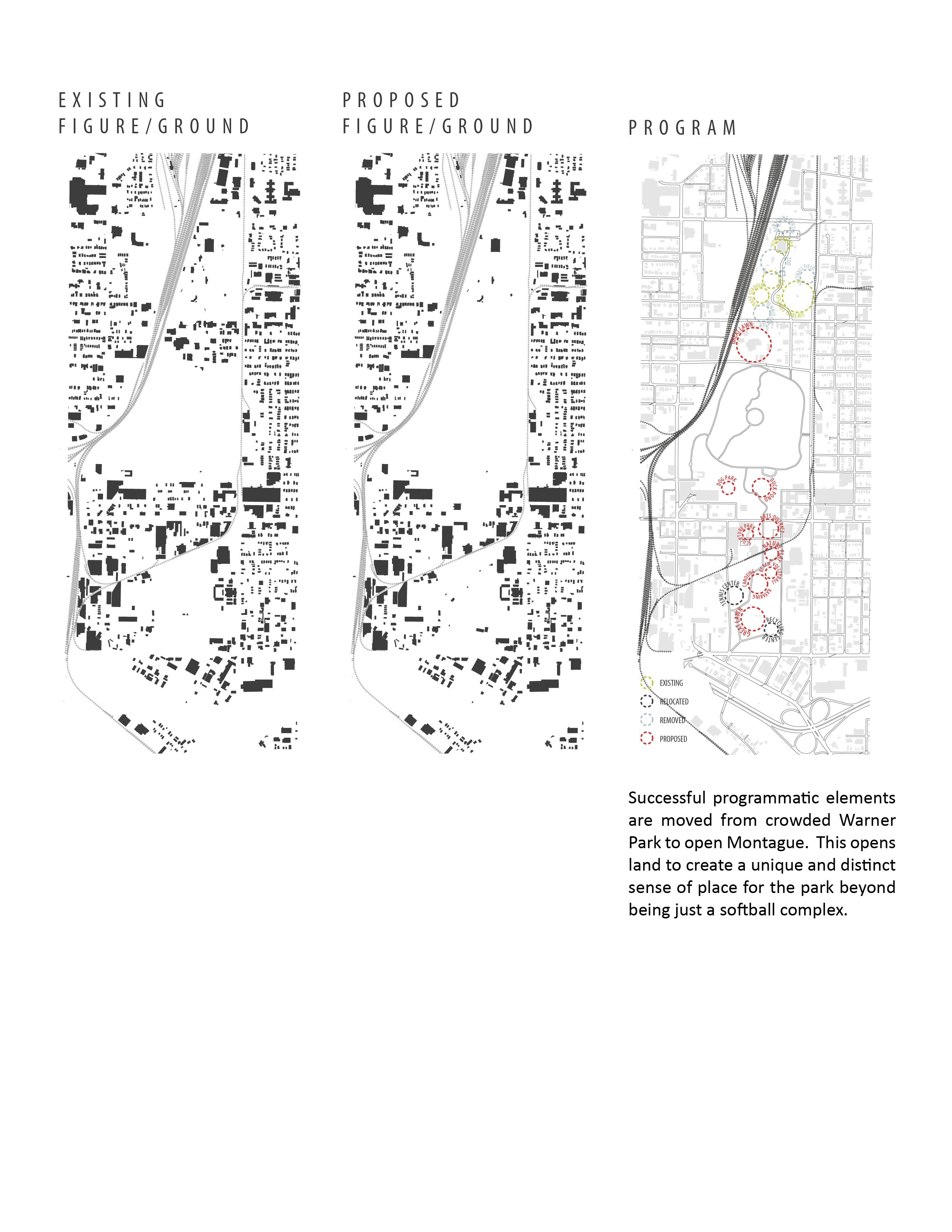
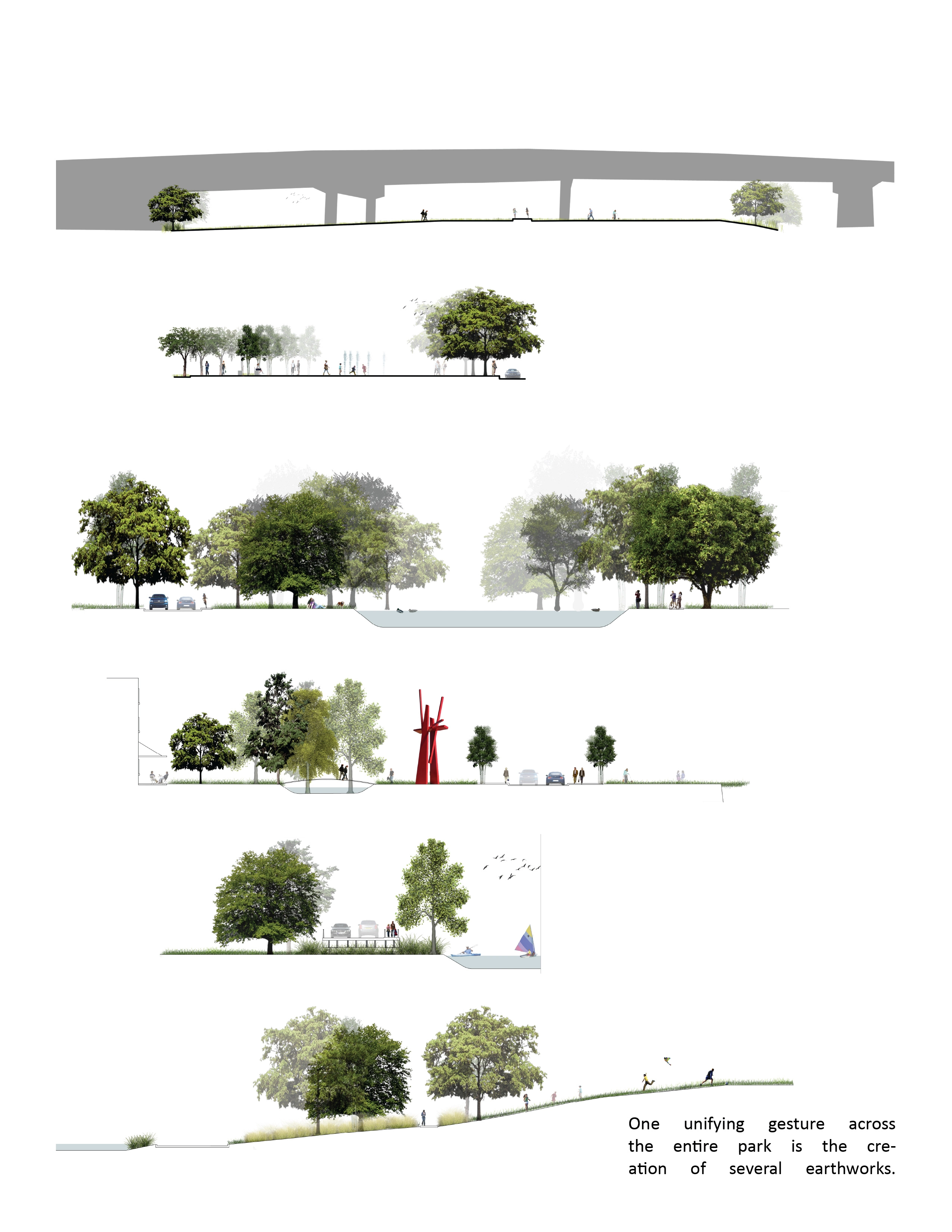
A key point in uniting the three existing spaces is successfully bridging the transition zones between them. To accomplish this, scenic features from the cemetery are extended into the transition zones. On the north side, rolling earthworks are used for this purpose and, on the south side, lakes extend the cemetery's pond through the new park spaces. Program elements are carefully redistributed throughout the entire site to allow a balance of passive and active recreation. Tennis courts and a recycling center from the north end were relocated to the southern end for this purpose. In order to unify the three sites ecologically, stormwater management and four ecological typologies are utilized throughout the site.
The major streets that cut through the park will undergo a road diet, narrowing them to two lanes of traffic with two lanes of on street parking each to provide safer crossings. A 5-mile pedestrian and bike path loops through the park to promote connectivity between the different sections. A separate vehicular road connects the north and south ends of the park through the cemetery.
The North Side: Warner Park
The first objective for this section of Chattanooga Central Park is to eliminate programmatic elements to allow for more passive and unorganized recreational opportunities. Four of the softball fields, Frost Stadium, the pool and fitness center remain on the site. Because of recent stormwater infrastructure investments in the park, the fitness center parking lot also remains intact. Other stormwater management infrastructure is spread out throughout the park and relocated according to the natural slope of the terrain toward the railroad tracks. This reorganization maintains or increases capacity, improves access to more areas of the site and improves the aesthetic quality and functionality of the system. In order to minimize large, concentrated parking lots and provide for passenger pick up/drop off at popular amenities, a vehicular road with two lanes of on-street parking will run through the park. This street aligns with a proposed vehicular access into the cemetery. Additional pedestrian entrances meet up with the existing street grid on Holtzclaw Ave; however, the redesign of the site makes the park's edge almost entirely permeable.
Emphasis is placed on creating views through the site to visually connect the user with Chattanooga National Cemetery as well as to Lookout Mountain and to pull the user through different parts of the site. A large grassy slope transitions from the cemetery to the existing Warner Park site. This sloping earthwork extends under the overpass of McCallie St to provide a continuous path experience. Tree plantings are utilized to screen athletic fields and also to frame views through the site.
The South Side: Montague Park
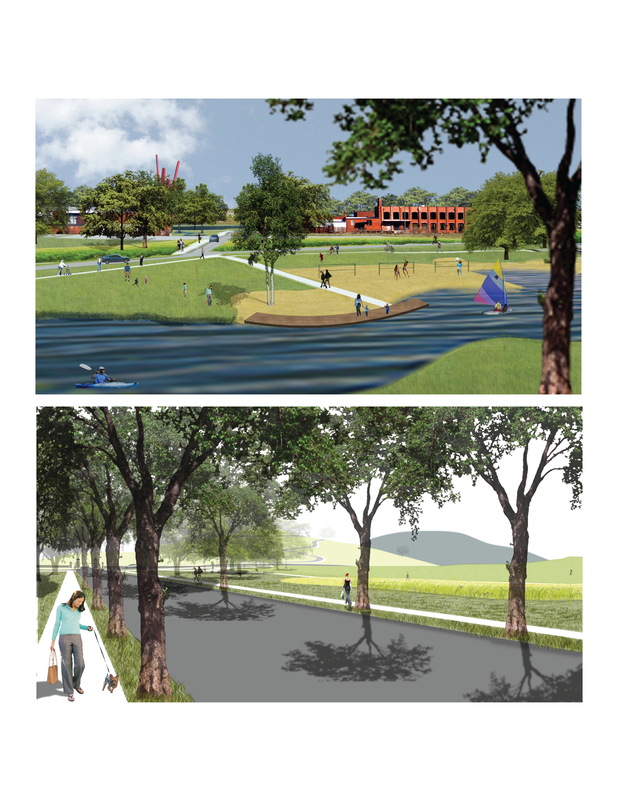
Because of its location within an industrial area it was important to establish a unique identity for this portion of the park. In response to its surroundings, the park's aesthetic incorporates the strange quality of these industrial developments. Landforms not only serve to cap the methane-leaking landfill, but also carry park visitors to where they can experience views to Lookout Mountain and Missionary Ridge. The great lawn rising above the site creates a center stage for the public to interact.
In order to differentiate the site from its surroundings the design defines its edges with landform and plant materials to create a unique sense of place and feeling of retreat. As part of the 100-year floodplain, the west side of the site capitalizes on the lower elevation to capture, retain and process stormwater. Buildings situated along the railroad tracks will funnel park visitors into the arts district and across the street to Chattanooga National Cemetery. In this area, the language of the cemetery and its existing retention pond is carried down to blend the edge and create a smooth transition into the proposed park space. A multi-use path forms a loop around the park's perimeter that carries users through open lawn, dense meadow, constructed wetlands, wooded areas and over the railroad tracks to an active arts and entertainment district.
A vehicular road will run along the site's periphery to provide convenient access to major programmatic elements such as a large central lake, rock climbing wall, tennis center, nature playscape, beach volleyball and recycling center. Relocating the recycling center to the south side of Chattanooga Central Park educates the public and encourages recycling in Chattanooga by highlighting the massive footprint of this former landfill.
Conclusion
The potential benefits of consolidating Montague Park, Chattanooga National Cemetery and Warner Park into a single, contiguous, open space would change the face of recreation, community and development in Chattanooga. The consolidated park will activate existing, underutilized open spaces and provide new social, economic and ecological opportunities for the city. Chattanooga Central Park will alter the fabric of the city by redefining the concept of open space in Chattanooga and will be the centerpiece of Chattanooga's park system.
-
Blythe Bailey, Stroud Watson, The River City Company, Outdoor Chattanooga
Advertisement
Related Awards
Award of Excellence, General Design
A Floating Forest: Fish Tail Park in Nanchang City
In Nanchang, within the Yangtze River floodplain, we revitalized a heavily degraded 126-acre landscape into a floating forest that manages stormwater, restores habitats, and provides diverse recreational spaces—all within a limited budget and a short timeline. This innovative urban nature model strengthens the district’s identity and spurs surrounding development. Fish Tail Park offers a scalable solution for flood-prone regions, seamlessly integrating flood resilience, ecological restoration