.webp?language=en-US)


Vertical Territories
Chen Chen, Student ASLA; E. Scott Mitchell, Student ASLA; Amy Whitesides, Student ASLA
Fantastic analysis and gorgeous design. The scale and bravado of taking on the design and technology is incredible.
Awards Jury
-
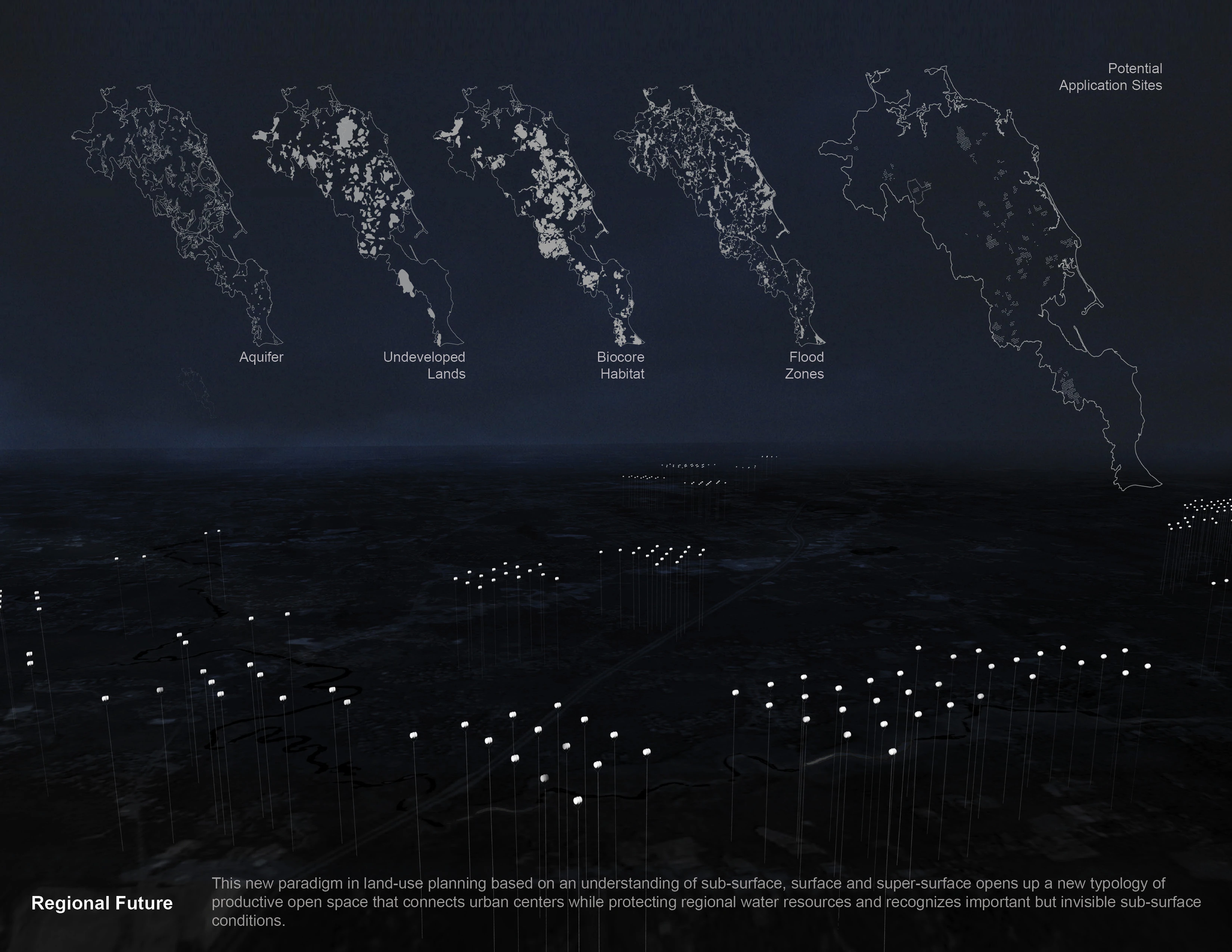
Vertical Territories proposes the redevelopment of South Weymouth Naval Air Station as productive open space. It promotes alternative energy innovation, habitat preservation, floodwater management and freshwater conservation through a layered approach that allows for functional density without compromising the expansive quality of the ground plane. The project uses technology and conservation to stitch together adjacent but disconnected urban centers and serves as a prototype for urban planning that recognizes the critical infrastructural services landscape provides.
-
Vertical Territories proposes a redevelopment strategy for South Weymouth Naval Air Station, a decommissioned US Naval base approximately 15 miles South of Boston, located at the convergence of three towns; Abington, Rockland and Weymouth, Massachusetts. Known as SOWEY, the air base was purchased by the military in 1940 and transformed from 1500 acres of marsh and woodlands into one of the only naval bases in the US to house fixed-wing propeller, jet, helicopter, and lighter than air craft simultaneously. It was decommissioned in 1997 and has since been the site of numerous development proposals. The most recent of which is currently on hold due to public debate and the need for cleanup of toxic areas on site.
Highly contested plans for its redevelopment currently include a movie studio complex, retail shops and a planned residential community. The proposed plans for SOWEY do not address the region's declining economic conditions, the existing excess of residential land, the lack of public open space or the current water shortages and the pressure the development would place on these resources. Current proposals view the site as an economic resource for a few businesses. Larger issues of wildlife conservation, public health and safety and environmental productivity are ignored. In contrast, our proposal considers the site a regional resource and a potential prototype for urban development that places a premium on the environmental and public health services of open land overlooked by typical urban expansions such as those proposed.
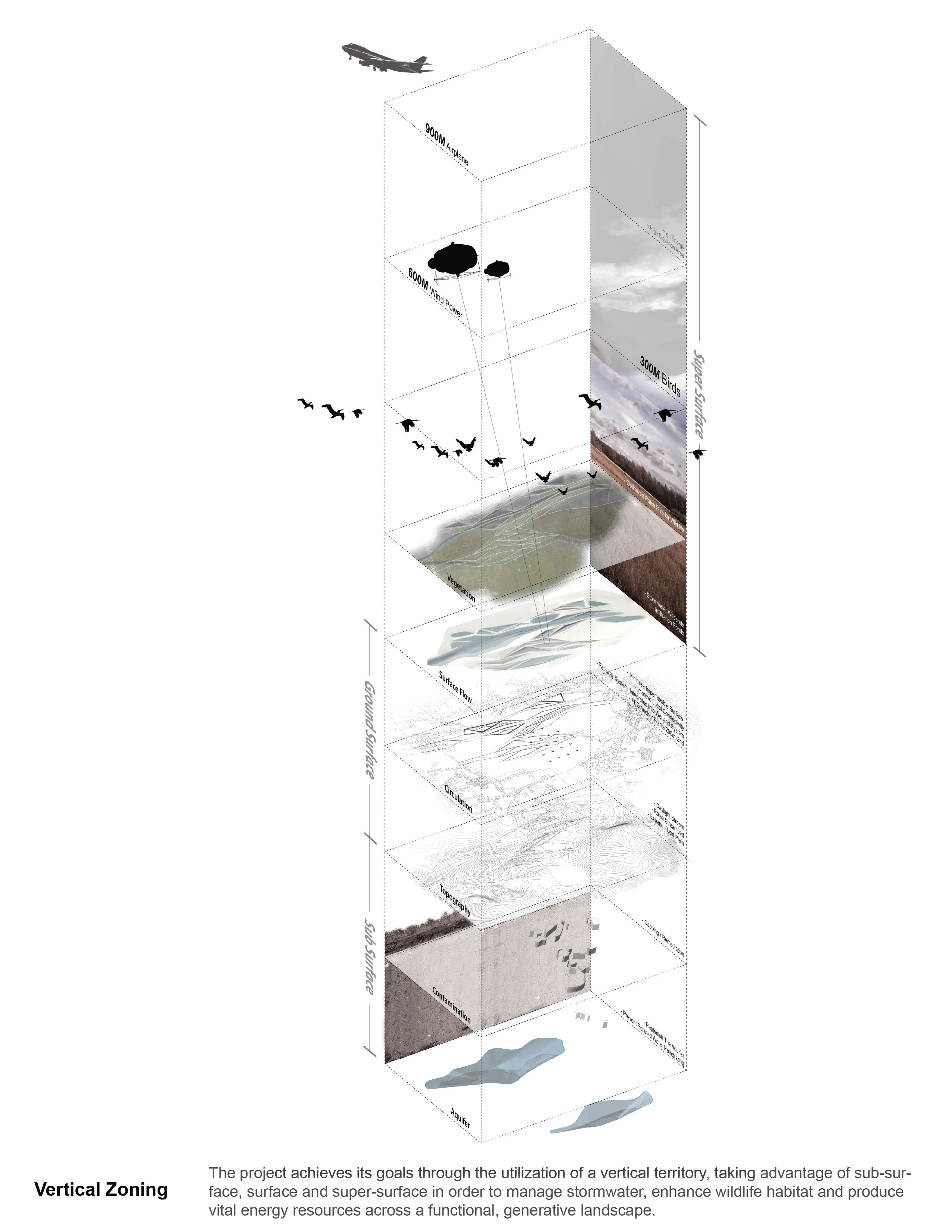
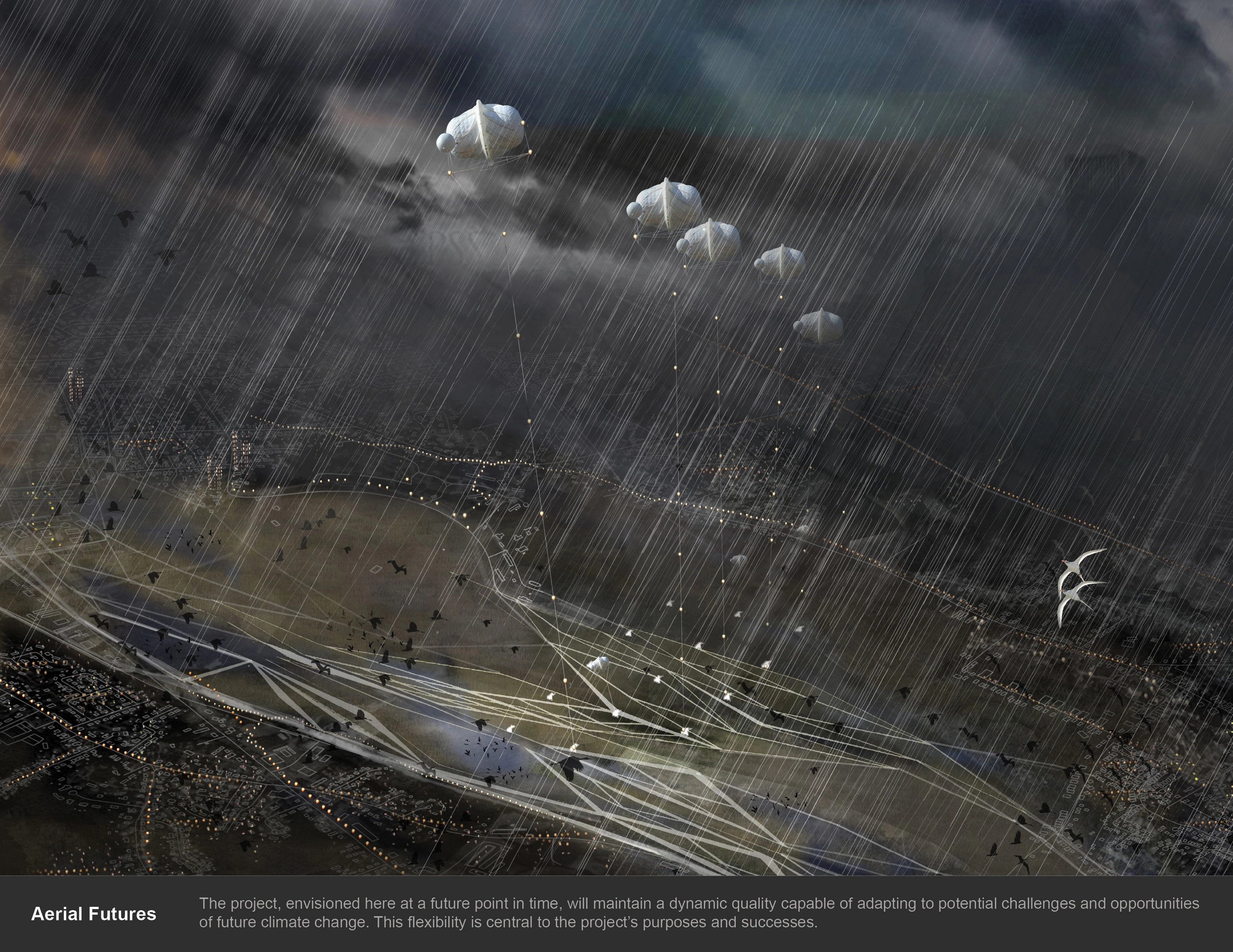
In contrast, we envision SOWEY as a public space that protects and replenishes freshwater resources, provides important flood control services, conserves habitat for endangered species, and serves as a testing ground for emergent high altitude wind generation technologies that could serve as an economic resource for the region. The project spatially achieves these goals through utilization of vertical territory, taking advantage of sub-surface, surface and super-surface to generate energy, manage storm water and enhance public open space and wildlife habitat. The layered approach allows for density of function without compromising the expansive open quality of the ground plane and allows a once gated 'backyard' to towns in economic decline to become a generator of vital resources.
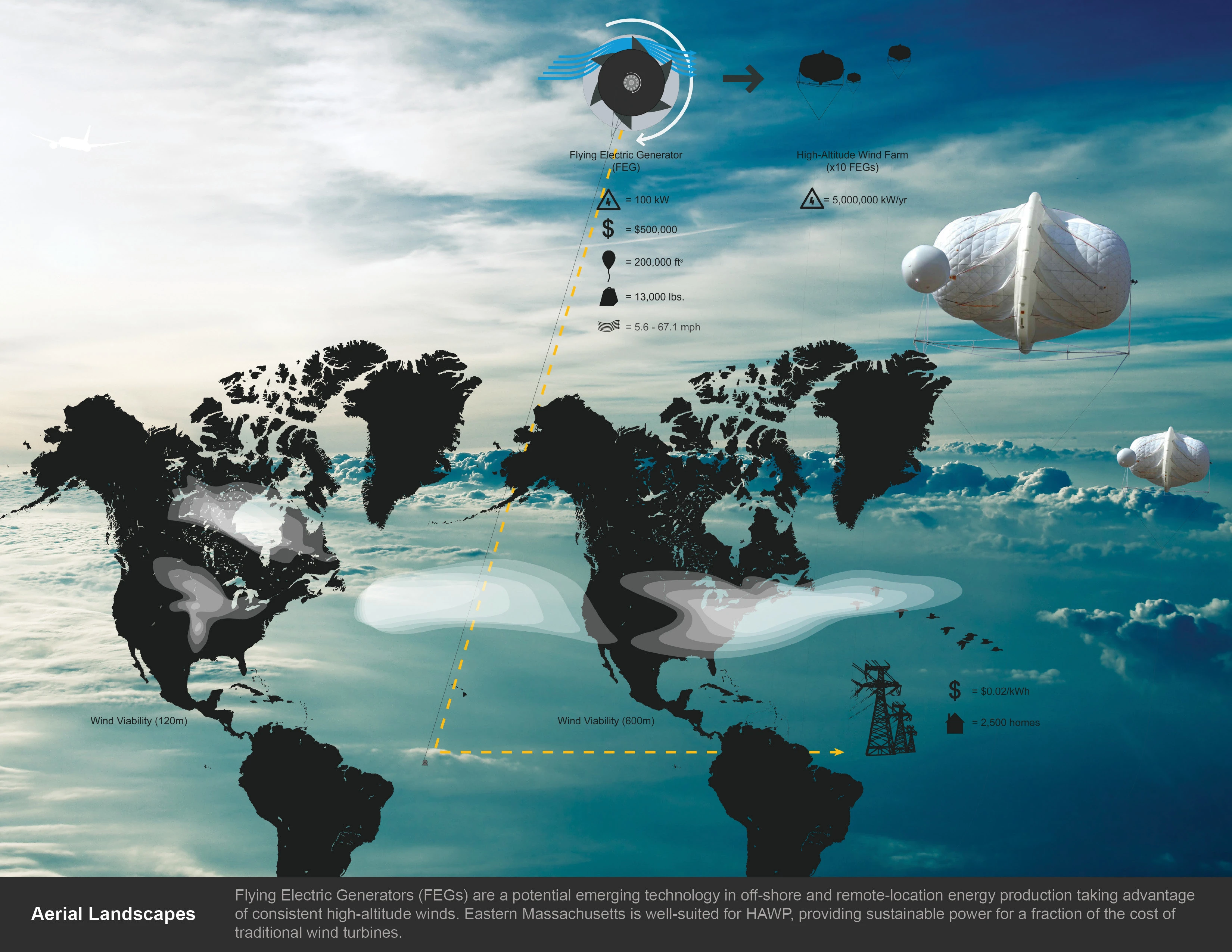
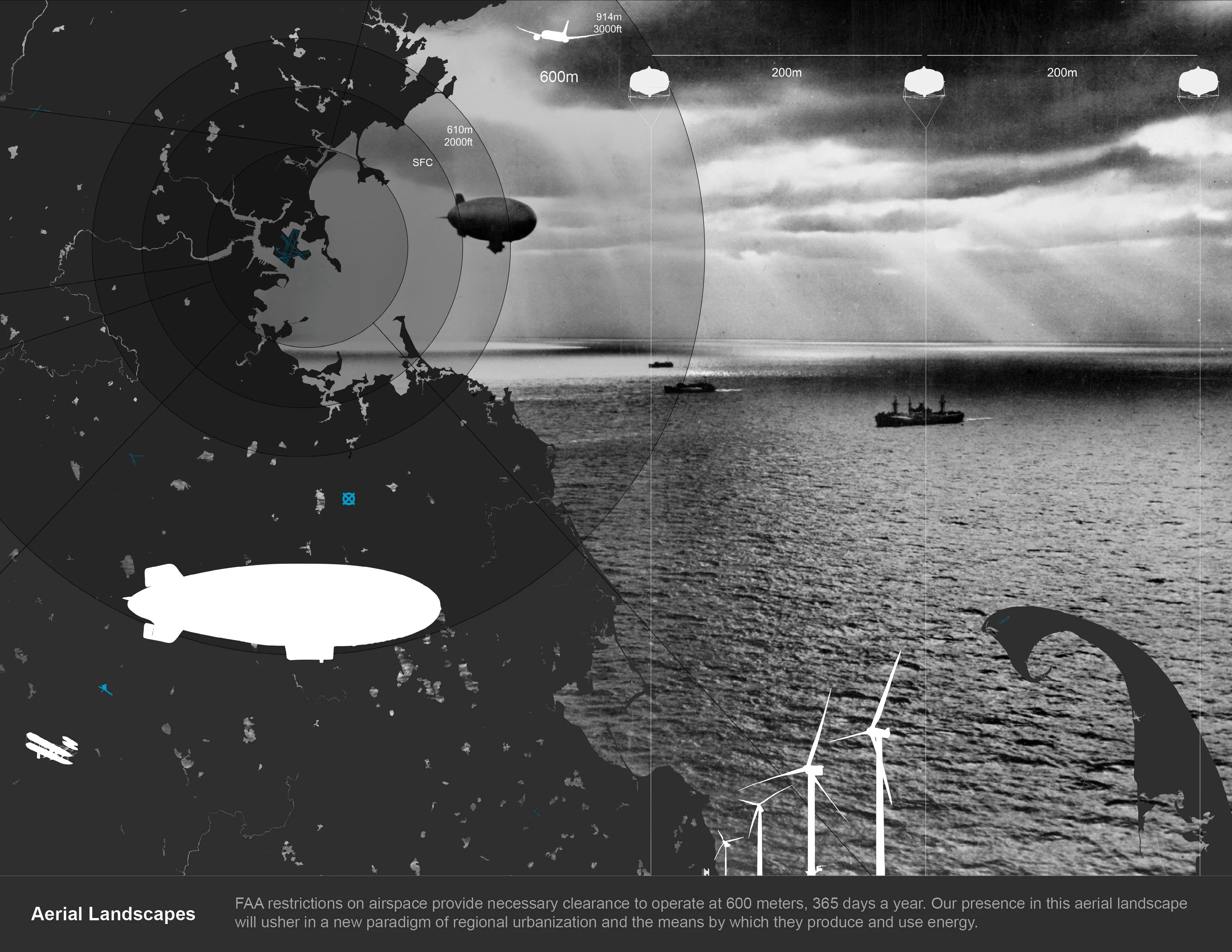
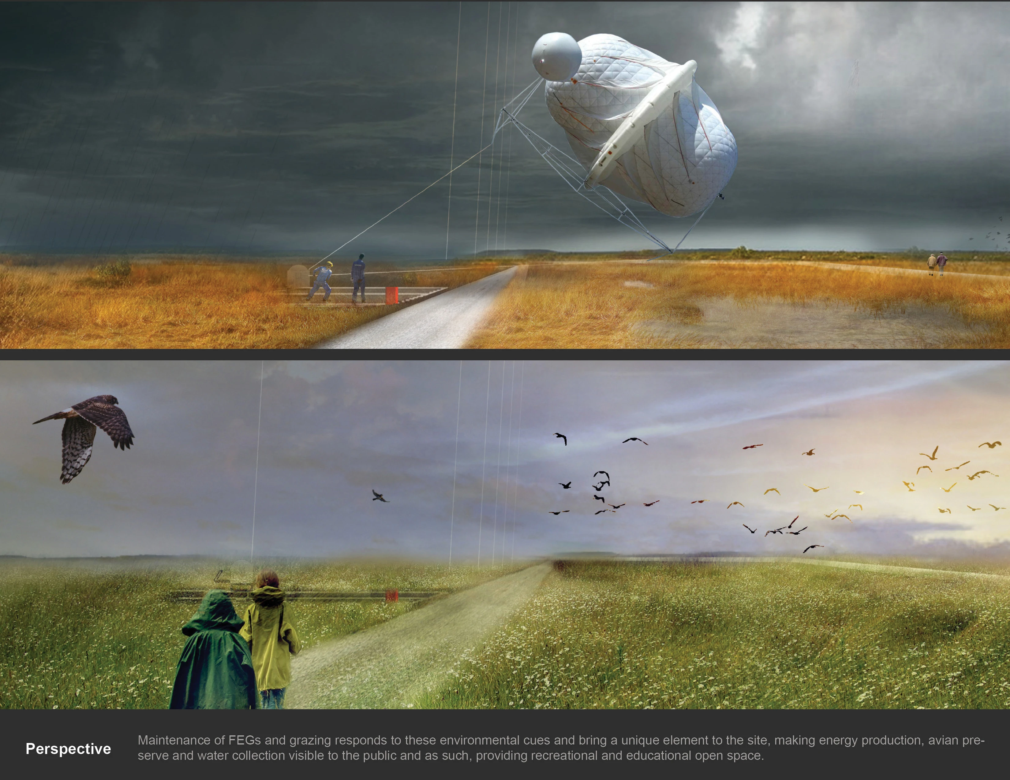
At the core of this proposal is the implementation of a testing area for emergent high altitude wind generation technologies, or flying electric generators, (FEGs). High altitude winds have recently been identified by innovators in the alternative energy industry to have the potential to produce significantly greater energy at far lower cost than traditional wind turbines. SOWEY, along with much of the Northeast, lies beneath an area of consistent high altitude winds. These winds make the site an ideal location for testing of emergent high altitude wind technologies and possibly one of the first sites for large scale deployment of FEGs as regional energy generators.
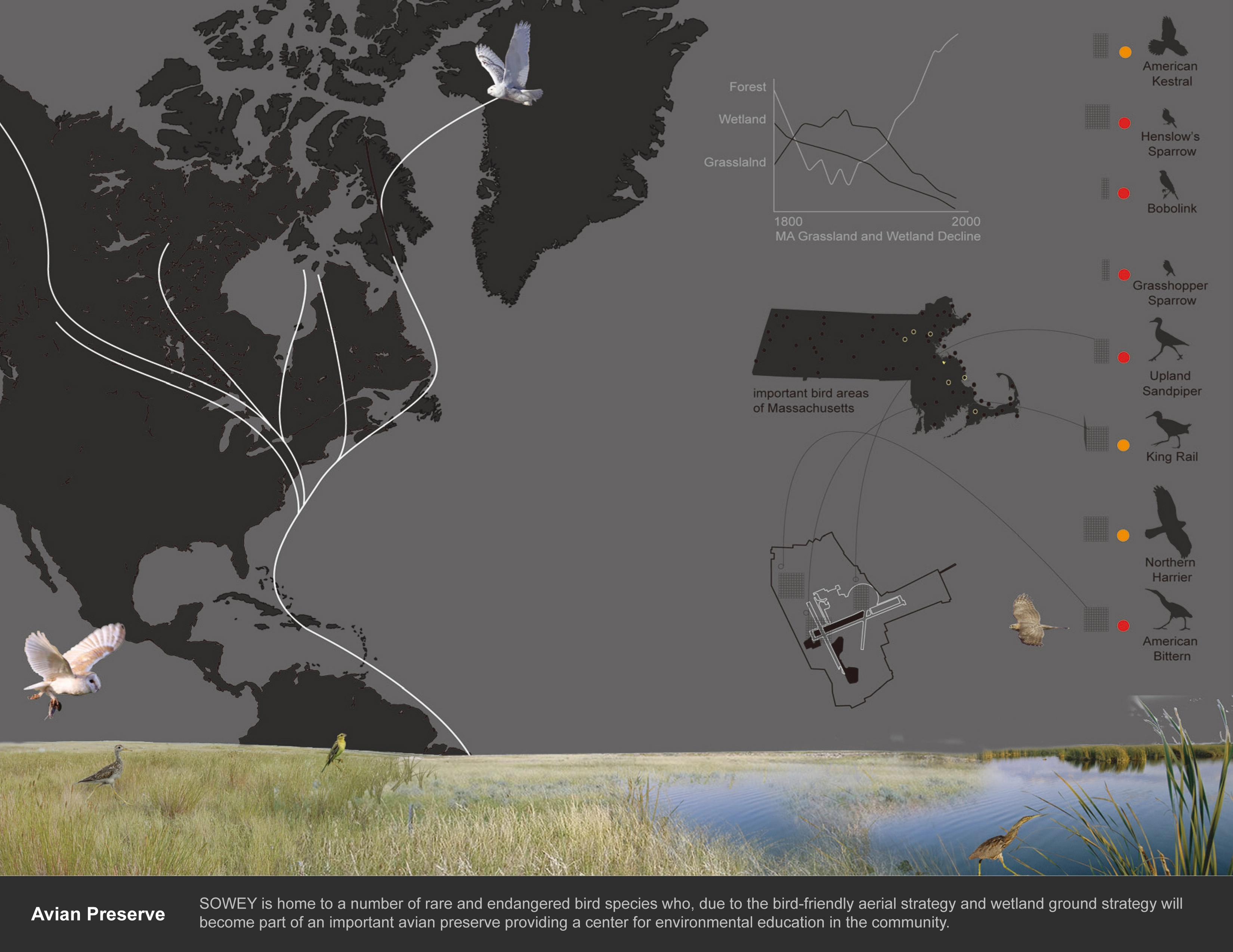
Compared to traditional wind turbines, FEGs offer a number of benefits that are important to their implementation at SOWEY. Traditional turbines are known to be a cause of death for migrating birds. The lack of large, exposed rotating blades as well as the increased height at which FEGs operate significantly reduces the danger of bird-turbine interactions. This is significant for the development at SOWEY because the site currently serves as habitat for a number of Massachusetts' endangered bird species including the Bobolink, Upland Sandpiper, Grasshopper Sparrow, Barn Owl, Snowy Owl, American Kestrel, American Bittern, and the King Rail. In addition, many other wetland and grassland species utilize the site as a stopping point on the North Atlantic Flyway. Implementation of a traditional turbine strategy or a large residential and commercial development would be at odds with the conservation of critical habitat for these species. Development of the site as a testing ground preserves habitat while still allowing the ground at SOWEY to operate in an economically productive manner for the region.
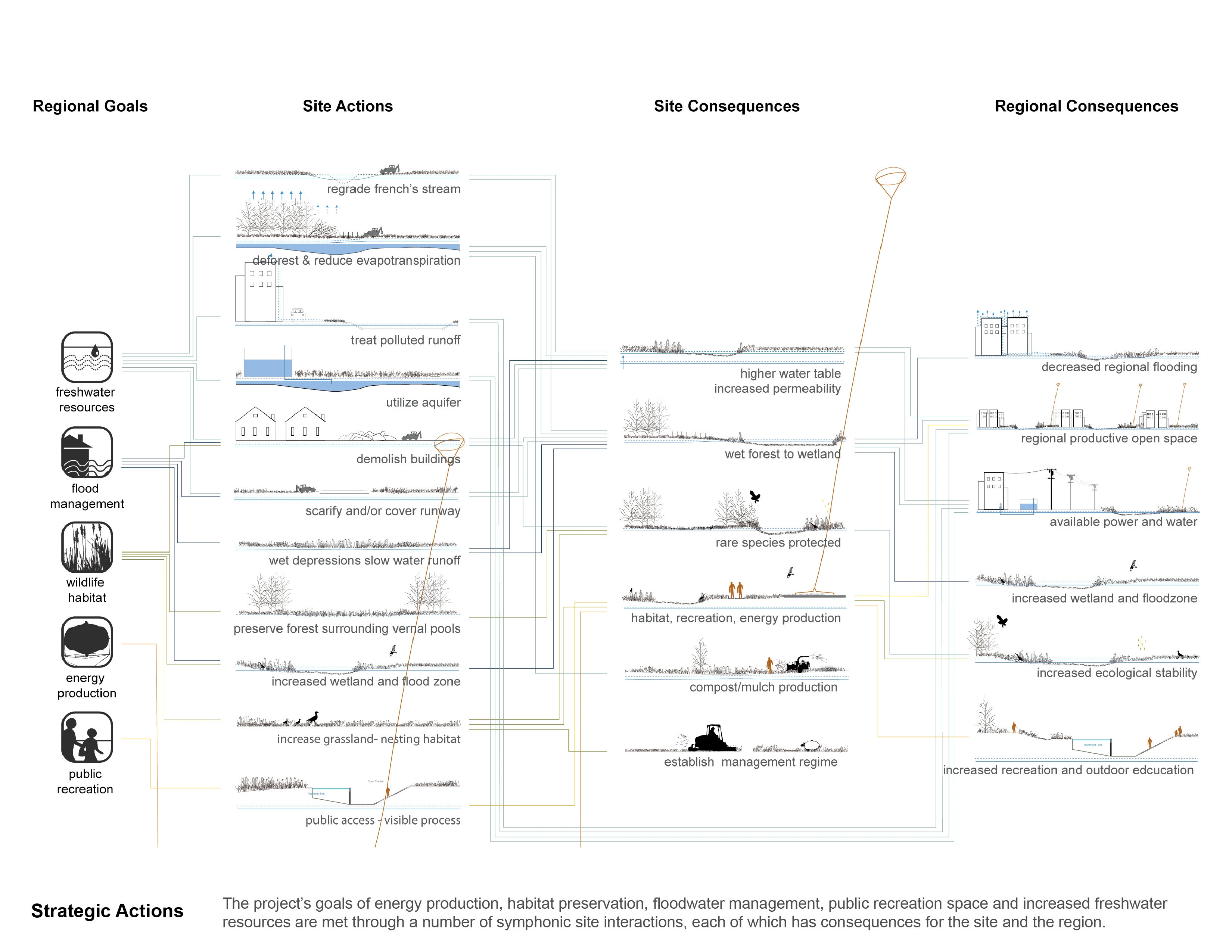
In addition, the high altitude turbines require only a single tether point on the ground, compared to the large foundations of traditional turbines. The implementation of an FEG test site therefore takes up very little ground space, freeing the ground plane to be utilized for other ecologic and cultural services. Vertical Territories takes advantage of this fact and combines the aerial FEG strategy and avian preserve with a wetland floodwater detention and management system on the ground.
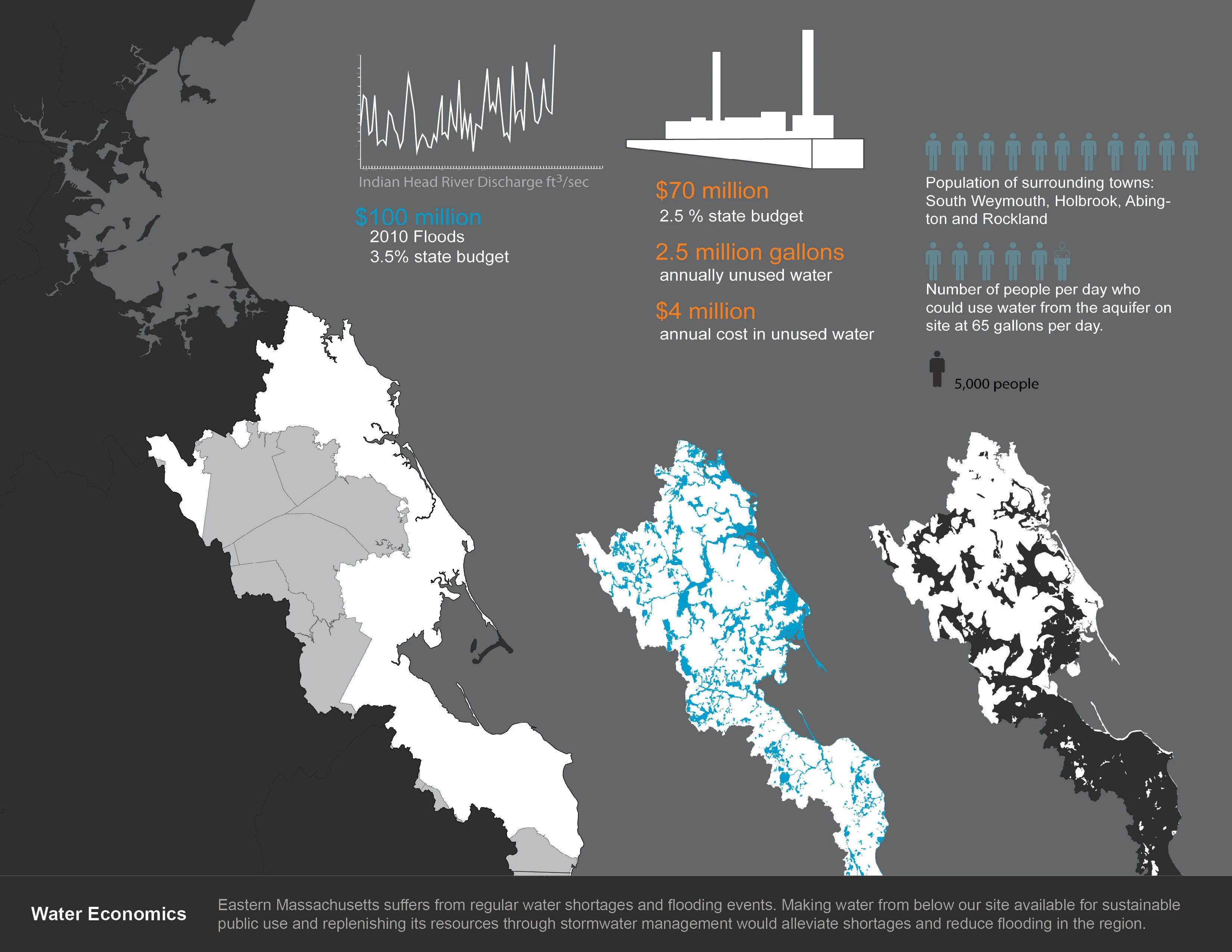
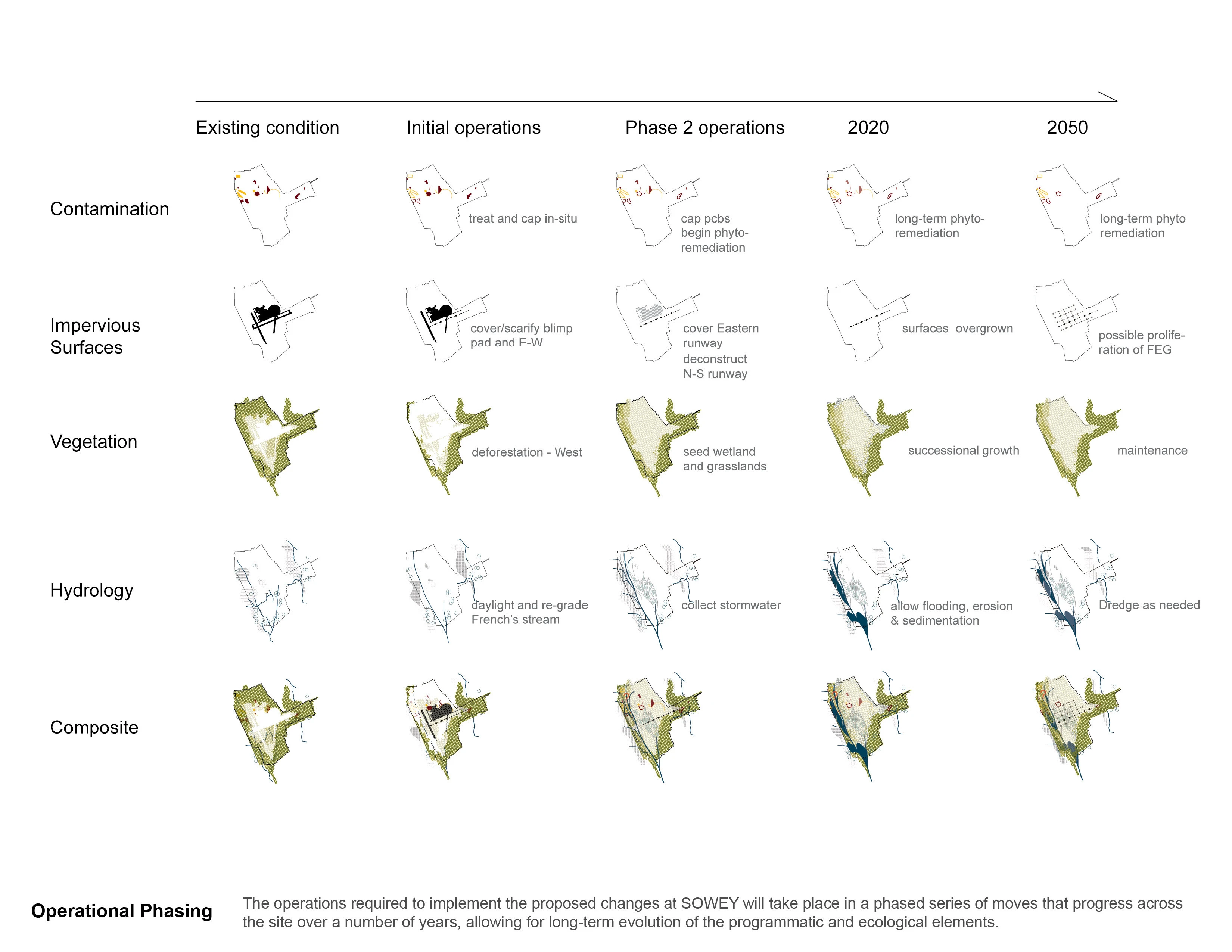
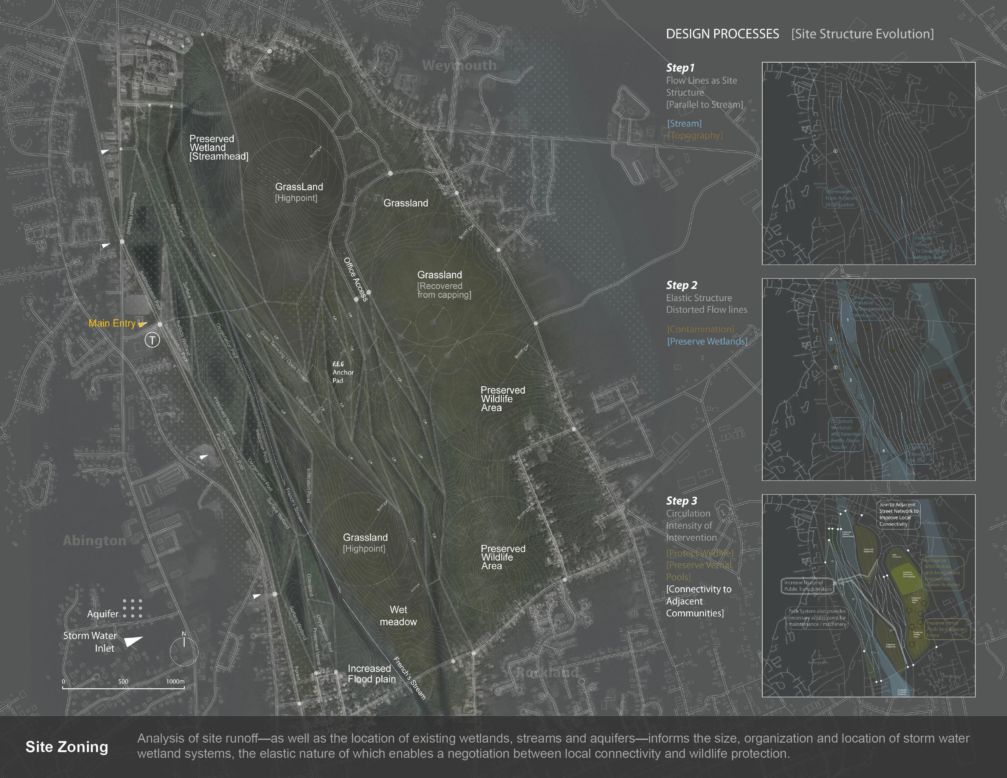
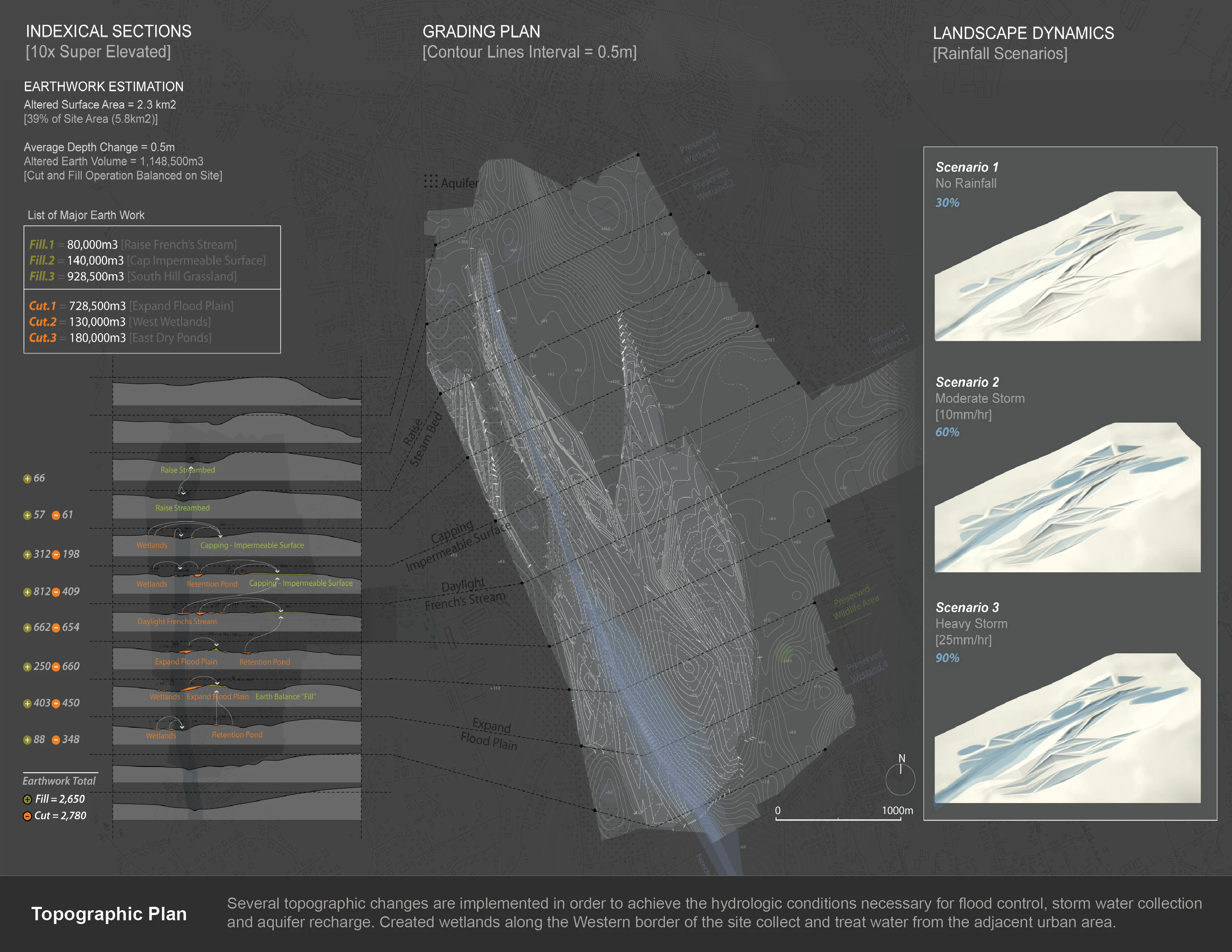
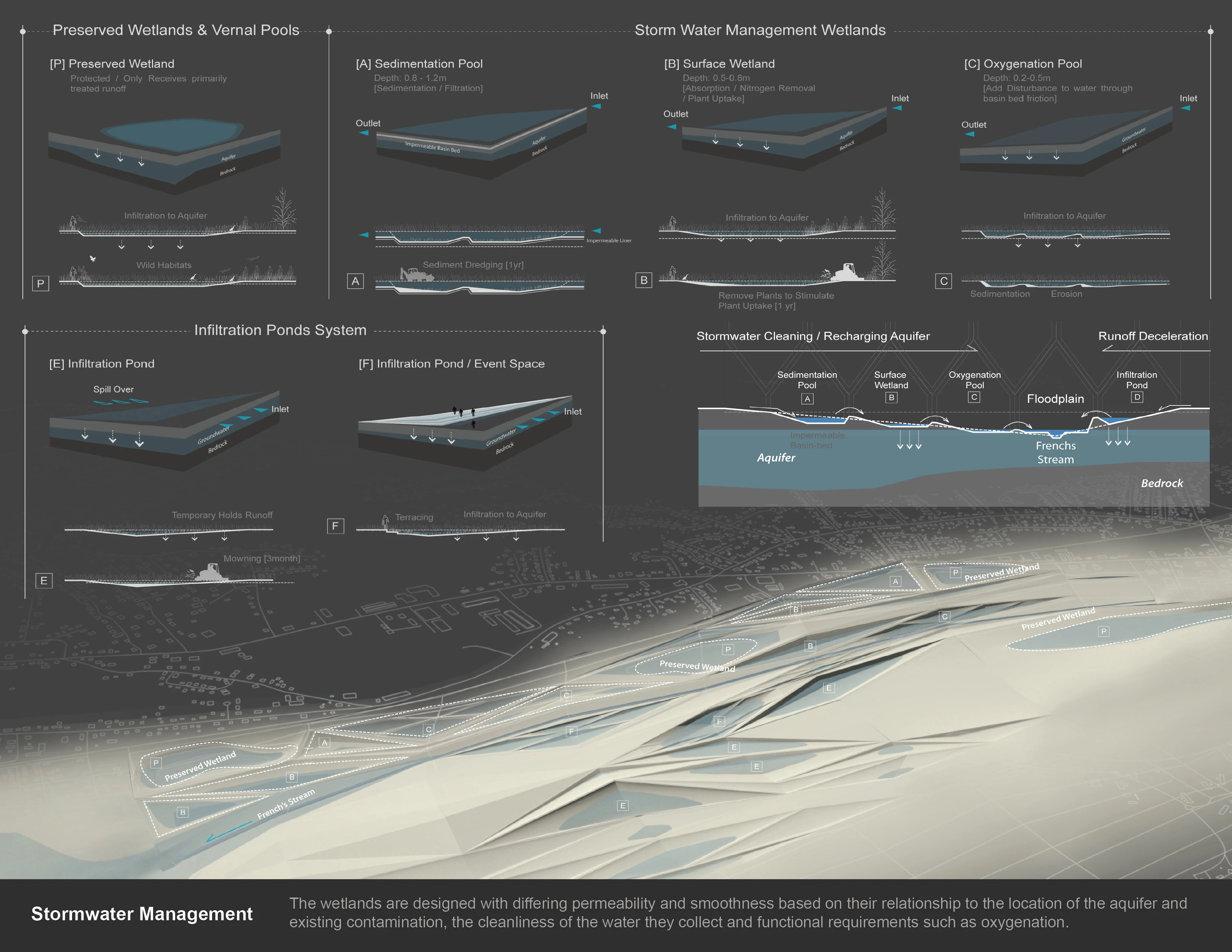
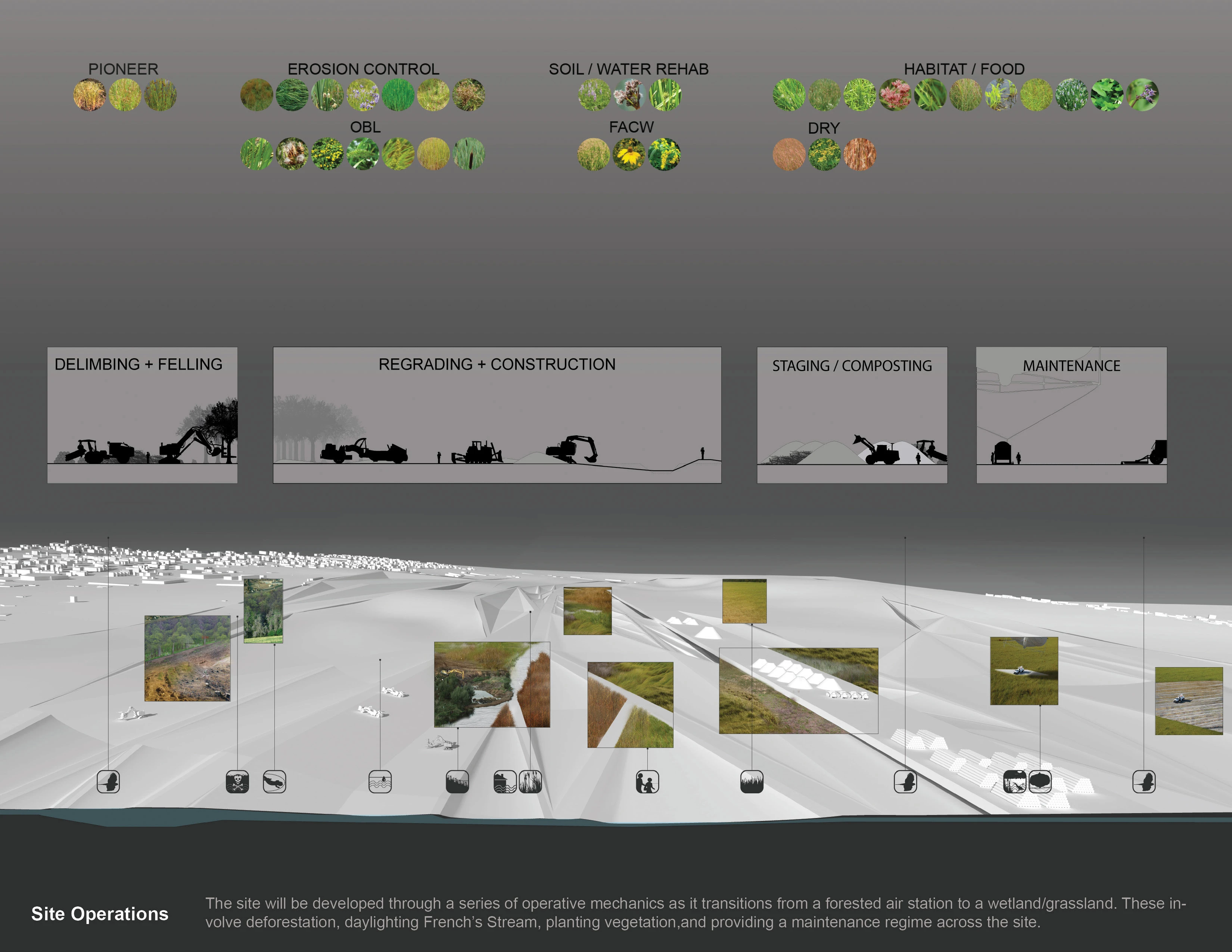
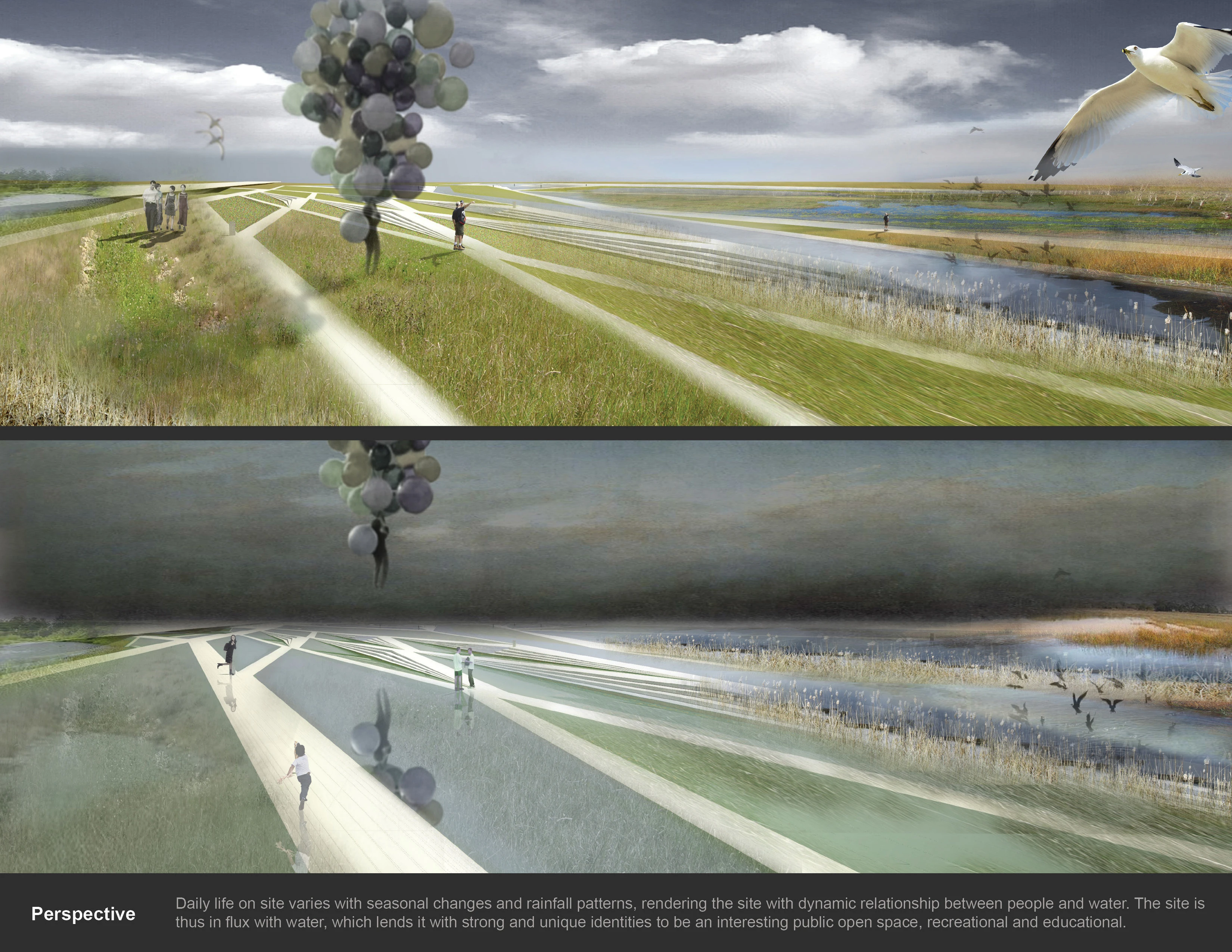
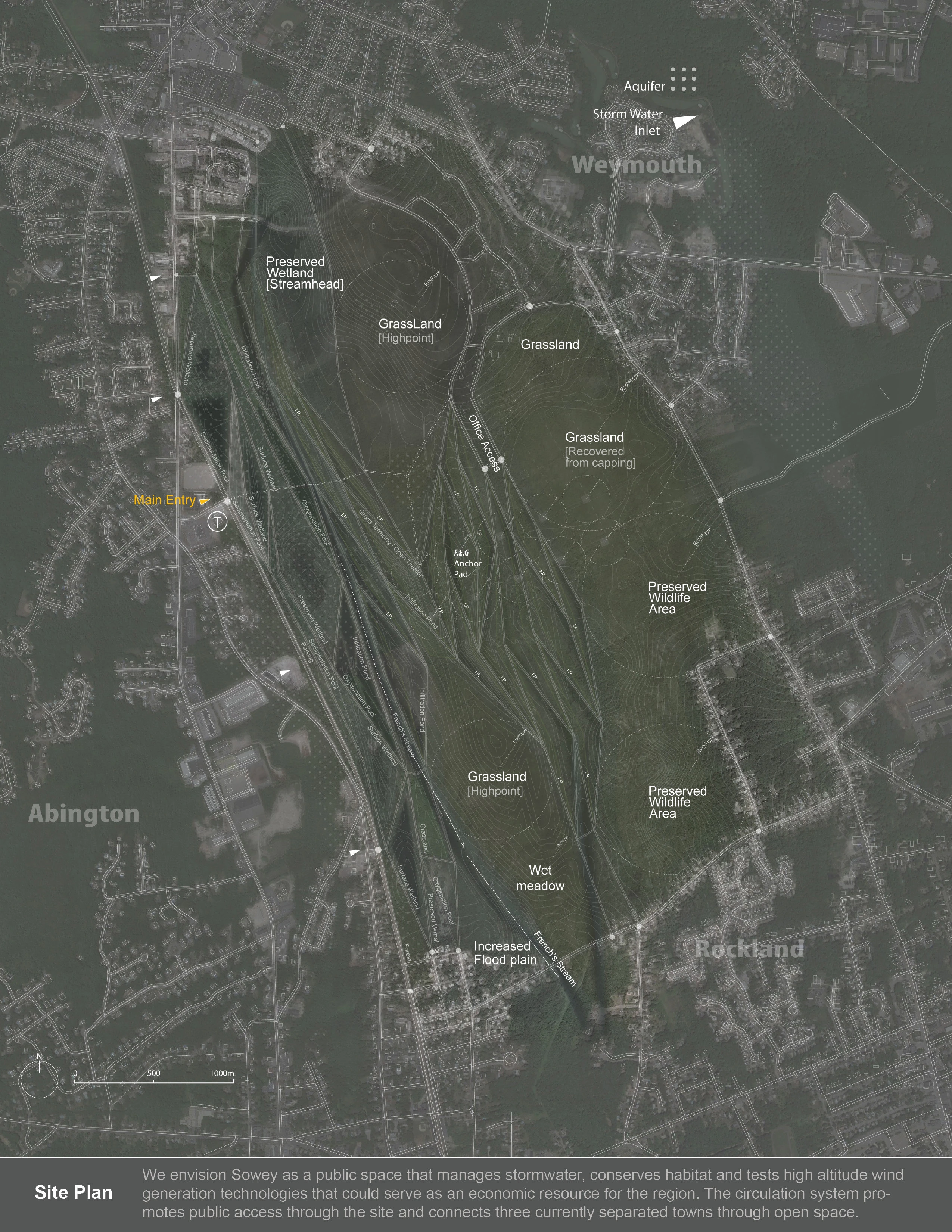
The Naval Air Station is located at the intersection of three watersheds, all of which drain into the Boston Harbor. Two creeks run through the site, French's Stream, which drains to the Southeast and Old Swamp River which drains to the Northeast. These streams are both 'gaining streams' meaning they exchange water with the large aquifer upon which the site is situated. Both of these streams flood regularly, causing damage to homes and property downstream from the Naval Station. Flooding occurred as recently as spring of 2010, when statewide flood events cost the state $100 million dollars. Despite regular flooding events, the towns surrounding SOWEY, like many in Eastern Massachusetts, suffer from regular water shortages due to contamination and improper management of water resources. These shortages have led to the building of a desalination plant in nearby Brockton which cost the state $70 million dollars. Vertical Territories seeks to alleviate these water shortages and the intensity of flood events through making water from the aquifer below the site available for public usage while replenishing its resources through a series of wetlands that aid in storm water management and rainwater retention. These wetlands are made accessible to the public via a set of paved and non-paved pathways that tie in to the adjacent neighborhood. Taking their cues from existing roadway structure, these paths make connectivity between the three towns that once backed onto SOWEY possible.
The strategy for implementation of the proposed wetland and grassland habitat depends greatly on the management of onsite streams and the high water table that contributes to them. The water table at SOWEY has been fluctuating in response to the varied land uses on site throughout its history. The proposed site operations are orchestrated so as to take advantage of this sensitivity. Initial grading of French's stream diminishes the amount of water it takes from the aquifer. Selective deforestation limits evapotranspiration where desired and allows for the creation of wetlands along the Western border of the site that collect and treat rainwater. The wetlands are designed with differing permeability and smoothness based on their relationship to the location of the aquifer and existing contamination, the cleanliness of the water they collect and functional requirements such as oxygenation. Maintenance of grassland and successional vegetation as well as occasional dredging of sedimentation in the wetlands will be a part the ongoing maintenance regime on site. These are relatively low cost measures compared to costs of flooding and water shortages currently experienced.
The project operates at the site level to develop what was once a remnant piece of land between three towns into a vibrant open space that connects the towns while serving recreational, resource production and infrastructural needs. In addition, it offers a new paradigm in land-use planning based on an understanding of sub-surface, surface and super-surface conditions. Vertical Territories creates a new typology of productive open space that connects once disparate urban centers while protecting regional water resources and recognizing the important services natural resources can provide if made central in the process of planning for urban development.
-
Philippe Coignet for his guidance in the making of conceptual models.
Harvard Graduate School of Design Department of Landscape Architecture.
Advertisement
Related Awards

Award of Excellence, General Design
A Floating Forest: Fish Tail Park in Nanchang City
In Nanchang, within the Yangtze River floodplain, we revitalized a heavily degraded 126-acre landscape into a floating forest that manages stormwater, restores habitats, and provides diverse recreational spaces—all within a limited budget and a short timeline. This innovative urban nature model strengthens the district’s identity and spurs surrounding development. Fish Tail Park offers a scalable solution for flood-prone regions, seamlessly integrating flood resilience, ecological restoration