.webp?language=en-US)


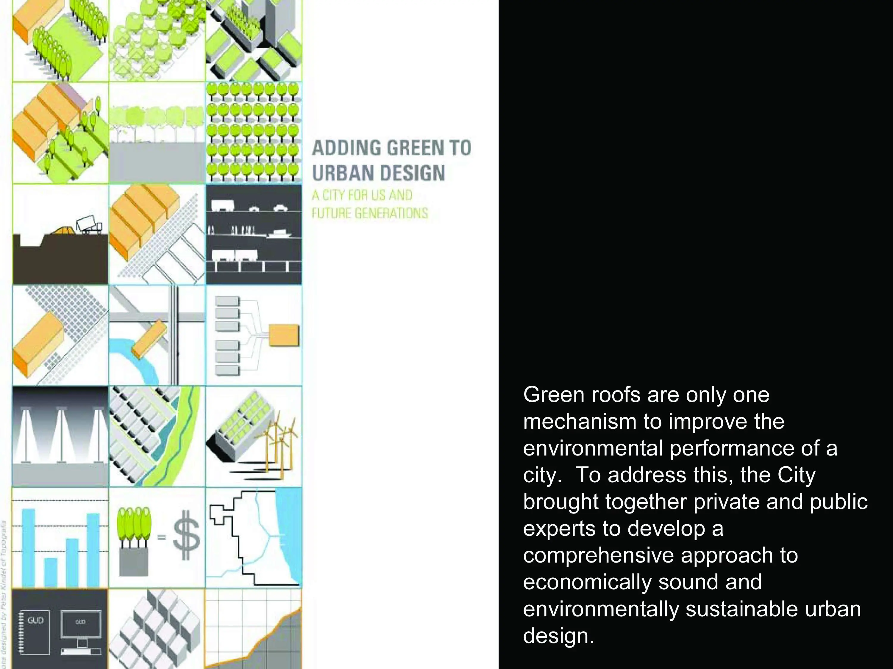
Adding Green to Urban Design
This comprehensive plan crosses all scales and departments within the city and provides a snapshot of exactly how this should work in other cities. It’s a top-down initiative: Chicago started early in redirecting its infrastructure toward a green future and the breadth of work is unbelievable. The plan provides measurable demonstration projects. It’s effective, multi-disciplinary work and it sets a great precedent.
Awards Jury
-
Adding Green To Urban Design (GUD): A City for Us and Future Generations presents a rationale, a vision and a detailed implementation strategy for economically sound and environmentally sustainable urban design.
Nine City of Chicago departments and sister agencies, along with more than 50 professionals from various fields of expertise worked collaboratively to develop GUD’s 21 key actions that maintain and improve Chicago’s urban design to optimize its environmental benefits for current and future generations.
-
Adding Green To Urban Design (GUD): A City for Us and Future Generations is a framework plan for the City of Chicago that presents a rationale, vision and detailed implementation schedule for economically sound and environmentally sustainable urban design. Better known as the Green Urban Design or GUD plan, it provides direction to the Chicago City Council in regulating urban design, and to the Chicago Plan Commission in reviewing individual development projects. Adopted by the Plan Commission on Nov. 20, 2008, it also guides City departments in making decisions about public investments and improvements to the city's built environment.
Background
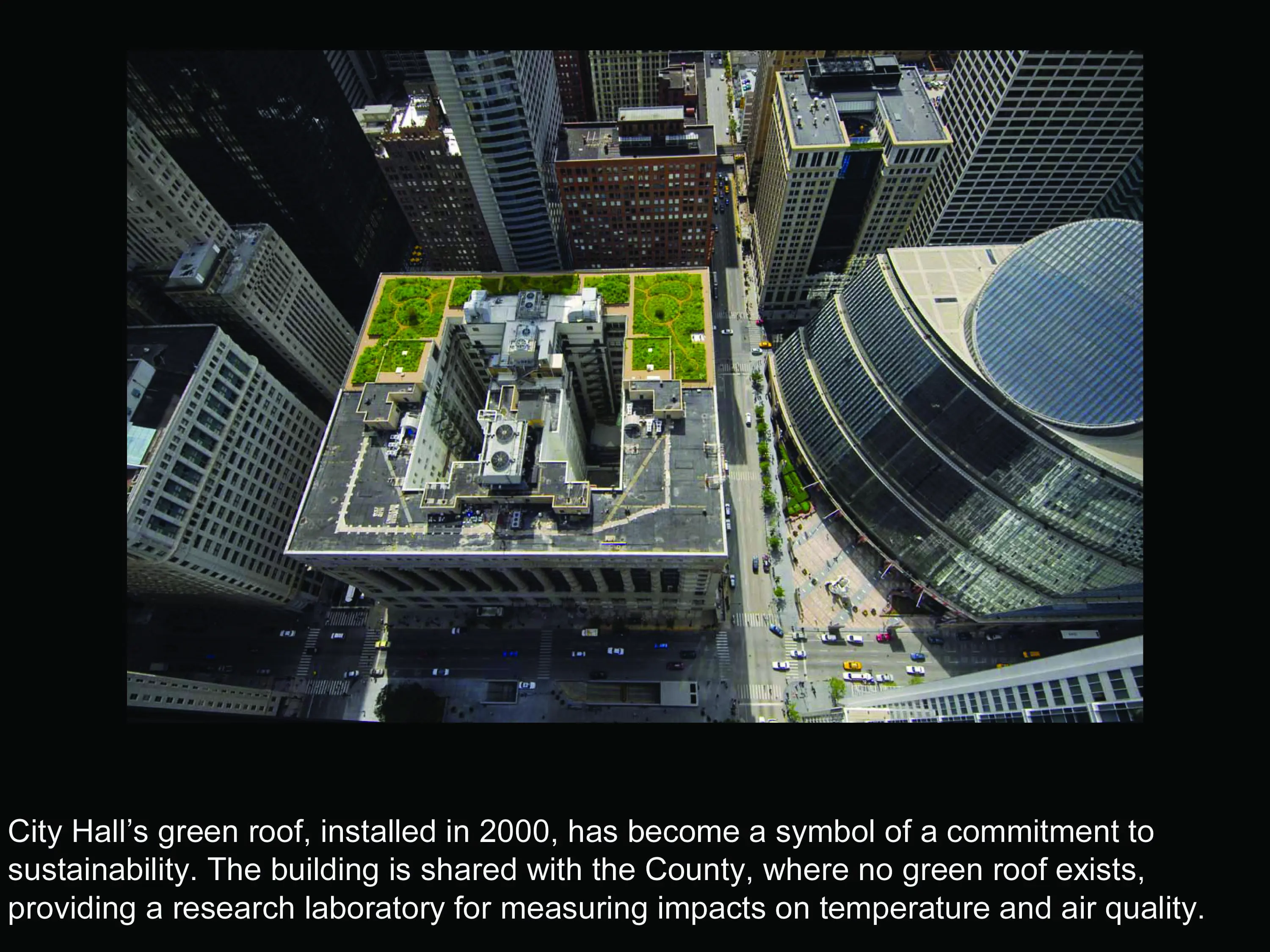
Chicago’s effort to become a green and livable city started with a series of single-issue initiatives. A well-documented example is the green roof initiative, which began in 2000 with the planting of the 22,000-square-foot green roof on top of City Hall. While effective at encouraging the design and construction of more than 500 green roof projects throughout the city, the initiative was not comprehensive enough to address all of the possibilities for improving the environmental performance of the urban, built environment.
In 2005, representatives from eight City departments and sister agencies formed a working group to discuss strategies and programs that would enhance the environmental footprint of Chicago’s urban form. The working group was motivated by the premise that population density and related land uses make cities more environmentally friendly than their rural or suburban counterparts. Another driving force behind the effort was a model of projected climate changes for the Chicago region that was completed by scientists at the University of Illinois and Texas Tech University. The projections detailed how Chicago’s built environment would be exposed to higher average temperatures, hotter and longer heat waves, and more frequent heavy rainstorms. Since the events would exacerbate many environmental challenges in Chicago, such as an overburdened combined sewer system and high levels of ground level ozone, the working group was pressed to determine how to mitigate the projections through appropriate choices for urban design.
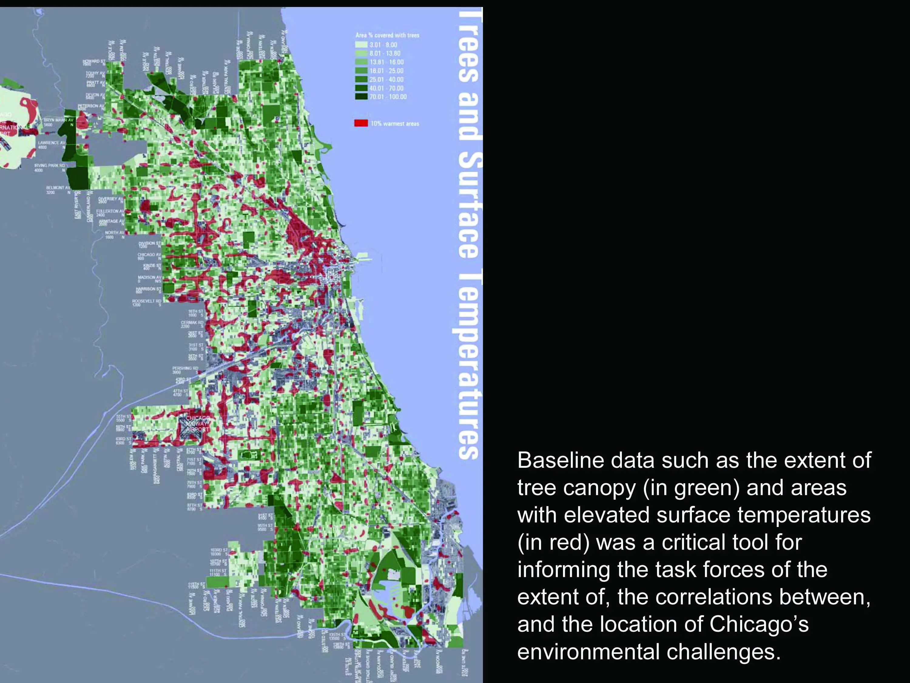
Since many of the existing programs that encourage more environmentally-friendly design were oriented to strategies and systems within buildings, the working group focused on features outside the building envelope, such as rooftops, facades, sidewalks, streets and other public and private hardscapes and landscapes. The group began with a review of existing ordinances and practices that affect urban design. City staff also completed an environmental baseline study using aerial imagery, spatial data and an analysis of City of Chicago basement flooding data. Environmental baselines were completed for: elevated surface temperatures, which illustrated the extent and primary locations of Chicago’s urban heat islands; tree canopy coverage, which averaged 13.8 percent citywide; and the extent of basement flooding, due primarily to an over-burdened combined sewer system.
The discussion was broadened into a public input process in the fall of 2006 to help identify critical issues, solicit solutions and lay the groundwork for the framework plan. The public input process was guided by a steering committee consisting of representatives from a variety of civic, non- and for-profit organizations and businesses that influence the way Chicago’s urban form is planned, built and maintained. The process included 50 professionals in urban design, planning and landscape maintenance that worked as four task forces to develop strategies that would guide future development in the following areas.
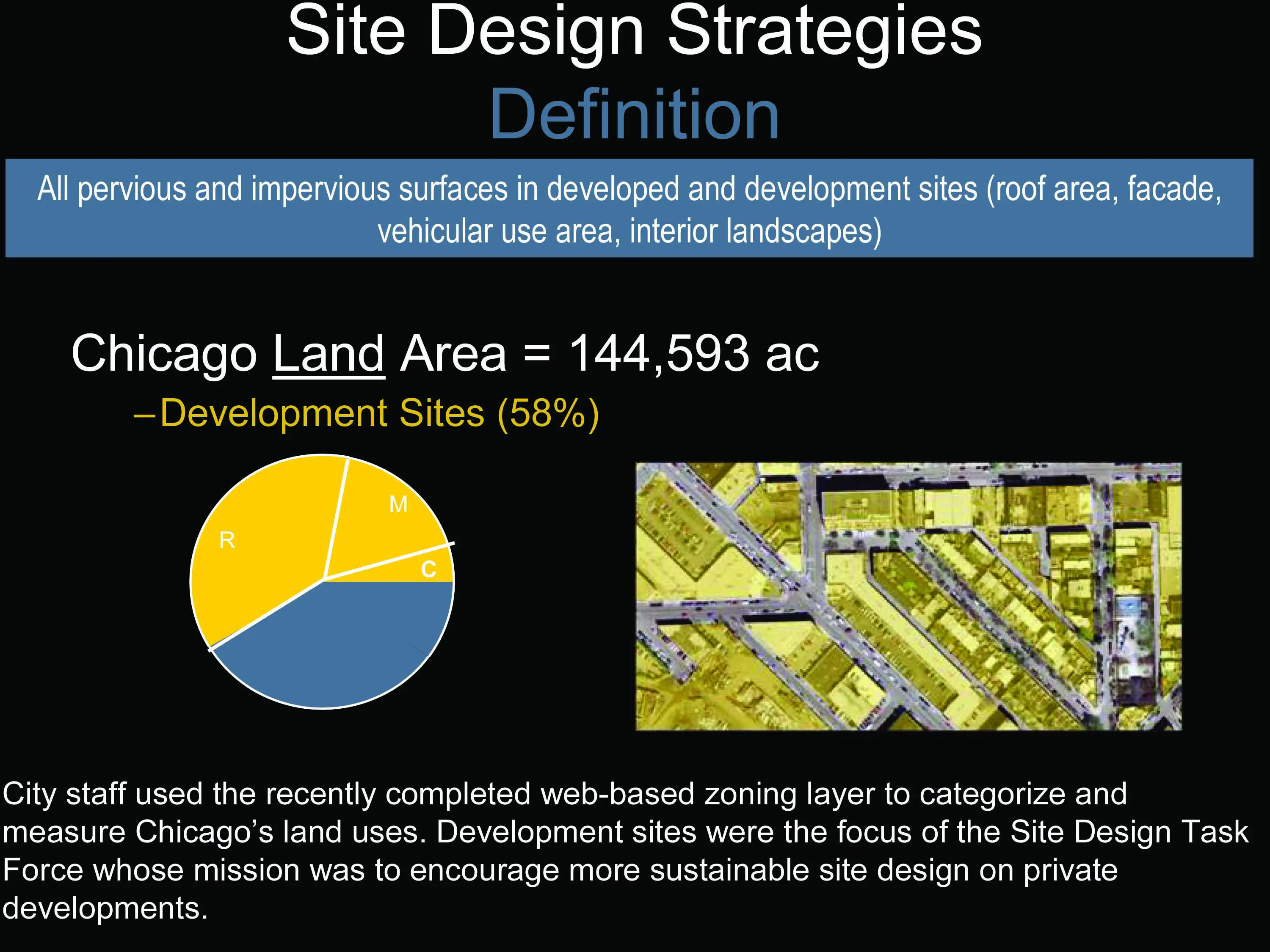
- Site Design: All pervious and impervious surfaces within a development site, including roof areas, facades, vehicular use areas, and interior landscapes
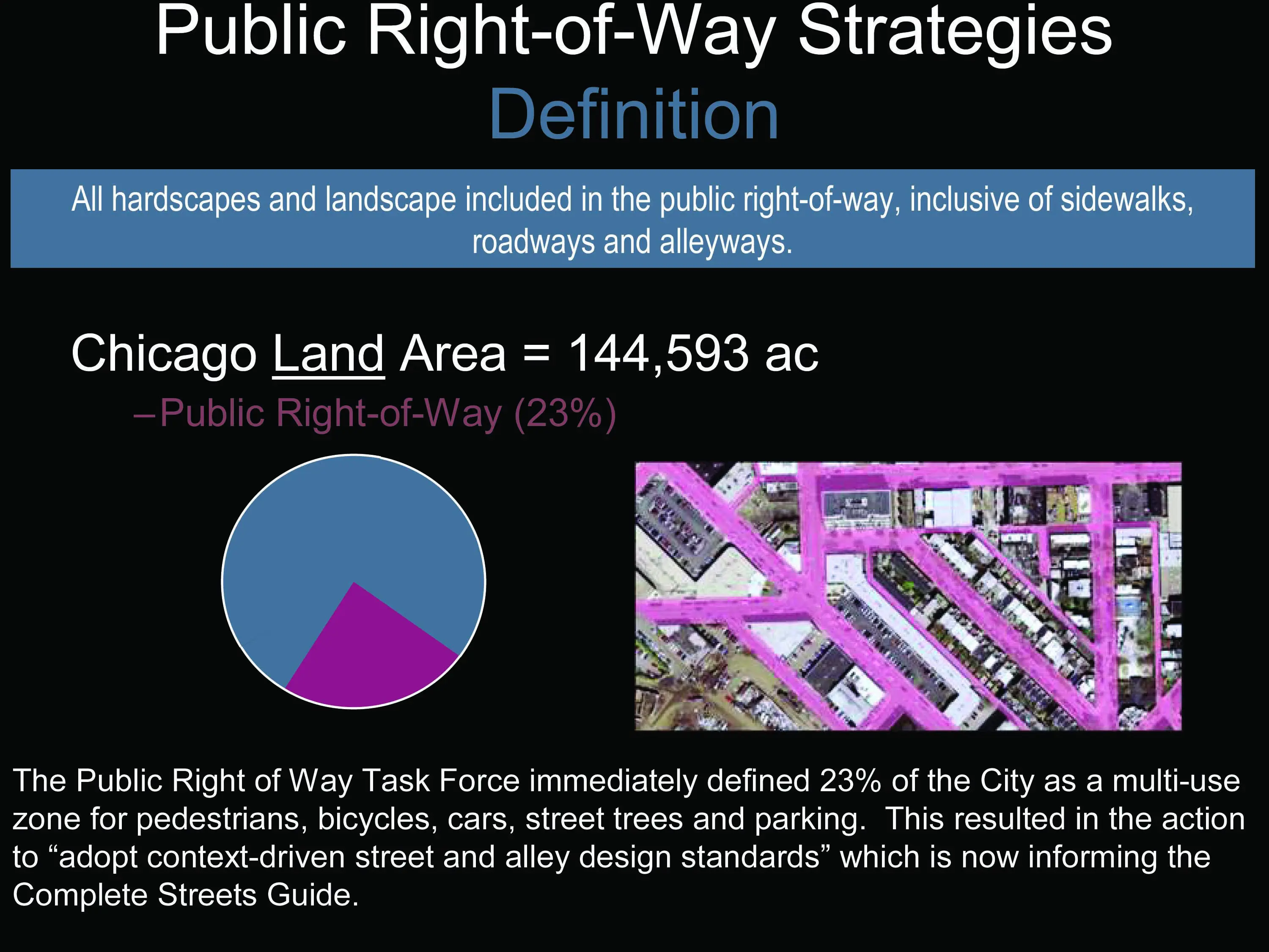
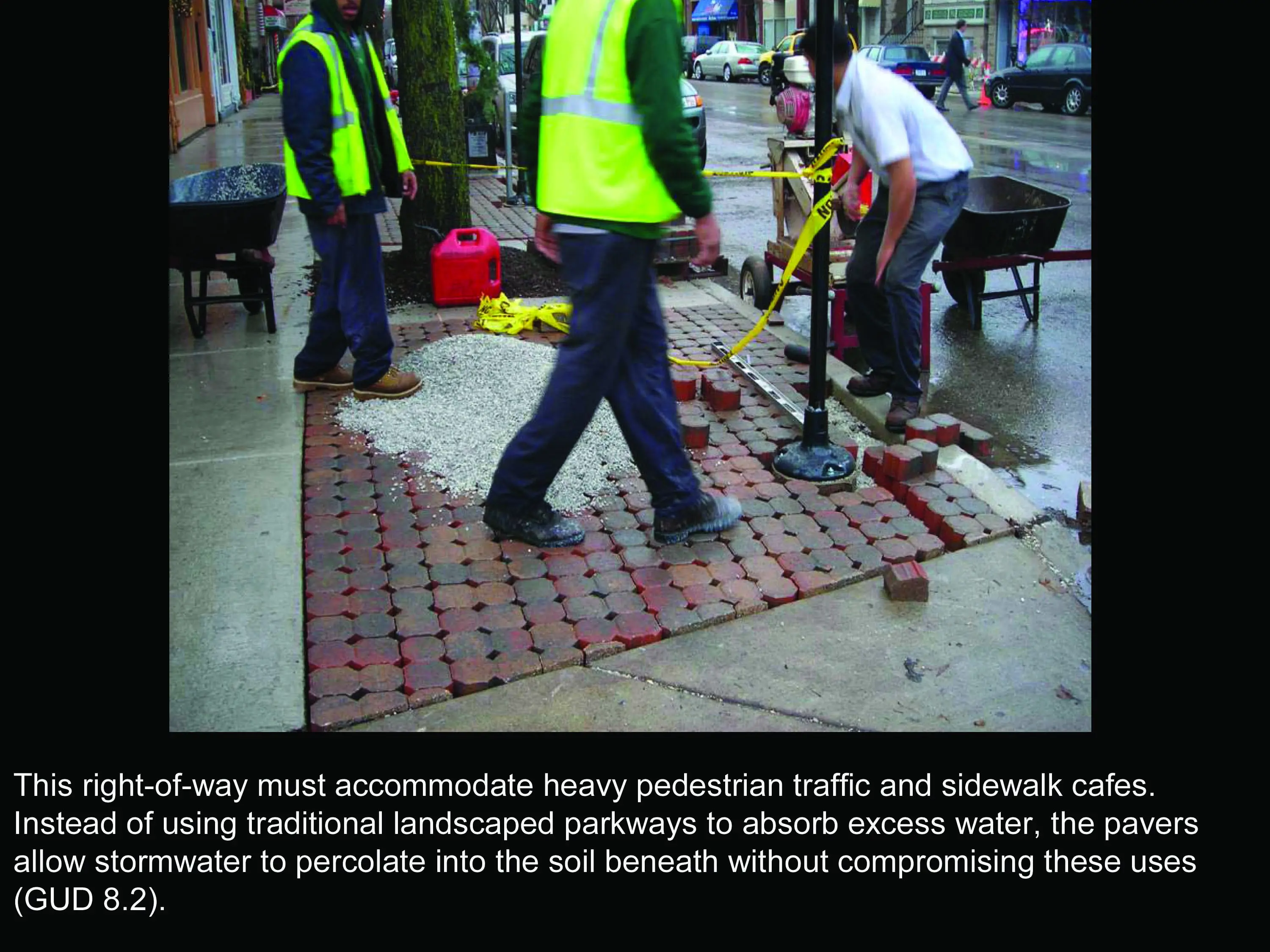
- Public Rights-of-way: All landscapes and hardscapes in the public right-of-way, inclusive of sidewalks, roadways and alleyways
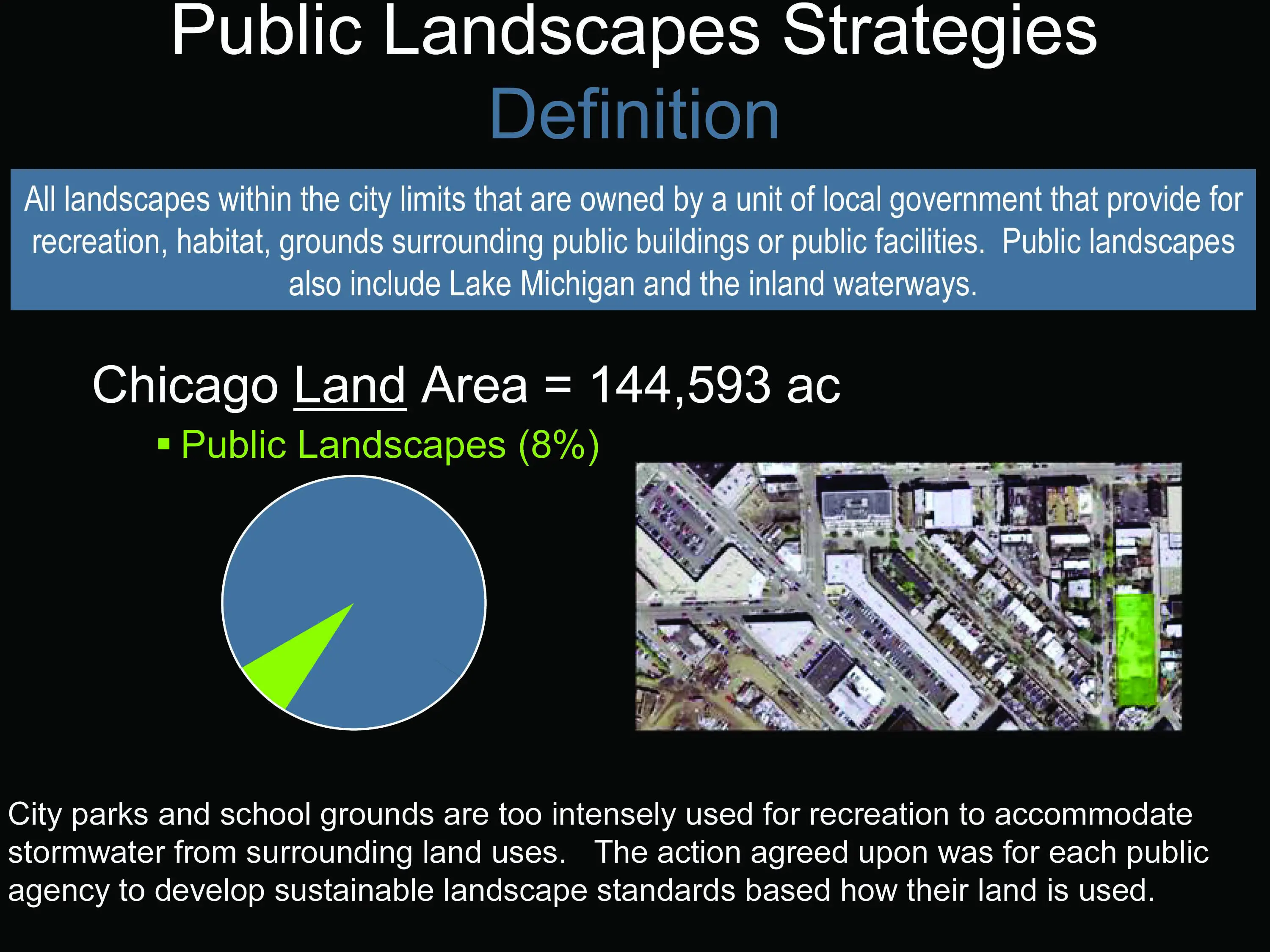
- Public Landscapes: All publicly-owned landscapes within City limits that provide for recreation, natural habitat, and grounds surrounding public buildings or public facilities
- Indicators: Measures and processes that guide, monitor, and evaluate ongoing strategies implementation
An initial task of the steering committee was to refine and finalize the working group's goal for the planning process. After much deliberation and thoughtful discussion, the steering committee agreed on the following goal:
Maintain and improve Chicago’s urban design to optimize its environmental benefits for current and future generations.
The GUD Plan
In 19 months and a combined 230 hours of pro bono time, the task forces developed 21 strategies for Chicago planners, builders and government agencies to make sustainable urban design a reality. The key actions are presented in the framework plan in the context of four major approaches:
- Environment: Design and maintain to ensure environmental sustainability and function
- Integration: Promote design that is responsive to the neighborhood context balancing functions, environmental goals and economic vitality
- Innovation: Test, evaluate and, when appropriate, expand use of and monitor green technologies
- Assessment: Empower all stakeholders at all times with an understanding of the rationale and outcomes
The 21 strategies included both short and long term actions. The following are a few of the shorter term activities that have been implemented.
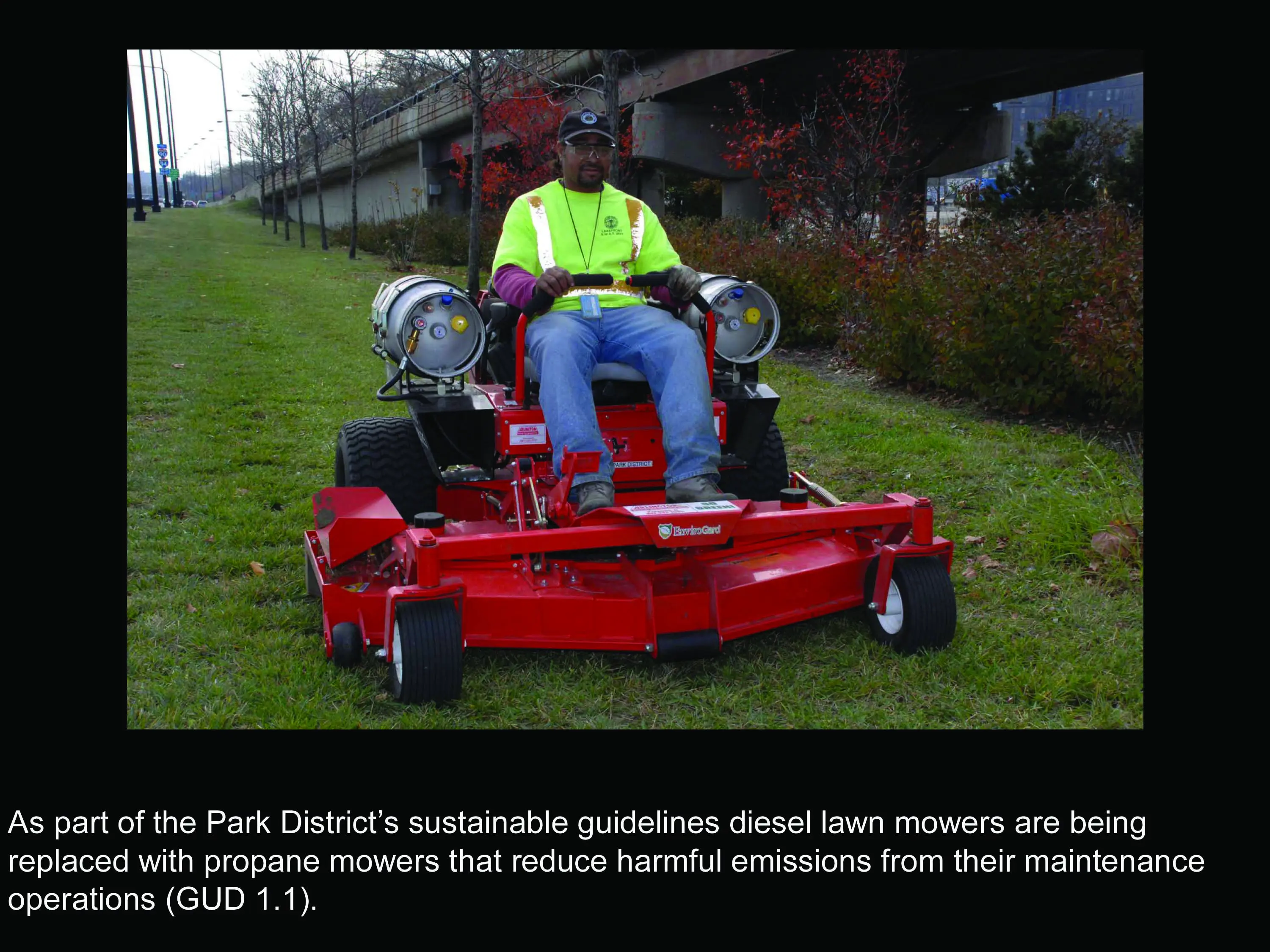
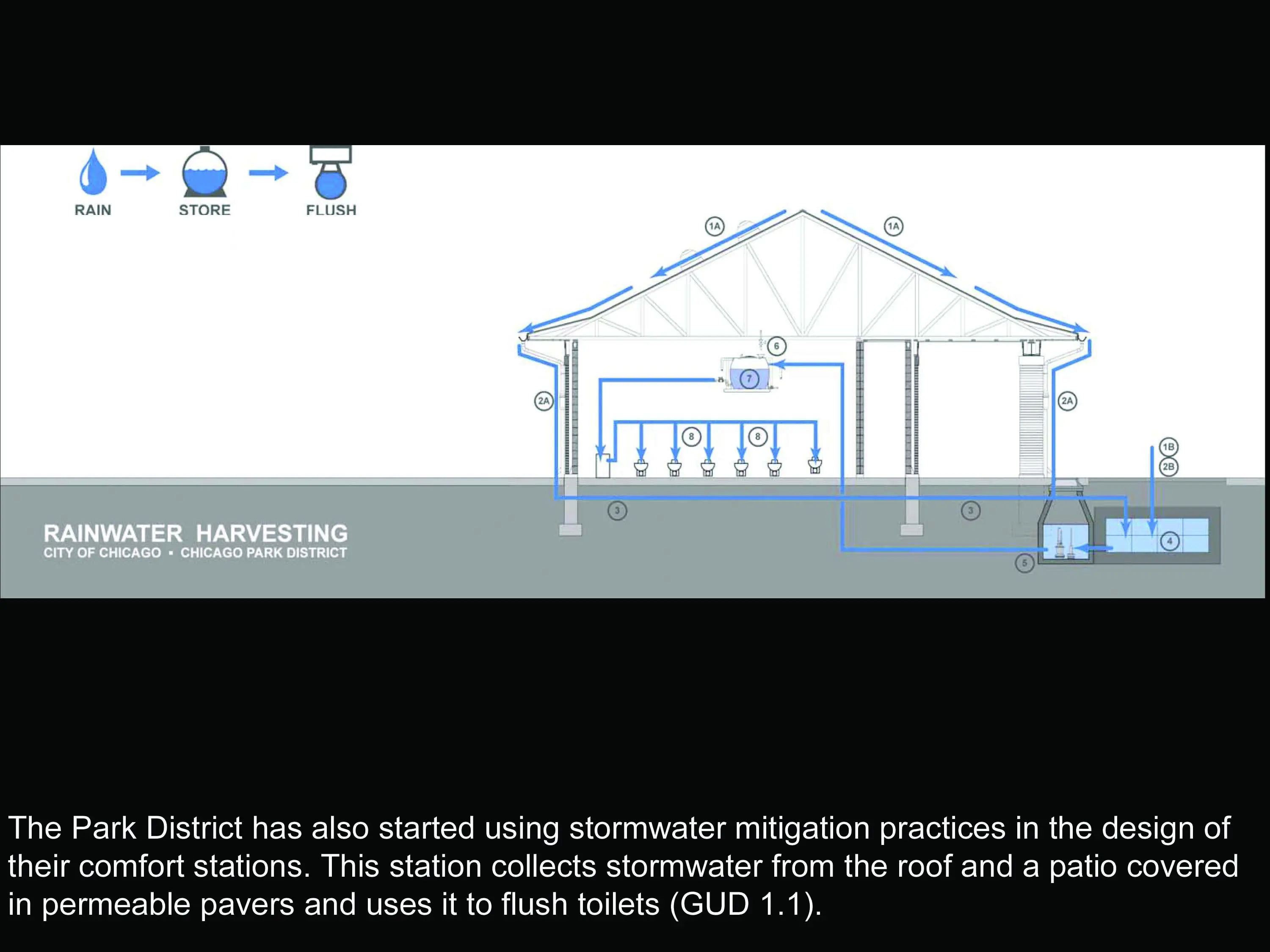
- GUD Action 1.1: Develop Sustainable Landscape Standards for Public Landscapes - The Chicago Park District began replacing their fleet of diesel lawn mowers with propane mowers to reduce emissions from their maintenance operations.
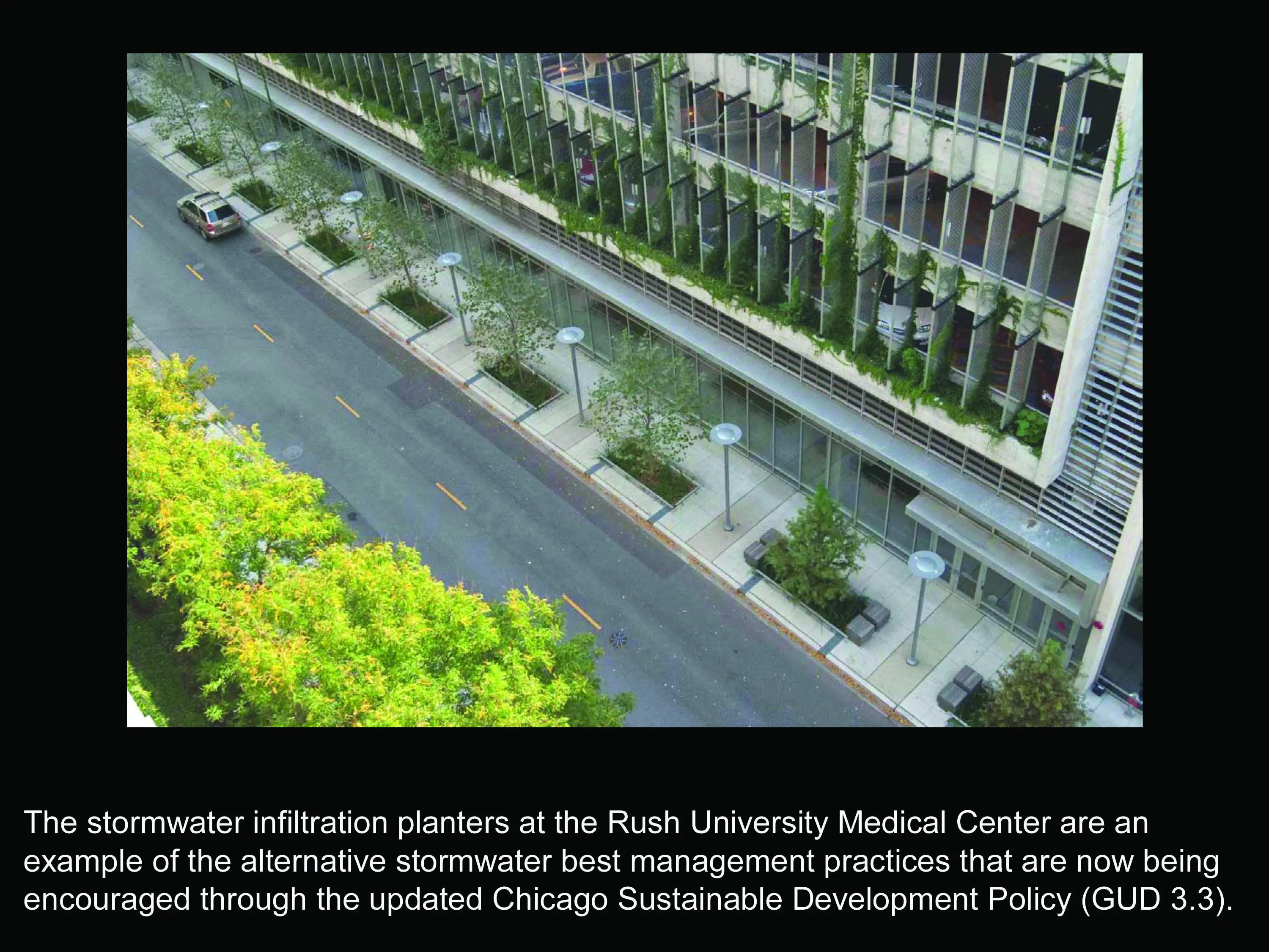
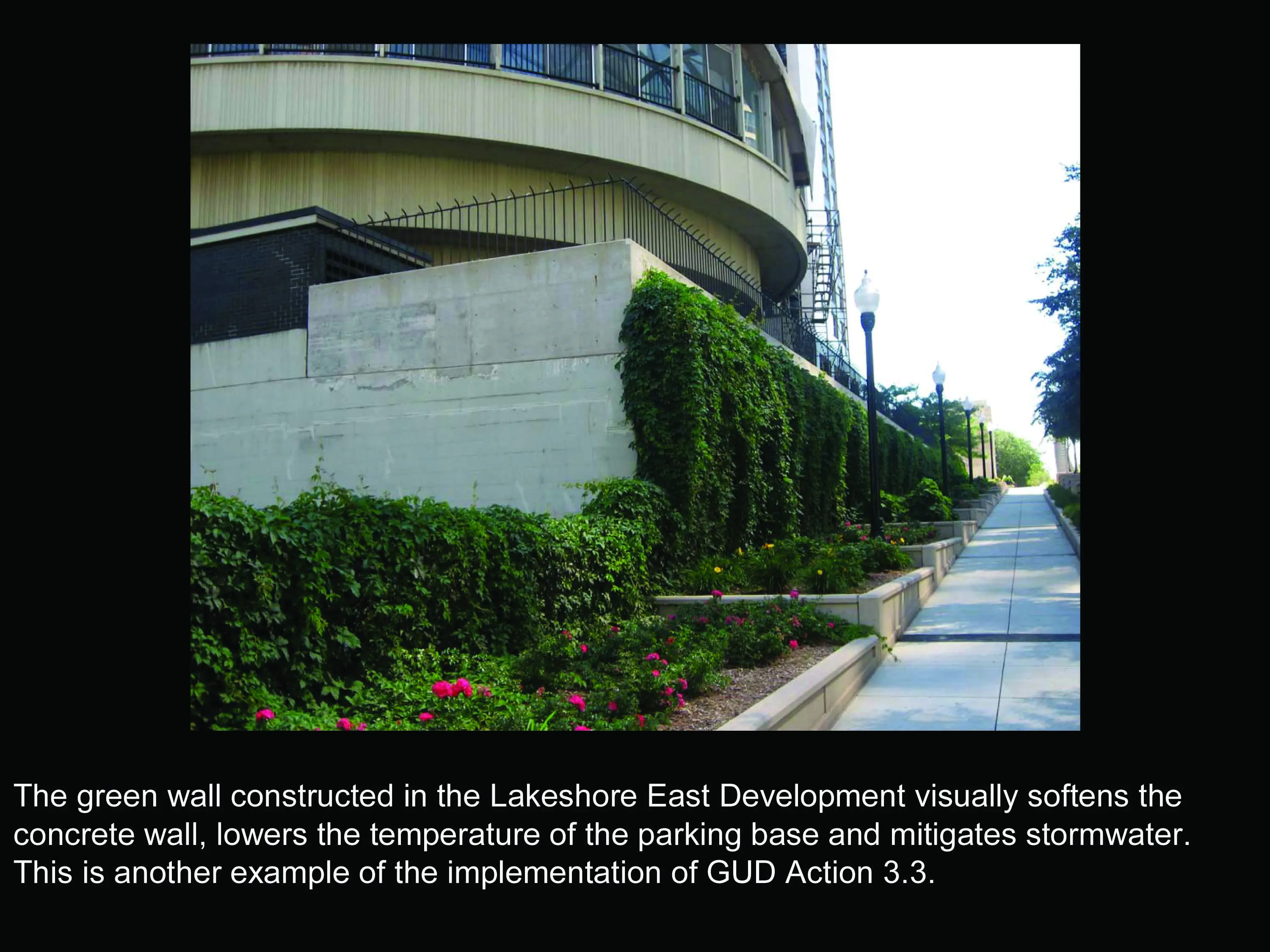
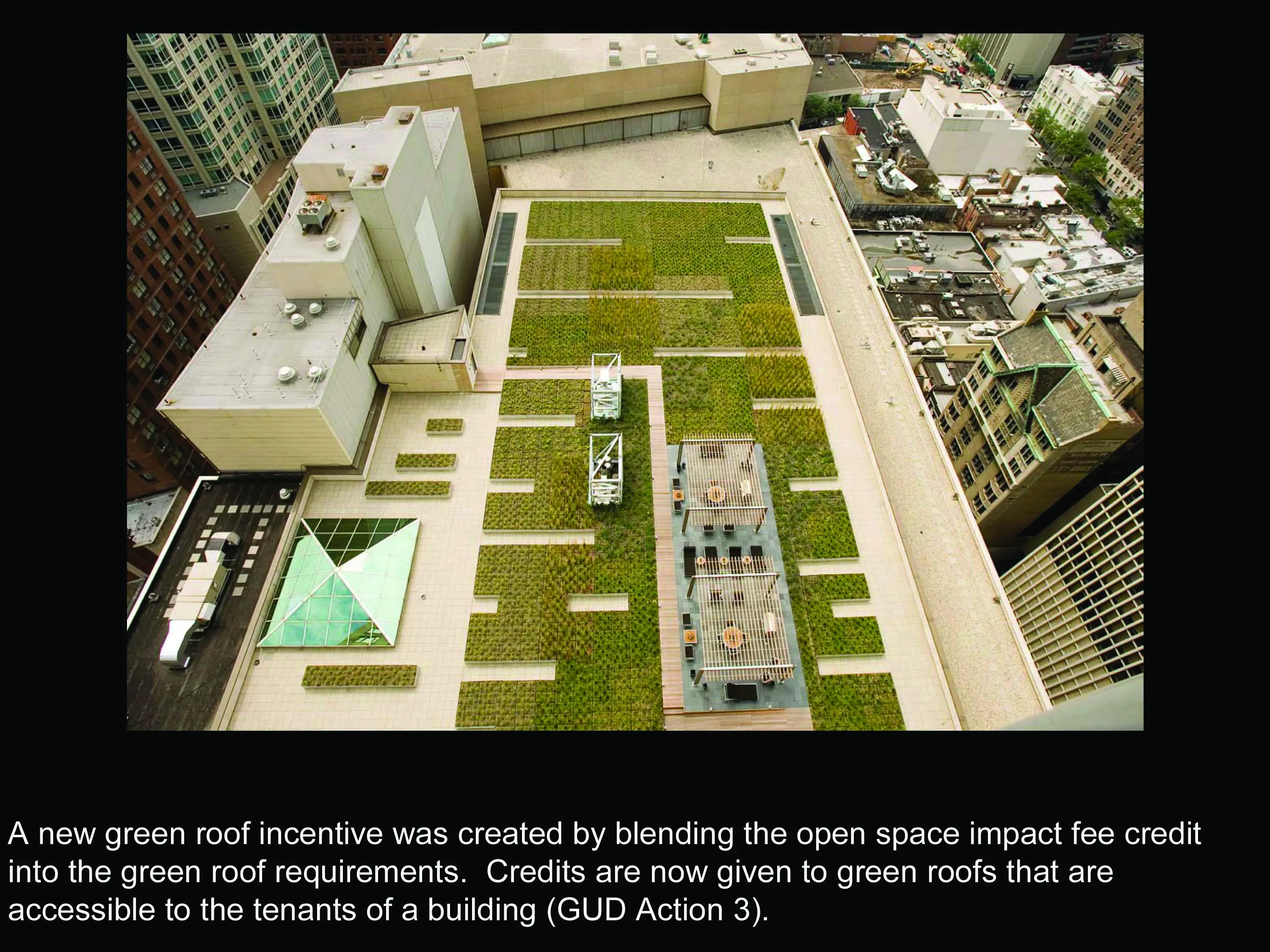
- GUD Action 3.3: Expand Green Roof Requirements - The Chicago Sustainable Development policy was improved by expanding the required green roof coverage percentage requirements and allowing alternative stormwater best management practices for projects receiving assistance from the City.
- GUD Action 7.1: Define Canopy Cover Goals - The City and the Chicago Trees Initiative set a tree canopy target of 20% and outlined an action plan to attain the goal in the 2009 Urban Forest Agenda.
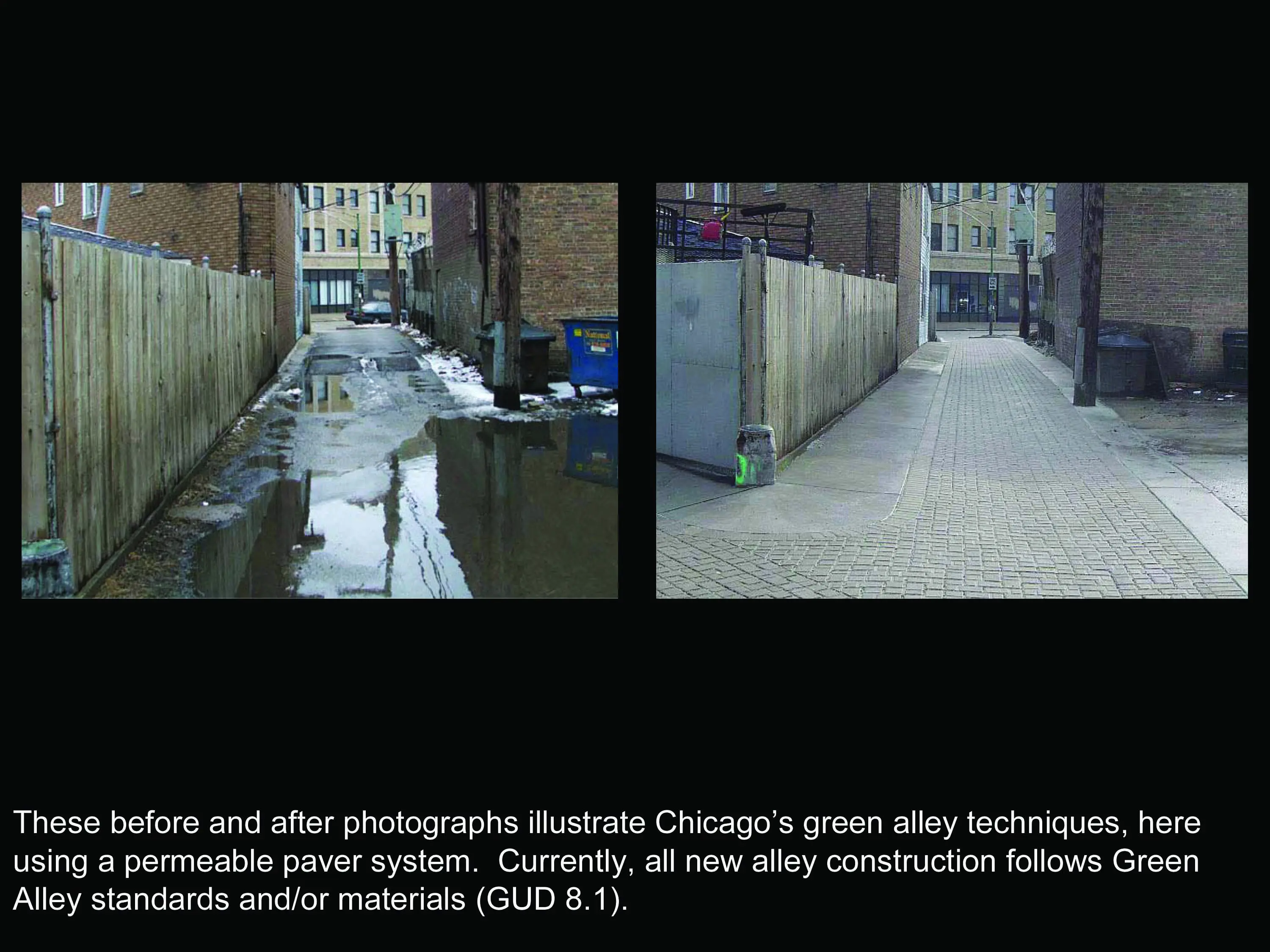
- GUD Action 8.1: Adopt Green Alley Design Standards - All new alley construction now use Green Alley standards and/or materials.
- GUD Action 8.2: Develop Sustainable Street Design Standards - A Sustainable Street Design Standard Matrix on land use, street types, and right-of-way widths will be completed in 2011 in conjunction with the Sustainable Streets Standards developed by the Chicago Department of Transportation.
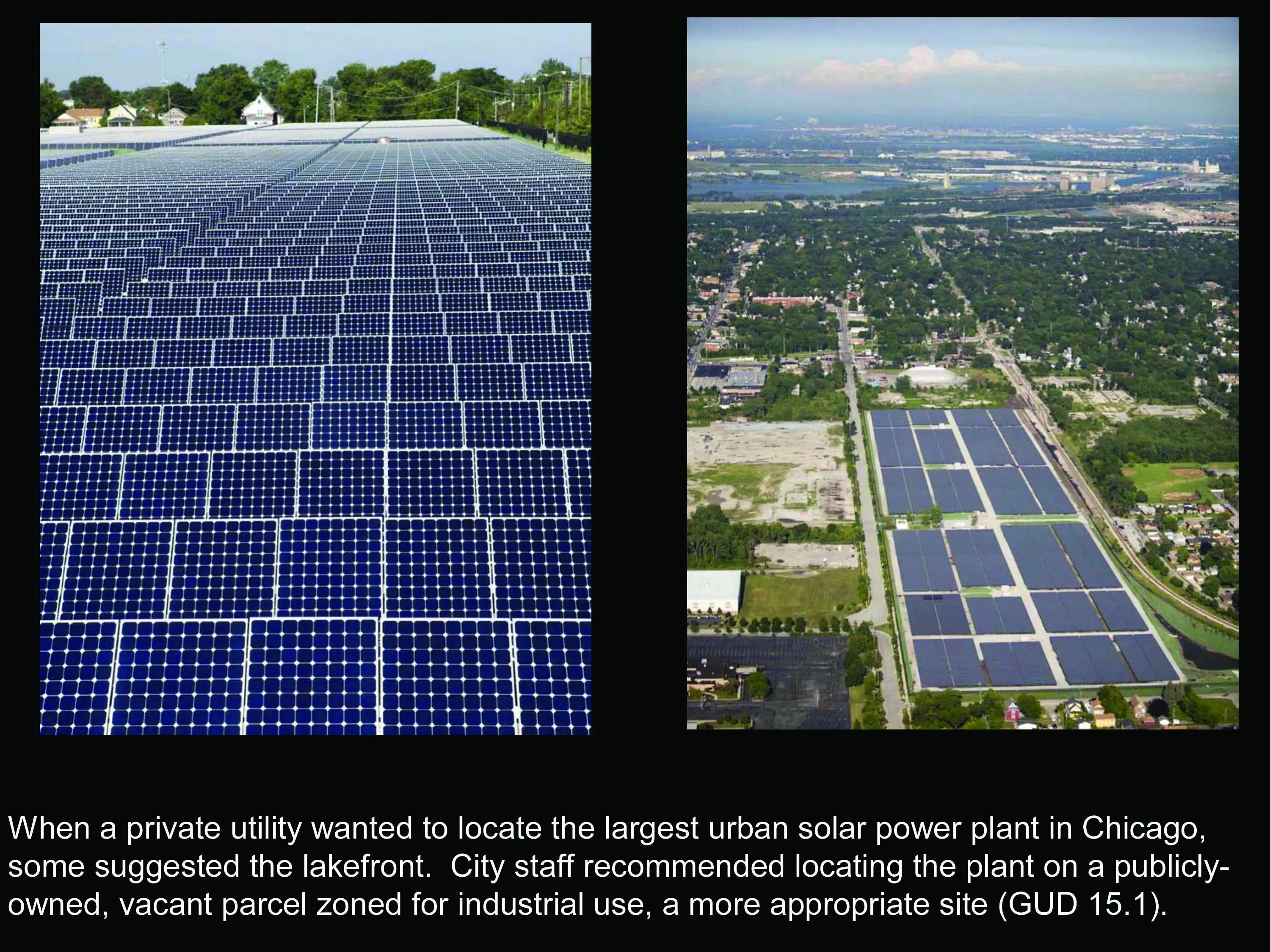
- GUD Action 15.1: Capture and Use Renewable Energy in Public Landscapes - The City assisted a private utility in locating and permitting the largest urban solar power plant in the United States (10 megawatts) on publicly-owned, vacant land in the West Pullman Planned Manufacturing District.
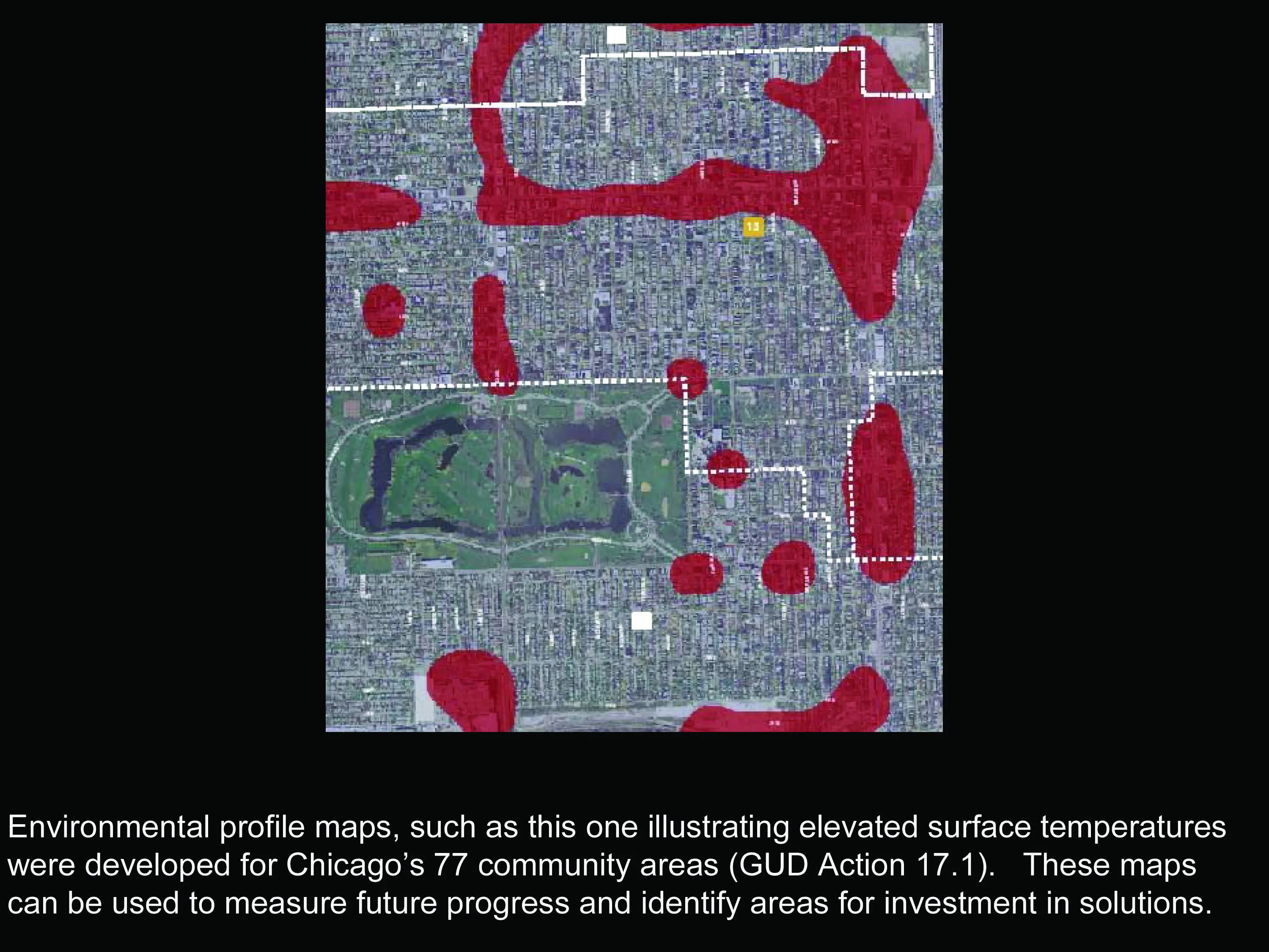
- GUD Action 17.1: Create Community Area Environmental Profile Maps and Data-sets - Environmental profile maps and data-sets were developed for each of Chicago’s 77 community areas using the water, air and land indicators.
Several of the longer term strategies have been initiated and have led to further analysis.
- GUD Action 5.1: Establish Maintenance Requirements - Initial work to establish maintenance requirements and enforcement for green roofs required by the Chicago Sustainable Development Policy included an investigation of alternative methods for enforcing the maintenance agreement (city inspections vs. use of satellite imagery). Given the decrease in the City budget for in-the-field inspections and the higher level of sophistication of City staff in GIS analysis and application, the recommendation was to use satellite imagery to identify and monitor the number and health of green roofs. Satellite imagery from fall 2010 has been purchased and will be analyzed by June of 2011 to create a database of the number, square footage and health of all green roofs in Chicago.
- GUD Actions 14.4: Assess Public Land Opportunities for Stormwater Landscapes and 15.1: Capture and Use Renewable Energy in Public Landscapes - An assessment of land opportunities for the creation of stormwater management landscapes and shared renewable energy systems will be completed in 2011 as part of two planning projects. One study will explore innovative stormwater best management practices within the context of residential and commercial block typologies in the Washington Park/Woodlawn neighborhoods while the other will investigate shared stormwater best management practices and renewable energy systems opportunities in Chicago’s 24 designated industrial corridors.
The GUD plan’s most important section is the Implementation Road Map. This section presents the 21 key actions with corresponding critical next steps. It details target dates for the completion of each action along with the city department or agency that is responsible for implementation. The road map is a dynamic document that is being used as a progress report every year. Its content will evolve to reflect completed steps, but also added or modified steps when appropriate, to support the realization of the 21 key actions.
-
Writer: Laurie Marston and Associates
Laurie B. Marston, AICP
Writer: Nancy Seeger Associates, Ltd.
Nancy SeegerConsultant
Anne Jaluzot
Consultant: Adrian Smith + Gordon Gill
Peter Kindel
Partner: City of Chicago, Department of Transportation
Partner: City of Chicago, Department of Environment
Partner: City of Chicago, Department of Information Technology
Partner: City of Chicago, Department of Streets and Sanitation
Partner: City of Chicago, Department of Buildings
Partner: Chicago Park District
Partner: City of Chicago, Department of Water Management
City of Chicago, Dept. of Housing and Economic Development
Deputy Commissioner: Kathleen E. Dickhut, ASLA;
Green Projects Administrator: Michael Berkshire;
Managing Deputy Commissioner: Patricia A. Scudiero;
Staff Assistant: Jeanne Chandler;
Supervising Plan Examiner: Noah Szafraniec;
Chief Landscape Architect: Ronald Daye, RLA, AICP;The City of Chicago, Department of Housing and Economic Development wishes to thank the following individuals for donating their time to participate in the public input process, supply information and review document drafts:
Metropolitan Mayors Caucus
Kate Agasie
University of Illinois
Susan Ask
Wicker Park–Bucktown Chamber of Commerce (SSA 33)
Paula Barrington
Environmental Systems Research Institute–
Illinois Satellite Office
Drew Bieber
Chicago Development Council
Bill Bornhoff
Walgreen Co. / ICSC
Zack Church
Openlands
Glenda Daniel; Jim DeHornThe Will Group
Steve Davis
Industrial Council of Nearwest Chicago
Steve DeBretto
Farr Associates
Doug Farr
LR Development Company
Kevin Farrell
Lincoln Square Chamber of Commerce
Melissa Flynn; Christie HahnU.S. Equities Realty, LLC
Cassandra Francis
Friends of the Chicago River
Margaret Frisbie
Logan Square Neighborhood AssociationLucy
Gomez-Feliciano
Planning Resources Inc.
Keven Graham, ASLA
Terry Guen Design Associates, Inc.
Terry Guen, FASLAShefsky & Froelich Ltd.
Jack Guthman
Center for Neighborhood Technology
Peter HaasDLK Civic Design
Richard Hayden, ASLAChicagoland Bicycle Federation
Nick Jackson; Rob SadowskyThe Care of Trees, Inc.
Scott Jamieson, Affiliate ASLAGeneral Growth
Rich Kobe
Shefsky and Froelich
Edward Kus
T.Y. Lin
John LaPlanteDLK Architecture
Diane Legge Kemp, ASLAKnight Engineers and Architects
Kevin Lentz
Chicago Climate Exchange
Angela Leontis
Home Builders Association of Greater Chicago
Christine Ludwiszewski
Mercy Housing Lakefront
Tony Mastracci
Civic Consulting Alliance
Tom McKoneConservation Design Forum
Jason Navota
Consortium to Lower Obesity in Chicago Children /
Northwestern University Children’s Memorial Hospital
Jonathan Necheles
Conservation Design Forum Inc.
James Patchett, FASLA
CH2M HILL
Jade Paul
Moore Landscapes
Jim Pearson
Camiros Ltd
Leslie Pollock
UIUC — Department of Natural Resources and Environmental Sciences
Amy Ritter
Friends of the Parks
Eleanor Roemer; Erma TranterChicagoland Chamber of Commerce
Jerry Roper
Jacobs/Ryan Associates
Terry Ryan, FASLA
AIA Chicago Chapter
Peter SchlossmanHitchcock Design Group
Bill Schmidt
NeighborSpace
Mary Jo Schnell
Daniel Weinbach and Partners
Wendy Schulenberg, ASLAUniversity of Chicago
Brian Shaw
Community Counsel
Irene Sherr
Chicago Design Initiative
John Syvertsen
Institute for Environmental Science and Policy (UIC)
Thomas Theist
Illinois Natural History Survey
David Thomas
Northern Realty Group, Ltd.
Michael Tobin
Hines Interests Limited Partnership
Gregory Van Schaack
Christy Webber Landscapes
Christy Webber, ASLAU.S. Green Building Council — Chicago Chapter
Doug Widener
Wolff Landscape Architecture Inc.
Ted Wolff, ASLA
Wight and Company
Jay Womack
Site Design Group
Ernie Wong, ASLA
General Growth
Julie Zamudio
Advertisement
Related Awards
Award of Excellence, ANALYSIS AND PLANNING
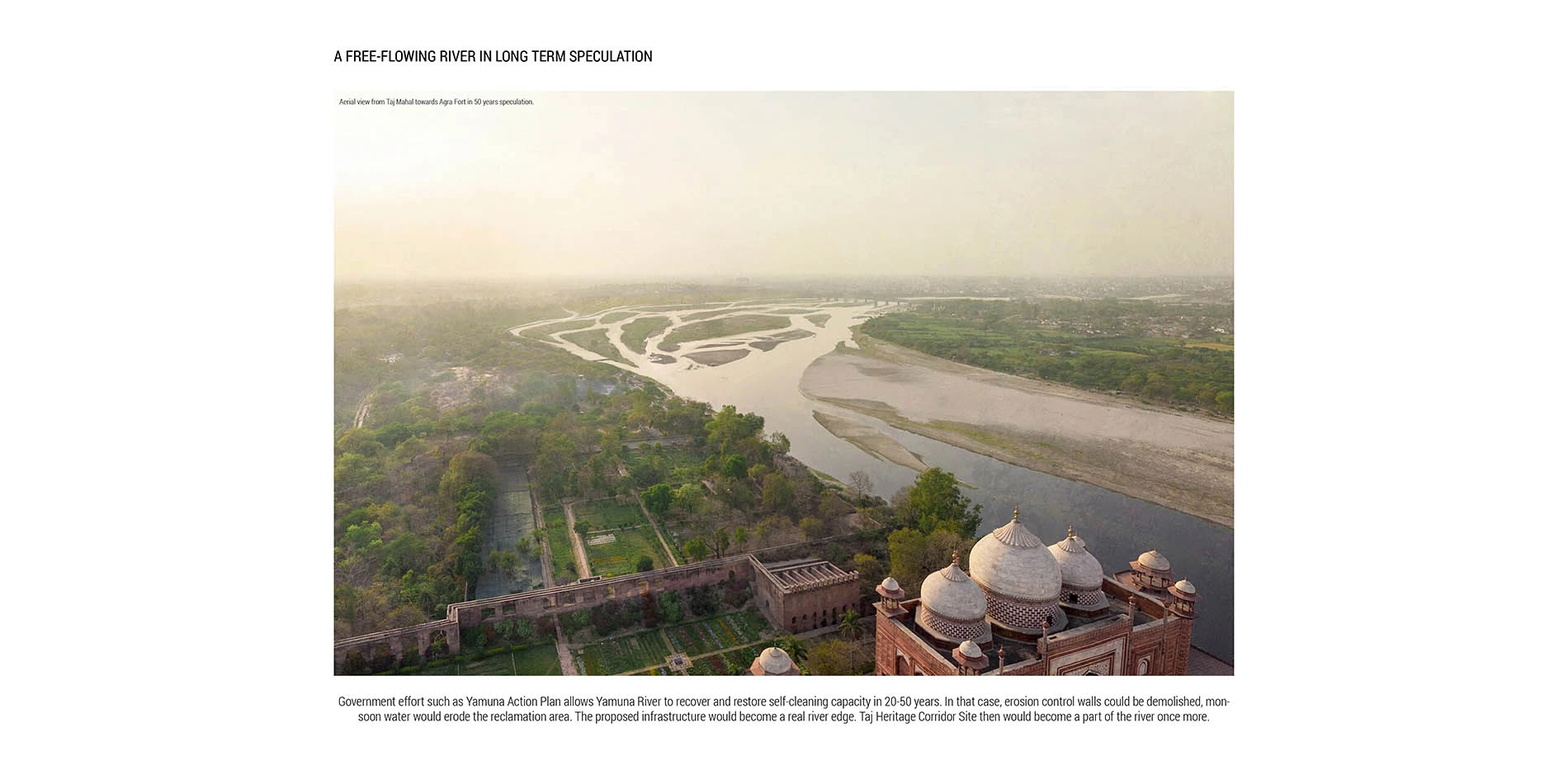
Rethinking Taj Heritage Corridor: A River as Historic Connection
Locates between Taj Mahal and Agra Fort, this proposal on Taj Heritage Corridor aims to reestablish the image of riverfront that was destroyed during the problematic reclamation project in 2002-2003. By creating a recreational water treatment canal along the original river bank, a landscape urban infrastructure is proposed to visually connect the city's scattered historic riverfront monuments and create public space for both tourists and local community. With a full respect of the silently mild image on Yamuna River in Agra, the design proposed an educational space that highlights the inherent dialogue between environment and history. Through analysis in different scales with the understanding of extreme site conditions, political background, and feasibility potentials, the design demonstrates the strong capacity of landscape intervention in resolving the complex contradiction between modernity and historic environment conservation.