.webp?language=en-US)


-
This project addresses an unprecedented tangle of environmental, climatic and cultural issues presented by the city of Yatutsk, in the Russian northeast. The coldest city on earth, built on continuous permafrost, Yakutsk, is faced with an environmental crisis stemming from inadequate planning, pollution, and poor building practices. The design proposal applies concepts of sustainability to this extreme environment, combining basic practices and unique technological solutions to resolve ecological issues and create public space for cold climate.
-
Context
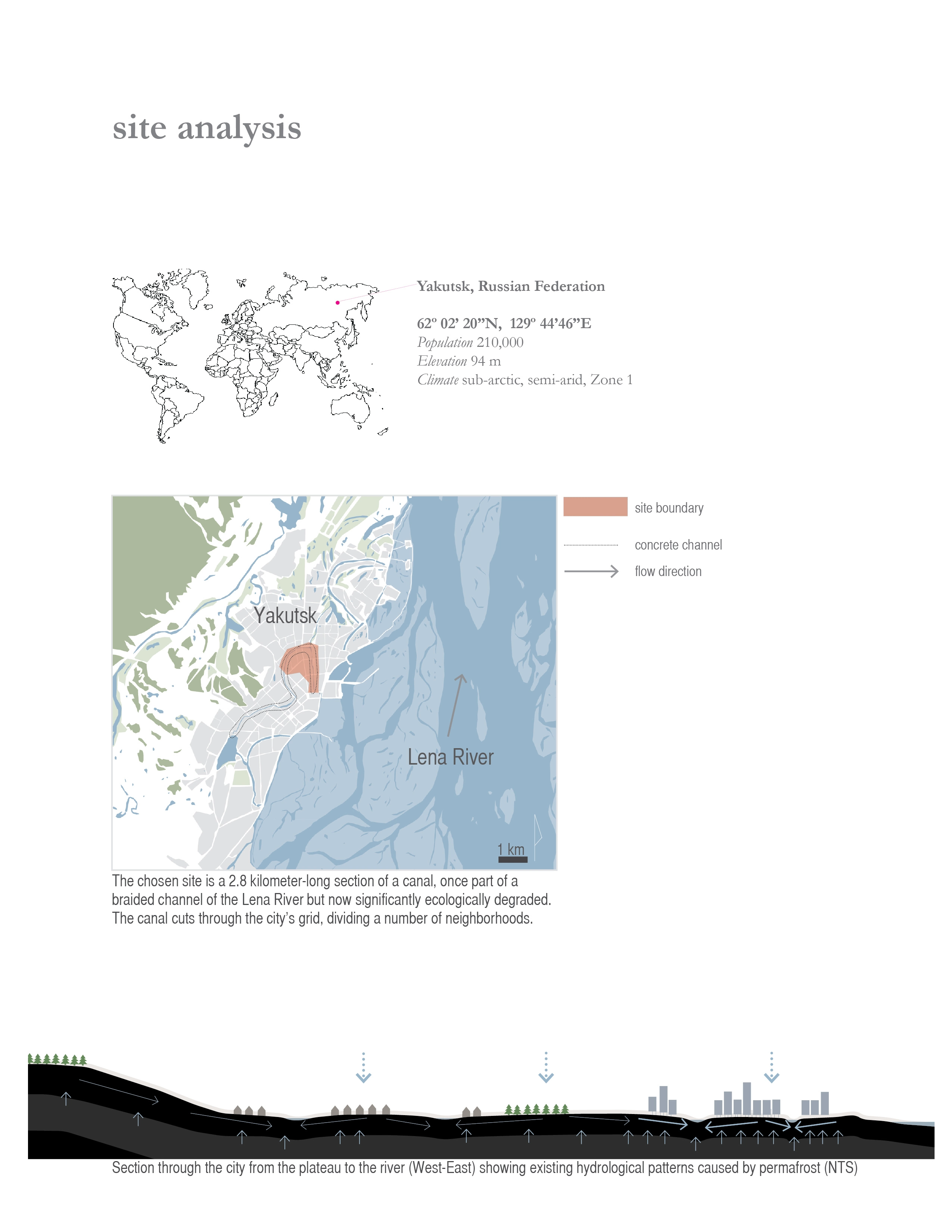
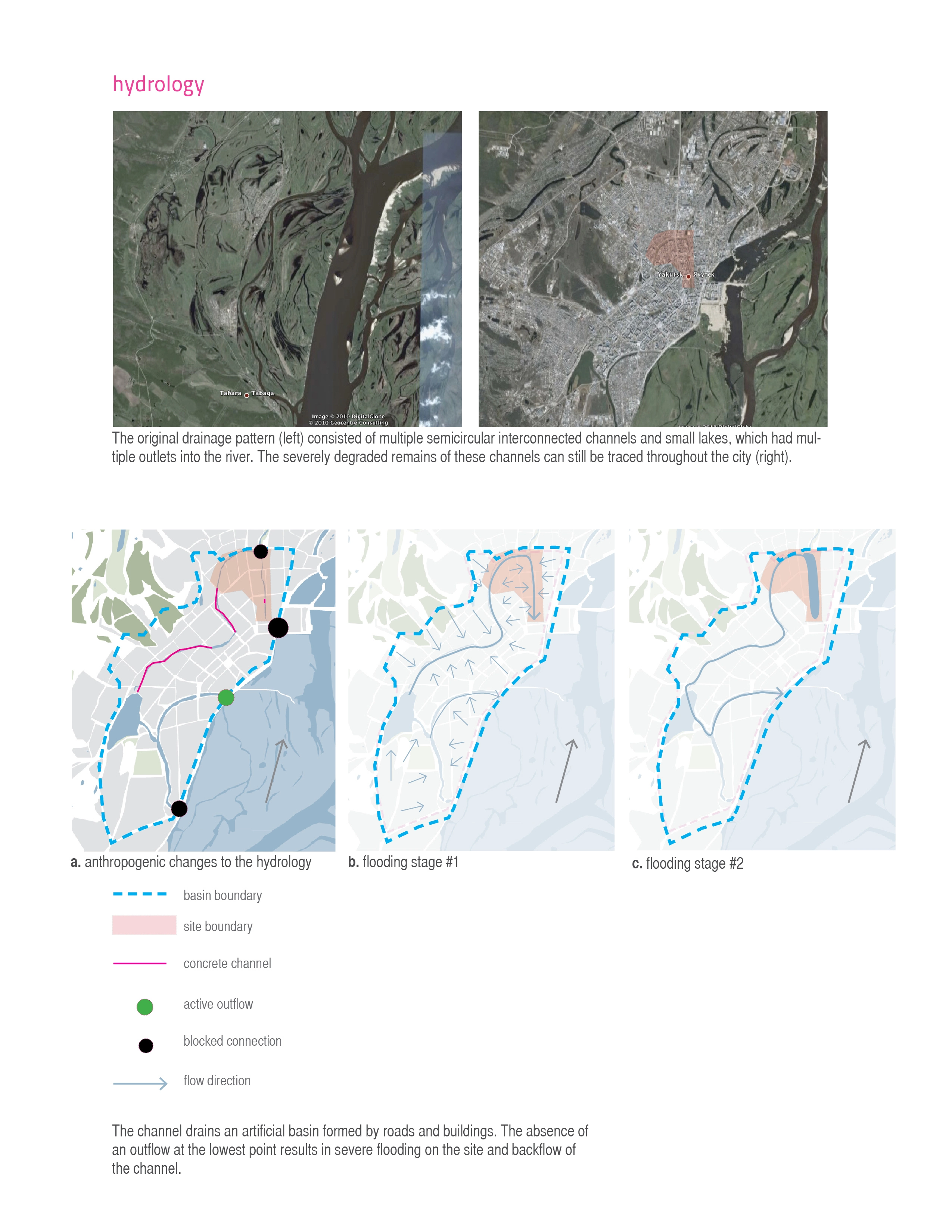
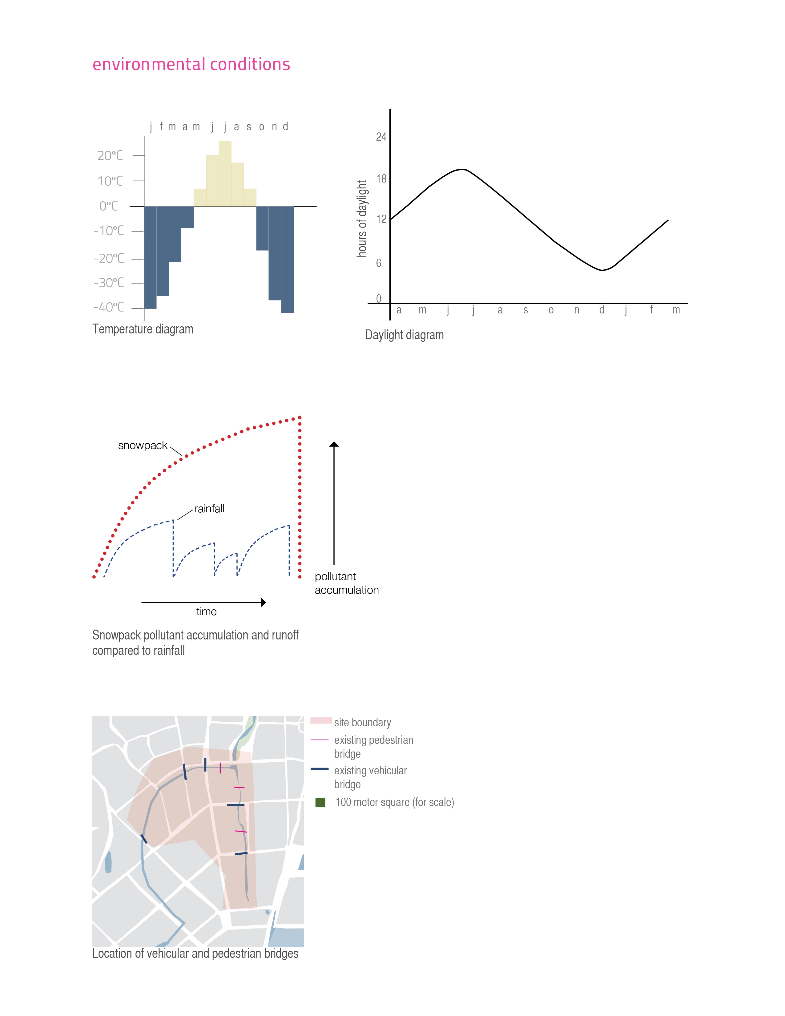
The project site is located in the city of Yakutsk in the Russian northeast. This city, with a population of 220,000, is located only 450 kilometers south of the Arctic Circle and is the coldest city on the planet. It is situated in a sub-arctic semi-arid climate with temperatures reaching -55C in the winter and +35C in the summer, and with an average yearly precipitation of about 7 inches. Winter conditions last for six months. On December 20th, there are only 4 hours of daylight, and about 50 days during winter have thick fog. Yakutsk is built on continuous permafrost, which starts 1.5 meters below the surface and is 250 meters deep. Permafrost is the major factor that affects hydrology, soils, and vegetation in the area: all buildings are constructed on piles to minimize heat transfer to the ground, all infrastructure (sewer, water, heat, electric) is located above ground, and there is no underground storm sewer. Even though the city gets very little precipitation, the permafrost, which acts as an impermeable layer, and flat topography, cause regular inundation in many areas. Pollutants from sewer and fuel leaks, exhaust, and illegal dumping concentrate in the snowmelt, causing severe pollution of soil and bodies of water. In 2005 ecologists rated the ecological situation in Yakutsk “7” (critical) on a scale from 1 (favorable) to 9 (catastrophic) based on a number of natural and anthropogenic factors. Scientists specifically point out that drainage, ecology, and the creation of green space are the major priorities that should be addressed.
Site
The 2.8 kilometer-long, 40-80 meter wide drainage corridor selected for the design intervention is a former braided channel of the Lena River, which due to anthropogenic factors such as road construction and filling for development has lost its connectivity with the river and is ecologically degraded. With no outlet at its lowest point, the channel floods adjacent neighborhoods during snowmelt and becomes a stagnant polluted pool in the summer. The channel cuts through a number of neighborhoods creating a barrier even when it is covered with ice due to the water and sewer pipes that run along its banks. Even through there are several existing vehicular and pedestrian crossings, the distances between them are too great for comfortable travel on foot during winter months.
Program
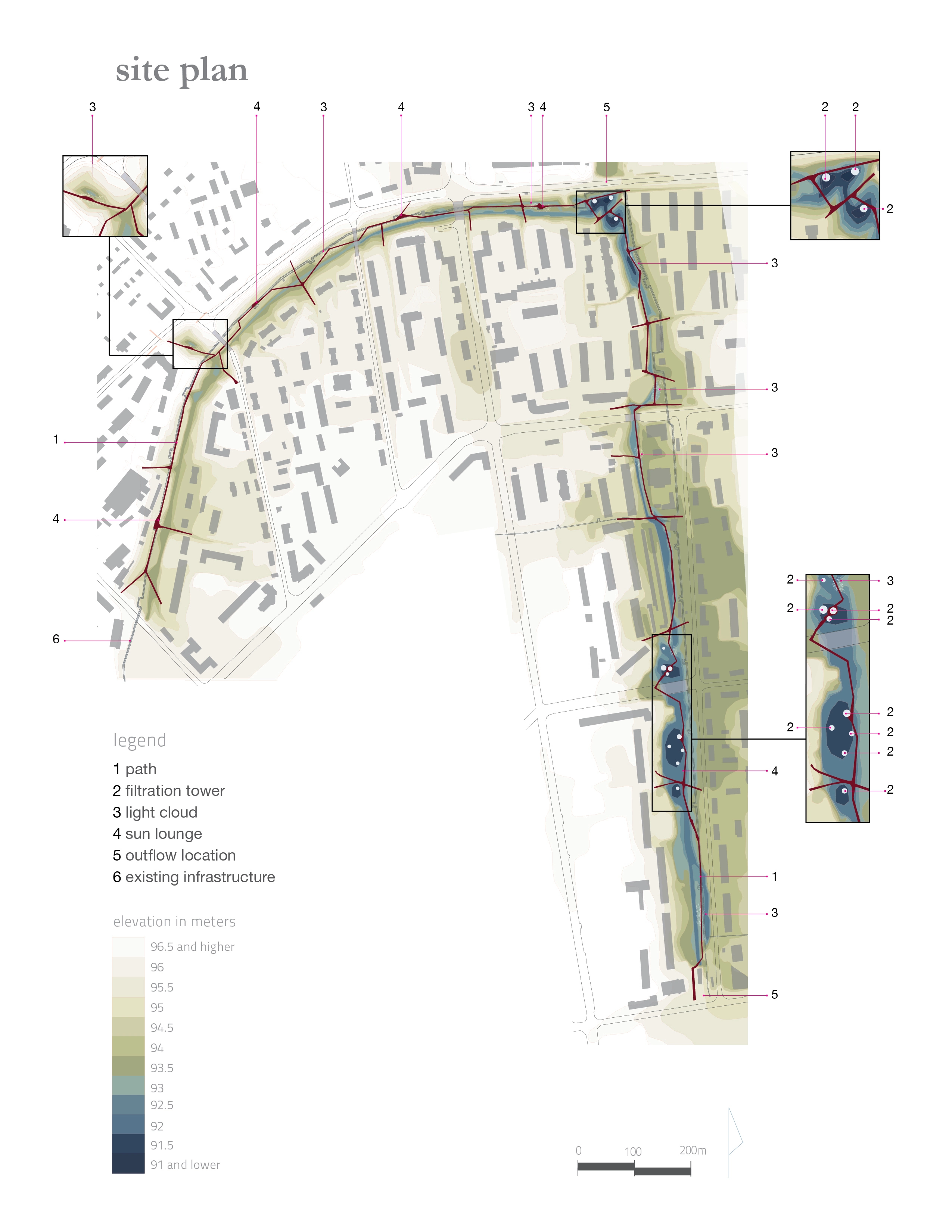
The program for the design proposal consists of water collection, transport, filtration, and storage; the creation of connectivity across and along the channel; areas of climatic refuge; and lighting. The intent of the design proposal is to address environmental issues, while creating a public space designed for extreme winter conditions.
Channel Modifications
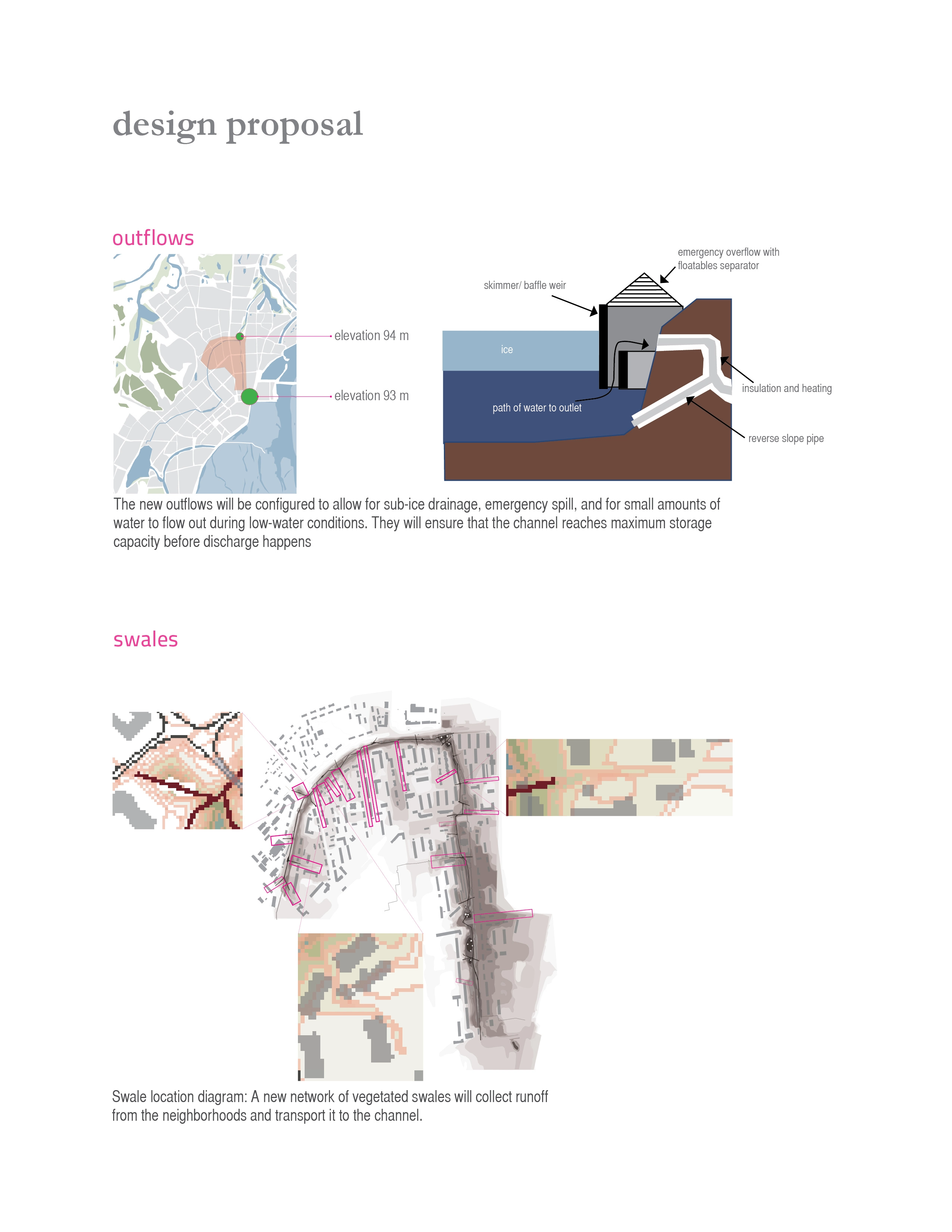
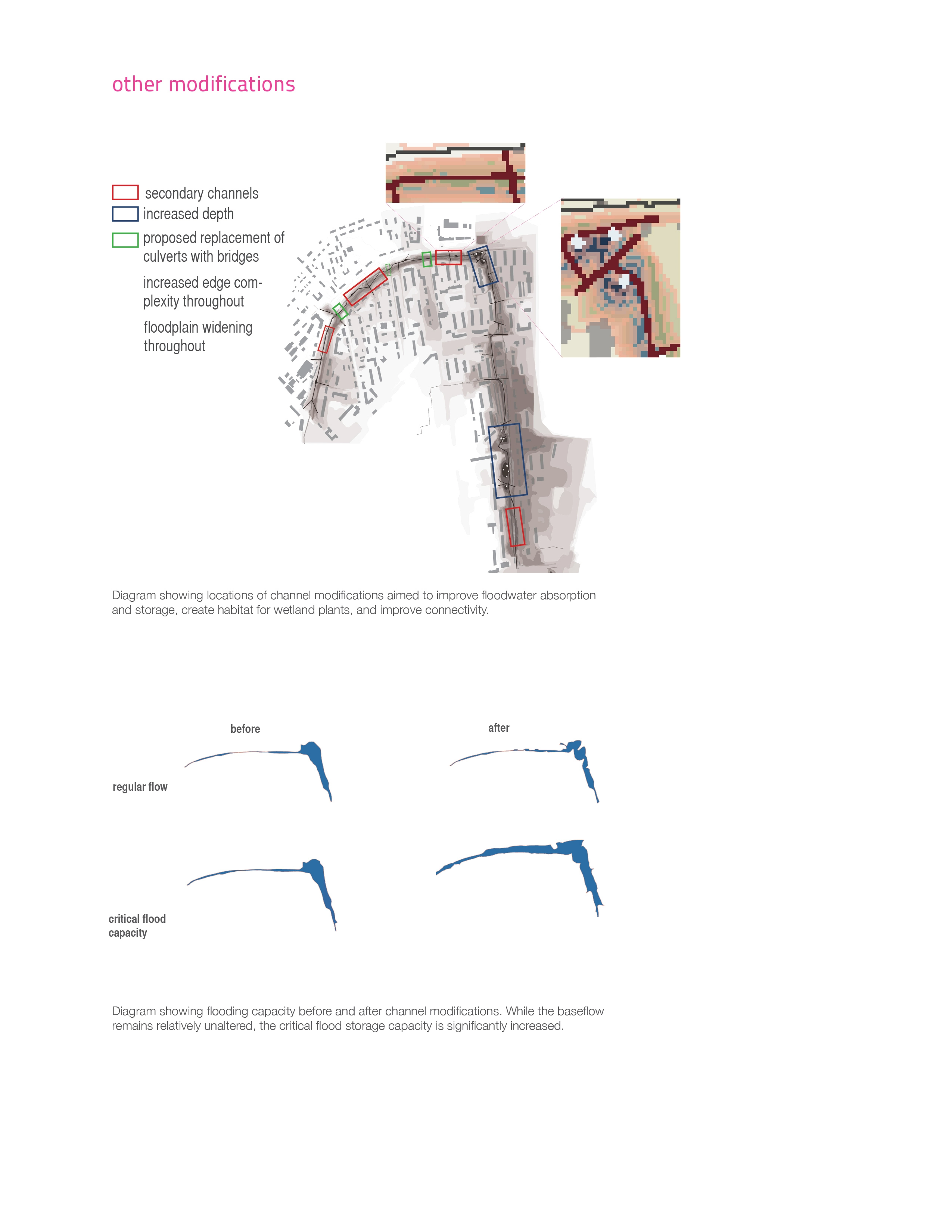
Two new outflows are proposed at the southeast and northeast ends of the site for proper drainage. The outflow elevations are set to ensure that the channel reaches maximum storage capacity before discharge in order to minimize the amount of pollutants entering the river. Runoff will be collected from the neighborhoods and transported to the channel via a network of vegetated swales. The channel corridor will be modified to allow for greater flood absorption, increased floodwater storage capacity, as well as habitat for wetland plants and improved pedestrian connectivity.
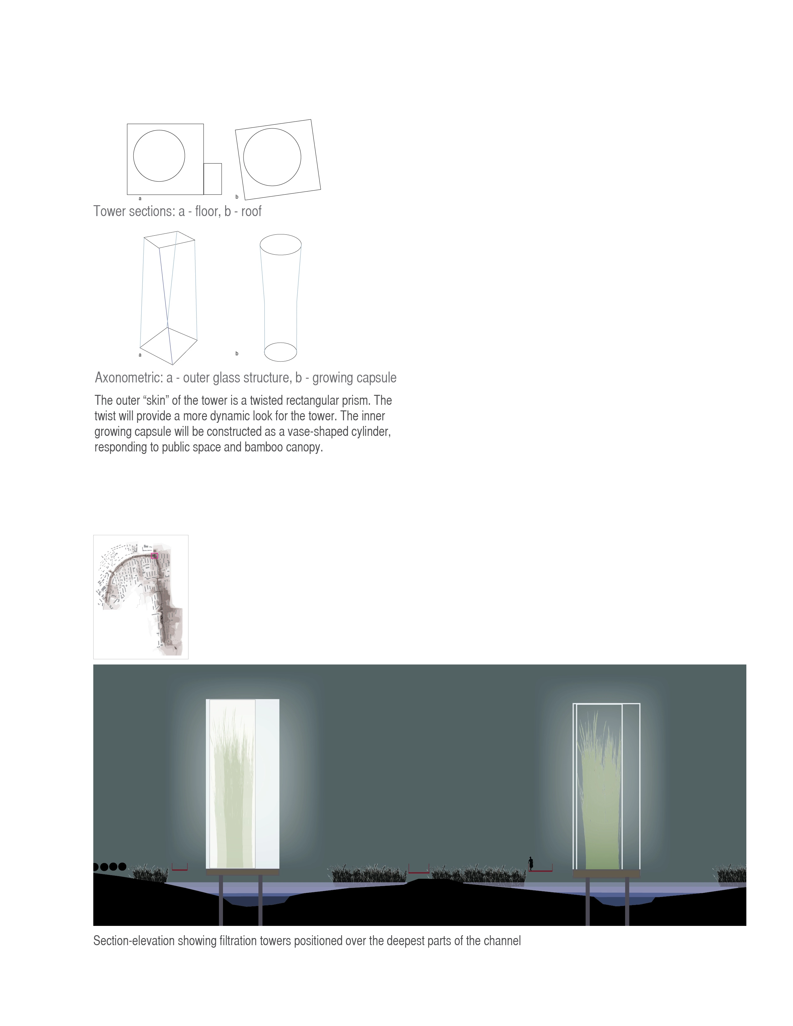
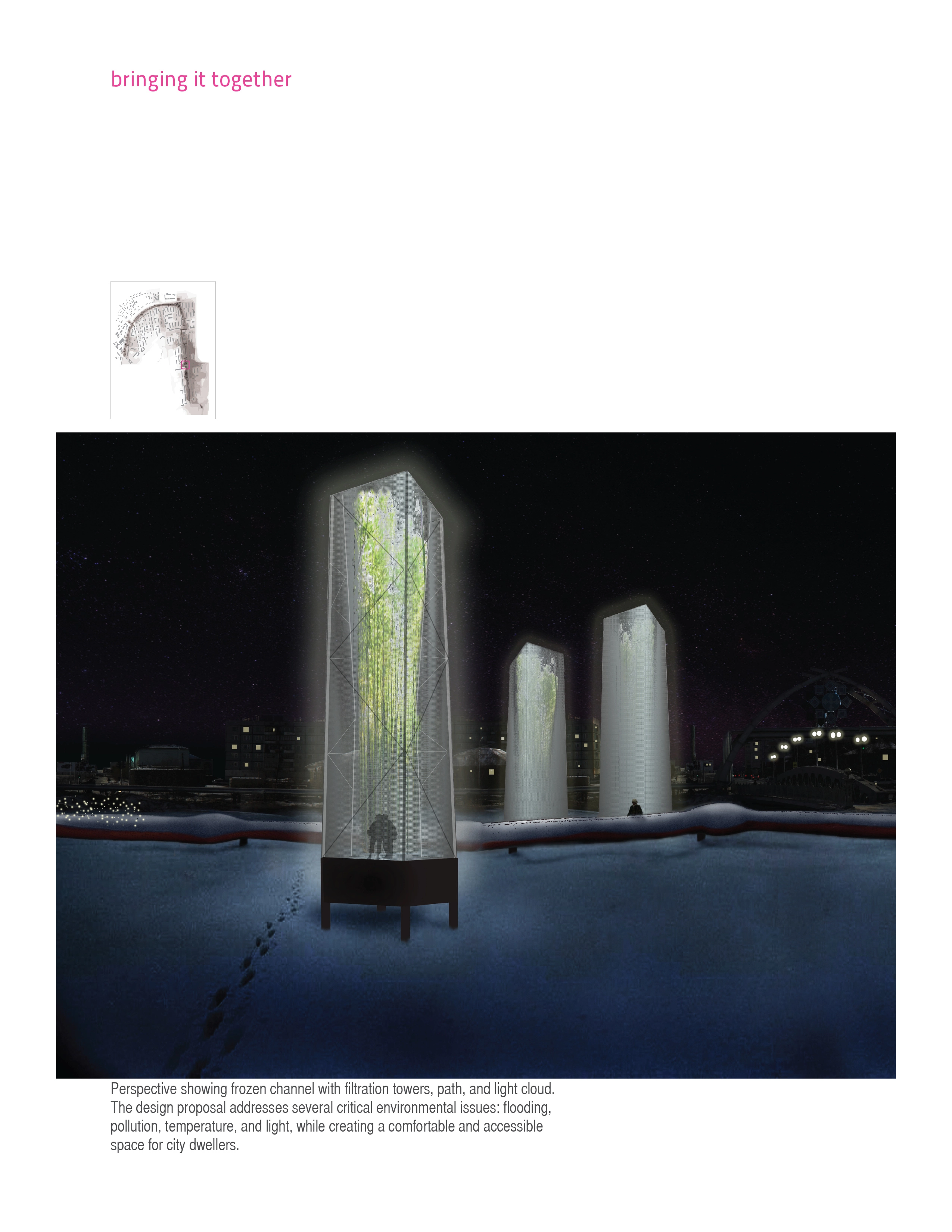
Filtration Towers
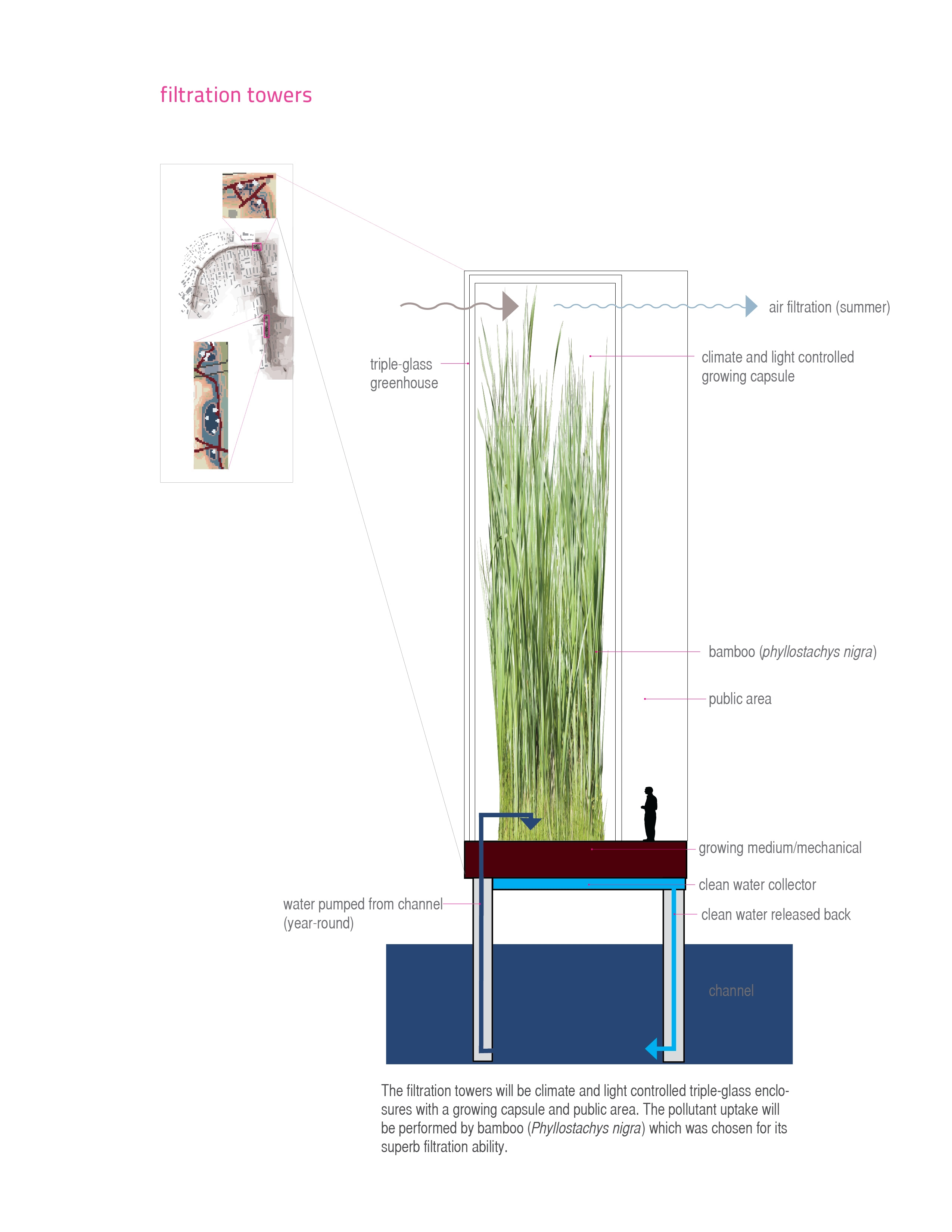
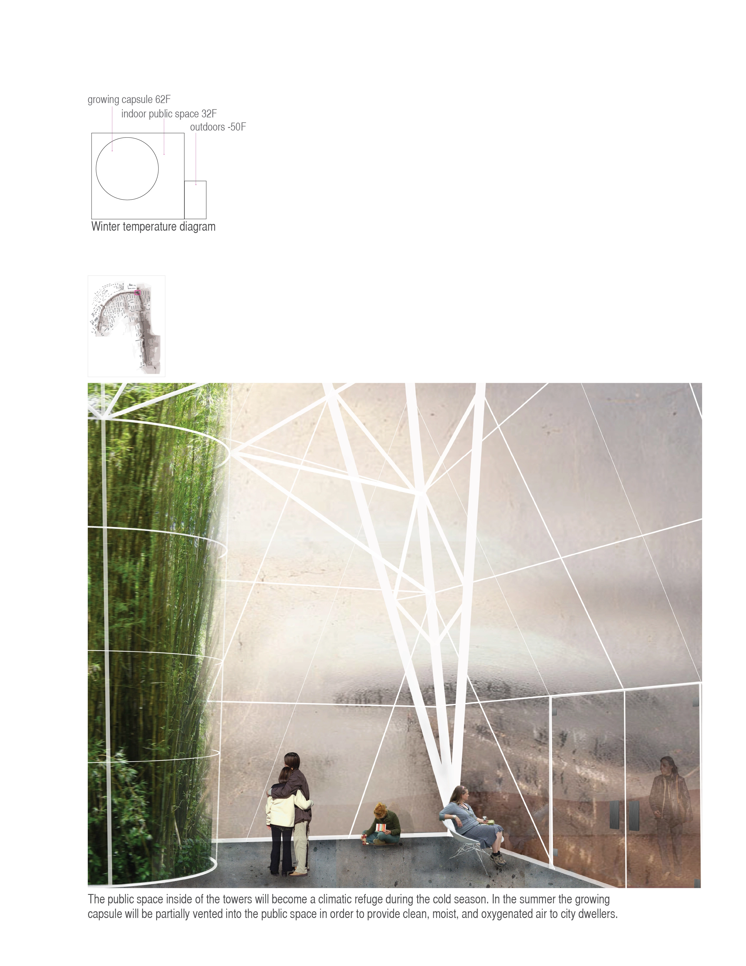
An extremely short growing season and plant dormancy during snowmelt make application of constructed wetlands very limited for this project. While it is proposed that the channel and its sides will be revegetated using a mix of native species, the main solution for year-round pollutant removal are twelve filtration towers. The concept for the filtration towers combines a greenhouse, a constructed wetland, and an indoor public space. The filtration towers will be climate and light controlled triple glass enclosures positioned over the deepest parts of the channel, where water will remain liquid under the ice. The filtration function will be performed by bamboo (Phyllostachys nigra) planted in the growing capsule. A pump will continuously pump water from the channel into the capsule where it will be distributed over the growing surface via sprayers. The water will be taken up by the bamboo and released through the process of evapotranspiration. The condensation will then be collected and released back into the canal. The daily evapotranspiration rate of bamboo can be controlled by changing the temperature: during severe danger of flooding in early spring the temperature in the towers can be adjusted to optimal (20-22ºC) and they can be vented to the outside, allowing each tower to evapotranspire approximately 32,000 liters of water daily. During winter months the temperature in the towers should be kept at a lower setting (10-15ºC) in order to continue the filtration process, but respond to lower water supply. The public space between the first and the second glass skins of the towers will provide climatic refuge throughout the year. In the winter its temperature will be significantly higher than the outside, but not as high as the inside of the growing capsule, and will create a comfortable climate for visitors. In the summer the growing capsule will be partially vented into the public space providing clean, moist, oxygenated air to city dwellers.
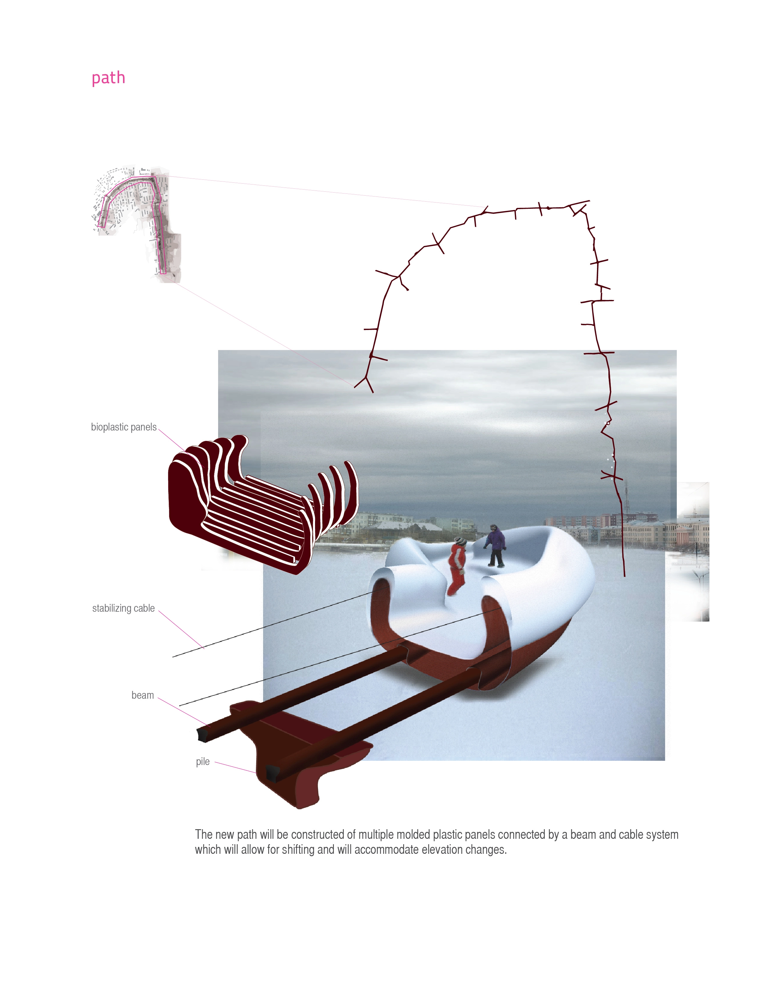
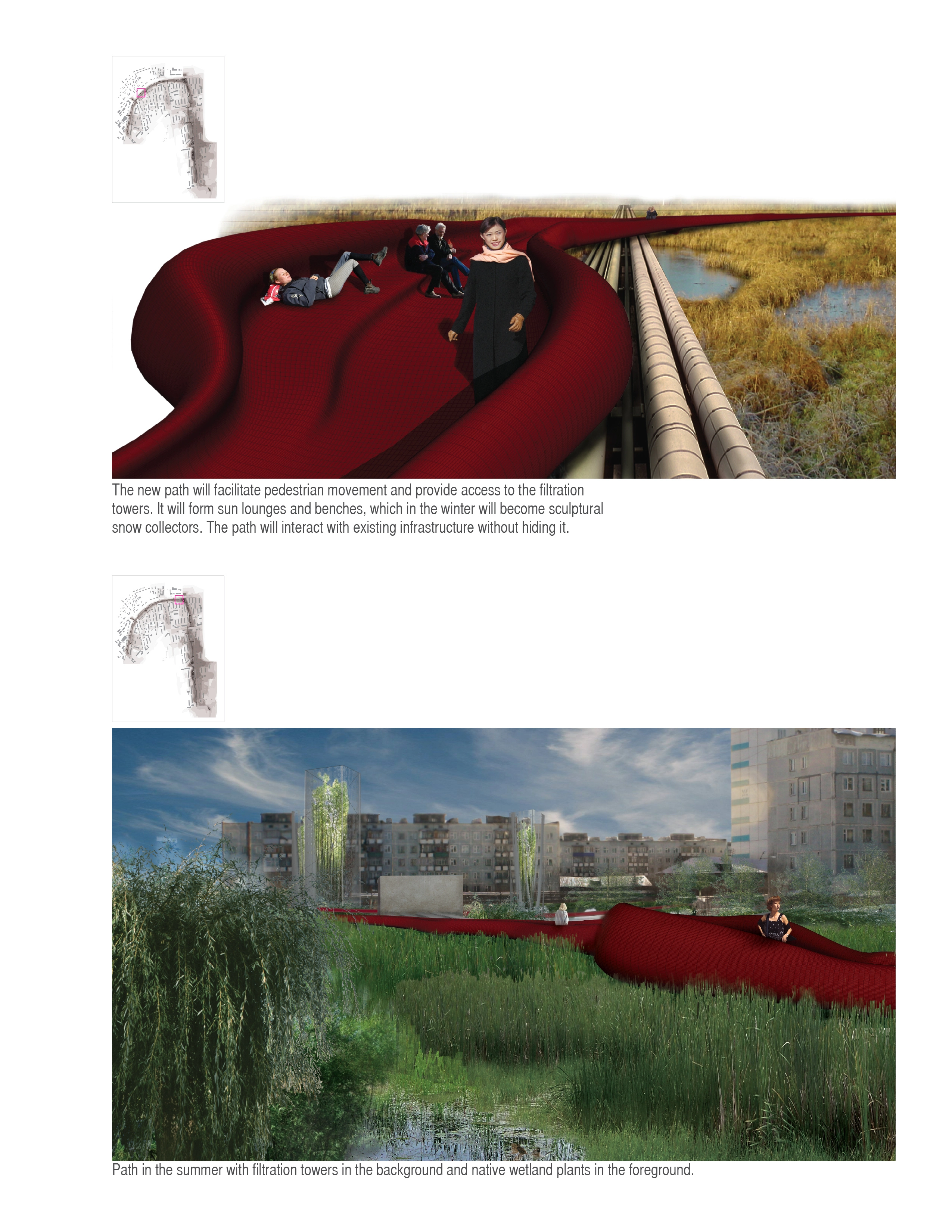
Path
The new path will span the entire length of the site, creating multiple connections and “stitching” together the opposite banks of the canal. The bridge-like elements of the path will extend into the neighborhoods, creating easy access to amenities and transportation, and facilitating movement across and along the canal. The organic shape of the path will form sun lounges and benches, creating gathering and resting spaces, which in the winter will serve as sculptural snow collectors and play areas. The path will provide access to the filtration towers and interact with existing infrastructure without hiding it. The width of the path will vary between 2.5 and 5 meters depending on its shape and will be able to accommodate pedestrians, bicycles, and snow management equipment. The path will be constructed of multiple molded plastic panels connected by a beam and cable system. This type of construction will allow for shifting, and will accommodate elevation changes. The panels will be made of P11 bioplastic, which is the only non-biodegradable plastic sustainably manufactured from plant oil. P11 has remarkable impact resistance in both very high and very low temperatures, and is extremely lightweight. The color choice for the path is based on color research for northern climates and will help create a strong graphic presence during all seasons.
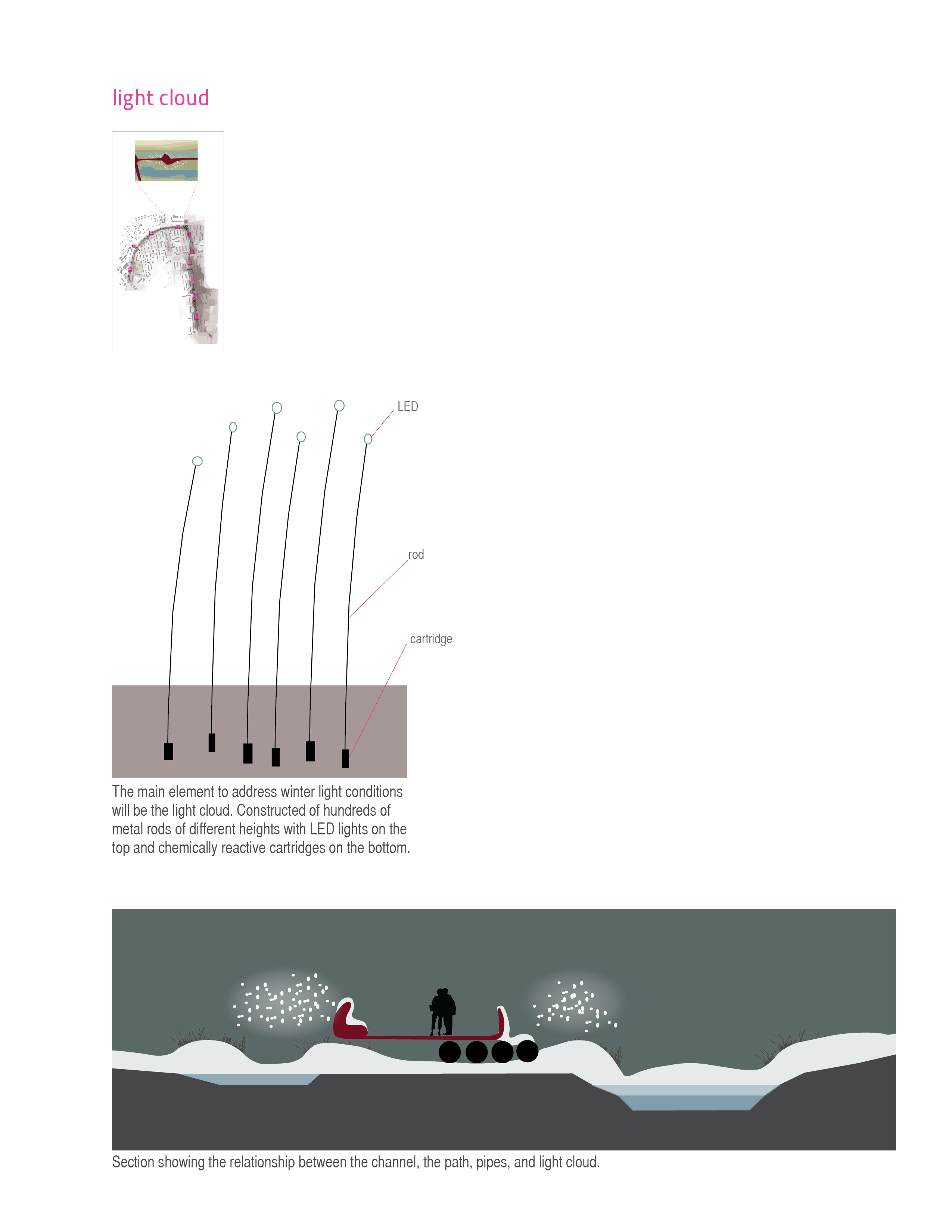
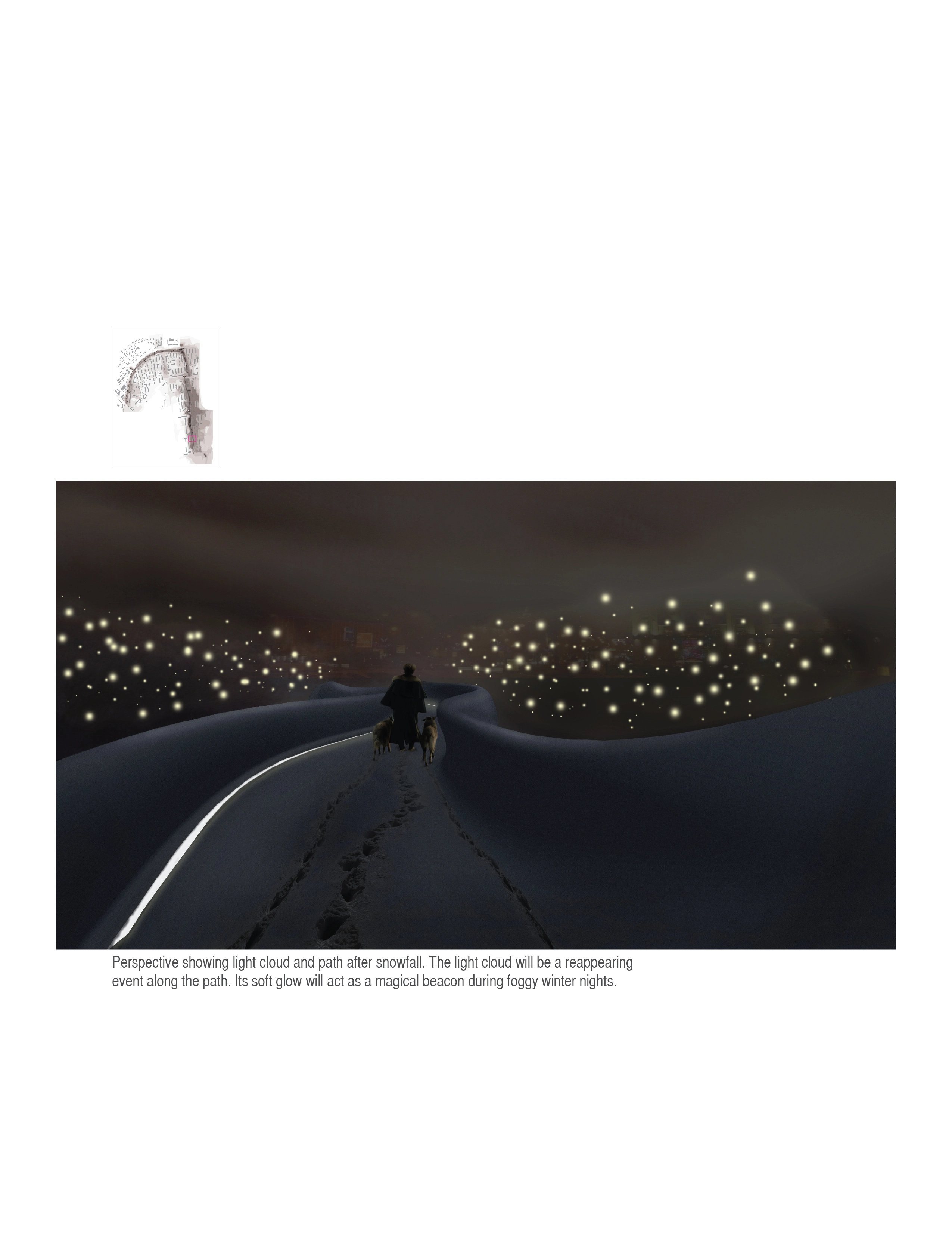
Light Cloud
The main element to address winter light conditions will be the light cloud, constructed of hundreds of metal rods of different heights with LED lights on the top. The light cloud will be a reappearing event along the path. Its soft glow will act as a magical beacon during foggy winter nights. The lights can potentially be powered by a chemical reaction between negatively charged pollutants in the soil and chemically reactive cartridges at the bottom of the rods, acting as an indicator of pollution levels.
-
Satellite images of drainage patterns:
Google EarthPollutant accumulation diagram adapted from Minnesota Stormwater Manual (2005)
Outflow design diagram adapted with changes from Minnesota Stormwater Manual (2008)
Photographs used as a base for renderings taken by Trunin N.N.
Advertisement
Related Awards
Award of Excellence, General Design
A Floating Forest: Fish Tail Park in Nanchang City
In Nanchang, within the Yangtze River floodplain, we revitalized a heavily degraded 126-acre landscape into a floating forest that manages stormwater, restores habitats, and provides diverse recreational spaces—all within a limited budget and a short timeline. This innovative urban nature model strengthens the district’s identity and spurs surrounding development. Fish Tail Park offers a scalable solution for flood-prone regions, seamlessly integrating flood resilience, ecological restoration