.webp?language=en-US)


Orongo Station Conservation Master Plan
This is truly a once-in-a-century opportunity and this landscape architect has really stepped up to the plate. The client has also gone beyond the call of duty--this is a heroic story. It shows the value of sustainable landscape architecture in addressing a couple of hundred years of impact.
Awards Jury
-
The Orongo Station Conservation Master Plan for a 3,000-acre sheep farm in New Zealand establishes a vision for the extensive regeneration of a devastated ecology while expanding agricultural production and revealing a cultural landscape rich in history. Completed in collaboration with a team of public officials, private stakeholders and local experts, the project serves as an important model that can expand the current definitions of sustainability and landscape architecture.
-
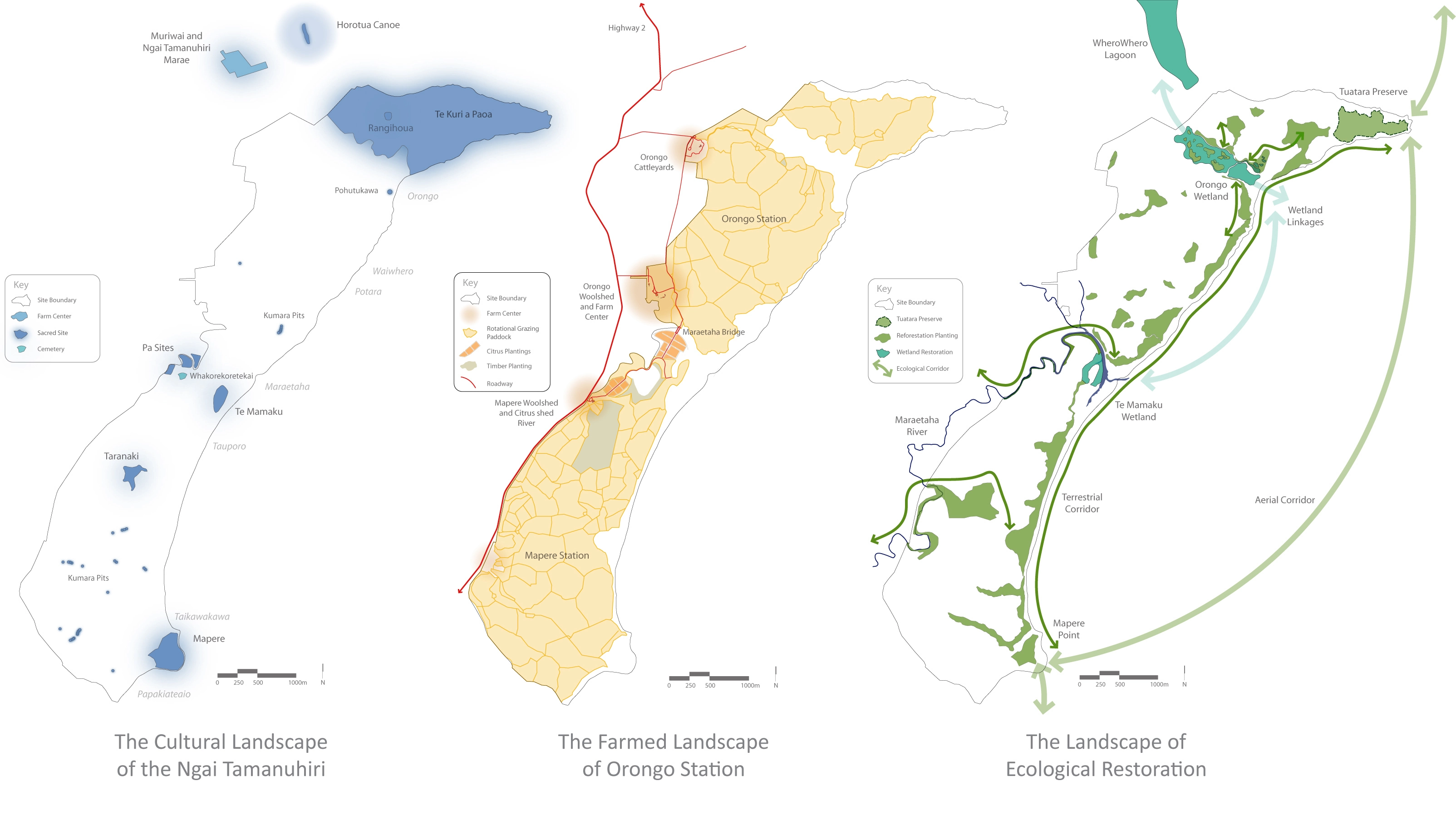
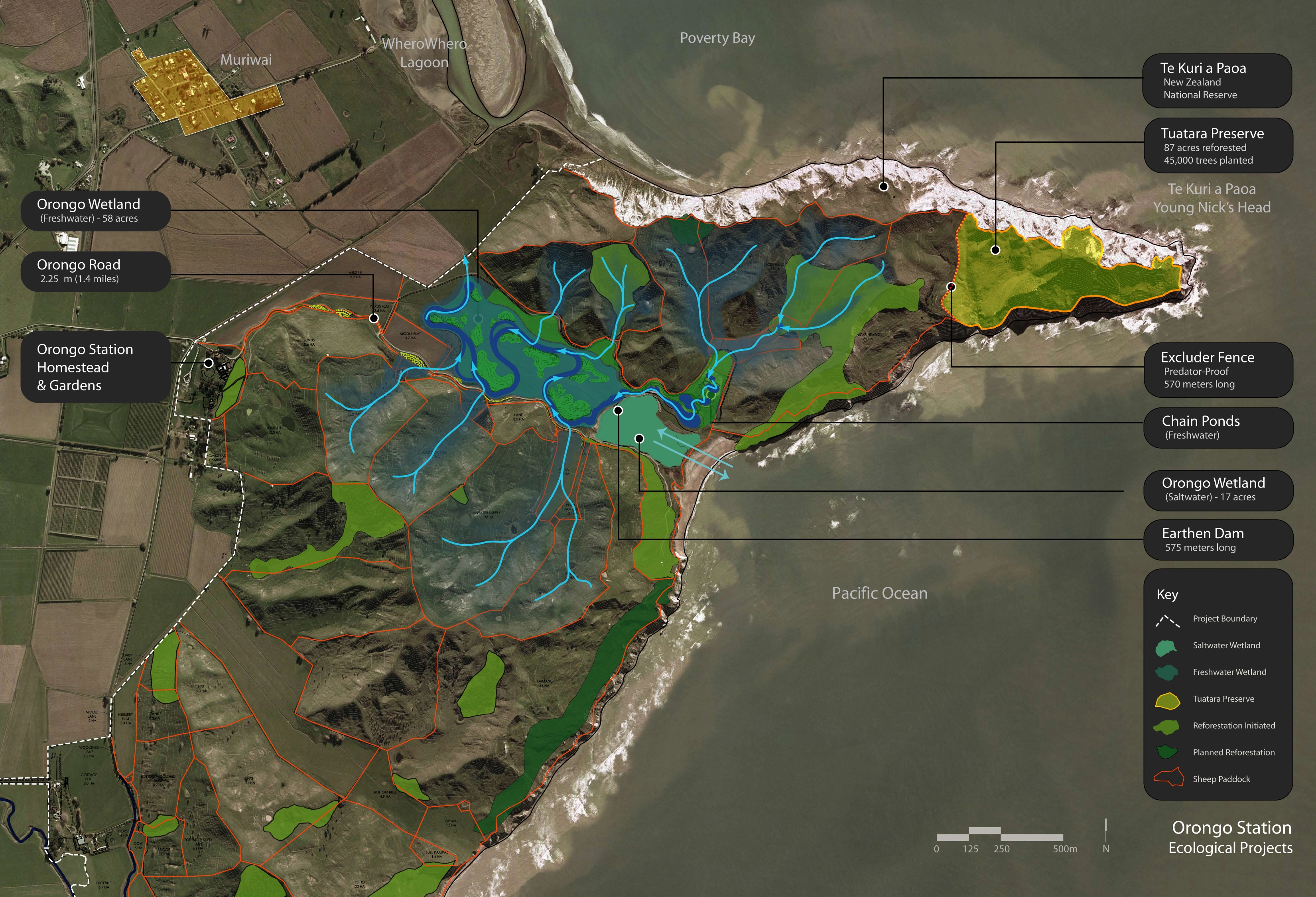
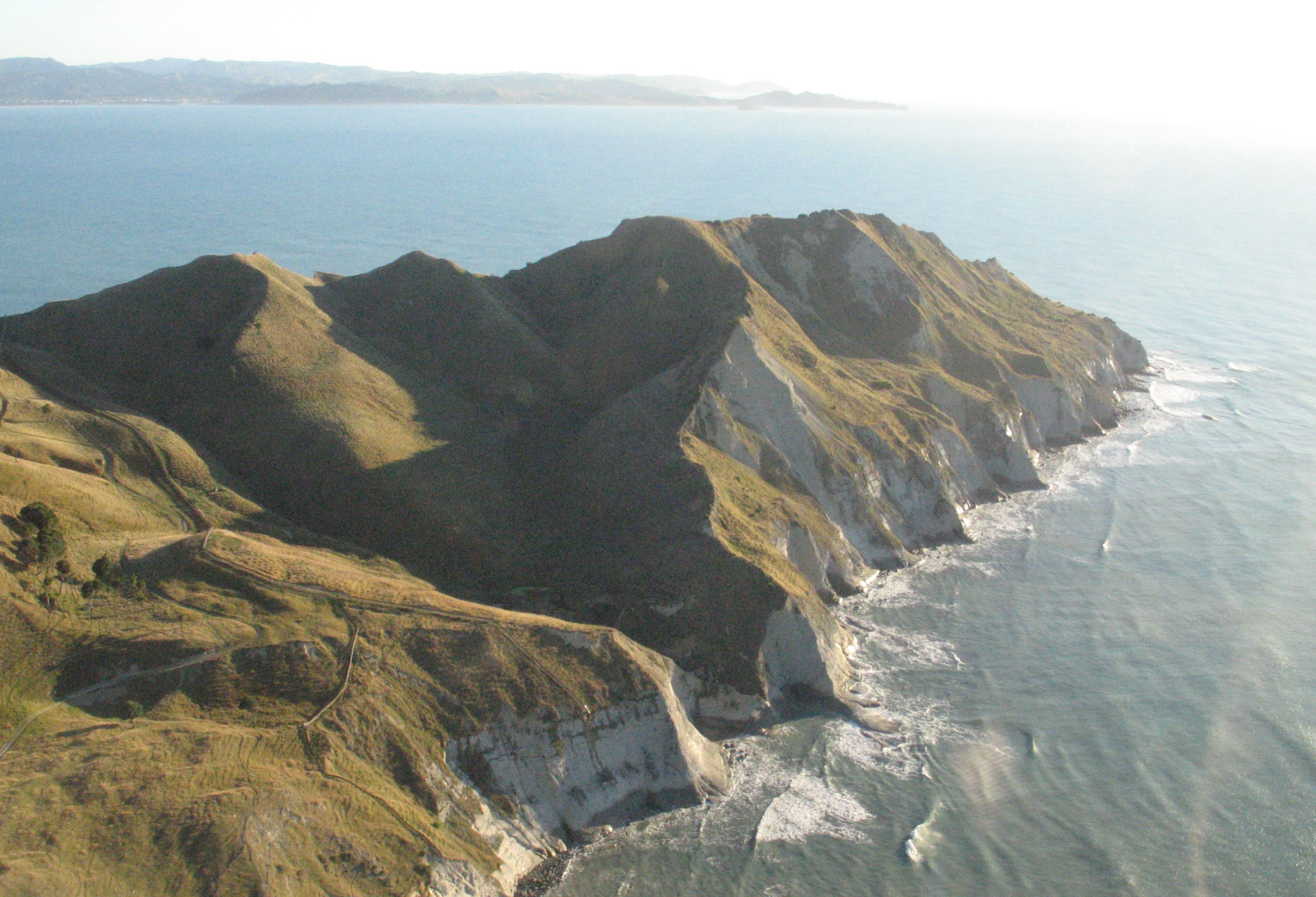
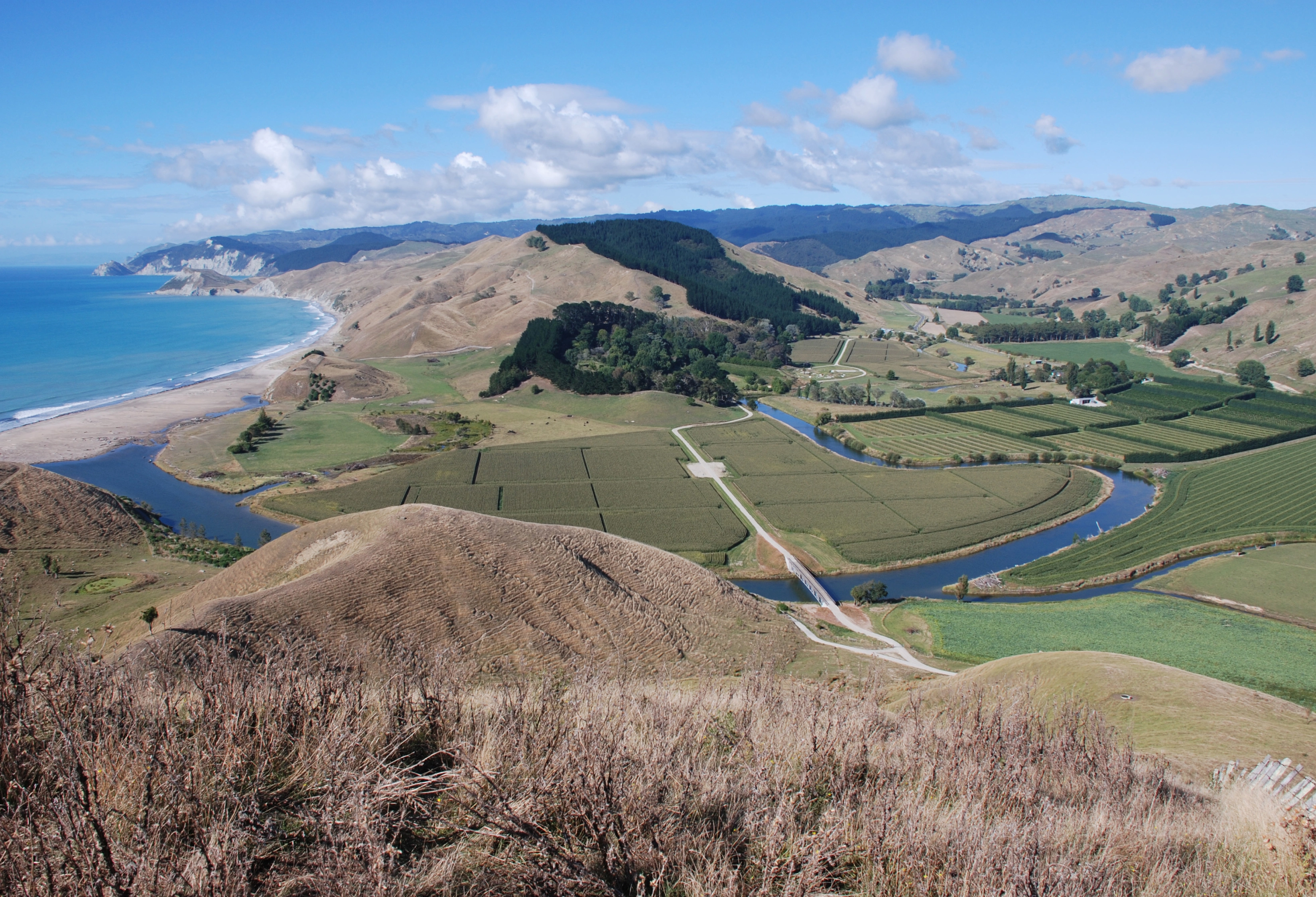
In 2003, Orongo Station was a typical sheep farm on the East Coast of New Zealand's North Island. Grazing sheep and livestock was tough due to the brutal salt spray and erosion on the exposed slopes. The station's only notoriety came from the prominent cliffs on its northern peninsula—Te Kuri a Paoa, also called Young Nick's Head. This promontory is important to the history of New Zealand both as the landing site of the Horouta Canoe, bringing Maori to the island, and as the first land spotted by Captain Cook's crew, the first whites to visit the island in 1769.
The ecology of Orongo Station, like that of much of New Zealand, has been under assault ever since the arrival of mankind in the 13th century. Lush, temperate rain forest covered the North Island and teemed with a rich diversity of birds, amphibians, and invertebrates. Early Maori settlers cut much of the forest for fire, shelter, and agriculture. The later arrival of English colonists brought further destruction of the forests for lumber and grazing while introducing mice, cats, weasels, rabbits, and other alien mammals that quickly decimated native bird and amphibian populations.
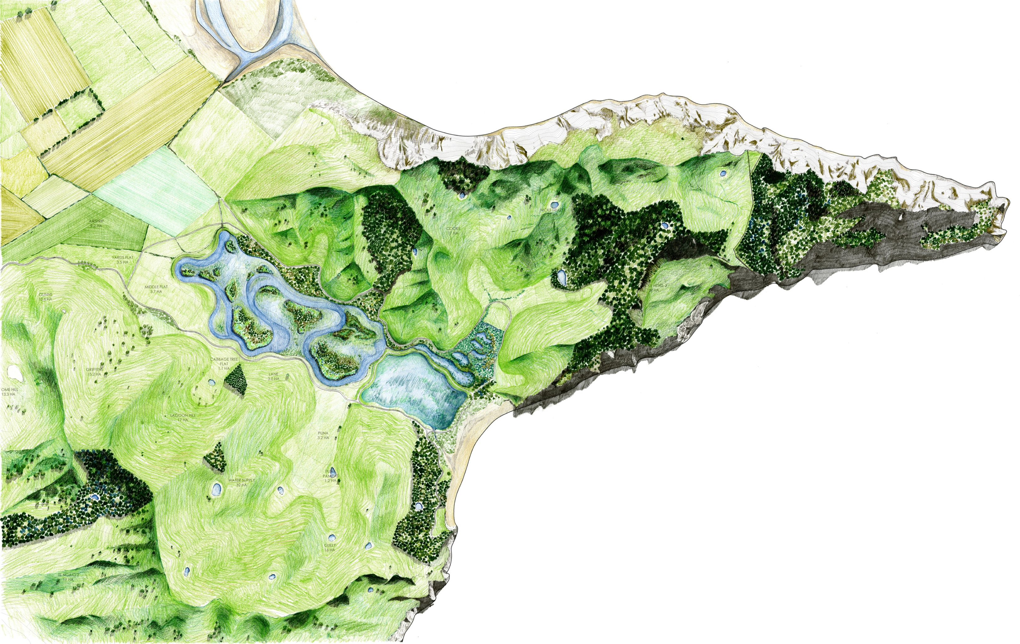
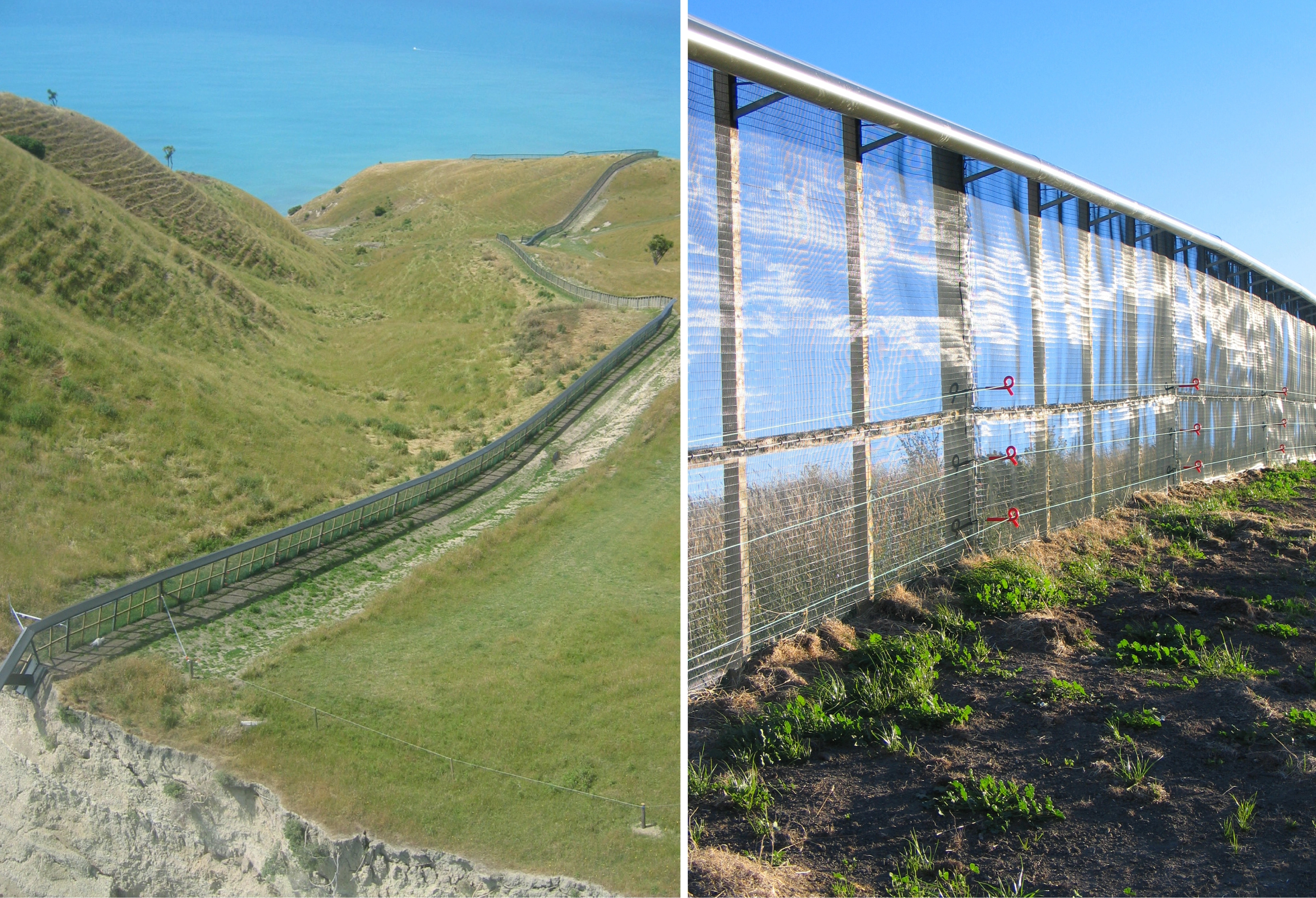
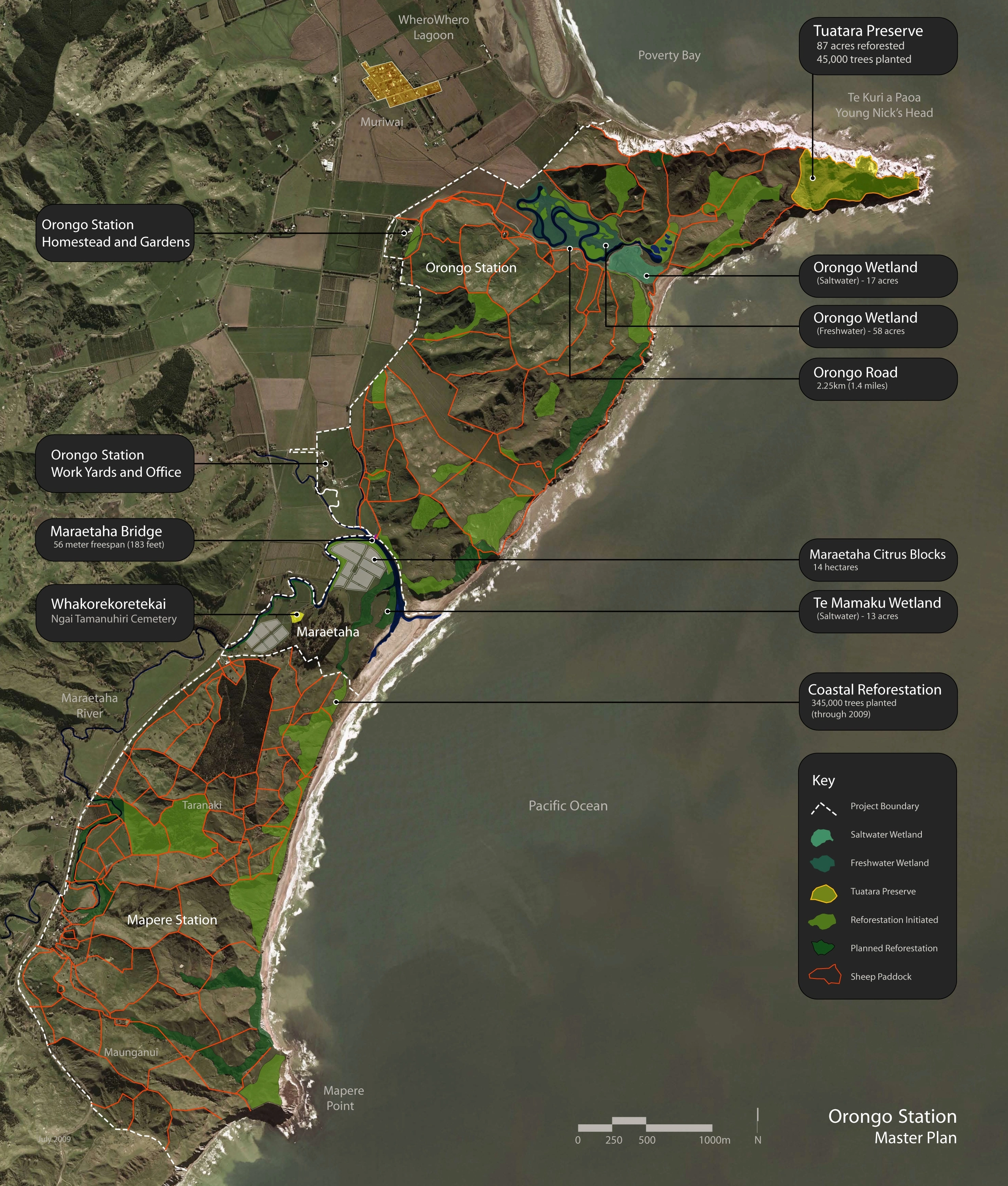
Assisted by a talented team of biologists and ecologists, the team saw a unique opportunity for a major wildlife conservation area on the peninsula of Young Nick's Head. Protected by steep cliffs on three sides, the landscape architect orchestrated the installation of a predator-proof fence to create a sanctuary ideal for nesting migratory birds. Existing rodents and pests were eradicated and a dense planting of coastal woodland tree saplings were planted to create habitat. The ultimate goal for the sanctuary is to re-introduce the Tuatara, a highly endangered prehistoric reptile that once inhabited the exposed cliffs of the North Island. The effectiveness of the restoration efforts are supported by a vigilant and aggressive pest control regime. The improved habitat and reduced predation has already attracted new arrivals and nesting including blue penguins, and fluttering shearwaters. An audio system that plays recorded bird calls has attracted the endangered grey-faced petrel to nest and breed, the first success of its kind in the world.
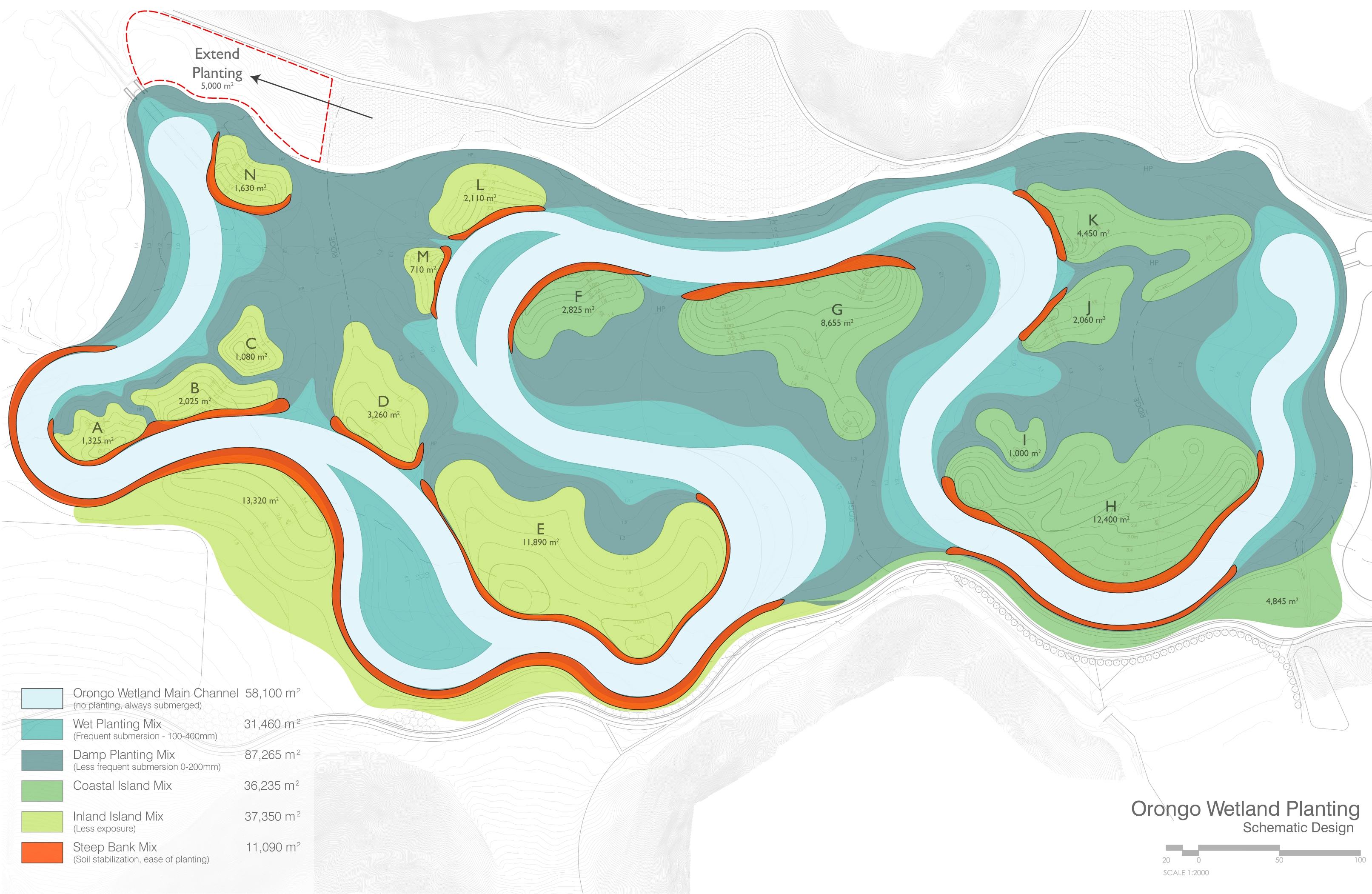
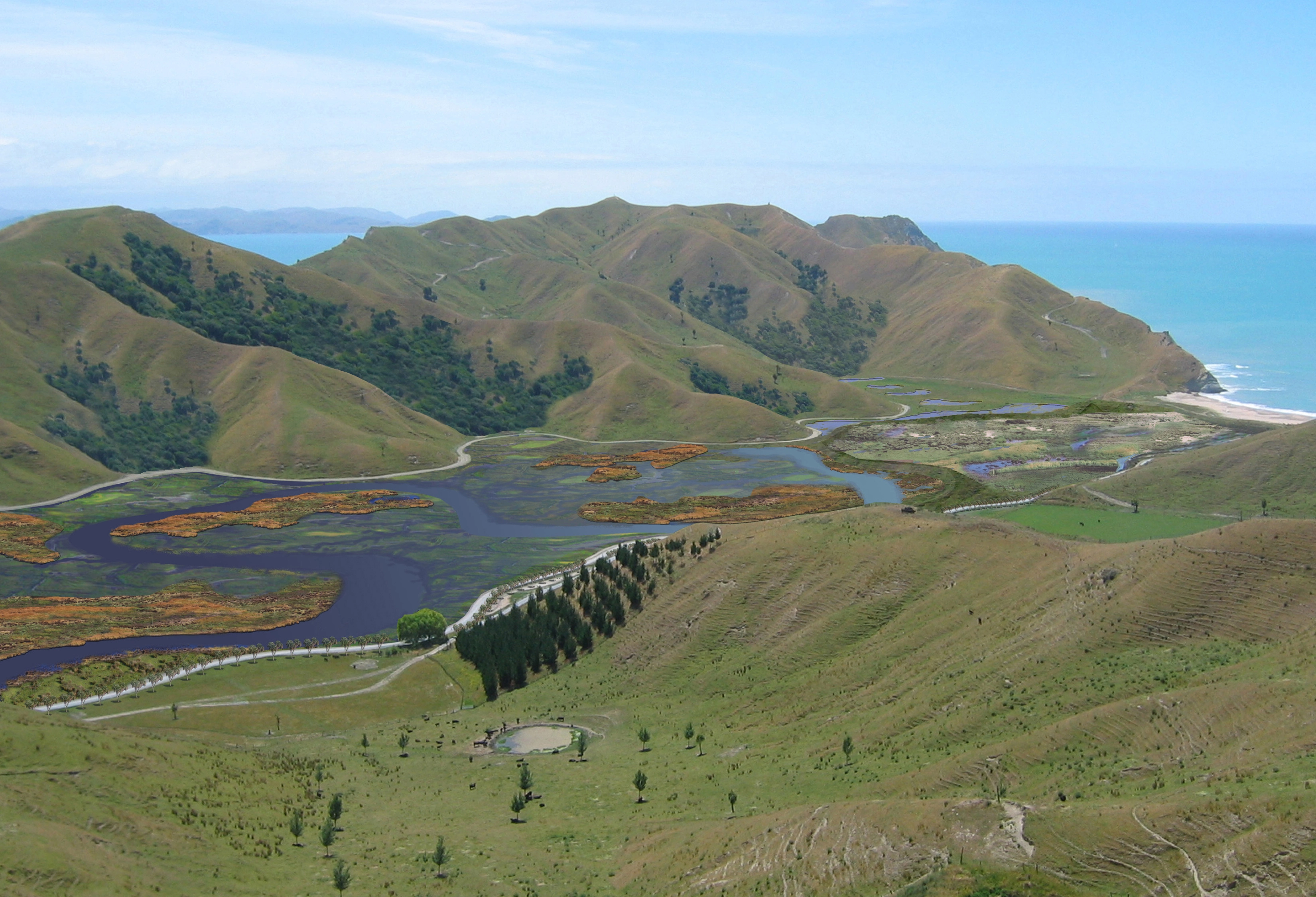
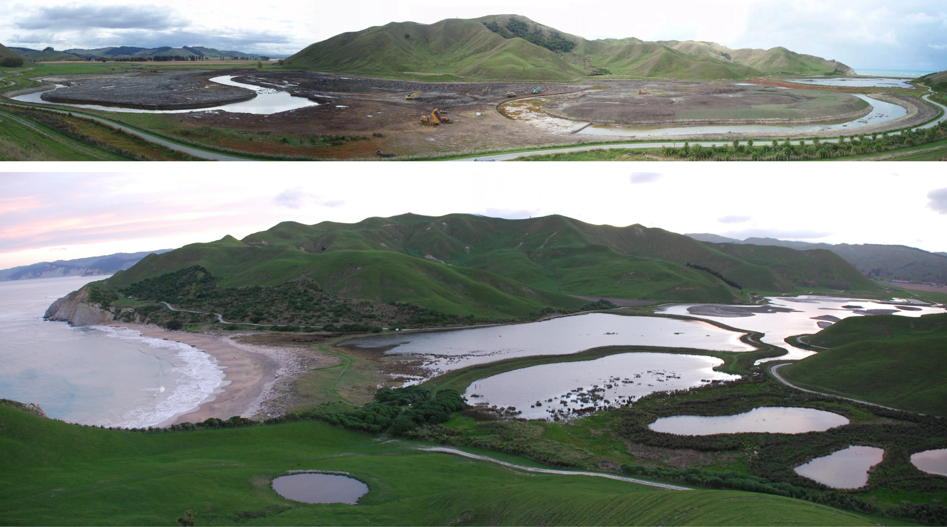
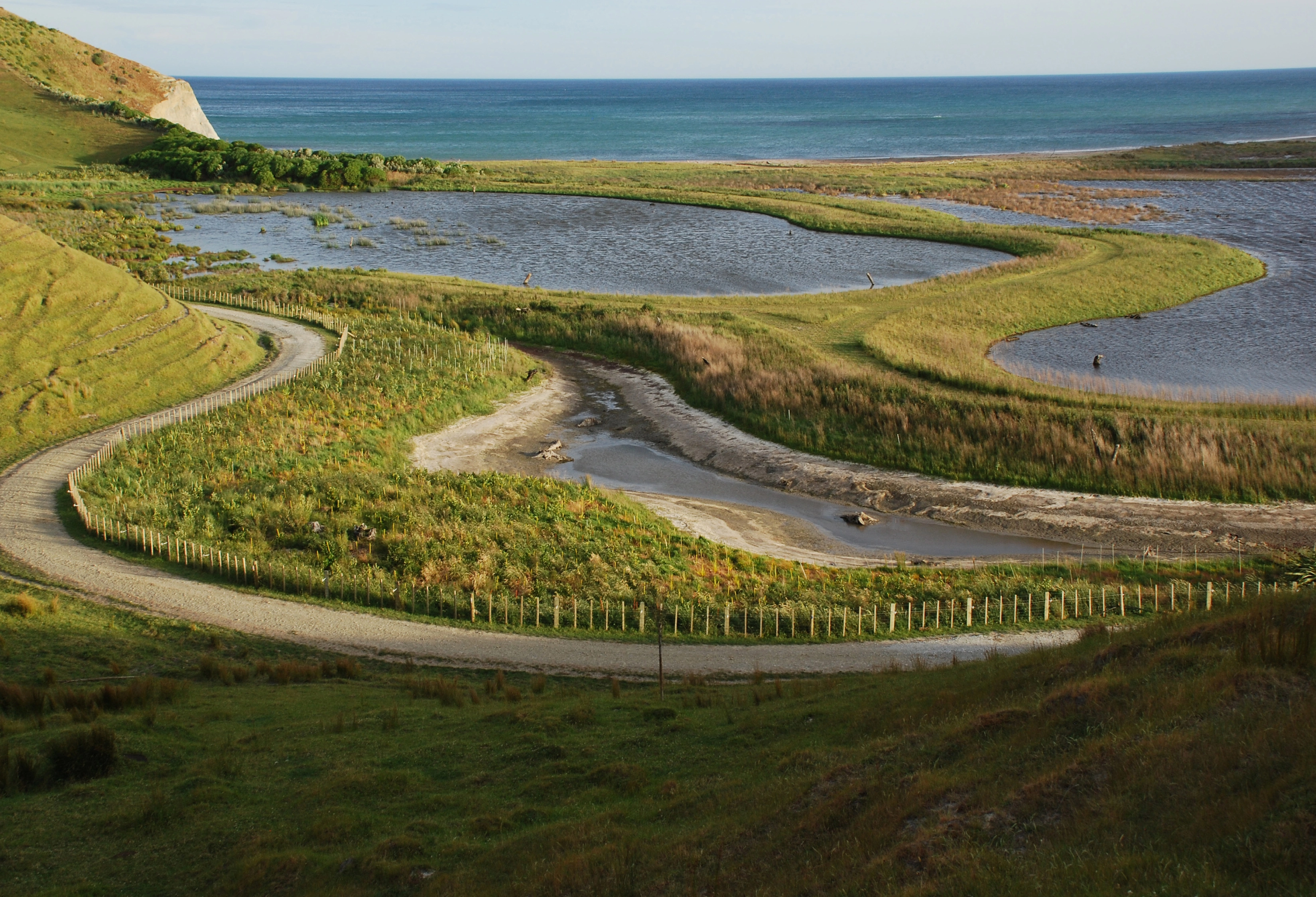
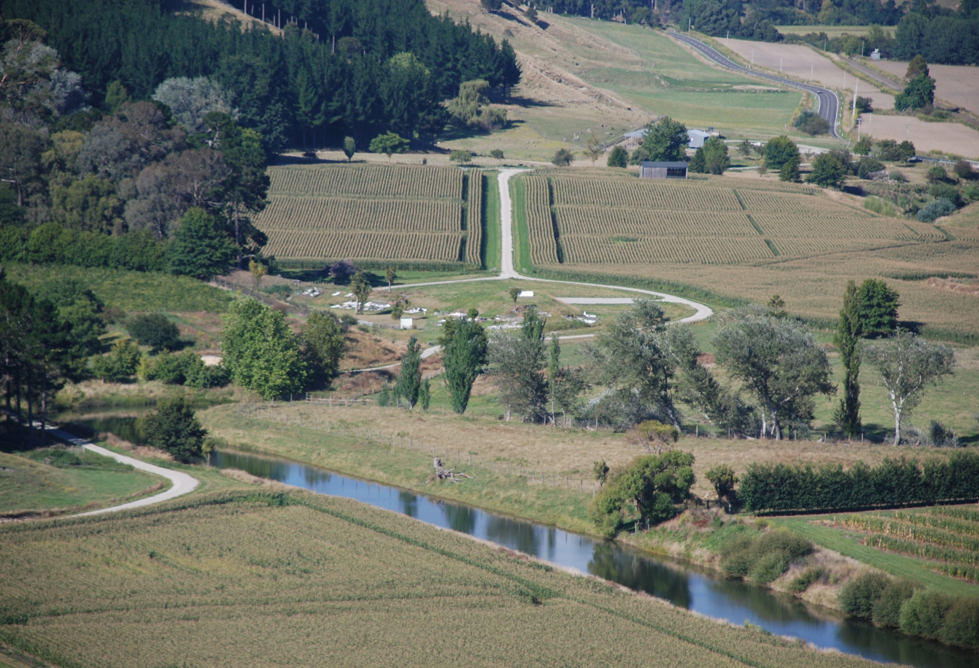
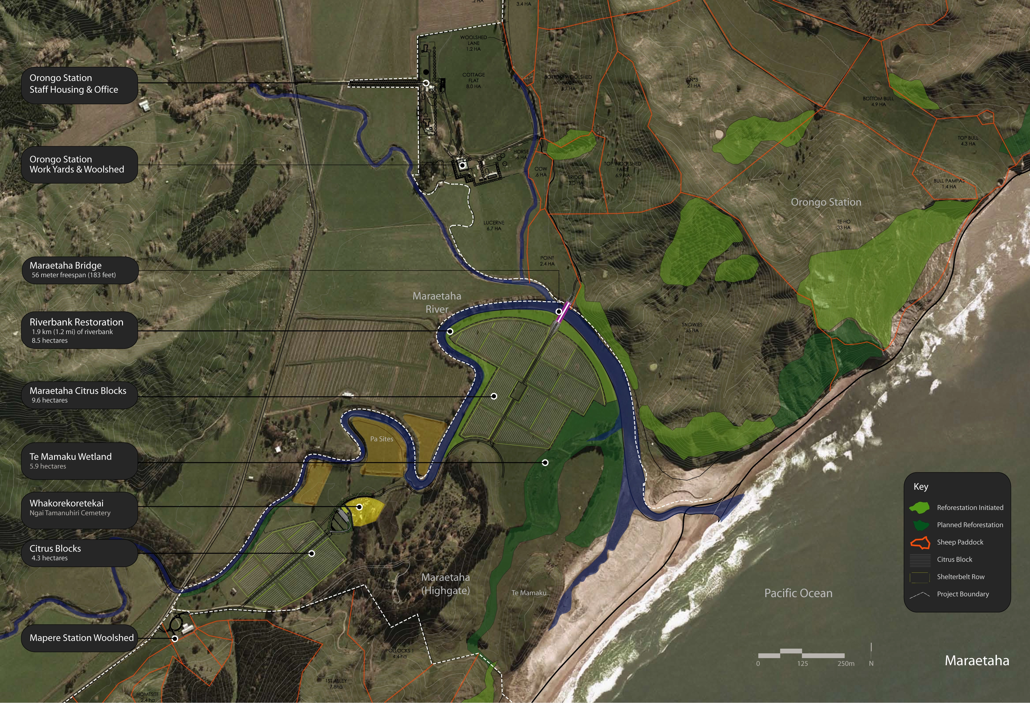
To support the efforts of the Tuatara Preserve, the landscape architect initiated an extensive plan for restoring the adjacent Orongo wetland, a once-vibrant tidal wetland that previous landowners drained for grazing. To provide a diversity of habitat, the master plan proposed the restoration of a saltwater wetland and the construction of a freshwater wetland. A large sinuous earthen embankment divides the watersheds and diverts rainwater to the inland freshwater wetland. While the saltwater wetland is tidal, the freshwater wetland is designed to accommodate seasonal flooding. A winding ribbon of water flows year-round and the broad flats flood during the wet season. To create and maintain habitat throughout the year, islands were designed and shaped from fill created by excavation of the channel. The islands' slopes and sizes are carefully calibrated to provide protective habitat for specific amphibians.
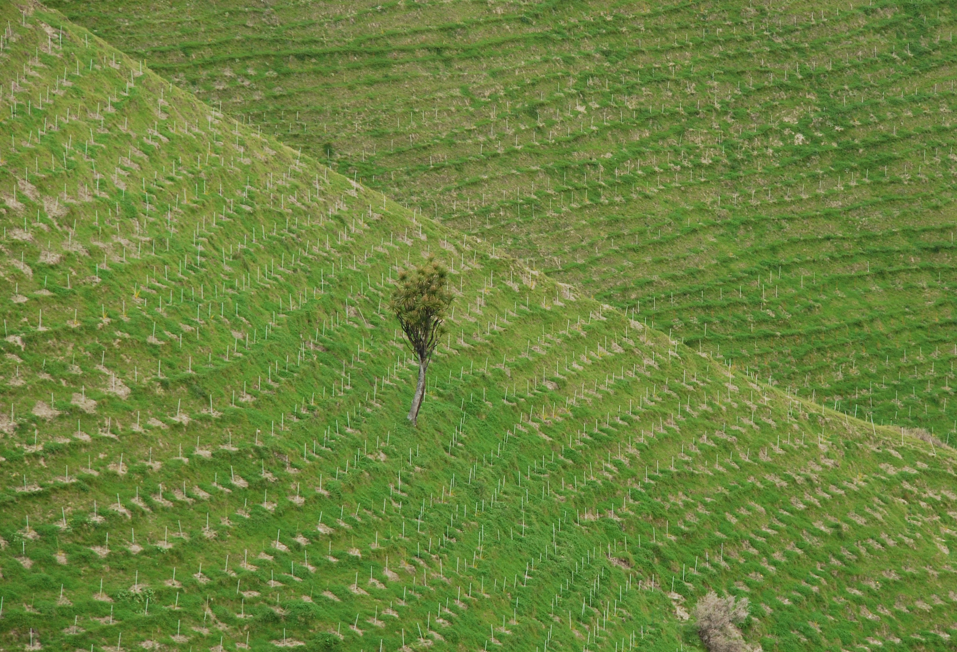
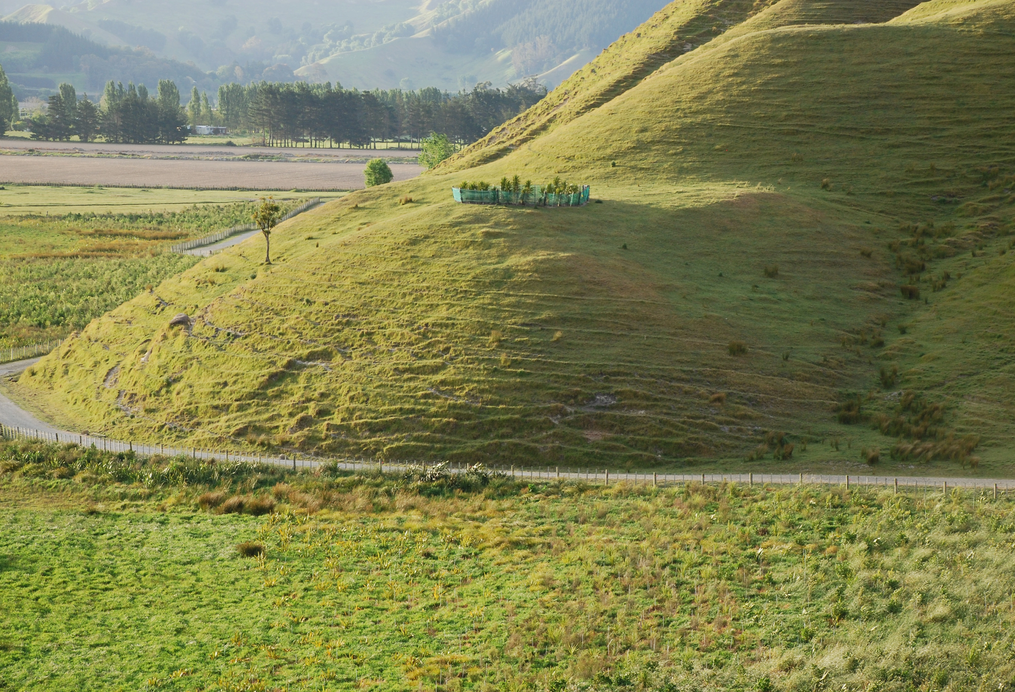
Reforestation on the uplands above the wetlands is part of a larger effort that extends southward from the Tuatara Preserve five and one half miles along the coast. These highlands are exposed to battering winds and rain and are slowly eroding into the sea. Reforestation helps stabilize the vulnerable coastline while creating valuable habitat and increased connectivity through wildlife corridors. To date, 500,000 trees have been planted at Orongo Station.
The land of Orongo Station is sacred to the local Maori tribe—the Ngai Tamanuhiri. Remnants of earthen defensive structures, fishing encampments, and pits created to store the staple food crop (the Kumara) are found throughout the landscape. The master plan engaged the tribe to restore a cemetery on the property which suffered from poor access and neglect. Simple design strategies raise the prominence of the cemetery in the river valley and protect adjacent historic defensive structures. These efforts have fostered a positive relationship with the tribe and create a regional model for integrating agricultural practices with the restoration of Maori cultural landscapes. Moreover, the ecological restoration projects are a source of pride for the tribe. The design team worked with the Ngai Tamanuhiri to start a nursery that allows the tribe to supply some of the trees required for the reforestation effort. This provides much needed employment and invites the community to share their wisdom of local plants and participate in the ecological regeneration.
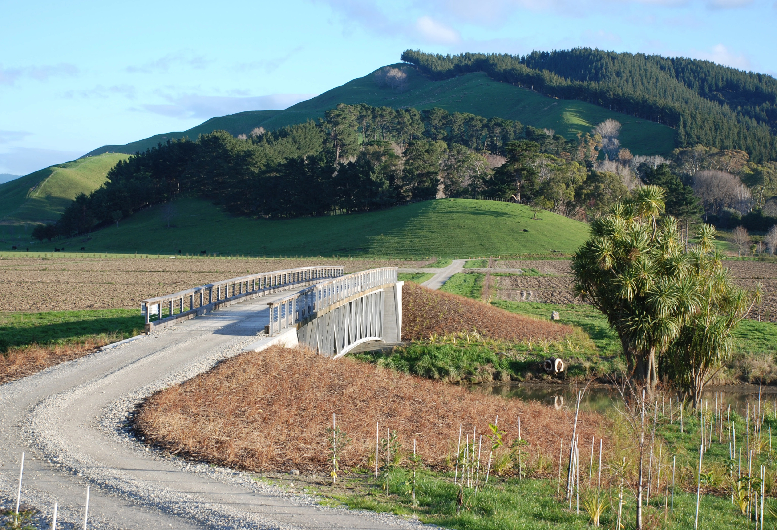
The efforts to celebrate the Maori cultural landscape and to restore ecologies and habitat for endangered species are unique in their integration with an active, working, and profitable agricultural operation. In their search for more balanced farming practices, the designers sought methods to integrate these efforts while designing some of the primary functional pieces of the farming operation. The architecture of the farm, the shearing sheds, vehicle and equipment storage, and staff housing have been composed to create a multifunctional courtyard. A bridge and road over the Maraetaha River were designed by the entrant not only to provide improved farm connectivity but to compose the river floodplain in a way that celebrates the surrounding physical and cultural landscapes. The road and bridge strike a straight line across the floodplain to align with the peak of the enormous hill of Taranaki beyond, a site of sacred significance to the Maori. Also, the designers collaborated with farmers to lay out the flat's citrus fields and inscribed a sweeping arc of shelterbelt trees to mark its outer boundary. A journey across the field pierces the broad arc which parallels the natural course of the river and serves as the site for a major riverbank restoration planting. The bridge design keeps a low, elegant profile to respect views from adjacent properties and roads.
Finally, the efforts to knit ecology, farming, and the cultural landscape together have been distilled into a series of gardens and buildings at the residence of Orongo Station's owners and their family. The complex is anchored by a historic house, the Homestead. The gardens and buildings create formal and informal spaces for entertaining, for play, and discovery. They are rich in narrative, using plants and earthworks to tell important stories about New Zealand ecology and culture. The gardens look back through the island's environmental history, distilling the primary forces at work, and recomposing them in a contemporary language. The gardens create a lens for visitors to understand the efforts of the nationally important conservation efforts on Orongo Station and the new vision that they represent.
-
Nelson Byrd Woltz Landscape Architects
Thomas L. Woltz, ASLA, Partner in Charge
Breck Gastinger, Senior Project Manager
Contributing Staff: Hara Woltz, Sara Myhre, Evan Grimm, Jim Kovach, Jeff Aten, ASLA, David Timmerman, Karl Krause, Student ASLAOrongo Station
Kim Dodgshun, General Manager
Advertisement
Related Awards
Award of Excellence, ANALYSIS AND PLANNING
Rethinking Taj Heritage Corridor: A River as Historic Connection
Locates between Taj Mahal and Agra Fort, this proposal on Taj Heritage Corridor aims to reestablish the image of riverfront that was destroyed during the problematic reclamation project in 2002-2003. By creating a recreational water treatment canal along the original river bank, a landscape urban infrastructure is proposed to visually connect the city's scattered historic riverfront monuments and create public space for both tourists and local community. With a full respect of the silently mild image on Yamuna River in Agra, the design proposed an educational space that highlights the inherent dialogue between environment and history. Through analysis in different scales with the understanding of extreme site conditions, political background, and feasibility potentials, the design demonstrates the strong capacity of landscape intervention in resolving the complex contradiction between modernity and historic environment conservation.