
.webp?language=en-US)


Mark Rios, FASLA
on Los Angeles' Plan to Become More Sustainable
In 2015, Los Angeles Mayor Eric Garcetti launched the city’s ambitious 20-year sustainability plan, which calls for increasing water conservation, generating renewable energy, achieving zero waste, investing in mass transit, and revitalizing the Los Angeles River watershed. Two years later the city has already made great progress, but some of the big goals seem perhaps out of reach. For example, one is to reduce the urban heat island effect more than any other city in the U.S. -- three degrees within just two decades. Currently, Los Angeles is about 40 percent rooftops and 20 percent roads. A new cool roof ordinance requires reflective roofs on new development and there are also tests underway to create cool pavement. The city also has goals to increase the tree canopy, and 18,000 trees were planted in 2016. Do you think these strategies are enough?
Our mayor is pretty incredible with his ability to articulate a road map towards being more sustainable. For a long time, landscape architects have been the voice for being thoughtful about water, drainage, and stormwater runoff. We’re happy to hear our political system is now actually enforcing, documenting, and requiring measures to manage water and fight the urban heat island effect. We can be strong advocates, but it's sometimes hard to convince our clients of something that is more expensive. Now developers are being asked to step up to the table through enforceable obligations. As a community, landscape architects are happy about these efforts and really support the Mayor's road map.
Los Angeles has already reduced per capita water use by 20 percent, meeting the 2017 goals. Eventual goal is 25 percent by 2035. In the city’s green building code, there are now water budgets for landscape irrigation, new incentives to remove turf in favor of residential gardens, and free recycled water deliveries for landscape use, along with millions for green street projects. Do these water goals go far enough? What else could be done?
This is a tough question for Los Angeles, because we always talk about the physical landscape, but the cultural landscape is also important. The whole dream of the backyard and the lawn is part of our culture. It’s really a culture that was described in the ‘50s and ‘60s through movies. In Hollywood, everybody had a front yard and backyard. The lawn was the default landscape.
We’ve made great progress to collectively redefine what the aspirational landscape is -- it may no longer be a lawn and palm tree. It may be the beauty of the Santa Monica Mountains. Our native landscape has this inherent appropriateness and generates an emotional connection. We have been working really hard to replace the lawn. And if we can achieve that, it will be a huge step towards achieving these ambitious water goals. We've been irrigating grass for the last 50 years. We really need to change cultural expectations.
By 2035, L.A. seeks to add more transit infrastructure than any other city. The city seeks to pair this infrastructure with transit-oriented development. The plan calls for expanding zoning capacity and key transit nodes. How do you see progress going on that front?
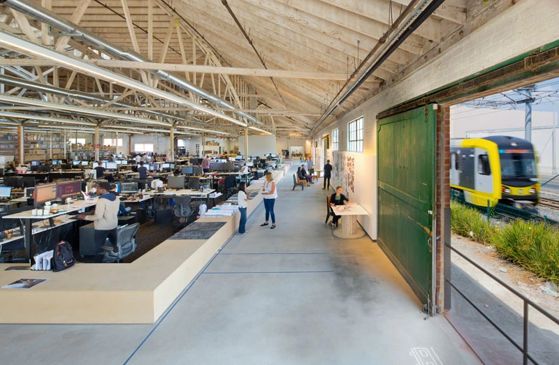
Everybody in L.A. is really excited about this plan. We just moved our office to the Expo line. We’re right at the Crenshaw Station stop, and the Crenshaw Station is going to be the line that links LAX, our airport, with LACMA and Hollywood.
L.A. has been really behind in public transportation. Everyone is excited about the multiple new lines being built. We don’t have enough mass transit. Transit oriented developments are certainly going to change the face of the city, because they include higher-density floor area ratios (FARs), which help support new village neighborhoods. These developments will make the city more walkable and livable, because people will have these mini-centers around each station.
Looking ahead to 2035, the potential change created by autonomous or driverless vehicles is just wild. I went to a event sponsored by the Mayor’s office, where I was so proud to hear them conducting research on how our city form could change if we maximize transportation systems with driverless cars. Some of the predictions and studies on how L.A. could change are really astounding. We're talking about maybe taking one freeway lane offline or creating green spaces by potentially eliminating a road lane. Can we transform them into greenways? Can we decommission parking lots because we don’t have much need for cars to be parked for eight hours while somebody is at work? Autonomous vehicles will change the character of Los Angeles.
By 2035, Los Angeles also wants all trips made by walking, biking or transit to be 50 percent, up from 26 percent today. Measure M, a ballot measure that passed with 70 percent of the vote, will use a half-penny tax to raise $120 billion over the next 40 years for mass transit and bikeway projects. Los Angeles also launched a regional integrated bike share system plan and has set up more than 65 stations and a thousand bikes. Do you think this vision will come together? Will Angelenos bike share to the subway? Will the complete street infrastructure be there? I’ve heard there are neighborhoods that still don’t have sidewalks, let alone bike lanes.
There is great potential to achieve these goals. The basic urban form of Los Angeles are these village centers. We have a very disperse urban pattern. If you look at Boston and other cities, there’s a symmetrical layout, a center city with suburbs. We have a dozen or two dozen village communities between downtown and the West Side. As people are encouraged to use bikes and walk more, the village form of land use will help realize that.
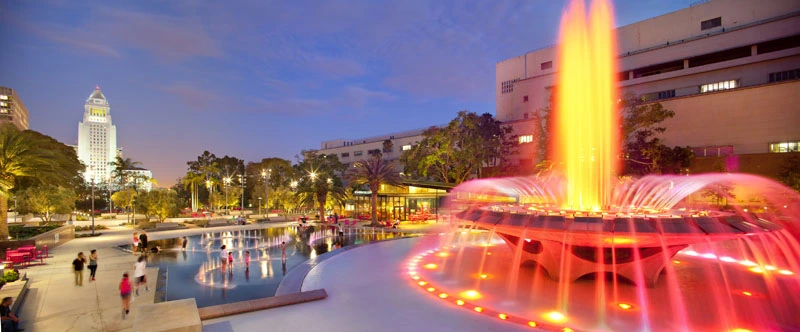
The city also wants to ensure that 75 percent of Angelenos live within half a mile of a park by 2035. The past seven years the city has added more than 35 parks covering 16,000 acres, including your firm’s Grand Park downtown, which brought much-needed green space. Is the city on track for this ambitious goal? Does the 50 Parks L.A. Initiative, which assists underserved communities, have enough funds? How can the city ensure everyone benefits equally?
Los Angeles has a disparity in terms of where parks are located. There are some well-served communities and some underserved ones.
East L.A. and South Central do not have the kind of park density that they do in the Valley or other locations. It’s really hard for the city to acquire new land and buy space for parks. The problem is if you have a park desert, how do you find space there?
There have been examples of decommissioning public space and having communities take over ownership, at least as far as park development. For example, weird pieces of land next to freeways and other kinds of public spaces can be decommissioned and given to community groups. It’s a way of creating parks in neighborhoods without empty spaces.
There are also ambitious efforts underway with the L.A. River and the plan Mayor Garcetti calls restoring 11 miles of the L.A. River, making accessible all 32 miles in the city by 2035. What do you want to see happen with the river? How can the city ensure the revitalization doesn’t create a new High Line and become an agent of gentrification?
The L.A. River is on everybody’s mind. People have been working passionately on it for a long time. The first goal is to make it a great circulation system for biking and moving through these different regions. Any new projects along the river have to build in bike lanes and pedestrian walkways along the river. What’s important right now is zoning that allows for greater density along the river. If we can create more dense villages along the L.A. River, then we'll see a built-in park system for these villages and good connective tissue besides the roadway network.
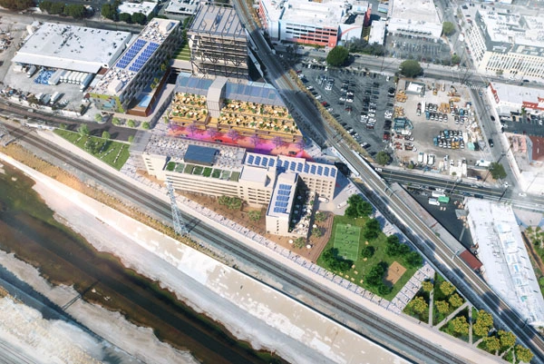
There’s a whole contigency who wants to return the L.A. River to a natural form, a landscaped waterway. In some places, it may be possible and still maintain the flood capacity, but I don’t think it needs to be done everywhere. I look at the land art movement. They had very architectural spaces that were really beautiful to experience. We need a whole series of solutions over the course of the river that also address the hydrological issue of maintaining the flood protection system. It doesn’t need to be all the same.
Gentrification is a big problem. Think of all the residential communities around the L.A. River that are going to suffer, because it’s historically been viewed as an industrial landscape. Now, it’s going to transform into this positive, landscape-driven set of places. All the communities currently around it may be pushed out, so how we mandate keeping existing people in place through affordable options is going to be essential.
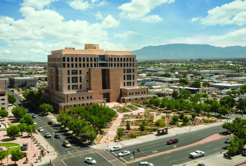
With your firm’s work at the Pete V. Domenici U.S. Courthouse in Albuquerque, New Mexico, your firm has demonstrated its commitment to sustainable design. The project was an early Sustainable SITES™ Initiative (SITES®) pilot project. So looking big picture, how can a sustainable, ecological landscape approach like you demonstrated in that project be applied to Los Angeles? What would an ecological Los Angeles in 2035 look like?
The most important thing that we learned with the Domenici project and the SITES® program is the critical need for documentation and ongoing monitoring, so you can really understand how a landscape is performing seasonally and over time. If we remove lawns and instead use native plants across the city, it’s going to cut down on irrigation.
Landscape architects need to become more proficient at quantifying every drop of water and being able to predict how new landscapes will perform. It's our responsibility to go back and monitor landscapes, so that we have a database and can understand how water is being used.
Mark Rios, FASLA, FAIA, is founding principal, and architect and landscape architect at Rios Clementi Hale Studios in Los Angeles.
This interview was conducted by Jared Green at the ASLA 2017 Annual Meeting in Los Angeles.