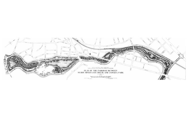
Olmsted Plan of The Riverway, 1892
“...It is absolutely essential that although the work is for the present under two municipalities and under the control of two park commissions acting independently of one another, that it should, to the public eye, be one work. Landscape unity between the two sides of the valley must be secured.” John Charles Olmsted's letter to W.L. Fisher, October 13, 1893.
Image: Frederick Law Olmsted National Historic Site 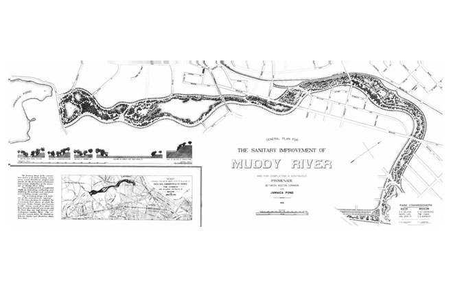
Plan for the Sanitary Improvement of Muddy River
“The natural sequence upon slightly higher ground to the last (the Fens) in following up a fresh watercourse bordered by passages of rushy meadow and varied slopes from the adjoining upland; trees in groups diversified by thickets and open glades.” City of Boston Seventh Report of the Board of Commissioners of the Department of Parks.
Image: Frederick Law Olmsted National Historic Site 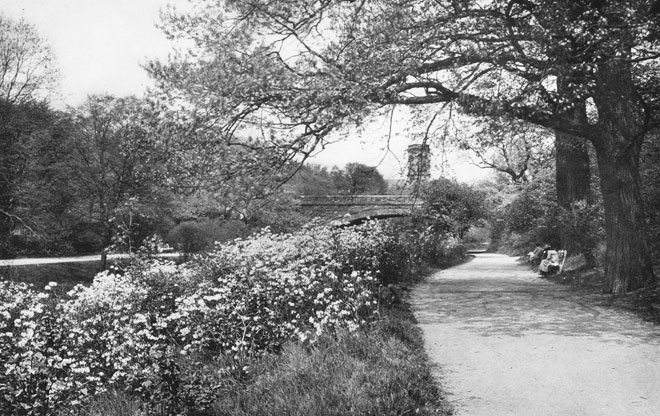
The Riverway in 1924
This photo was taken 28 years after initial construction.
Image: Frederick Law Olmsted National Historic Site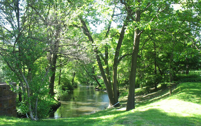
Muddy River Today
Image: Marion Pressley 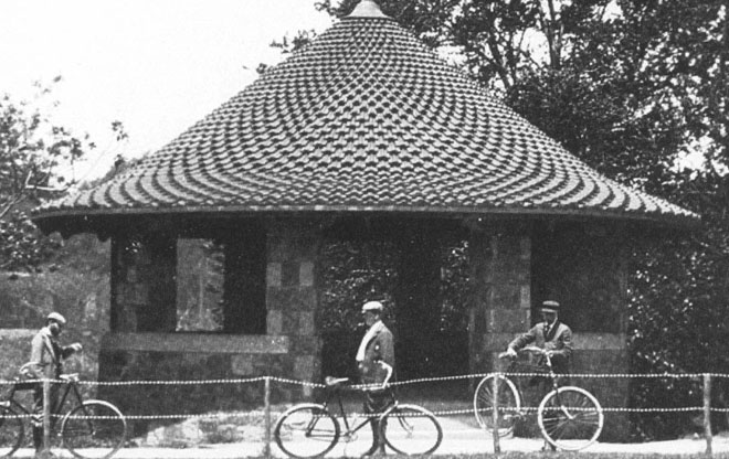
The Riverway Shelter, 1905
Image: Frederick Law Olmsted National Historic Site 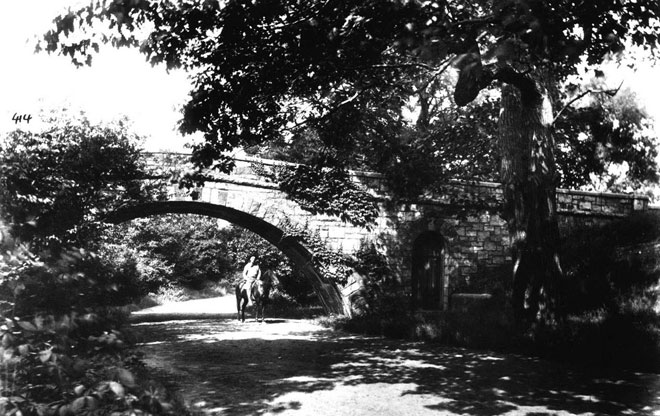
Bridle Path Bridge, 1919
Image: Boston Public Library 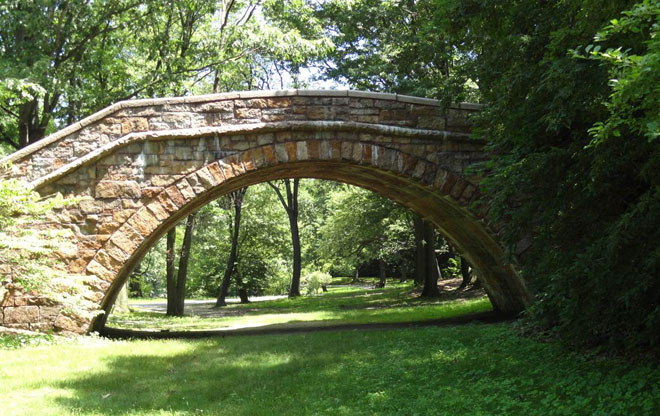
Bridle Path Bridge Today
Image: Marion Pressley 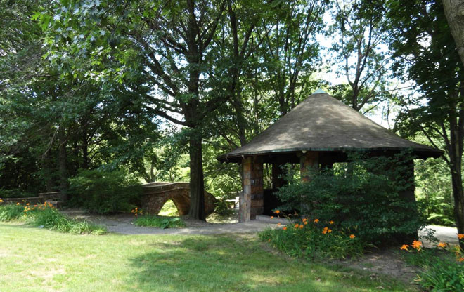
The Riverway Shelter and Bridge Path Bridge
Image: Marion Pressley 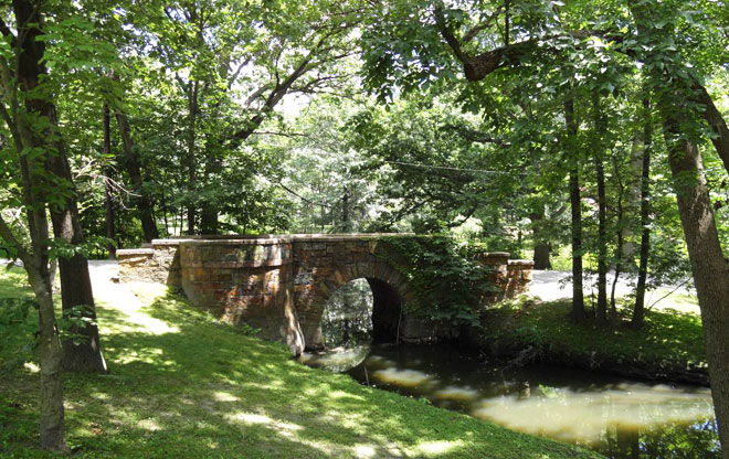
Island Bridge at Netherlands Road
Image: Marion Pressley 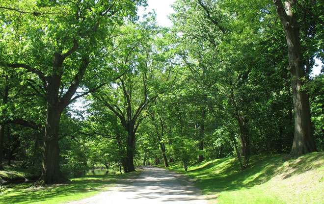
Perfect for Strolling or Running
Image: Marion Pressley