PROJECT NARRATIVE
Context
Currently airports operate within a two-border system, one designed to control and filter human crossing and the other a botanical and zoological border with the intent of preventing ecological flow into the airfield. This ecological border strategy goes beyond a perimeter fence that restricts the movement of large mammals; it is mainly based on vegetation management that avoids creating bird habitat in the airport and surrounding areas. Lawn, for obvious height restrictions and because it is not considered bird nesting space has always been the vegetative choice for airfields. Although lawn might not be natural bird habitat certain species have adapted to it and now see it as attractive foraging space, especially high-risk bird species such as large raptors and waterfowl, and flocking species such as the European Starling.
This strategy of categorizing all animals equally as a risk to the operation of an airport contrasts with how humans are actually managed, where automated filtered-border systems based upon a risk assessment determine if an individual is approved to cross or not. No-fly lists with the names of high-risk individuals began to be used shortly after the 9/11 attacks in the United States and are generated by complex predictive analytics of intelligence gathered through mass surveillance. Although new for border control, this strategy of control through knowledge based upon observation is not a new method of control. The origins can be traced all the way back to the seventeenth century, where a desire for a new understanding of nature shifted knowledge based on Greek and Roman philosophy towards imperial observation. Francis Bacon in particular led this discussion, he argued, with a religious undertone, that in order to return man into an ideal state of control over nature there first needed to be a complete understanding of its rules, achieved through observation. This was a philosophy that became apparent in the arts of the time as well, with ultra realistic depictions of animals and landscapes in Baroque landscape paintings often from a controlling birds eye view and with the popular use of the shepherd with his herd as a subject.
Concept
Knowing the similarities of the contemporary human border system with Francis Bacon’s views in achieving the ideal state over nature this project asks if Bacon’s vision could be possible today by using the human border as a model. Re-conceptualizing environmental management this project could then test this new theory through Toronto Pearson’s wildlife management program. Borrowing from the common landscape paintings done after the Baroque period the Landscape Architect would play the role of the shepherd, the lone figure that sits out watching over the domain he manages.
Strategy
By analyzing the current human border control system it was possible to break it down into 3 stages that would then act as a framework for the project: the Common Lands, Monitoring and Border Devices strategies.
Common Lands
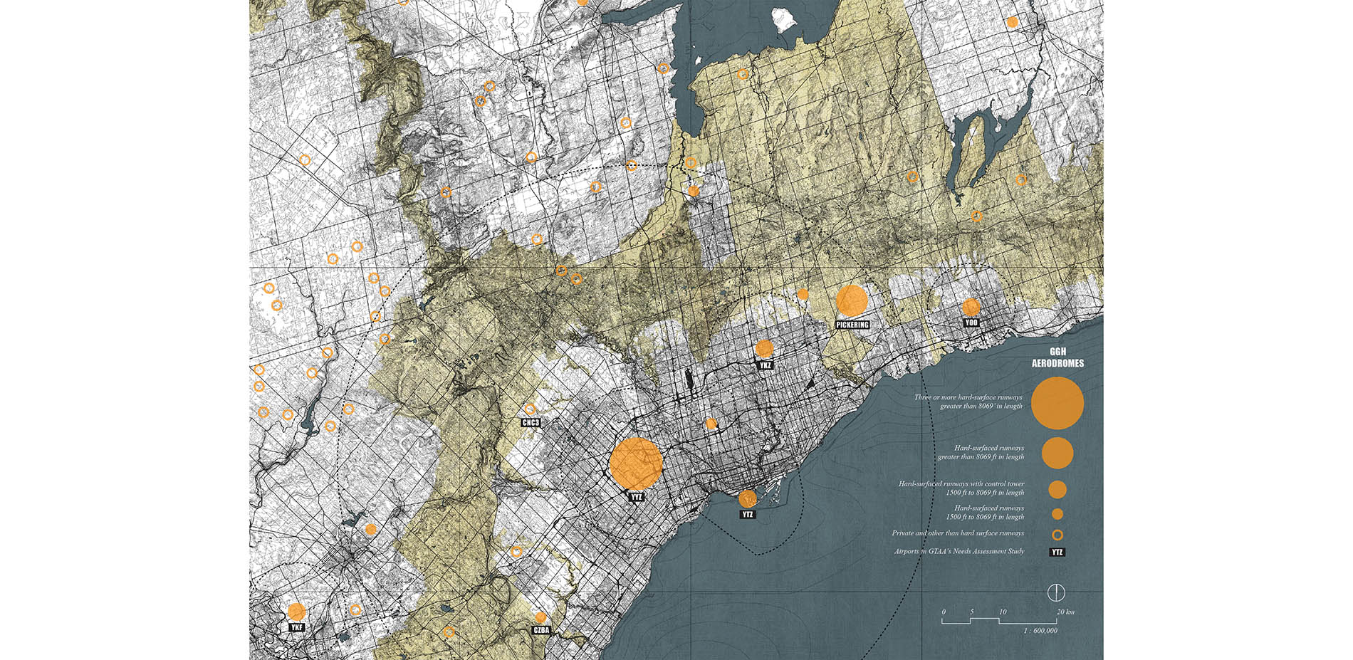
The data used to generate the No-Fly lists comes from both public and private sources, it is shared through governmental interagency cooperation, and it also comes from international intelligence sharing agreements. The data is captured to protect borders but the system requires a certain level of virtual borderless environment in order to operate, much the same way that the shepherd required the common-lands system in order to operate his economy. The common lands strategy is about utilizing the open space divided through multiple stakeholders’ ownership and management strategies and creating a common-land system that would match the different stakeholders with overlapping landscape strategies, taking into consideration stakeholders’ prerequisites and overarching ecological management goals.
Monitoring
Today’s technologically dependent society almost ensures everyone goes through daily surveillance and pattern-of-life analysis; our very actions form the modern border control system. This project proposes integrating existing airport surveillance technologies into a wildlife-monitoring program that seeks to gain a greater understanding of the social and behavioral patterns of animals against other surveillance programs such as meteorological and vegetation data. By having a greater understanding of bird movement versus the landscape type, airports can begin to strategically manage vegetation to allow only the no-risk bird populations to enter the airfield and strategically place risk-bird species away from aircraft approach zones. Since grassland songbirds present no risk to damage an aircraft, this project proposes testing the tall grass meadow as the initial vegetation of choice for the airfield and approach zones. The monitoring program would then assess bird movements and incorporate an adaptive management strategy.
A new typology of hybrid surveillance infrastructure is also proposed. Replacing the current perimeter fence with a mist-net system that helps in the tagging of birds along the edge of the airport adjacent to the creek but that will also act as a perimeter fence that will prevent large grazing animals from entering but will let the coyote enter so that it may control the rodent population. New science stations along a recreational trail along the creek where birds can be properly tagged will also be available for the public as viewing stations. A new radio tower typology that acts as central land-management control towers are equipped with a variety of monitoring technologies; viewing station; and a drone nest where drones responsible for vegetation monitoring and grazing control will be housed and charged.
Border Devices
As with human border and crowd control systems there always needs to be a mechanism to neutralize individuals who decide not to cooperate. Small-scale landscape devices that directly respond to animal’s physiological characteristics will be used to protect the runway and approach zones, where 93% of wildlife strikes occur.