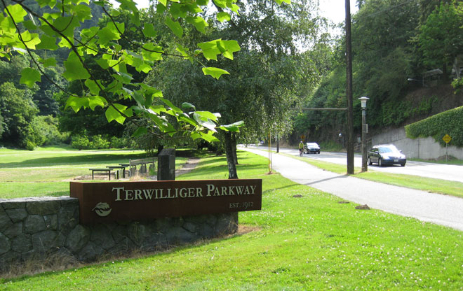
Welcome to Terwilliger Parkway
To celebrate the 100th anniversary of the opening of Terwilliger Parkway, the non-profit advocacy group Friends of Terwilliger installed this gateway sign in Duniway Park near SW 6th and Sheridan, where we start this tour. For over 30 years, the group’s mission has been to protect the natural character and scenic beauty of the corridor with a more recent focus on habitat and watershed restoration. In Portland, it is one example of the many "friends" groups that have formed to preserve, protect, and advocate for natural areas that make up Portland’s identity.
Image: Jean Senechal Biggs 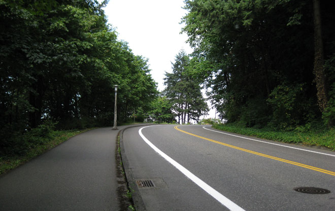
Legacy as a Scenic Drive
Terwilliger quickly rises up the hill from Duniway Park, where it takes on its character as a scenic drive with winding curves. The tree-lined roadway we see today does not resemble the roadway when it first opened to traffic in 1912. The area had been logged, creating exposed hillsides with views in all directions.
Image: Jean Senechal Biggs 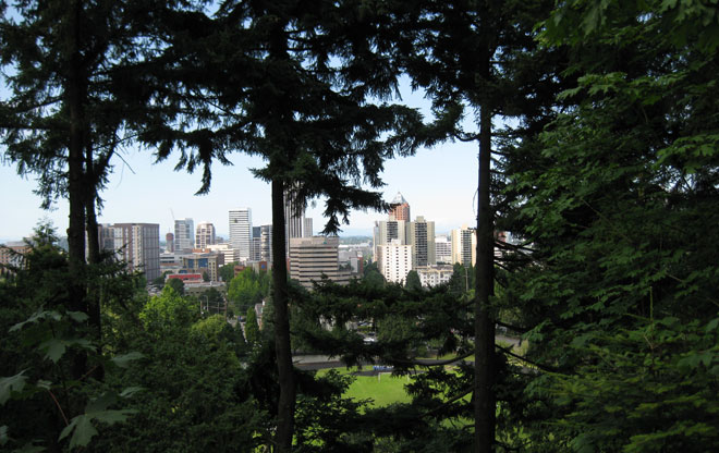
Framing Views
Your effort heading up the hill is rewarded with a view of downtown Portland through the trees. The 1983 Terwilliger Parkway Corridor Plan includes policies and a landscape concept plan that states that “major views shall incorporate the use of trees or other plant materials for enframement or enhancement of the view.” In anticipation of the parkway’s centennial celebration in 2012, Portland Parks & Recreation undertook selective tree trimming along the corridor to reestablish scenic views of downtown, Mt. St. Helens, Mt. Hood, and the Willamette River.
Image: Jean Senechal Biggs 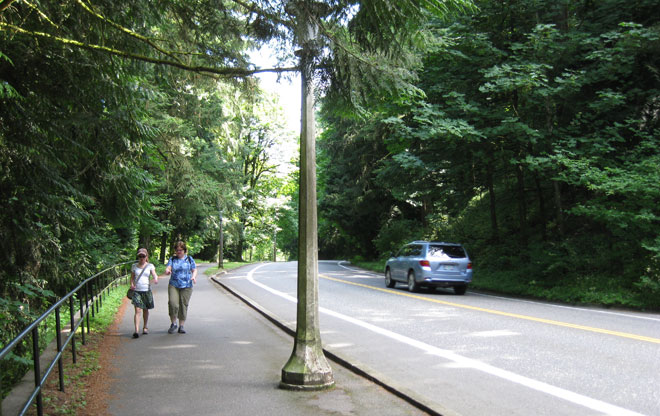
Paved Path for Walking
An asphalt-paved path built in the 1970s transformed the corridor into a popular destination for walkers, joggers, and cyclists.
Image: Jean Senechal Biggs 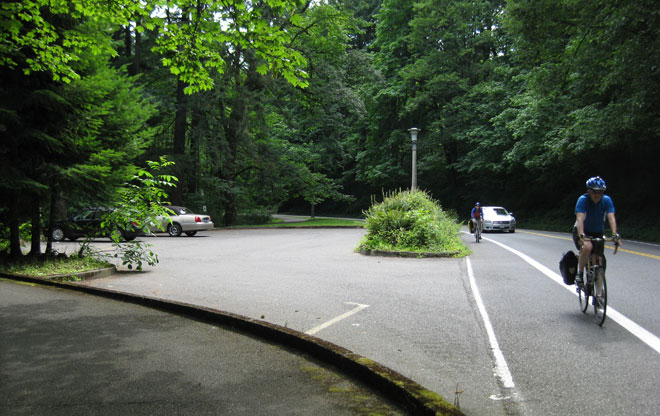
Bicycle Lanes Create Commuter Connection
Moving through Southwest Portland’s hills on a bicycle is a challenge. Terwilliger’s bike lanes – added in the 1980s in conjunction with roadway improvements – create a popular connection to downtown that avoids the higher traffic volume on major arterials. Transportation policies established in the 1983 corridor plan have worked to preserve the roadway’s primary function as a scenic drive and bicycle connection.
Image: Jean Senechal Biggs 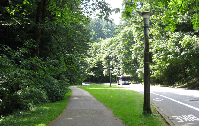
Transit on Terwilliger Boulevard
TriMet, the Portland region’s transit system, provides bus service that connects to Oregon Health & Science University (OHSU), Shriners’ Hospital, and the Portland VA Medical Center. As their facilities have grown, these institutions faced neighborhood concerns about increased traffic impacts on Terwilliger. Through the efforts of a transportation management association, they developed policies to limit parking and established programs that get many of their students, staff, and faculty to take transit, walk, and bicycle.
Image: Jean Senechal Biggs 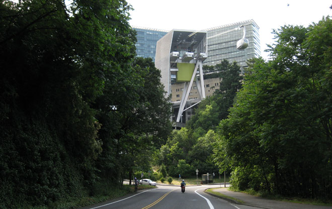
Take Flight
The Portland Aerial Tram flies overhead, connecting OHSU's campus on Marquam Hill to its campus in the South Waterfront district. The tram was built to provide an off-street, direct connection between the two campuses. Between 2006 and 2014, the tram had eliminated the need for more than 2 million vehicle miles, saving 93,000 gallons of gas, as well as lost time due to traffic delays. A one-way ride takes four minutes and provides great views of Portland as it rises 500 feet to reach the upper station.
Image: Jean Senechal Biggs 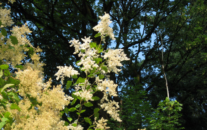
Native Plants Take Root
Oceanspray (Holodiscus discolor) and other native plants and shrubs are found along the parkway. A plant list in the 1983 Terwilliger Parkway design guidelines identifies plants compatible with the landscape concept plan in the parkway corridor plan. Restoration work has continued to return landscaped areas to a more natural state, with new plantings and the removal of invasive species.
Image: Jean Senechal Biggs 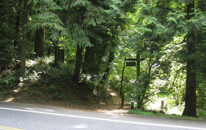
Connecting Trails and Natural Areas
A rustic sign post marks an entrance to the Marquam Nature Trail, a seven-mile link in the 40-Mile Loop popular with hikers and trail runners. Further south past Capitol Highway, George Himes Park is a deeply wooded area with trails that is accessible from the parkway.
Image: Jean Senechal Biggs 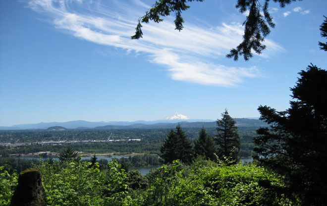
Beyond the Parkway
On a clear day, Mt. Hood can be seen from Elk Point near SW Westwood Street. A totem pole with surrounding benches marks this view, which was developed in response to the 1983 corridor plan.
Image: Jean Senechal Biggs