
.webp?language=en-US)


Very dense beautiful graphics.
Awards Jury
-
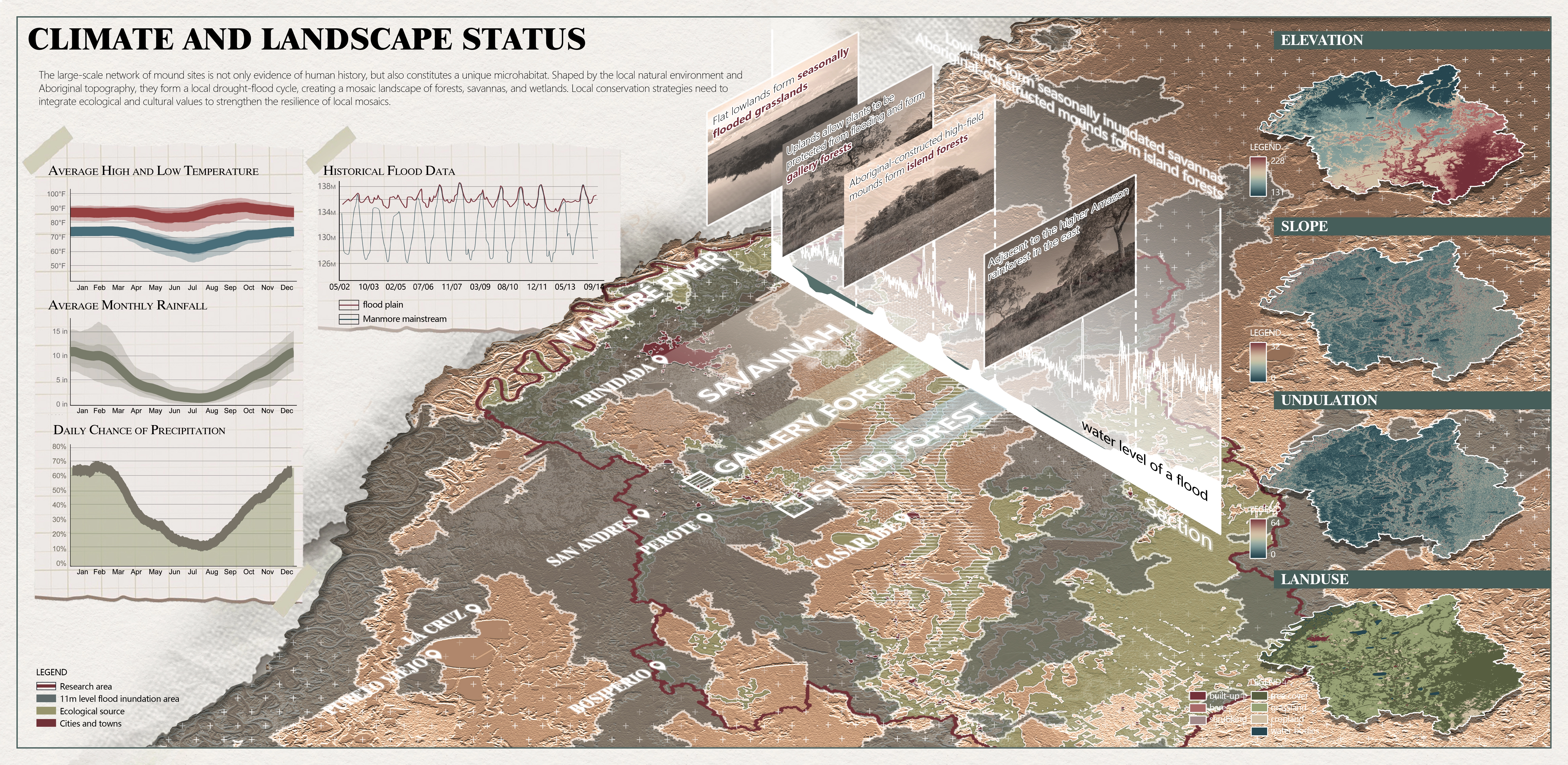
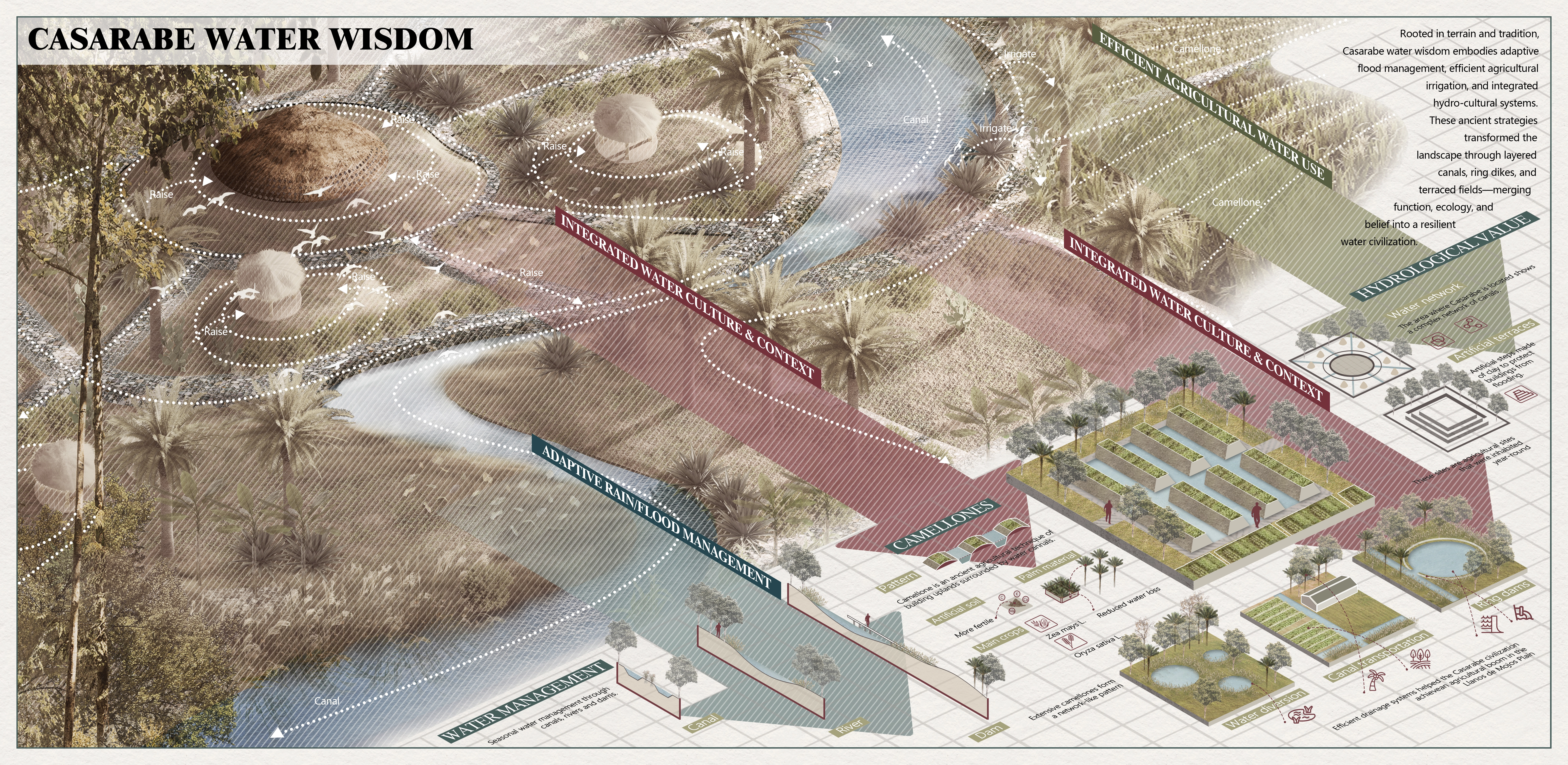
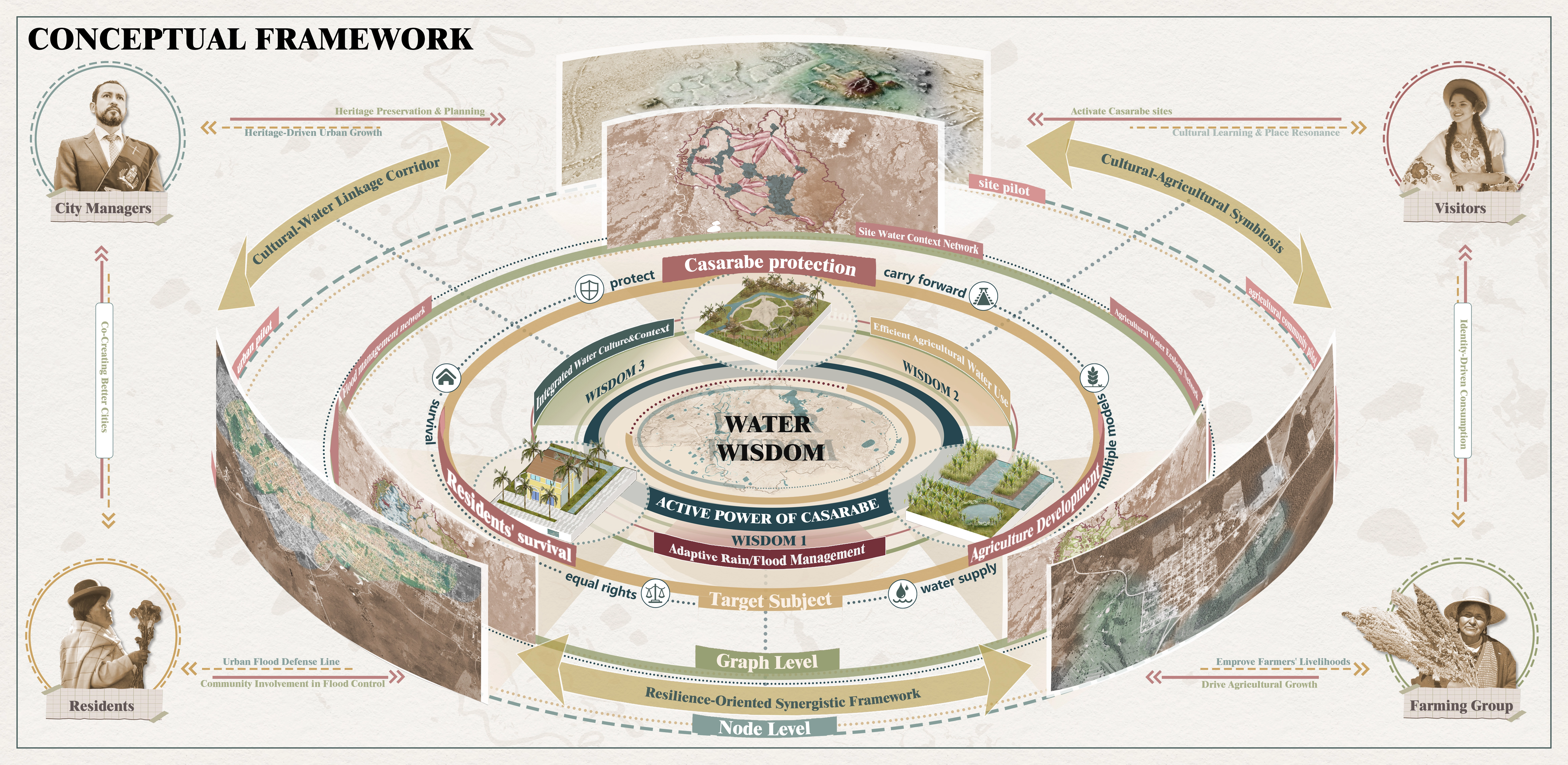
At the Casarabe heritage landscape in Beni Province, seasonal droughts and floods create water crises that threaten local communities, agriculture, and archaeological sites. The ancients countered extremes with ponds, canals, raised fields, and mounds, forming a resilient mosaic landscape. Drawing on three water-wisdom legacies—Flood Management, Efficient Agricultural Water Use, and Integrated Water Culture—we establish a Flood Management Network, an Agricultural Water Ecology Network, and a Sites Water Context Network. This heritage-informed, networked strategy balances ecological restoration, sustainable farming, and site conservation, offering an innovative, replicable model for resilient landscape stewardship.
-
Background
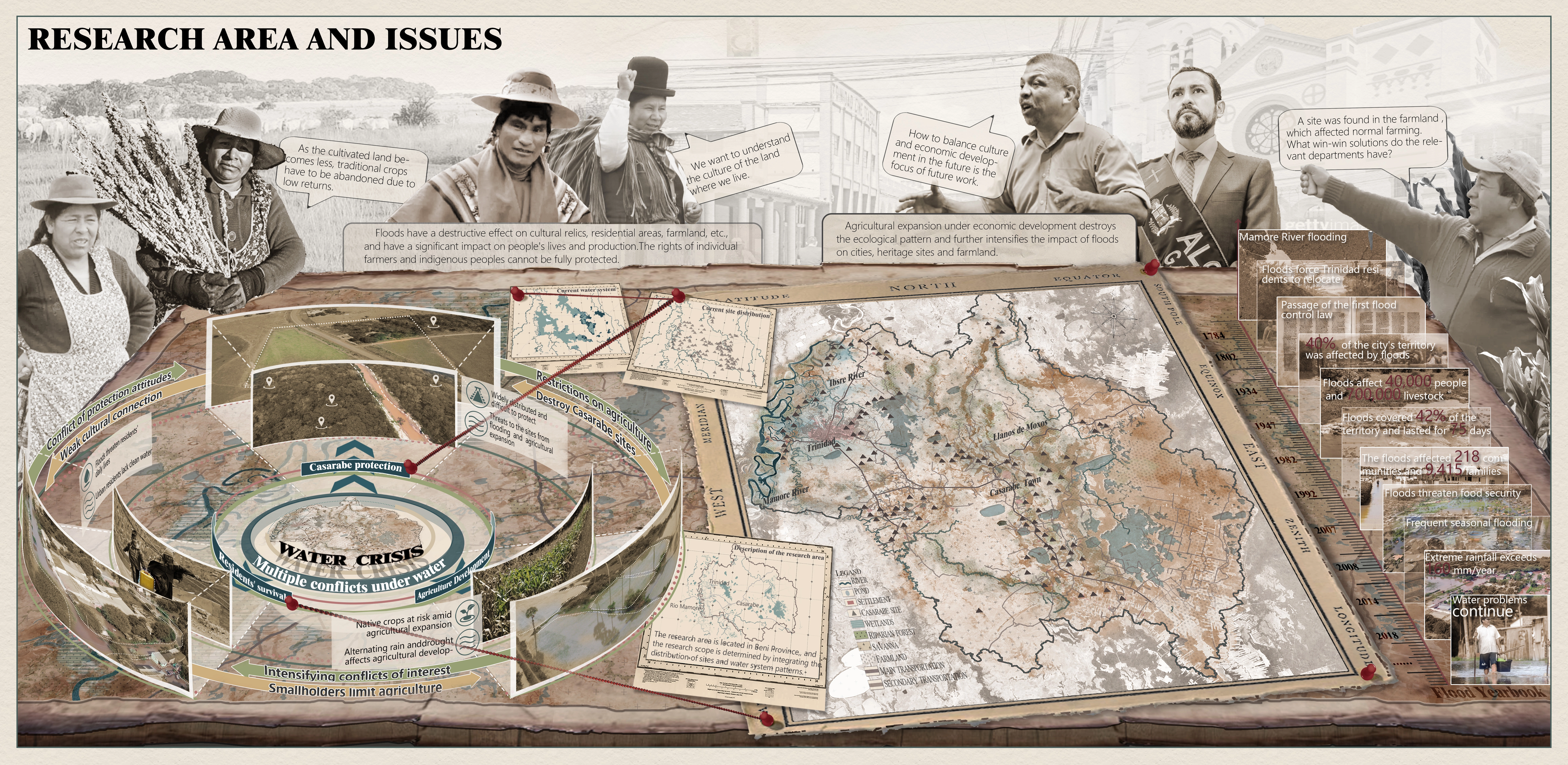
Recent airborne LiDAR surveys have revealed the vast, complex settlement landscape of Casarabe on the edge of the Amazon. Ancient ponds, canals, raised fields, and mounds to moderate both wet-season floods and dry-season droughts. Today, rapid land-use change and climate variability spark severe water scarcity, triggering land-use conflicts and accelerating loss of unrecorded archaeological features. Many sites risk destruction by agriculture, livestock grazing, and development long before formal recognition. A proactive, landscape-scale planning strategy is urgently needed to reconcile competing interests, safeguard irreplaceable heritage, and restore ecological resilience.
Issues
Within Casarabe’s study area, seasonal extremes intensify tensions among three interdependent systems: community livelihoods, agro-pastoral productivity, and site conservation. First, heritage sites are dispersed across thousands of hectares, making coherent protection zones spatially complex. Second, farmers and ranchers rely on the same floodplain that sustains archaeological earthworks; conservation buffers often conflict with productive land parcels. Third, climate variability deepens water stress—extended dry seasons strain crops and livestock, while intense rains cause flooding and erosion, undermining both soil fertility and fragile monuments. Without integration, efforts to boost yields or delimit reserves risk worsening inequities, degrading ecosystem services, and erasing cultural patrimony.
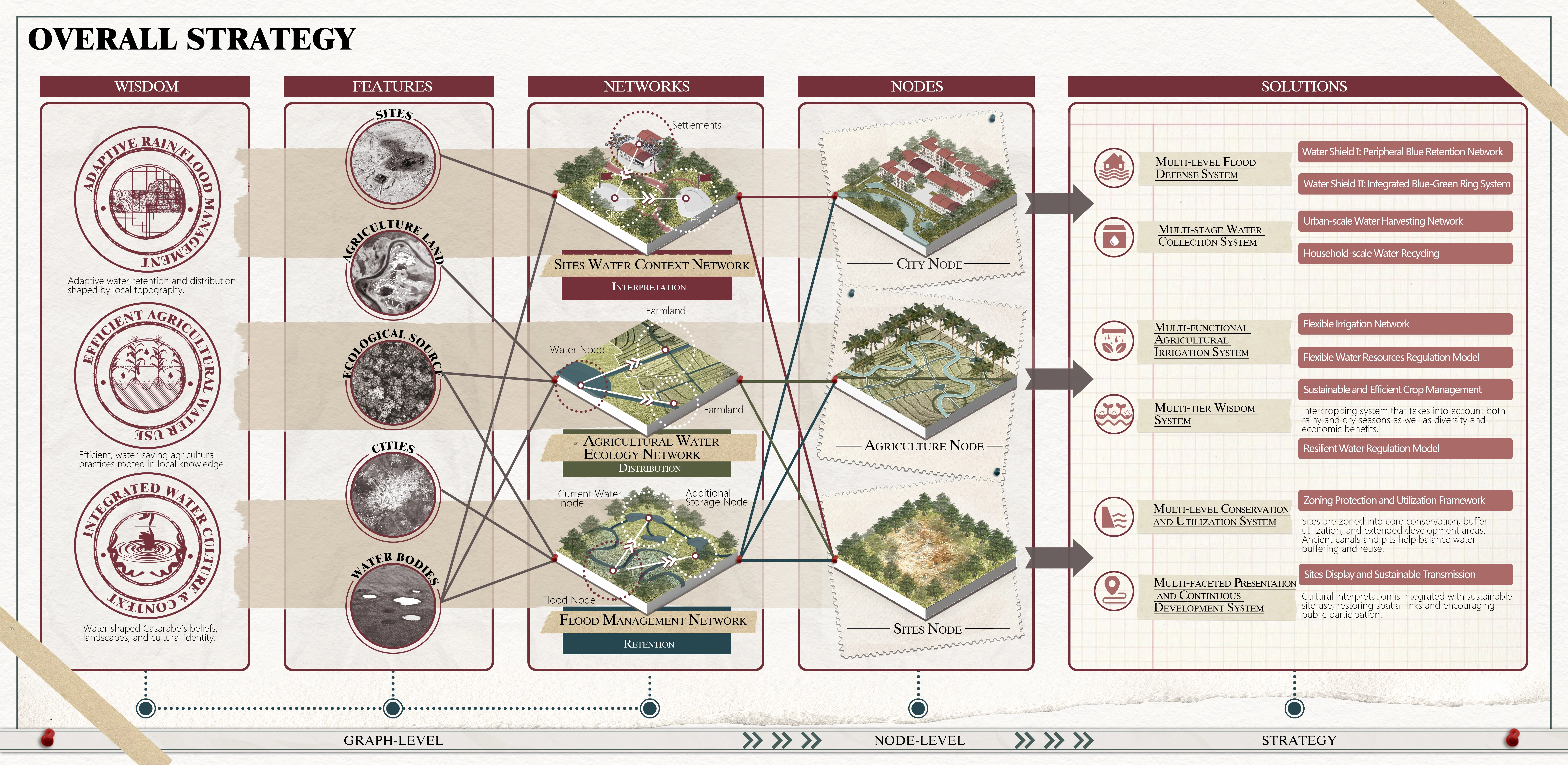
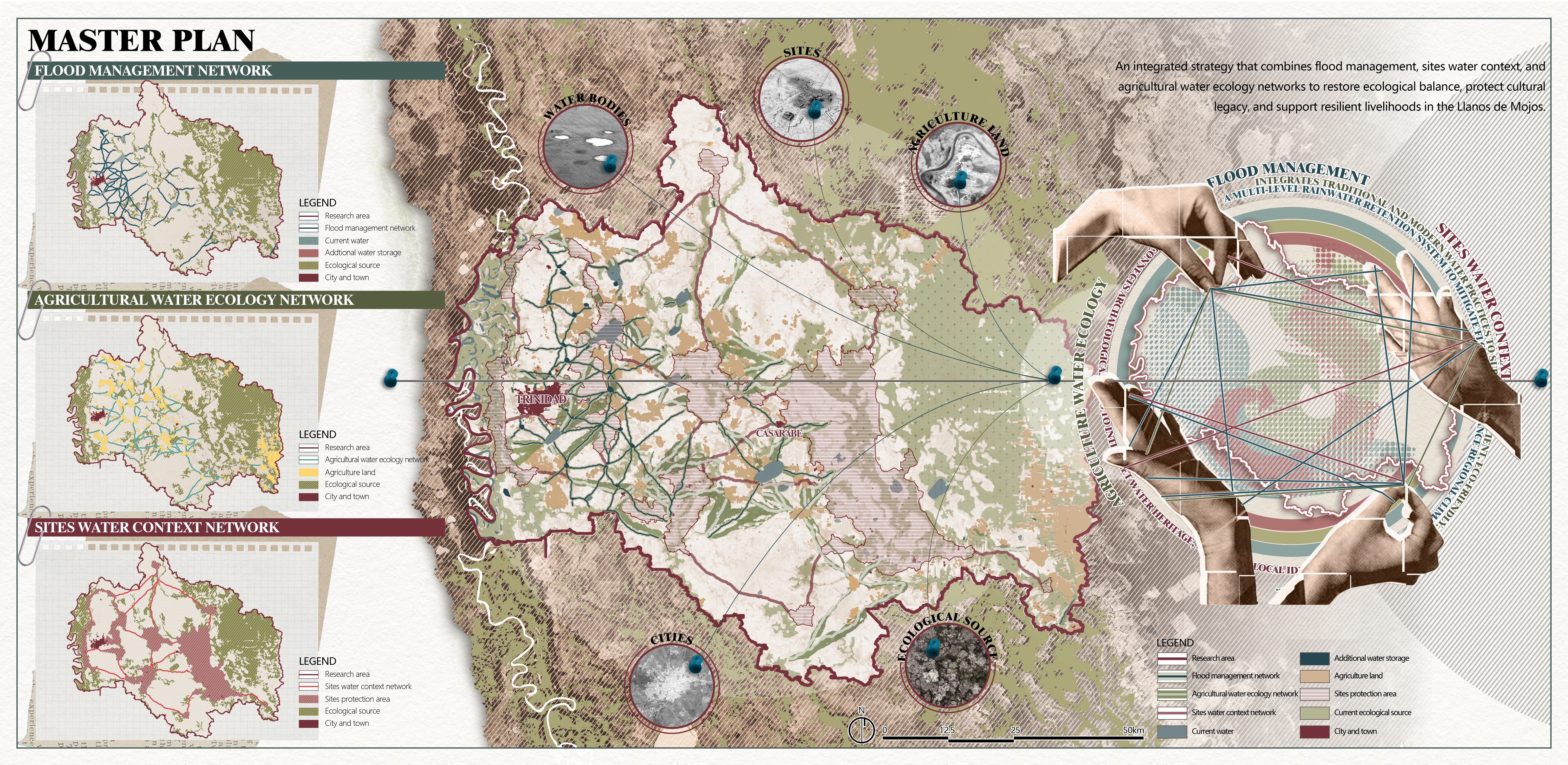
Strategy
Drawing on ancestral water wisdom, our plan weaves three complementary network systems—Flood Management, Agricultural Water Ecology, and Sites Water Context—into a unified framework:
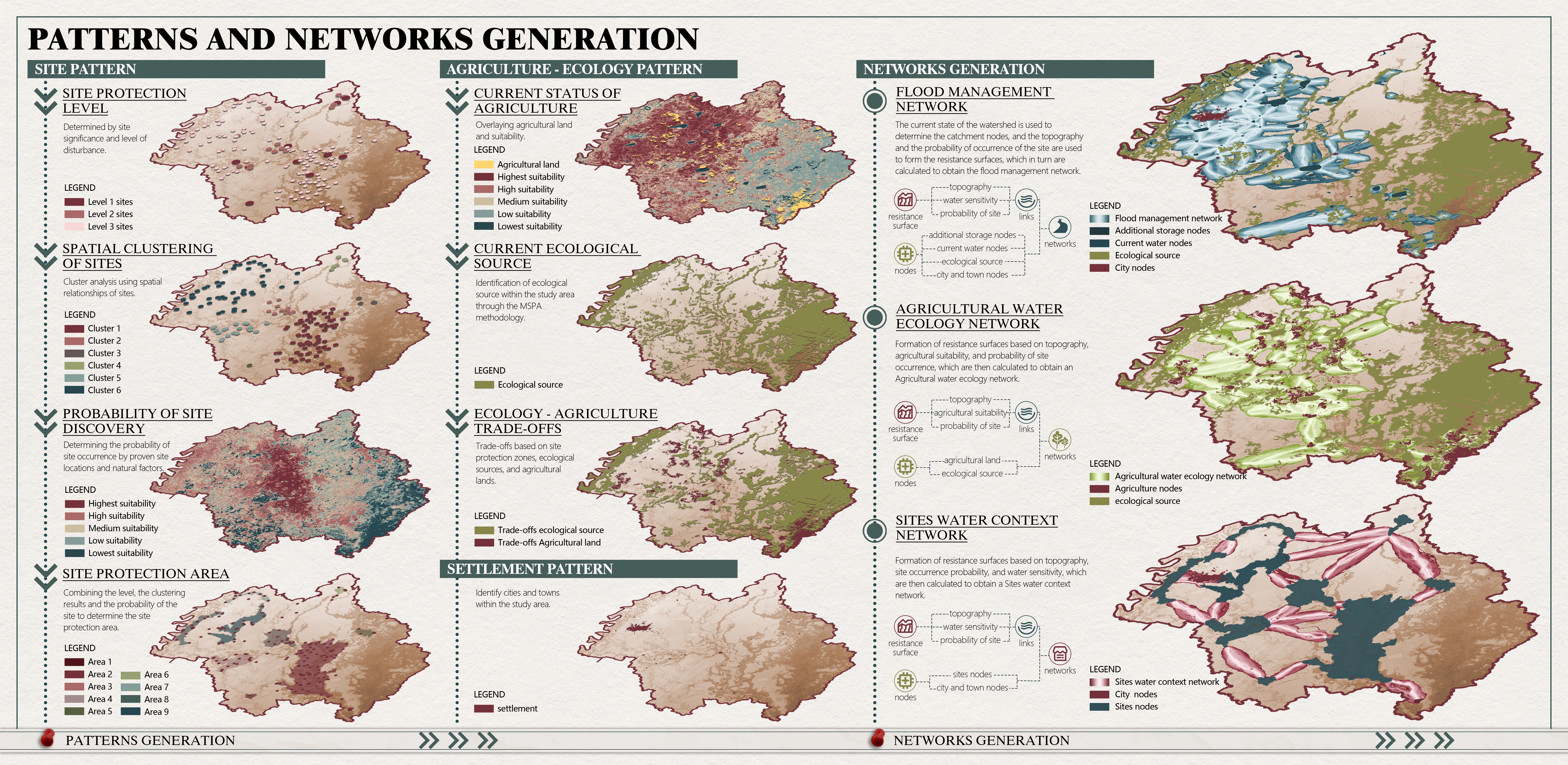
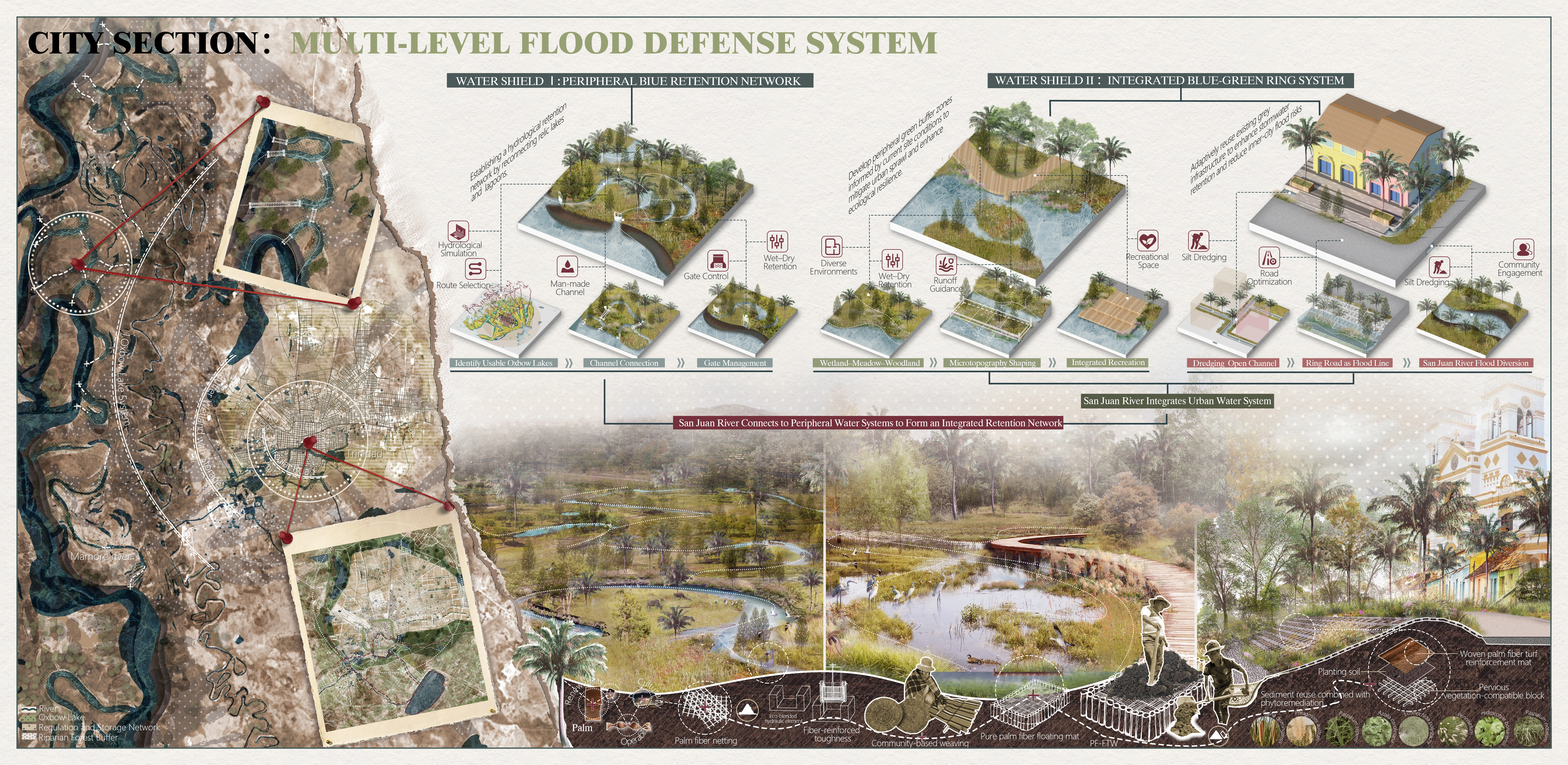
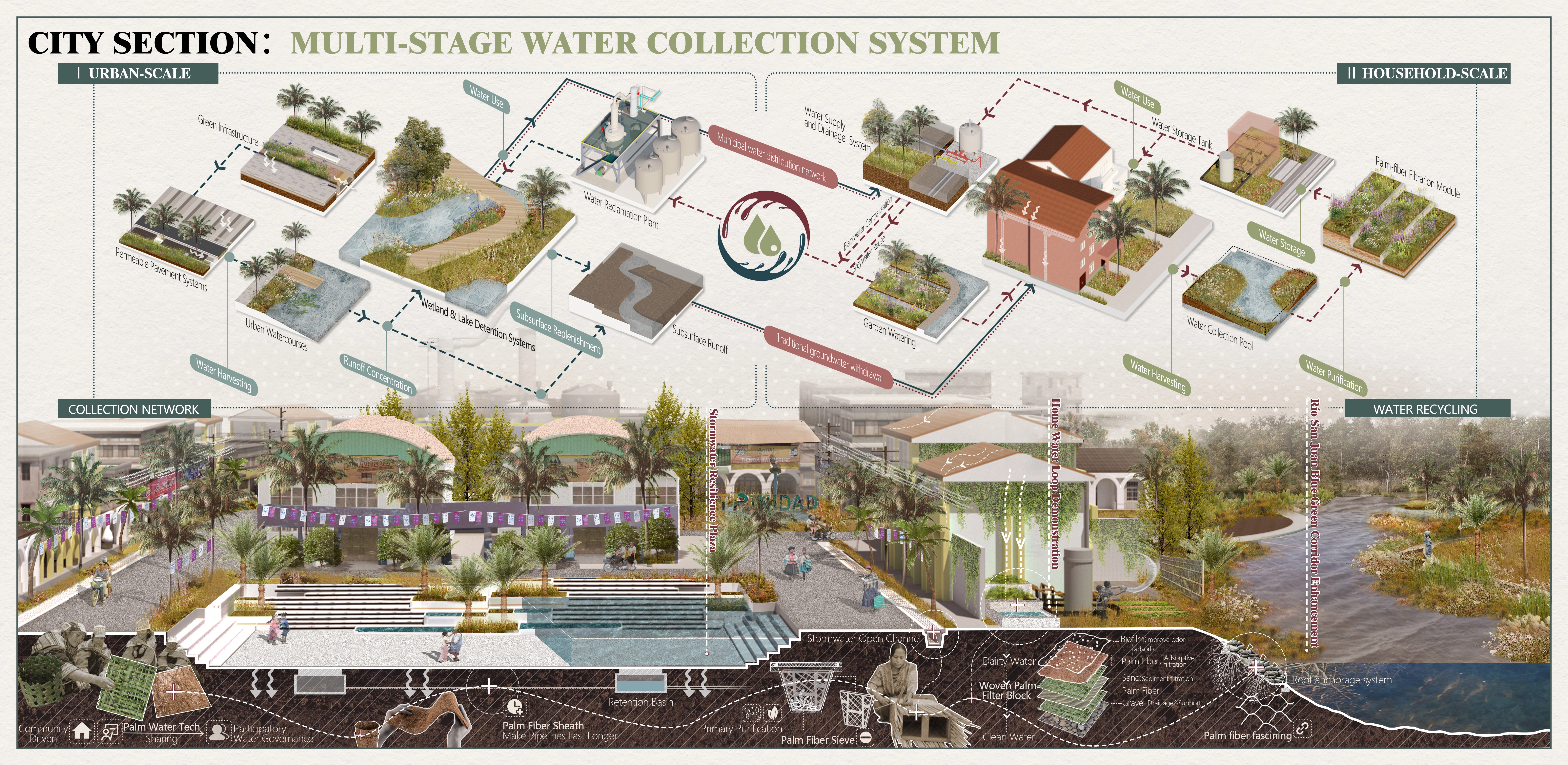
1.Flood Management Network
Determination of water bodies with water storage functions within the study area based on flood inundation data. Construction of a flood management network based on topography and spatial relationships between water bodies and cities and sites.
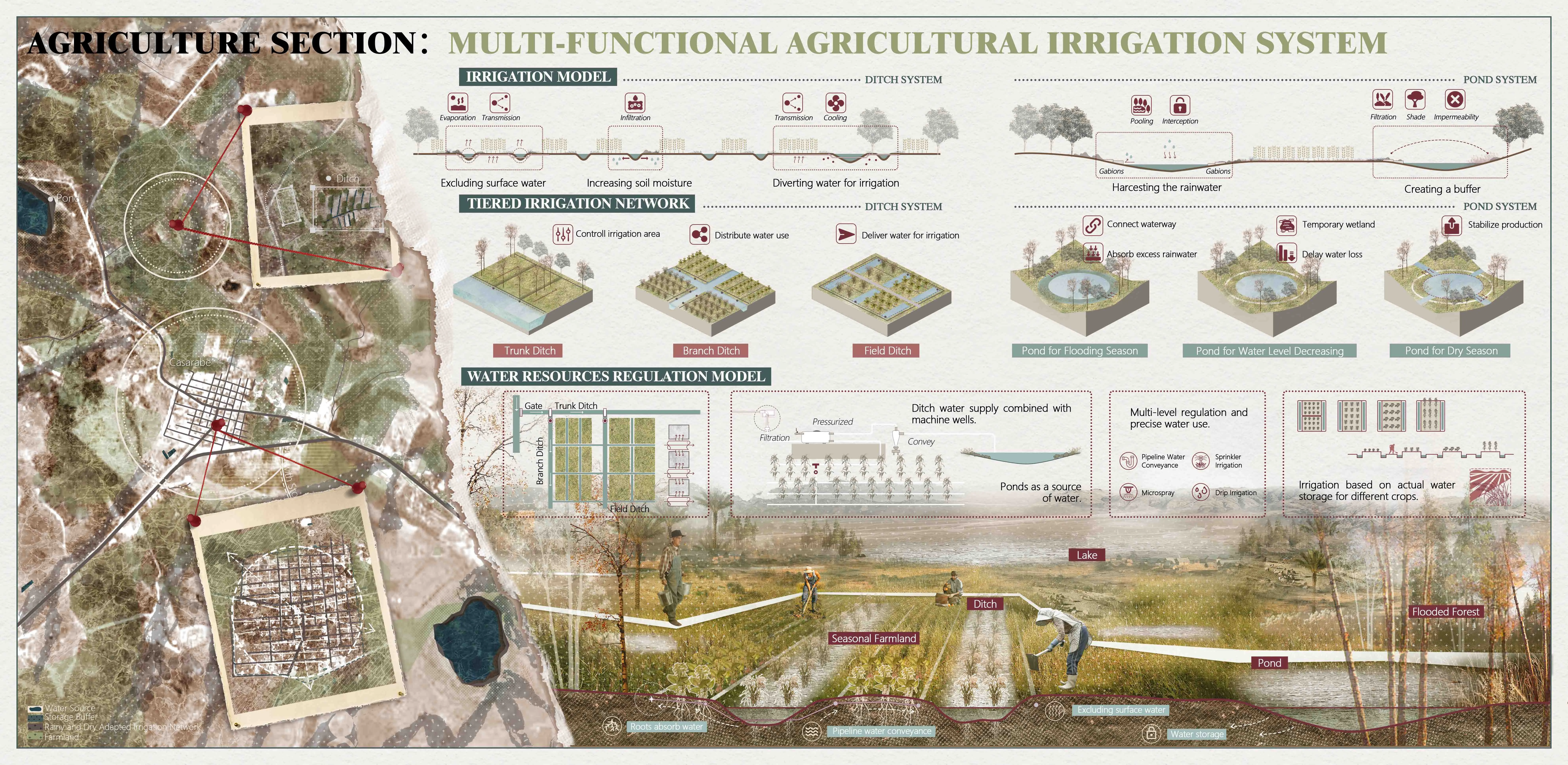
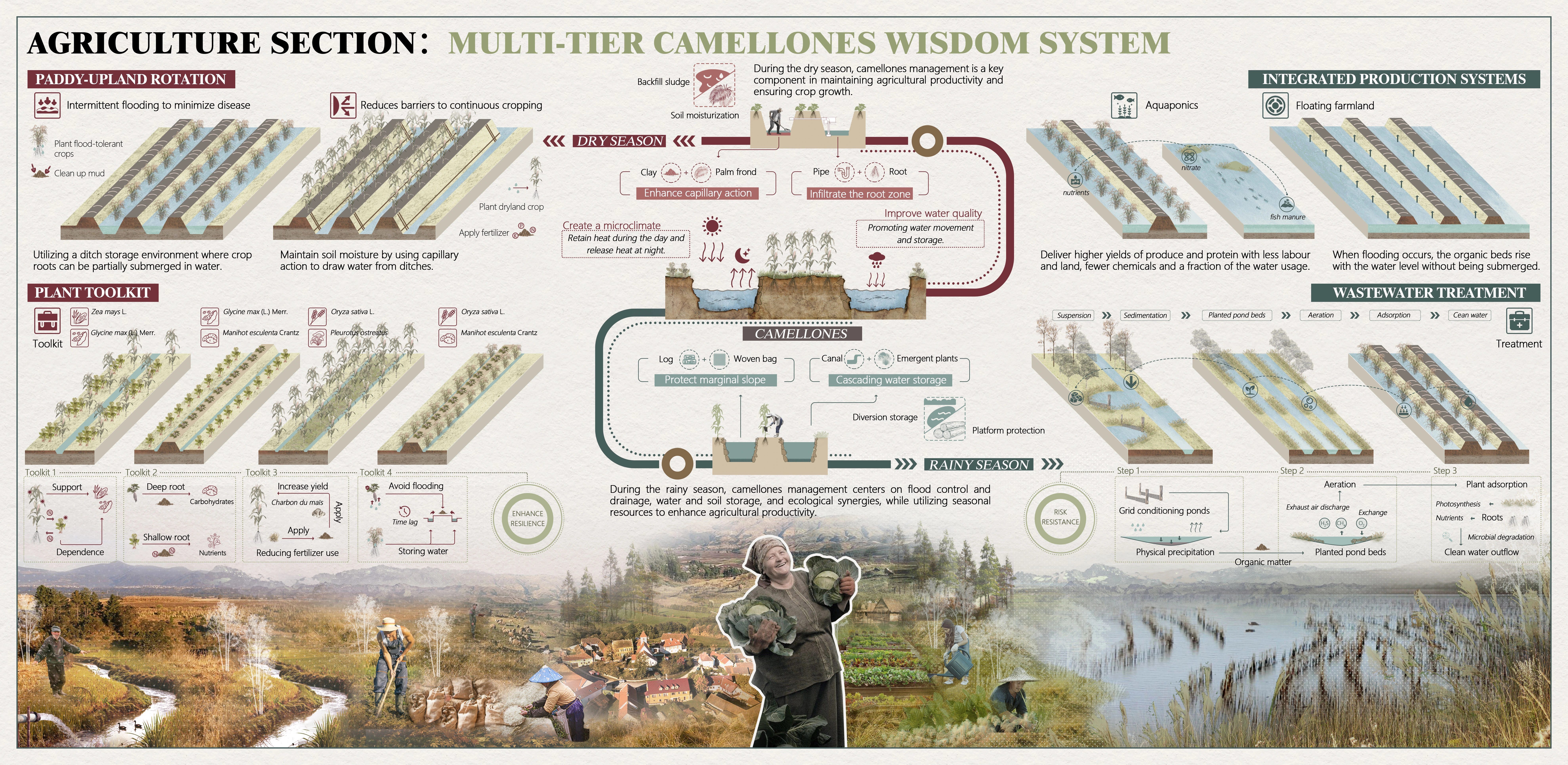
2.Agricultural Water Ecology Network
Based on the spatial relationship between agricultural land and ecological sources that have water-holding functions, constructs the Agricultural Water Ecology Network under the influence of topographic and ecological factors.
3. Sites Water Context Network
Based on the spatial relationship between the site as well as the main settlements, was constructed the Sites Water Context Network under the influence of multiple factors such as topography and flooding.
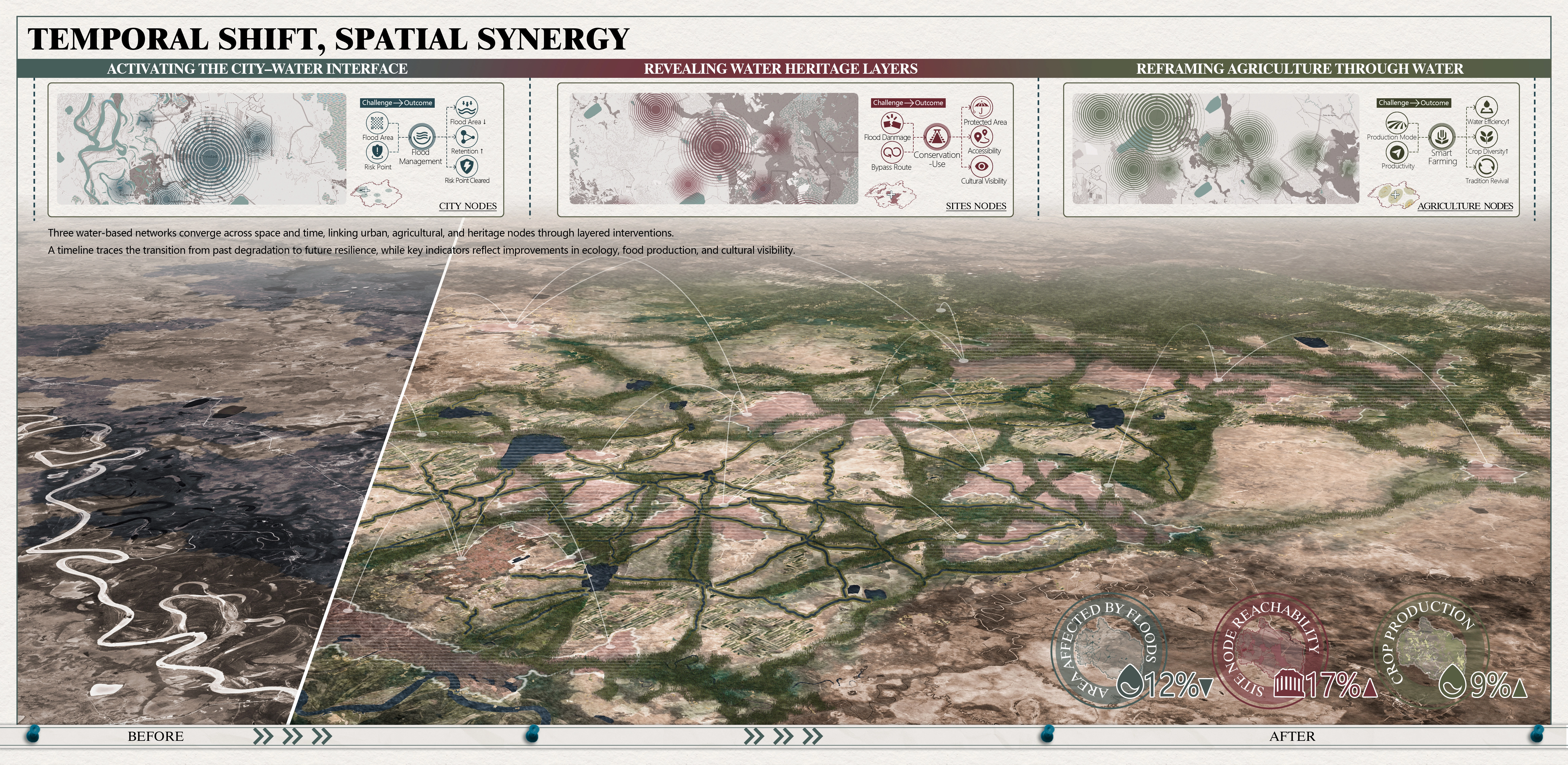
At the network level, we prioritize connectivity by integrating water risks, ecosystem service supply and demand relationships, land use, and sites distribution. At the node level, selected towns, farming communities, and archaeological sites become keystone points for targeted interventions with detailed water storage and drainage strategies.
By reactivating Casarabe’s ancestral water networks within a contemporary planning framework, the project delivers a replicable model of integrated landscape stewardship. It enhances flood-drought resilience, sustains agricultural productivity, and secures the protection of invaluable cultural heritage—achieving a balanced, multi-benefit outcome for people, economy, and environment.
-
- Southern cattail
- Phragmites australis
- Paspalum repens
- Azolla caroliniana
- German grass
- Pennisetum
- Bahiagrass
- Bactris gasipaes
- Rice
- Corn
- Soybean
- Cassava
- Reeds
Advertisement
Related Awards
Auwai Revived: Integrated Ecological Strategies from Mountains to Sea
This project revitalizes O'ahu's upland, agricultural, and coastal landscapes by weaving traditional Hawaiian water systems - especially the 'Auwai and loko i'a - into modern ecological design. Rooted in the ahupua'a ridge-to-sea framework, it integrates native reforestation, decentralized wastewater reuse, and multifunctional fishpond buffers to restore hydrological health, biodiversity, and cultural heritage. Through deep community participation, the design empowers local stewardship w