.webp?language=en-US)


The Bottom Rises: Sustainable Infrastructure Anchors a Reviving Neighborhood
Avery Deering-Frank, Student ASLA; Cooper Begis, Student ASLA; Amanda Buss; Violet Lam, Student ASLA; Jessie Hitchcock, Student ASLA; Ann Thuruthy; Dasom Mun, Student ASLA; Oren Mandelbaum, Student ASLA


Excellent narrative of the project and high quality of design execution. We felt the attention to social justice, equity and inclusion was very strong throughout the eight project sites with great overall contribution to the broader urban landscape of Dallas.
Awards Jury
-
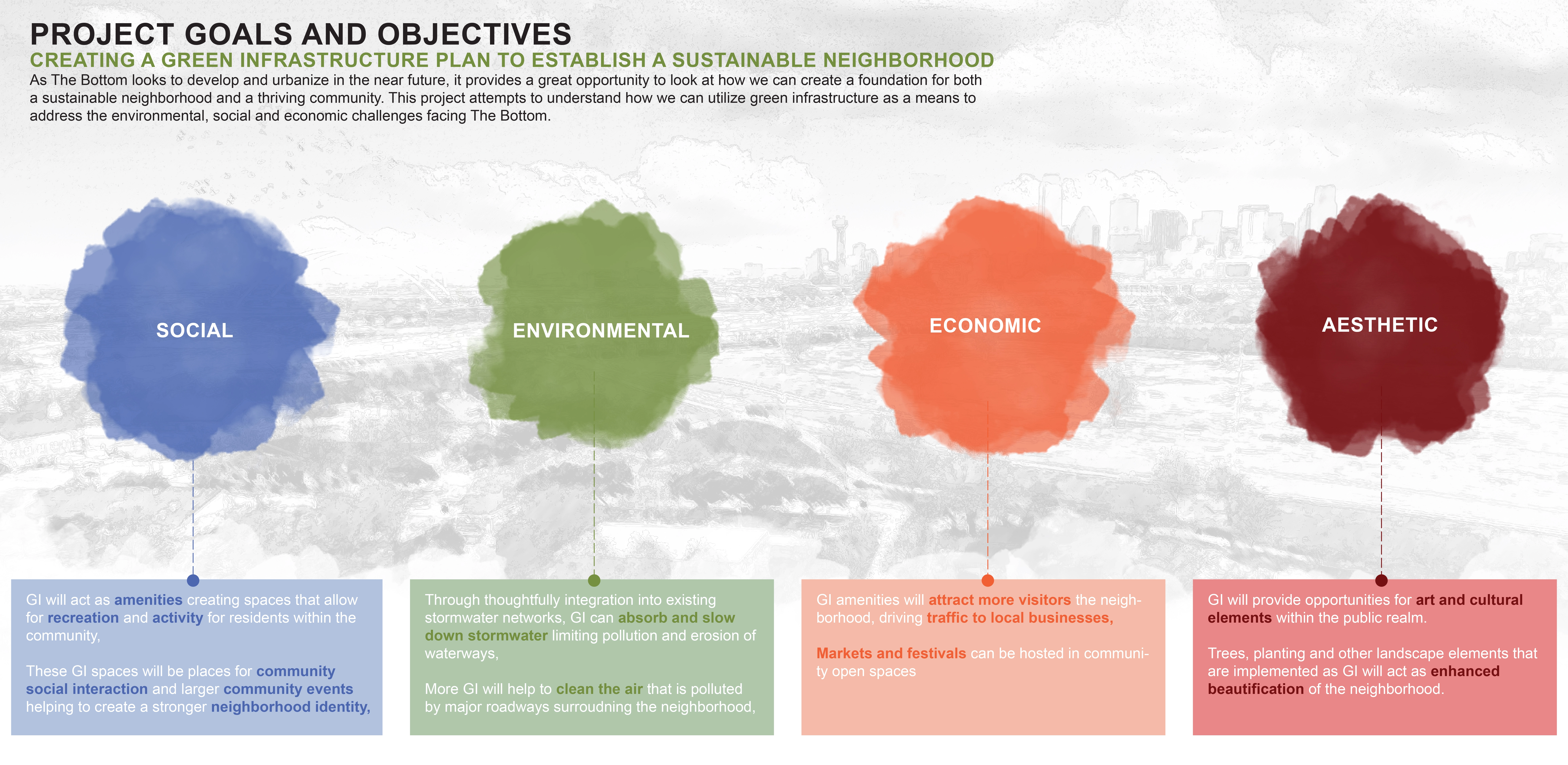
The pillars of environmental, social, and economic sustainability provide an infallible framework for a master plan designed to celebrate the cultural and historical significance of The Bottom, a historic Freedmen’s Town adjacent to the Trinity River just over a mile south of Downtown Dallas. The community’s unique bowl-shaped topography, resulting from natural elevation changes combined with a man-made levy and a barrier created by the I-35 highway corridor, provides for site-specific stormwater and connectivity design opportunities. The master plan implements a green infrastructure network, linking pocket parks, hillside trails, plazas, and green streets into a neighborhood-wide design that successfully mitigates stormwater runoff from the surrounding micro-watershed. Complete streets and a cultural trail inform internal circulation, connect to the greater Dallas community, and link open spaces to provide gathering places for residents and visitors alike. A business incubation center and community garden support local economic opportunities while gateways and signage enhance the neighborhood’s identity. Importantly, the plan provides for growth as The Bottom looks toward the next chapter in its history.
-
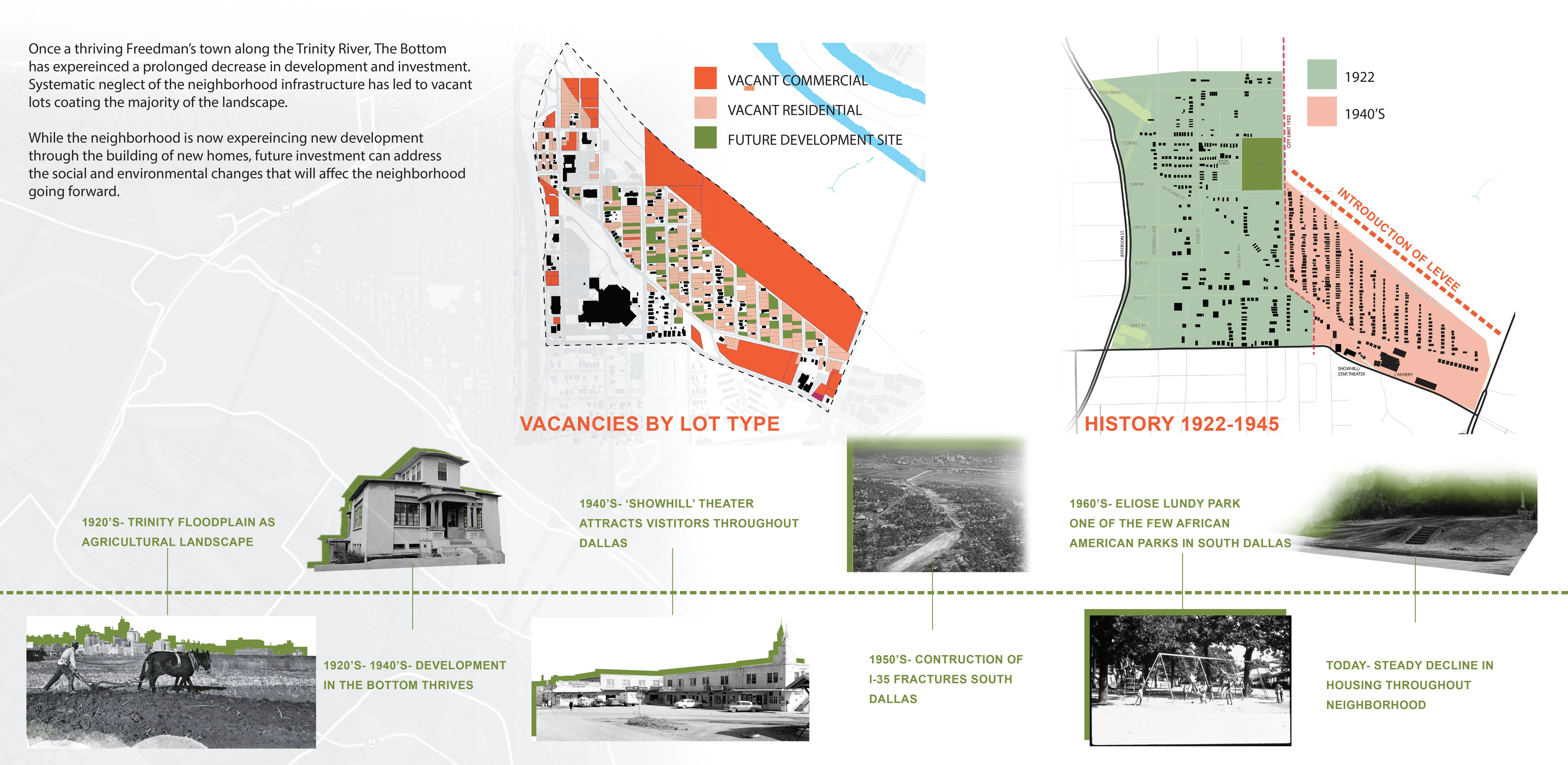
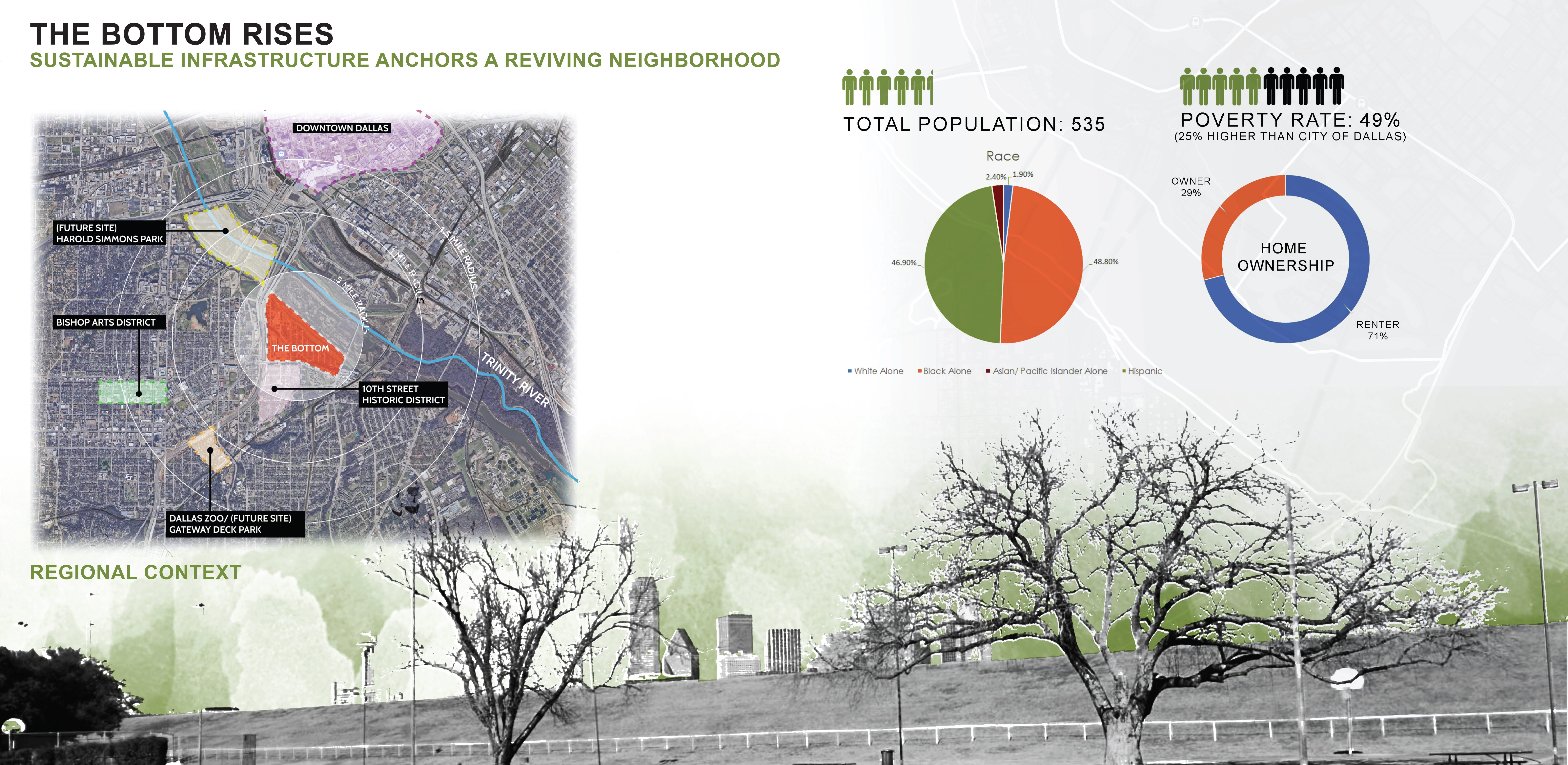
Originally settled in 1845 and later established as a Freedmen’s Town, The Bottom neighborhood was once a thriving, close-knit community occupying 240 acres adjacent to the Trinity River, just over a mile south of Downtown Dallas. Though vibrant businesses, churches, and residences filled the community through the mid-1900s, the neighborhood has since declined, and a majority of the lots not given over to the construction of the Trinity River levees to the north in the 1930s and I-35 to the west in the 1950s now sit vacant—stoops to nowhere with nature reclaiming the land.
Current reinvestment in the neighborhood through key stakeholders promises an exciting next chapter in The Bottom’s history as the community is reestablished through building nearly 400 new homes and attracting additional residents. As part of this reinvestment, our studio group partnered with The Golden S.E.E.D.S. Foundation, Inc., a local community development corporation serving The Bottom neighborhood, to plan and design spaces that support public amenities and community programming initiatives while incorporating a green infrastructure network into the framework of the neighborhood. The components of this green infrastructure network provide for desirable community amenities while also processing stormwater runoff from the surrounding micro-watershed. Importantly, the overall design features many elements informed by the unique culture and history of the neighborhood gleaned from multiple community engagement opportunities and extensive research.
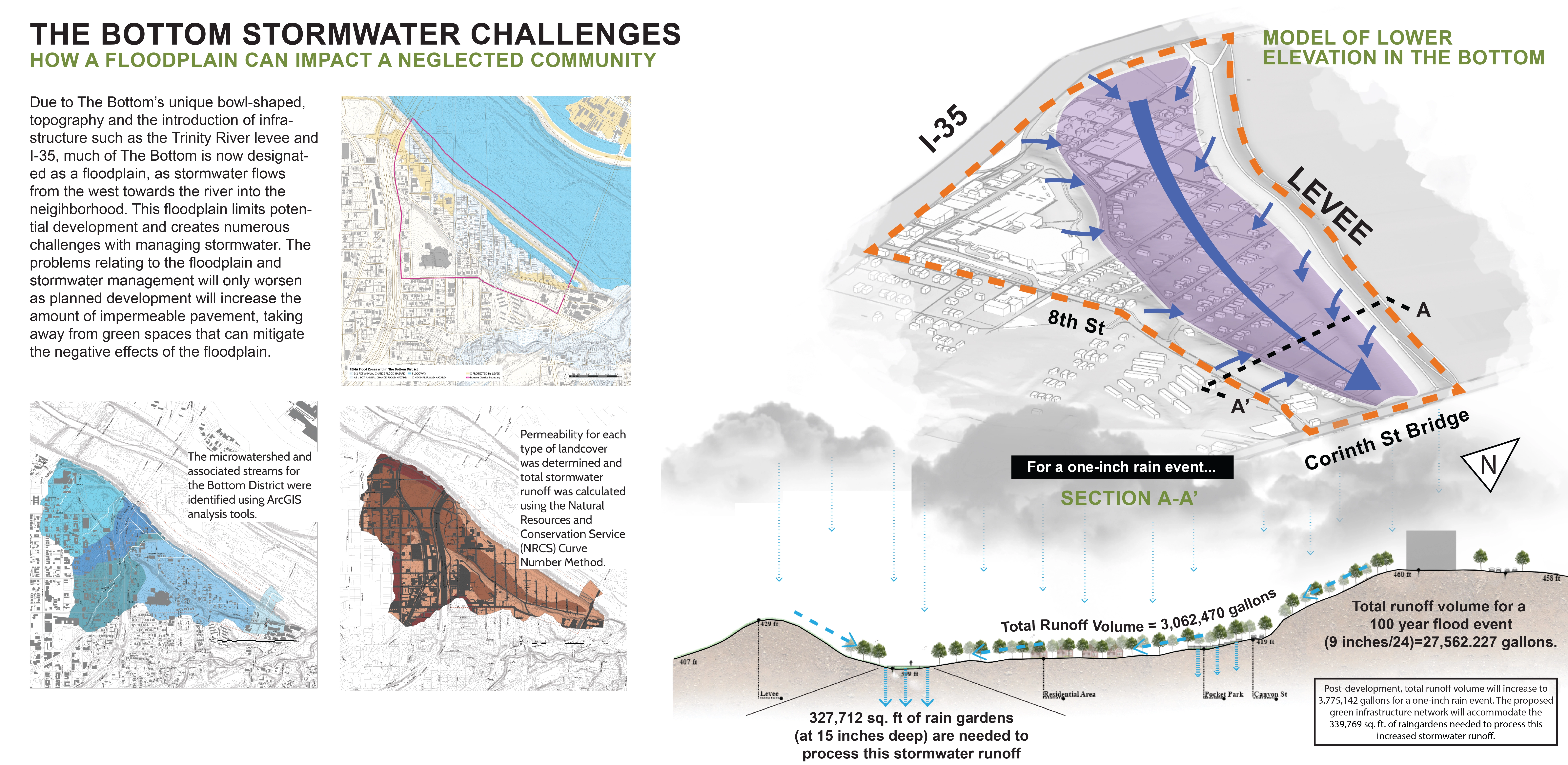
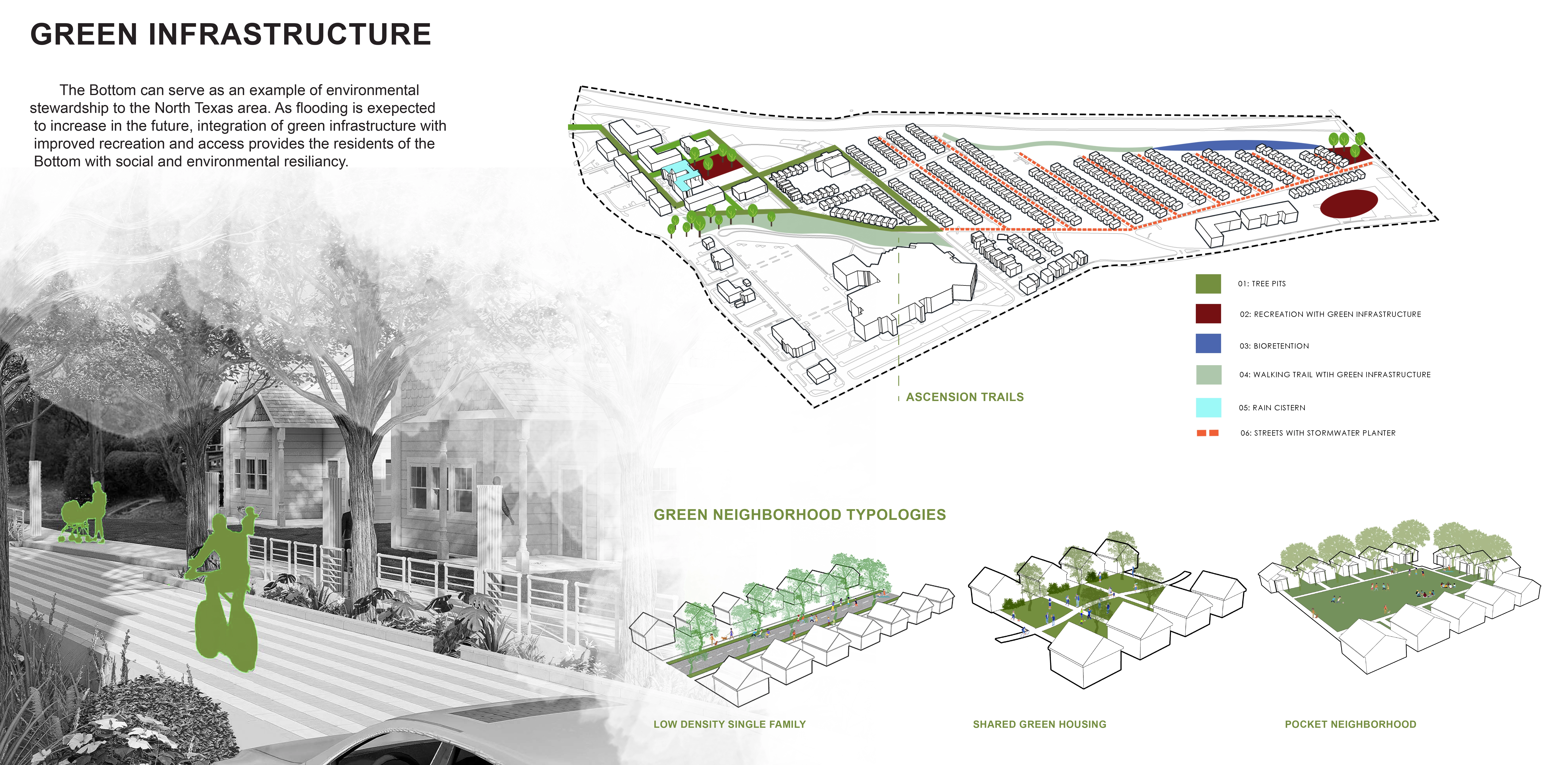
As the climate continues to change and weather events become more severe, managing flooding and stormwater runoff in developing urban environments will become a vital and existential challenge to overcome. By utilizing plants and green spaces to slow down and absorb the runoff (along with the heat and contaminants) into a natural system, green infrastructure is an alternative solution that may be thoughtfully integrated into existing stormwater management systems to sustainably mitigate the effects of runoff and flooding. Research related to the feasibility of this idea was applied in the development of a master plan for The Bottom neighborhood that responds to current stormwater challenges while also addressing social and economic issues resulting from disinvestment and neglect. In creating a plan to support a sustainable neighborhood, it was important to address each of these environmental, social, and economic factors, as they make up the foundation of a thriving community.
A large section of The Bottom falls into the flood plain due to its unique bowl-shaped elevation, which was created in part through a man-made levee that was built to prevent flooding from the nearby Trinity River. The poverty rate is higher in The Bottom neighborhood as compared to the greater Dallas statistical area, and few opportunities exist nearby for employment. Only a handful of restaurants and convenience stores from which to obtain food are within walking distance. Opportunities exist to connect to networks of public transportation, biking routes, and hiking trails as well as other cultural and recreational opportunities. The master plan responds to these components by aiming to not only utilize a green infrastructure network to minimize the flooding and damage from stormwater runoff in the neighborhood but also take advantage of the green infrastructure as an opportunity to create neighborhood amenities for the residents of The Bottom. Wetland trails, community gardens, and sloped parks are a few of the additions proposed that can both address the issues of stormwater runoff and be used by the community as spaces for economic growth, community events, and recreation.
Utilizing ArcGIS suitability analysis methods along with feedback from community engagements, the plan thoughtfully integrates green infrastructure so as to maximize its effectiveness in processing stormwater. The analysis considered, in part, soil type and land cover permeability, slope, and distance from key waterflows. It was then determined which types of green infrastructure would be most effective based on the context of the major spaces, connecting the entire system through a series of “green streets” which ensures all green infrastructure implemented successfully captures and treats the stormwater as it makes its way through the community.
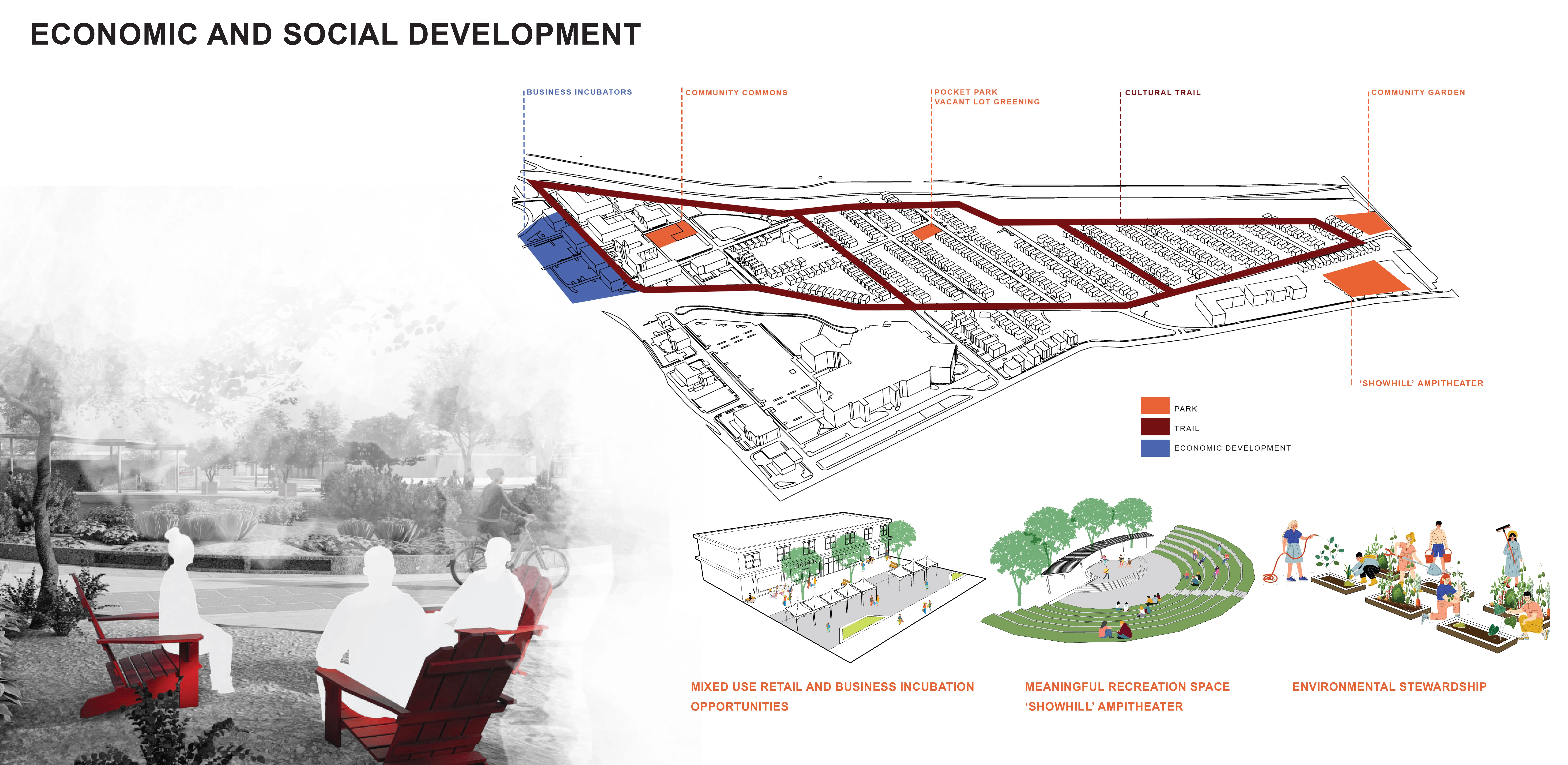
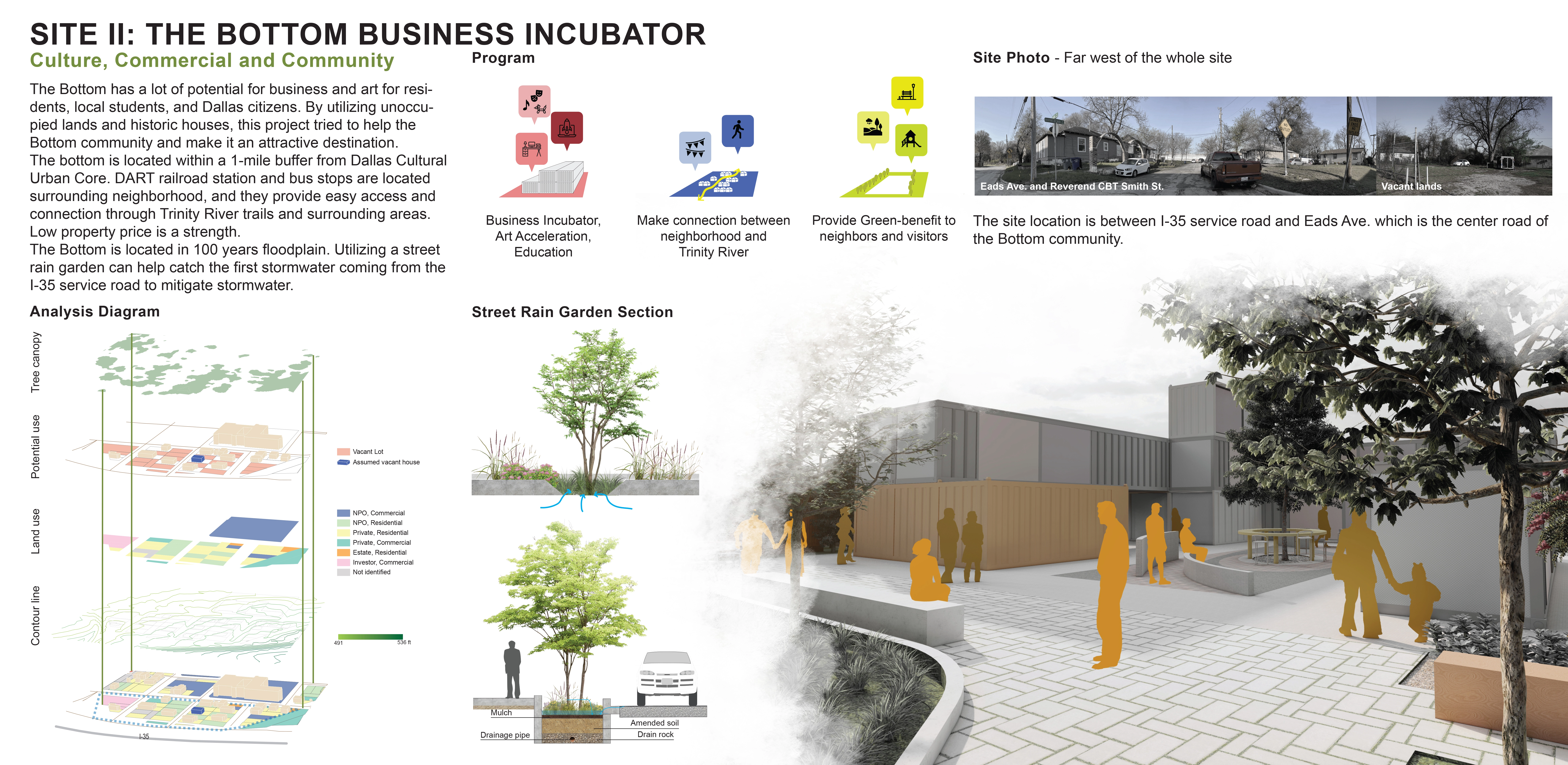
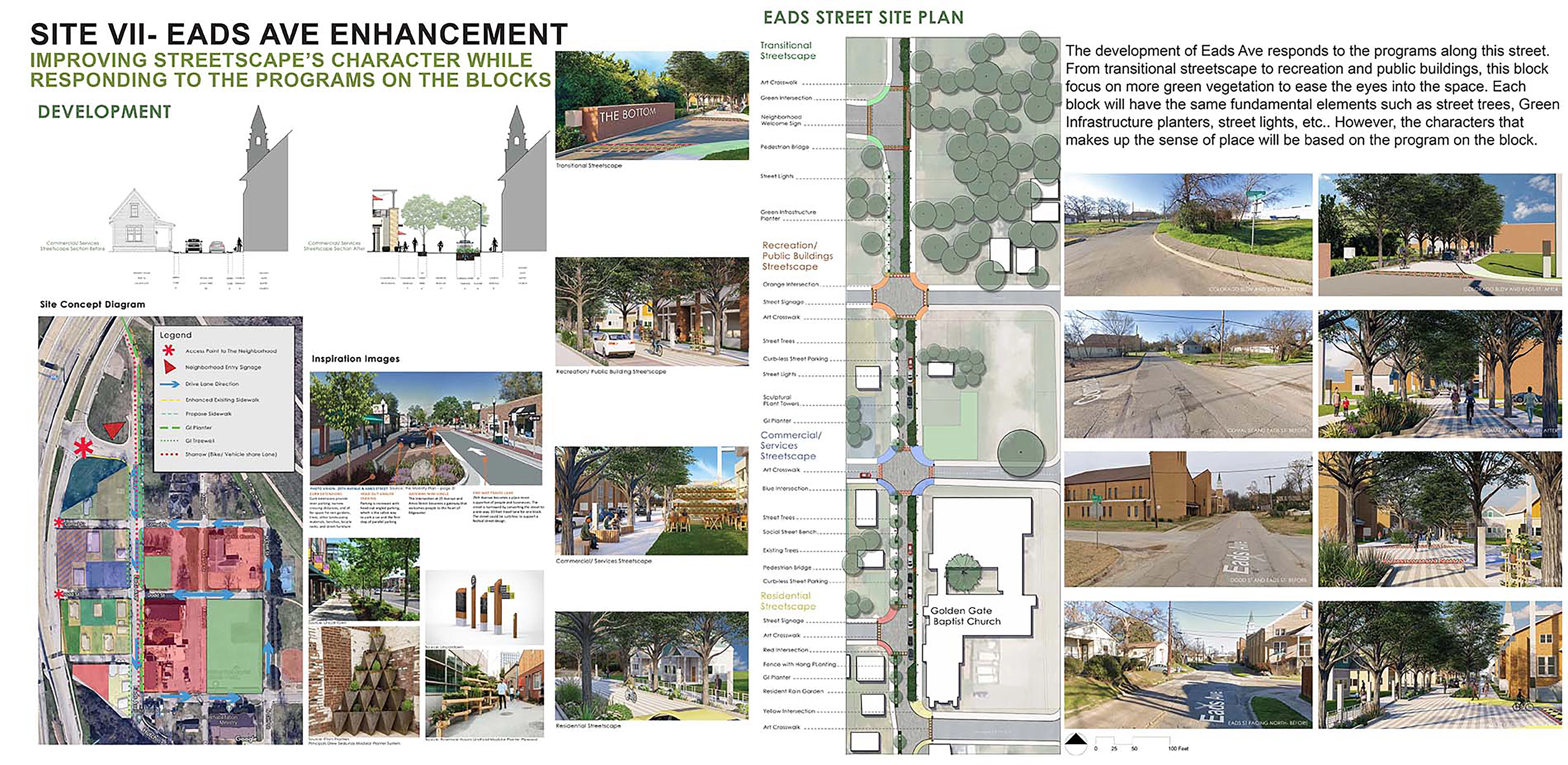
The final phase of the project drilled down on several aspects of the overall master plan, further expanding opportunities for social, economic, and environmental sustainability. Proposed neighborhood zoning reintroduces a commercial and mixed-use area along the I-35 highway corridor, with a business incubation district supporting community-owned initiatives and providing space for community members and visiting residents to generate income within the neighborhood. A community garden, noted as a desired amenity during a community engagement session, supplements residents’ food while providing for social, educational, and economic opportunities as the concept takes root and further evolves. Complete streets—which include green infrastructure elements—support multimodal transportation and create community gathering opportunities, which will be important in nurturing a strong social fabric as new residents move into the neighborhood.
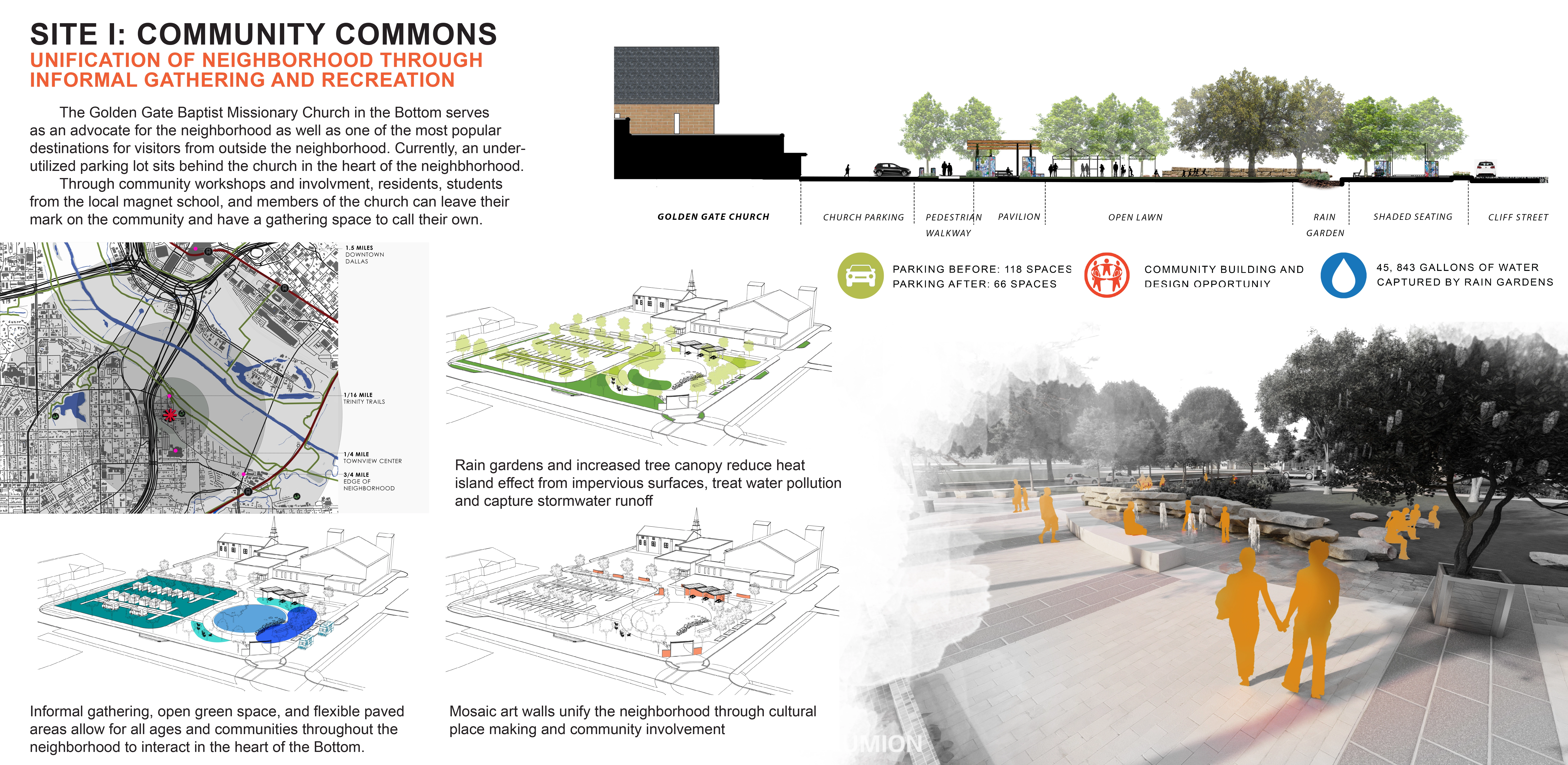
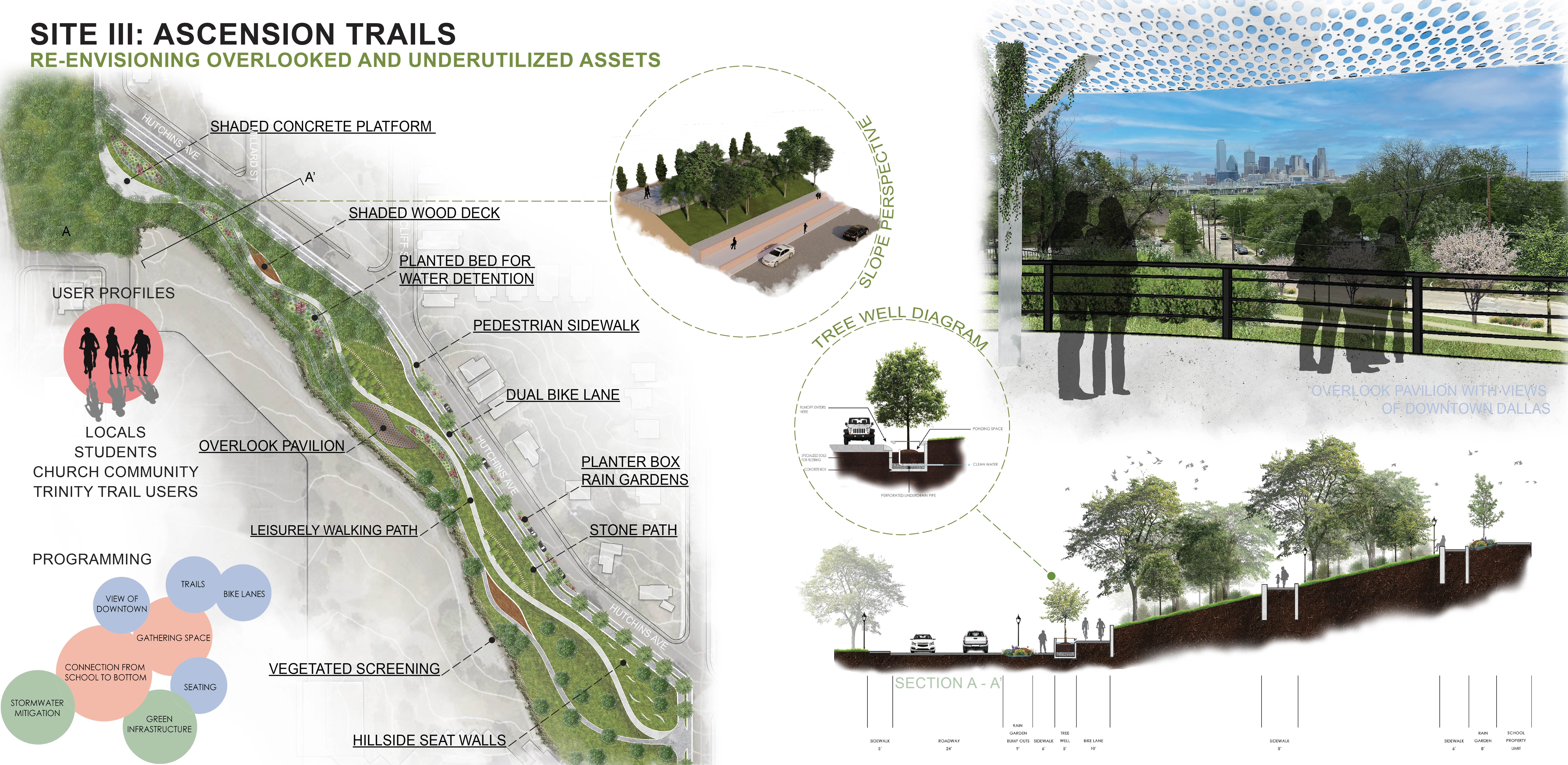
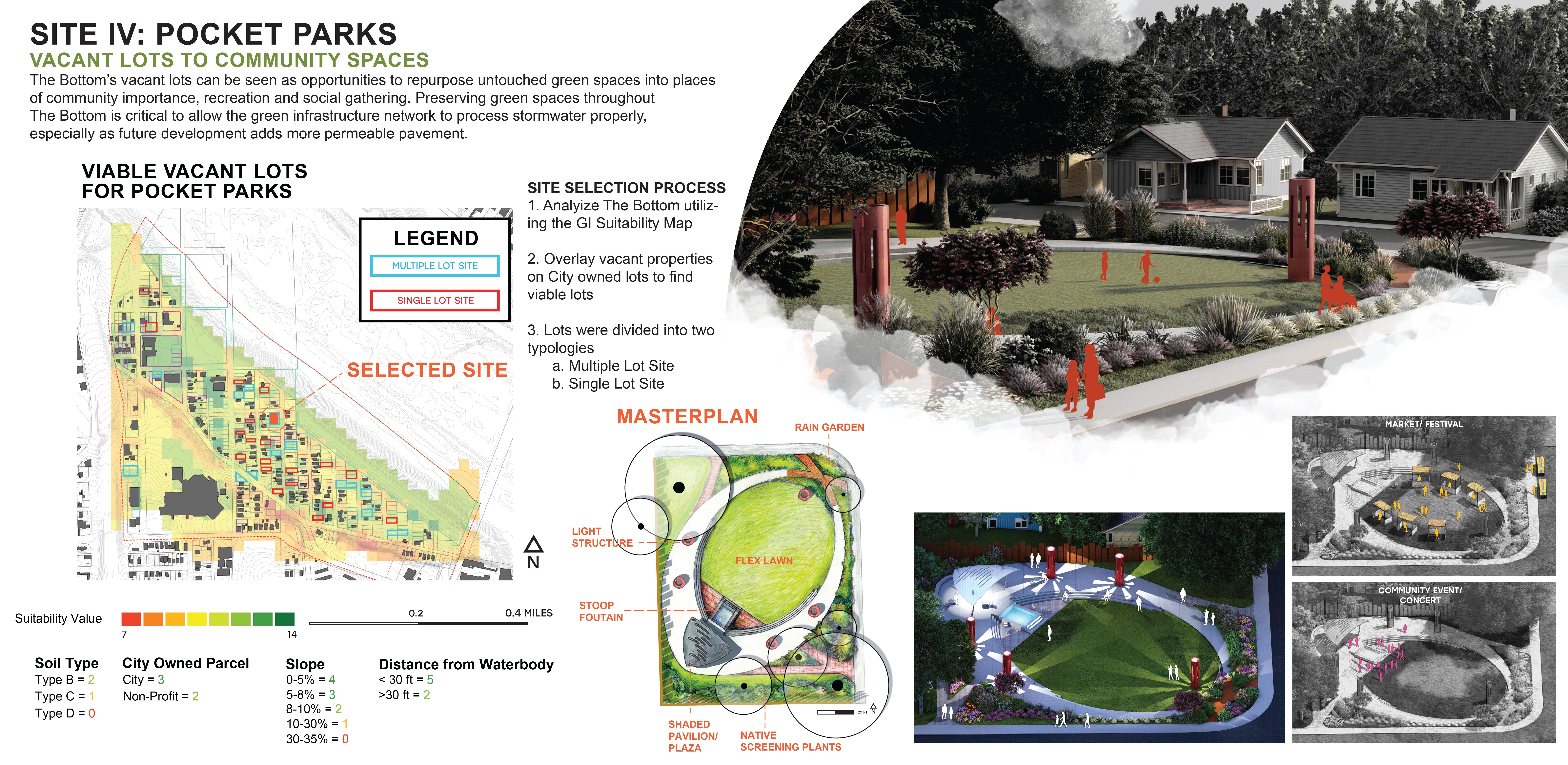
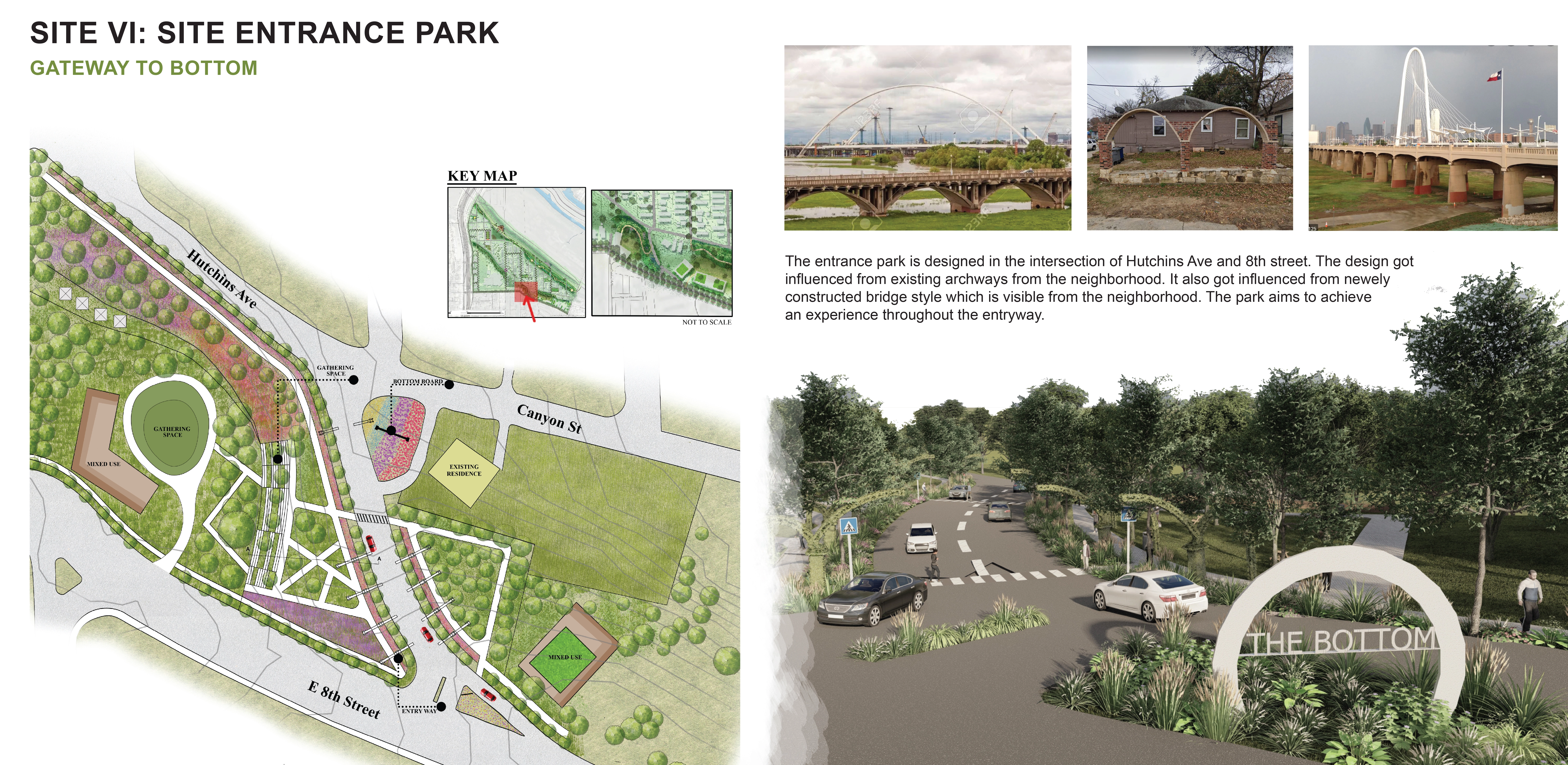
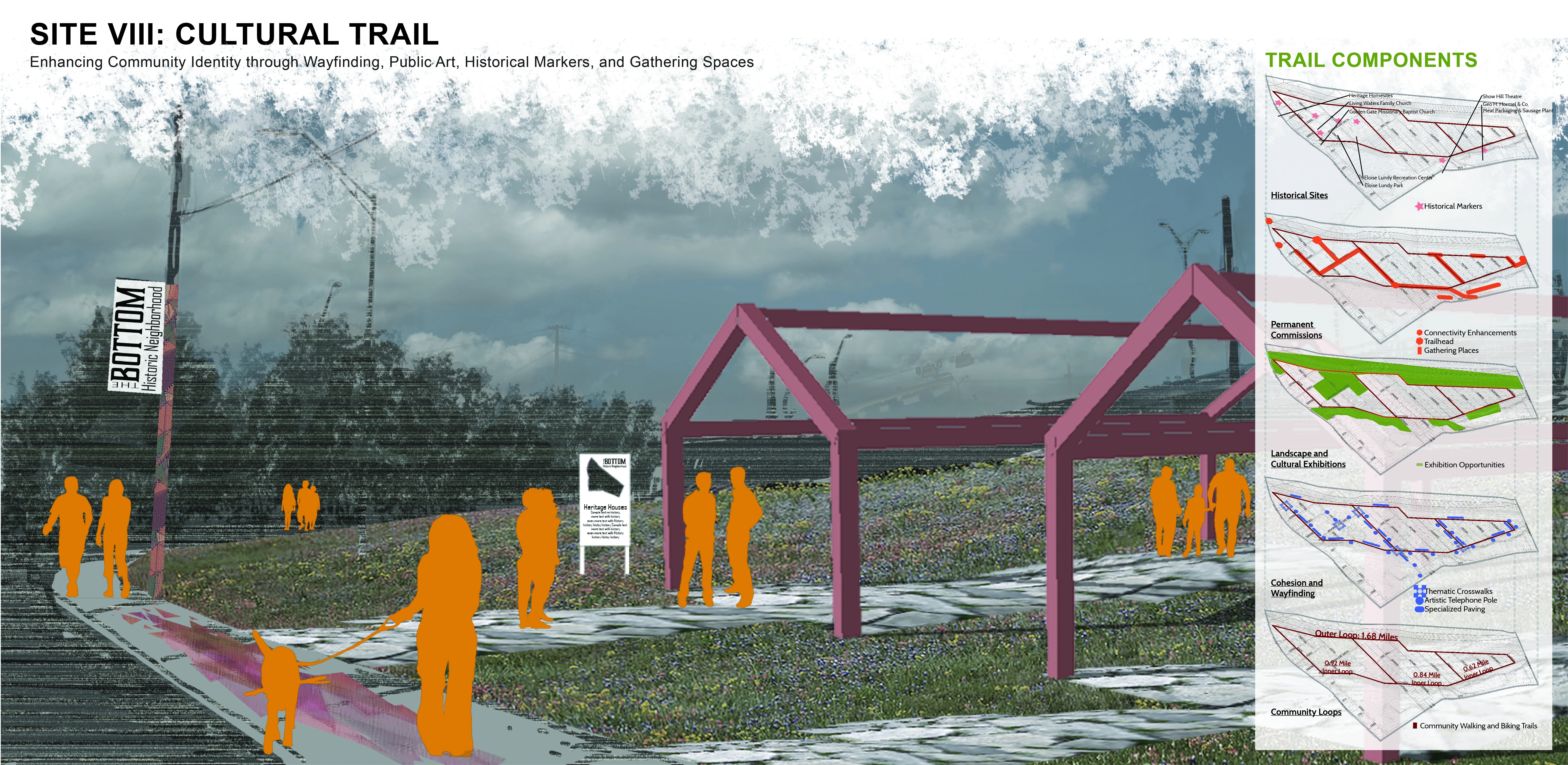
A hillside park beautifies a barren slope, connecting the community with the neighboring high school, integrating leisure and gathering opportunities, and celebrating the local terrain and views. Pocket parks throughout the community process stormwater runoff while providing for much-needed, walkable open space that balances the narrow residential lots. An entry park serves as a gateway specific to this unique community. Artistic and cultural elements introduced throughout the neighborhood as part of a cultural trail celebrate the history of The Bottom while providing room to evolve with the needs and interests of present and future residents. Finally, a community plaza anchors the community, reclaiming part of a nonporous parking lot as greenspace and serving as a social and cultural extension of the historic and incredibly significant Eloise Lundy Park.
While prioritizing social, economic, and environmental sustainability, this master plan and its supporting elements celebrate The Bottom’s rich cultural history and promising future. Community gathering spaces, cultural elements, community gateways, and commercial opportunities combine with green infrastructure networks to solidify the framework on which the community’s infrastructure may be built, ensuring resiliency for future generations that will call The Bottom home. Though the challenge of mitigating stormwater and flooding in urban environments will be a constant struggle as rapid development and climate change make threatening rain events more prevalent, by integrating green infrastructure within urban stormwater management networks, further damage to our natural water systems is prevented and opportunities to improve the social and economic conditions of The Bottom community are realized.
-
- Libbie Terrell Lee - Executive Director, The Golden S.E.E.D.S. Foundation, Inc.
Advertisement
Related Awards
Honor Award, Urban Design
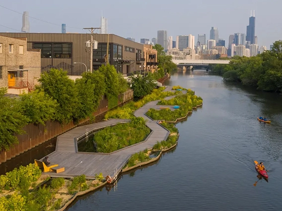
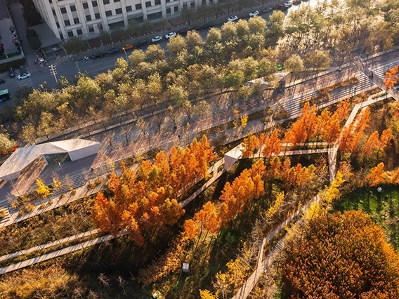
Urban Balcony Embracing Rewilded Nature
In a densely populated urban setting, this project unveils a rewilded natural area, revitalizing a former concrete waterway through innovative stormwater management. The design introduces a linear activity zone extending over four residential blocks, tailored for diverse social interactions. It underscores the vital role of landscape architecture in enriching the social and ecological aspects of urban living.