.webp?language=en-US)


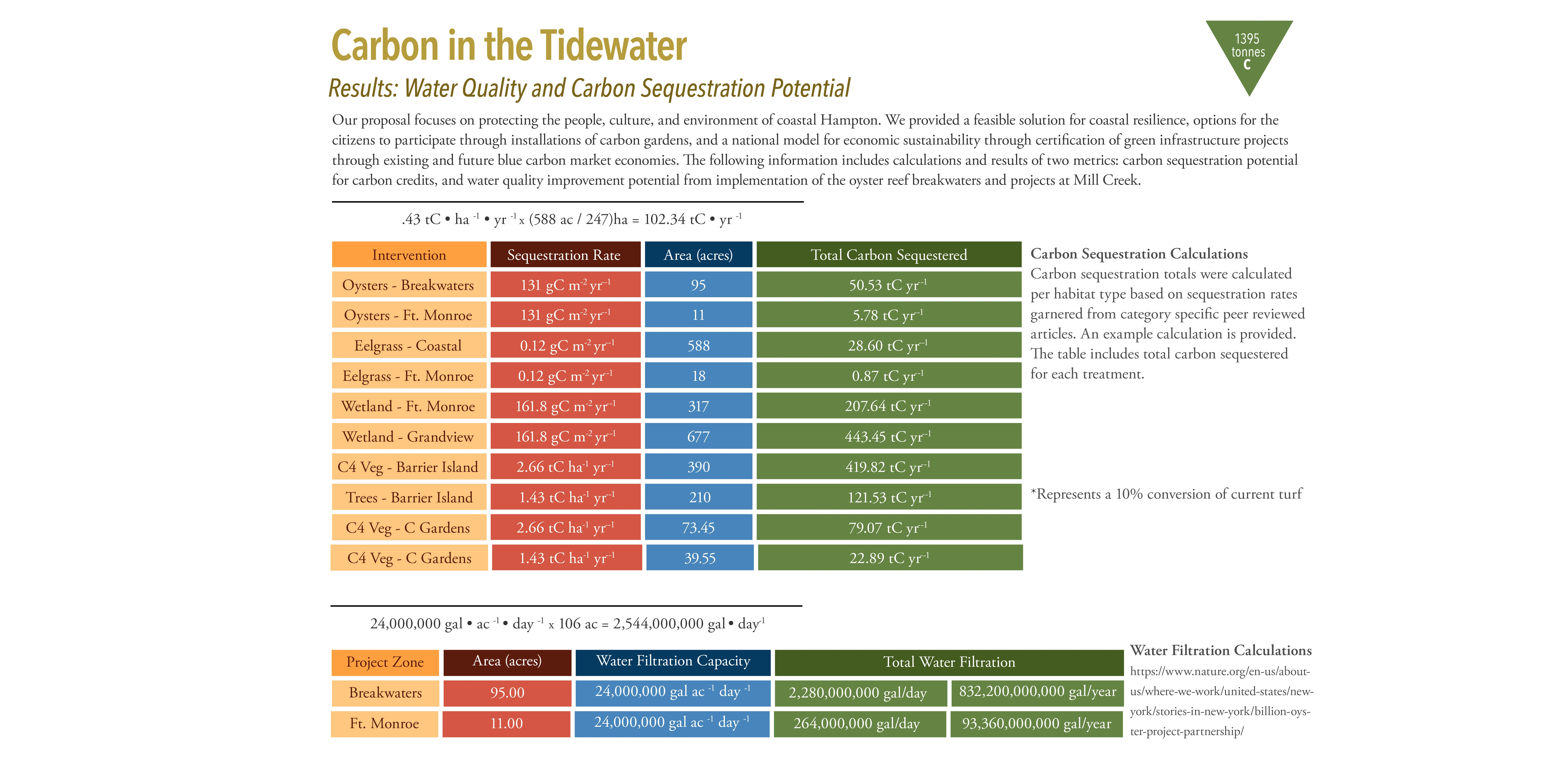
Carbon in the Tidewater
Leigh Muldrow, Student ASLA; Ryan McCune; DJ Bromely, Student ASLA; Christophe Fettke von Koeckritz, Student ASLA; Delaney Pilotte, Student ASLA; Kevin Ganjon
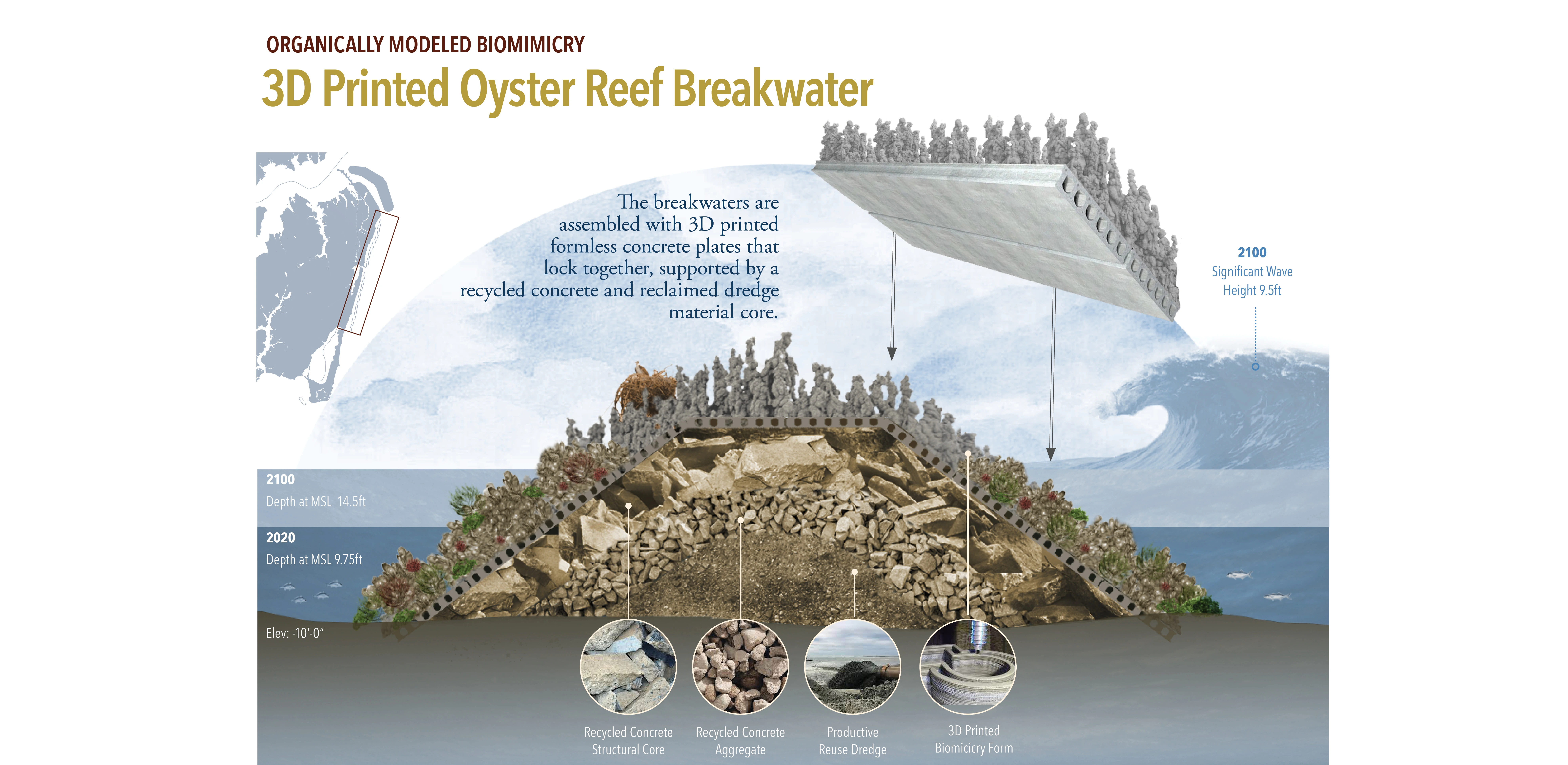

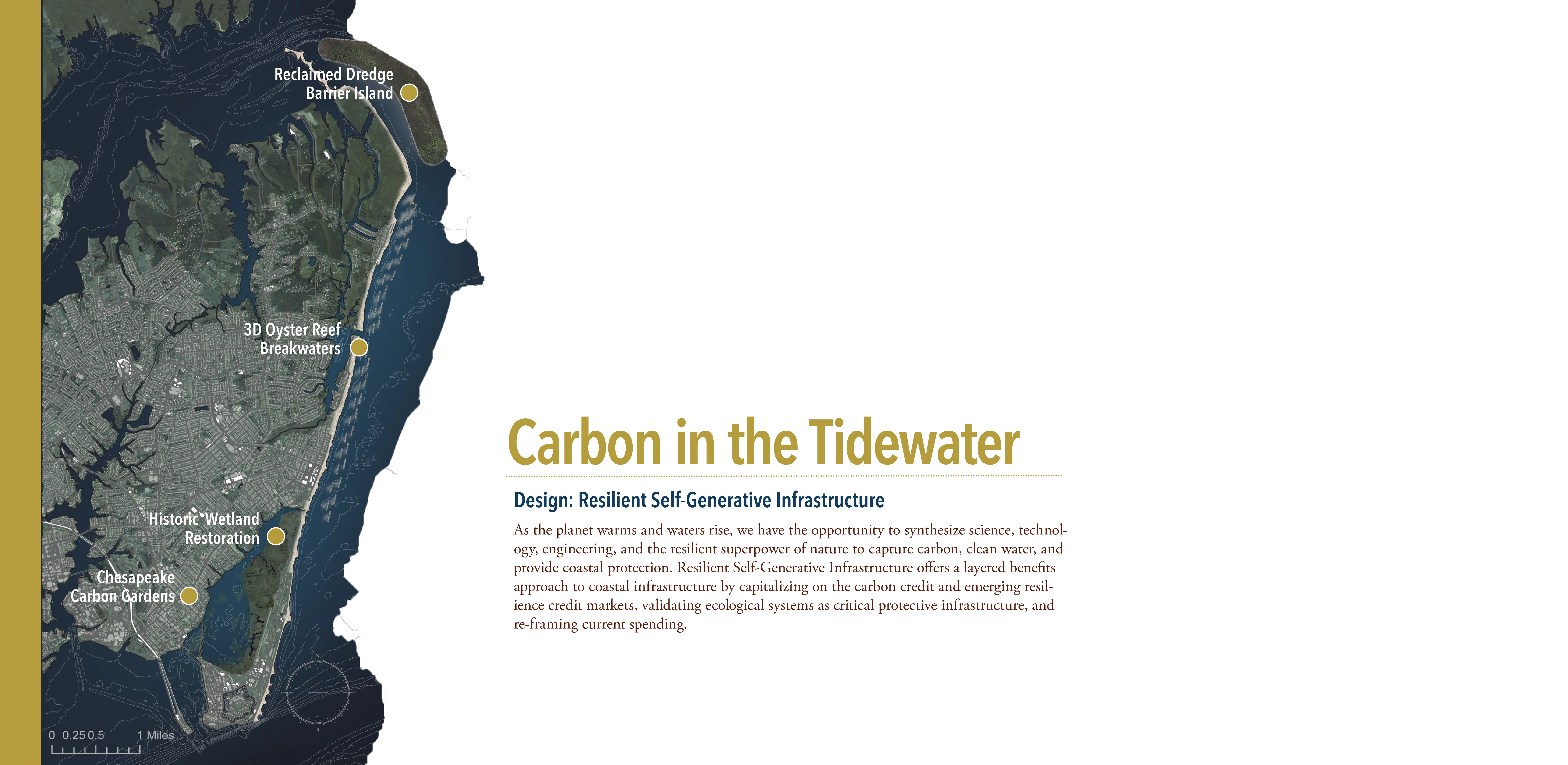
With a team made up of landscape architecture, engineering, environmental science, and political science students, this project proposes innovative solutions to growing coastal problems due to climate change. In addition to creating off-shore breakwaters made up of "3D printed formless concrete plates that lock together, supported by a recycled concrete and reclaimed dredge material core," proposals include converting residential lawns to carbon gardens that sequester carbon and help improve water quality in Tidewater, Virginia. The sophistication of the project is captured in the careful analysis and informative diagrams.
Awards Jury
-
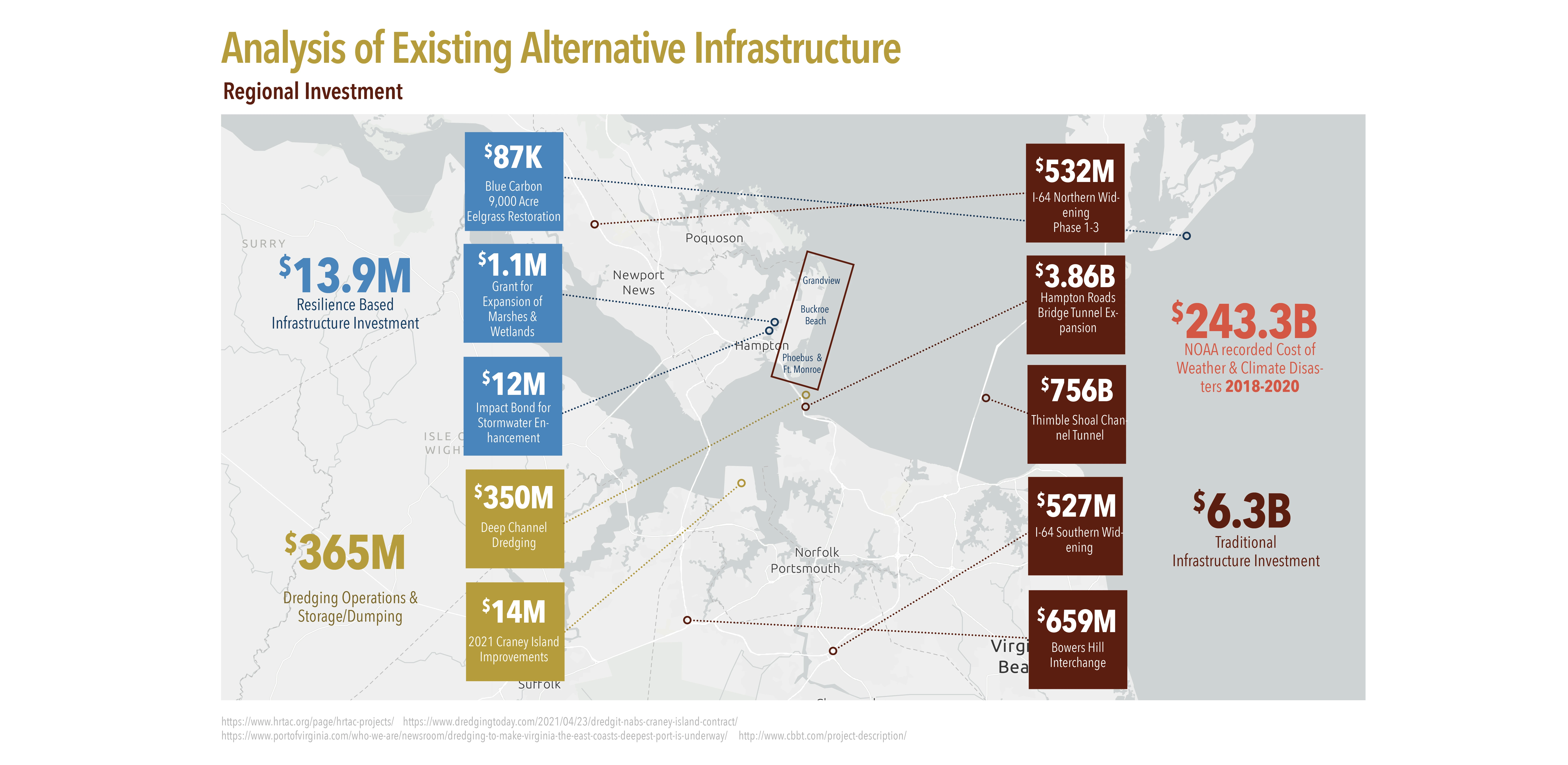
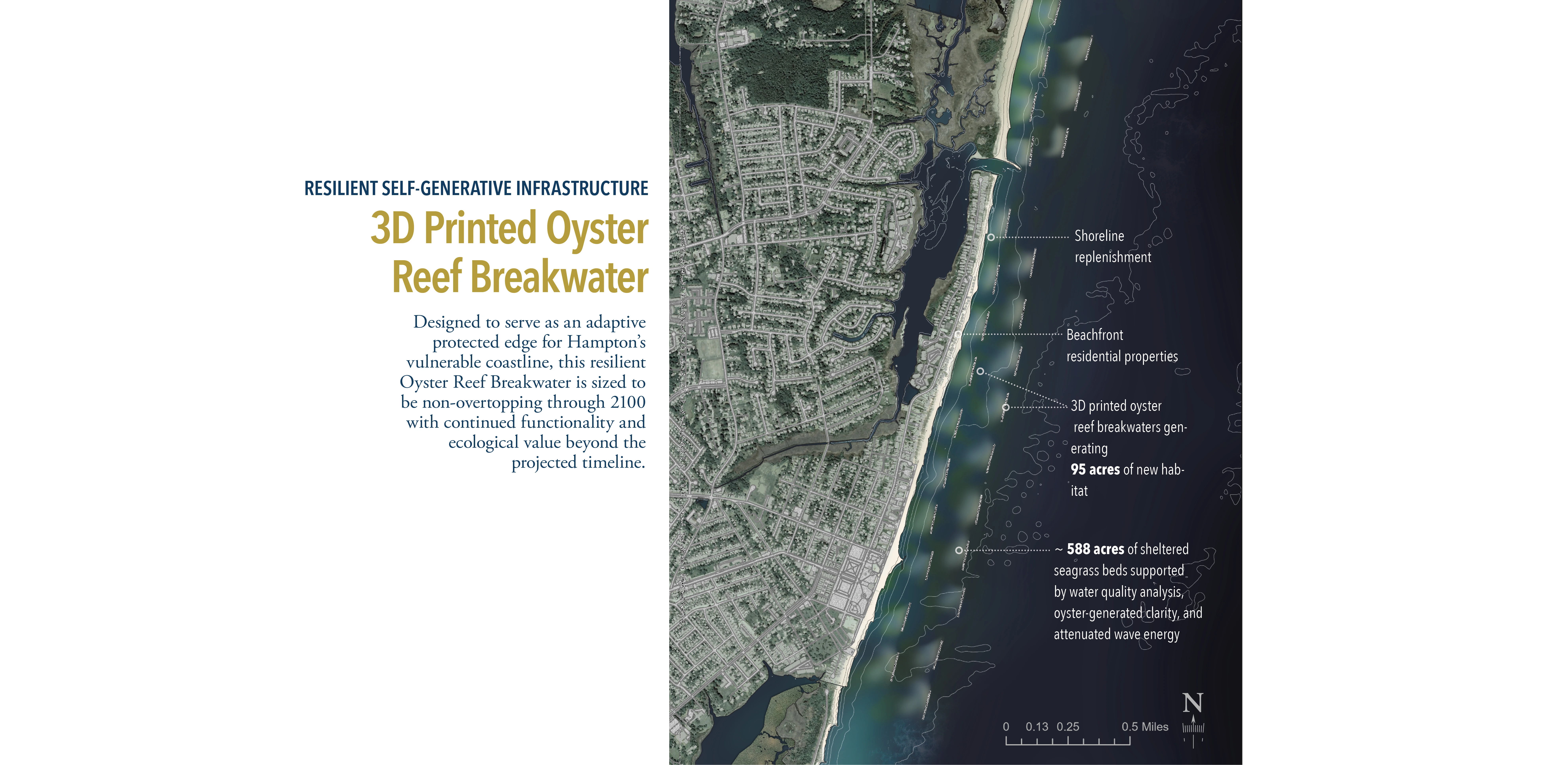
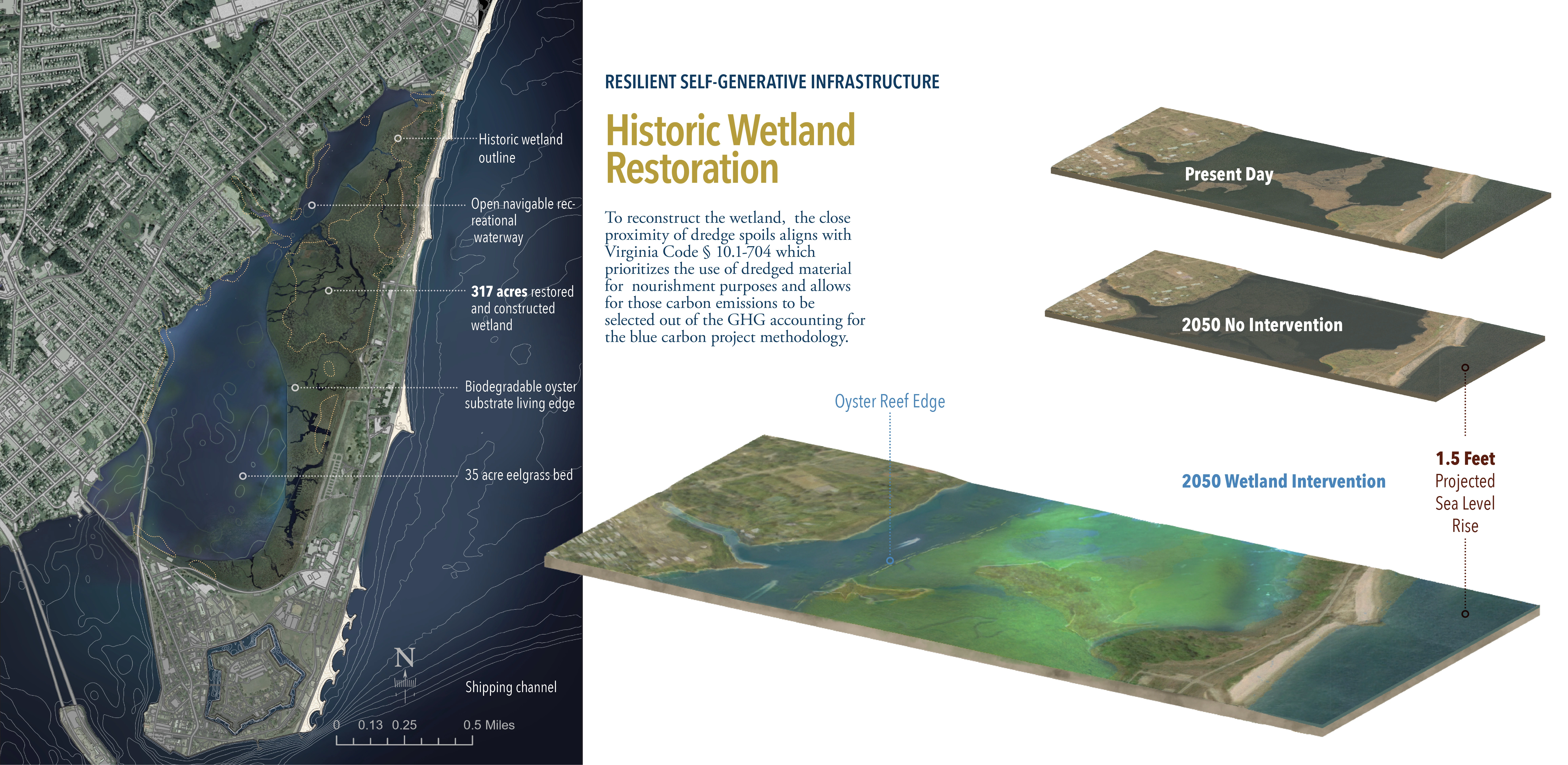
The City of Hampton, Virginia is on the front line of climate change with low elevation, high rate of land subsidence, and intense storm surge risk from direct exposure to the Atlantic Ocean. This project uses the Global Carbon Market to catalyze nature-based coastal infrastructure that is self-regenerating and captures carbon from the atmosphere while offering structural protection for both at-risk coastal wetlands, human life, and property.
-
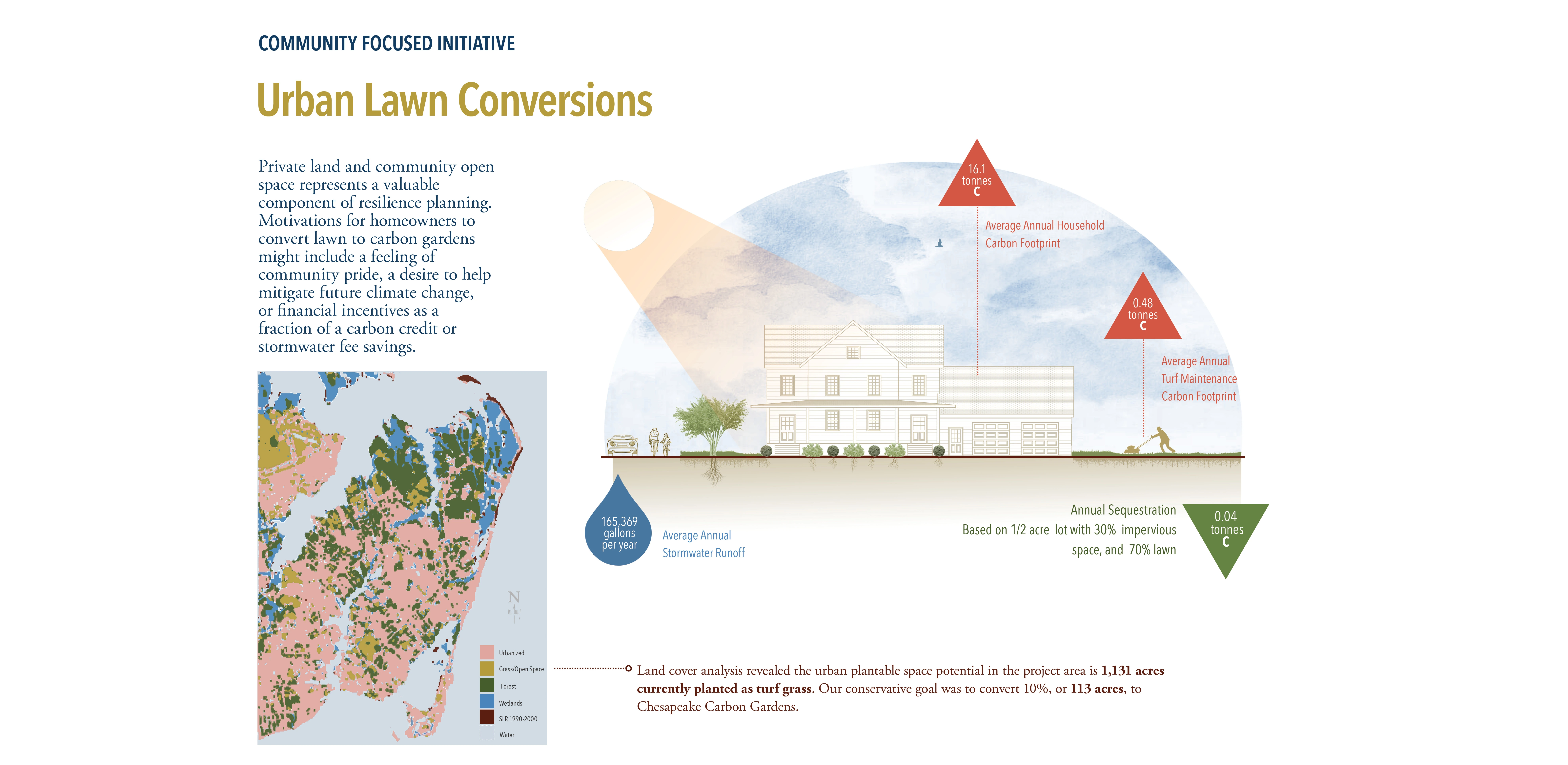
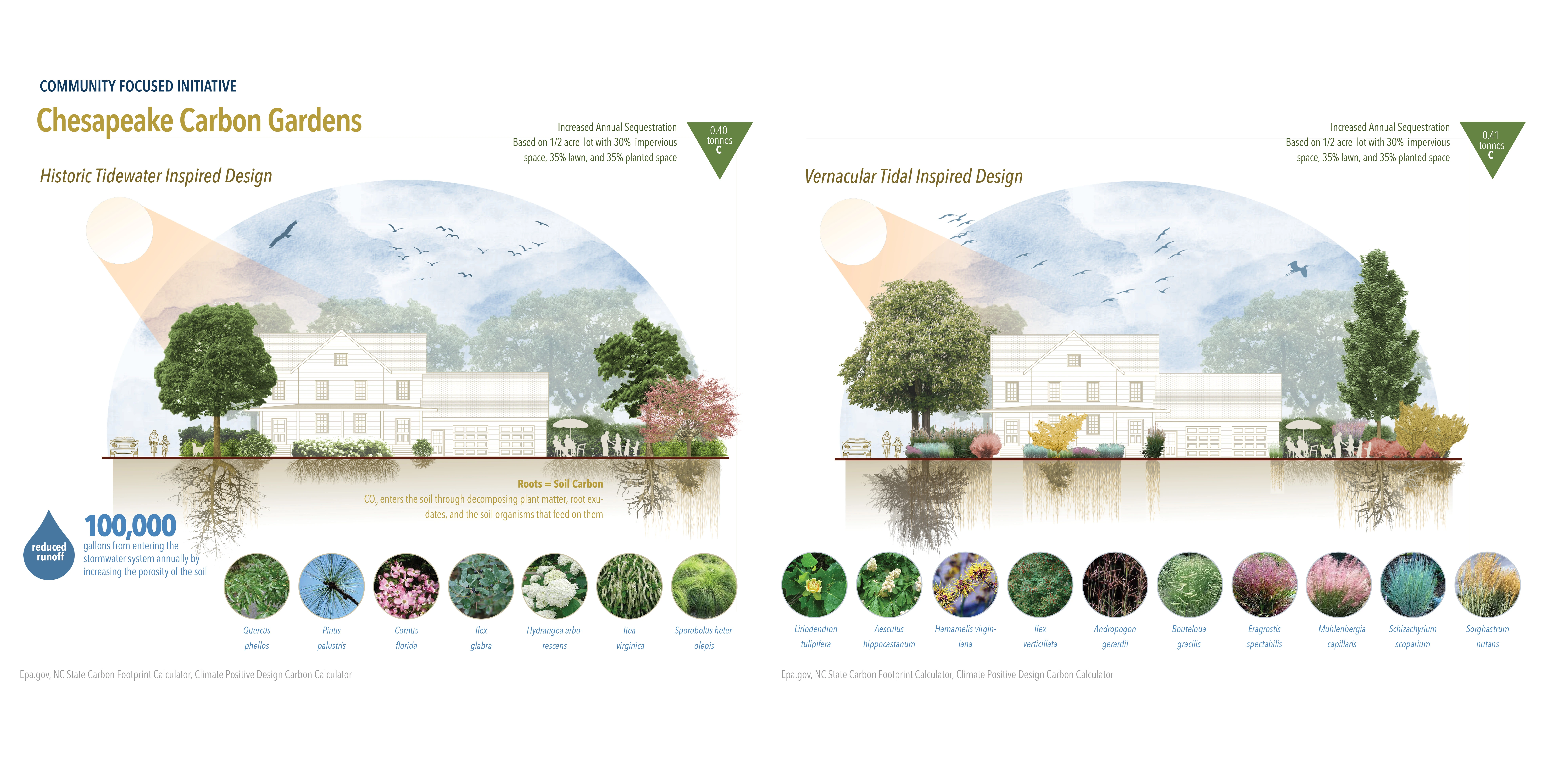
The goal of this project is to create innovative solutions for the city of Hampton, Virginia addressing human and ecological risks associated with climate change for the year 2050 and beyond while also addressing the economic challenges that come with property loss. While many inland flooding projects are currently underway in Hampton, the main objective of this project was to analyze coastal conditions, projections of sea level rise (SLR) and increasing storm surge energy to plan and design ecologically-based infrastructure that continually draws down carbon from the atmosphere. This work considers the economics of nature-based infrastructure funding, water quality concerns that could negatively impact living infrastructure design, and community initiatives to educate and engage homeowners and community leaders.
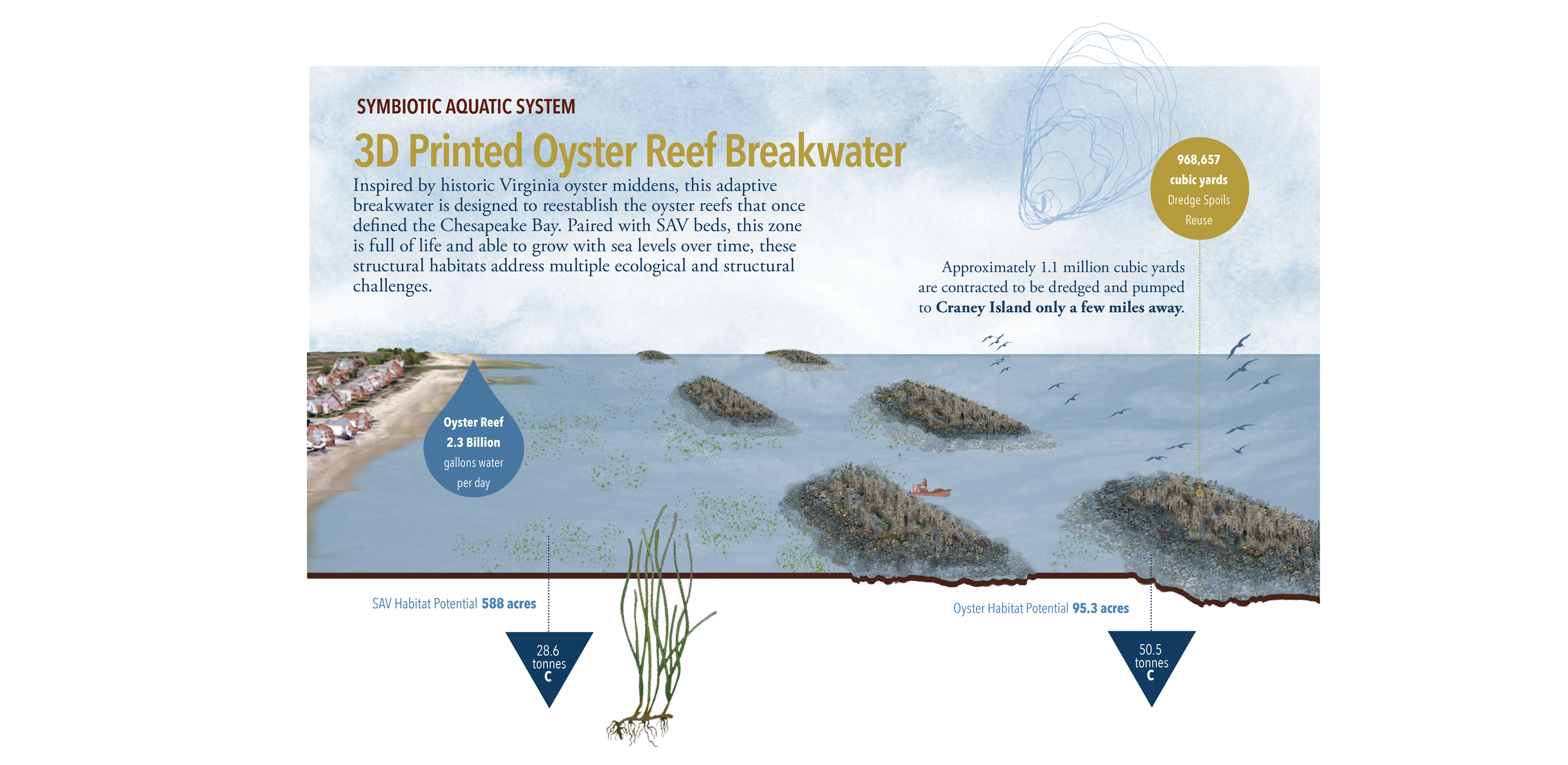
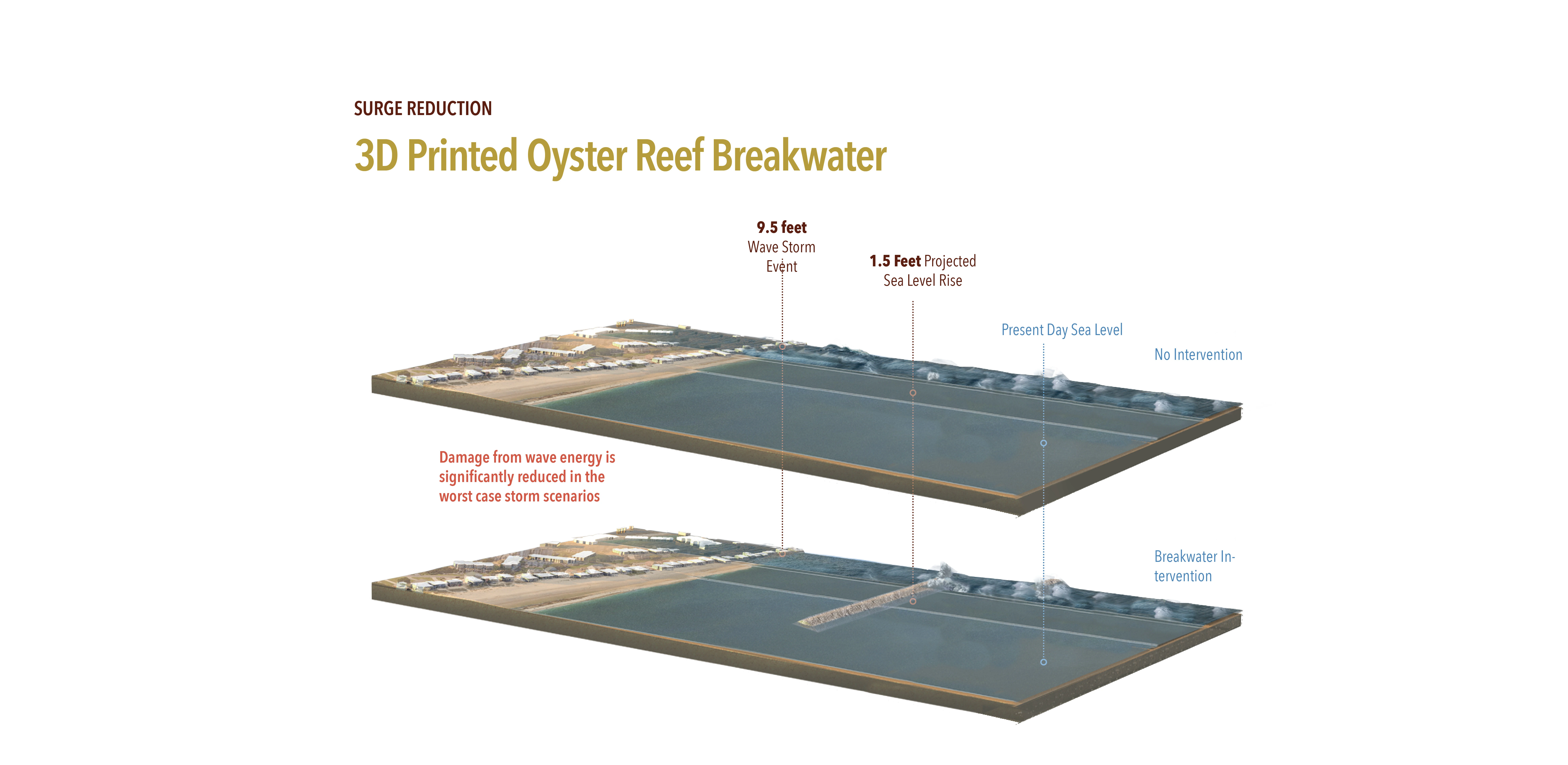
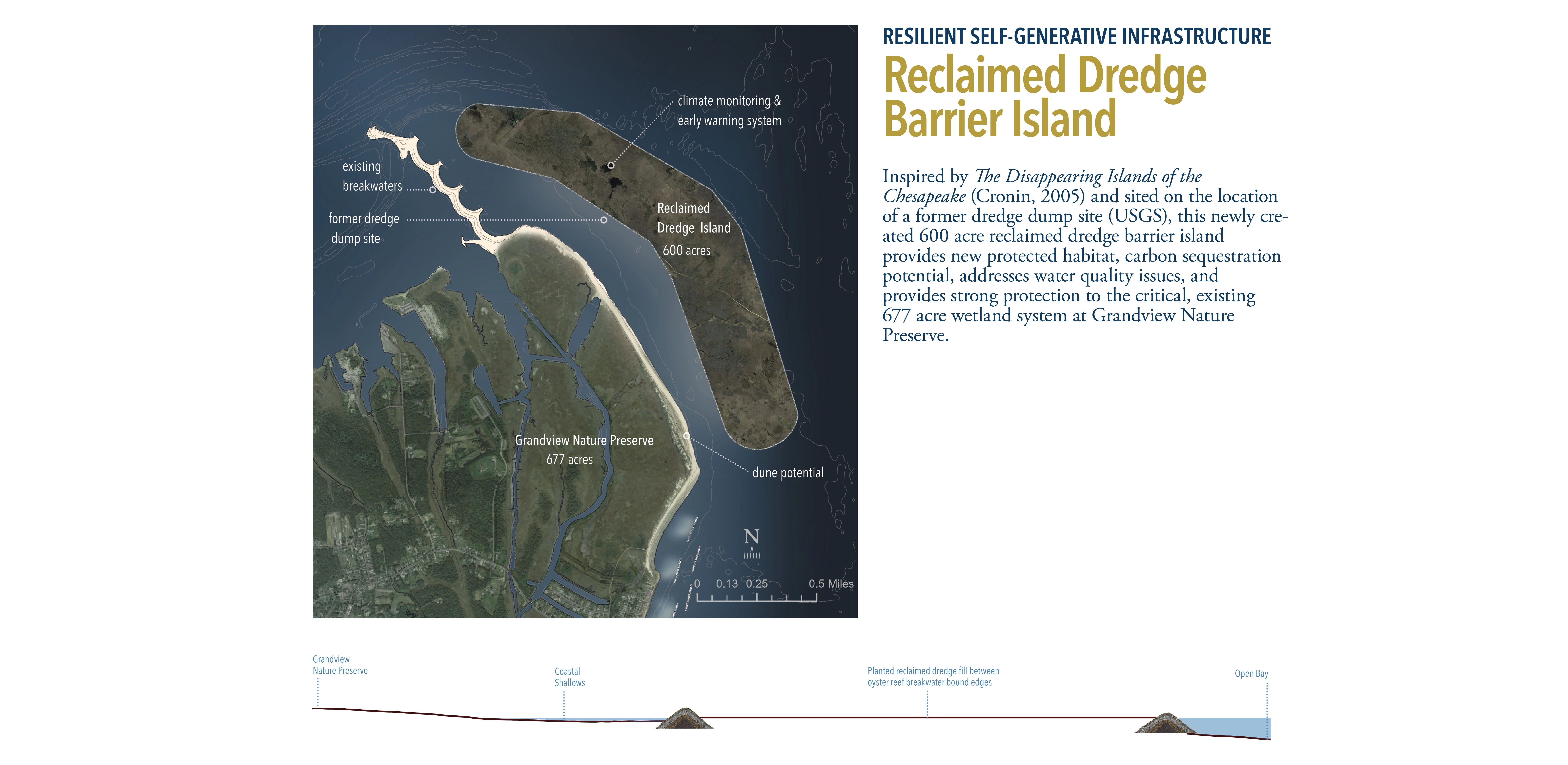
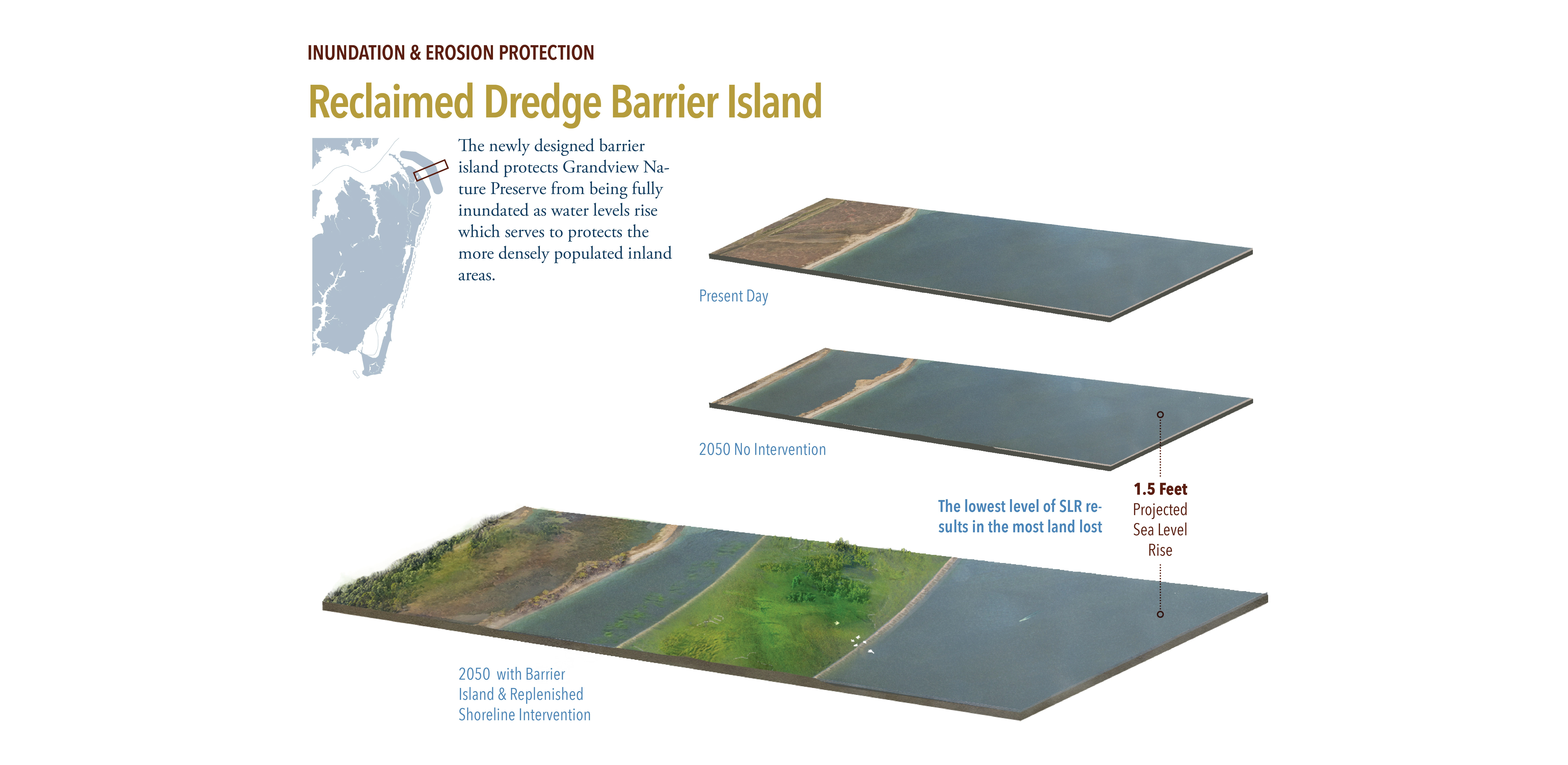
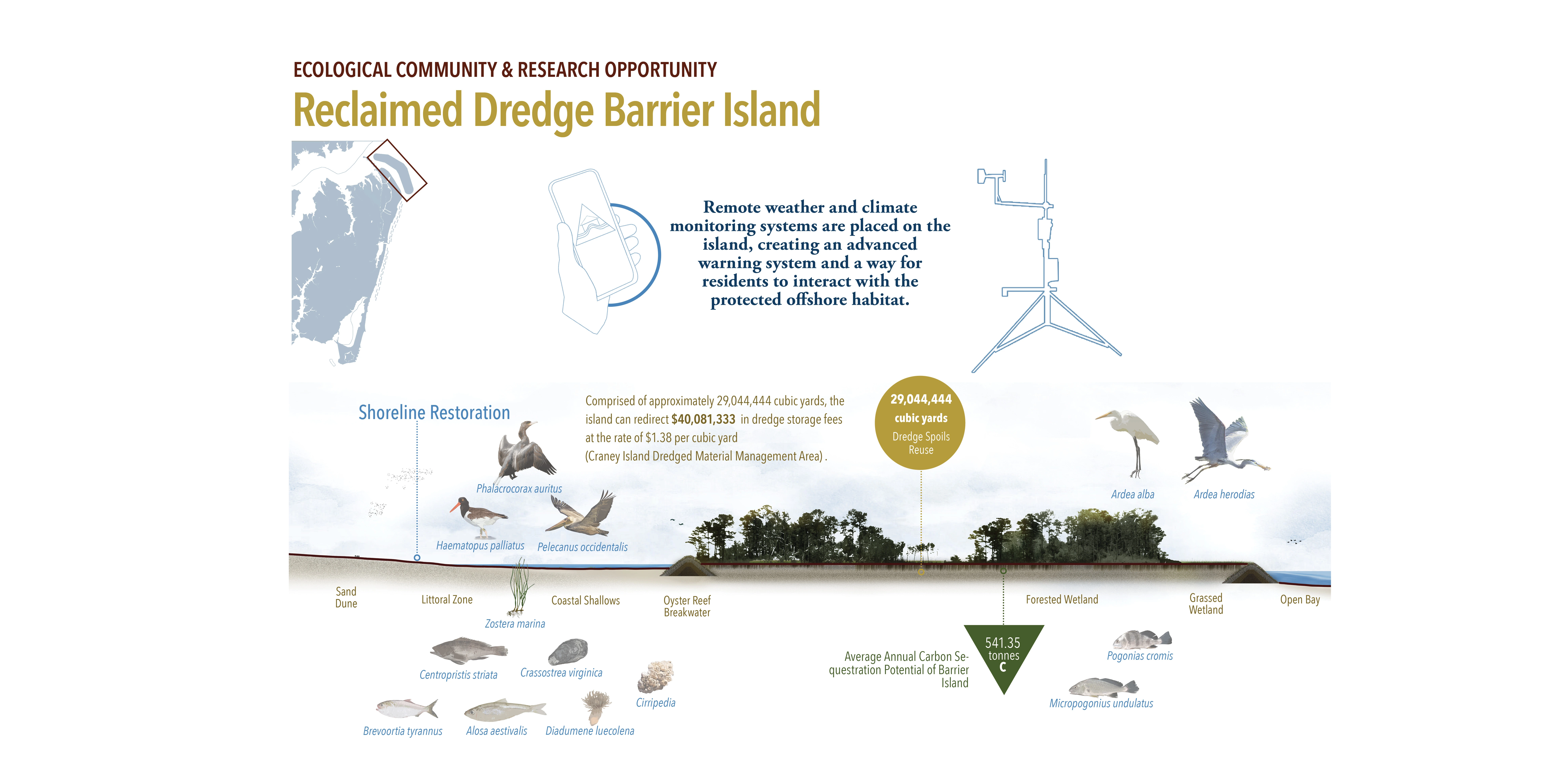
The proposed solutions are based largely on carbon offset and resilience credit project methodologies developed by The Nature Conservancy and Verra, a carbon offset project verifying agency. These methodologies helped to define the scale, scope, and environmental context of all the design solutions. Virginia joined the voluntary carbon market in 2020 and is nearing completion of a carbon offset project just off its eastern shore. Larger in scale, and including a resilience credit market that is currently in the development phase, Carbon in the Tidewater uses a multi-layered approach to address coastal issues in a holistic way by protecting, restoring, and creating new ecological communities and systems.The team projected technological advances in structural 3D printing allowing for organically-modeled, biomimicry-based oyster reef construction that has the potential to be structural, resilient, and self-regenerative. It is designed to mitigate intense wave energy during storm events but continue to be a source of ecological value if sea levels rise beyond projections. A shipping and military channel maintained at depths of roughly 90 feet offers a nearby source of productive dredge spoils that can be reused in barrier island creation and wetland restoration efforts. Additionally, productive reuse of dredge spoils eliminates storage and disposal costs while also protecting existing valuable natural resources. The team designed community carbon gardens to reframe native plant palettes as a tangible contribution to the climate crisis in both public and private space. Ultimately, this project works to reframe protective living infrastructure as an economic driver to encourage investment and continued maintenance.
Verified carbon offset projects must have measurable climate action and sustainable development outcomes, typically measured in metric tonnes of carbon sequestered. Carbon sequestration calculations were used to quantify permanent atmospheric carbon storage in the post-design landscape to meet the standards outlined in the project methodologies and generate carbon offset credits to be sold as a partial finance mechanism. The projected total carbon sequestration is estimated at 1,395 tonnes of carbon per year. Additionally, to address community concerns and the site suitability of living infrastructure, the designed oyster and eelgrass habitat is estimated to filter over 900 billion gallons of water annually.
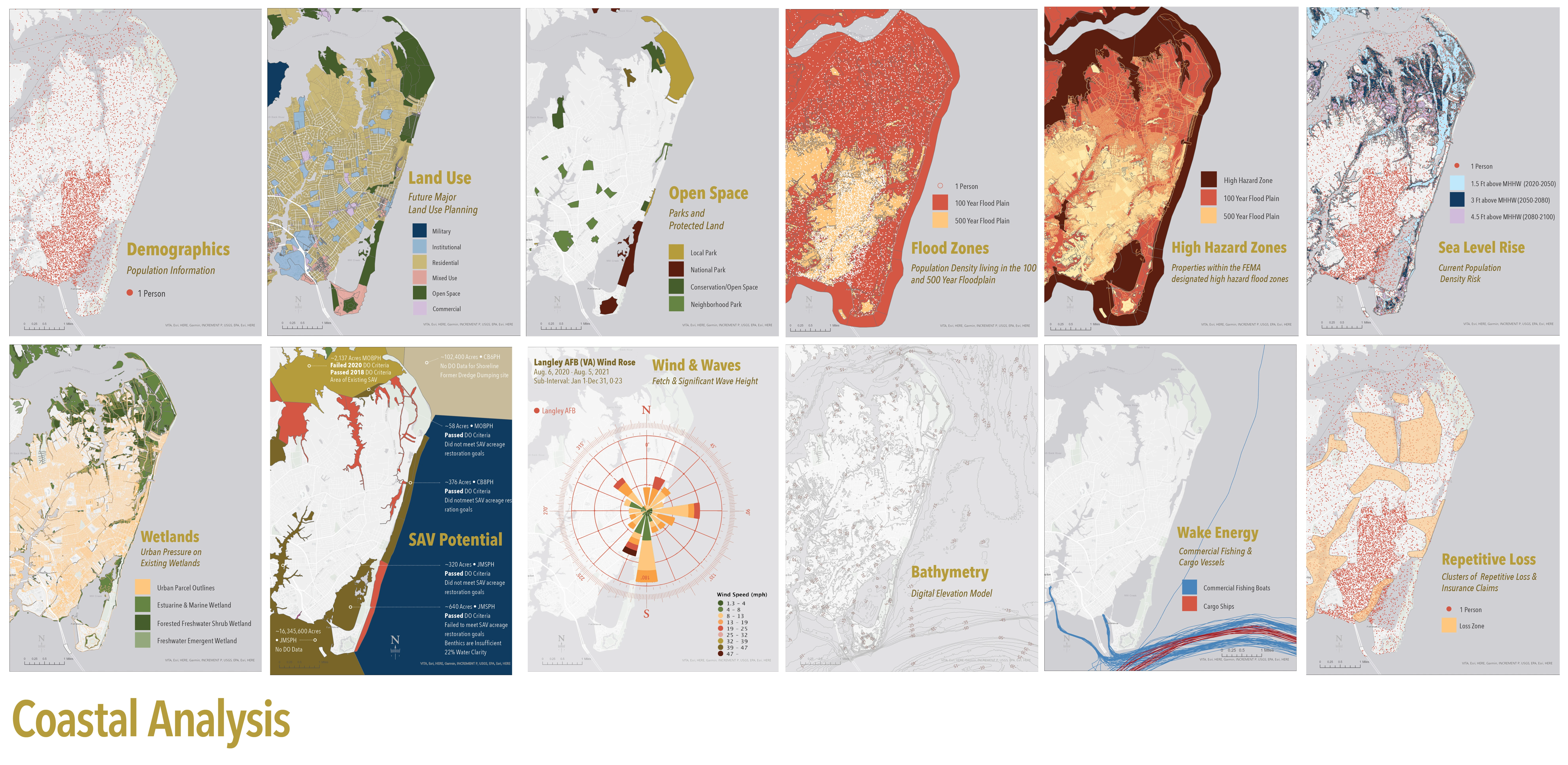
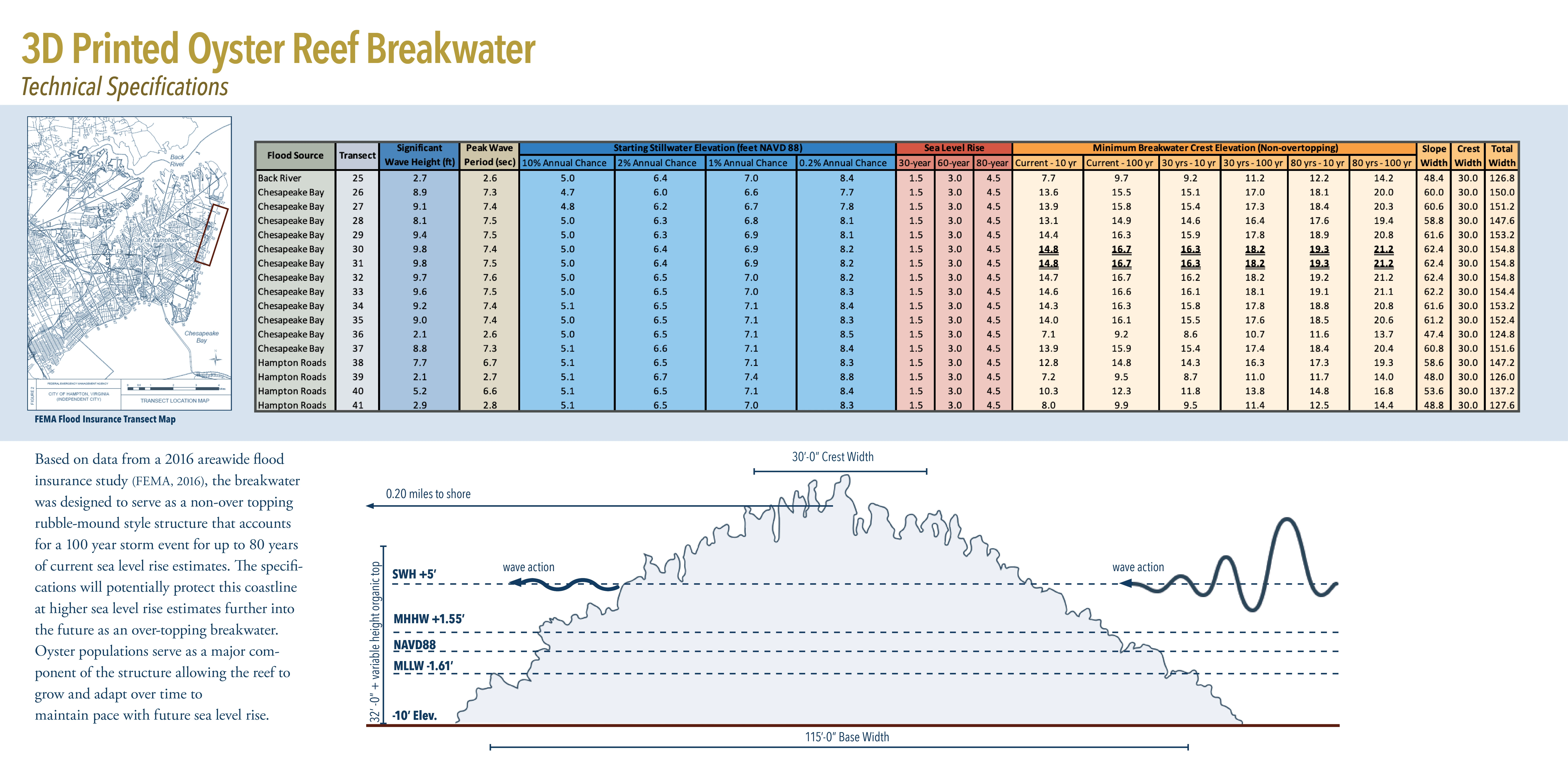
For this project, ecological and human risk was analyzed using data collected from the City of Hampton, the 2019 American Community Survey, FEMA, NOAA, the National Hurricane Center, Midwestern Regional Climate Center, National Wetlands Inventory, EPA, and the Virginia Department of Environmental Quality using ArcGIS. Coastal bathymetry was generated using a USGS digital elevation model. The team analyzed topography, sea level rise, existing and historic wetland cover, population density, urban density, land use, open space, flood zones, repetitive insurance loss areas, properties located in high hazard zones, flooding associated with hurricanes by intensity, shipping traffic counts, projected shoreline change, water quality data including submerged aquatic vegetation (SAV) supportive dissolved oxygen rates, tidal flow patterns, wind, and significant wave heights by storm severity.
Carbon calculations were performed using the Climate Positive Design Carbon Calculator, the NC State Carbon Footprint Calculator and category-specific permanent carbon sequestration rates based on peer-reviewed published articles. Breakwaters are sized to be non-overtopping through the year 2100 using the 2016 FEMA Flood Insurance Transect Map and Report. The team visited Hampton, and met with community representatives, local business owners, and residents. We shared the Coastal Observer phone application that allowed citizens to document weather and water events and upload geo-located images. This tool allowed us to remain engaged with the community during a distanced process.
Initiated on behalf of the City of Hampton by the Coastal and Estuarine Research Federation as a student design competition, continued collaboration with the community was limited. However the team worked to understand the sense of place and values of the community during a multi-day site visit, analysis of published print and digital media, and cultivating a relationship with a community contact. The final project was presented to the Hampton Chief Resilience Officer and a group of local commissioners. It was very well received and there have been multiple contacts since the presentation for guidance on next steps and opportunities. One of the most rewarding comments came from the Chief Resilience Officer, who expressed that our team tackled issues that had been identified but not yet addressed and that we clearly understood the community and its concerns.This project won the first place award in the CERF 2021 Design Competition.
Implementation will require a phased approach including testing emerging technologies in structural 3D printing, large scale oyster reef growth and support, and work to improve water clarity to support living infrastructure.
-
- Quercus phellos
- Pinus palustris
- Cornus florida
- Ilex glabra
- Itea virginica
- Hydrangea aborescens
- Sprobolus heterolepis
- Liriodendron tulipifera
- Aesculus hippocastanum
- Hamamelis virginiana
- Ilex verticillata
- Adropogon gerardii
- Boutela gracilis
- Eragrostis spectabilis
- Muhlenbergia capillaris
- Schizachyrium scoparium
- Sorghastrum nutans
Advertisement
Related Awards
Honor Award, Student Collaboration
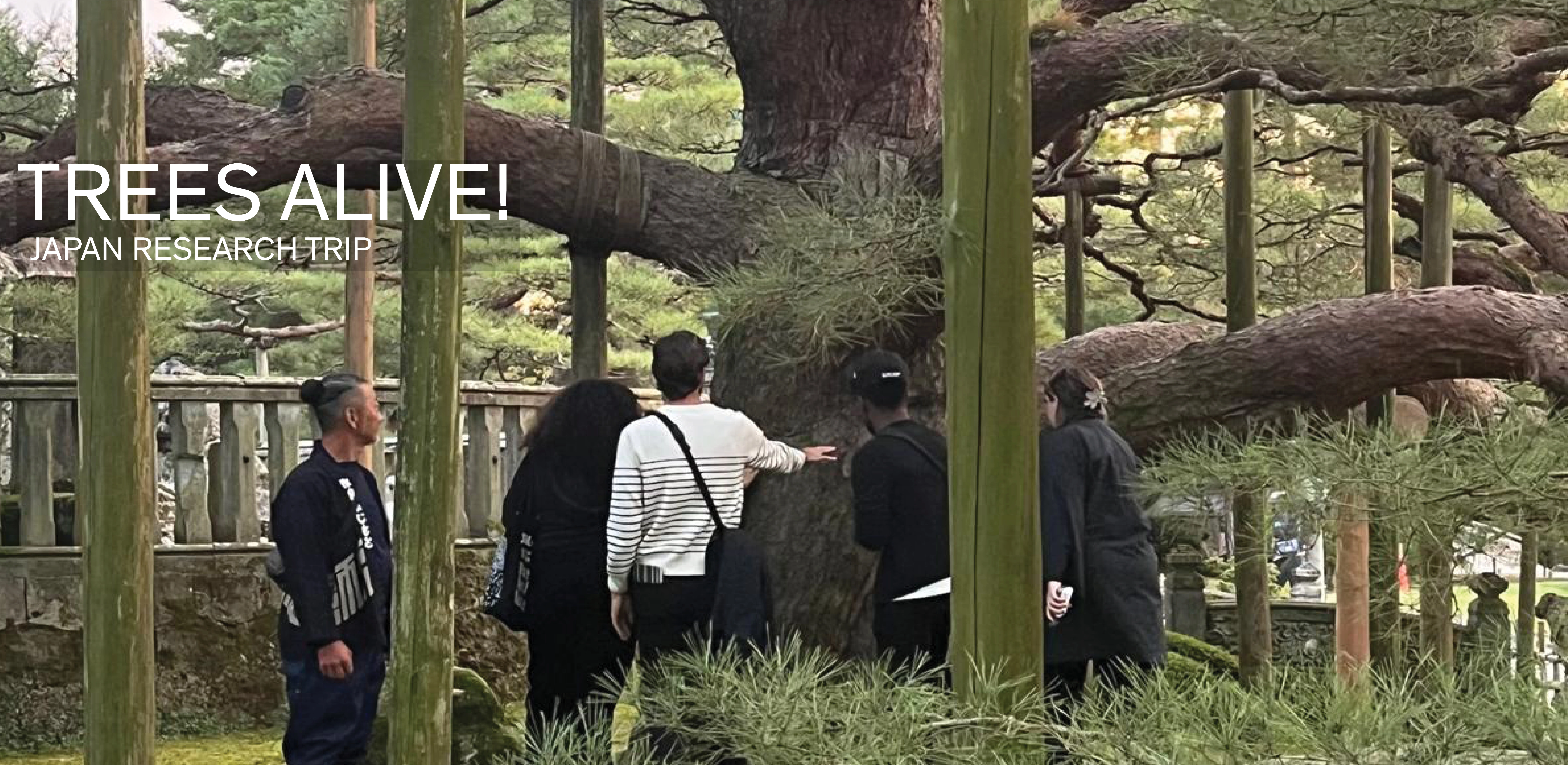
TREES ALIVE!: Techniques, Details, Traditions
TREES ALIVE! is a collaborative research and travel exchange between American and Japanese landscape architecture programs to study the techniques, details, and cultural traditions for trees in contemporary urban landscapes. Students participated in collaborative technical workshops and visits to significant gardens and landscapes to investigate urban tree planting and legacy tree conservation in Tokyo, Kanazawa, Chicago, Columbus (Indiana), Philadelphia, and New York. Two technical