.webp?language=en-US)


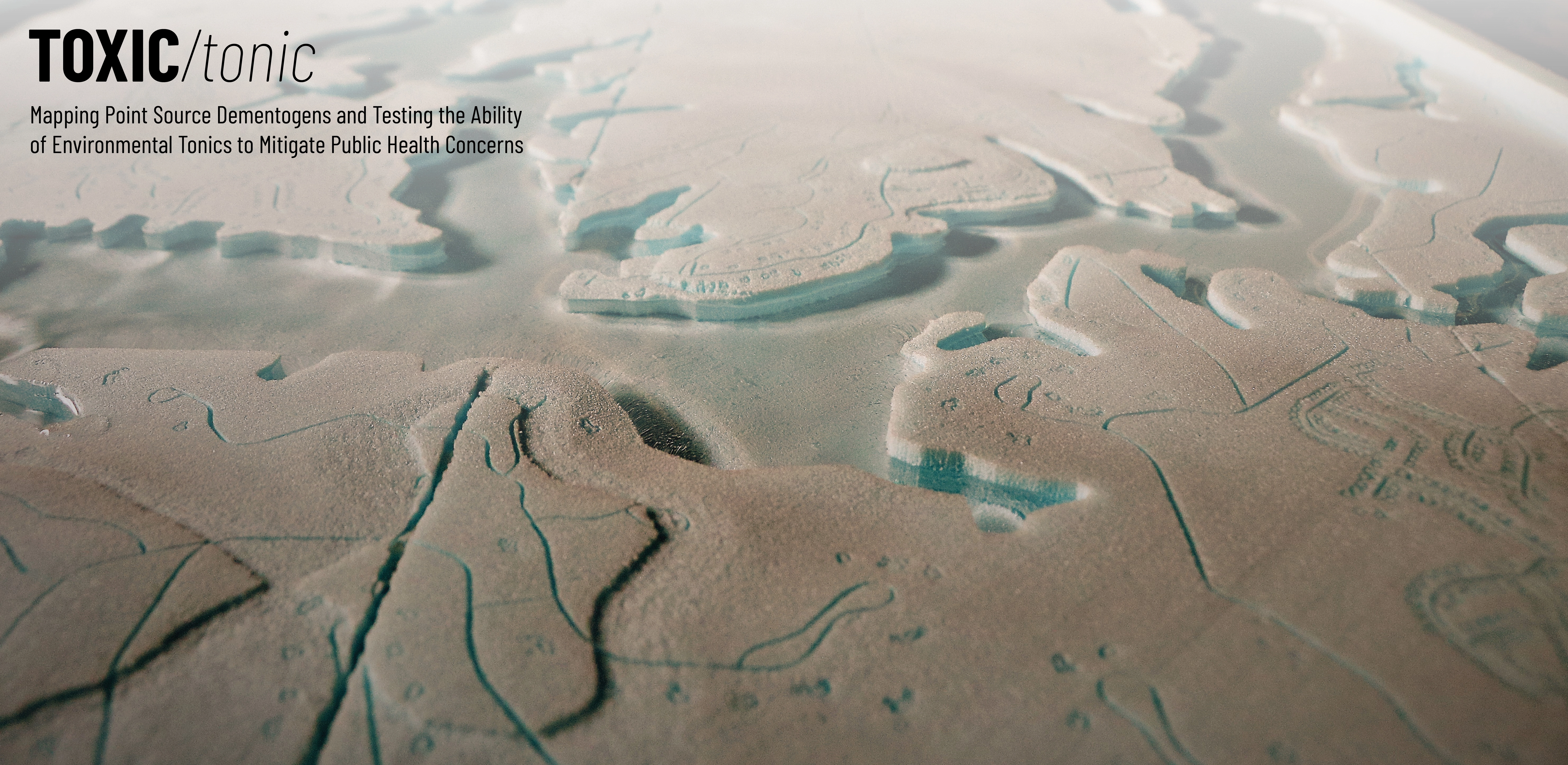
TOXIC/Tonic: Mapping Point Source Dementogens and Testing the Ability of Environmental Tonics to Mitigate Public Health Concerns
Britt Davis, Student ASLA

This project creatively investigated the connection between coal ash ponds and Dementia through map-based visual storytelling. Then, modeling was used to understand if landscape-based solutions, like constructed wetlands, could mitigate the spread of Dementogens across a site. Jurors were impressed by the multi-phase creative research inquiry and final outcomes.
Awards Jury
-
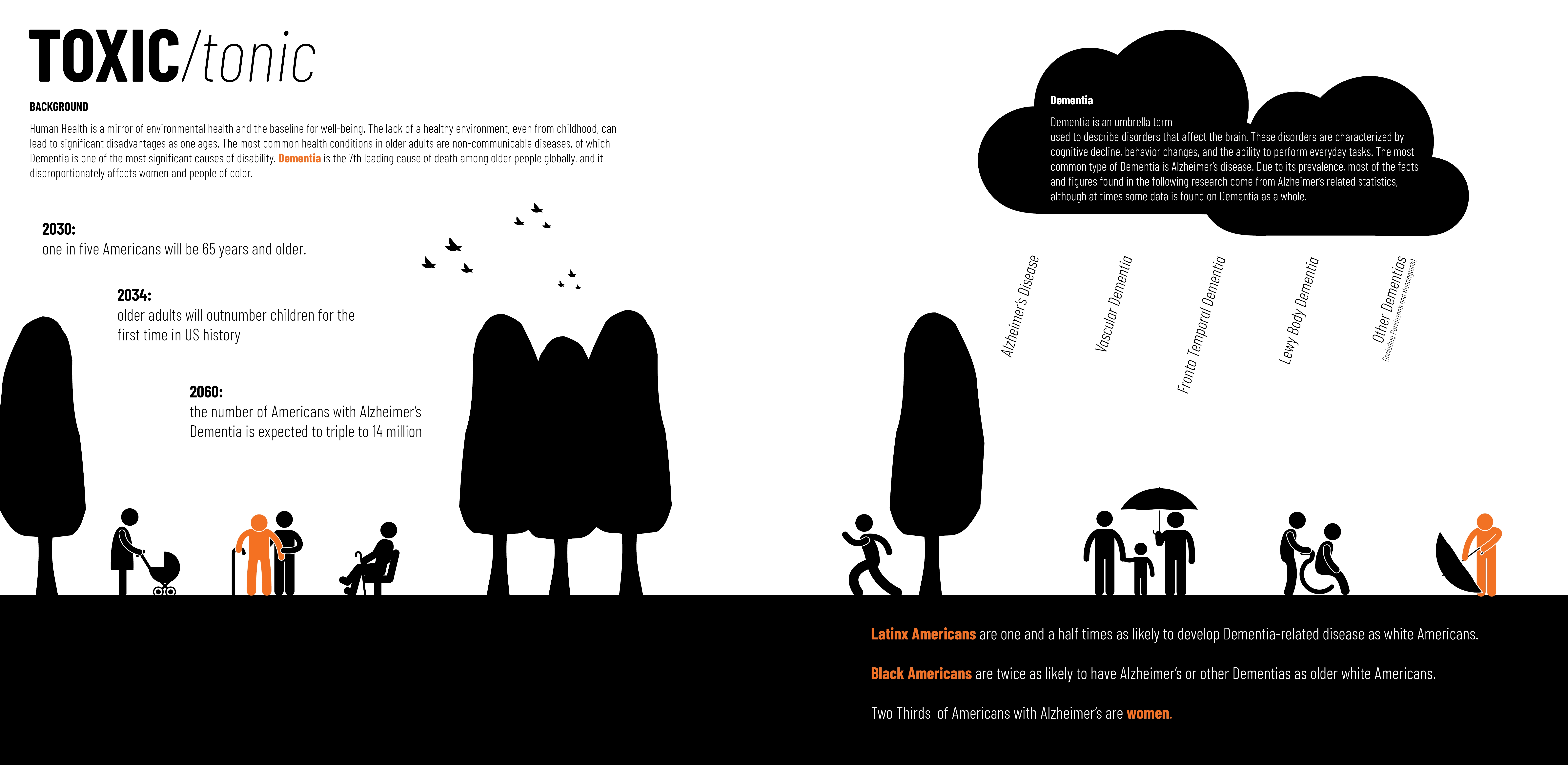
The number of Americans with Alzheimer’s is expected to increase to 14 million by 2060. Furthermore, by 2034 the number of adults will exceed children in the United States for the first time. Alzheimer’s and related Dementias bear a disproportionate burden on women and people of color. There is an imperative and urgent need to search for the point source of “Dementogens,” or categories of toxins that can lead to Dementia. However, little research exists on mitigating environmental pollutants related to Dementia using landscape-based solutions in landscape architecture and related disciplines. Through map-based visual storytelling, this research investigates coal ash ponds as a point source related to this growing public health concern. It uncovers the patterns of disproportionate disease rates affected by structural racism in the built environment. The study also examines the possible benefits of landscape-based alternatives, or environmental tonics to mitigate Dementogens by testing the ability of these strategies to diminish the TOXIC impacts of the built environment on human health.
-
BACKGROUND
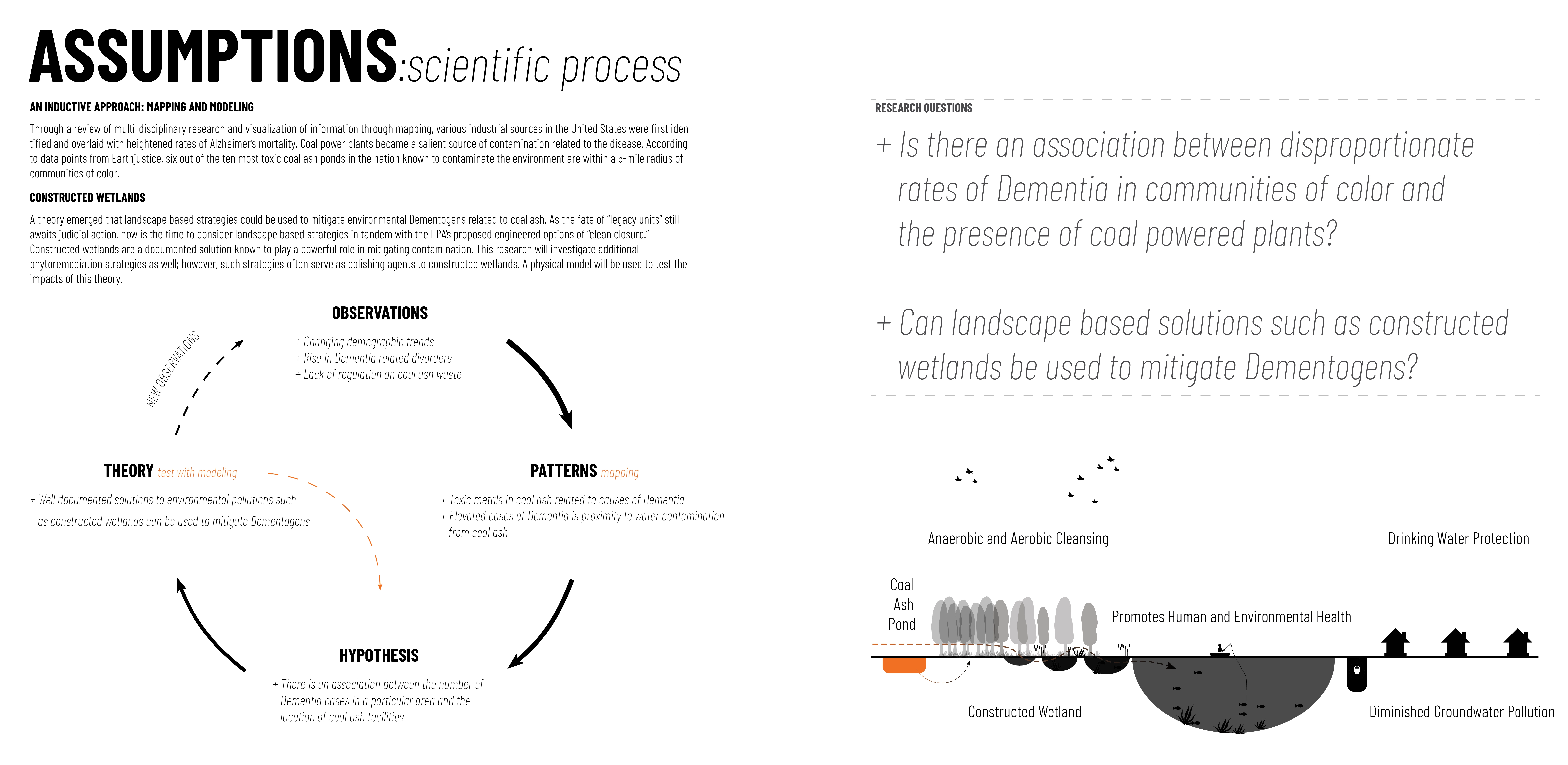
The lack of a healthy environment can lead to significant disadvantages as one ages. The most common health conditions in older adults are non-communicable diseases, such as Dementia. Dementia is the seventh leading cause of death among older people globally and a major cause of disability. Older Black Americans are twice as likely to develop Dementia as older white Americans. This research asks: Is there an association between disproportionate rates of Dementia in communities of color and the presence of coal-powered plants? Can landscape-based solutions, such as constructed wetlands, be used to mitigate Dementogens?
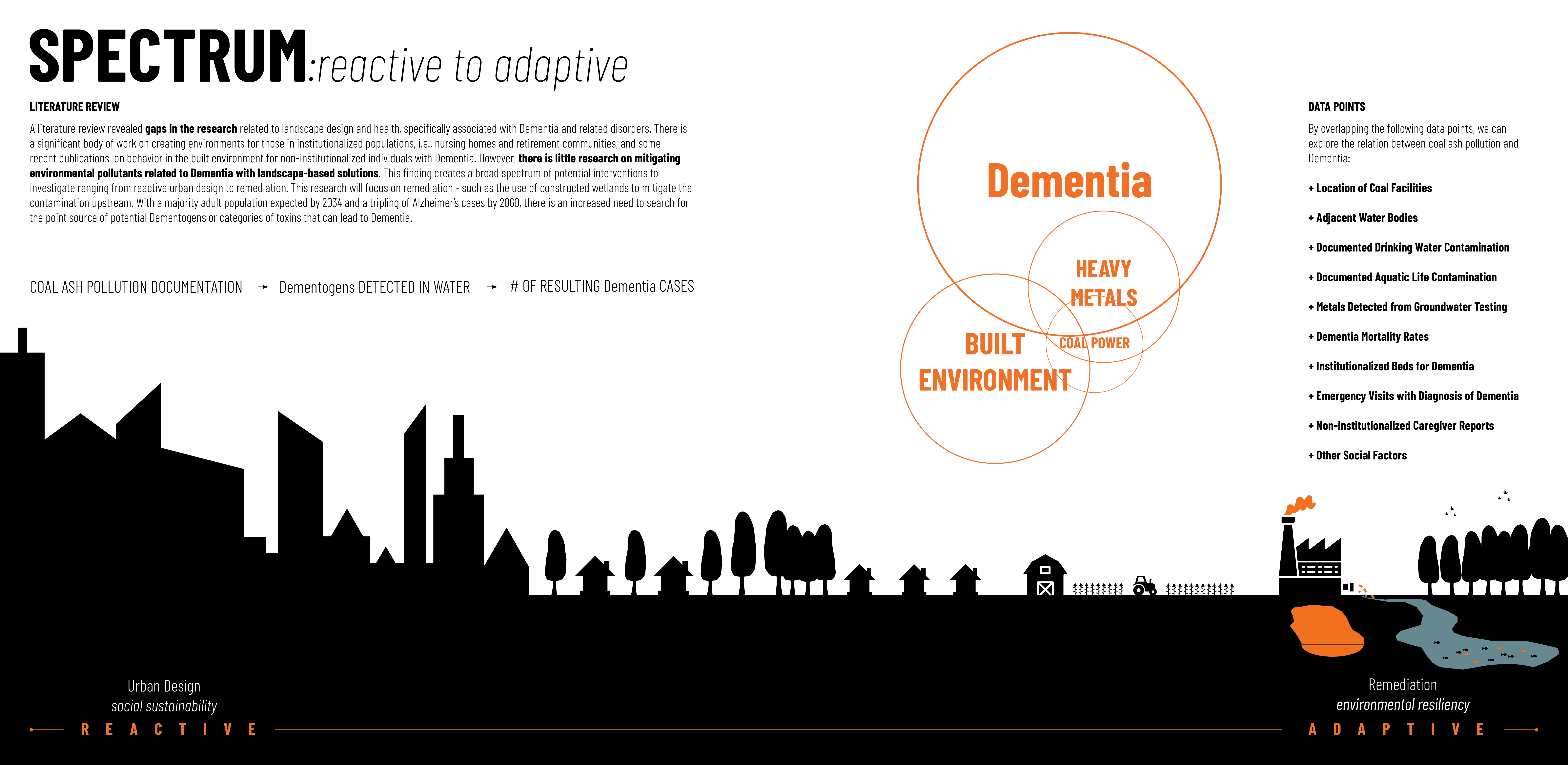
A Literature review revealed gaps in the research about landscape design and health, specifically associated with Dementia and related disorders. There is significant work focusing on health and the creation of environments, including nursing homes and retirement communities, and growing research on behavior in the built environment for non-institutionalized individuals with Dementia. However, there is little research on mitigating environmental pollutants related to Dementia with landscape-based solutions. With an exponential increase of Alzheimer’s cases by 2060, there is an increased need to search for the point source “Dementogens,” or categories of toxins that can lead to Dementia. We must examine potential patterns related to 1) trends this research terms as: TOXIC: Dementia and the Built Environment Association including impacts on vulnerable communities. We must also 2) explore landscape-based environmental strategies to mitigate at a localized level, or what this research terms as tonic: Testing Environmental Strategies.
ESTABLISHING THE CONTEXT AND RESEARCH DESIGN
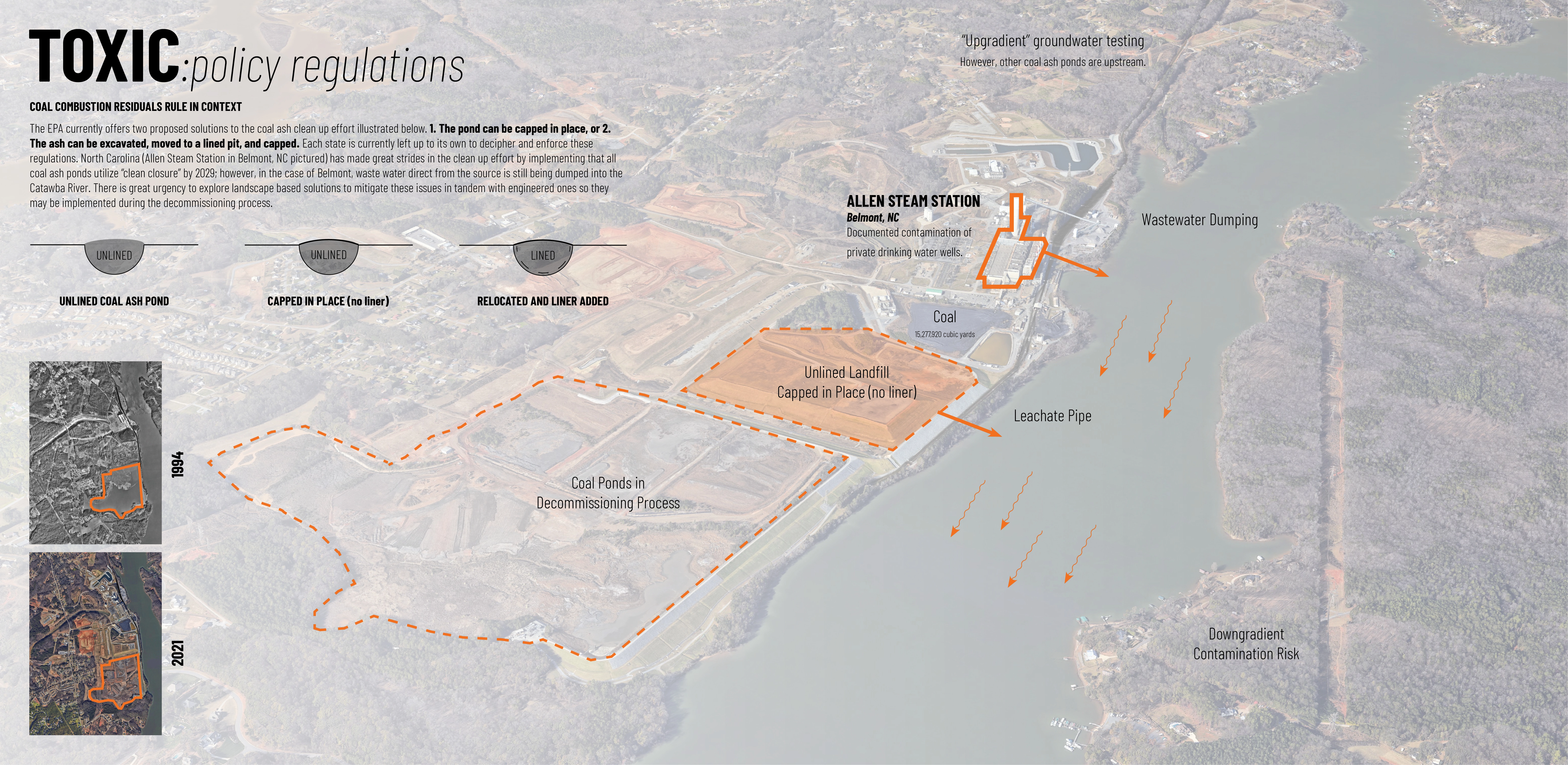
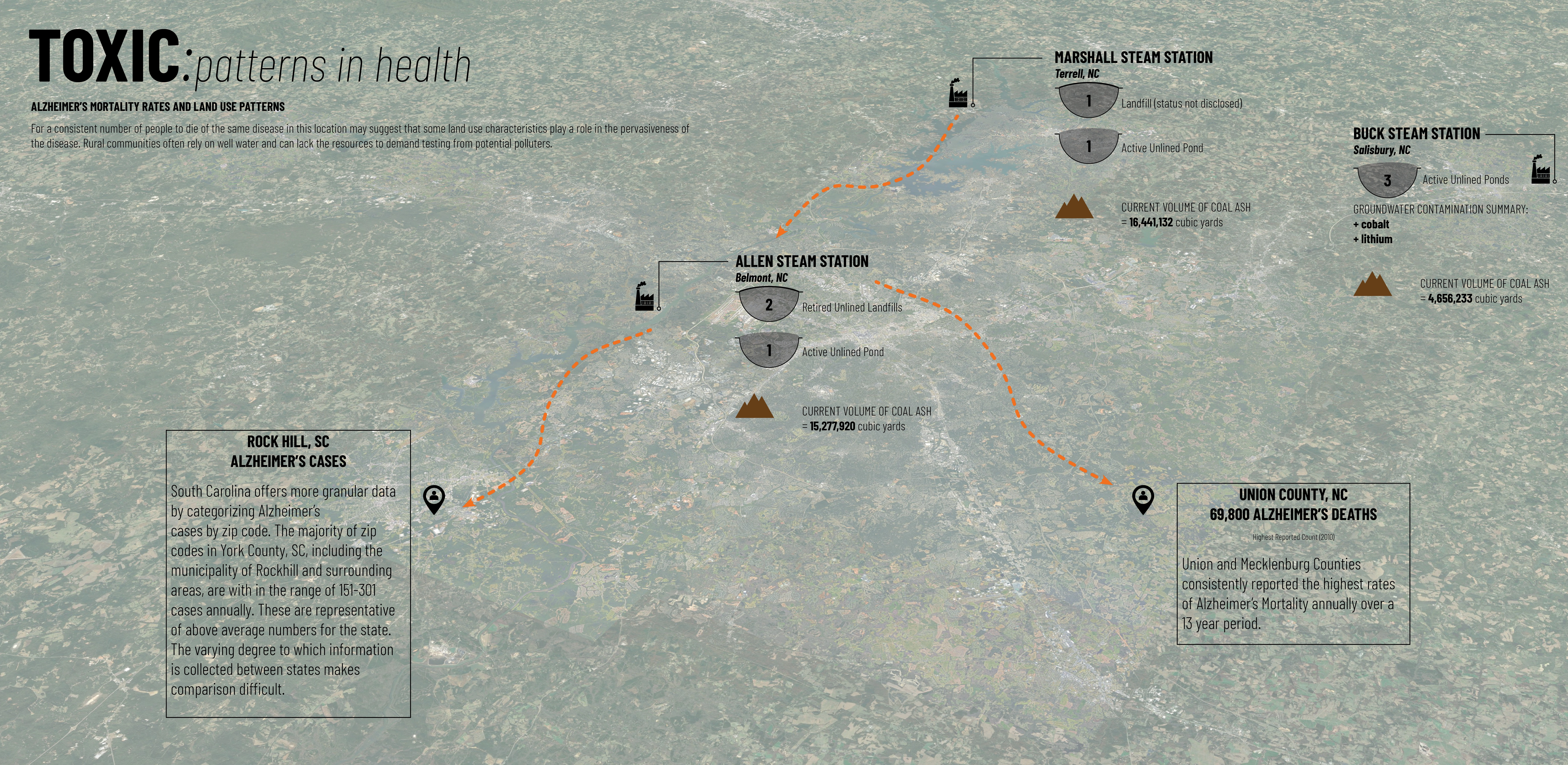
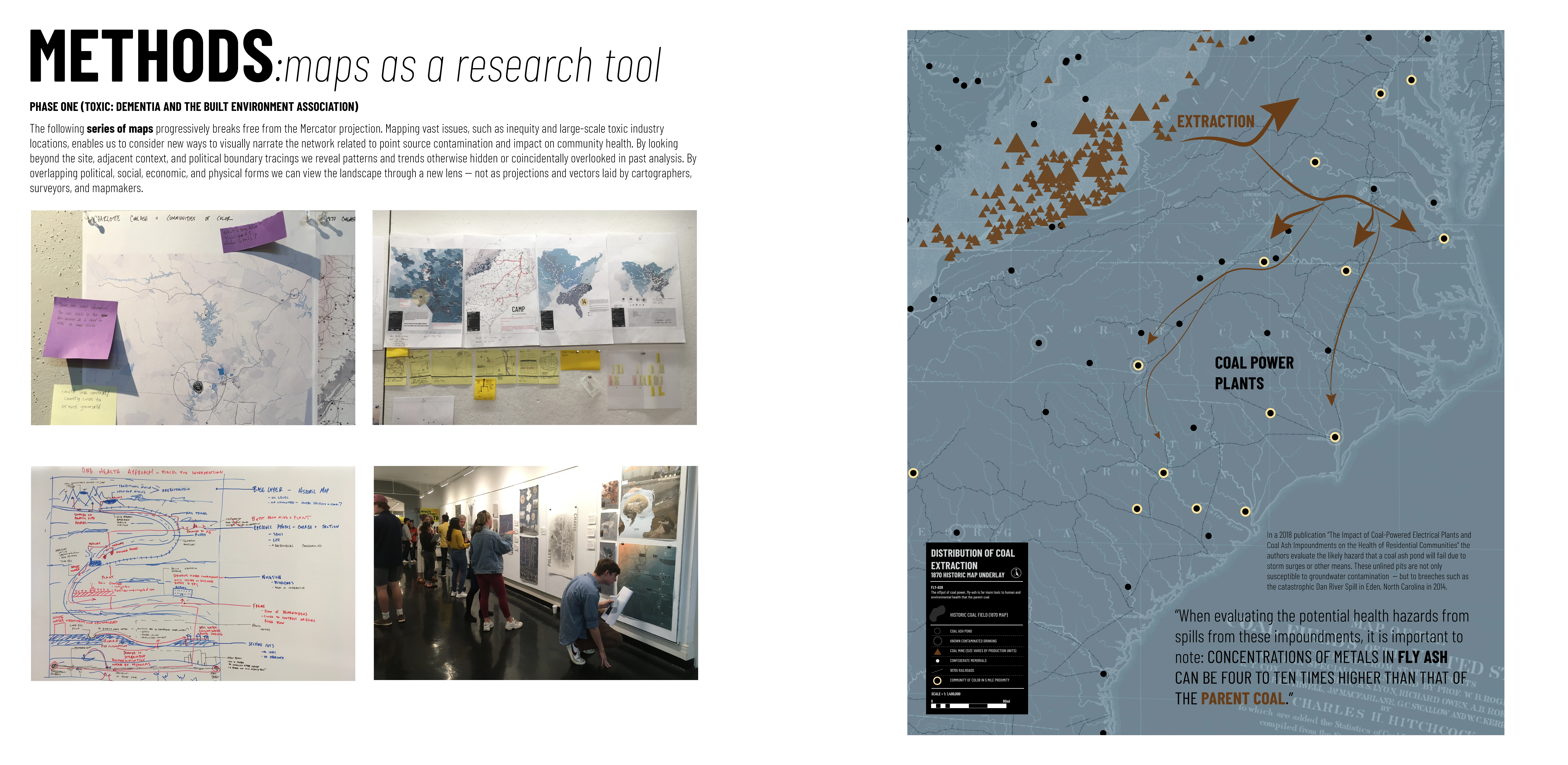
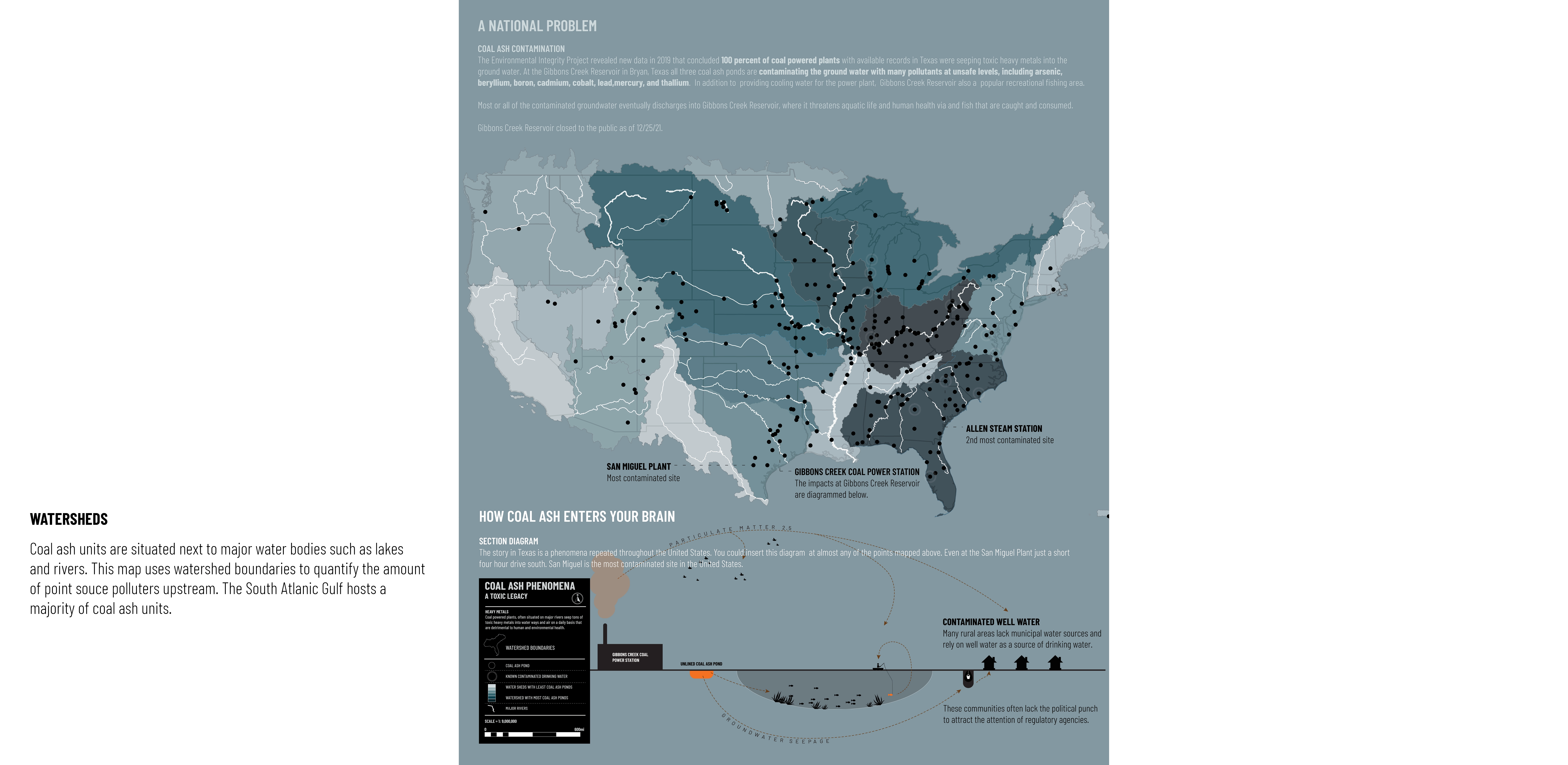
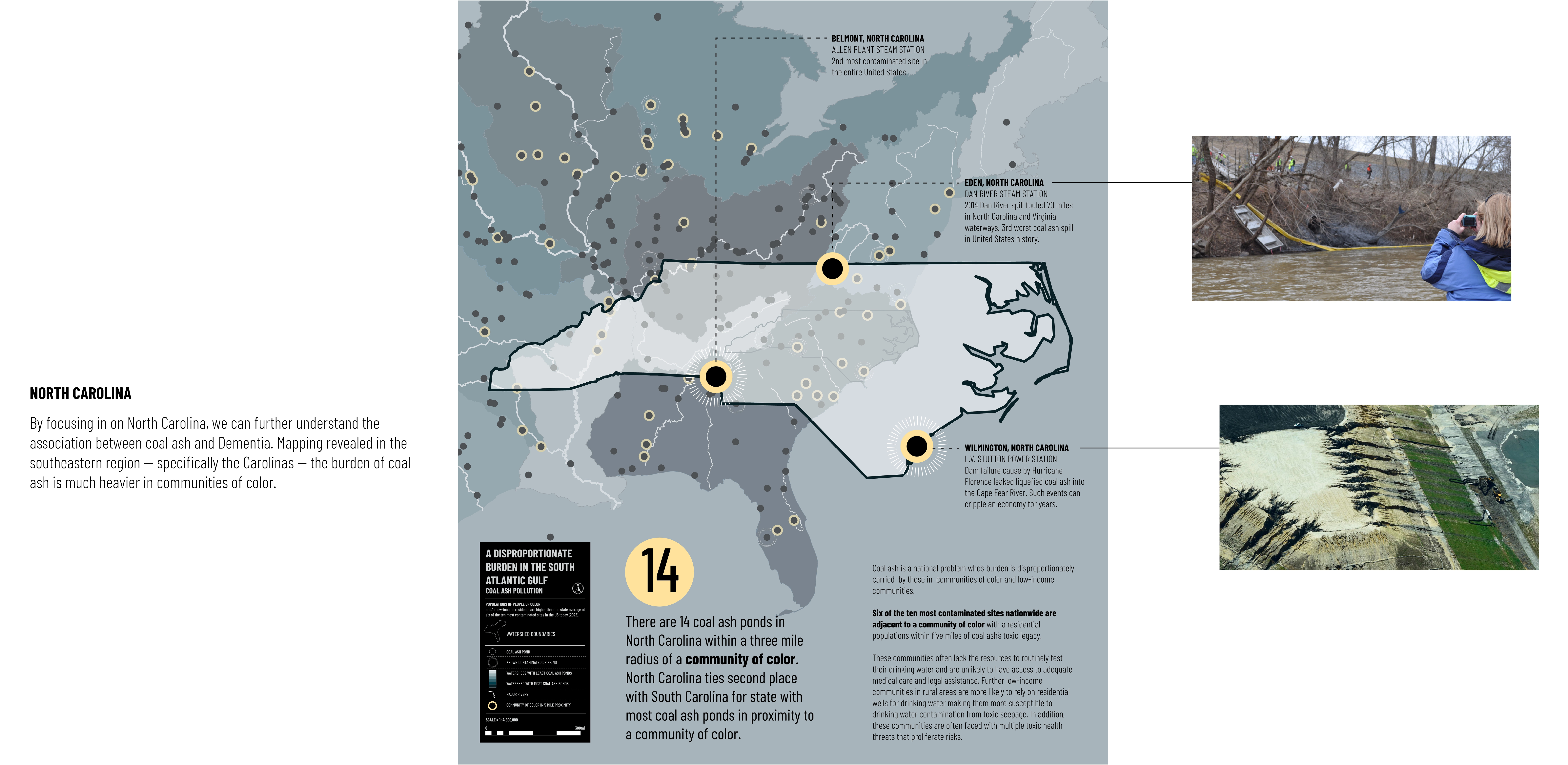
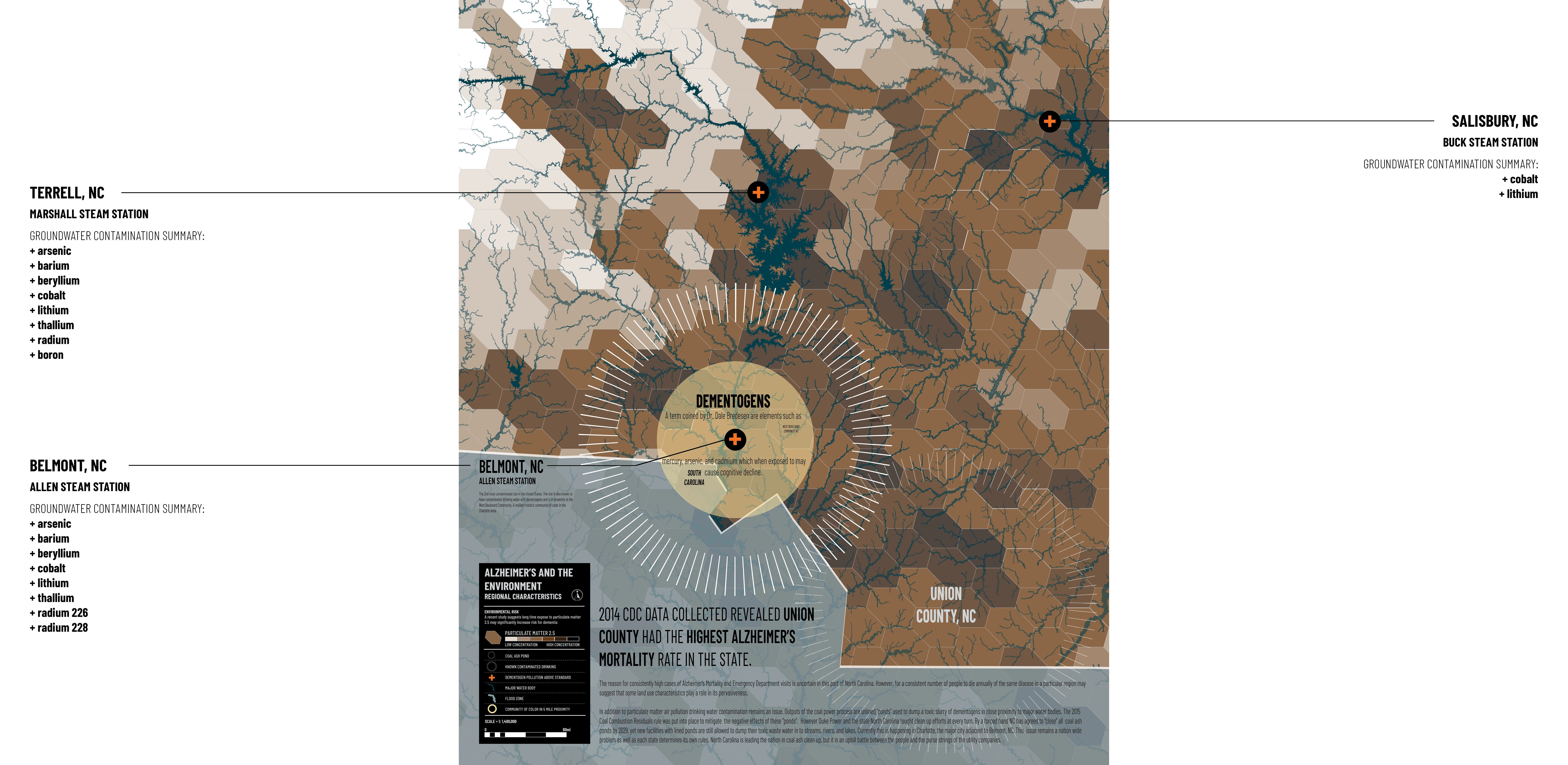
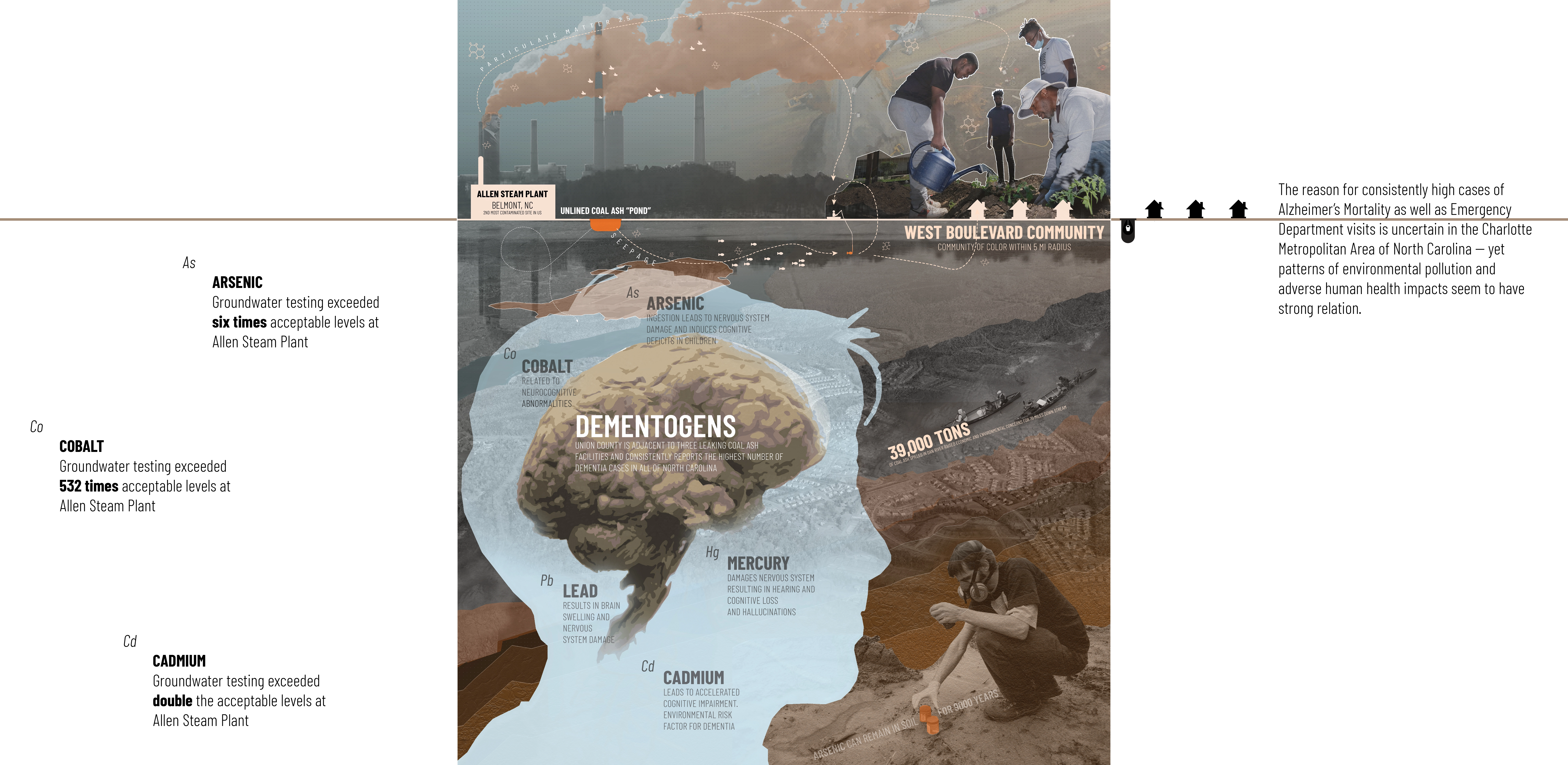
Through a review of multi-disciplinary research and visualization of information through mapping, various industrial sources in the United States were first identified and overlaid with heightened rates of Alzheimer’s mortality. Coal power plants became a salient source of contamination related to the disease. According to data points from Earthjustice, six out of the ten most toxic coal ash ponds in the nation known to contaminate the environment are within a 5-mile radius of communities of color. Hence, a Coal Power Plant near Charlotte, NC, the second most contaminated site in the US, emerged as a case study for this study due to an exceptionally high rate of Alzheimer’s mortality in downgradient municipalities and its adjacency to a community of color. A consistent number of people dying of the same disease may suggest that some land use characteristics play a role in the pervasiveness of the disease in this region.
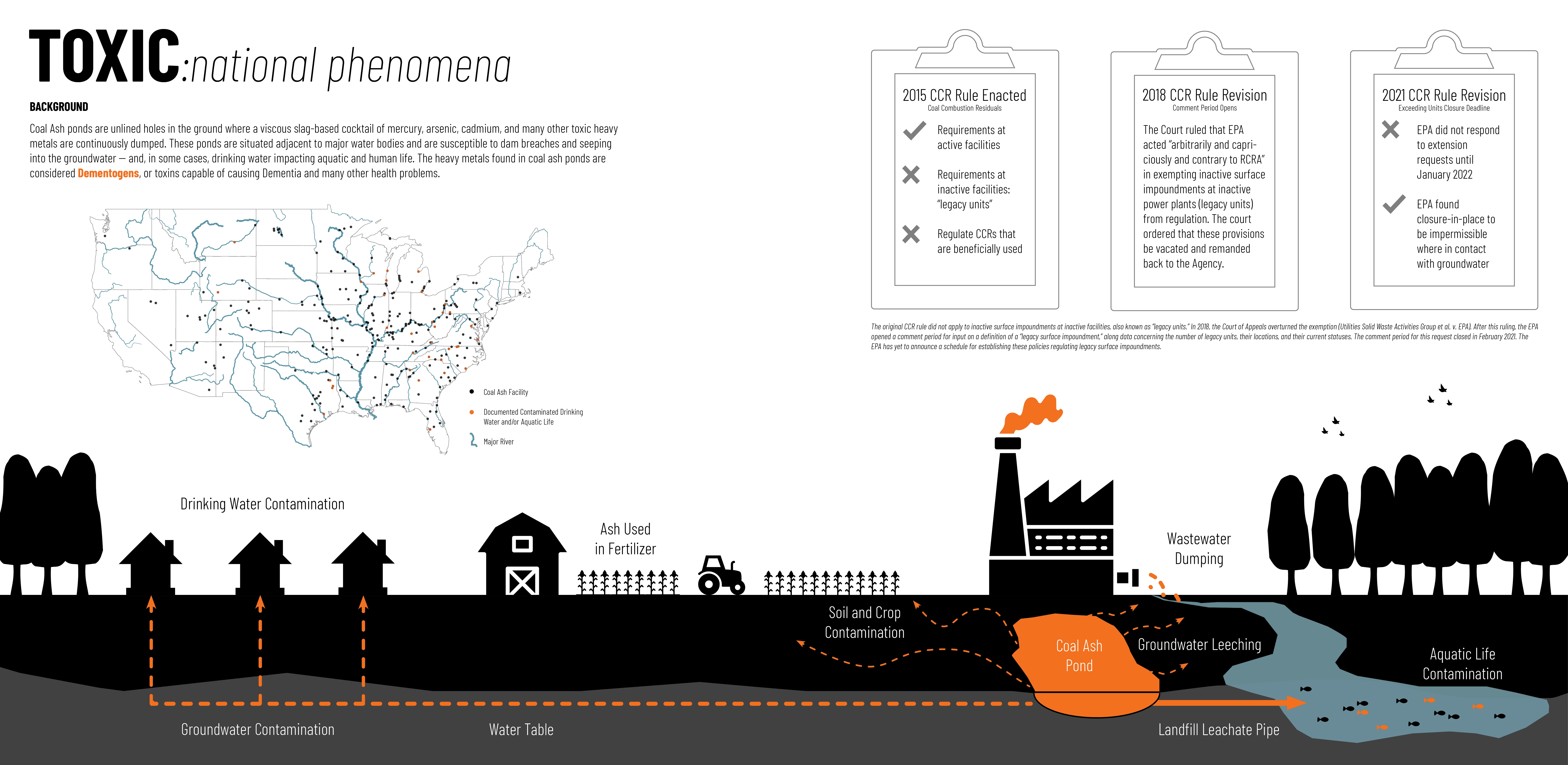
Coal ash ponds are used to store the waste product of coal power plants. These ponds are unlined holes in the ground where a viscous slag-based cocktail of mercury, arsenic, cadmium, (known Dementogens), and other toxic heavy metals are continuously dumped. These ponds are situated adjacent to major water bodies and susceptible to dam breaches and seeping into the groundwater -- and, in some cases, into drinking water impacting aquatic and human lives.
Mapping vast issues, such as inequity and large-scale toxic industry locations, enables us to consider new ways to visually narrate the network related to point source contamination and impact on community health. By looking beyond the site, adjacent context, and political boundary tracings, we break free from the Mercator projection, revealing patterns and trends otherwise hidden or coincidentally overlooked in past analysis. By overlapping political, social, economic, and physical forms we can view the landscape through a new lens -- not as projections and vectors laid by cartographers, surveyors, and mapmakers.
METHODS
This research benefited from a descriptive and testing approach in two phases: during the first phase, mapping strategy was used to understand and communicate the problem, and the second phase involved testing to understand the ability of a potential strategy that can mitigate the problem at a localized level. In Landscape Architecture, the act of mapping as a research tool is vital. Mapping informs designers through multiple lenses and is inherently a community development approach to unraveling injustices. In the first phase, maps were generated and used as an inductive approach to uncover patterns related to these TOXIC landscapes, generating new perspectives to hypothesize the future for places impacted by toxic landuse practices. Data from various sources, including the EPA, Center for Disease Control, United States Census, Earthjustice, and the Environmental Integrity Agency, was collected, formatted, tabulated, and imported into ArcGIS Pro. Spatial analysis revealed the relationships between utility companies and rates of Alzheimer’s mortality. Further map-based visual storytelling was used as a strategy for demonstrating complex socio-temporal problems in the built environment, particularly in areas in proximity to the Allen Steam Station Coal Power Plant near Charlotte, NC.
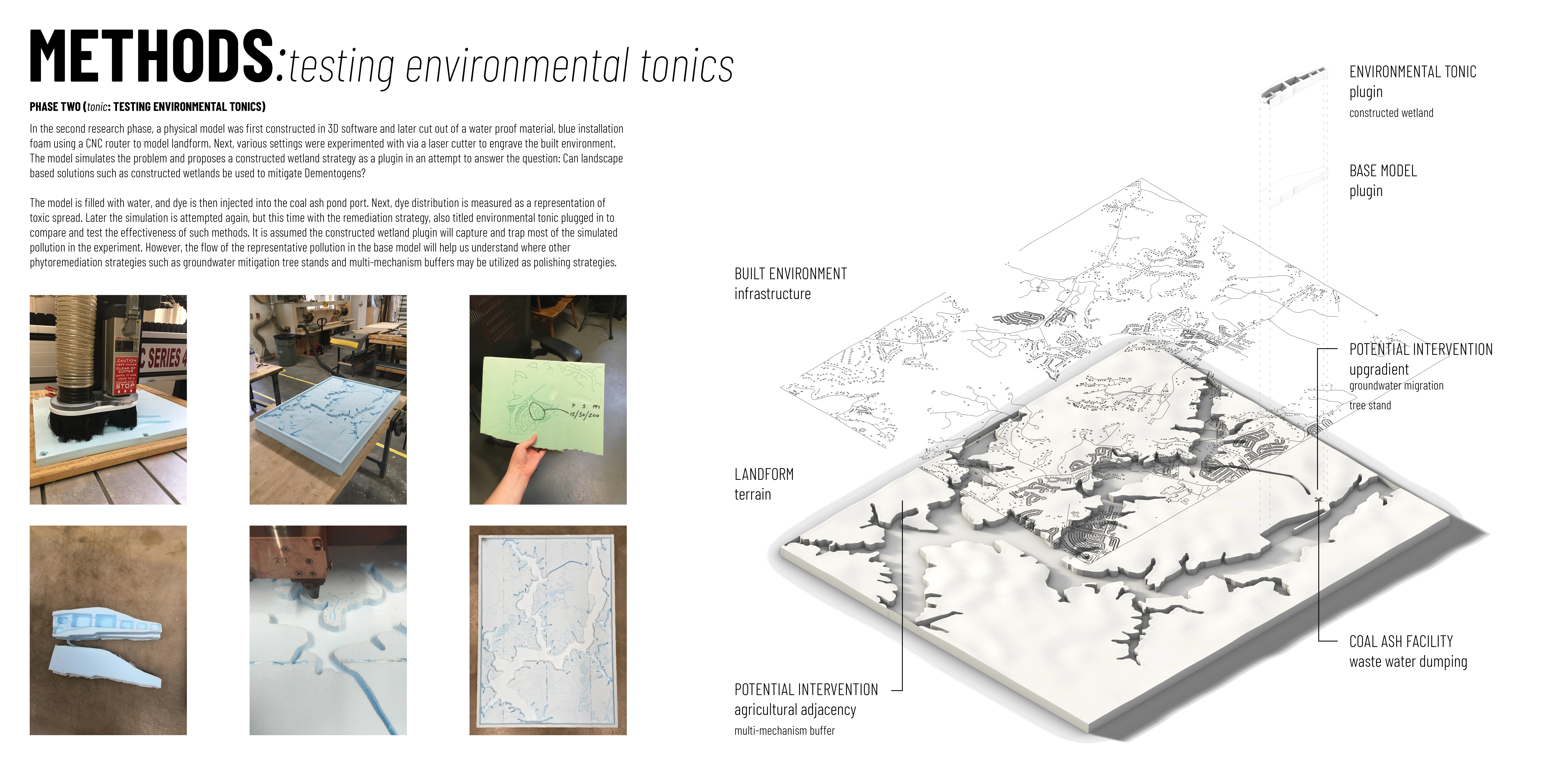
In the second phase (i.e. tonic: Testing Environmental Strategies), a physical model of the selected power plant area was constructed to simulate the built environment and propose various strategies as plugins. The model was first filled with water, and dye was then injected into the coal ash pond port. The dye distribution was measured as a representation of toxic spread. Later the simulation was attempted again by plugging in the new constructed wetland strategy to compare and test the effectiveness of potential landscape-based strategies as solutions.
OUTCOMES AND FUTURE WORK
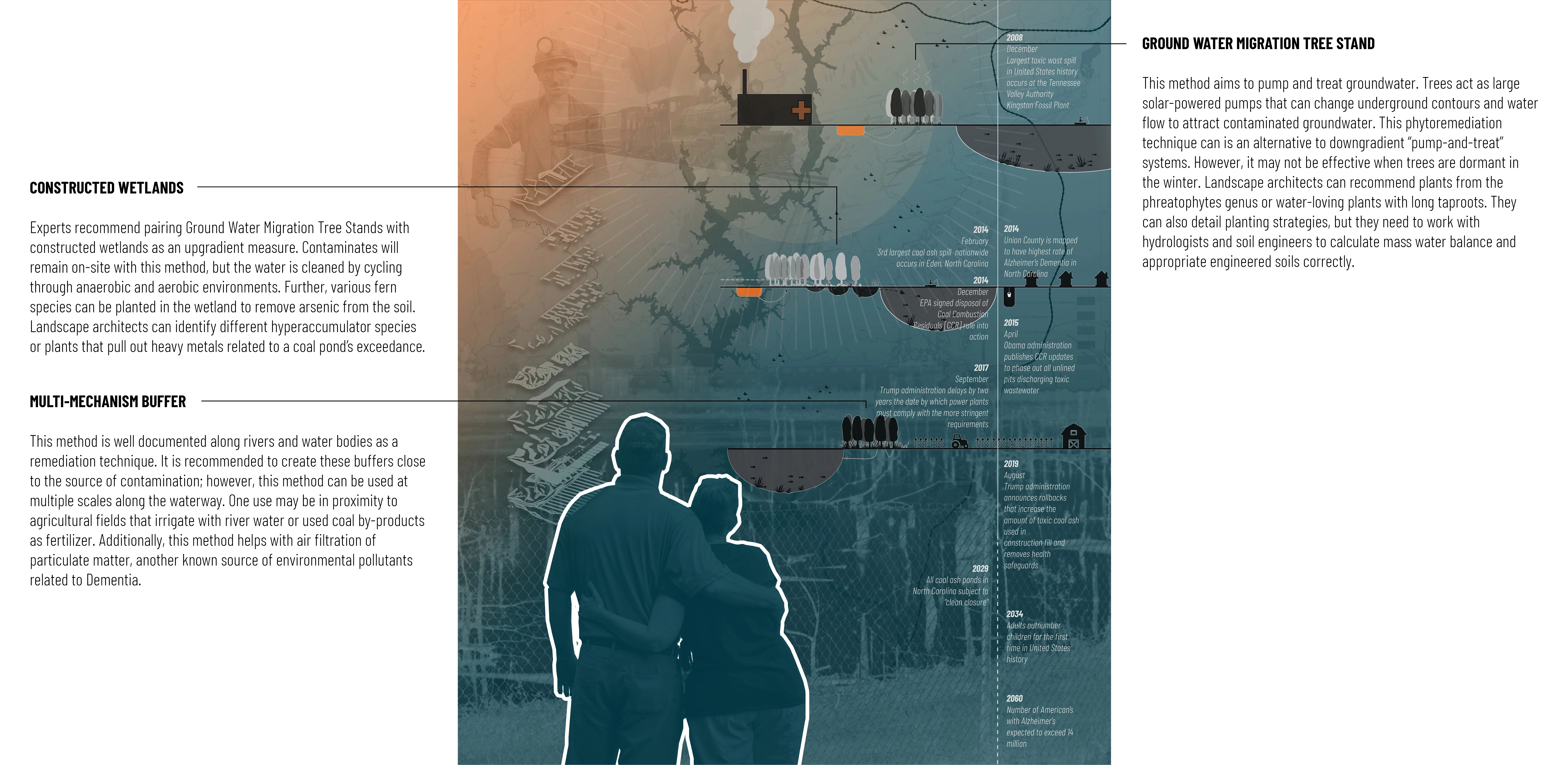
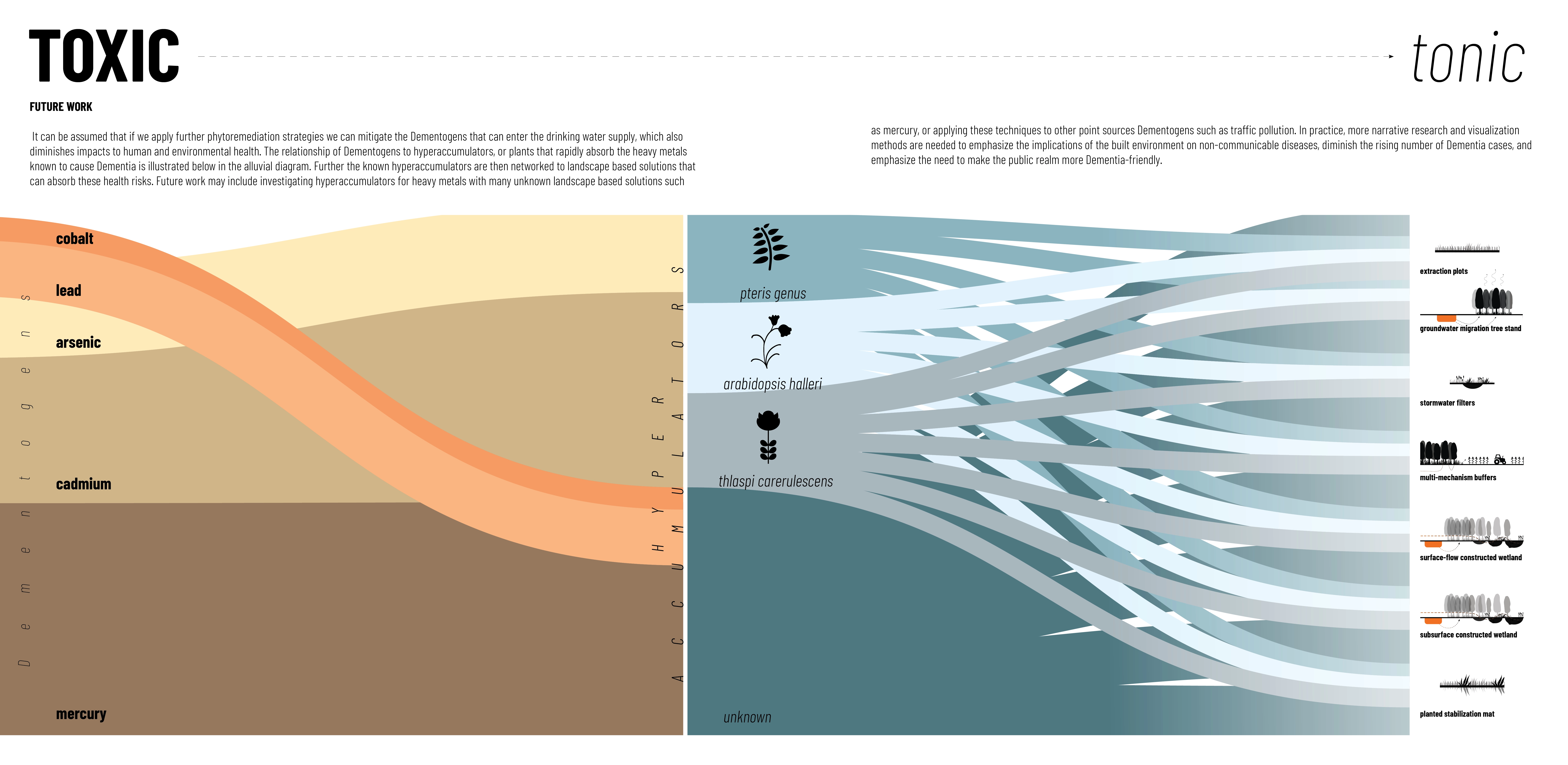
Mapping coal ash phenomena in NC revealed an association between disproportionate rates of exposure and elevated rates of Dementia in communities of color and the presence of coal-powered plants. When focusing on NC, it was observed that counties with coal ash ponds within a 5 miles radius of a community including a higher Black and/or Latinx population also had a high concentration of Dementia cases. Although there are documented landscape-based solutions to combat pollutants emerging from these plants, such as groundwater mitigation tree stands, constructed wetland, and multi-mechanism buffers, not much consideration has been given to the strategic implementation of these strategies. Mapping as a research tool provided an understanding of how and where landscape-based solutions can be considered in addition to engineered ones to mitigate the leaching of Dementogens and combat a disproportionate burden on communities.
During the model simulation and testing, the water and dye behaved as expected in both scenarios: one (with no intervention) and two (with a landscape-based strategy - constructed wetland - plugged in). In scenario one, the dye rushed rapidly out of the pipe and into the simulated river. From there it flowed downstream quite quickly within a matter of minutes and spread upstream a bit due to the gentle contour of the riverbed. In scenario two, the flow of the dye was significantly slowed down, taking more time to emerge from the pipe and flow into the first cell of the wetland form. Once the first cell was full, the dye flowed to the next chamber. This process continued until the dye reached the river. It can be assumed that if we apply further phytoremediation strategies, we can further slow down and mitigate the Dementogens that can enter the drinking water supply, diminishing impacts on human and environmental health.
This research is a call to attention and a call to action. It demonstrates a spectrum of strategies to address environment-based inequity problems, as well as uncovers and prioritizes needs collectively related to industrial point sources, such as coal power plants, in association with public health concerns, such as Dementia. It aims to influence the methods proposed by the EPA’s Coal Combustion Residuals Rule to consider landscape-based solutions during the decommissioning process. In addition, the use of maps as visual storytelling provides an opportunity to foster a dialogue between local officials and designers to formulate new understandings of the problem, address the range of reactive urban design and adaptive remediation approaches, and uncover impacts buried by traditional techniques. In practice, more narrative research and visualization methods are needed to emphasize the implications of the built environment on non-communicable diseases, the rising number of Dementia cases, and the need to make the public realm more Dementia-friendly.
-
- pteris genus
- arabidopsis halleri
- thlaspi carerelescens
- phreatophytes genus
Advertisement
Related Awards
Honor Award, Research
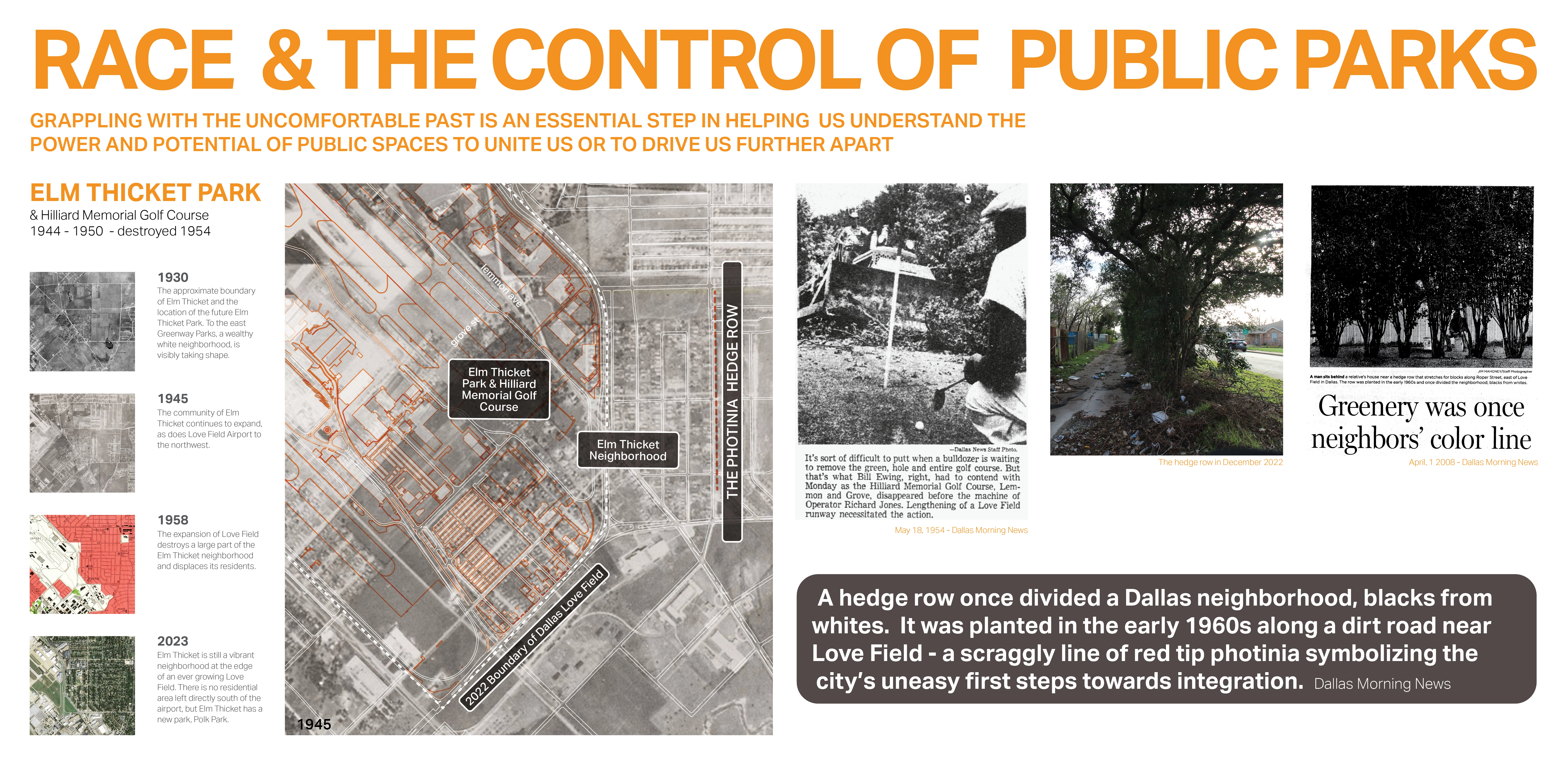
Race and the Control of Public Parks
This research uses a century long historical analysis of the public park system in Dallas, Texas, USA to uncover the physical and psychological ways in which public landscapes and the works of landscape architects have segregated urban spaces and how we might fight against these design practices. Through reframing past practice this work seeks to create a method for informing design thought and practices that seek to create a more just built environment.