Living with Water: Landscape as the Potential to Envision an Anti-Fragile System for Yuba River Watershed and Yuba City, California
Honor Award
Analysis and Planning
Yuba city, California, America
Jiahong Song, Student International ASLA;
Jiaying Wu;
Faculty Advisors:
Jie Liang;
Southeast University
Delft University of Technology


This expertly researched and documented analysis presents a clear example of how human-generated ecological destruction can be mitigated and eventually healed by the work of landscape architects. The proposal suggests ways to fortify a watershed made fragile through hydraulic mining by accommodating human activity within a landscape that faces regular periods of flood and drought. The in-depth research and presentation of ideas is impressive.
- 2022 Awards Jury
Project Statement
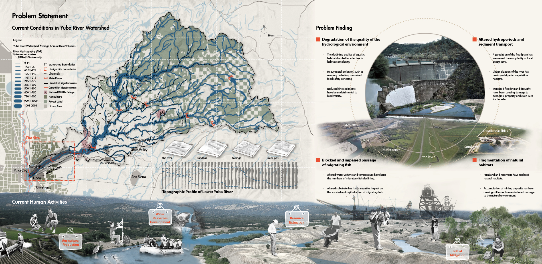
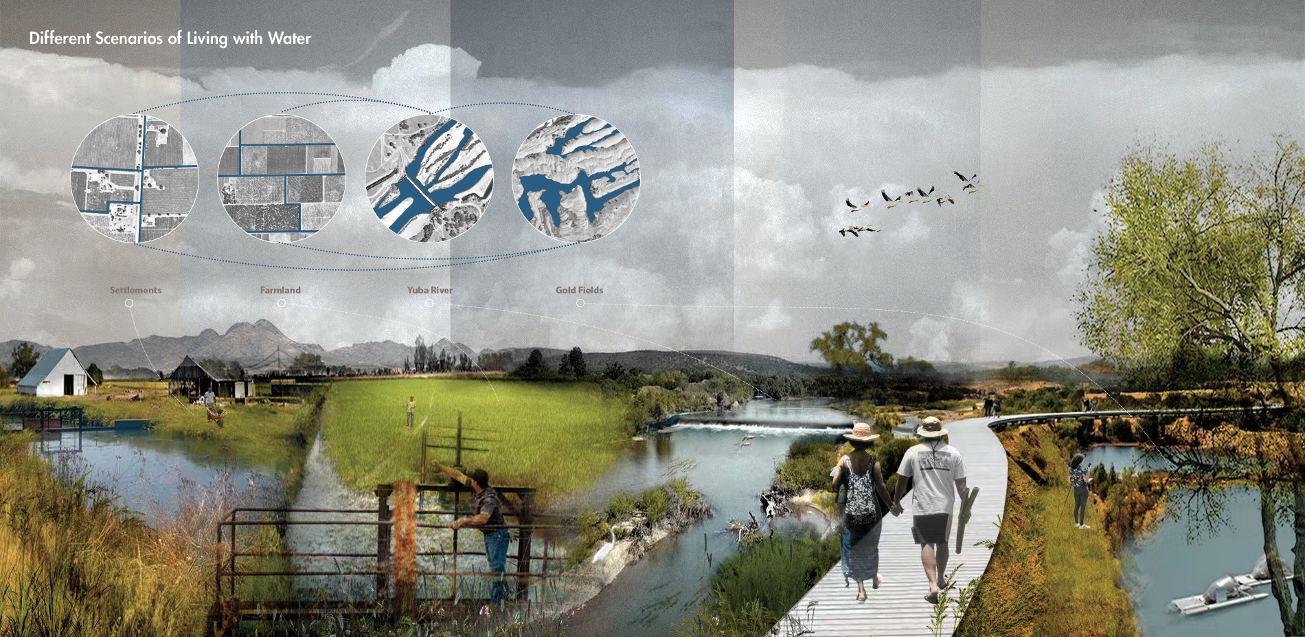
Our main design site is the lower Yuba River between Yuba City and the Englebright Dam.The basin has brought a series problems of ecological, economic and social chain problems of flooding, sedimentation, pollution and habitat destruction due to hydraulic mining, which are difficult to solve. The construction of existing dams can effectively reduce the risk of flooding, but the size of impact about dams on fish habitat destruction or flood without dams on downstream socioeconomics is difficult to judge. Therefore, we explore a middle possibility to disperse the areas of flood risk through the placement of flexible infrastructures in the watershed to reduce the flood pressure of single-point dams. At the same time, through the guidance of fish migration and the shaping of suitable water environment through functional boxes, it can be minimized the impact of dams on the interruption of fish migration paths, and optimizing the water ecological cycle to construct an anti-fragile resilient hydraulic system.
Project Narrative
Project Background
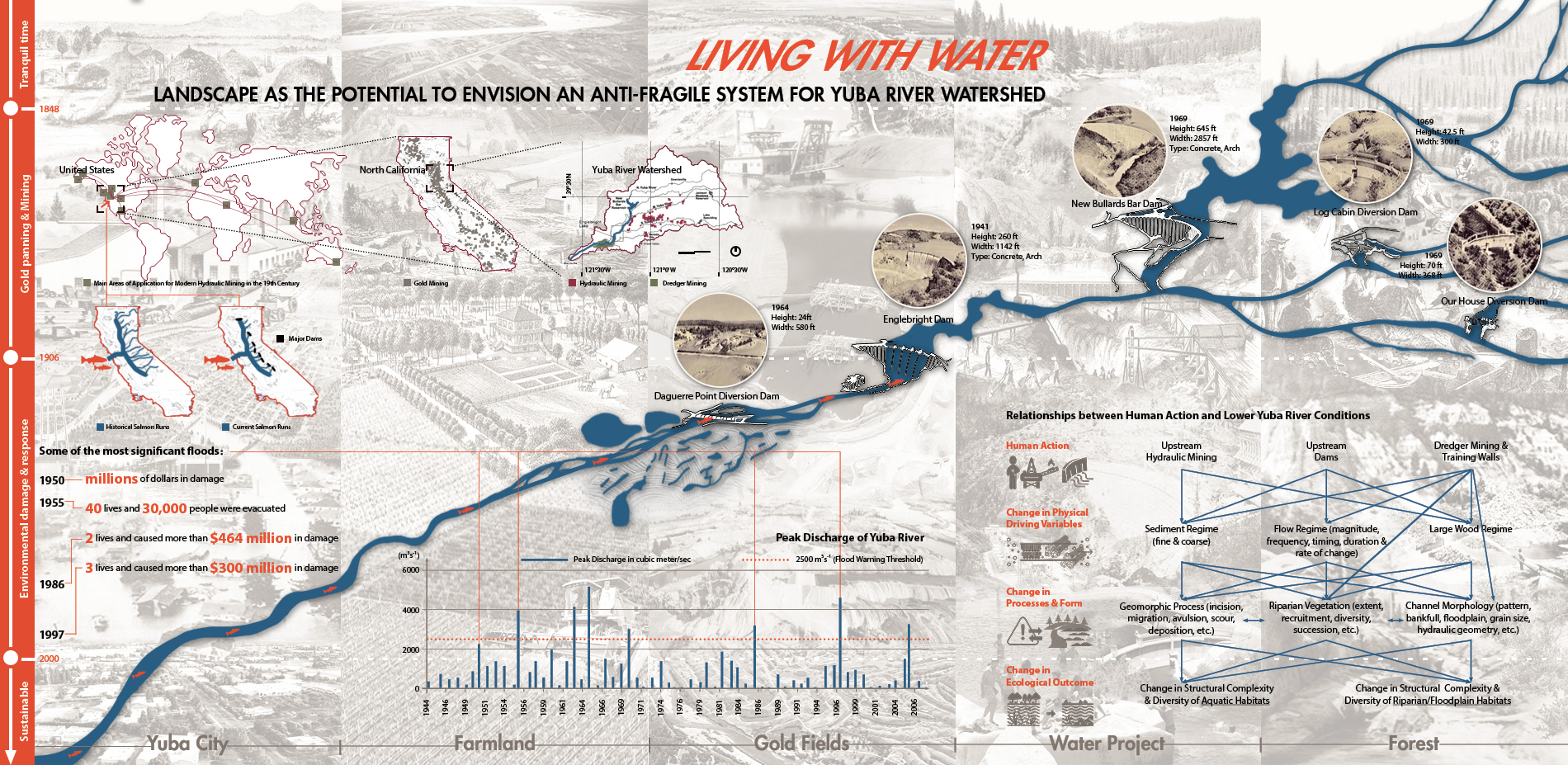
The Yuba River watershed has been encountering mining debris upstream since the California Gold Rush, profoundly aggravating the lower Yuba River and its floodplain and ruining neighboring farming and riparian habitat. Huge 'training walls' were created to keep the river in a single channel and reduce the sediment problem while dredging operations in the lower Yuba River, that is, the re-mining of significant quantities of hydraulic mining deposits in the lower Yuba River. The Gold Fields stretch of the river is today dominated by 20,000 acres of dredging tailings. The lower Yuba River ecosystem has been degraded as a result of altered natural hydrological conditions and sediment transport systems. However, unabated human exploitation activities, such as the development of hydroelectric resources, have resulted in additional environmental issues, such as impeding fish migration routes and worsening floods. While some initial mitigation measures and restoration projects have been implemented, a lack of overall planning has resulted in numerous organizations adopting their own plans, and some short-term efforts do not solve the region's interlocking concerns. Soil erosion, flooding, loss of agricultural production, and damage of fish habitat...... The existing fraile system is on the point of collapsing due to a slew of interconnected issues. As a result, this project intends to create an anti-fragile system in the lower Yuba River watershed, restoring environmental quality while making the entire system more resilient to future hazards through the introduction of flexible infrastructure.
Analysis of Planning Area
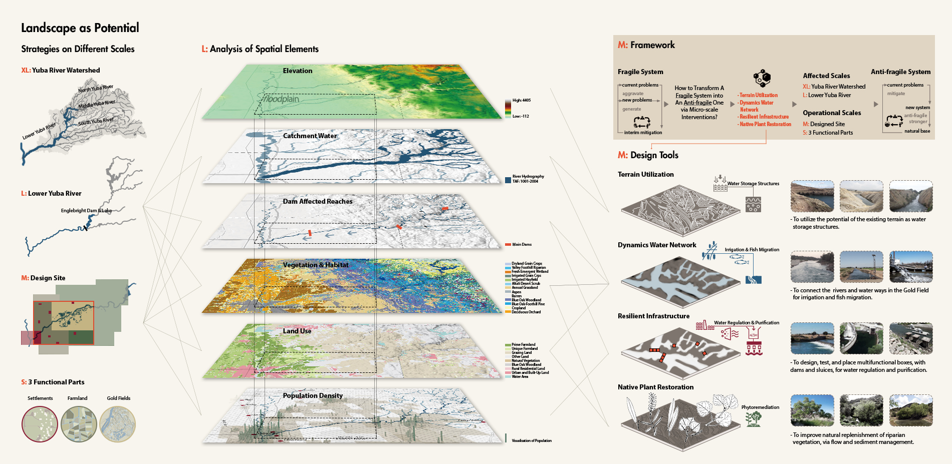
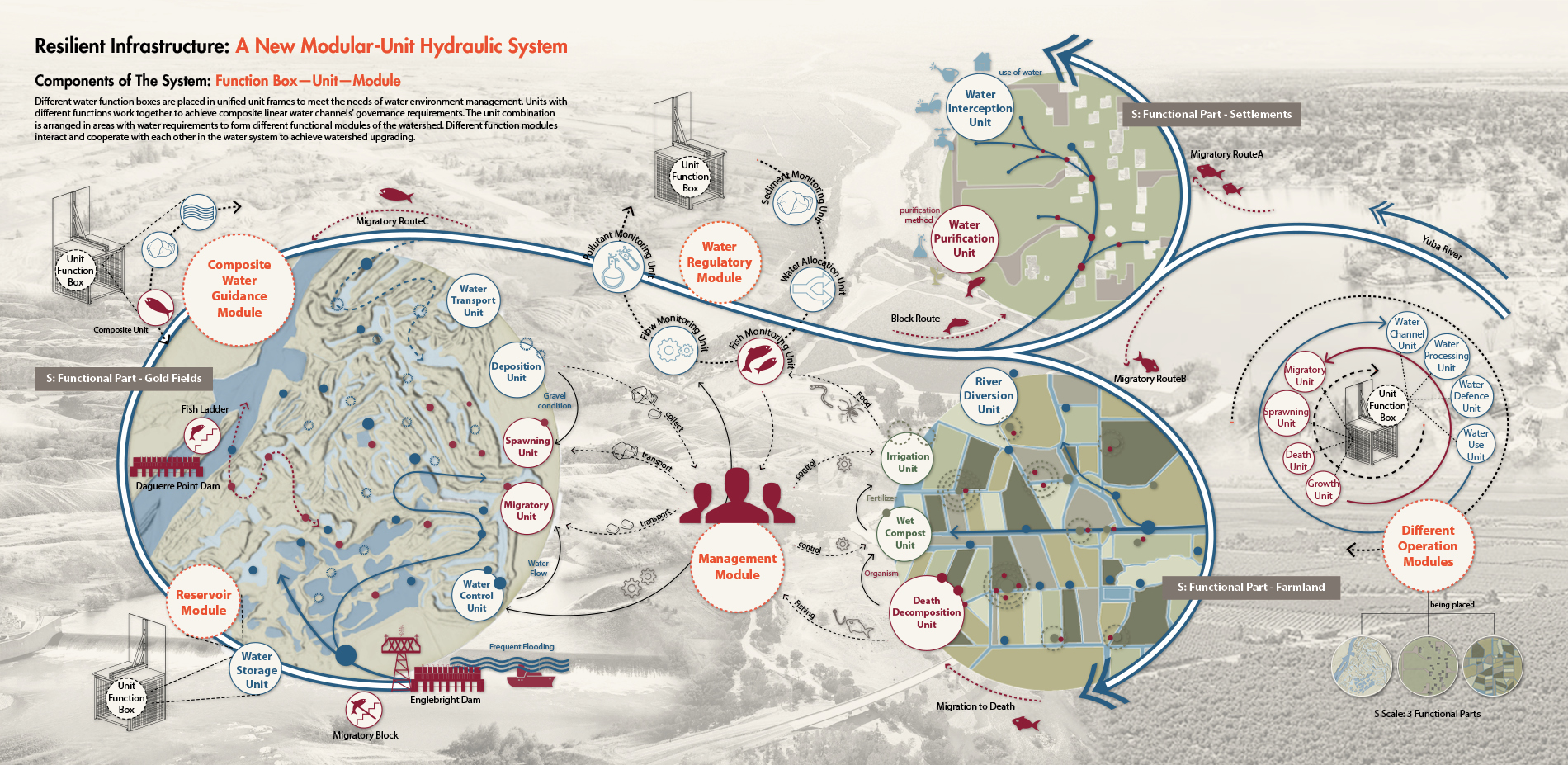
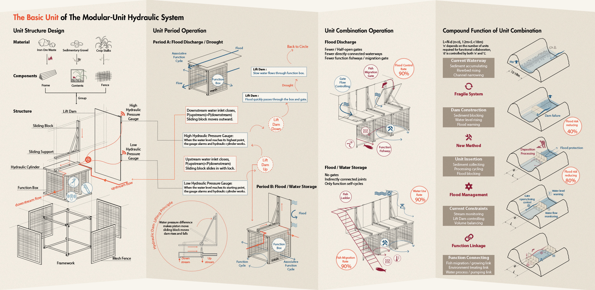
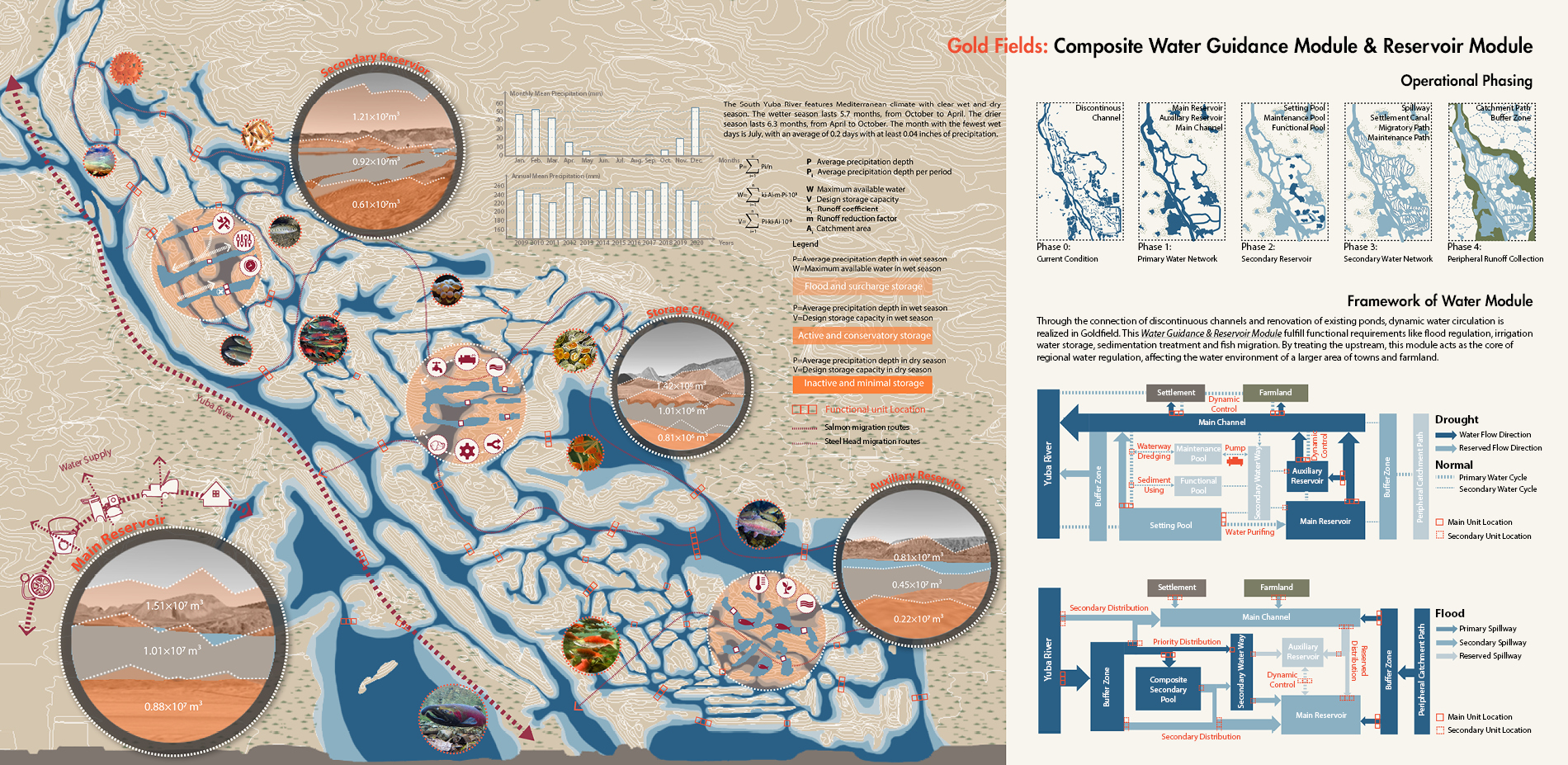
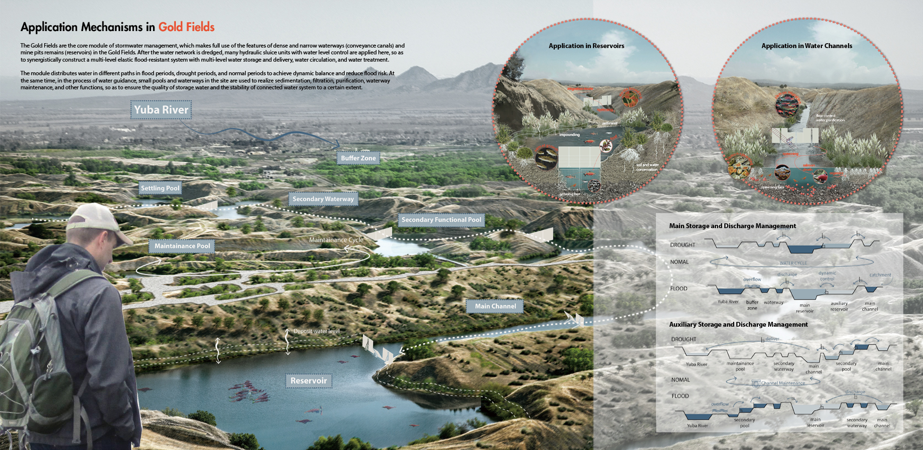
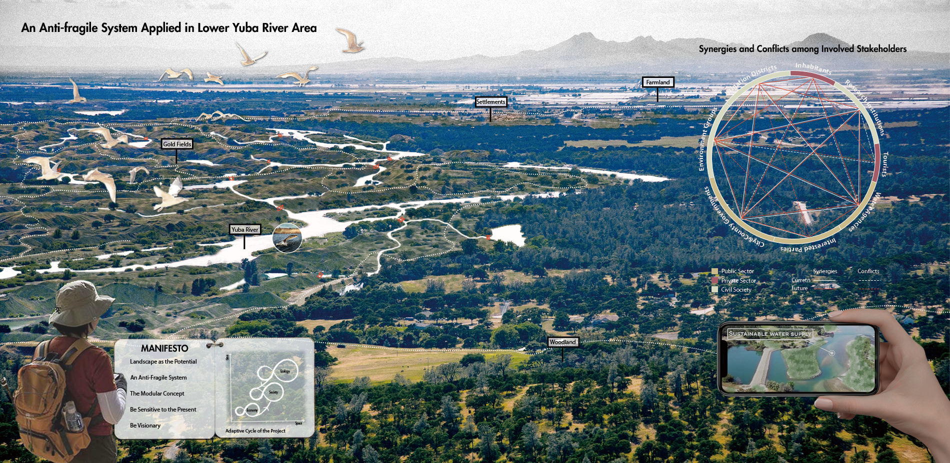
Our main design site, M-scale, is the lower Yuba River between Yuba City and the Englebright Dam, and we've divided it into three main functional sectors at S-scale: Gold Fields, farmland, and settlements. Data on local climatic conditions, terrain, flood cycles, fish migration routes and features, vegetation kinds, land use, current infrastructure, population, and other factors were collected and examined. After reviewing a large number of existing studies, we chose not to remove the existing dam, but to take advantage of the mining legacy that has produced characteristically narrow and dense gullies from the perspective of the hierarchical impounding pond system combined with topography, and proposed a resilient hydraulic system for integrated watershed management with a dredged water network and modal water treatment device placement, where Gold Fields, settlements and farmland downstream of the dam are controlled in tandem through water conveyance canals, and modal hydraulic devices with adjustable water levels are placed, where water treatment or fish function boxes are placed in the devices dotted in different impact areas to achieve water management in the watershed.
Strategies
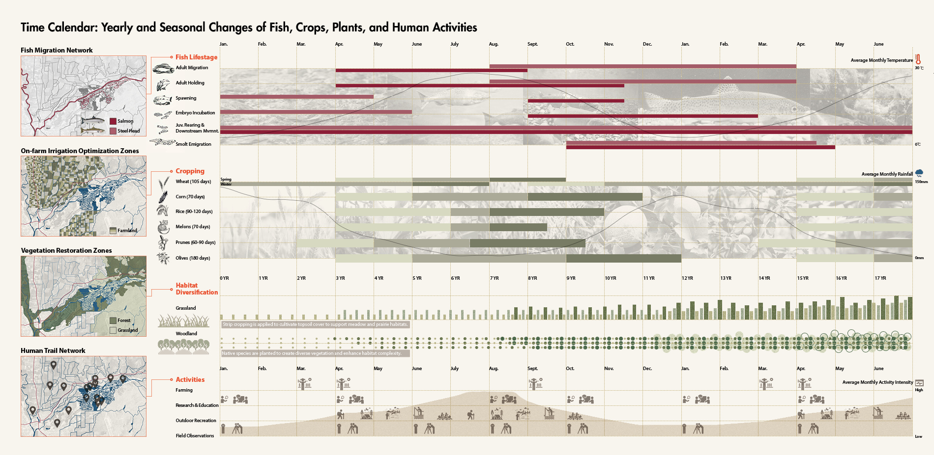
Terrain utilization, dynamics water network, resilient infrastructure, and native plant restoration are the four main design tools that are applied to the M-scale, the lower Yuba River watershed. To utilize the potential of the existing terrain as water transport and storage structures, the Yuba River and water channels are connected for irrigation and fish migration. And to design, test, and place multifunctional boxes, with dams and sluices, water regulation and purification will be improved. Also, native plants are used mainly for the restoration and diversification of natural riparian habitats. Based on the above design tools, we have focused on further design strategies in each of the three functional areas: the Golden Fields, the farmlands, and the settlements, in order to improve the resilient self-regulating hydraulic system, which treats the area of Gold Fields with ecological potential (mining pit terrain) and the area of settlements and farmland with social and economic attributes and the Lower Yuba River as a whole, integrating the three areas to spread the water and environmental pressure to points in the region for process management.
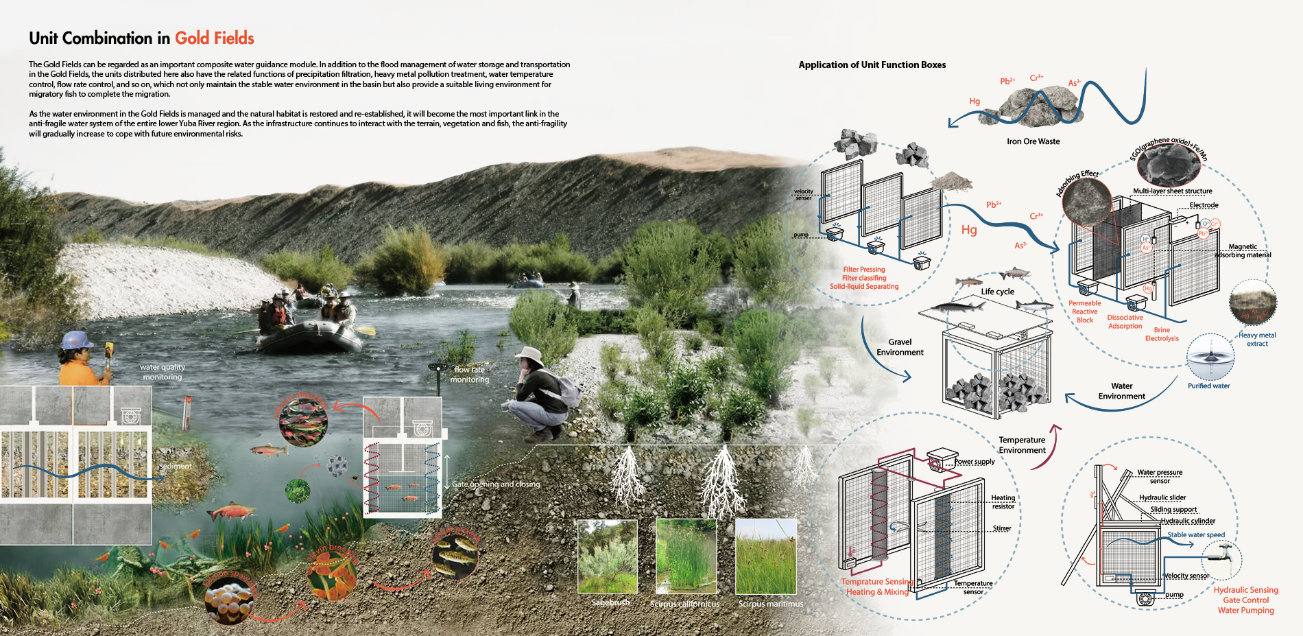
Gold Fields: The core risk management module is the Gold Fields, which serves as the main flood storage area and water reserve space during floods and droughts, with a hierarchical system of ponds using the mine pits. The area is operated with different paths and devices to control water during flood, drought, and normal periods in order to achieve a dynamic balance and reduce flood risk. Other functions such as sedimentation, filtration, purification, and watercourse maintenance are also carried out by means of device function boxes to improve the quality of the stored water and stabilize the water system. Function boxes suitable for fish habitats (e.g. flow control, gravel shaping, etc.), placed in suitable areas, can guide fish through their life cycle in the Goldfields waterway, providing a better solution to the blockage of fish migration paths by dams.
Farmland: The agricultural area can be considered as a secondary stormwater management area outside the gold fields, but still focuses on the distribution of functional points related to agricultural activities such as irrigation and water diversion from agricultural fields and composting of fish organic matter. With reference to the distribution of crops and irrigation water requirements, and with the aid of available information on the areas where agricultural water use is relatively high, the existing network of agricultural waterways will be improved and relatively more irrigation water points will be set up in areas where evaporation is high. At the same time, with the irrigation points set up composting points, after the spawning of the dying adult fish part of the guide to the farmland composting points, mixed bacteria liquid control temperature and acidity to mix and stir, closed fermentation, and then pass oxygen and water to form the final fertilizer into the farmland.
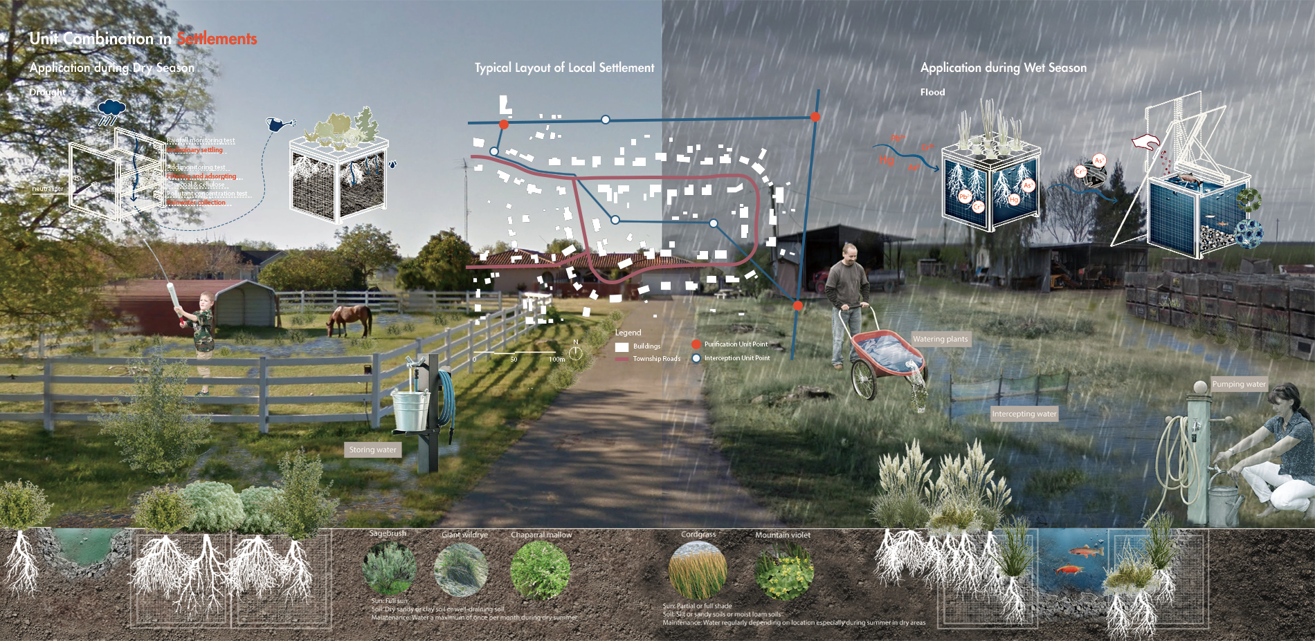
Settlements: The settlements have ditches along the farmland to divert water to the front yard of the farm, where water can be stored during the wet season to divert water to the yard for gardening and also to provide a functional box for wetland plants. In the dry season, the functional boxes of dry season plants shade the shallow ditches, absorbing groundwater and reducing water evaporation.
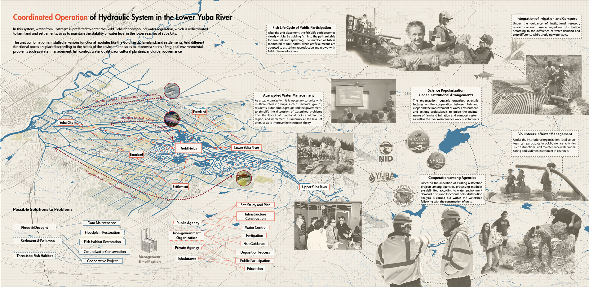
Coordinated Operation
From the point of view of institutional organization and public participation, the modular approach to the placement of the device points in different function boxes unifies the possibilities of water environment management and enhancement in a simplified way, allowing the institutions to identify the problems of the different regional catchments and the layout of the selected functional device points, and then allocate the different stages of operation (e.g. production of the device, placement in the function box, installation, maintenance, public awareness, public experience, etc.) in a uniform and the modular way in order to maximize the benefits of catchment enhancement. Civil groups are involved in the rearing of fish in the units, the harvesting of adult fish, the placement of farm equipment, the control of compost, the detection of flows, the treatment of sediment pollutants, etc. under a resilient system.
Plant List:
- Segebrush
- Scripus californicus
- Scripus maritimus
- Giant wildrye
- Chaparral mallow
- Cordgrass
- Mountain violet