.webp?language=en-US)


Alabama Meadows
Firms
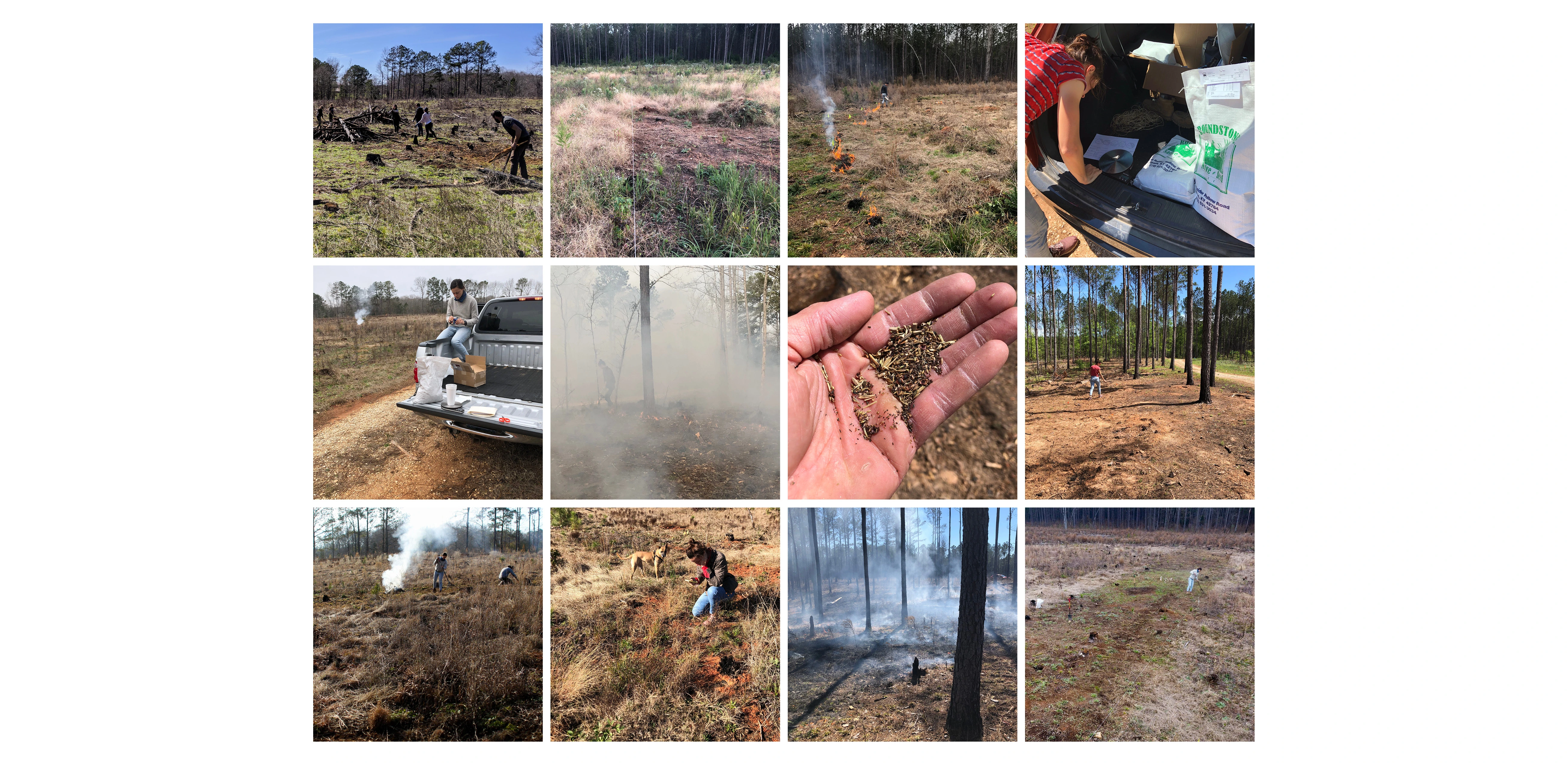

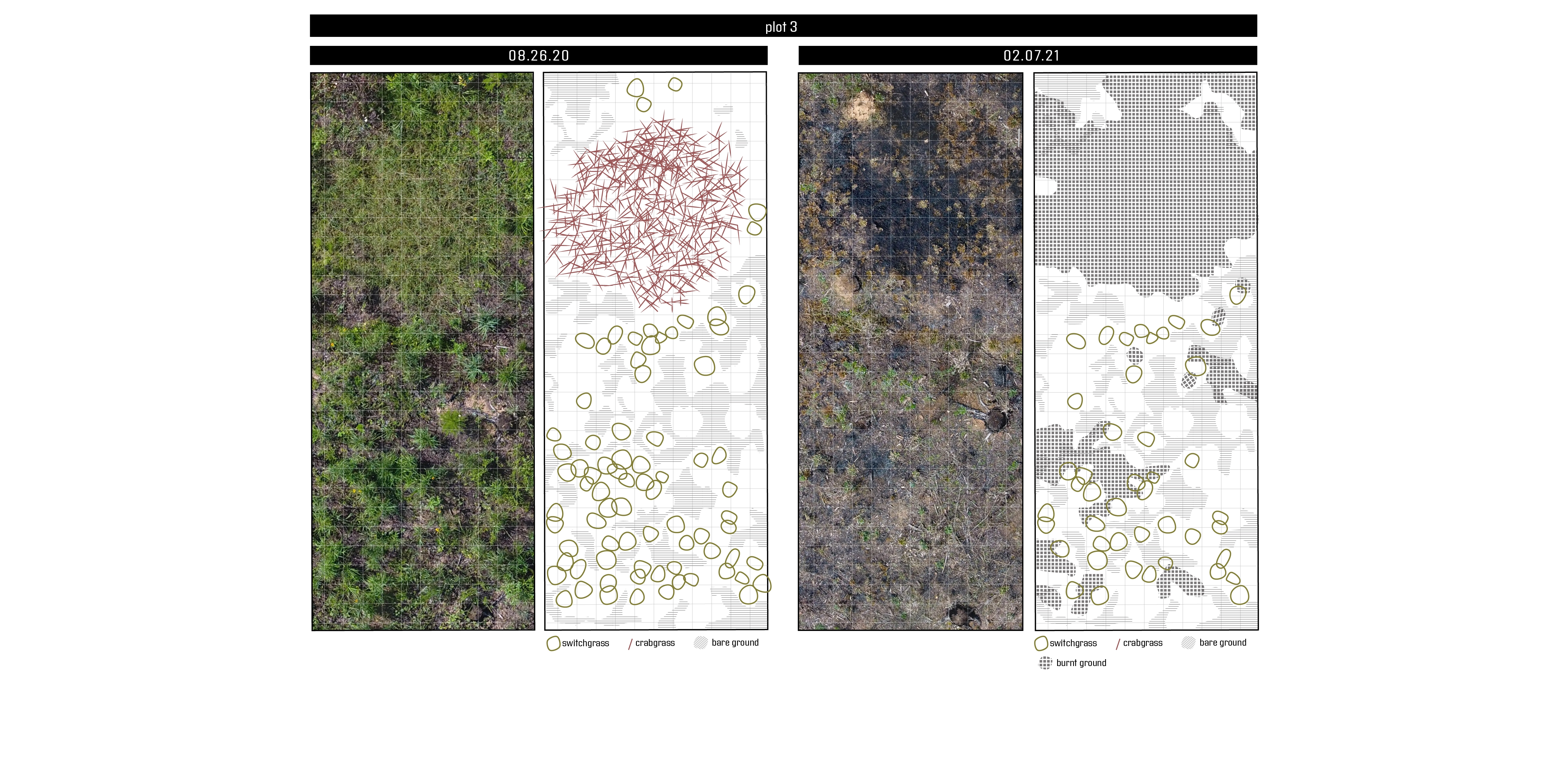


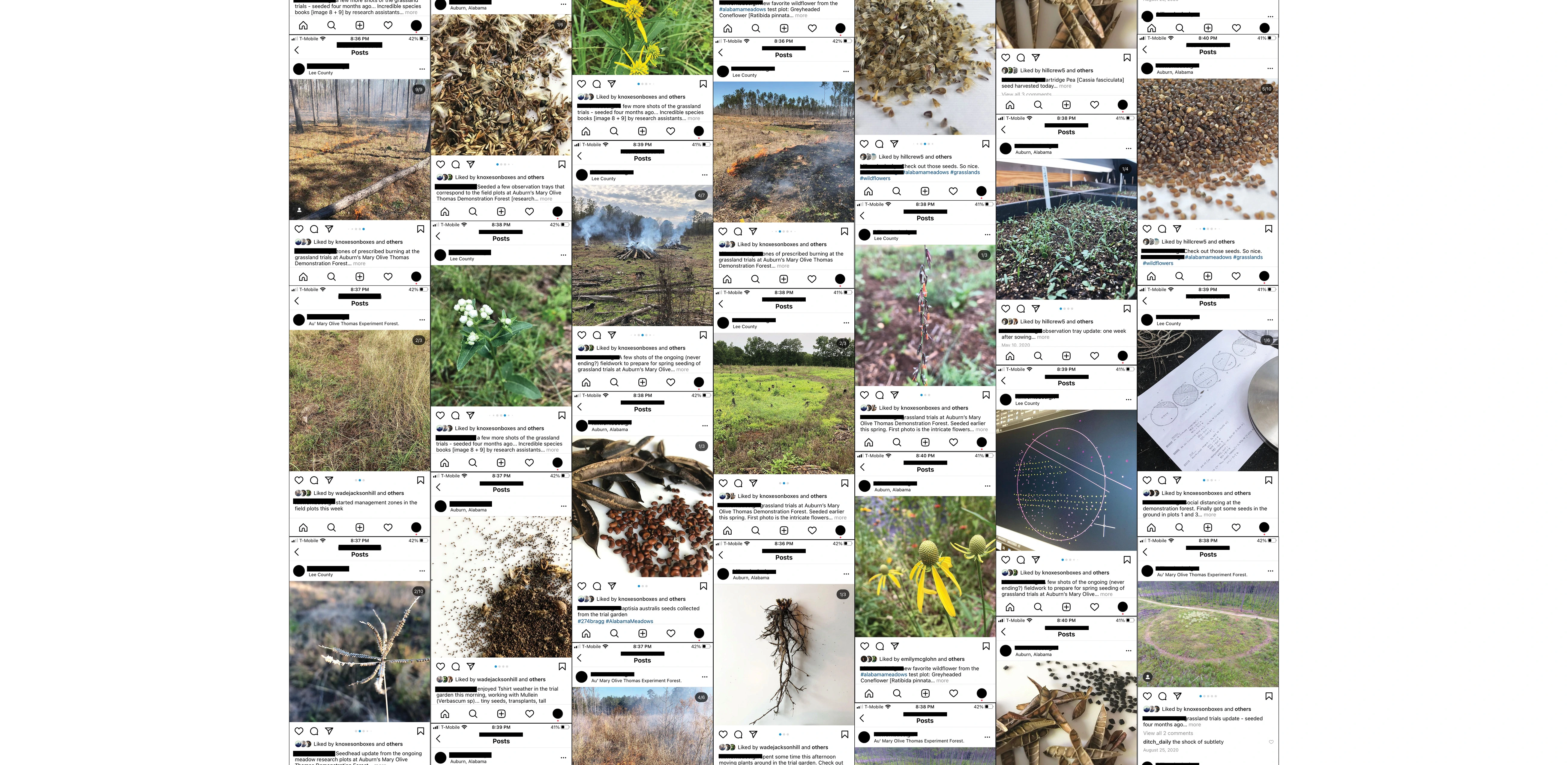
Careful observation and sampling occur regularly using drone and ground photography, active journaling, and field drawing. The meadows initiative aims to recreate long-lost habitat, increase biodiversity, and offer a counter example to the traditional manicured landscape aesthetic of the south, while providing ecological and cultural value to the region.
Awards Jury
-
Alabama Meadows is a field-based research project that seeks to re-build knowledge about the largely eradicated southeastern meadow landscape typology. The project uses grounded theory to guide the installation and maintenance of five meadow test plots at the Mary Olive Thomas Demonstration Forest in Auburn, Alabama. Though historically misunderstood and under-valued, the re-introduction of meadows and grasslands to the southern landscape has the potential to provide incredible ecological and cultural value to the region. Through hours of field work, labor, and careful observation, this research initiative attempts to build on-the-ground experience in re-creating long-lost habitat, increasing biodiversity and providing a counter to the traditional manicured and static landscape aesthetic of the south.
-
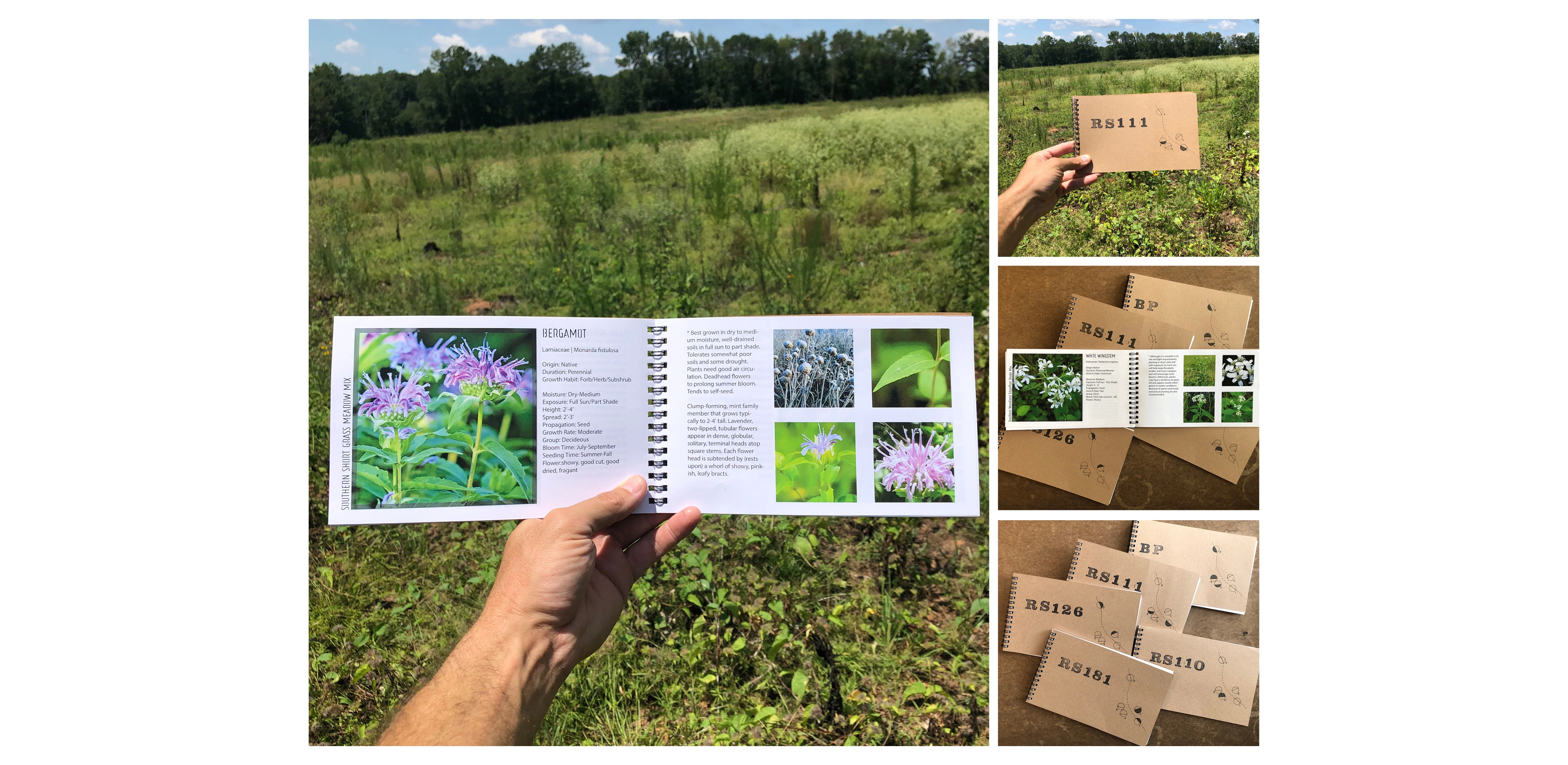
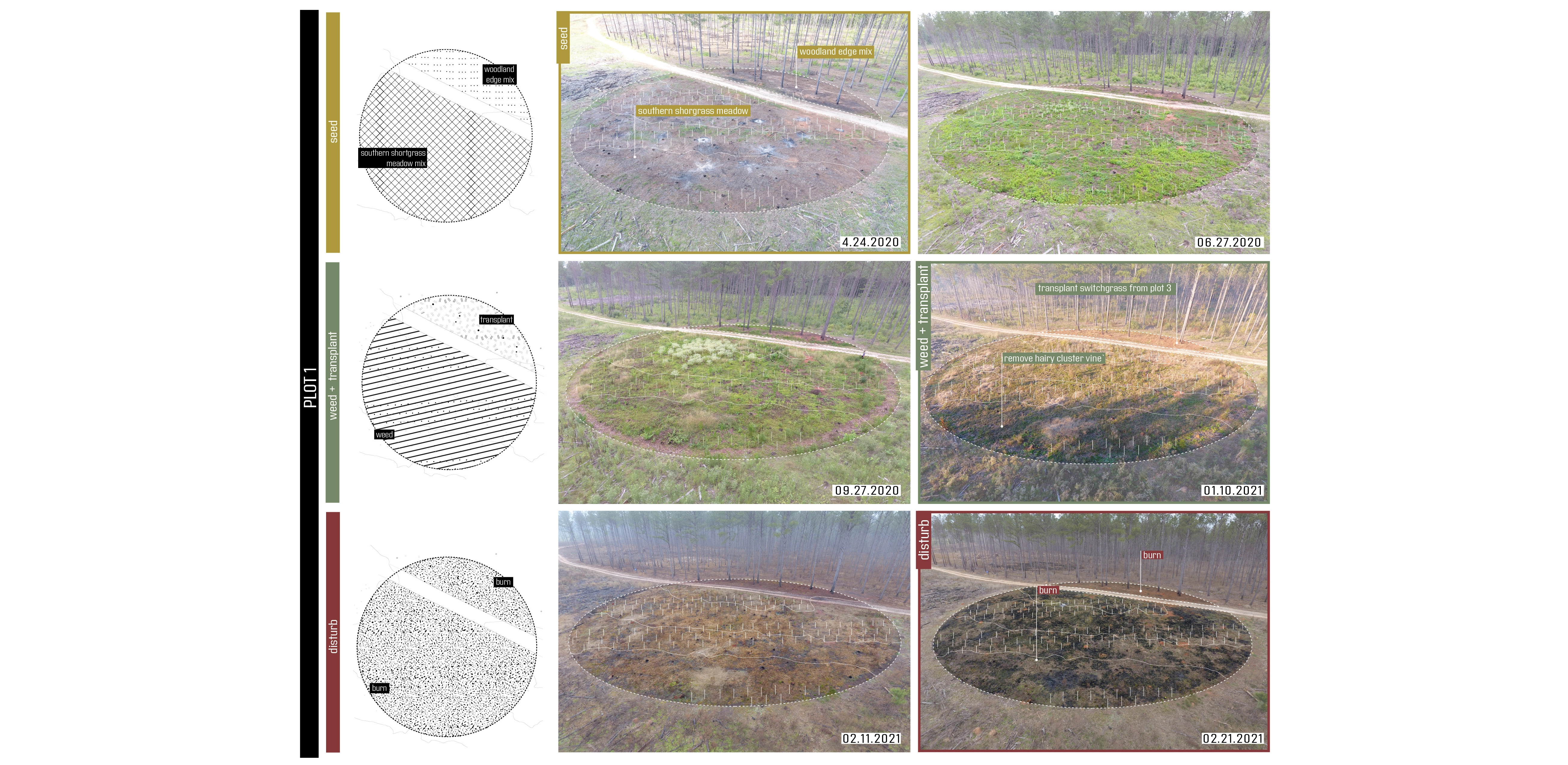
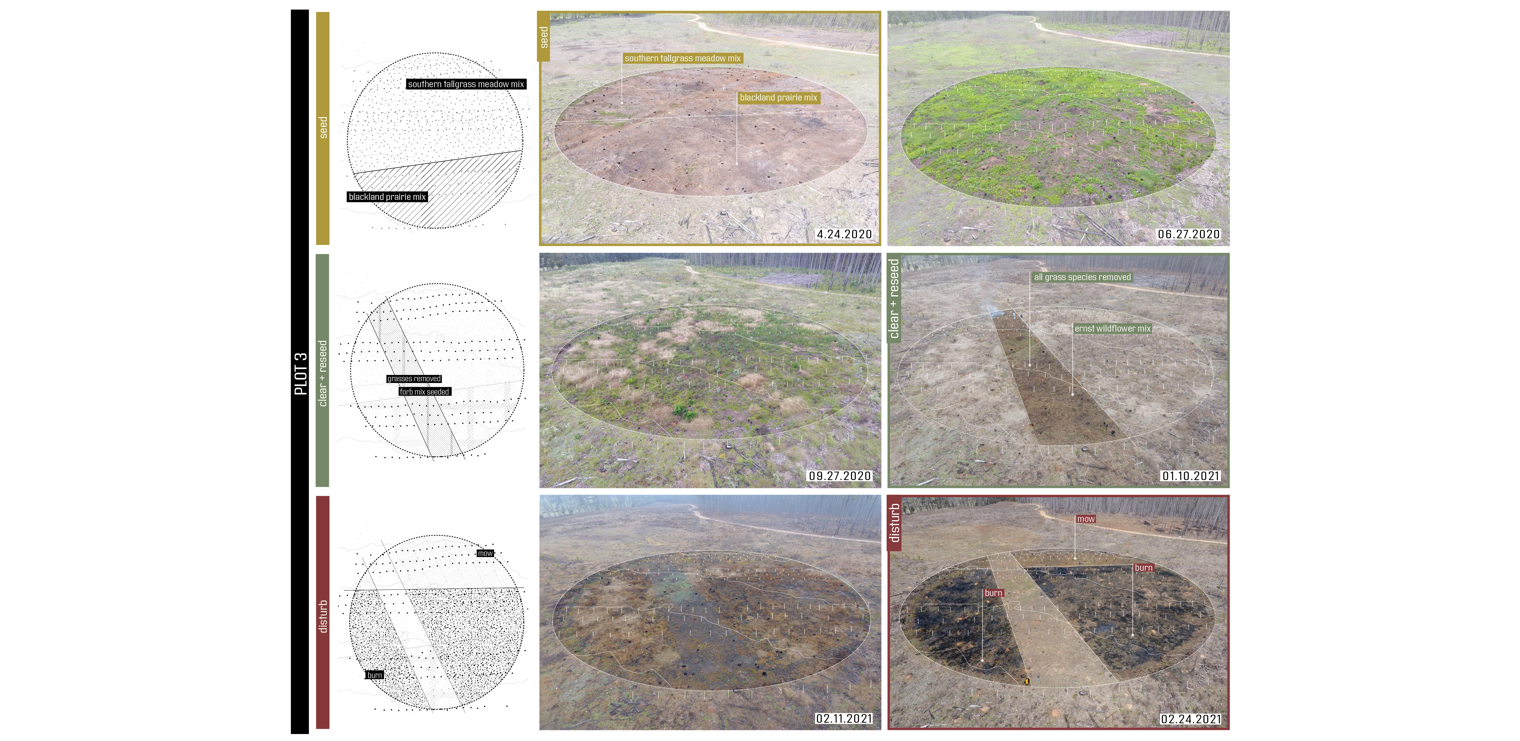
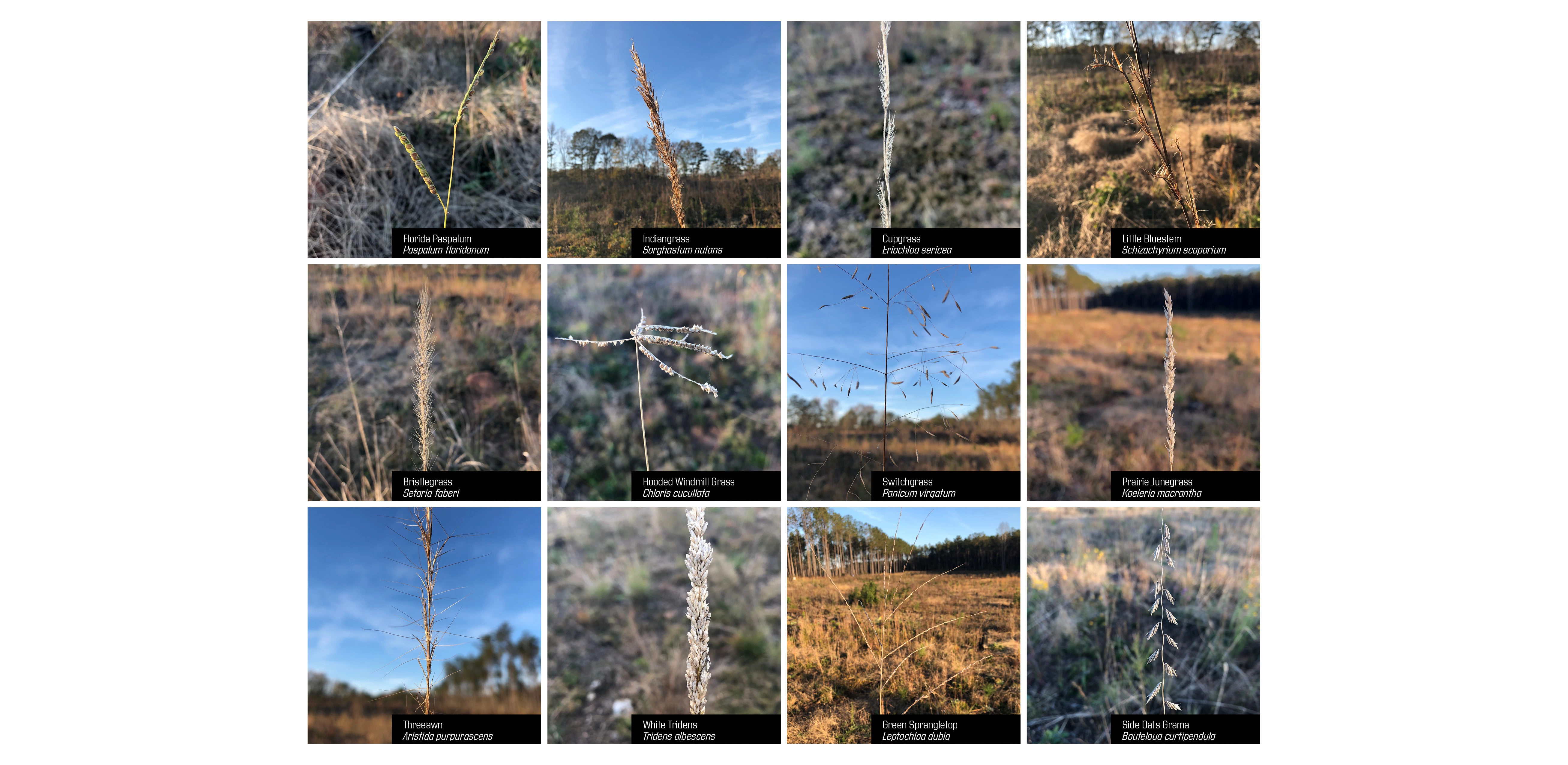
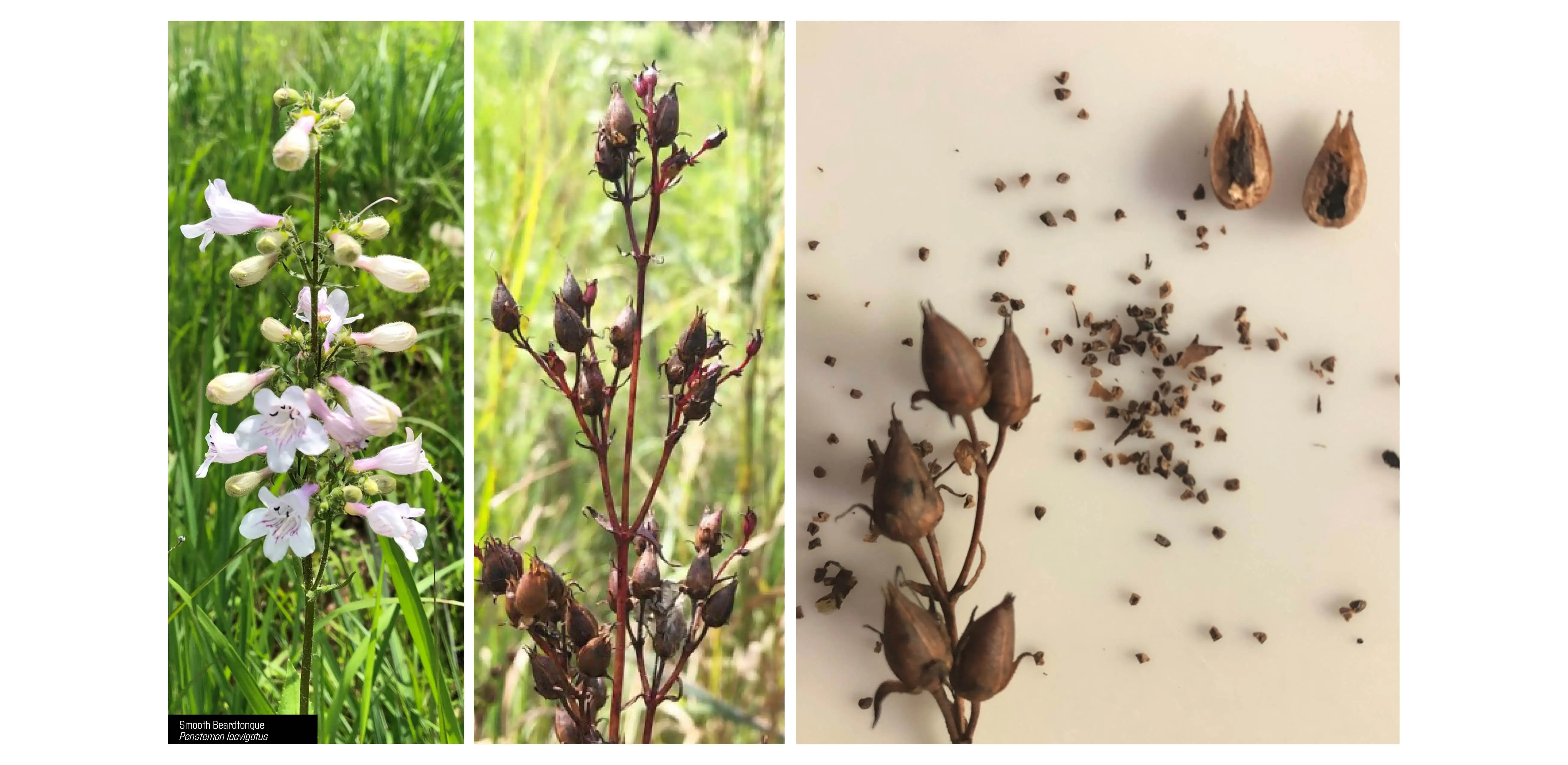
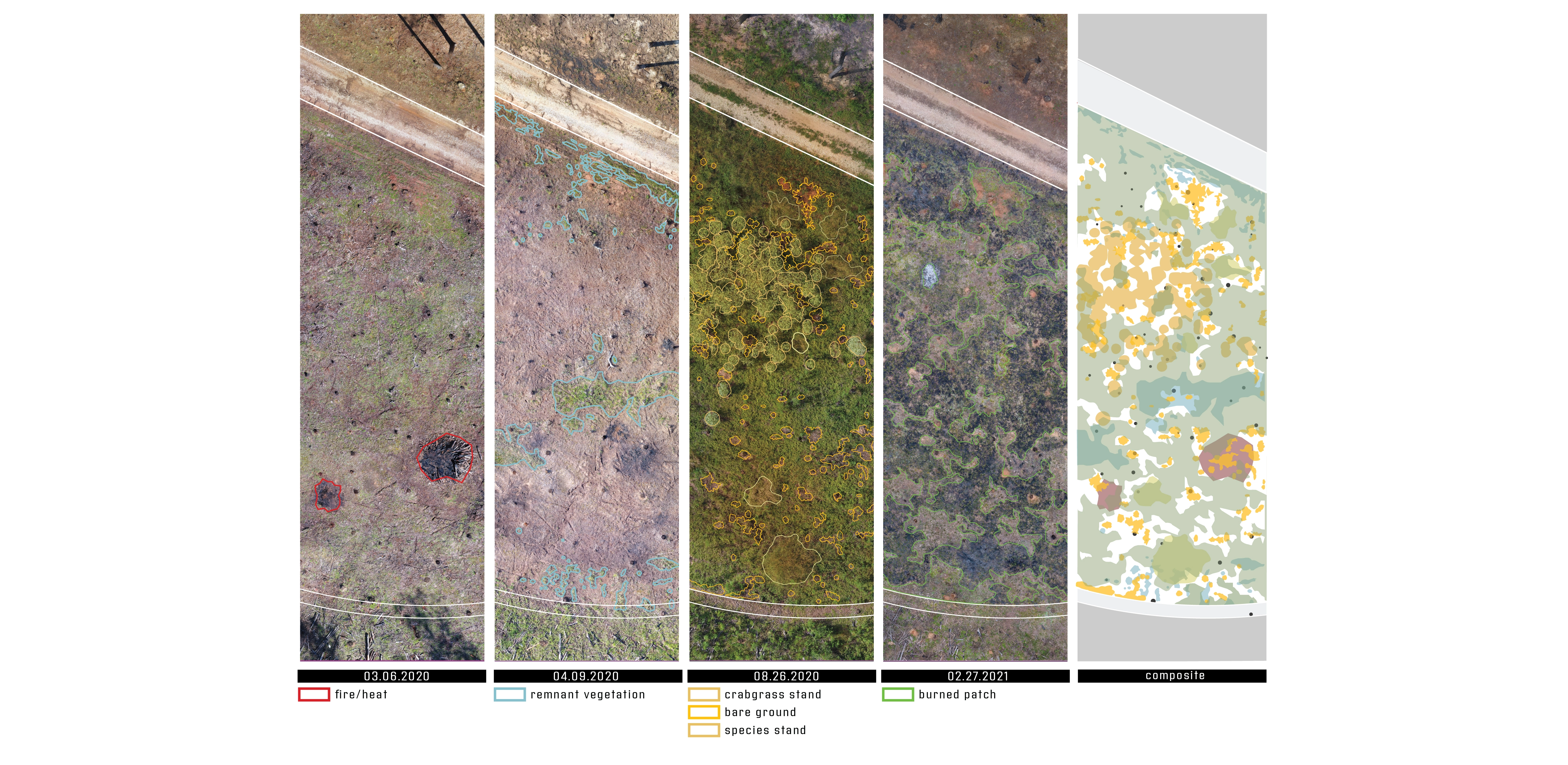
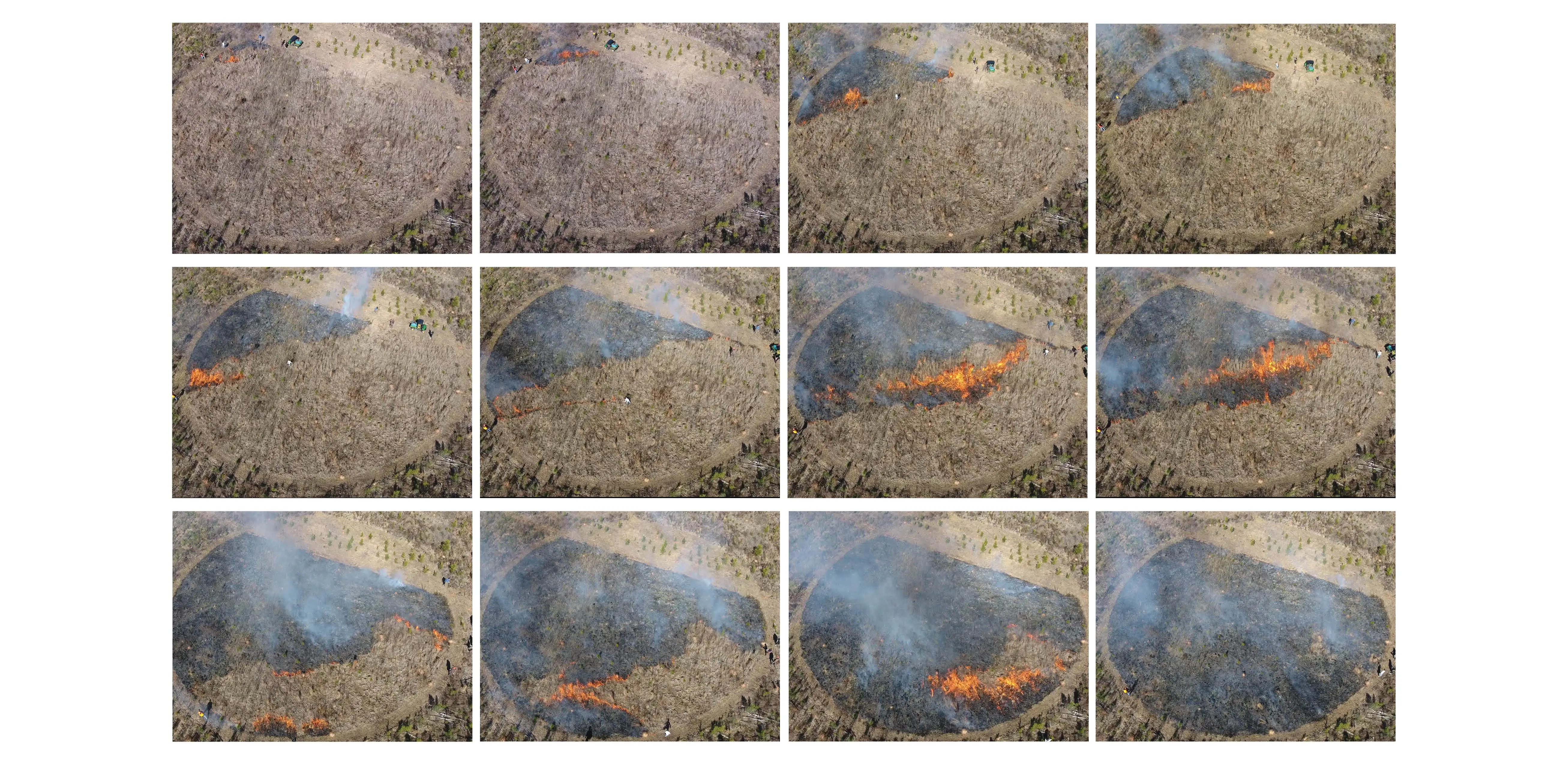
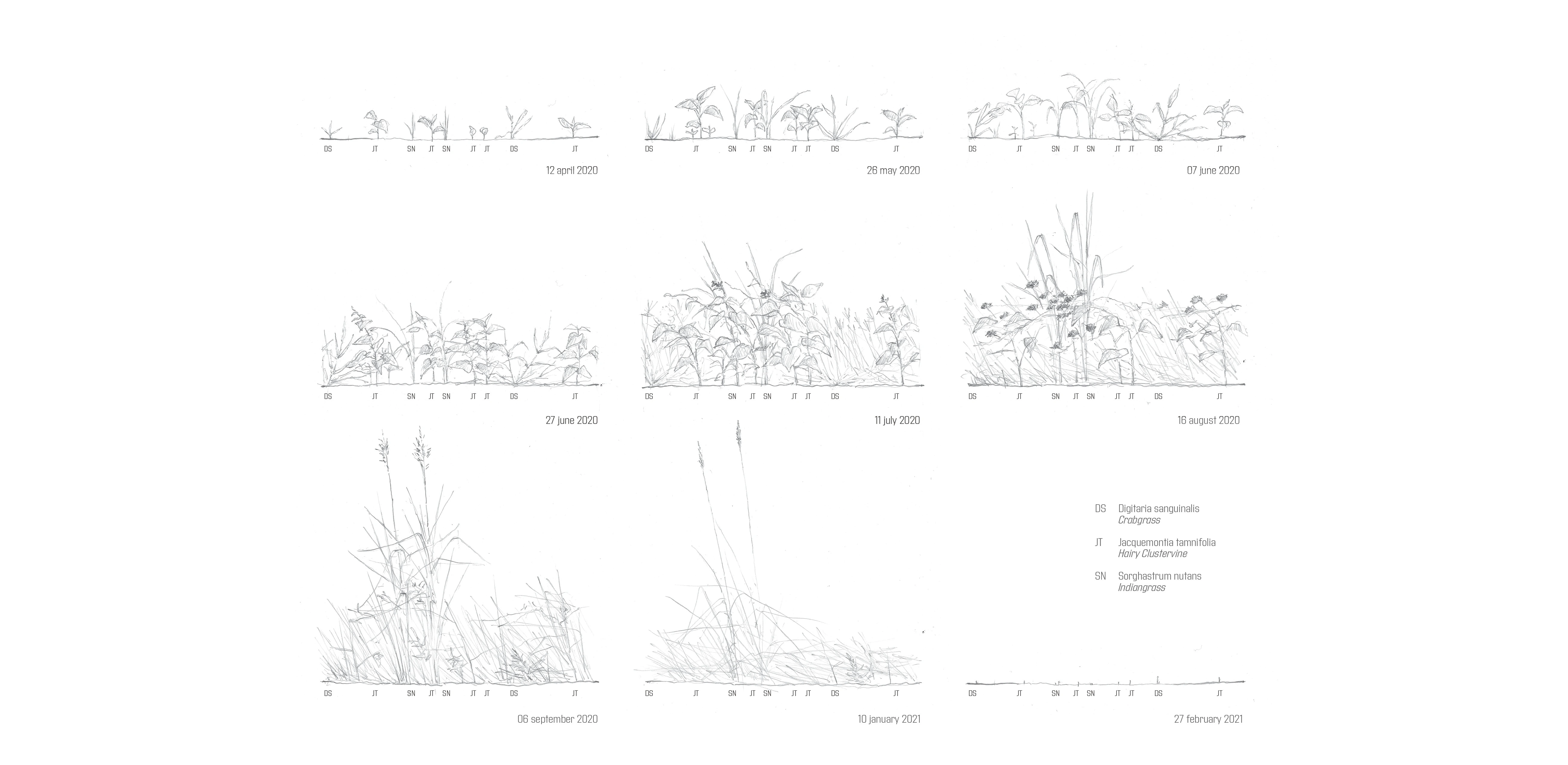
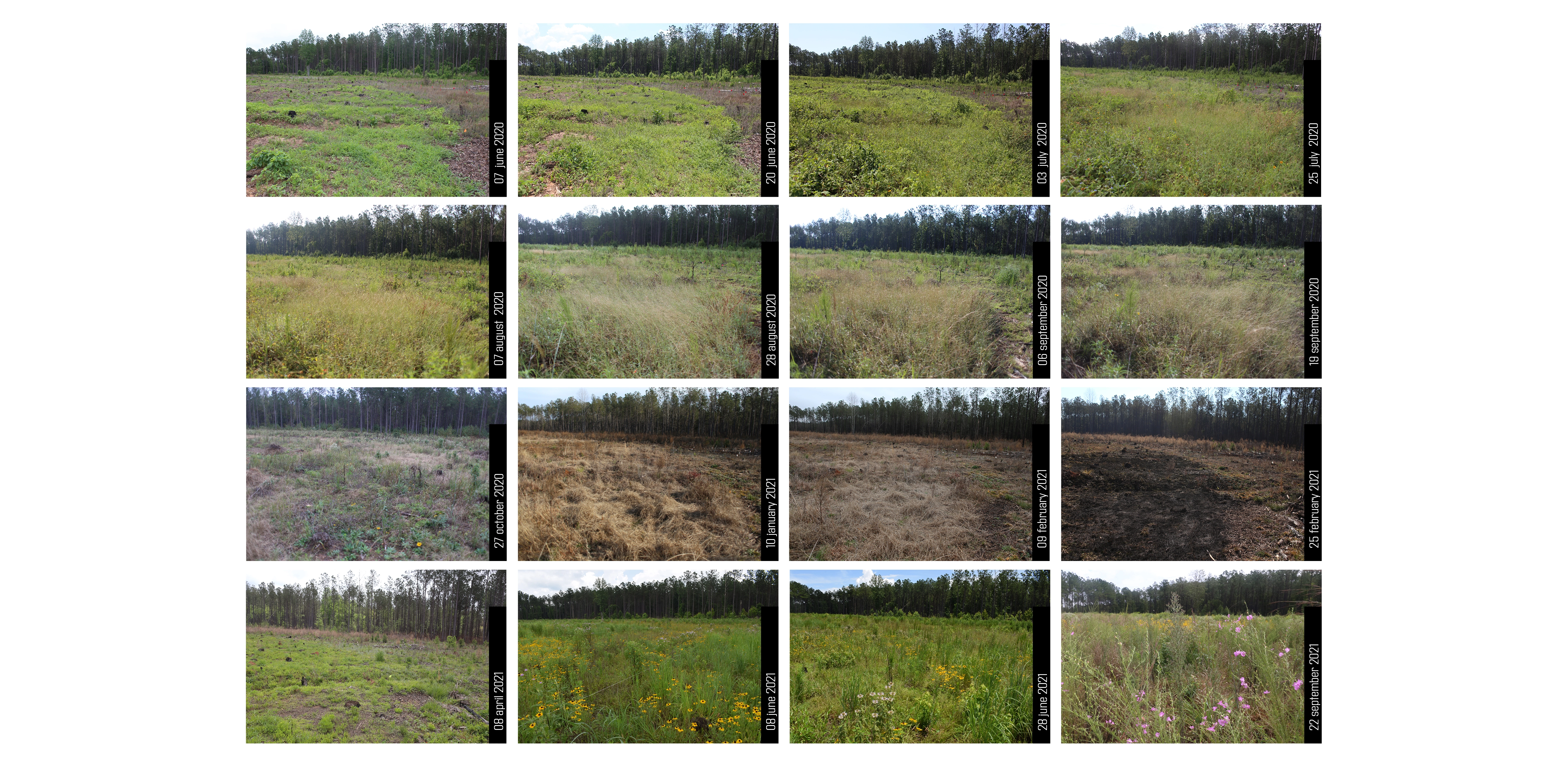
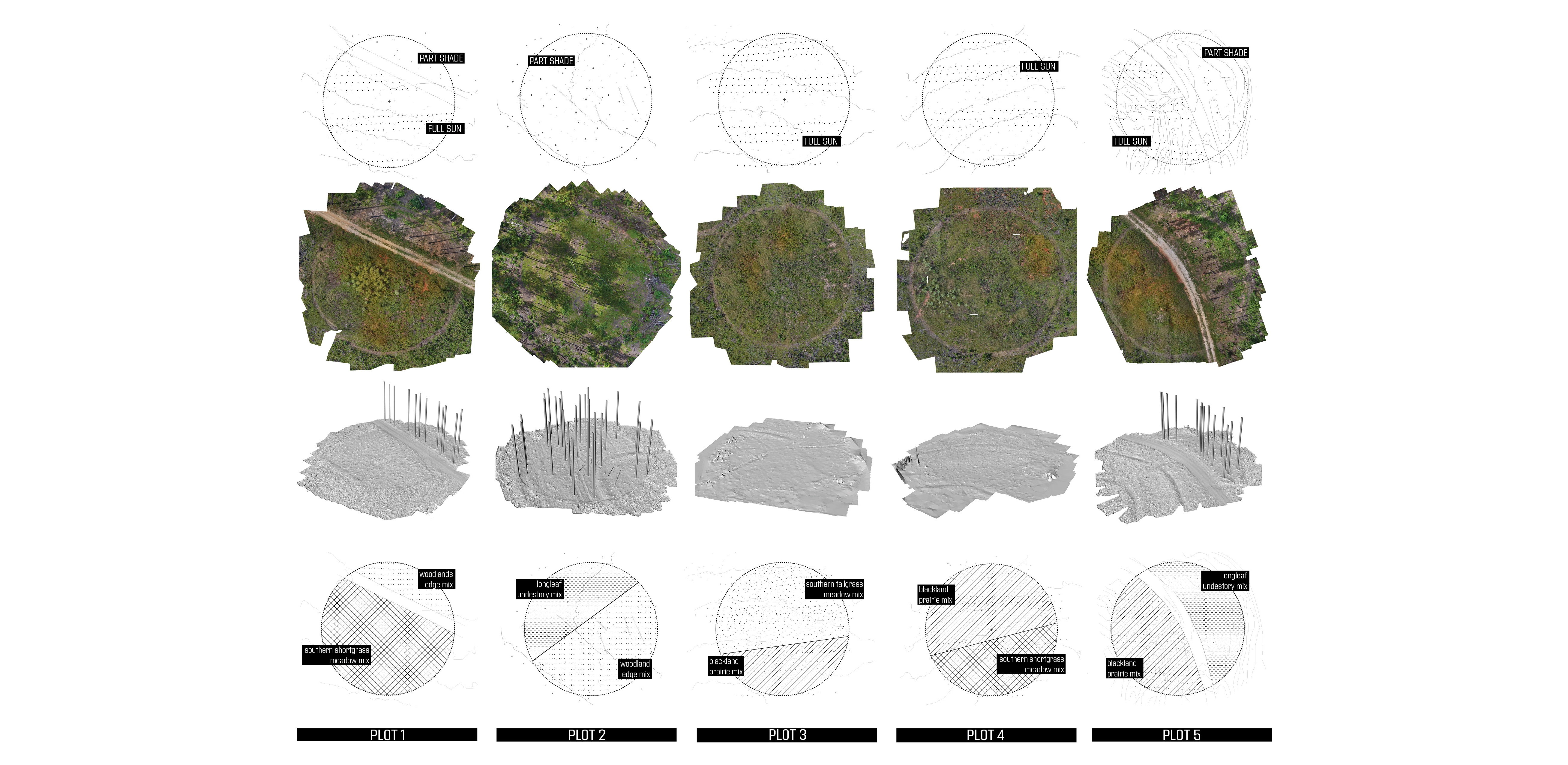
BACKGROUND Meadows and grasslands were once a thriving landscape typology in the state of Alabama. Historically, these grass and forb dominated landscapes were host to thousands of native and endemic species including pollinators, insects, and small mammals. Across the South, these once expansive landscapes have largely been converted or removed to make way for other “high value” uses like commercial forests and residential development. The suppression of natural fire, on which these landscapes depend, has only made matters worse. According to Southeastern Grasslands Initiative (SGI), meadows and grasslands occupy just 10% of their historic range in the across the region. The removal of this critical habitat has had an immense impact on regional biodiversity. Meadows and grasslands are critical hotspots for ecological diversity where even small, fragmented patches serve as a seedbank and safe haven for many species. Our advocacy for and interest in the southeastern meadow typology is not purely ecological – it also lies in a fascination with meadows as a cultural artifact. Amidst the typical sprawling condition of suburbanization, patches of wildflowers and tall grasses offer an alternative to the static, controlled turf grass that permeates the south. Meadows provide richness in light and texture rarely witnessed in the region. In a landscape otherwise dominated by regimented commercial forestry and agriculture, grasslands provide immersion and otherness that have the capacity to captivate the imagination. Though slowly re-gaining interest, a general lack of knowledge has made the re-introduction of grasslands and meadows slow and difficult. There is little documentation about appropriate installation methods or long term management, and thus, all too often meadows are installed and maintained like lawn or a field crop. Traditional, heavy-handed management, like soil enhancement, irrigation, and fertilization typically lead to the colonization of non-desirable and invasive species, which keep the intended meadow plants from reaching their full potential. If this typology is to be successfully re-introduced, appropriate installation and maintenance strategies must be tested and developed. GROUNDED THEORY The Alabama Meadows research borrows from the rich methodology of Grounded Theory. First described by Glaser and Strauss in 1967, Grounded Theory seeks to immerse the researcher within the data, “grounding” them within context and specificity, allowing research discoveries to be unearthed from within. This methodology has taken many forms through the years, but the Alabama Meadows initiative has truly spatialized this approach to research. The test plots were designed not to prove or disprove specific hypotheses prior to installation, but rather to fully immerse the researchers (and visitors) within the ongoing, first-hand ‘data’ of the meadow. Immersion occurs through the on-the-ground layering and testing of a diverse collection of variables over time. Layering different configurations of site conditions (solar, hydrological, soil, etc.), species selection, installation techniques, and management regimes across the project allow us to produce, observe and collect the large dataset from which our learning emerges. Five test plots were installed at the Mary Olive Thomas Demonstration Forest in the spring of 2020. Each was designed to generate a collection of gradients and layered conditions that can be manipulated and observed through time. Each test plot (composed of one 150’ diameter circle) is sited within the Demonstration Forest to offer a particular solar orientation, soil condition, hydrological flow, and/or wind exposure. For instance, Plot 4 lies on a fully exposed south facing slope, while Plot 2 is embedded within the dappled shade of a Loblolly Pine stand. Each of these unique microclimates and site conditions were subdivided and seeded with at least two seed mixes. Six seed mixes sourced from three different distributors were seeded across the five plots. Over the last two growing seasons, each plot was layered with distinct disturbance regimes, including hand weeding, over-seeding, transplanting, mowing, and prescribed burning. As a specific example, Plot 3 has been divided into zones, each receiving calibrated treatments of seeding, clearing, weeding, transplanting, burning, and mowing. Those operations have cumulatively constructed the unique condition within each zone of each plot. Each interaction we have is responsive to existing growth or decay, species composition and performance. Over time, these on-going interactions will construct a spatially and ecologically shifting field upon which we can continuously build our work. OBSERVATIONS AND DRAWINGS The medium of landscape is notoriously difficult to capture and represent faithfully. The discipline relies heavily on static representations of place, omitting the richness and nuance of the landscape, which is constantly in flux. Complex landscapes, like meadows and grasslands, are too often forced through a technocratic lens in order to simplify and regularize their components and interactions. Prototypical construction drawings beget static objects for construction; they are not suited to capture the highly temporal conditions of the project, like the seasonal emergence of grasses, species competition or spells of wet and dry. The Alabama Meadows Research grapples with those challenges, extending the disciplinary tools to better record and represent change through time, process and operation - embracing the complexity of the landscape we are continuously generating. Careful observation and sampling occurs regularly throughout the plots. Techniques of drone photography, ground photography, active journaling, and field drawing allow the researchers to not only see the changes but give them tools to analyze relationships that are obscured by time. Photographs employ fixed station points and consistent frames. These tools allow the researchers to compare events that were separated by time, such as the effects of high temperature fires on the next season’s growth patterns and species makeups, or the relationship between a native grass species and a weedy colonizer. The collection of photographs, drawings, and artifacts serve both as a tool to learn about the grasslands, but also as a mechanism to challenge traditional methods of landscape representation. Research within this initiative extends well beyond the lessons learned from the physical installation and maintenance of the grassland. These plots simultaneously serve as a means to explore new techniques in gathering field information, provide first hand opportunities for observation, and ground for testing new strategies for representation of landscape dynamics and change through time. LOOKING FORWARD At the writing of this text, the Alabama Grasslands Project is entering its third growing season, with signs of spring just barely emerging. These early years have already offered researchers invaluable insights into site preparation strategies, installation techniques, and intimate knowledge of the character and habit of a large number of grass and forb species. The work and methodology will continue into year three and beyond – though now that each meadow is established, observations will focus increasingly on long-term management dynamics and their impact on species distribution and densities. As each plot continues to evolve, the intended research will also expand to include the observation and dissemination of the spatial and aesthetic qualities of the plots. This combination of insights, from meadow installation, change over time and spatial quality, will continue to serve the discipline by generating a body of knowledge, making the re-introduction of meadow and grassland typologies back into landscapes more approachable for designers and clients throughout this region.
-
- Lily Dendy - Graduate Research Assistant
- Hannah Keltner - Graduate Research Assistant
Advertisement
Related Awards
Honor Award, Research
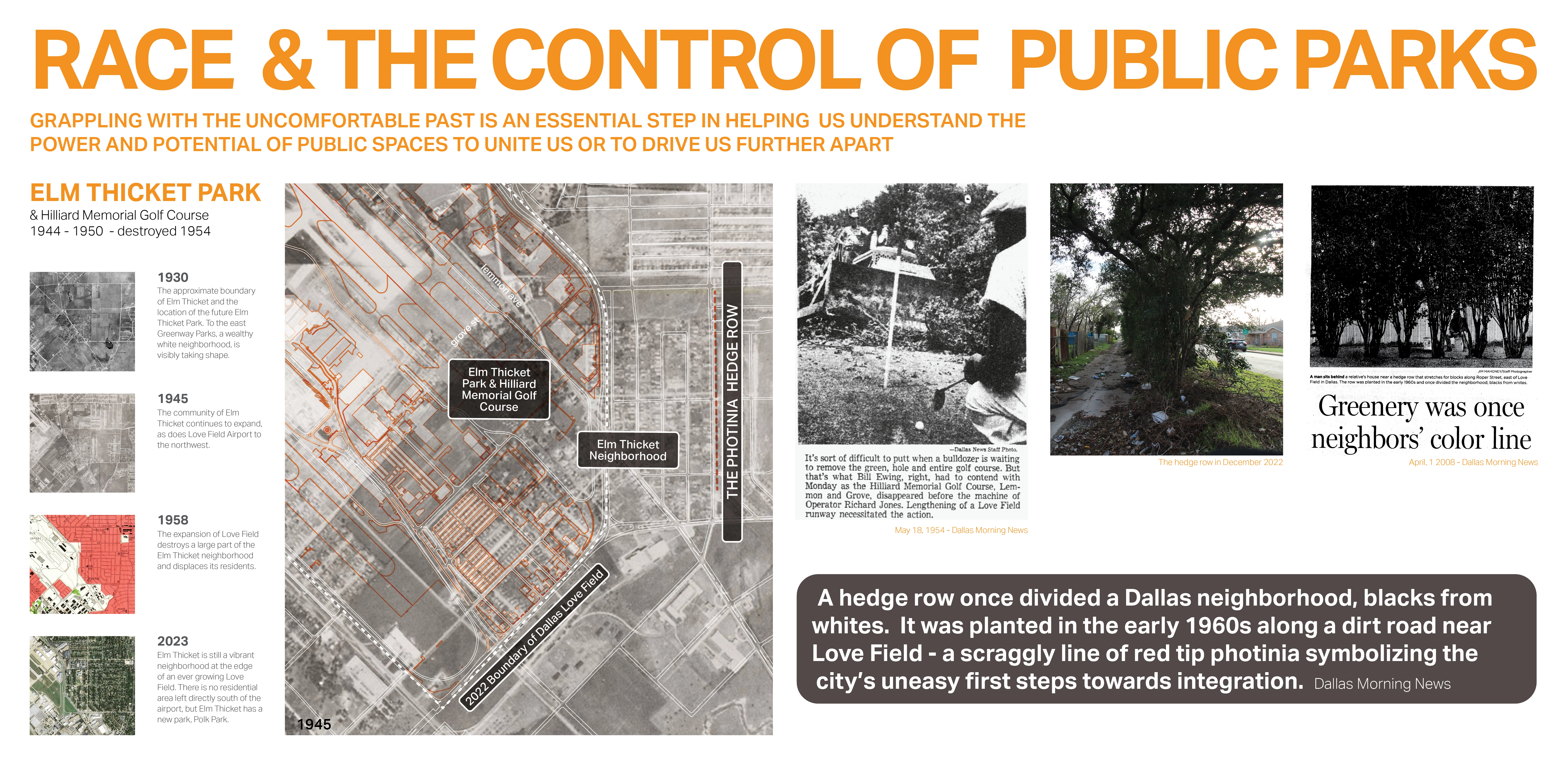
Race and the Control of Public Parks
This research uses a century long historical analysis of the public park system in Dallas, Texas, USA to uncover the physical and psychological ways in which public landscapes and the works of landscape architects have segregated urban spaces and how we might fight against these design practices. Through reframing past practice this work seeks to create a method for informing design thought and practices that seek to create a more just built environment.

Related Articles
Landscape Architecture Magazine
LAM Wins Five ASBPE Awards
Landscape Architecture Magazine earned national and regional honors for editorial excellence, publication design, and profile.
Jun 1 2026