.webp?language=en-US)


The Restoring of a Montane Landscape
A lot of effort was put into restoration of the landscape and attention to detail. The gestures made throughout the whole landscape are amazing. An enormous undertaking and very impressive.
Awards Jury
-
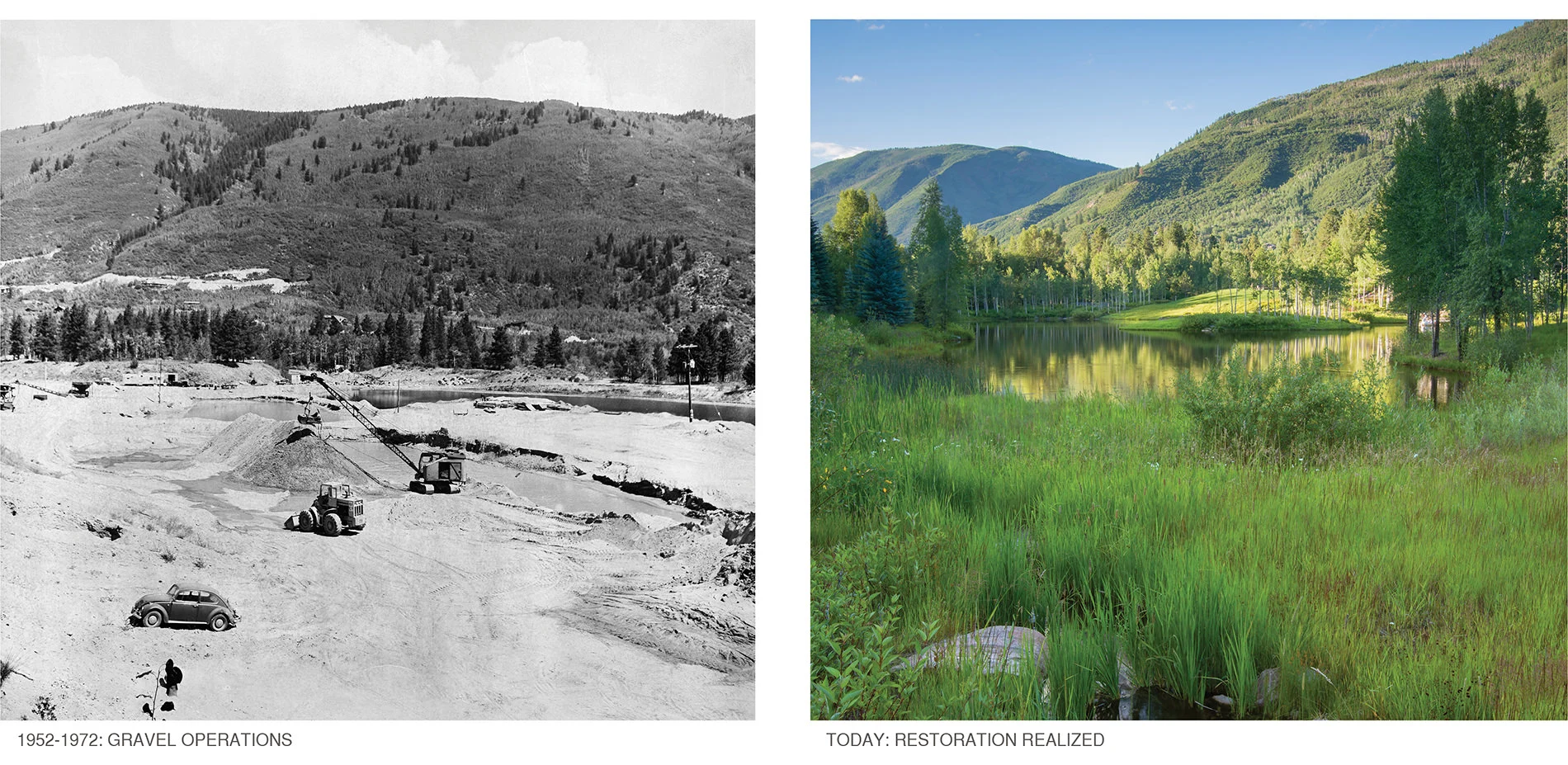
The design for this 28-acre property combines the landscape architect’s creative vision with the owner’s commitment to land stewardship, environmental sustainability and responsible management. The site, a complex and dynamic natural ecosystem, was a virtual wasteland for almost a century, its natural resources – centuries-old Ponderosa pine trees and gravel – harvested and mined for use in building the infrastructure of a burgeoning city. In the 1970s, the abandoned property, identified by its gravel piles, raw soil and rampant weeds, became the temporary site for a tree farm and a campground for transients.
Through an artful application of ecological principles, a multi-disciplinary team transformed a dark-side-of-the-moon landscape into a high performing montane ecosystem challenged by harsh climatic conditions and condensed growing seasons. Today, ten reintroduced vegetation communities – including aspen and mixed conifer forests, sagebrush shrublands, meadows, and riparian landscapes – reconnect critical wildlife corridors, improve regional watershed quality, and encourage recreational opportunities. -
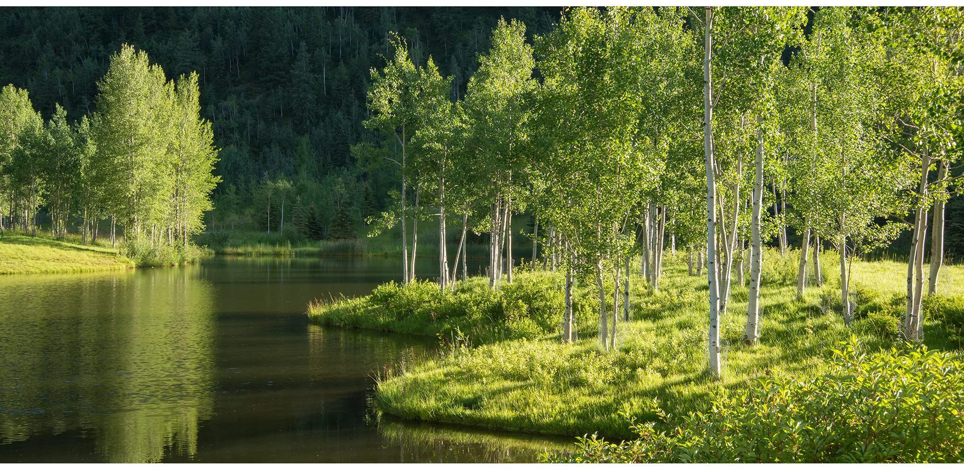
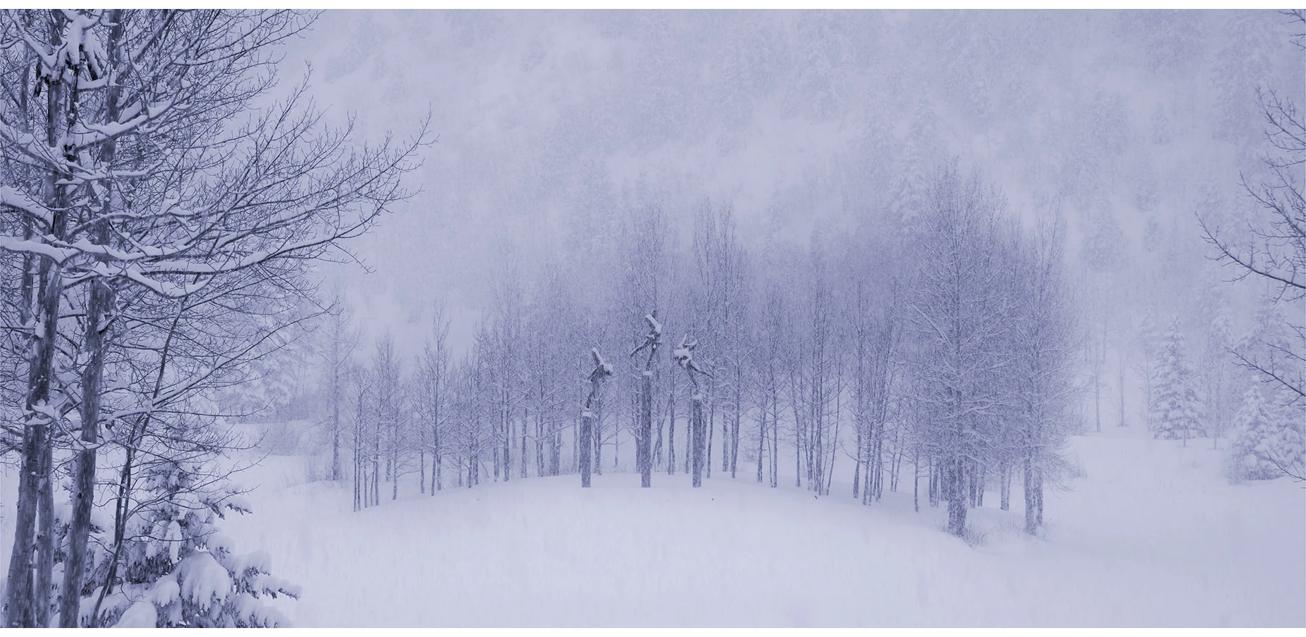
Situated just 13 miles west of the Continental Divide, the property is located at the end of a glacially-formed mountain valley. At 8,000’ in elevation, the site falls within the Montane Life Zone, a distinct ecosystem characterized by moist and cool north and east-facing slopes covered with aspen and mixed conifer forests, and intervening riparian and wetland ecosystems. Highly valued for their conservation values, montane landscapes are complex and dynamic, representing thousands of years of adaptations by living things to the natural processes occurring within them. Sudden changes in moisture availability, plant or animal diversity or development can degrade and often destroy this fragile landscape.
A notable Ponderosa pine forest once thrived on the site’s sandy soils and shallow groundwater. During the Silver Boom of 1890, miners and loggers harvested the trees, using the timber for mine and home construction. The few remaining trees, including one estimated at more than 125 years old, are some of the largest and oldest specimens found in the region.
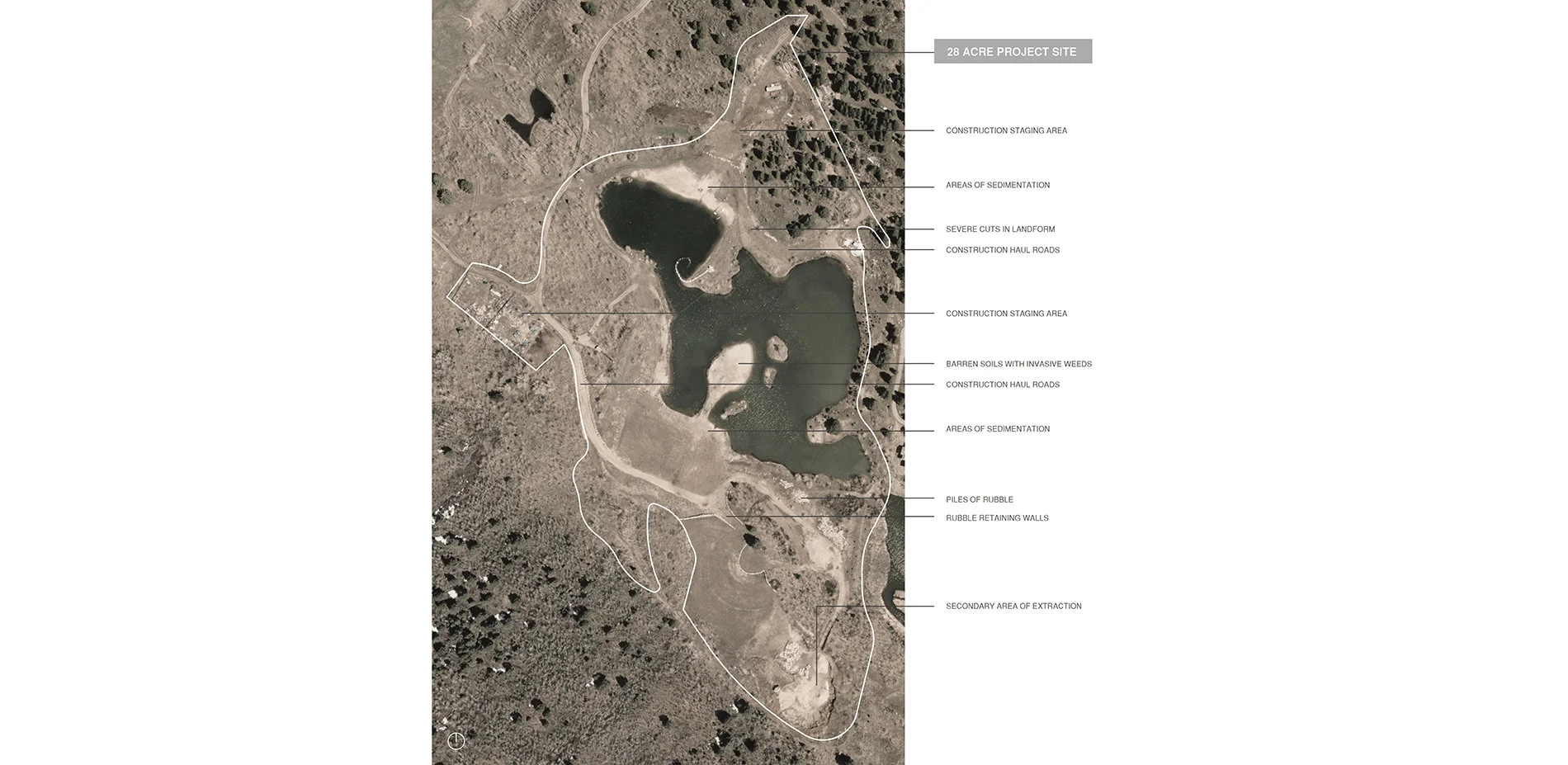
The site is located on the terminal moraine of a glacier that retreated some 11,000 years ago, leaving in its wake a 300’ deep glacial outwash of sand, gravel and boulders. In the mid-1960’s, the State Highway Department established a sand and gravel operation on the property. Extraction and gravel mining on the site generated a crude 6.5-acre hole in the ground, which instantly filled with groundwater.
Multi-Faceted Restoration
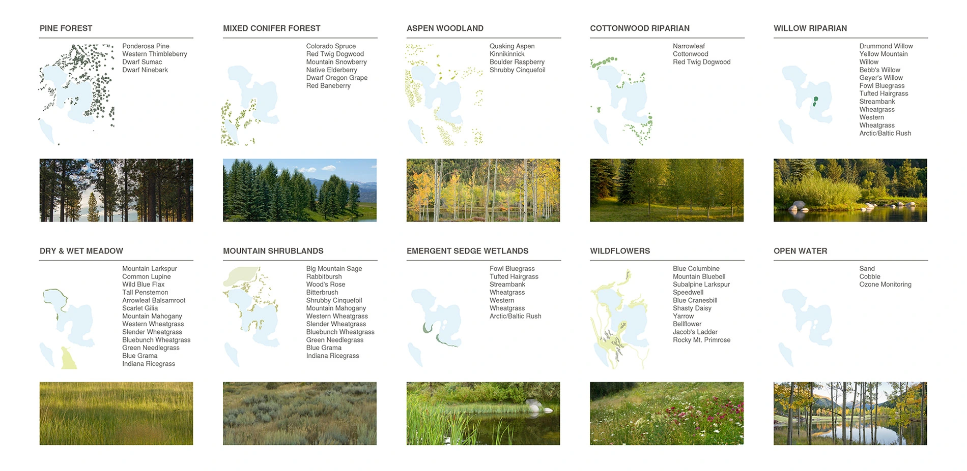
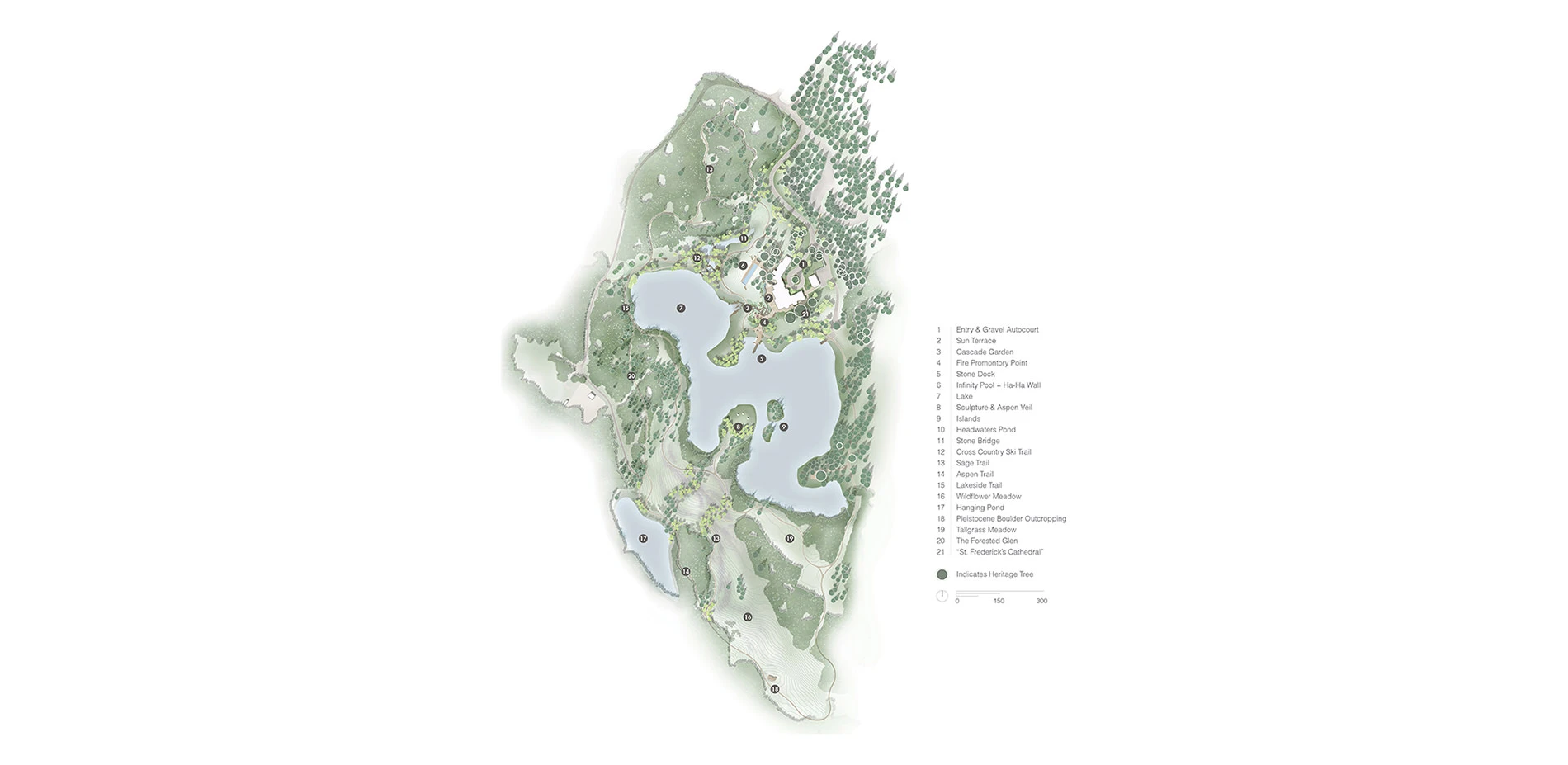
Restoration of the neglected, barren and weed-infested property began with an analysis of surrounding existing environmental conditions, including a detailed study of predominant vegetative communities, species composition and density, and microclimates that would inform the development of an overall design for the property. A complete site analysis revealed extreme climate variations, including intense solar exposure, prevailing winds, temperature fluctuations and extended snow coverage from October through April. In addition, a study of the regional Montane plant communities suggested the implementation and/or reintroduction of ten distinct vegetation types including pine forest, mixed conifer forest, aspen woodland, cottonwood riparian, willow riparian, dry meadow, wet meadow, emergent sedge wetland, mountain shrublands, wildflowers, and open water.
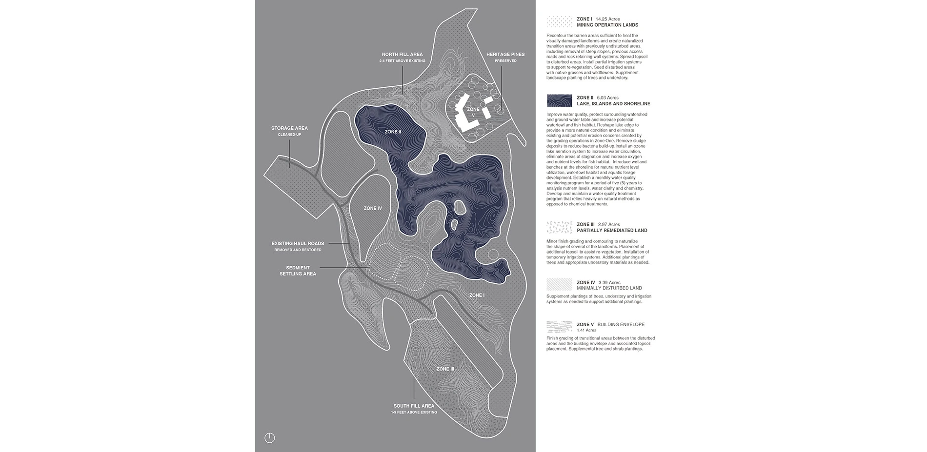
ZONE I – Previously Mined Land (14.25 acres)
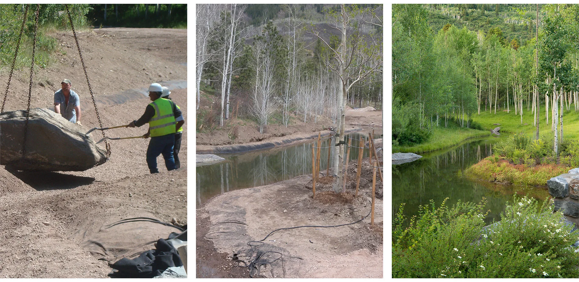
The visual remnants of the gravel operations – exposed embankments and barren land clearings – required extensive soil enhancement, land contouring, and native vegetation restoration at a macro-scale. In order to create a seamless transition between disturbed and preserved lands, the landscape architect identified existing drainage patterns and plant communities on adjacent properties, and then extended, restored or recreated them on the site. This strategy proved successful in restoring native plant communities and strengthening wildlife habitat. Today, corridors of fir and spruce, reintroduced in existing drainages, provide a protected linkage between the mountain and the lake for mule deer, elk, even an occasional cougar, in all seasons.
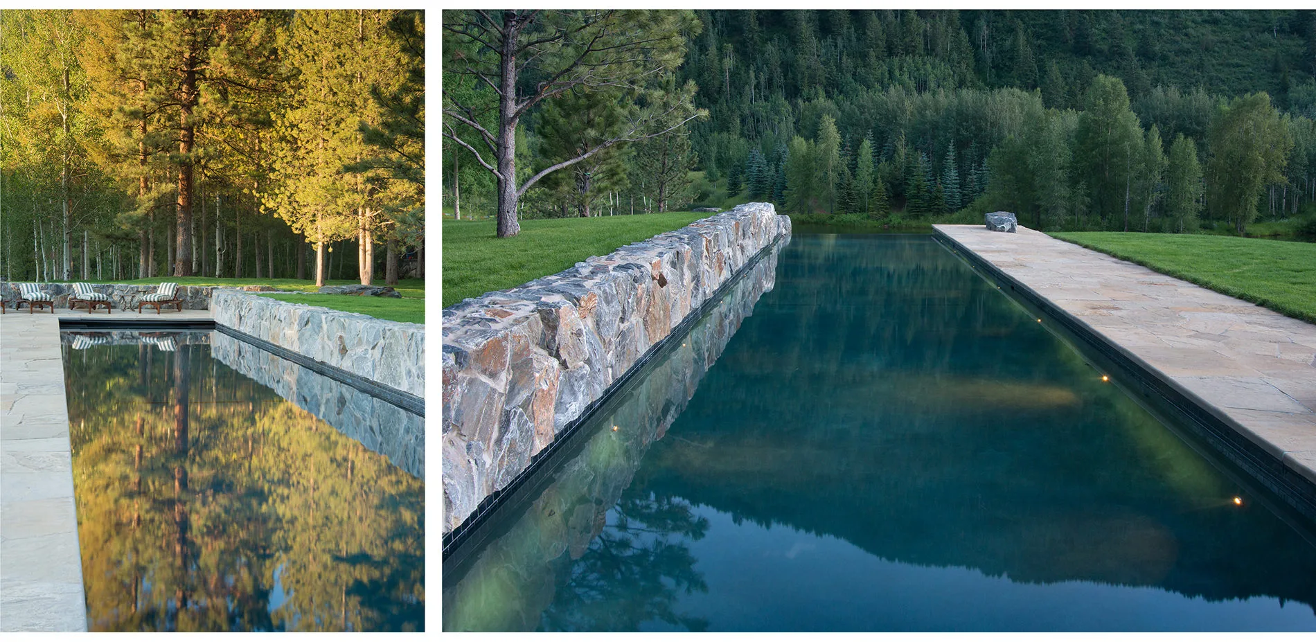
ZONE II – Lake, Shoreline and Islands (6.03 Acres)
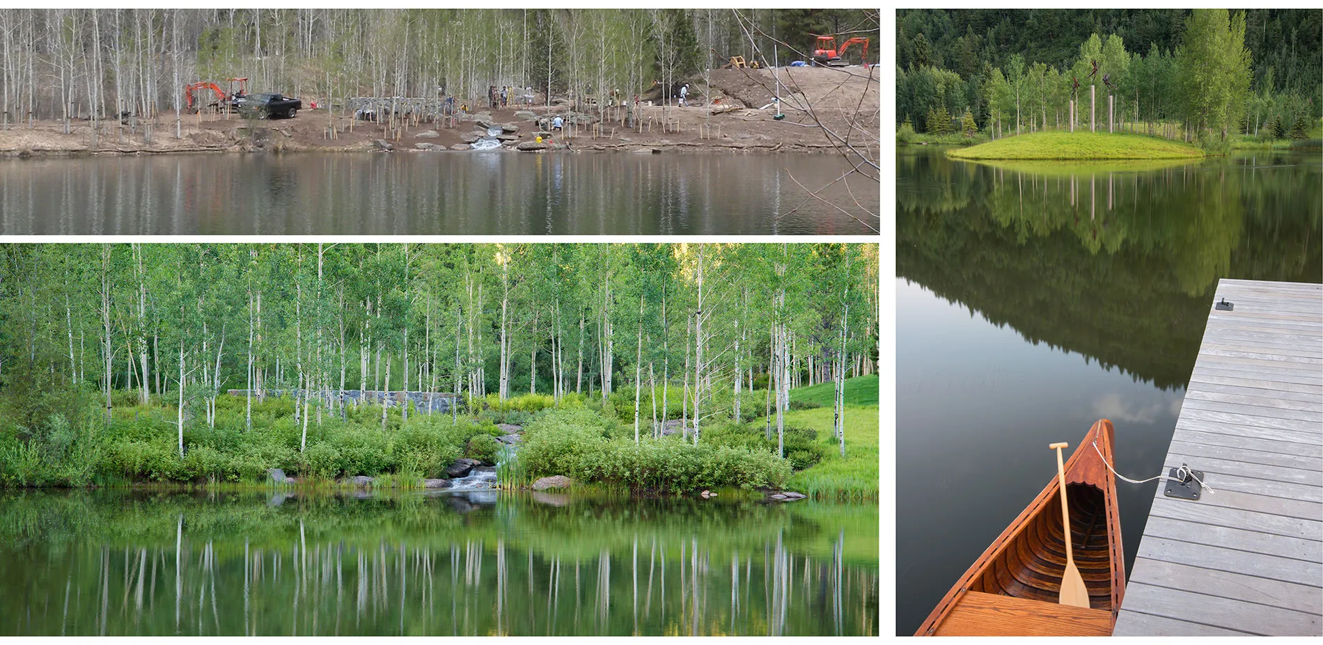
Compacted soils and steep slopes had rendered the lake’s shoreline an aesthetic eyesore and a sterile ecosystem. To remedy the situation, the landscape architect reshaped almost a mile of the shoreline, implementing five acres of introduced wetlands. Sedges, reeds, cattails and other wetlands species were planted at varying water depths. Almost immediately, the lake became a refuge for birds and wildlife, and the wetlands continue to provide a multitude of services including water filtration, and erosion and sedimentation control. In addition, water percolates from a deep underground aquifer, contained and protected by layers of sand, and returns to the adjacent river at a point below the property. This natural and intricate water reuse system is instrumental in balancing ground and surface water to create aquatic stability and enhancing the health and biological diversity of the larger watershed.
A long-term water treatment and maintenance plan utilizes natural methods to protect the surrounding watershed and aquifer. Sludge deposits are removed on a regular basis and an ozone aeration system reduces bacteria accumulation, eliminating stagnation and increasing dissolved oxygen levels. A monthly water quality monitoring program analyzes nutrient levels, water clarity and chemistry. Stocked with rainbow and brook trout, the lake – for the first time ever – is a centerpiece of the property and major contributor to its environmental, recreational, historical, and visual character.
ZONE III – Partially Remediated Land (2.97 Acres)
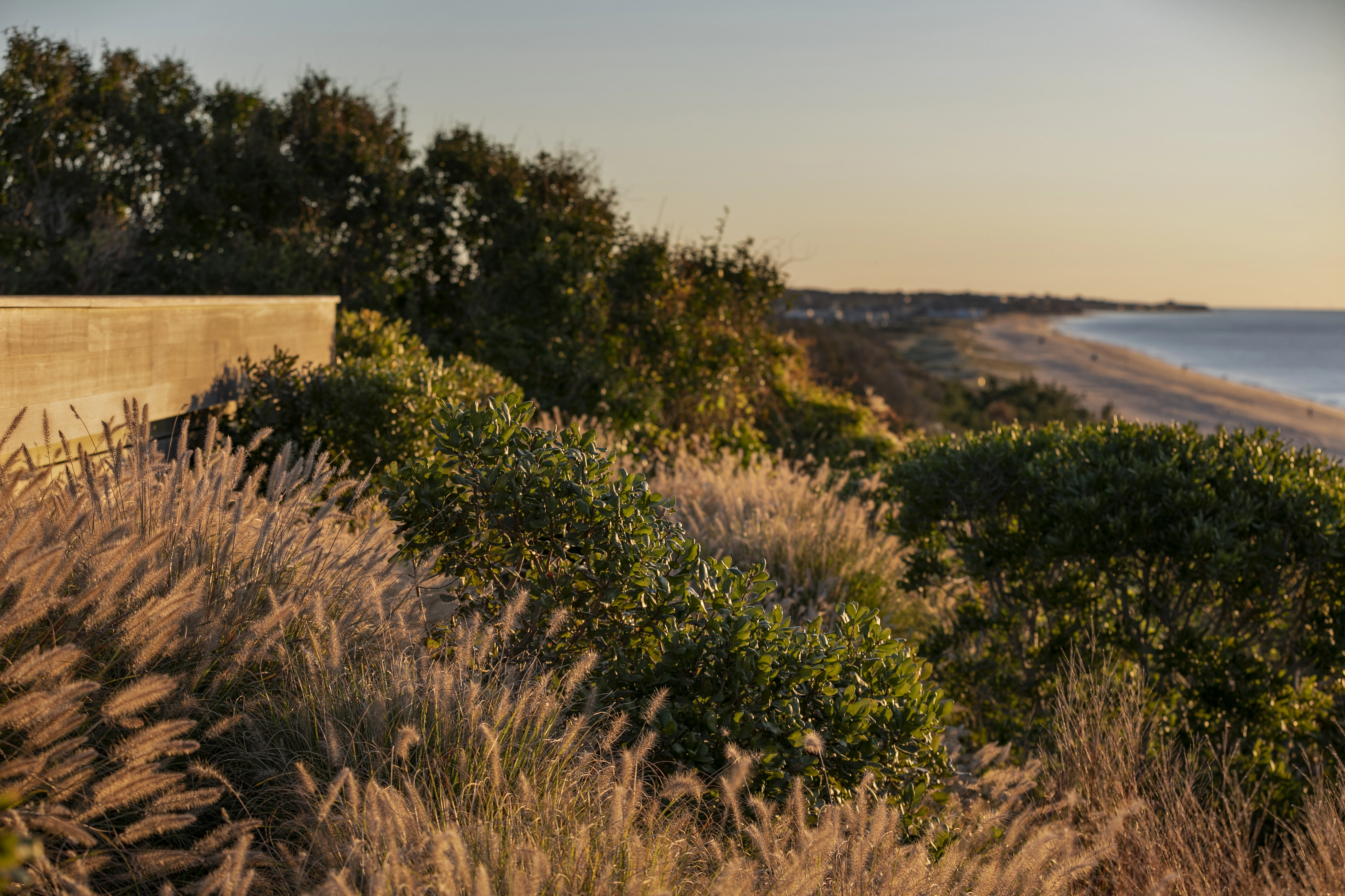
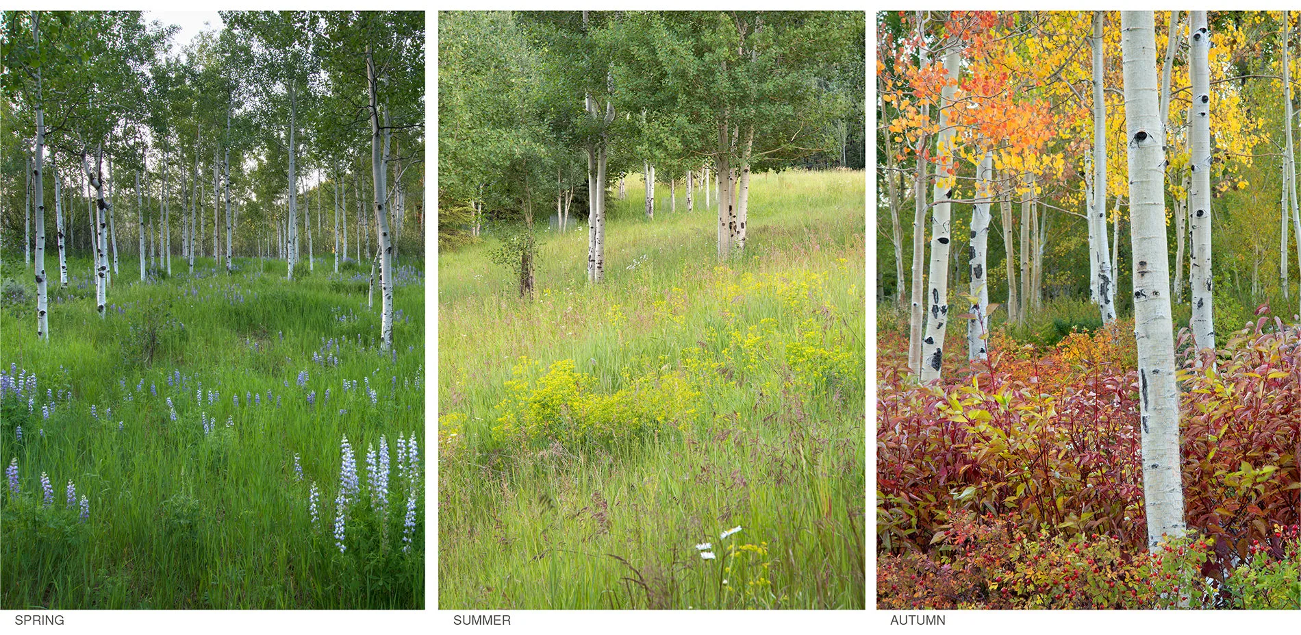
Across the entire site, restoration included minor grading revisions aimed at naturalizing landforms that had been irregularly shaped by mining processes. Supplemental topsoil and irrigation helped re-establish a seasonally-changing native grass and wildflower meadow.
ZONE IV – Minimally Disturbed Lands (3.39 Acres)
Preserving and enhancing the property’s existing montane forests was a priority for the landscape architect. Supplemental plantings of trees were intermixed with a layered understory of fruiting shrubs, including kinnikinnick, mountain ash, thimbleberry, serviceberry and wild raspberry to increase biological diversity and help sustain wildlife and bird populations. Consistent forest management and monitoring suggest that the forest is vibrant and healthy.
ZONE V – Lands Disturbed by Development Activities (1.41 Acres)
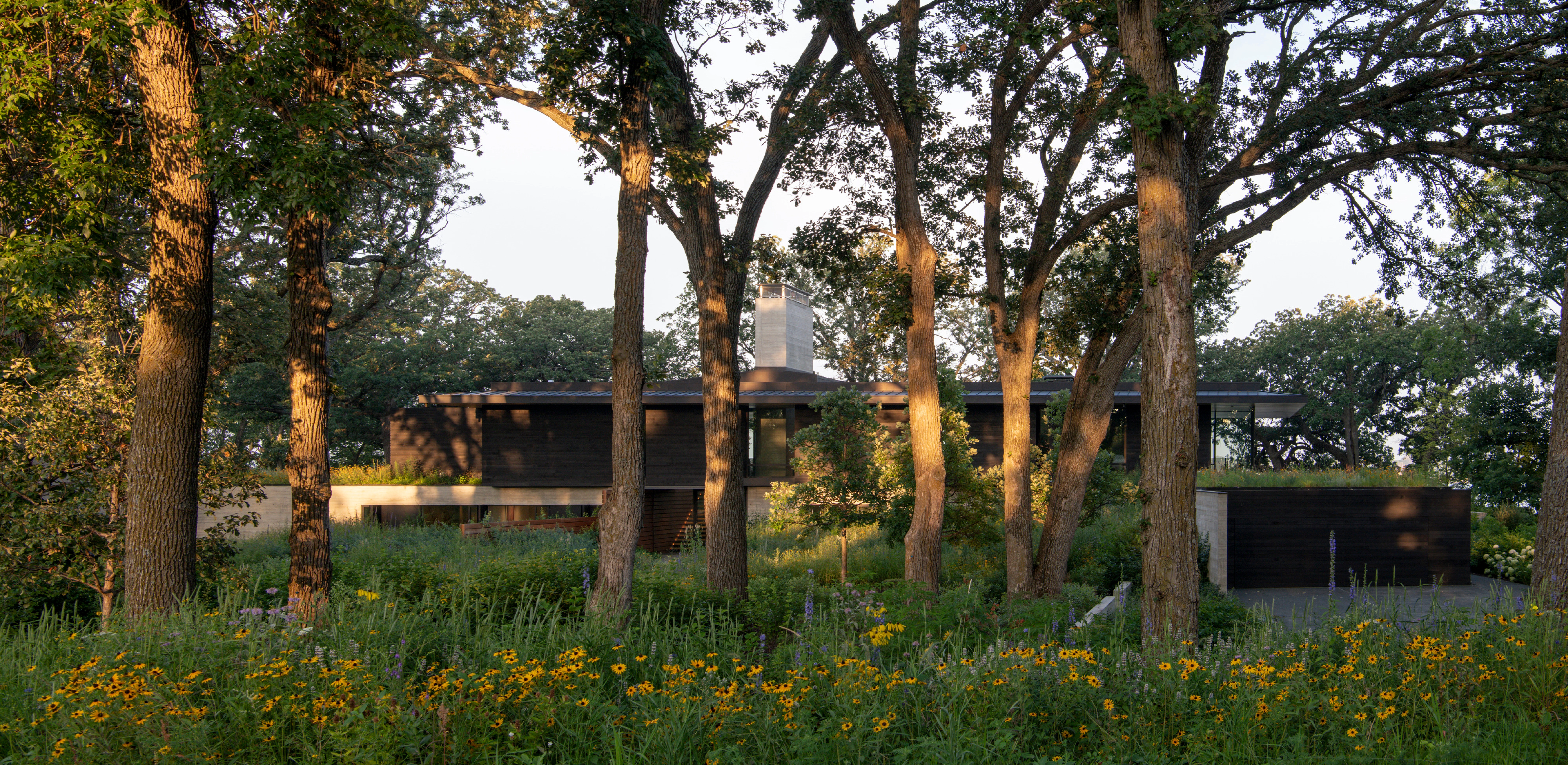
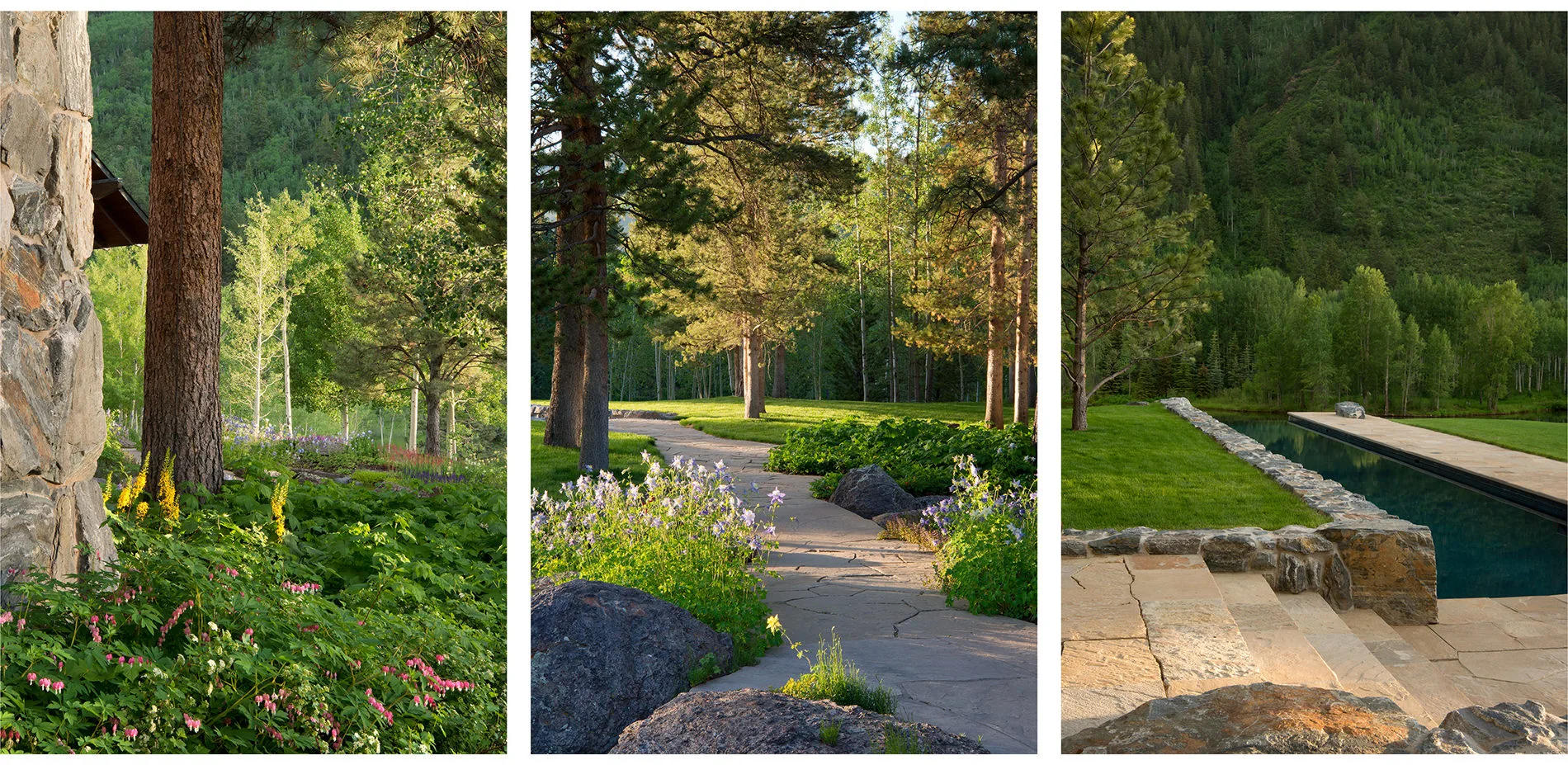
In conjunction with site restoration efforts, the landscape architect, in close collaboration with the architect and contractor, created a master plan for the property that included a new residence, an ensemble of outdoor living areas and a network of recreational trails. Inspired by the innate privacy of the existing Ponderosa pine forest, the landscape architect considered a design that delightfully integrates the natural systems and vegetation with a gracious outdoor living environment that offers opportunities for large formal functions as well as intimate family gatherings.
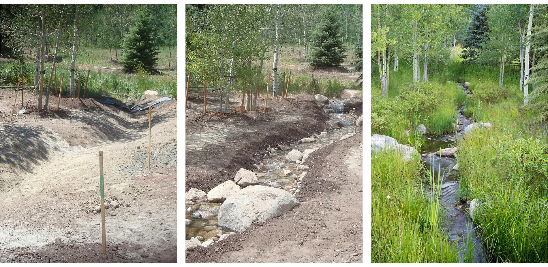
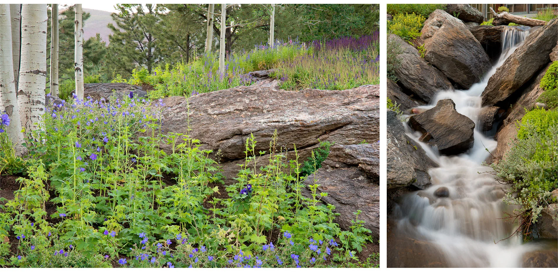
An informal gravel drive winds through the property in the deep shadow of the pine forest, offering occasional fleeting views to the lake and mountain. Located in a natural clearing on the edge of a south-facing bluff overlooking the lake, the home blends discreetly into the existing landscape. From the main living area, a sandstone walkway descends to the lake, widening at a campfire promontory, and terminating at a stone dock. Paralleling the walkway, a stream emerges, following the natural fall of the topography to the lake below. Artfully crafted to emulate streams found in the Rocky Mountains, the feature meanders through intermittent still pools, slicing through geologic crevasses, pouring over cantilevered rock ledges and finally slowing, near the lakeshore, to pass tranquilly through a tapestry of native wildflowers, shrubs and riparian grasses.
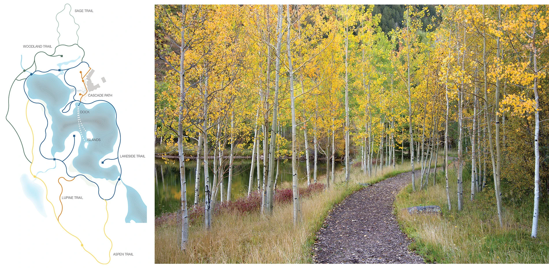
To the west of the sun terrace, a flagstone path meanders through preserved Ponderosa pines, ultimately joining the distant pool terrace. The pool, hidden from view by a classic “ha-ha” wall, is an unexpected discovery. The linear pool terrace terminates on a granite outcropping overlooking a lower valley and a second stream feature. Capturing runoff from the local watershed, the stream traverses through a woodland landscape, passing under a stone bridge and cascading down crafted granite shelves before it finally reaches the lake. A network of natural trails circumnavigates the lake, offering a year-round, seasonally rich journey through the distinct landscape narratives. -
Design Workshop, Inc.
- Richard Shaw, FASLA – Principal in Charge and Lead Designer
- Mike Albert, ASLA – Project Manager (Land Approvals, Schematic Design, Design Development)
- Paul Squadrito – Project Manager (Design Development, Construction Documentation + Construction Observation)
- Ed Krafcik – Design Staff
- Kelan Smith – Environmental Graphics + Signage
- Sarah Horn – Project Assistant
- Dori Johnson – Project Assistant
- Sarah Shaw – Historical & Cultural Narrative Report
Arborist
- Earth-Wise Horticultural, Inc.
Architecture
- 4240 Architecture
Audio/Visual Designer
- Low Voltage Experts
Civil Engineer
- Alpine Engineering
Geotechnical Specialist
- HP Geotech
Irrigation Specialist
- Hines Irrigation
Lighting Designer
- Lacroux Streeb Lighting Design
Mechanical Engineer
- Beaudin Ganze
Client Design Representative
- Mark Rios, FASLA
Structural Engineer
- KL&A; Structural Engineers
Surveyor
- Bookcliff Surveying
Water Rights Engineer
- Resource Engineering, Inc.
Water Rights Legal Counsel
- Patrick Miller Kropf
Construction Team
- General Contractor
- TIS Specialist
Landscape Contractor
Pool Contractor
- Colorado Pool and Spa Scapes
Cascade Garden Stone Craftsman
- Water & Stone
Lighting Contractor
- Encore Lighting
-
Plants
- Little Valley Wholesale Nursery
- Monrovia
- Landscape Workshop
- Eagle Crest Wholesale Nursery
- Mountain Greenery
- Planted Earth
- Welby Gardens
Soils
Stone Paving
Stone Walls
Pool Finish
Pool Tile
Lighting
Irrigation
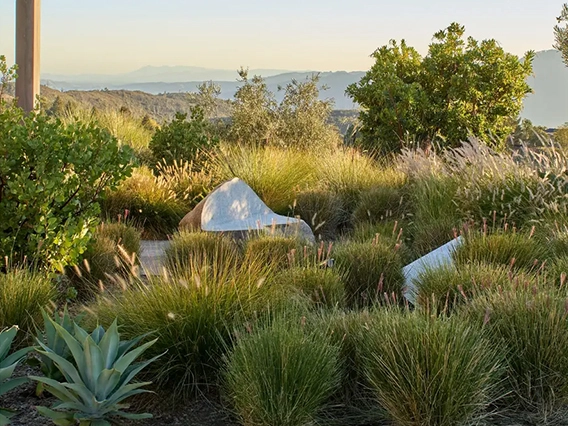
Peninsula Sculpture
Advertisement
Related Awards
Honor Award, Residential Design
Trinity Road
The story of Trinity Road unfolded over the past five years and is fundamentally a story of fire resilience and succession of the surrounding forest. The garden was designed and the project considered completed when two wildfires ravaged the hills immediately surrounding the site. After the fires the landscape design team was brought in to create a new vision for the site that knit together the original planting and a new series of paths and gardens.