


Honor Award
Re-transforming Landscape at the Arroyo Seco Confluence
Yingjun Hu, Assoc. ASLA, Graduate, University of Southern California
Advisors: Robert S. Harris, Hon. ASLA; Charles S. Dwyer; Ying-Yu Hung, ASLA
 494
494
 Close Me!
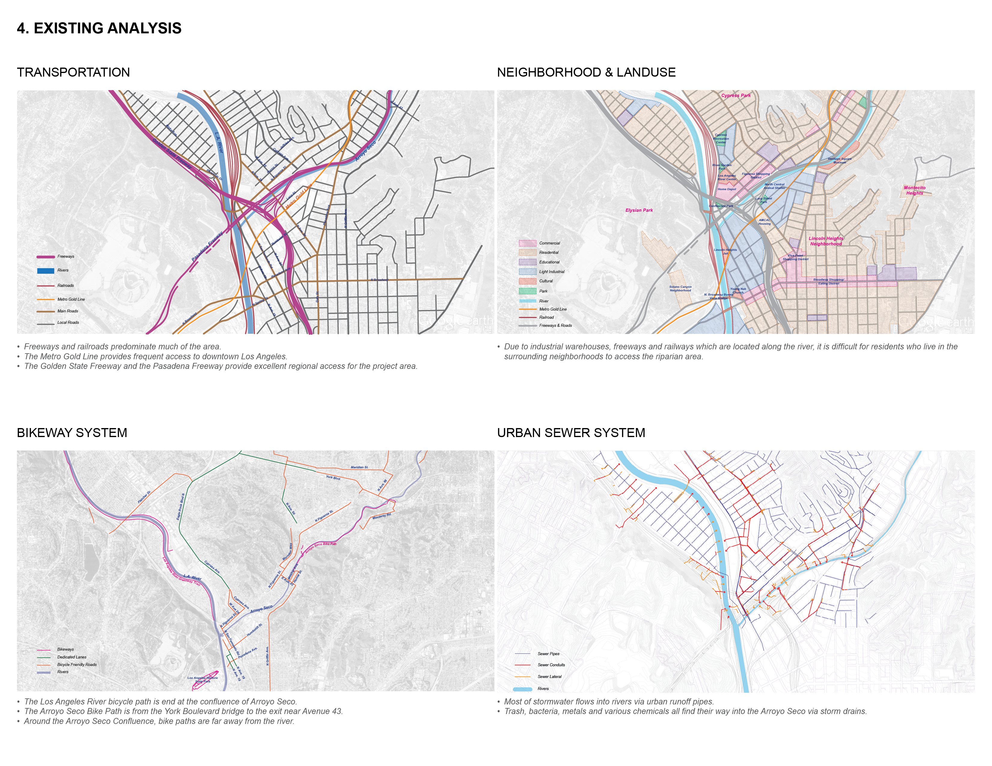
Existing Analysis
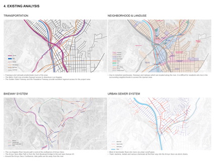
Transportaion, Neighborhood & Landuse Bikeway System and Urban Sewer System
Download Hi-Res ImageImage: Hu Yingjun
Image 4 of 16
 Close Me!
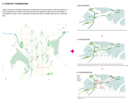
Concept Framework
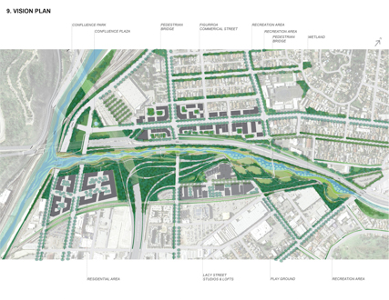
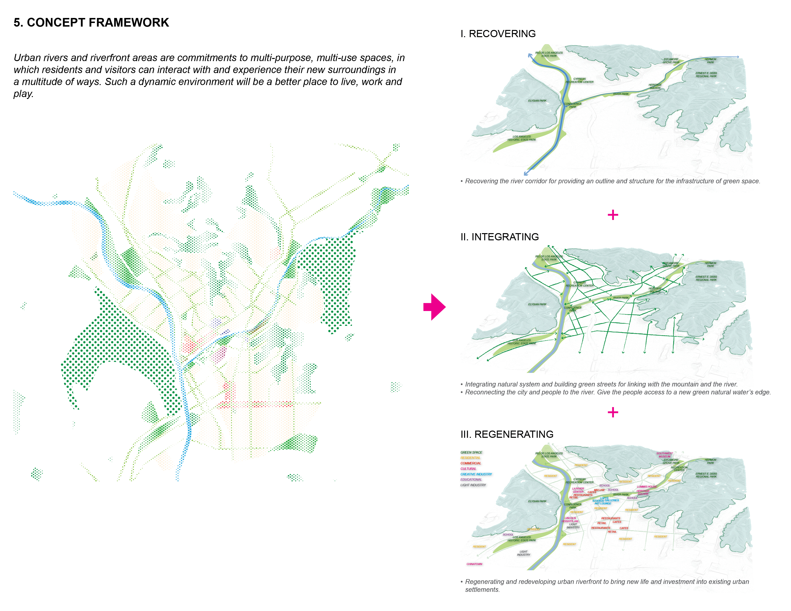
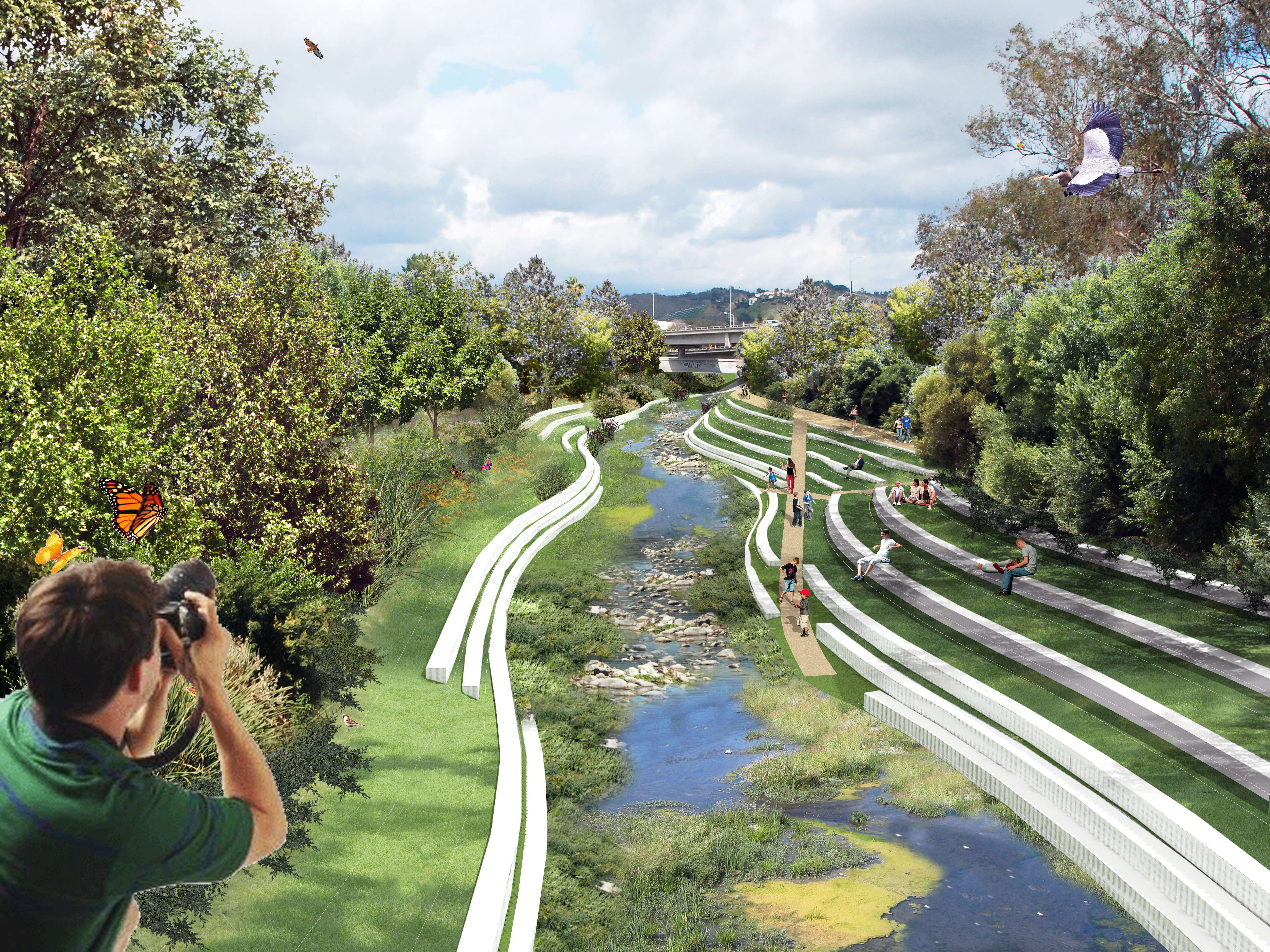
Urban rivers and riverfront areas are commitments to multi-purpose, multi-use spaces, in which residents and visitors can interact with and experience their new surroundings in a multitude of ways. Such a dynamic environment will be a better place to live, work and play.
Download Hi-Res ImageImage: Hu Yingjun
Image 5 of 16
 Close Me!
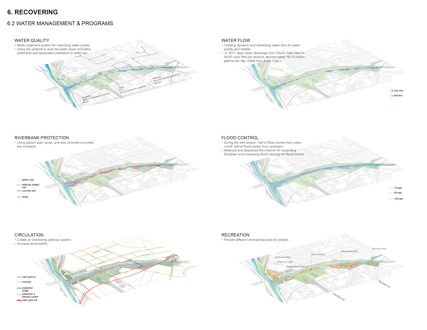
Recovering Water Management
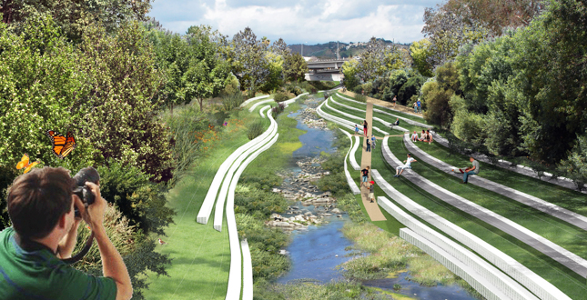
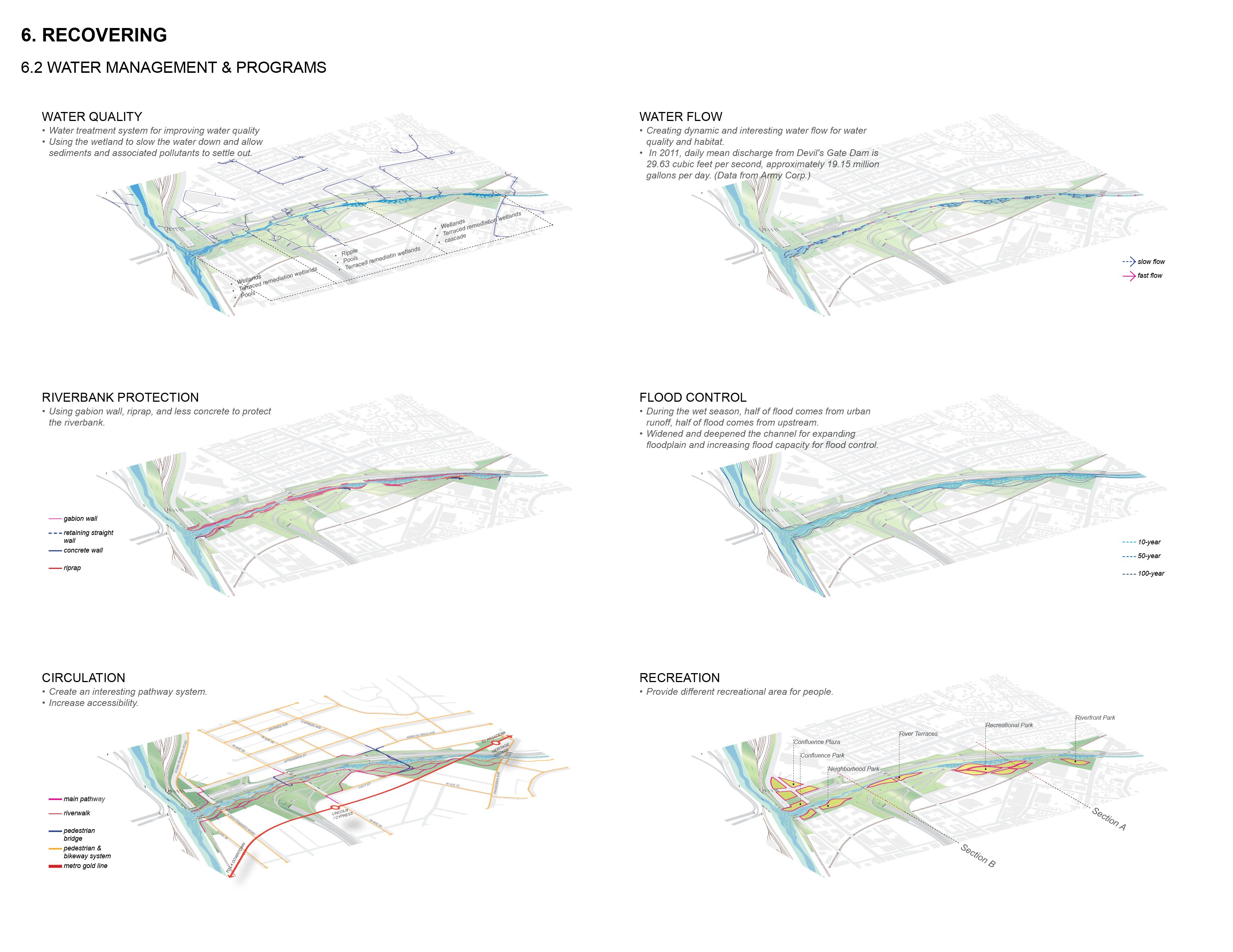
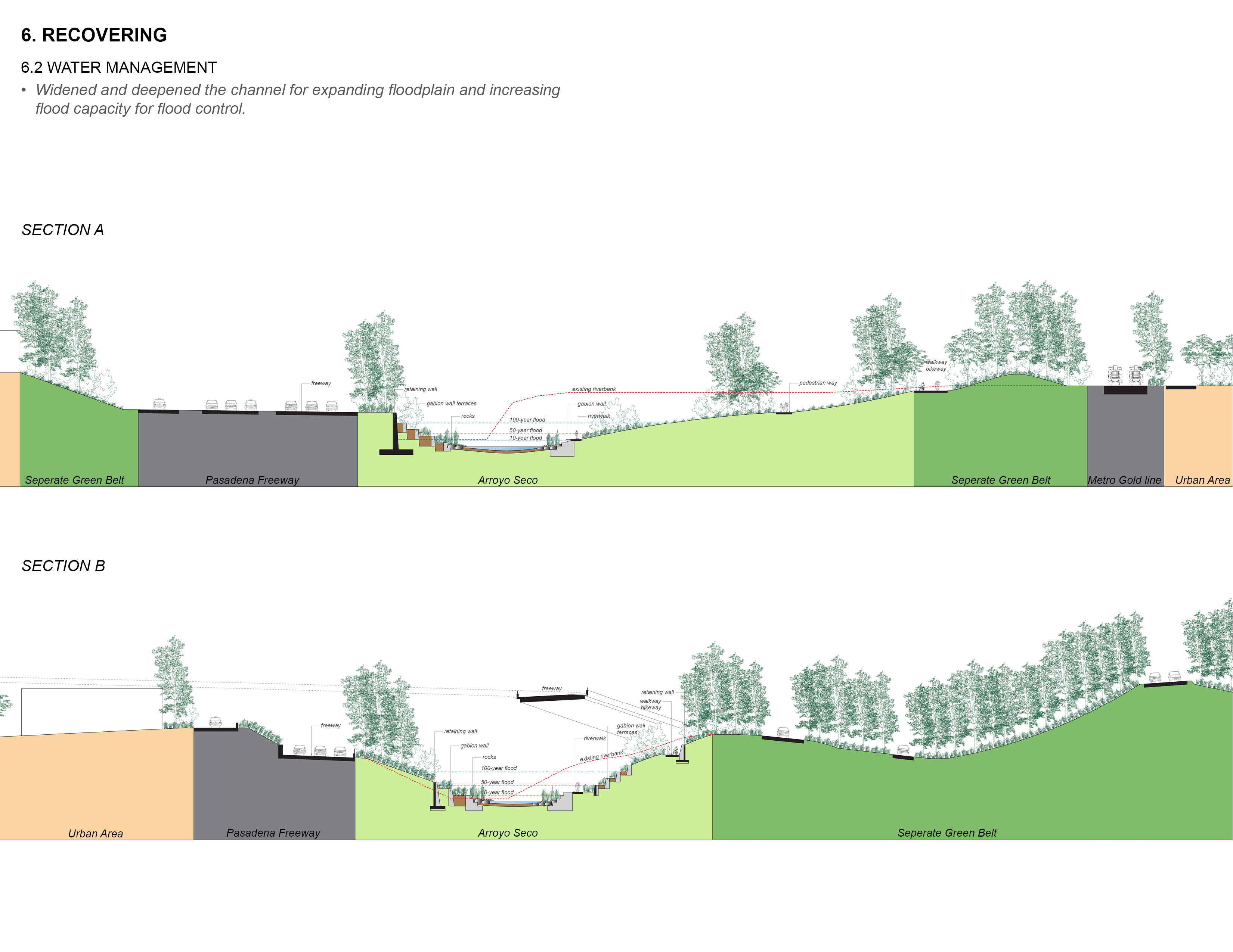
Widened and deepened the channel for expanding floodplain and increasing flood capacity for flood control.
Download Hi-Res ImageImage: Hu Yingjun
Image 9 of 16
 Close Me!
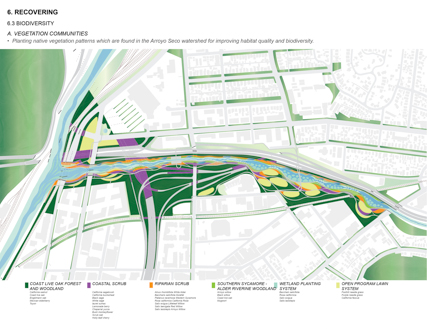
Recovering Biodiversity
A vegetation Communities. Planting native vegetation patterns which are found in the Arroyo Seco watershed for improving habitat quality and biodiversity.
Download Hi-Res ImageImage: Hu Yingjun
Image 10 of 16
 Close Me!
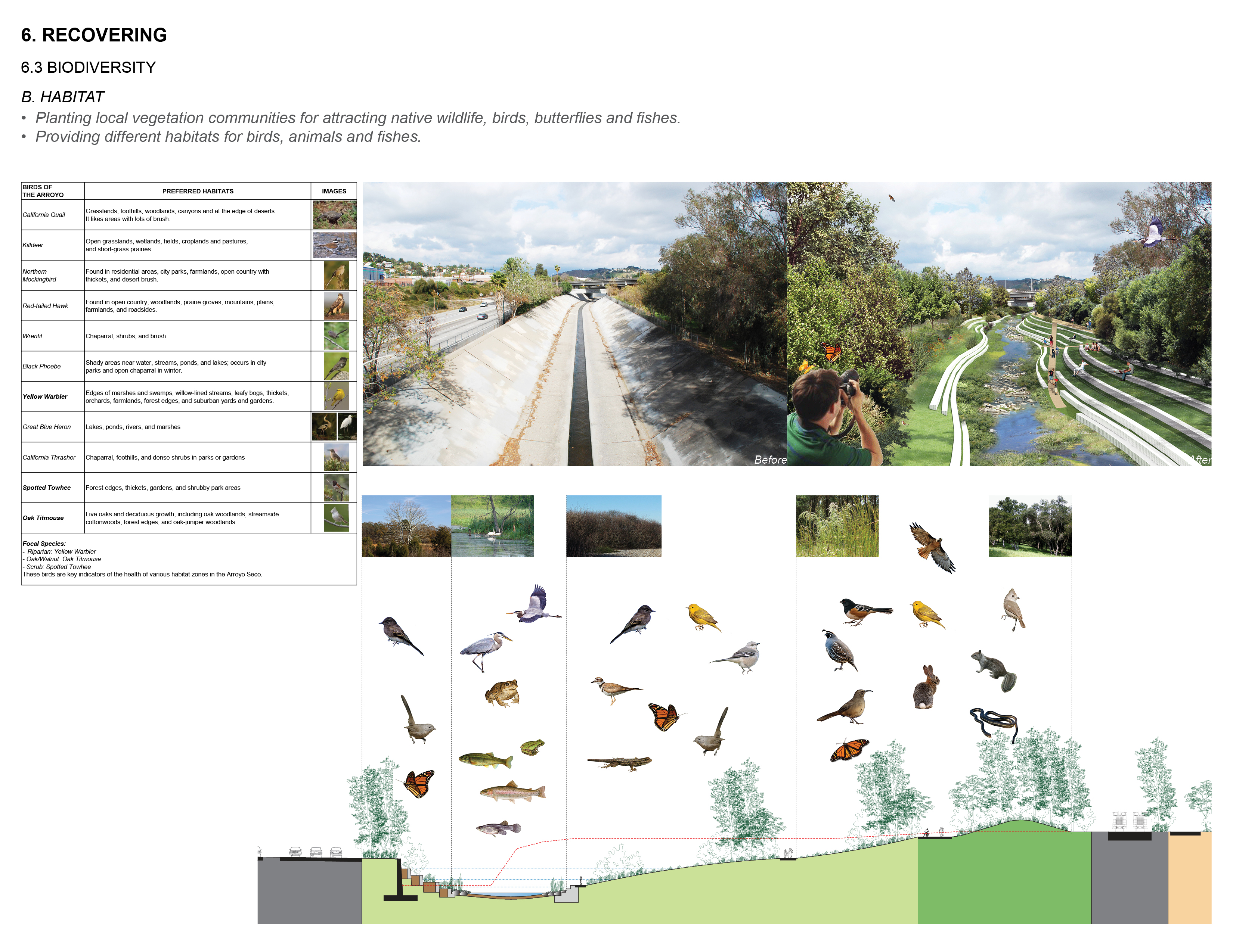
Recovering Biodiversity
Habitat Planting local vegetation communities for attracting native wildlife, birds, butterflies and fishes. Providing different habitats for birds, animals and fishes
Download Hi-Res ImageImage: Hu Yingjun
Image 11 of 16
 Close Me!
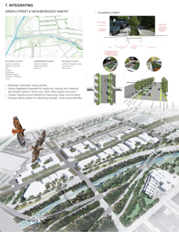
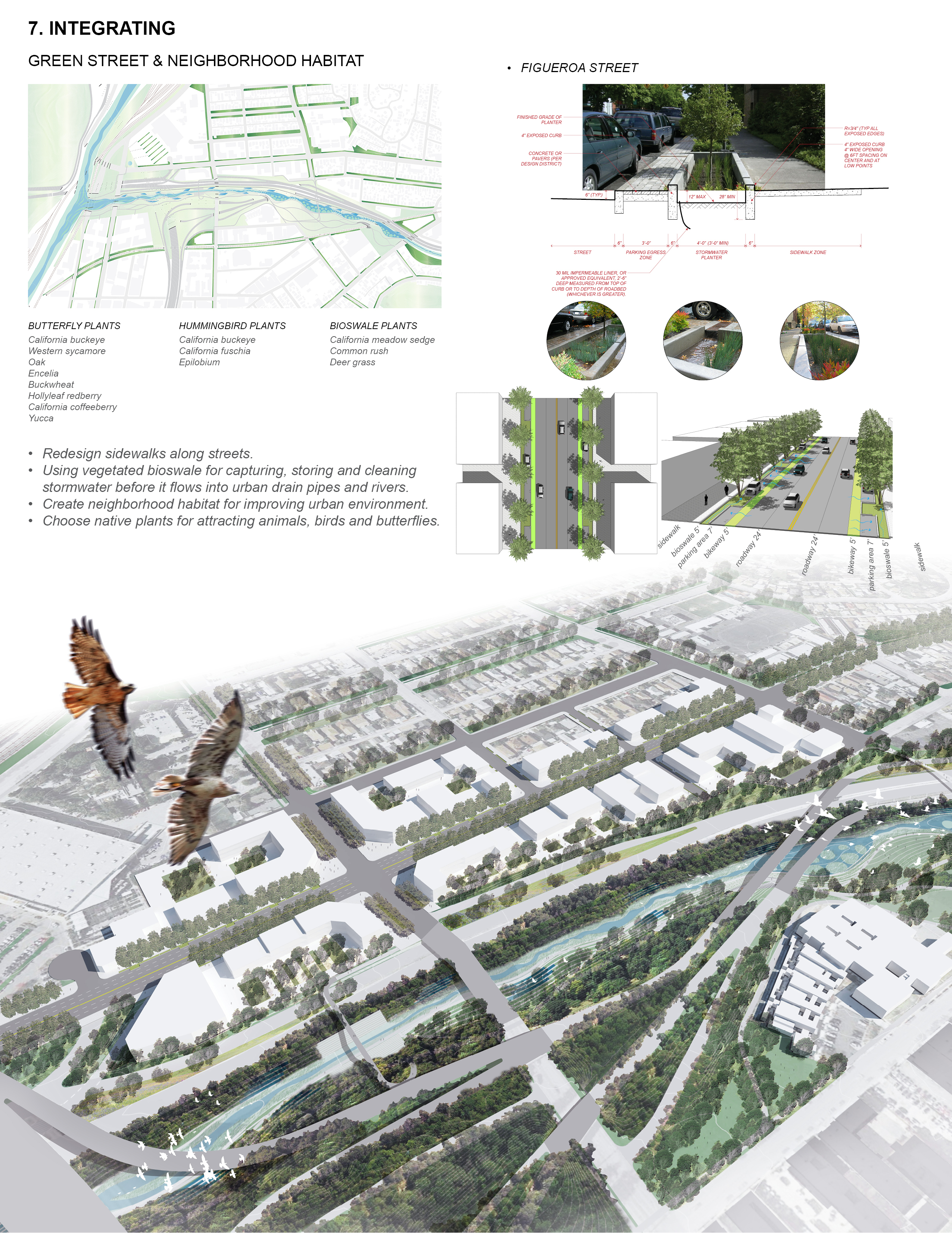
Integrating Green Street & Neighborhood Habitat
Download Hi-Res ImageImage: Hu Yingjun
Image 12 of 16
 Close Me!
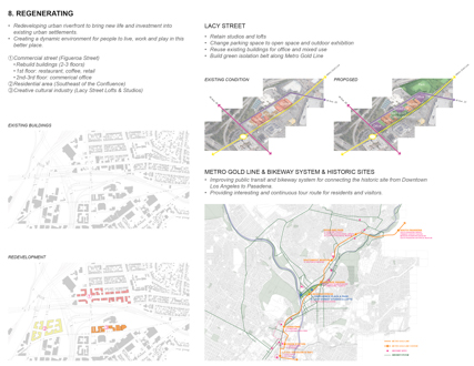
Regenerating
Redeveloping urban riverfront to bring new life and investment into existing urban settlements. Creating a dynamic environment for people to live, work and play in this better place.
Download Hi-Res ImageImage: Hu Yingjun
Image 13 of 16
Project Statement
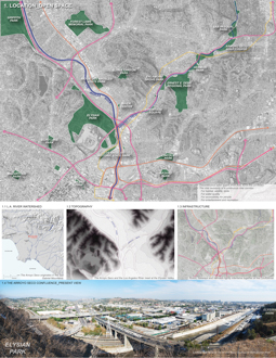
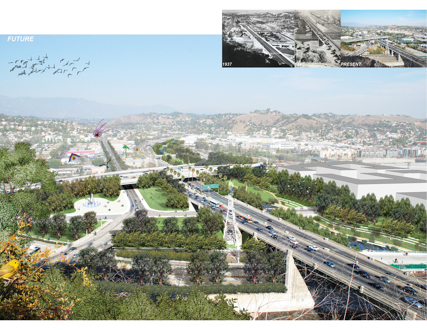
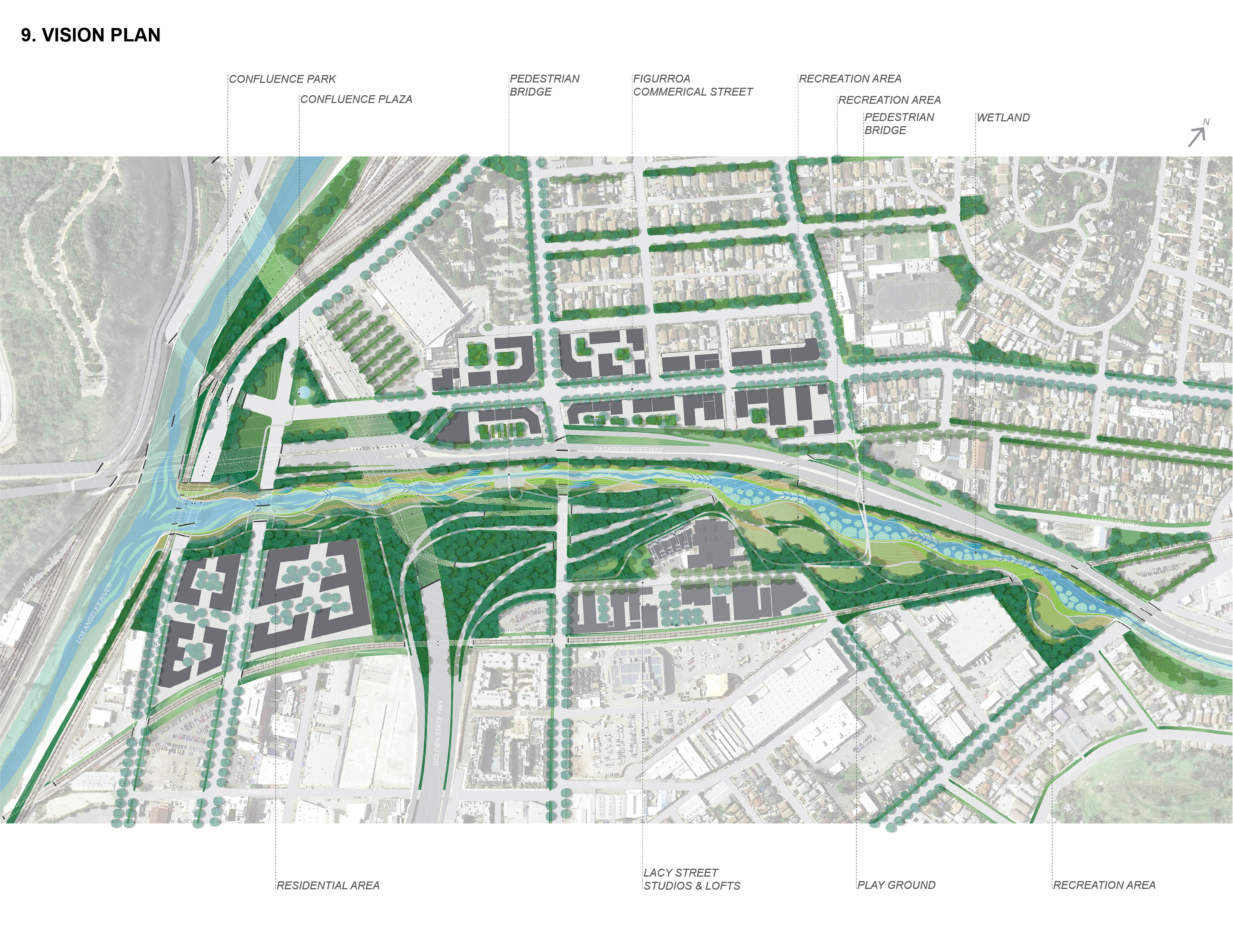
The Arroyo Seco Confluence is a complicated site in which freeways, rail infrastructure and the rivers are tightly intertwined. What's more, the Confluence is a very important site with immense potential. The objectives of this study are to re-transform the Arroyo Seco from a channelized and single-functional channel to a multi-functional corridor of significant natural and cultural value, to provide safe access and create activities and recreation for people within the maze of preexisting infrastructure, to regenerate for developing to bring new life and investment to nearby urban areas.
Project Narrative
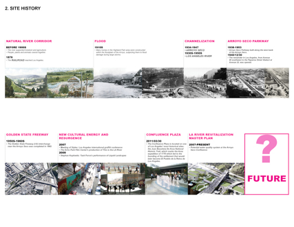
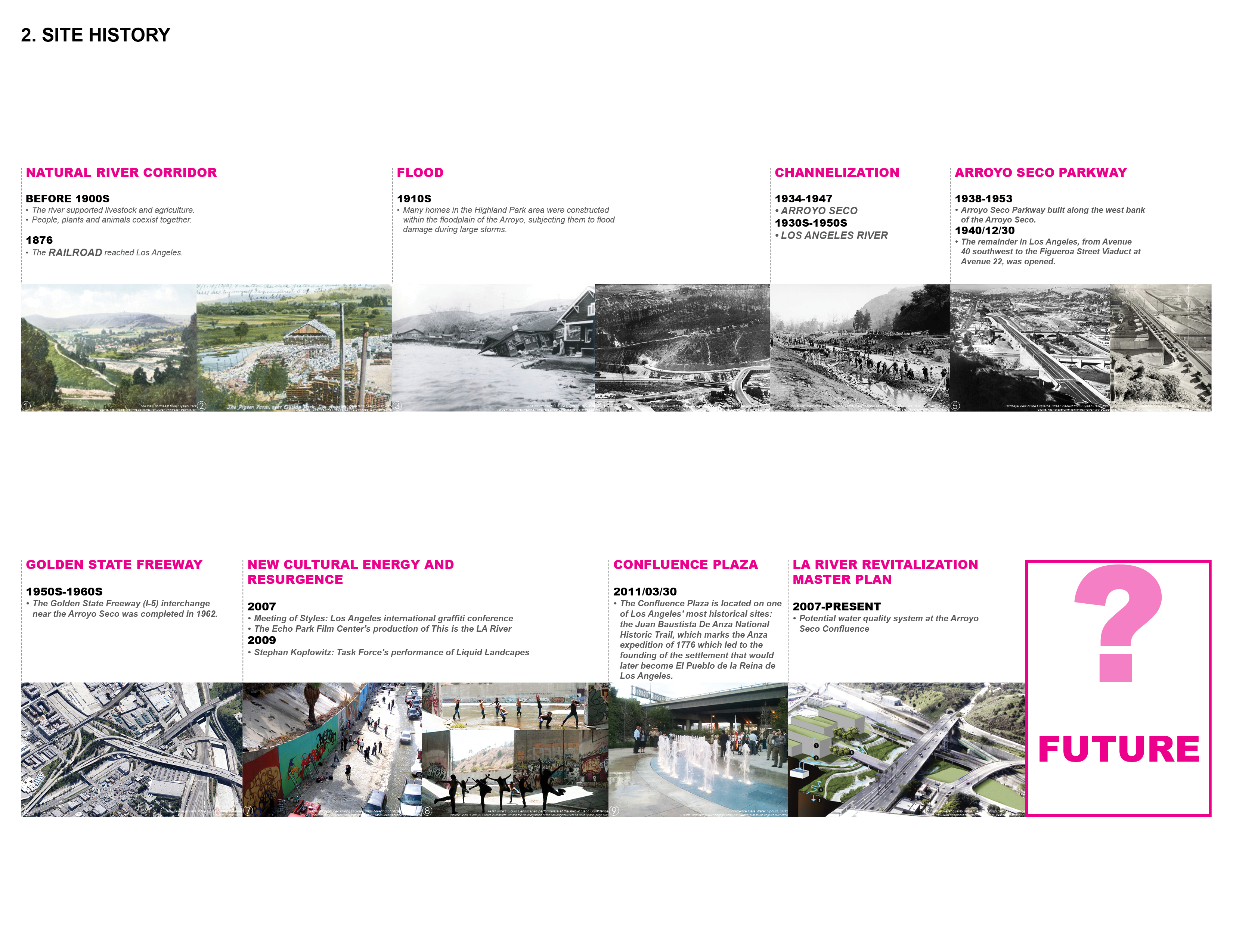
In today's world, a lot of rivers are seriously polluted and channelized. This leads to a series of issues, such as ecological degradation of urban rivers, lack of accessibility, lack of open space around urban riverfront, disordered development of urban riverfront area, and the crisis of historical continuity and heritage protection.
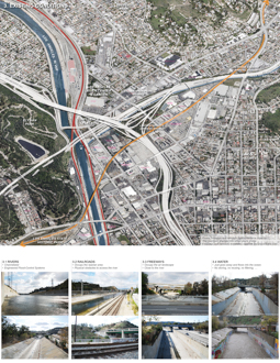
The confluence of Arroyo Seco and the Los ANgeles River, located within the original flood plains of the Los Angeles River and Arroyo Seco water bodies, which are located within the lower Los Angeles River Watershed. The site is a complicated site in which freeways, rail infrastructure and the rivers are tightly intertwined. What is more, the Arroyo Seco has been channelized by concrete, freeways and rail infrastructure predominate much of the area. The Metro Gold Line cuts across the northern portion of the Project Area and provided frequent access to downtown Los Angeles, the many communities located in the northeastern sections of Los Angeles, and the cities of South Pasadena and Pasadena. The railroad tracks serving Metro's Metrolink regional passenger rail service and freight service parallel the western and eastern banks of the Los Angeles River, which are adjacent to a series of electrical transmission lines. The railroads, freeways and electrical transmission line are visual and physical obstacles to the future revitalization of the Arroyo Seco Confluence.
The Pasadena Freeway/State Route 110 (SR110) parallels the path of the Arroyo Seco. Entrances and exits to the from SR 110 are located on the northern perimeter of the Plan Area. The Golden State Freeway/Interstate Highway 5 (I-5) cuts north-south through the Project Area. I-5 runs in a trench from Lacy Street to Spring Street at the southeast portion of the Project Area. Entrances and exits to I-5 and SR 110 provide excellent regional access for the Project Area. Bt freeways, railways, and industrial physical structures create obstacles to pedestrian and bicycle modes of travel.
However, the Arroyo Seco Confluence is a very important site with immense potential: unparalleled opportunity for habitat and stream restoration; key spot for flood management and water quality improvements; easy access to touch the river; gateway to the river through Downtown; historical, cultural, environmental and hydrologic importance.
Basing on the above, the most important objective of this study is to transform the Arroyo Seco from a channelized and single-functional channel to a multi-functional corridor of significant natural and cultural value. Secondly, it is to provide safe access and create activities for recreation within the maze of pre-existing infrastructure. Thirdly, it is to create a synergy that elevates an urban riverfront landscape to a thriving and harmonious balance of complex systems where modern infrastructure meets natural ecology.
Concept framework:
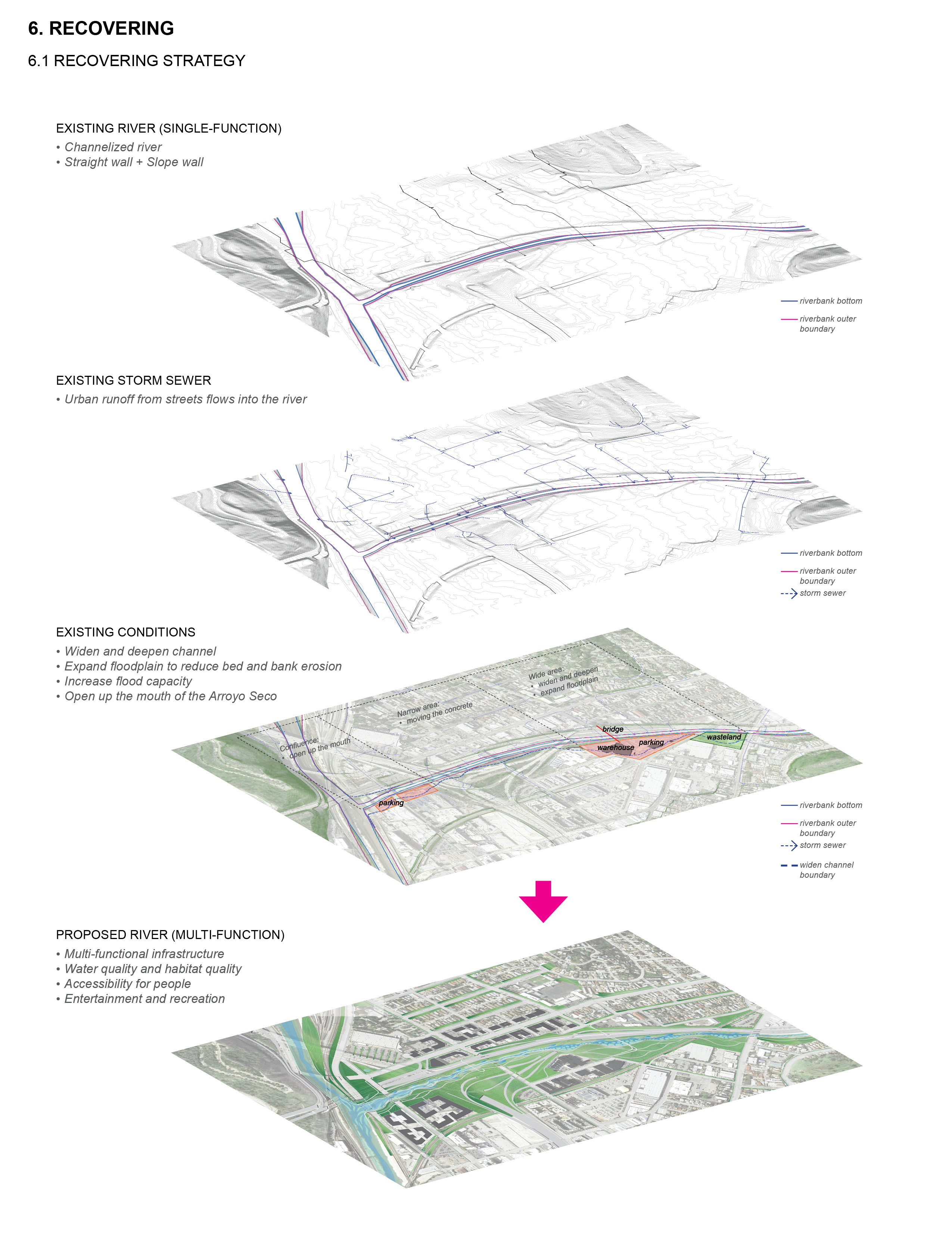
1. Recovering the river corridor for providing an outline and structure for the infrastructure of green space.
2. Integrating natural system and building green streets for linking with the mountain and the river, and reconnecting the city and people to the river. Give the people access to a new green natural water's edge.
3. Regenerating for developing to bring new life and investment to nearby settlements.
Design Strategies:
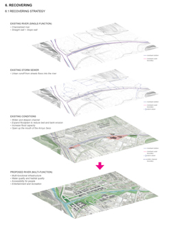
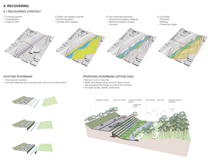
1. Widen the deepen the channel for expanding floodplain and increasing flood capacity.
2. Introduce new landscape elements for water quality, such as terraced remediation wetland and wetland treatment system.
3. Plant native vegetarian communities for habitat and biodiversity.
4. Created pedestrian and bikeway system for providing access to people, and provide different open spaces along the river.
5. Redesign sidewalks along streets and use vegetated bioswale for capturing, storing and cleaning stormwater before it flows into urban sewer pipes and rivers.
6. Redevelop urban riverfront area and Improve public transit and bikeway system for connecting the historic site from Downtown Los Angeles to Pasadena.
7. Provide interesting and continuous tour route for residents and visitors.
Finally, the Arroyo Seco Confluence is commitment to multi-purpose, multi-use space, in which residents and visitors can interact with and experience their new surroundings in a multitude of ways. Such a dynamic environment will be a better places to live, work and play.
Additional Project Credits
Additional Faculty Advisors
Robert Perry, ASLA
Travis Longcore
Arroyo Seco Foundation
Special thanks to
Qin Gao