


Honor Award
DUNESCAPE
Chelsea Andersson, Student ASLA; Olivia Bennett, Student ASLA; and Bradley Wells, Student ASLA, Undergraduate, SUNY College of Environmental Science & Forestry
Faculty Advisors: Jamie Vanucchi and Martin Hogue
 Close Me!
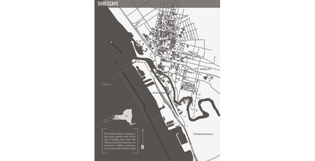
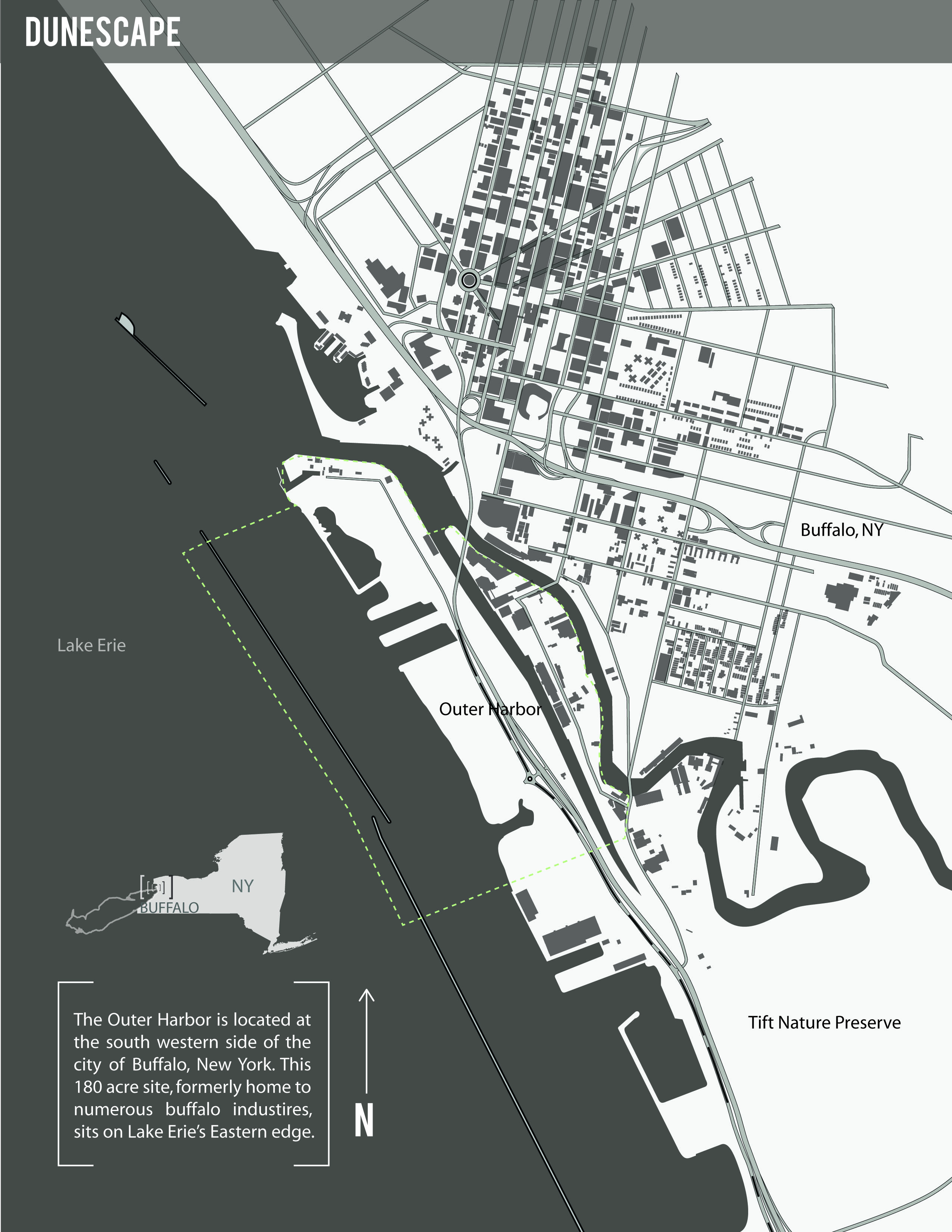
The Outer Harbor is located at the south western side of the city of Buffalo, New York. This 180 acre site, formerly home to numerous buffalo industries, sits on Lake Erie’s Eastern edge.
Download Hi-Res ImageImage: Chelsea Andersson, Olivia Bennett, and Bradley Wells
Image 1 of 17
 Close Me!
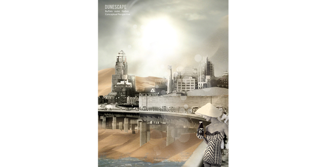
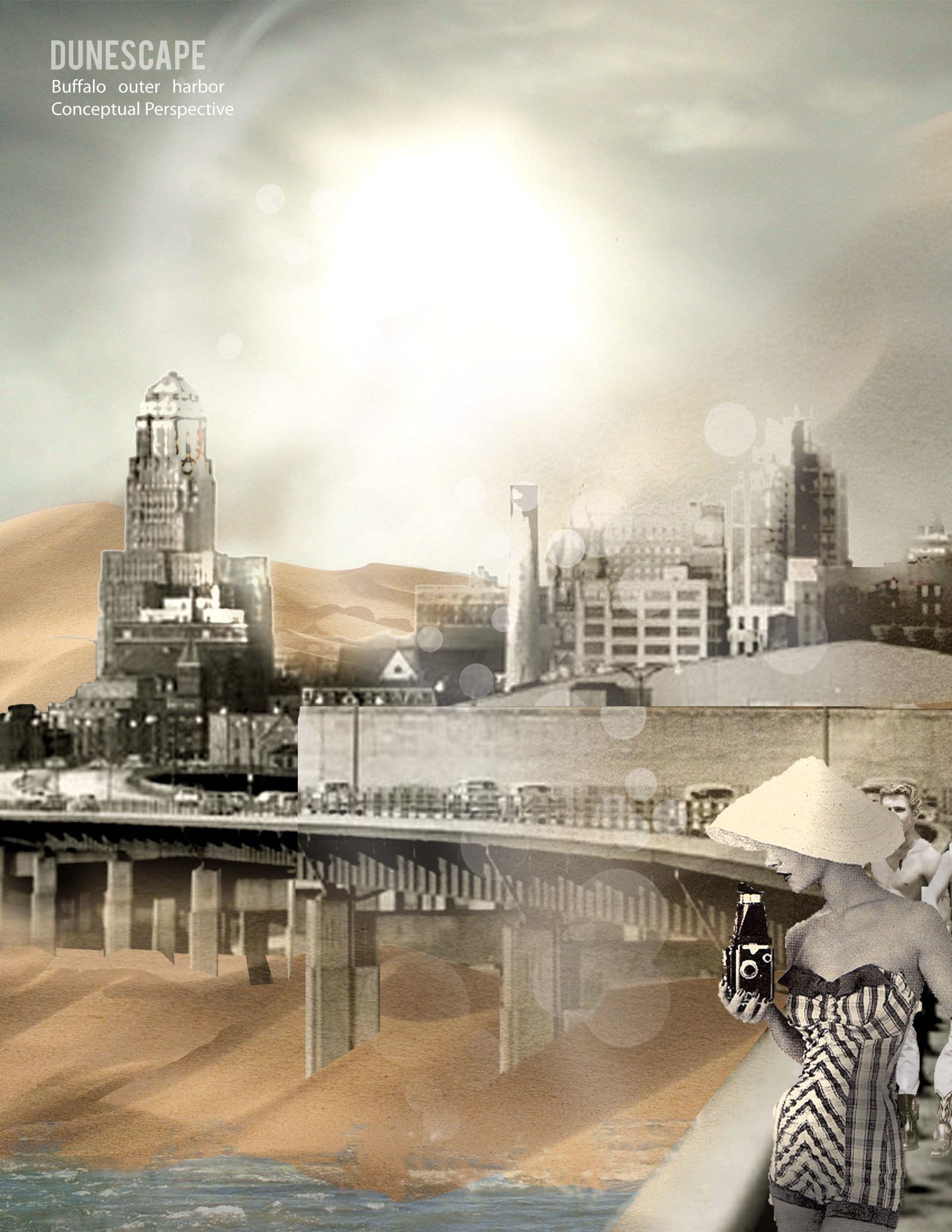
Buffalo outer harbor conceptual perspective.
Download Hi-Res ImageImage: Chelsea Andersson, Olivia Bennett, and Bradley Wells
Image 2 of 17
 Close Me!
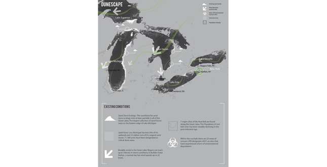
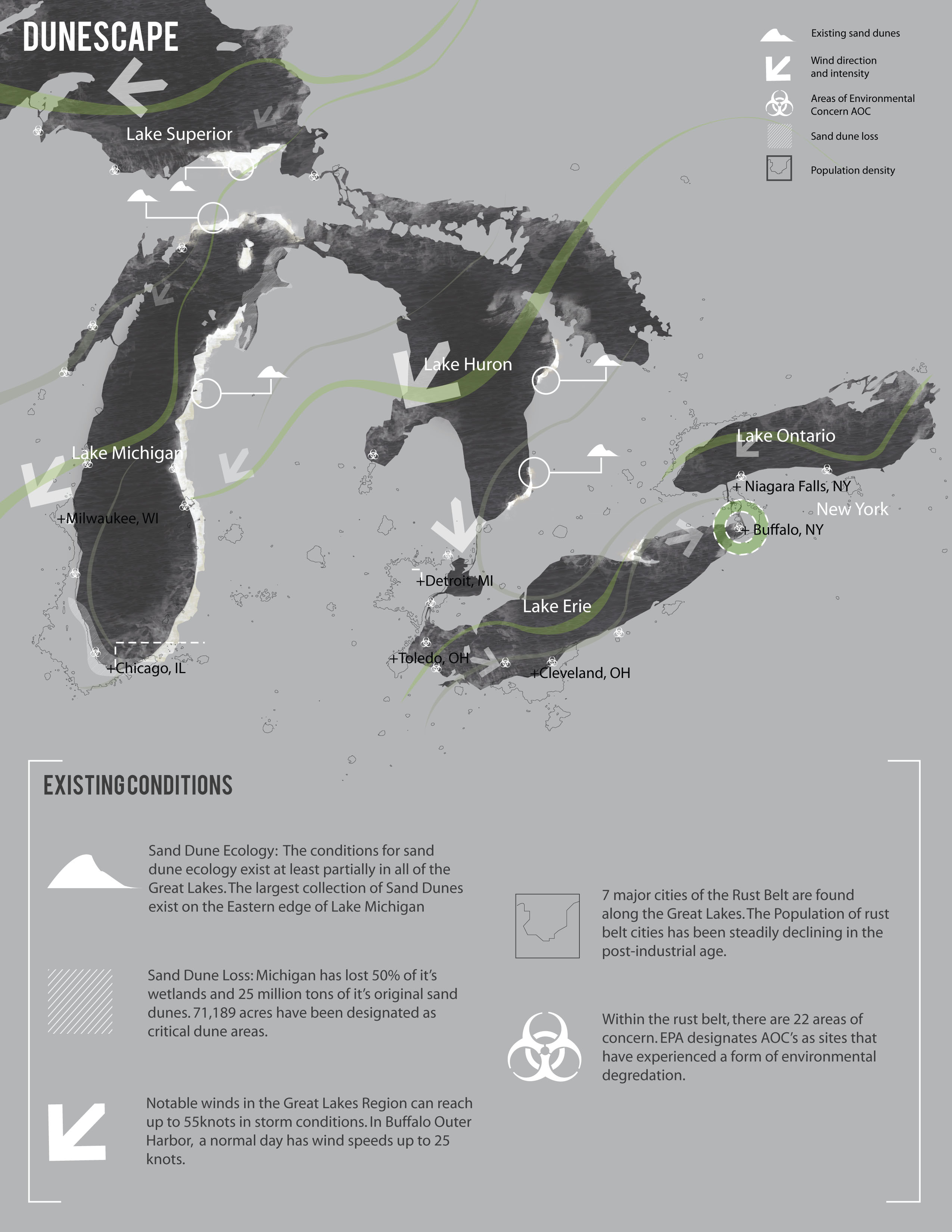
Existing Conditions.
Download Hi-Res ImageImage: Chelsea Andersson, Olivia Bennett, and Bradley Wells
Image 3 of 17
 Close Me!
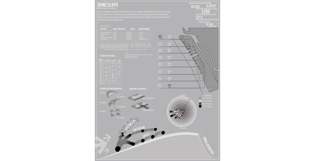
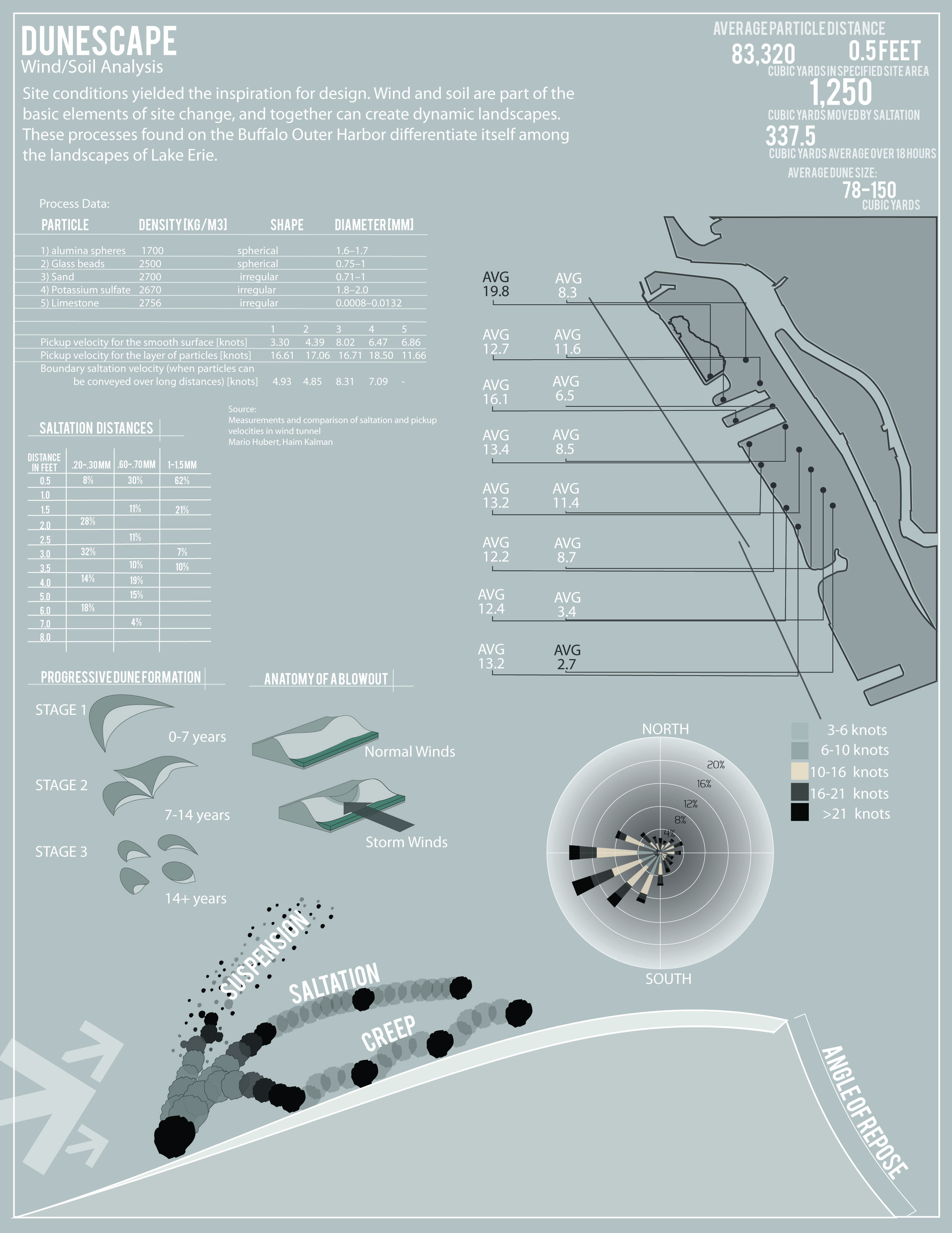
Site conditions yielded the inspiration for design. Wind and soil are part of the basic elements of site change, and together can create dynamic landscapes. These processes found on the Buffalo Outer Harbor differentiate itself among the landscapes of Lake Erie.
Download Hi-Res ImageImage: Chelsea Andersson, Olivia Bennett, and Bradley Wells
Image 4 of 17
 Close Me!
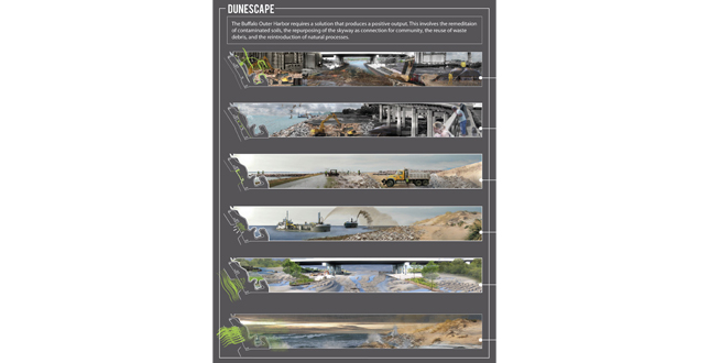
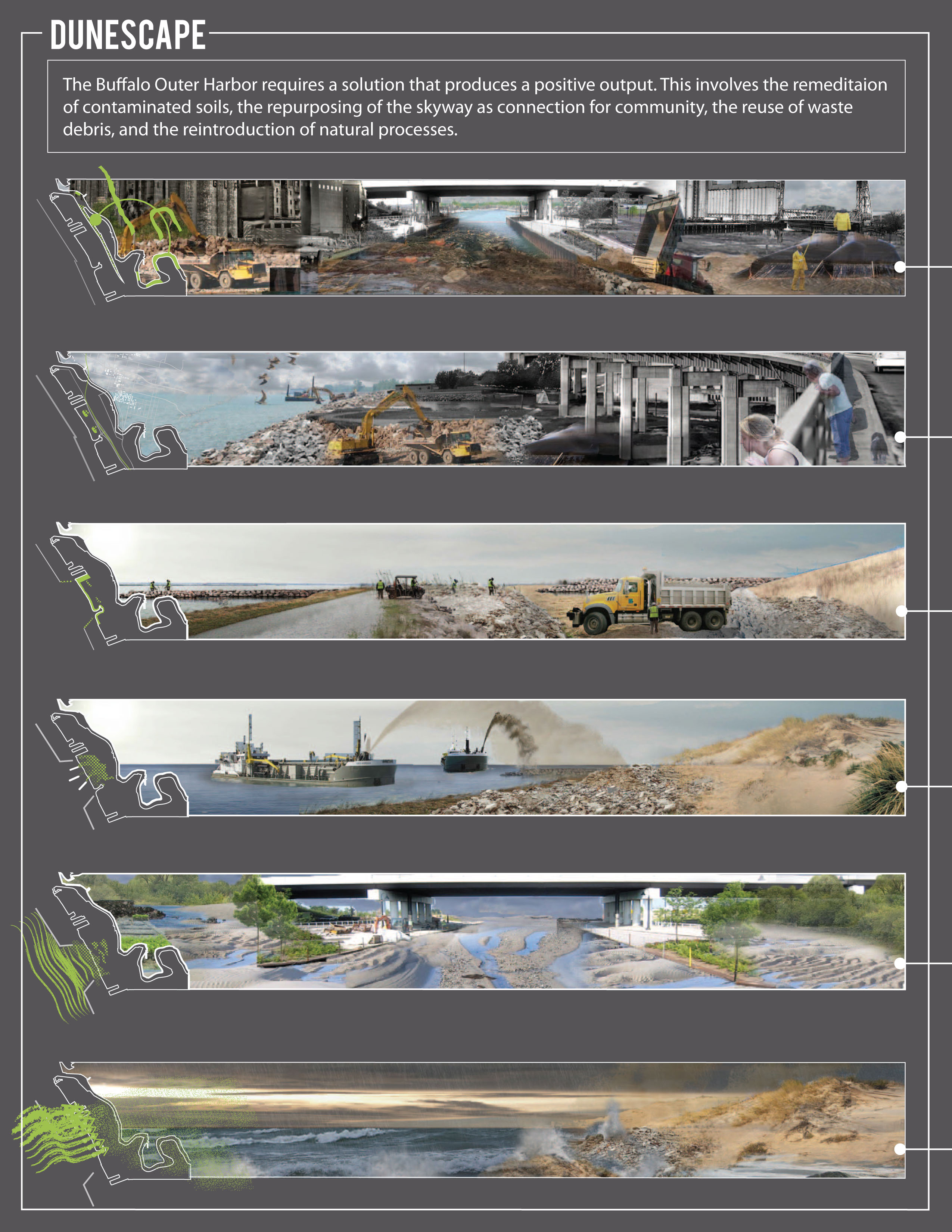
The Buffalo Outer Harbor requires a solution that produces a positive output. This involves the remediation of contaminated soils, the repurposing of the skyway as connection for the community, the reuse of waste debris, and the reintroduction of natural processes.
Download Hi-Res ImageImage: Chelsea Andersson, Olivia Bennett, and Bradley Wells
Image 5 of 17
 Close Me!
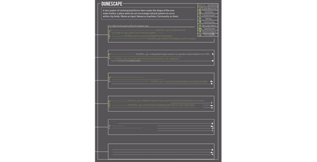
A test system of evolving landforms then create the shape of the new outer harbor, a place where we can encourage natural systems to occur within city limits. Waste as input. Nature as machine. Community as client.
Download Hi-Res ImageImage: Chelsea Andersson, Olivia Bennett, and Bradley Wells
Image 6 of 17
 Close Me!
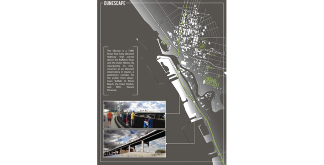
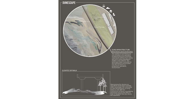
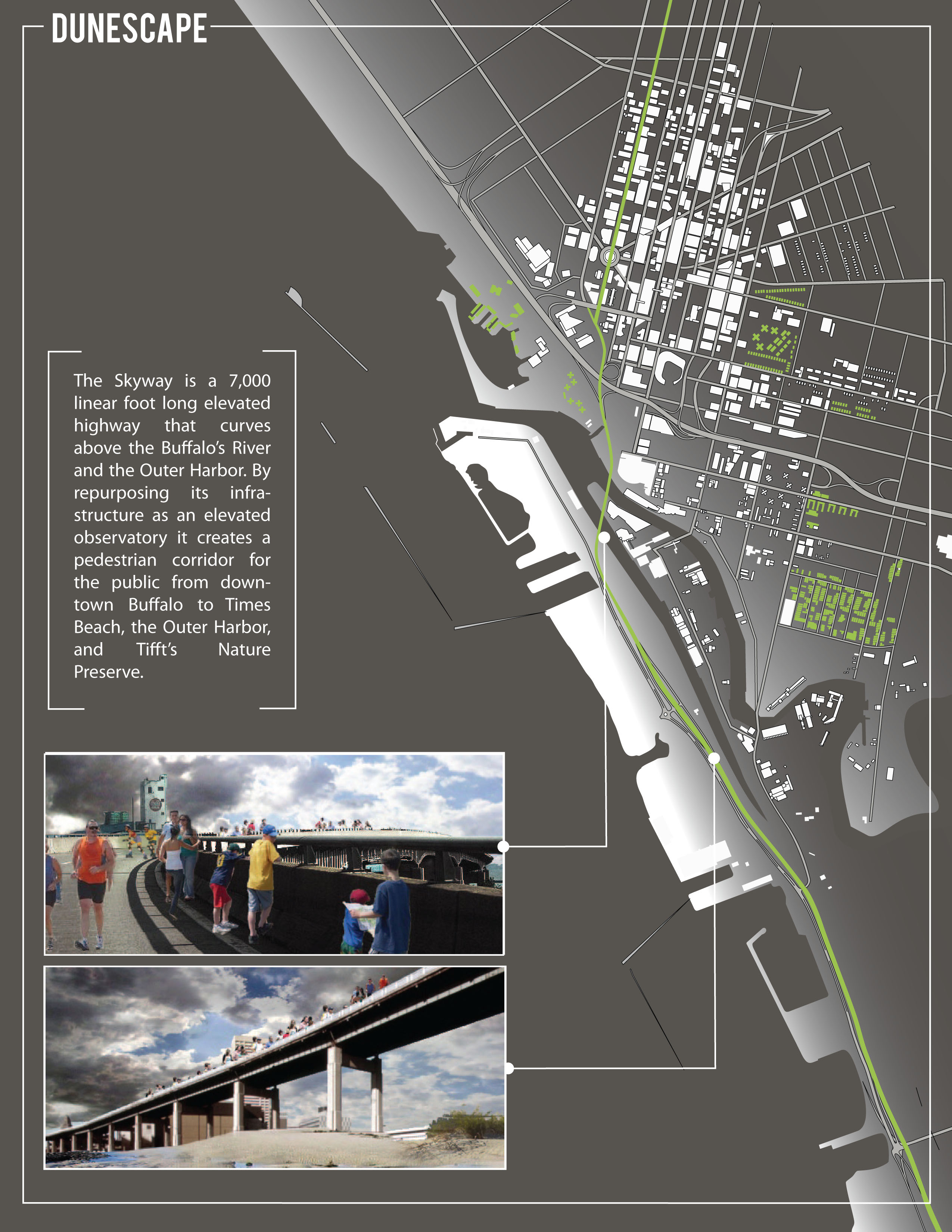
The Skyway is a 7,000 linear foot long elevated highway that curves above Buffalo’s River and the Outer Harbor. By repurposing its infrastructure as an elevate observatory, it creates a pedestrian corridor for the public from downtown Buffalo to Times Beach, the Outer Harbor, and Tifft’s Nature Preserve.
Download Hi-Res ImageImage: Chelsea Andersson, Olivia Bennett, and Bradley Wells
Image 7 of 17
 Close Me!
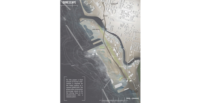
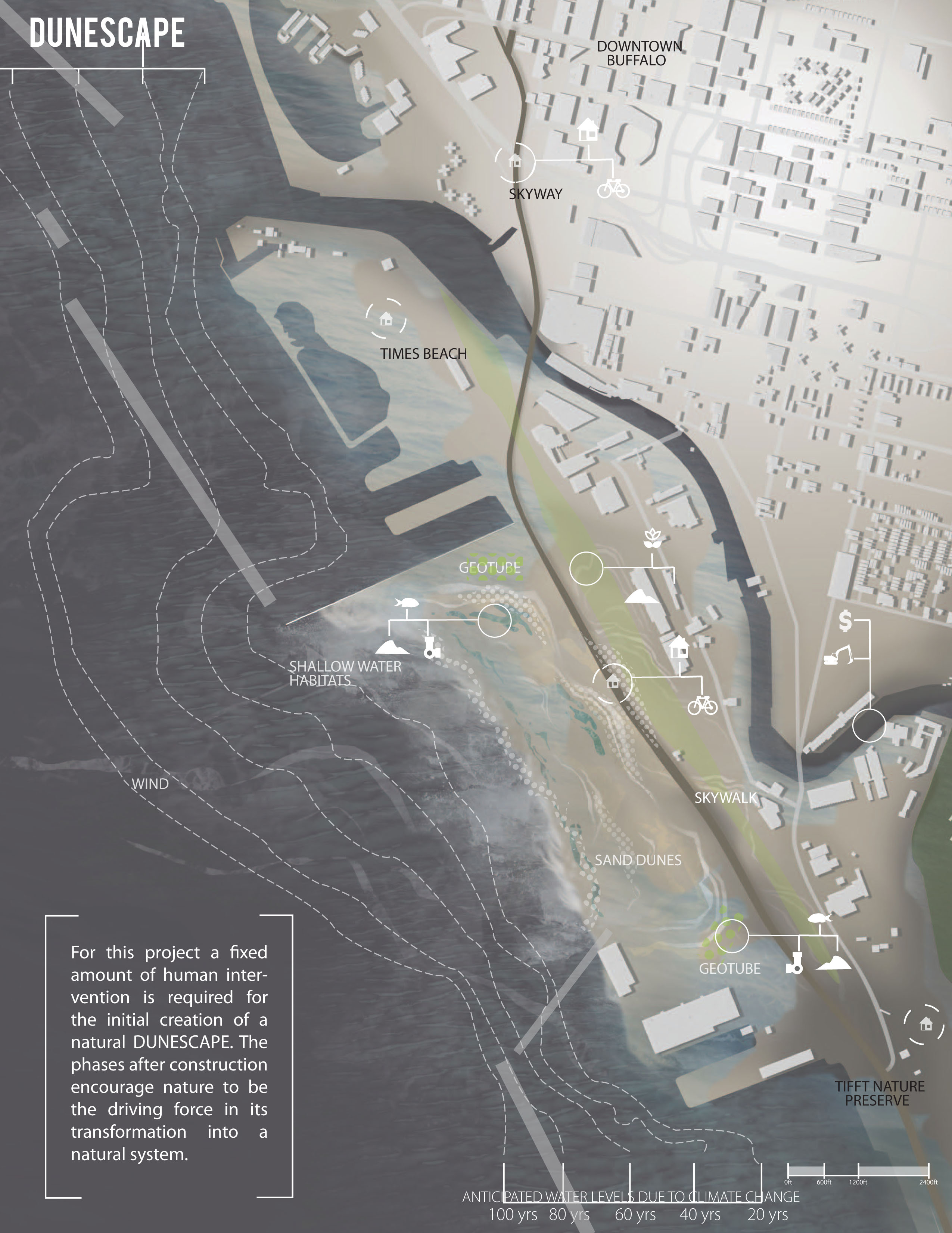
For this project a fixed amount of human intervention is required for the initial creation of a natural DUNESCAPE. The phases after construction encourage nature to be the driving force in its transformation into a natural system.
Download Hi-Res ImageImage: Chelsea Andersson, Olivia Bennett, and Bradley Wells
Image 8 of 17
 Close Me!
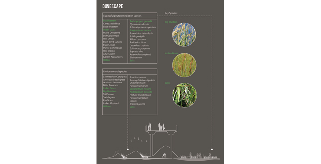
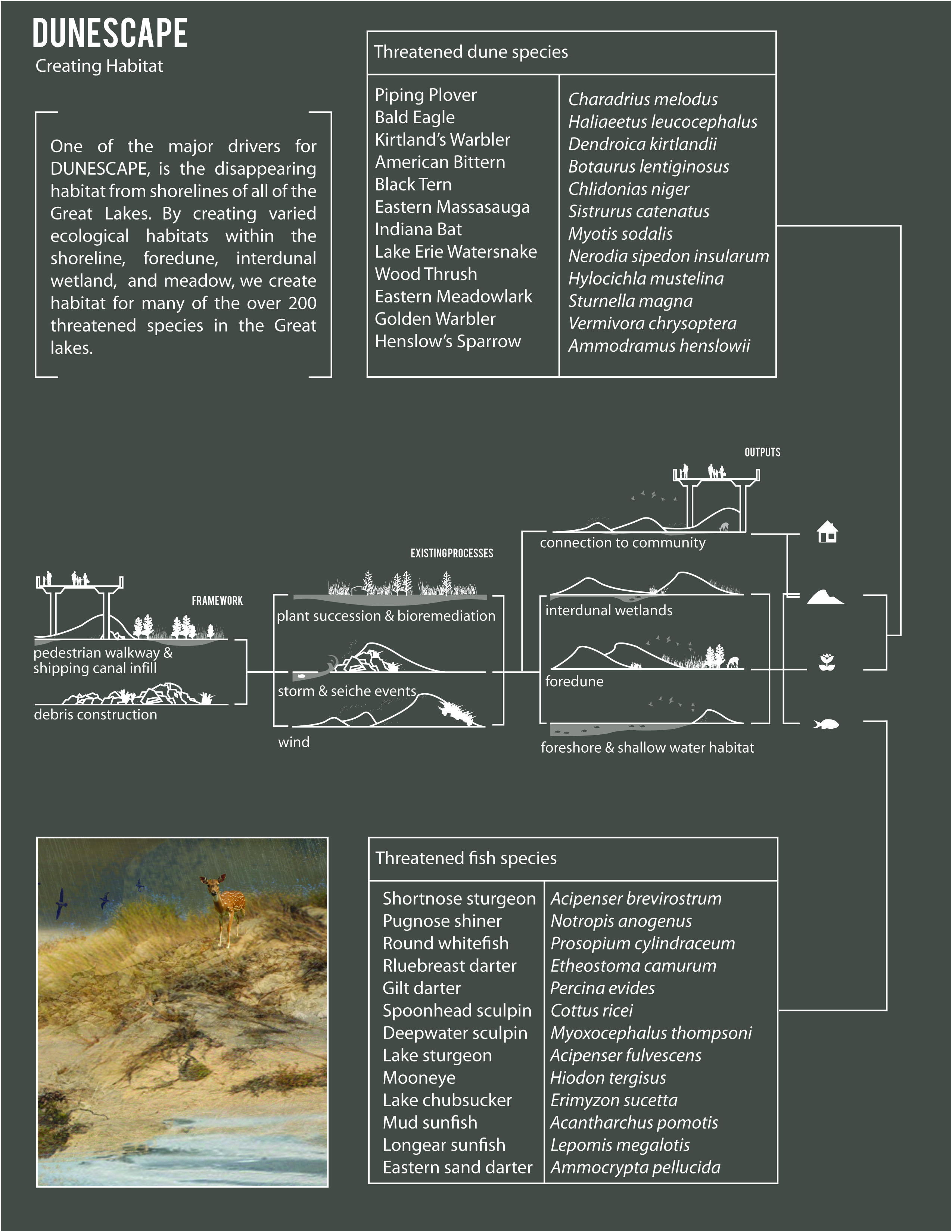
Key Species.
Download Hi-Res ImageImage: Chelsea Andersson, Olivia Bennett, and Bradley Wells
Image 9 of 17
 Close Me!
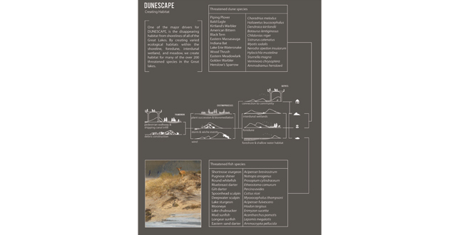
One of the major drivers for DUNESCAPE, is the disappearing habitat from shorelines of all of the Great Lakes. By creating varied ecological habitats within the shoreline, foredune, interdunal wetland, and meadow, we create habitat for many of the over 200 threatened species in the Great Lakes.
Download Hi-Res ImageImage: Chelsea Andersson, Olivia Bennett, and Bradley Wells
Image 10 of 17
 Close Me!
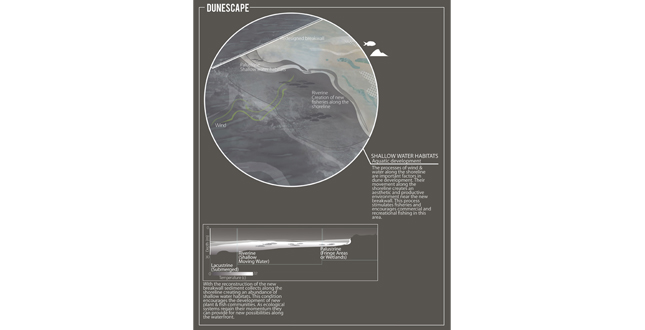
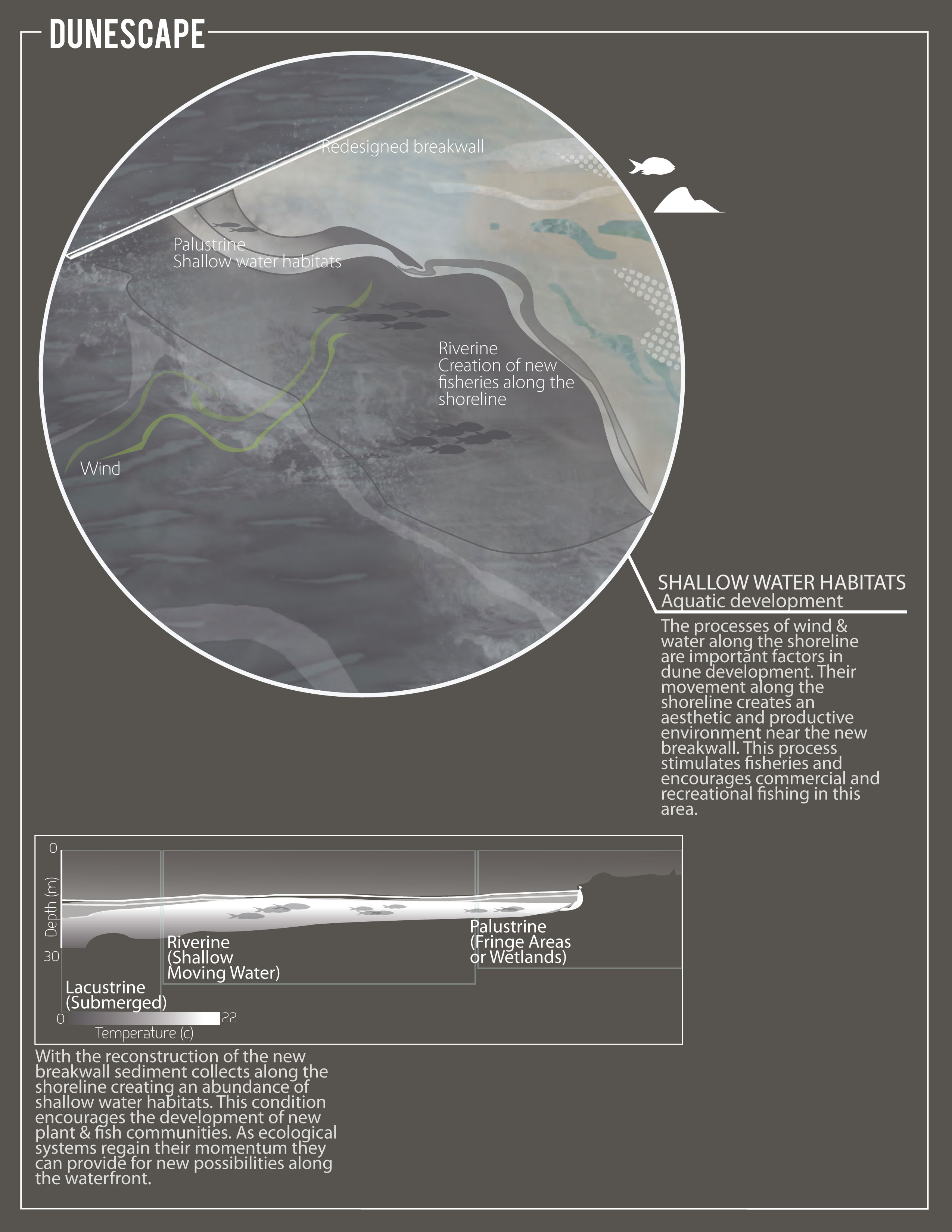
Shallow Water Habitats. Aquatic development.
Download Hi-Res ImageImage: Chelsea Andersson, Olivia Bennett, and Bradley Wells
Image 11 of 17
 Close Me!
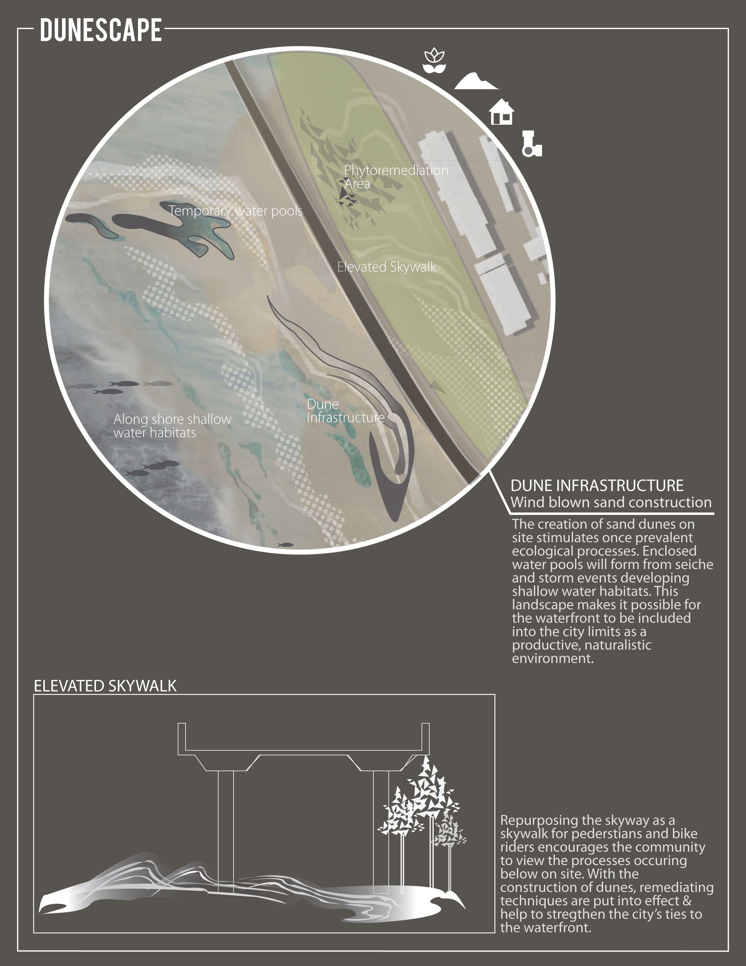
Dune Infrastructure. Wind blown sand construction.
Download Hi-Res ImageImage: Chelsea Andersson, Olivia Bennett, and Bradley Wells
Image 12 of 17
 Close Me!
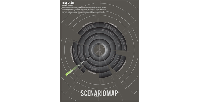
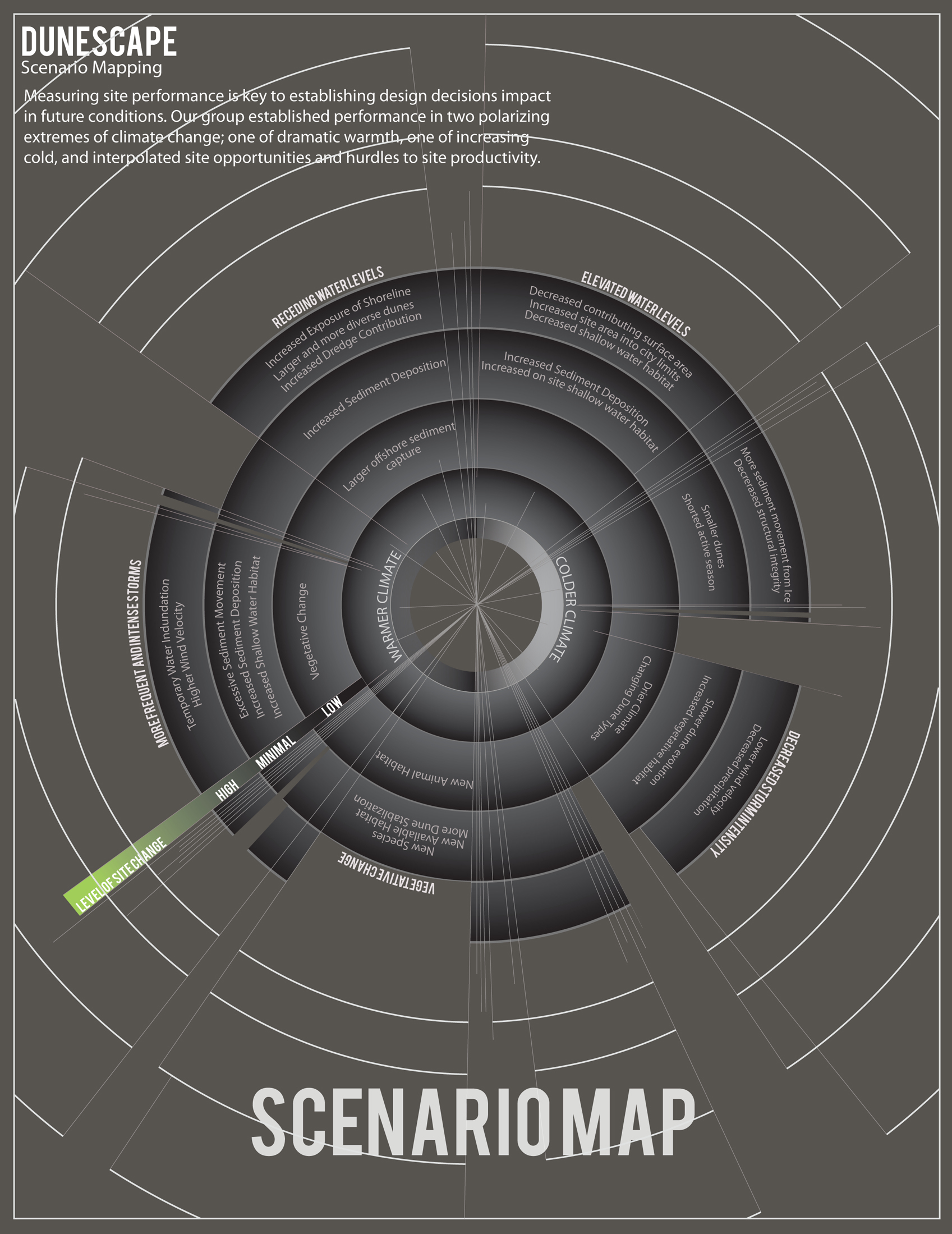
Measuring site performance is key to establishing design decisions impact in future conditions. Our group established performance in two polarizing extremes of climate change; one of dramatic warmth, one of increasing cold, and interpolated site opportunities and hurdles to site productivity.
Download Hi-Res ImageImage: Chelsea Andersson, Olivia Bennett, and Bradley Wells
Image 13 of 17
 Close Me!
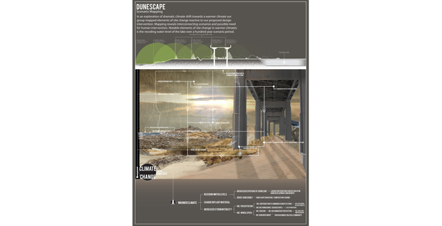
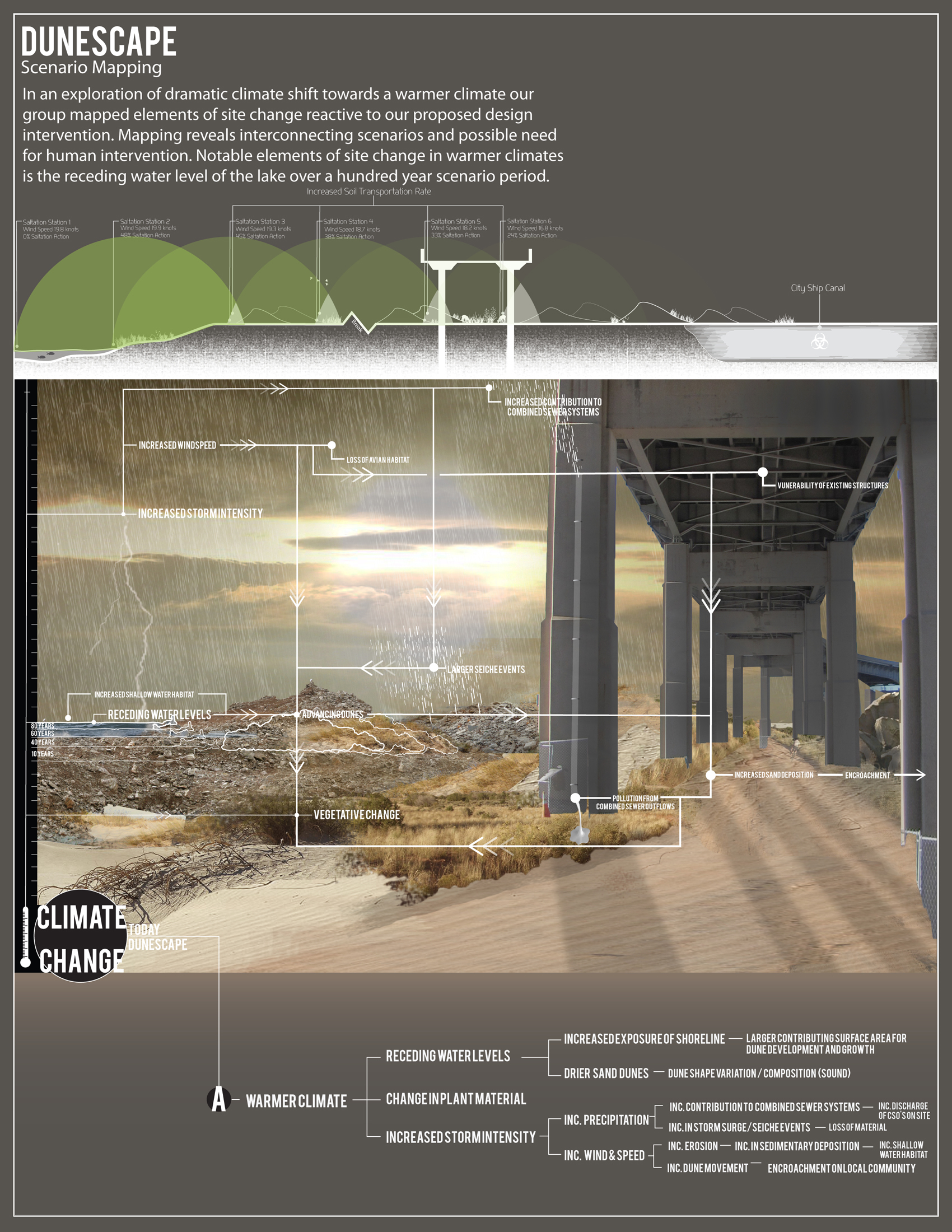
In an exploration of dramatic climate shift towards a warmer climate our group mapped elements of site change reactive to our proposed design intervention. Mapping reveals interconnecting scenarios and possible need for human intervention. Notable elements of site change in warmer climates is the receding water level of the lake over a hundred year scenario period.
Download Hi-Res ImageImage: Chelsea Andersson, Olivia Bennett, and Bradley Wells
Image 14 of 17
 Close Me!
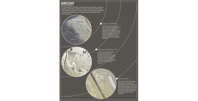
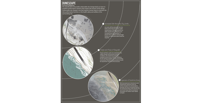
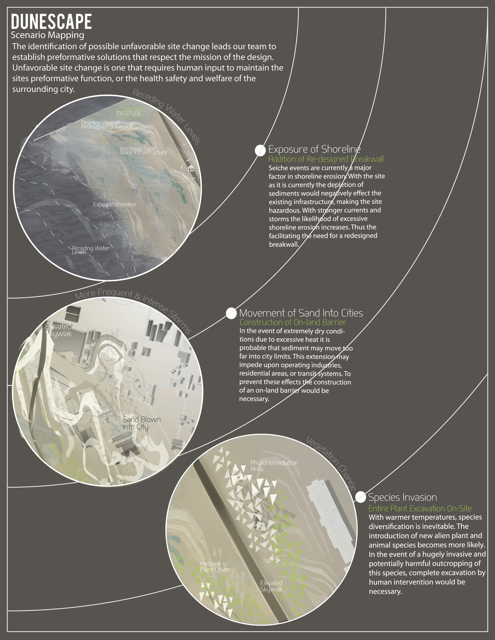
The identification of possible unfavorable site change leads our team to establish performative solutions that respect the mission of the design. Unfavorable site change is one that requires human input to maintain the sites performative function, or the health, safety, and welfare of the surrounding city.
Download Hi-Res ImageImage: Chelsea Andersson, Olivia Bennett, and Bradley Wells
Image 15 of 17
 Close Me!
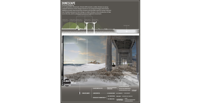
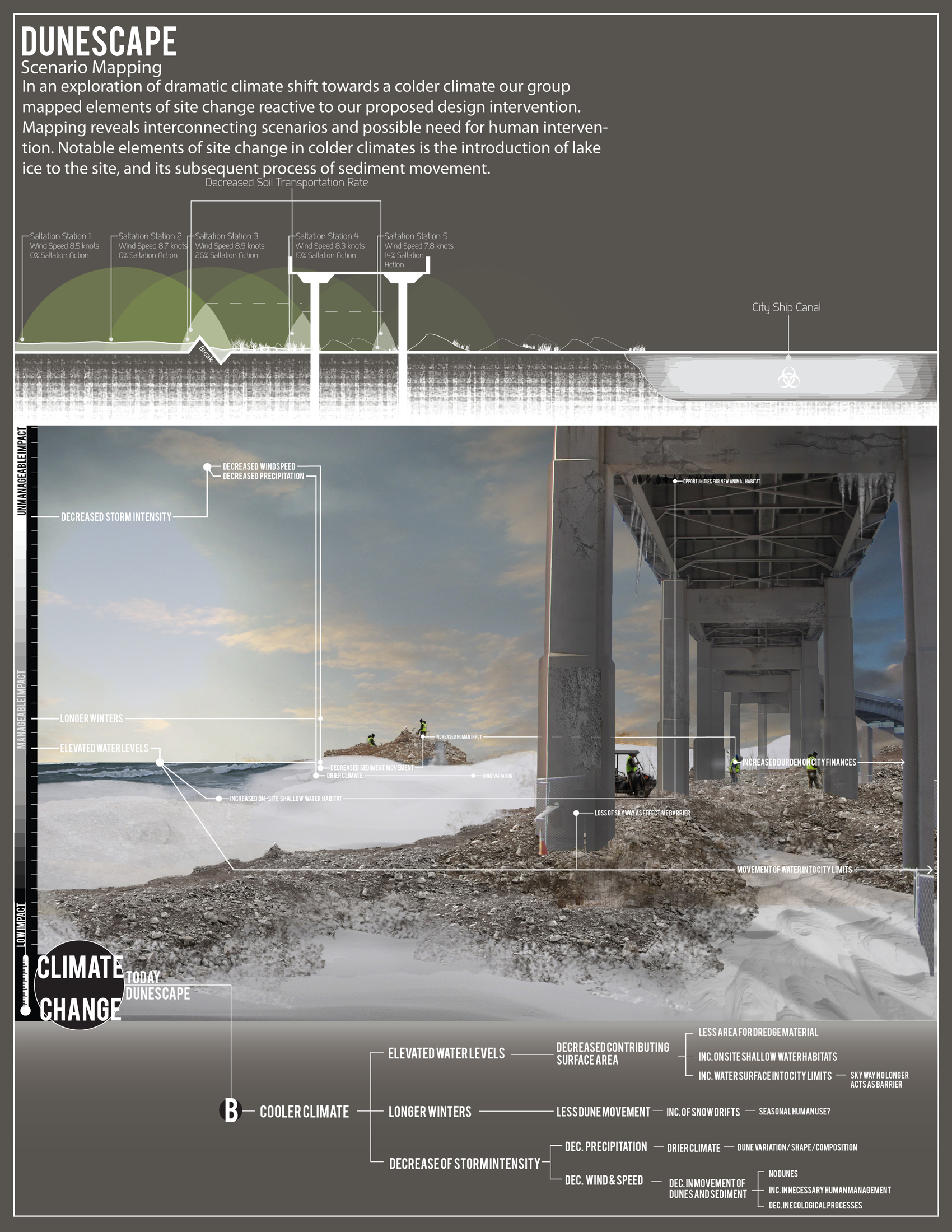
In an exploration of dramatic climate shift towards a colder climate our group mapped elements of site change reactive to our proposed design intervention. Mapping reveals interconnecting scenarios and possible need for human intervention. Notable elements of site change in colder climates is the introduction of lake ice to the site, and its subsequent process of sediment movement.
Download Hi-Res ImageImage: Chelsea Andersson, Olivia Bennett, and Bradley Wells
Image 16 of 17
 Close Me!
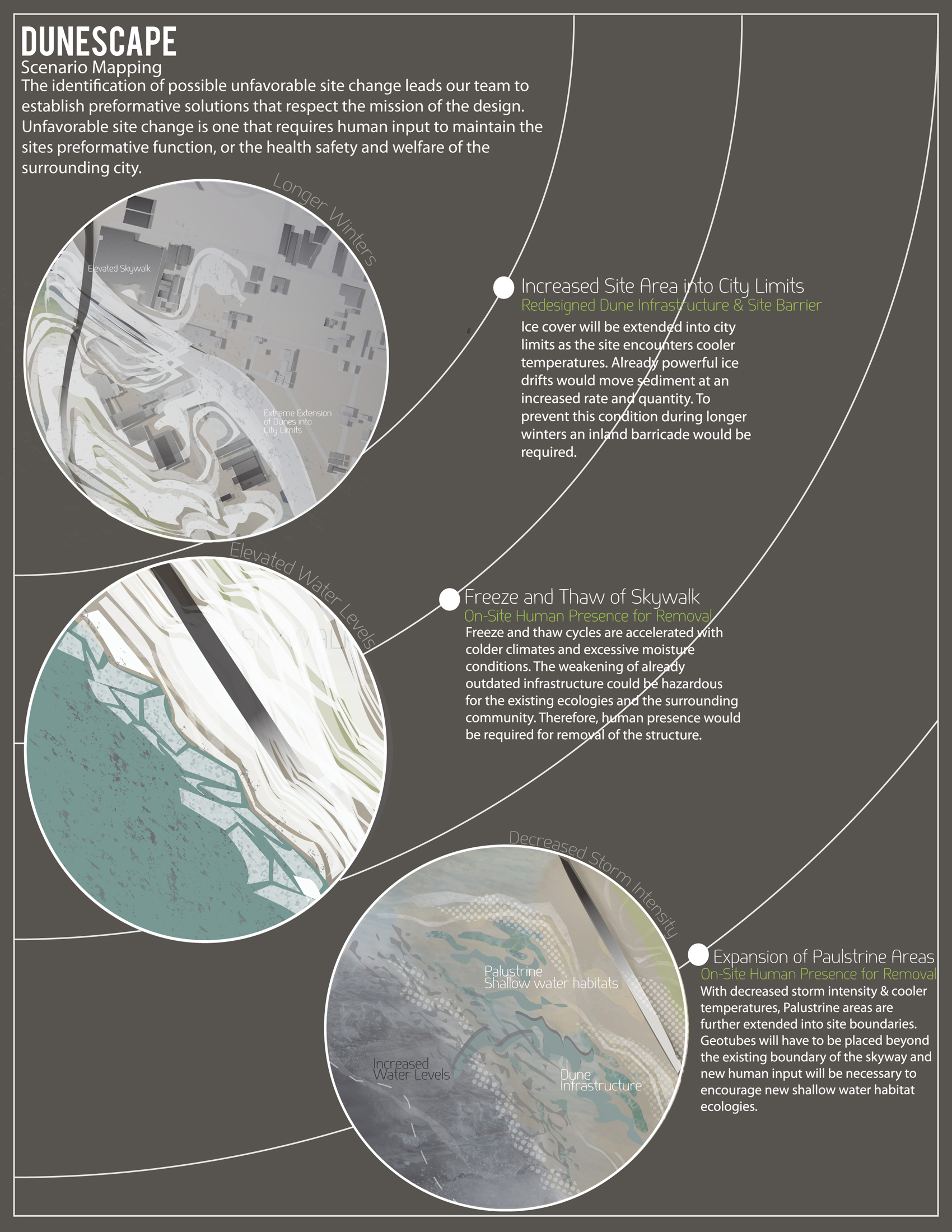
The identification of possible unfavorable site change leads our team to establish performative solutions that respect the mission of the design. Unfavorable site change is one that requires human input to maintain the sites performative function, or the health, safety, and welfare of the surrounding city.
Download Hi-Res ImageImage: Chelsea Andersson, Olivia Bennett, and Bradley Wells
Image 17 of 17
Project Statement
It is important to understand that redevelopment for any rust belt city should be conscientious of the unlimited time frame yet limited budget. Buffalo, New York was left with 180 acres of industrial wasteland along it’s outer harbor; a product of Erie Canal dredging. By utilizing existing site materials to create the foundations for an uninhibited landscape, and allowing natural systems to act upon it, the site becomes as “natural” as a man made site could ever be.
Project Narrative
Buffalo’s Outer Harbor was once the center of the city’s shipping district. At this Western terminus of the Erie Canal, industry bloomed. The constant exchange made the city of Buffalo, New York, home to many major corporations. Manufacturers of steel, cement, copper, and other industrial materials made their livelihood on the city’s outskirts. They took advantage of this remarkable economic system and the ease with which they could receive, sell and dispose of their product.
The onset of globalization in recent years has left Buffalo struggling. Many once bustling water front cities grew stagnant as moves toward air and land transportation became more prevalent. Many industries that had once thrived in their location went bankrupt, leaving only contamination and vacant warehouses behind them.
Like many rust belt cities, Buffalo has had to radically re-plan in order to deal with hundreds of vacant properties, a struggling economy, acres of contaminated soils, and crumbling social and built infrastructure. While some areas have begun to see efforts of revitalization, the city will require years of input to reach its restoration potential.
Today, Buffalo is still required to dredge over 600,000 cubic yards of highly contaminated soil from the base of the Buffalo River. The city ships this soil to a combined disposal facility adjacent to the graveyard of Bethlehem Steel, a once major industry in buffalo and huge contributor to the pollution.
The city has no output from the transportation of these contaminated soils. In the CDF the soils occupy over 130 acres of property while they remain untreated, and unusable. There is no plan to revitalize this area of extreme toxicity.
The Outer Harbor itself occupies 180 acres, and over 10,000 linear feet of shoreline. In its current state, researchers have discovered elevated levels of metals, polychlorinated biphenyls (PCBs), polycyclic aromatic hydrocarbons (PAHs), and numerous other chemicals; with many hotspots of contamination exceeding recommended levels.
Industrial remains have scarred this landscape leaving flats of asphalt and concrete. These stagnate areas are impenetrable to plant life, and inhospitable to animals. Piles of illegal dumping give the only artifact of human presence. The only visitors pass from over 100 feet above on Buffalo’s outdated, and soon to be dismantled, elevated highway; the Skyway.
The site is a product of manmade landworks. It is the original output of soils moved in the creation of the Erie Canal. In this way, it has never known a “natural” landscape. It has even worked to shelter itself from a number of existing environmental conditions. Winds reach up to 24.5 knots on an average day. Storms are also frequent from turbulent Lake Erie, and annual “seiche” events. These events cause storm surges of up to eight feet, severely eroding the shoreline. The strong infrastructure of the break walls and 15 ft. bulkheads separate the site from nature even further.
Despite its appearance as a blank slate, this site has many extreme factors which work against design.
One of the guiding principles of the effort to restore the Buffalo River is to allow the contaminant levels to be reduced to a point that would allow beneficial uses of sediments. The Buffalo River Restoration Partnership hopes to see future "beneficial re-use" of clean, dredged sediment for regional habitat and river restoration. Possible beneficial re-use opportunities include the use of dredged sediment for upland purposes, in-water restoration, or fill, rather than disposing of the sediment and taking up space in a CDF or landfill.
DUNESCAPE helps address these hopes by utilizing the contaminated soils to act as the foundation for diverse, and productive dune ecology, rather than remaining un-utilized in CDF #4. Over 450,000 cubic yards of material will be intercepted, re-distributed, and remediated on site, providing expanded usable area on the Buffalo Outer Harbor. Future navigational dredging, with soils more suitable to re-use form the substrate for a site-wide implementation of various forms of sand dunes. Thus, encouraging subsequent ecologies and habitats to form.
The establishment of this type of environment speaks directly to the strong, natural processes already present on the harbor; wind, seiche, and erosion; utilizing them for productive means. The resulting productivity of the site takes many forms. Increased shallow water habitat results from the removal of the costly breakwall adjacent to the site, with the dunes acting as shore stabilization measures. Pockets of reduced air velocity and vegetative growth promote the establishment of avian fauna, along with micro fauna capable of continued site remediation. The diverse nature of dunes make them an excellent attraction for travelers of not only the animal kingdom, but also of the community and the great lakes system.
The ultimate challenge of this design is its mission; uninhibited, naturalized, productive landscape. Assessing these goals means testing the site through various scenarios, and reading if those goals still hold true over the extremes of environmental change. Within our research of dramatic climate shift both in the current direction, and the opposite colder variant, our site preformed well to environmental shift. Although vastly different on a visual characteristic level, through the snow and ice, wind and rain; DUNESCAPE was seen to perform successfully. As it continues to utilize the natural environmental as process and inspiration with significantly reduced human input than traditional solutions for this type of site.
Additional Project Credits
Additional Faculty Advisors
Isabel Fernandez and Dan Reeder