


Honor Award
Growing Pier 68: Landscapes of Accretion
Michal Kapitulnik, Student ASLA, Graduate, University of California, Berkeley
Faculty Advisor: Judith Stilgenbauer
 Close Me!
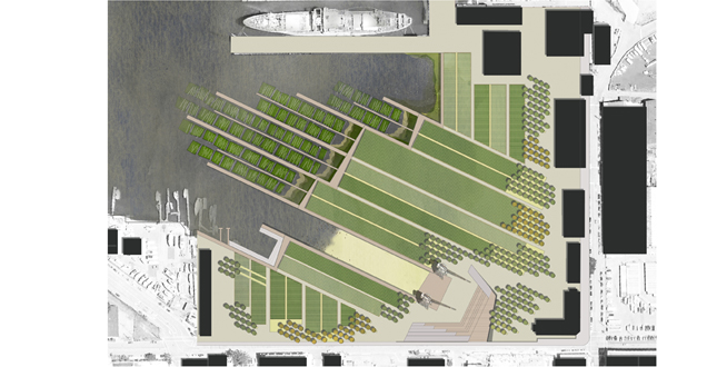
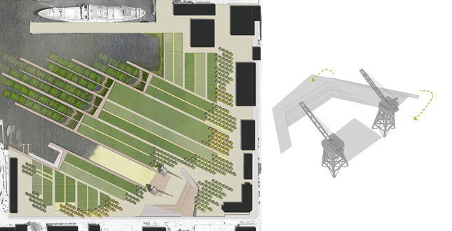
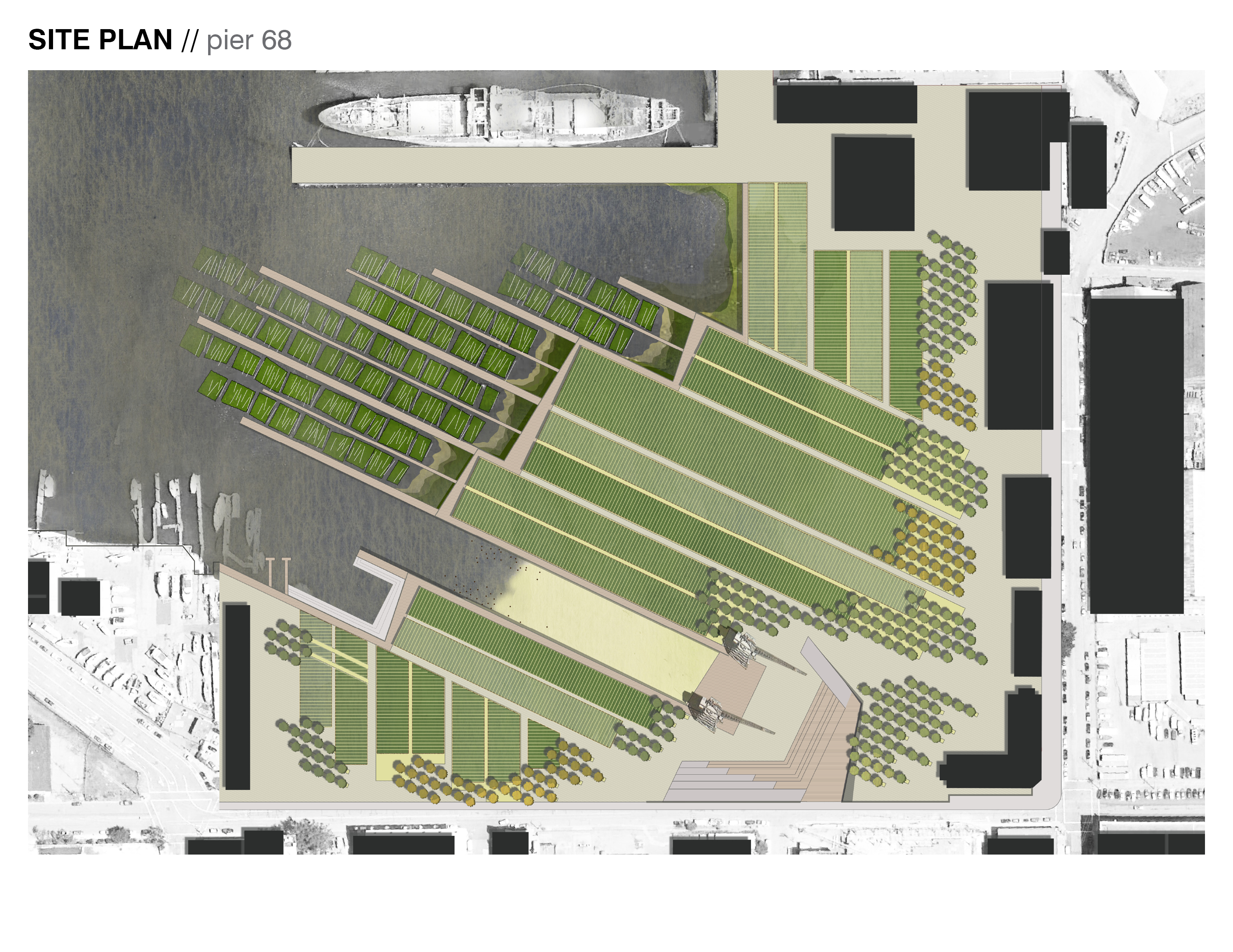
Site Plan — Pier 68. At the edge of the San Francisco Bay, Pier 68 becomes a testing-ground for a new hybrid landscape where habitat creation, terrestrial and aquatic agriculture, small-business incubation, and recreation co-exist. These rich adjacencies facilitate a new, dynamic landscape experience.
Download Hi-Res ImageImage: Michal Kapitulnik
Image 1 of 15
 Close Me!
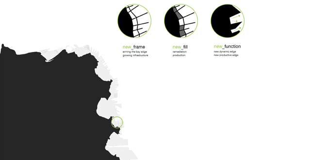
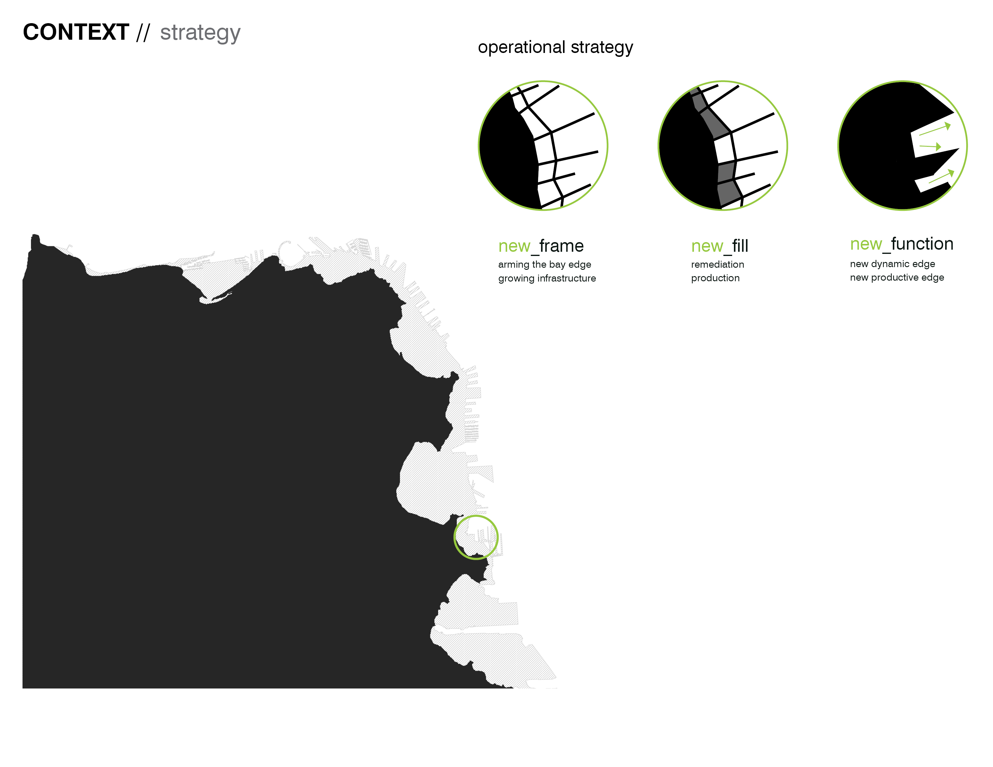
Context — Strategy. Pier 68 was built on fill, as part of the historic San Francisco Port. This land was formed over time—through the deployment of a complex framework for siltation and accretion. This edge — created as a hub for a once vibrant shipping industry — is no longer economically, ecologically, or socially relevant.
Download Hi-Res ImageImage: Michal Kapitulnik
Image 2 of 15
 Close Me!
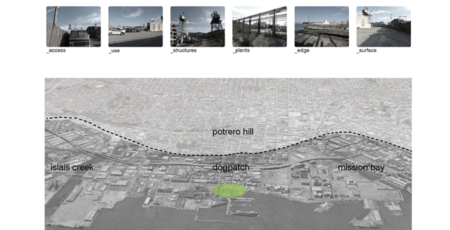
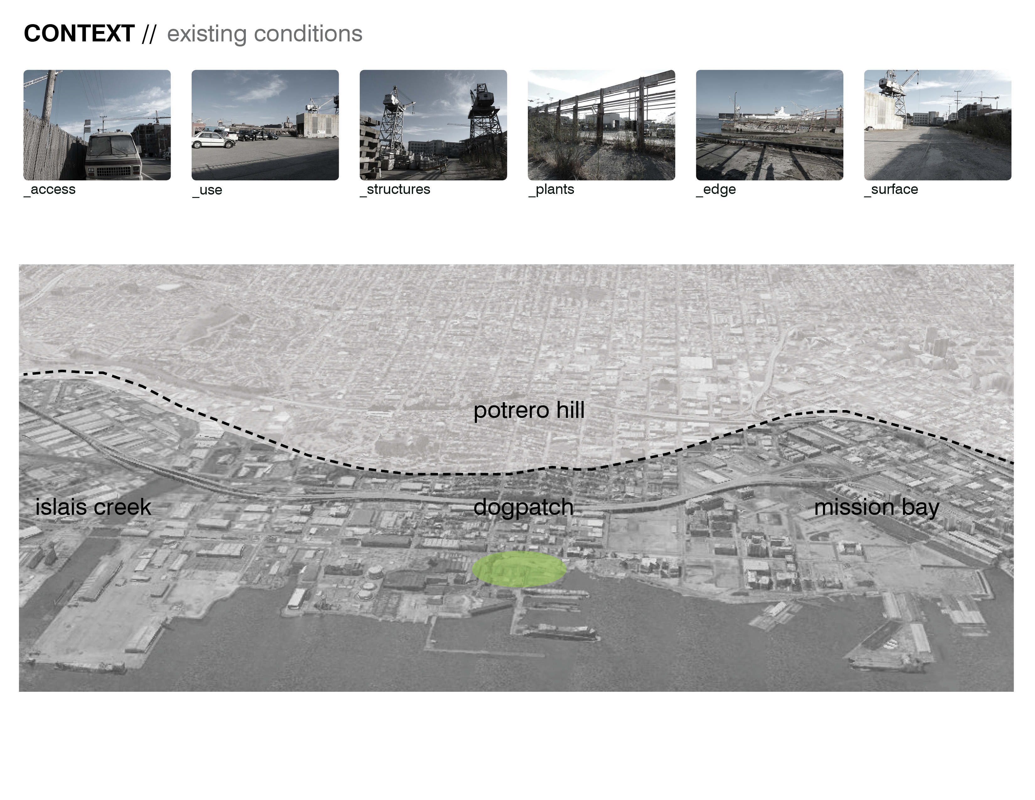
Context — Existing Conditions. Pier 68 is located in the Dogpatch neighborhood of San Francisco. With a density of only 3,000 ppl/sq mile (vs the city average of 16,000 ppl/sq mile), the community needs for open space in this neighborhood are less demanding, allowing the future of this site to move beyond the purely recreational. Thus, this 14 acre site can act as a testing ground for engaging the local community in a new way, incorporating the social and ecological needs of the neighborhood.
Download Hi-Res ImageImage: Michal Kapitulnik
Image 3 of 15
 Close Me!
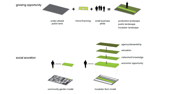
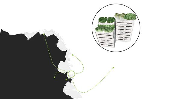
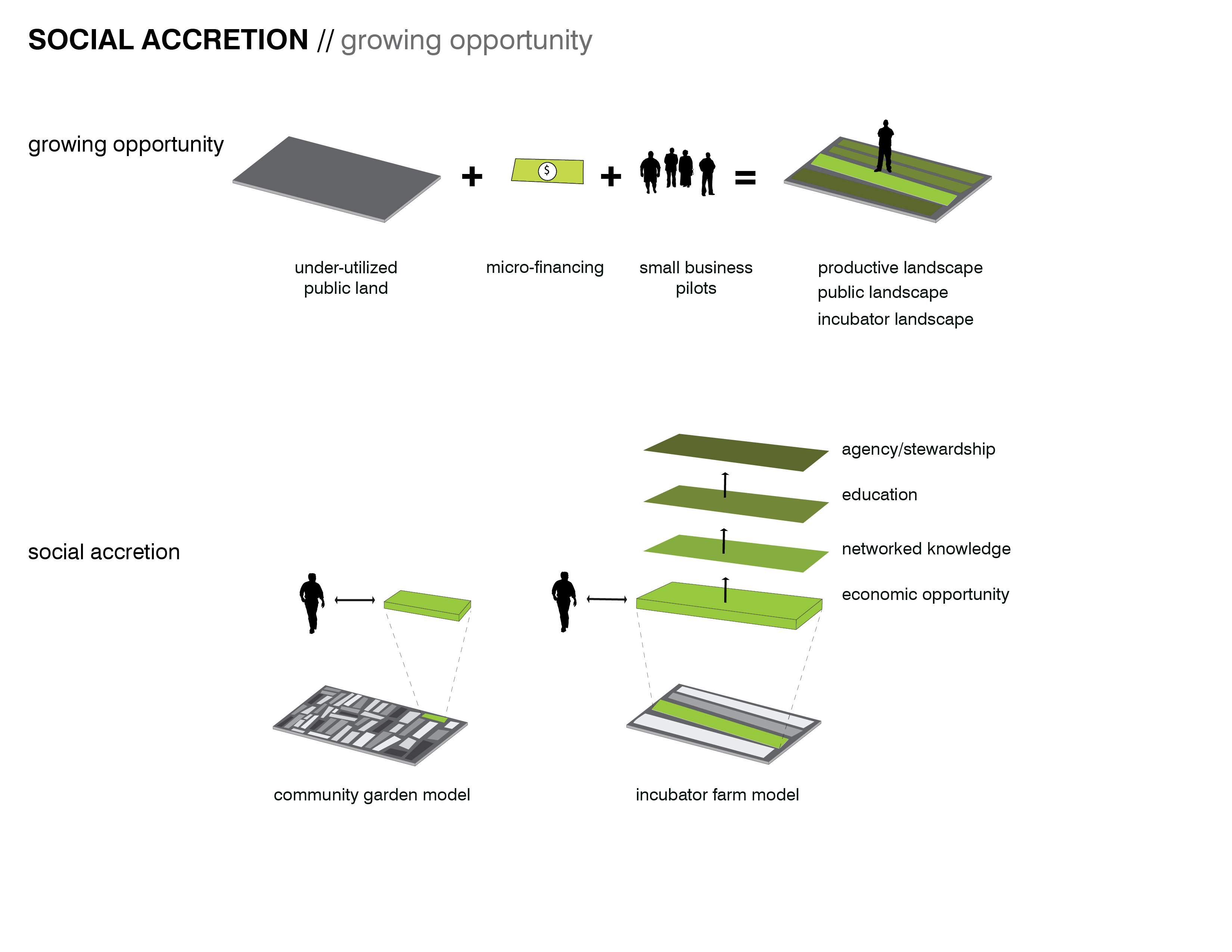
Social Accretion — Growing Opportunity. Balancing the recreational and social needs of the context, the landscape becomes a mechanism for incubating community, generating economic opportunities, and facilitating new relationships to the Bay. The site provides opportunities for small incubator farm businesses, which allow networked knowledge and expansion, as well as providing opportunities for a variety of different scales of operation.
Download Hi-Res ImageImage: Michal Kapitulnik
Image 4 of 15
 Close Me!
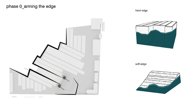
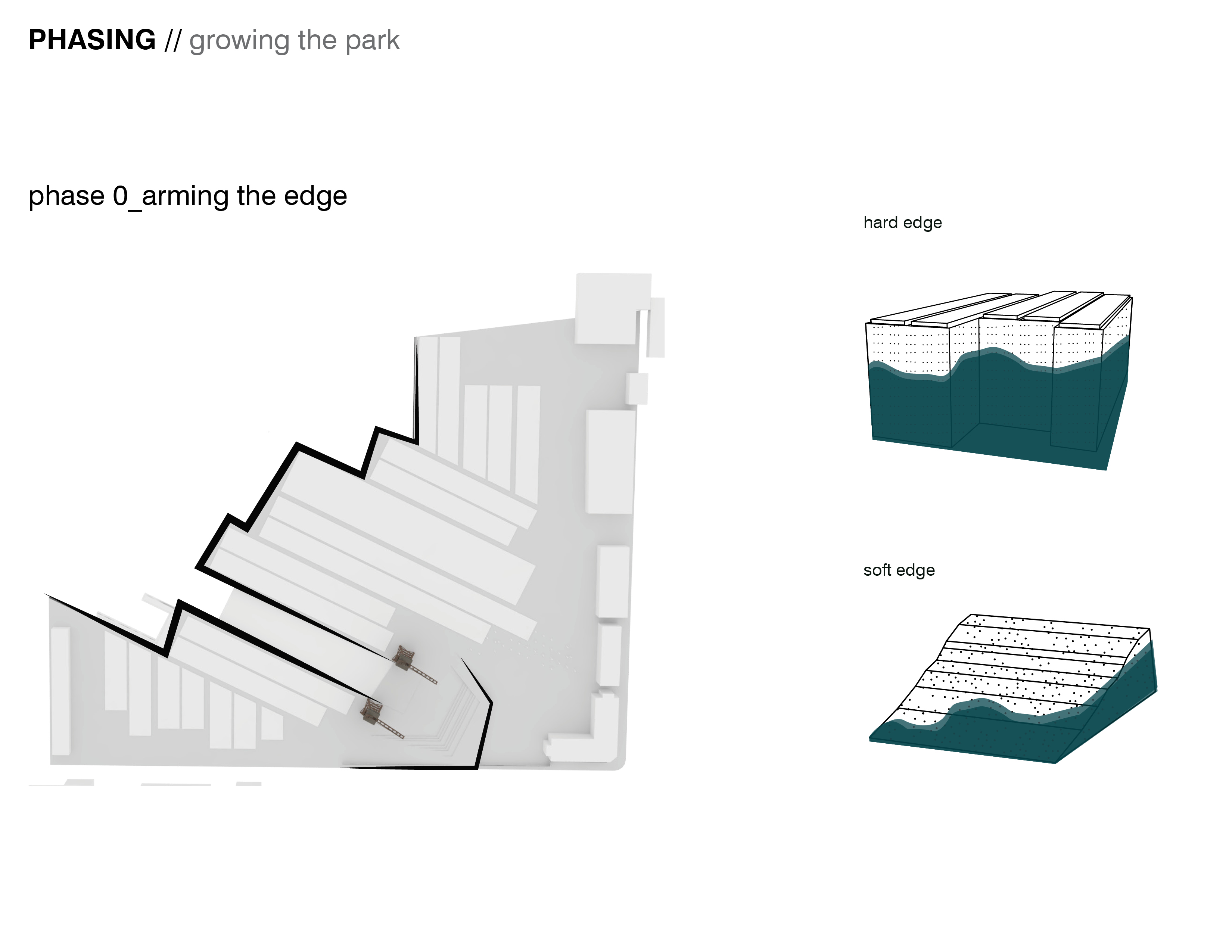
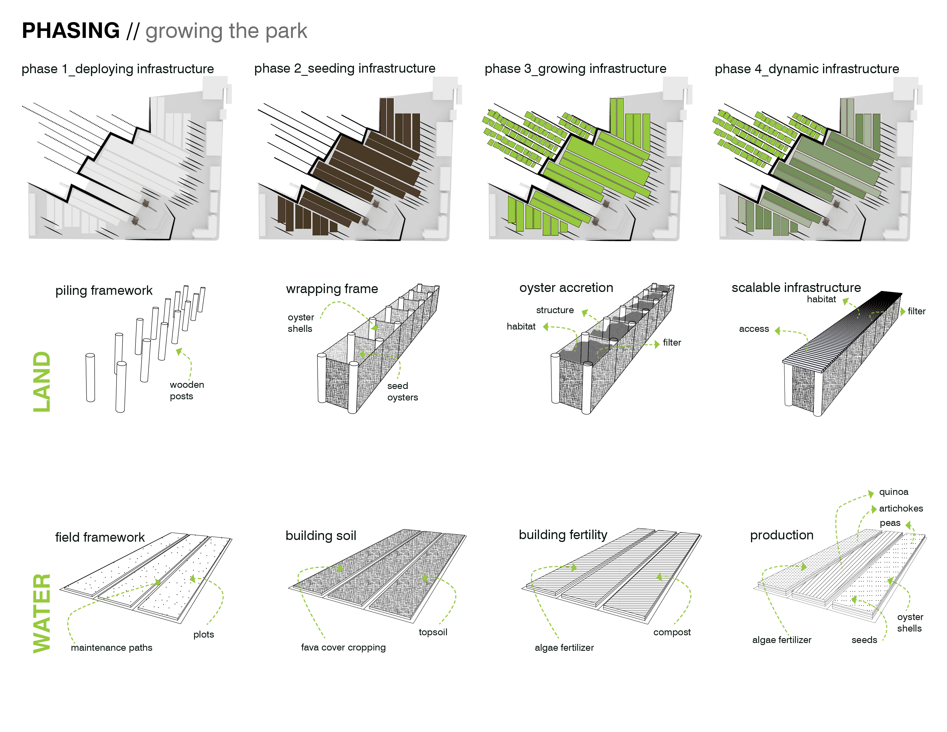
Phasing — Growing the Park. In order to explore these ideas spatially, the first phase of the site preparation addresses the degraded site edge, by creating a hard edge- which arms and contains the fill, and a soft edge- which facilitates the accretion of ecologically rich wetland habitat.
Download Hi-Res ImageImage: Michal Kapitulnik
Image 5 of 15
 Close Me!
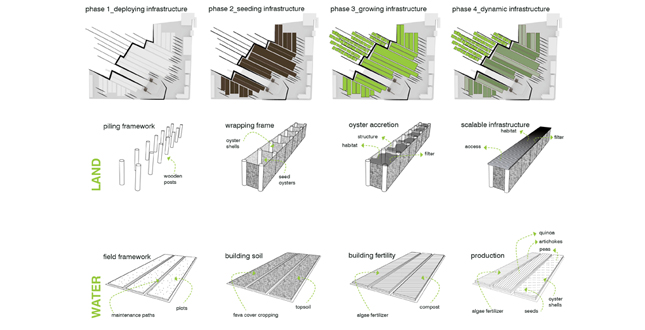
Phasing — Growing the Park. Subsequent phases involve deploying an ever-changing infrastructure that serves both recreational and ecological functions, both on land and in water. This infrastructure develops through accretion, building on itself and allowing the edge to become more dynamic and resilient.
Download Hi-Res ImageImage: Michal Kapitulnik
Image 6 of 15
 Close Me!
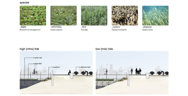
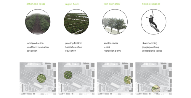
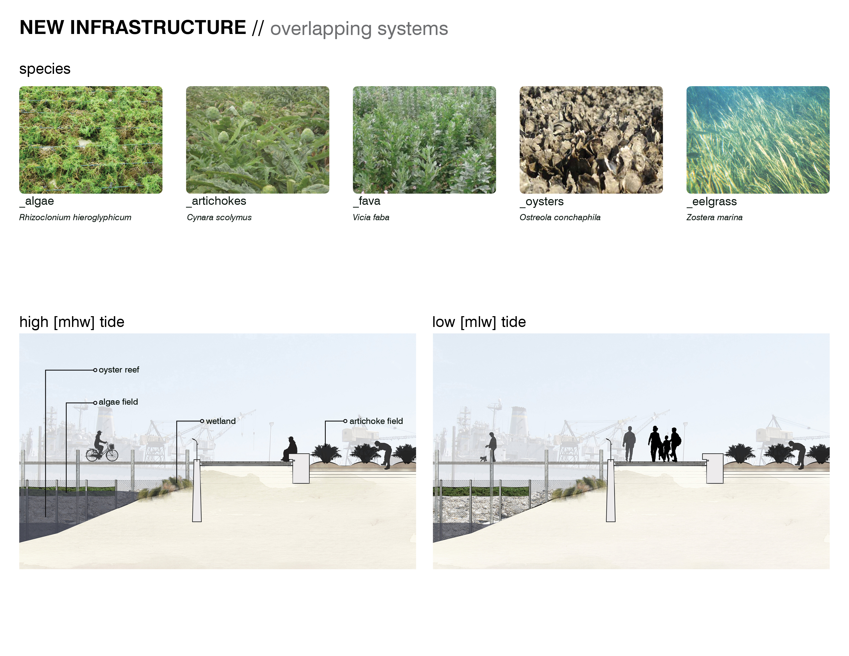
New Infrastructure — Overlapping Systems. In the early phases of the park, plant and oyster species act to remediate soil and water, as well as building soil fertility. As the site becomes cleaner, the aquatic and terrestrial beds facilitate the farming of algae, artichokes, and other plants adapted for coastal agriculture. Experiencing the site becomes about change and new types of adjacencies. Tidal fluctuation exposes oyster reefs and wetland edges. Seasonal harvests reveal the production cycles of local food.
Download Hi-Res ImageImage: Michal Kapitulnik
Image 7 of 15
 Close Me!
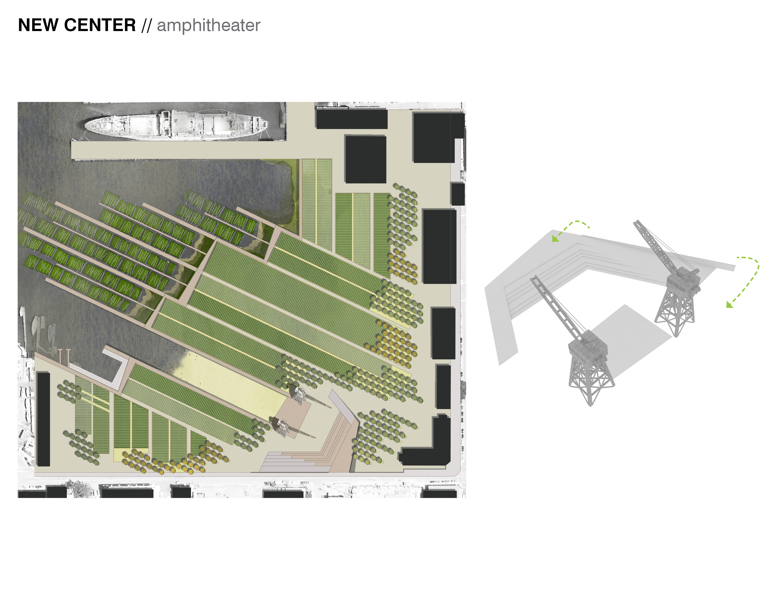
New Center — Amphitheater. Framed by the historic cranes on-site, the new amphitheater creates a new core to the park. The amphitheater reinforces the historic geometry of the site, while also providing new entrances and gathering spaces in the park, as well as framing views of the Bay.
Download Hi-Res ImageImage: Michal Kapitulnik
Image 8 of 15
 Close Me!
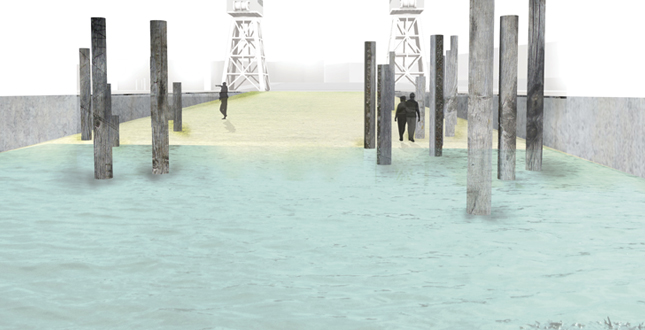
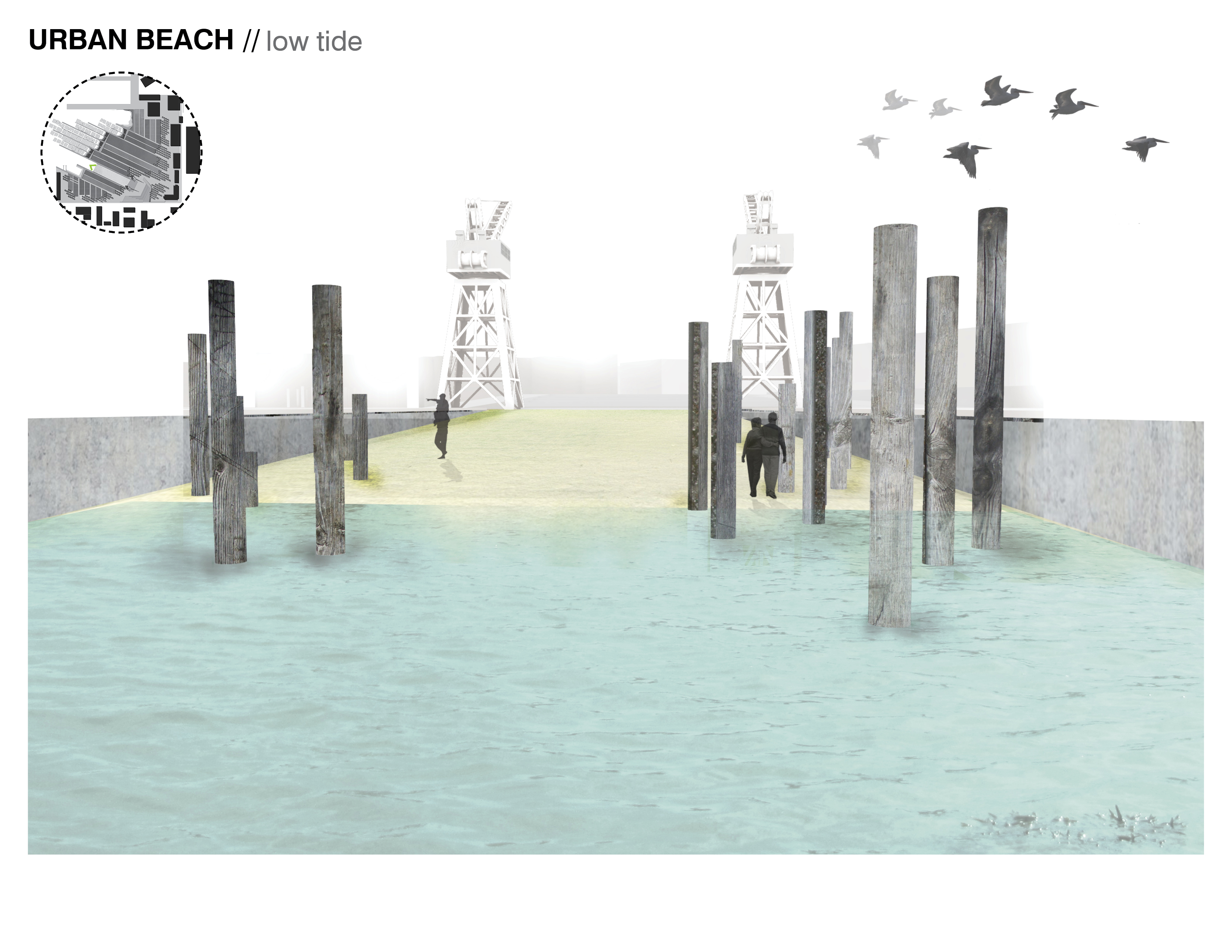
Urban Beach — Low Tide. Re-purposing the main slip, a new urban beach allows access to the Bay edge. Tidal fluctuation is highlighted by a series of recycled wooden pilings. The pilings serve a didactic purpose, marking both tidal fluctuations as well as sea level rise. The beach provides views of the aquatic algae and oyster fields, and the Bay Bridge beyond.
Download Hi-Res ImageImage: Michal Kapitulnik
Image 9 of 15
 Close Me!
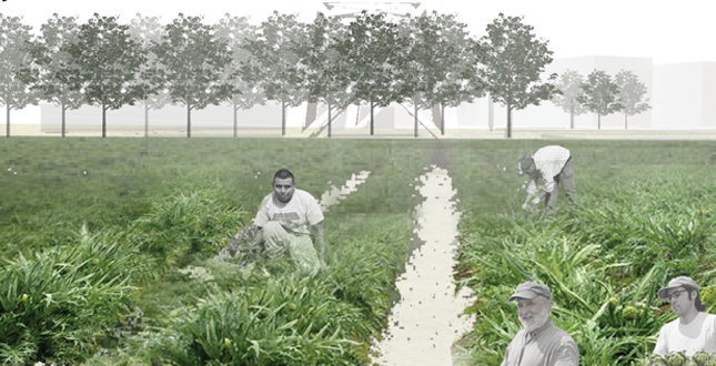
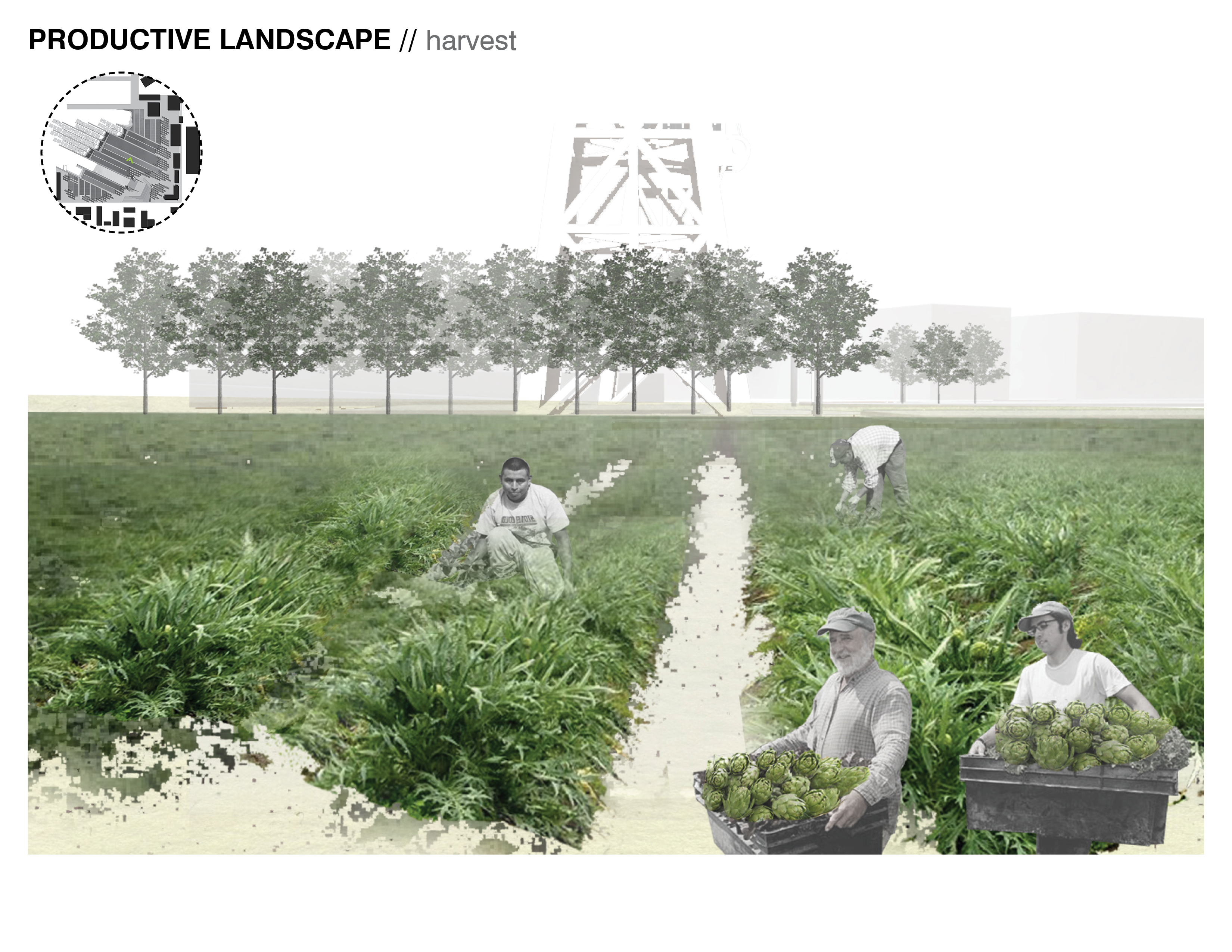
Productive Landscape — Harvest. Artichoke fields provide a new formal landscape for park users to observe small-scale agricultural production. The park incubates locally-owned agricultural businesses, allowing opportunities for scalar growth within the site, as well as value-added processing of products in the cooperatively-used support buildings on-site.
Download Hi-Res ImageImage: Michal Kapitulnik
Image 10 of 15
 Close Me!
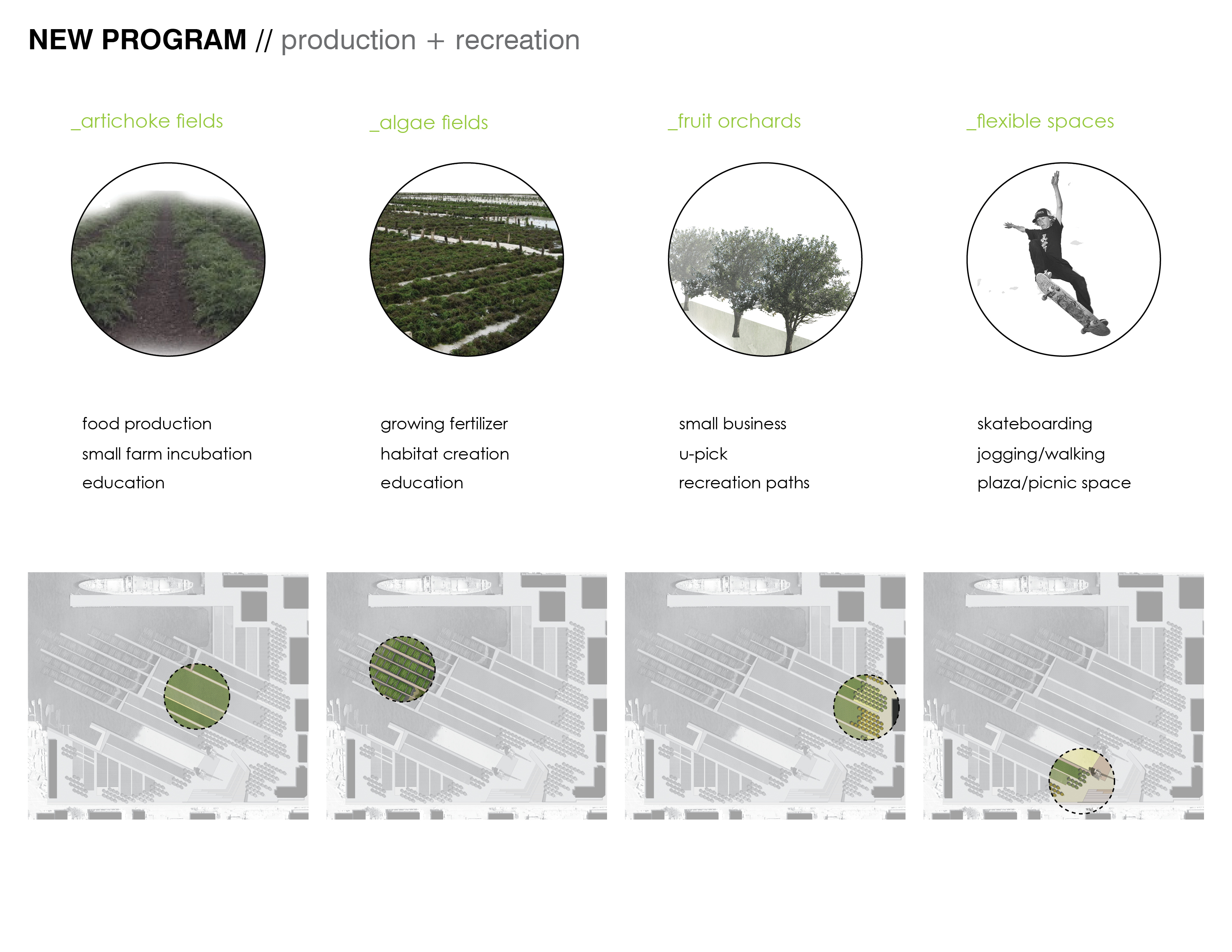
New Program — Production and Recreation. Production and recreational program overlap in this new hybrid park space, providing a dynamic experience for park users. In addition, the park itself changes throughout the phases (from remediation to production) as well as the seasons.
Download Hi-Res ImageImage: Michal Kapitulnik
Image 11 of 15
 Close Me!
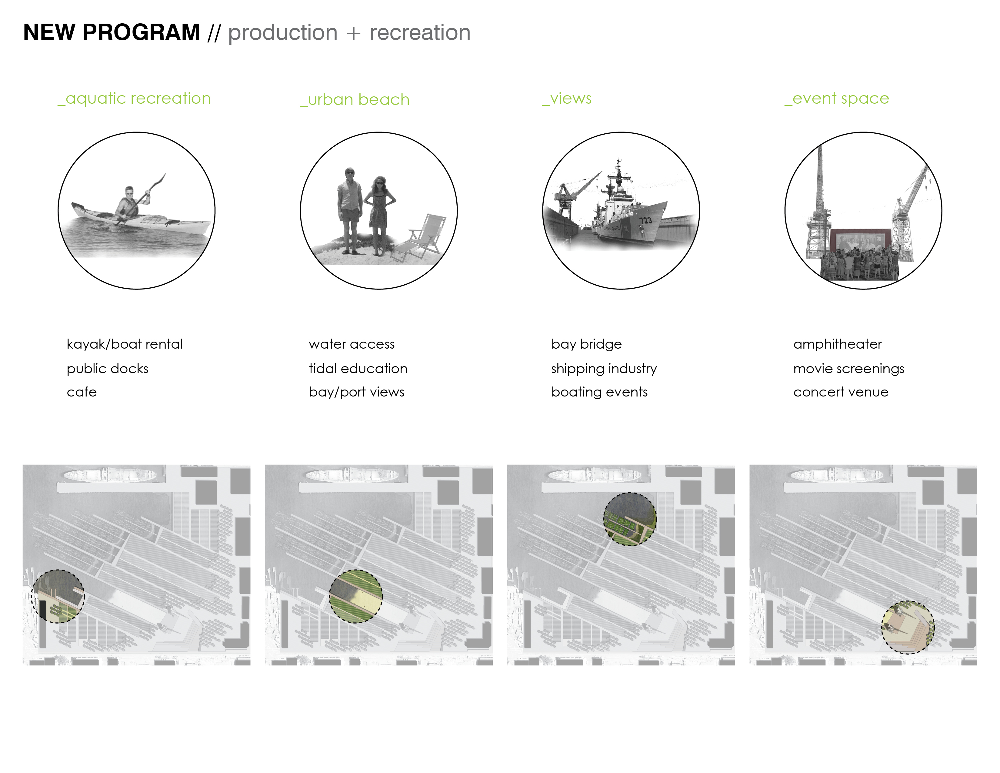
New Program — Production and Recreation. Flexible recreation spaces accommodate individual users as well as large groups and regional events. The park is allowed to grow as the neighborhood needs for the site change over time. In addition, the park showcases the Bay and the aquatic habitat, as it grows and helps clean the water.
Download Hi-Res ImageImage: Michal Kapitulnik
Image 12 of 15
 Close Me!
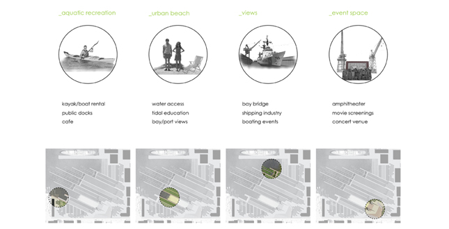
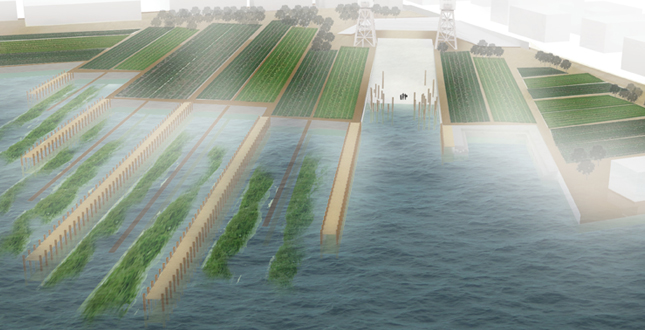
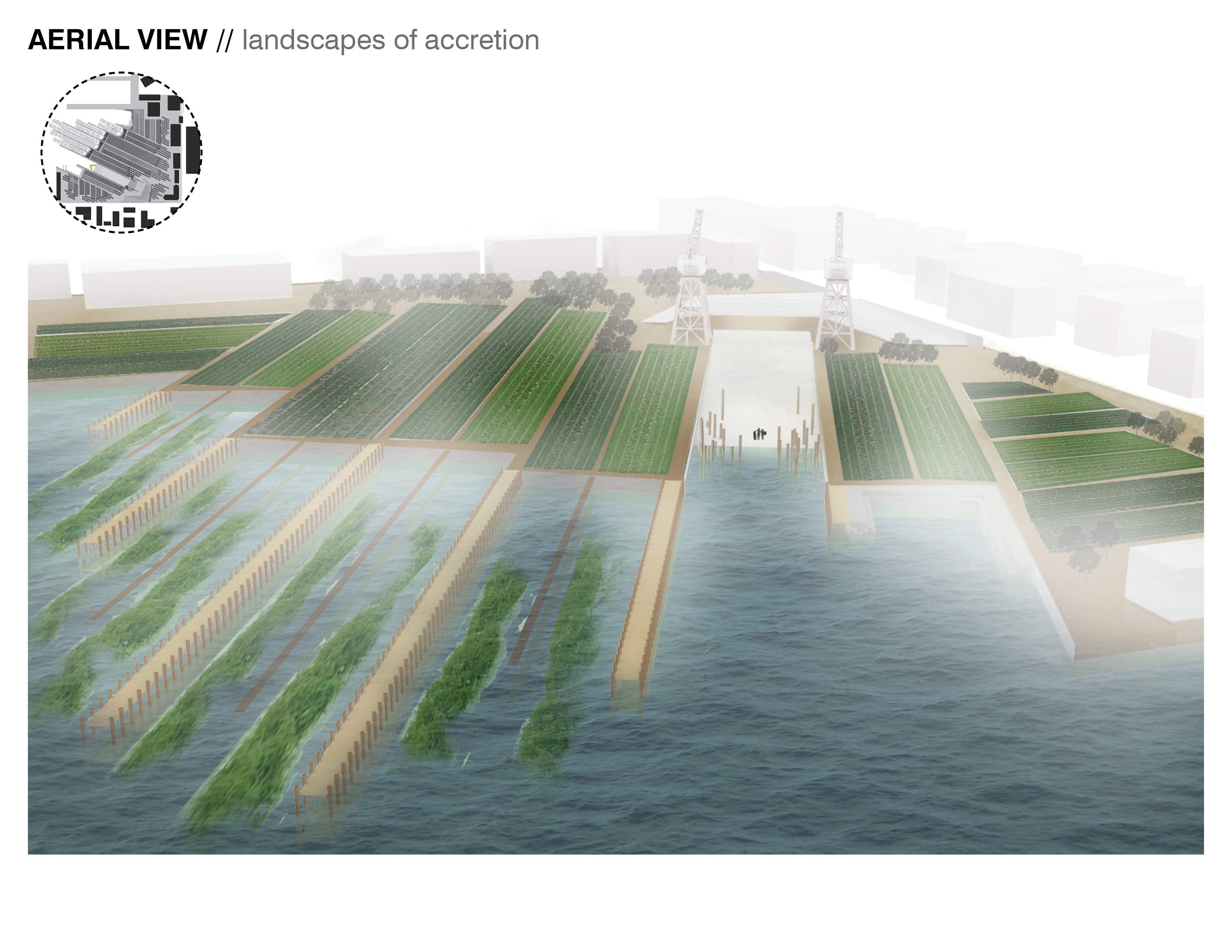
Aerial View — Landscapes of Accretion. Pier 68 becomes a landscape of accretion, constantly in flux. A new recreational paradigm allows users to engage with the Bay as well as local food production. Aquatic and terrestrial farms, an amphitheater, kayak launch, and beach, layer the site with new uses and new meaning — ultimately enriching user experiences of the park and the Bay.
Download Hi-Res ImageImage: Michal Kapitulnik
Image 13 of 15
 Close Me!
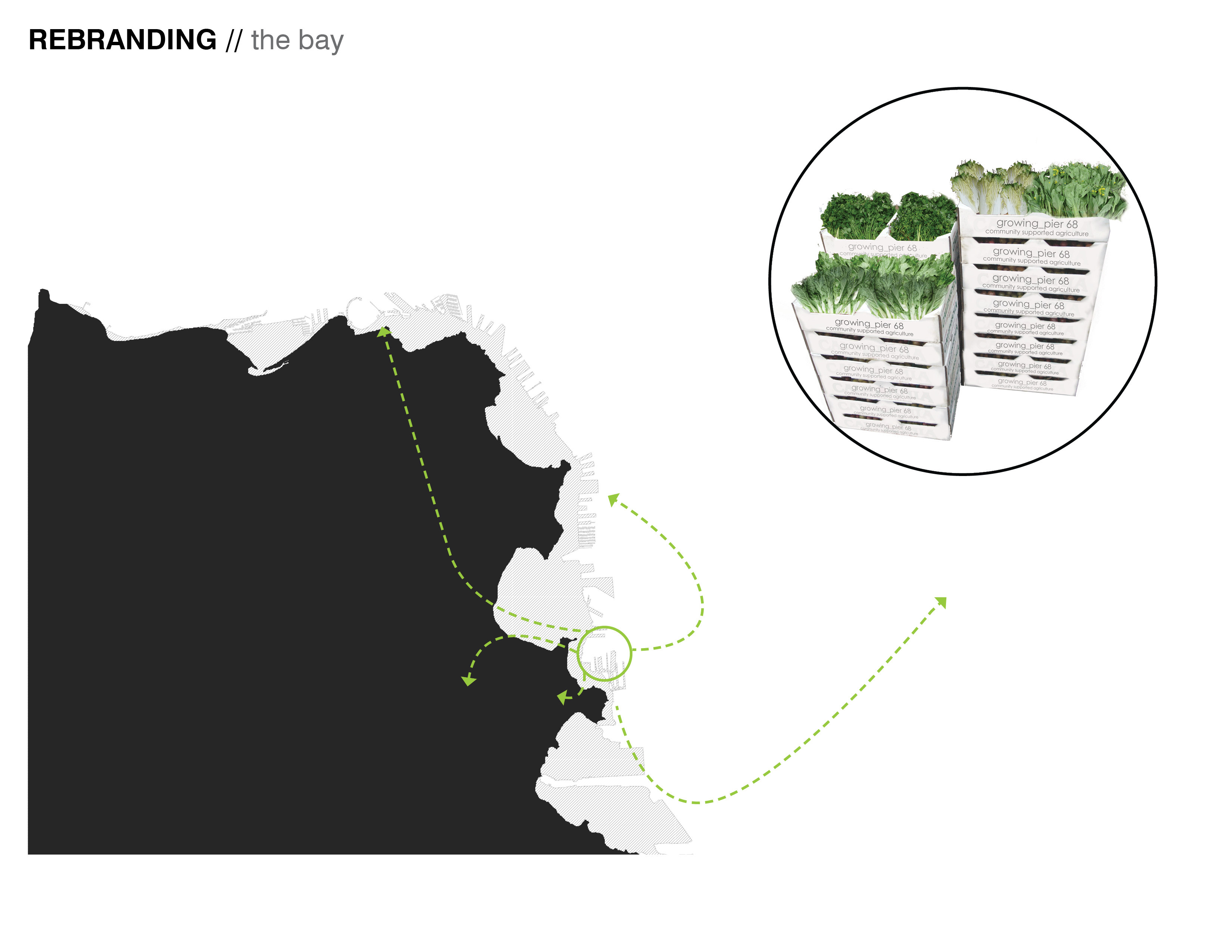
Rebranding — The Bay. As the site grows, supporting local agricultural businesses, these businesses can start to capitalize on the local food market in San Francisco. The buildings on-site serve as the infrastructure for distribution and processing, while creating a sense of stewardship for the site and the Bay.
Download Hi-Res ImageImage: Michal Kapitulnik
Image 14 of 15
 Close Me!
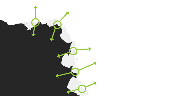
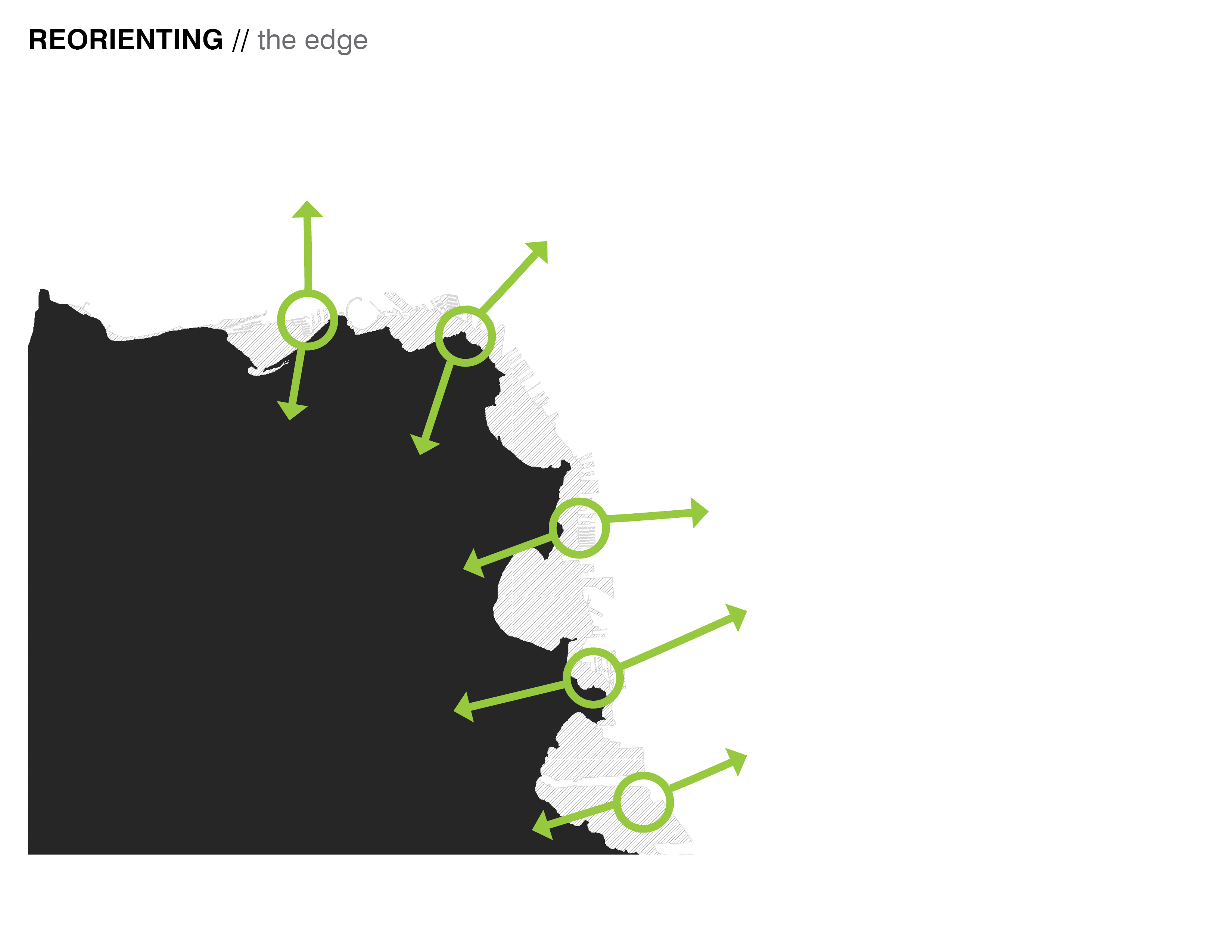
Reorienting — The Edge. No longer a shipping and industrial hub, the Bay edge must be re-conceptualized to better serve the needs of the city and the environment. As catalyst sites such as Pier 68 become available, they can begin to form a productive buffer that better responds to the land and water adjacencies, ultimately creating a more flexible and resilient Bay edge.
Download Hi-Res ImageImage: Michal Kapitulnik
Image 15 of 15
Project Statement
Historically, the San Francisco Bay was a landscape constantly in flux, influenced by wind, erosion, and water. Over the past century, the Bay edge has become more static. Yet this constructed edge was formed over time, through the deployment of a complex framework for siltation and accretion. This industrial edge is no longer economically, ecologically, or socially relevant. This project proposes a new way of engaging the Bay edge, creating a new productive landscape that incubates new hybrid uses and opportunities.
Project Narrative
Context
The edge of the San Francisco Bay was once influenced by natural processes such as wind, erosion, and water — resulting in a landscape constantly in flux. Over the past century, the Bay edge has become a more static, constructed edge. Yet this edge too was formed over time — through the deployment of a complex framework for siltation and accretion. This edge — created as a hub for a once vibrant shipping industry — is no longer economically, ecologically, or socially relevant. This project looks at a new way of engaging the Bay edge to create a new productive landscape that incubates and promotes new ecological, economic, and social opportunities on the site. As an operational strategy, a new framework is developed to arm the edge of the site and create opportunities for remediation and production that engage both the aquatic and terrestrial adjacencies of the site. In doing so, Pier 68 acts as a catalyst site for a more flexible, resilient edge — an edge that can act as a testing ground for new types of hybrid programs — ecological, productive, and recreational.
Existing Conditions
In its current condition, Pier 68 is dominated by invasive species, a degraded edge, and a general lack of public access to the site, and subsequently to the Bay edge. In spite of this, the site has a series of existing industrial relics and historic buildings that reinforce the historic geometry of the ship-repair slip that marks the center of the site. These relics — two cranes that mark the edge of the slip — provide a poetic framework for new uses and users.
Pier 68 is located in the Dogpatch neighborhood of San Francisco. With a density of only 3,000 people/sq mile (vs the city average of 16,000 people/sq mile), the community needs for open space in this neighborhood are less demanding, allowing the future of this site to move beyond the purely recreational. Thus, this site can act as a testing ground for engaging the local community in a new way, incorporating both the social and ecological needs of the neighborhood and the city at large.
Landscape as Social Incubator
Currently, the city of San Francisco has an unemployment rate of 9.2%, compared to the national average of 8.8%. Given the low density of the Dogpatch neighborhood, future uses of Pier 68 could, and should, act to do more than just provide open space for the residents of Dogpatch and greater San Francisco. Balancing the recreational and social needs of the context, the landscape becomes a mechanism for incubating community, generating economic opportunities, and facilitating new relationships to the Bay. The site provides opportunities for small incubator farm businesses, which allow networked knowledge and expansion, as well as providing opportunities for a variety of different scales of operation. As such, these small businesses become stewards of the park, as well as providing an opportunity for visitors to engage with local food production models.
Different than a community garden model — where individuals each farm a small land parcel in a collective space — the scale of the incubator farm model allows for increased productivity and efficiency, as well as providing mechanisms for collective use of tools and processing facilities. In addition, the site accommodates multiple scales of production, allowing for expansion of businesses over time. Over time, the site acts as a catalyst for rebranding the Bay edge and its possibilities.
Phasing: Growing the Park
In order to prepare the site for more productive uses, the preliminary phase of the site preparation addresses the degraded site edge, by creating a hard edge — which arms and contains the fill, and a soft edge — which facilitates the accretion of ecologically rich wetland habitat. Subsequent phases involve deploying an ever-changing infrastructure that serves both recreational and ecological functions, both on land and in water. This infrastructure develops through accretion, building on itself and allowing the edge to become more dynamic and resilient. In the early phases of the park, plant and oyster species act to remediate soil and water, as well as building soil fertility. As the site becomes cleaner, the aquatic and terrestrial beds facilitate the farming of algae, artichokes, and other plants adapted for coastal agriculture. In addition, a closed loop of fertilizer, soil-building and production between land and water begins to emerge.
Experience
Experiencing the site becomes about change and new types of adjacencies. Tidal fluctuation exposes oyster reefs and wetland edges. Seasonal harvests reveal the production cycles of local food. Re-purposing the main slip, a new urban beach allows access to the Bay edge. Recycled pilings serve a didactic purpose, marking both tidal fluctuations as well as sea level rise. The beach provides views of the aquatic algae and oyster fields, and the Bay Bridge beyond. Artichoke fields provide a new formal landscape for park users to observe small-scale agricultural production. Framed by the historic cranes on-site, the new amphitheater creates a new core to the park. The amphitheater reinforces the historic geometry of the site, while also providing new entrances and gathering spaces in the park.
Production and recreational program overlap in this new hybrid park space, providing a dynamic experience for park users. Flexible recreation spaces accommodate individual users as well as large groups and regional events. The park is allowed to grow as the neighborhood needs for the site change over time. In addition, the park showcases the Bay and the aquatic habitat, as it grows and helps clean the water. Pier 68 becomes a landscape of accretion, constantly in flux. A new recreational paradigm allows users to engage with the Bay as well as local food production. Aquatic and terrestrial farms, an amphitheater, kayak launch, and beach, layer the site with new uses and new meaning—ultimately enriching user experiences of the park and the Bay.
Expansion
As the site grows, supporting local agricultural businesses, these businesses can start to capitalize on the local food market in San Francisco. The buildings on-site serve as the infrastructure for distribution and processing, while creating a sense of stewardship for the site and the Bay. No longer a shipping and industrial hub, the Bay edge must be re-conceptualized to better serve the needs of the city and the environment. As catalyst sites such as Pier 68 become available, they can begin to form a productive buffer that better responds to the land and water adjacencies, ultimately creating a more flexible and resilient Bay edge.