


Honor Award
Microcosm of America
Joshua Brooks, Student ASLA, Undergraduate, Lousianna State University
Faculty Advisors: Lake Douglas; Van Cox; and Bruce Sharkey
 Close Me!
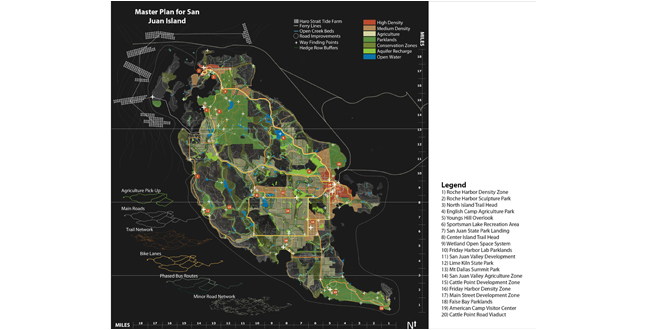
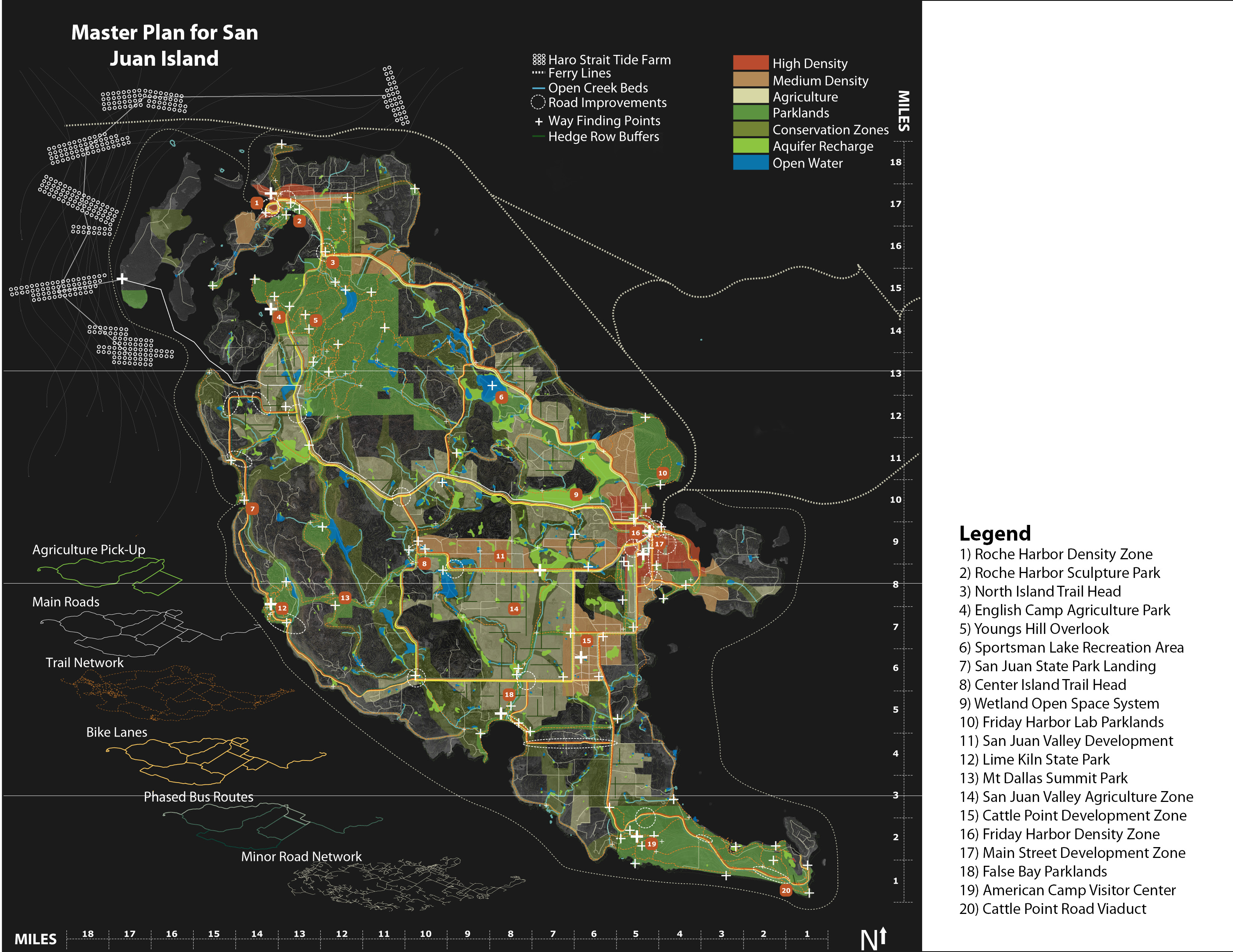
The goal of the project from the beginning was to develop a process rather than a plan. How San Juan Island and the National Park Service can reach such an ambitious framework depends on the relationships established over the next thirty five years.
Download Hi-Res ImageImage: Joshua Brooks
Image 2 of 16
 Close Me!
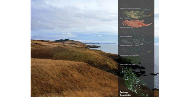
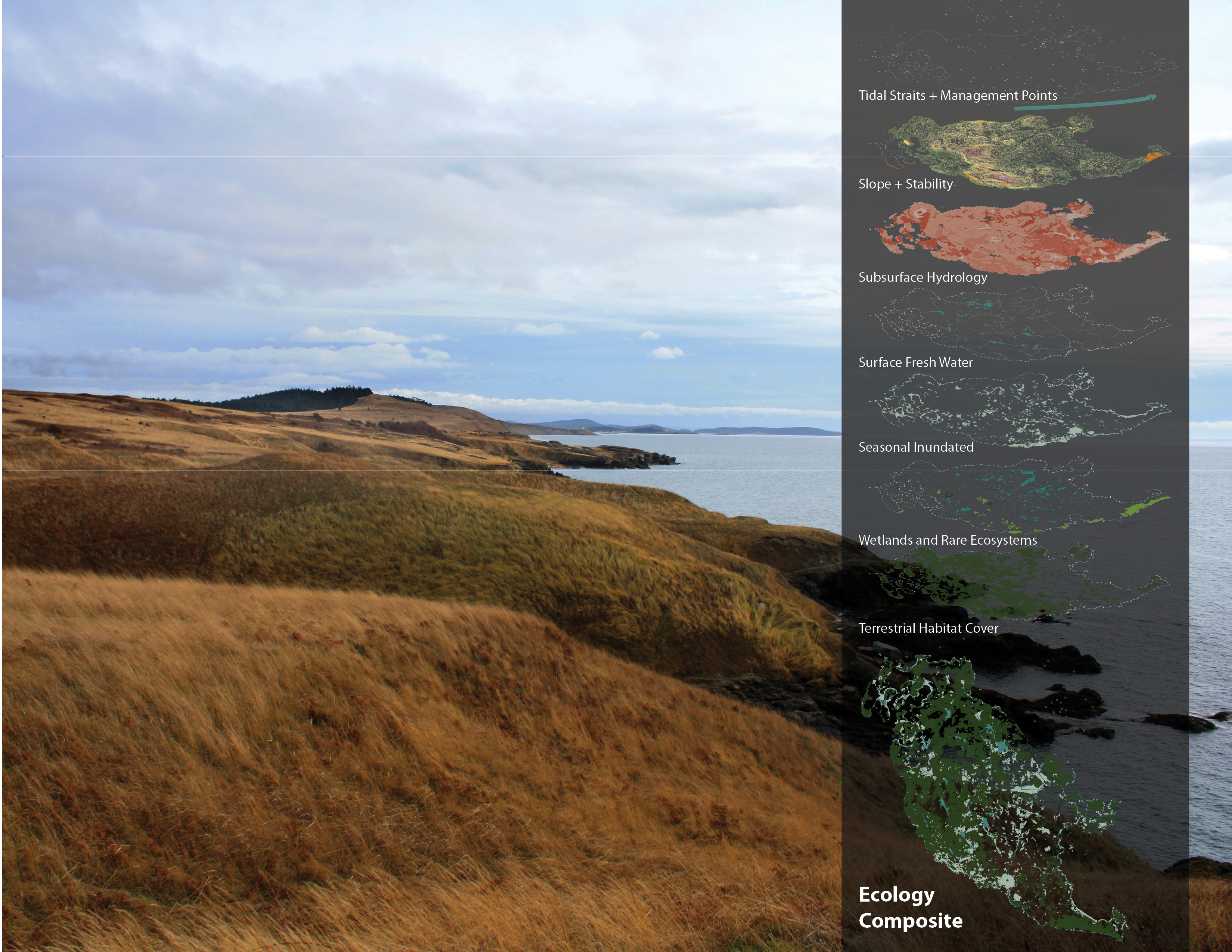
This glacial formed landscape offers a rich juxtaposition of land and water. A truly unique landscape this island houses some of the largest tracks of intact Puget Sound Prairie and Gary Oak Savannahs as well as offering a migration stop for many birds and marine species.
Download Hi-Res ImageImage: Joshua Brooks
Image 3 of 16
 Close Me!
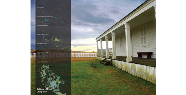
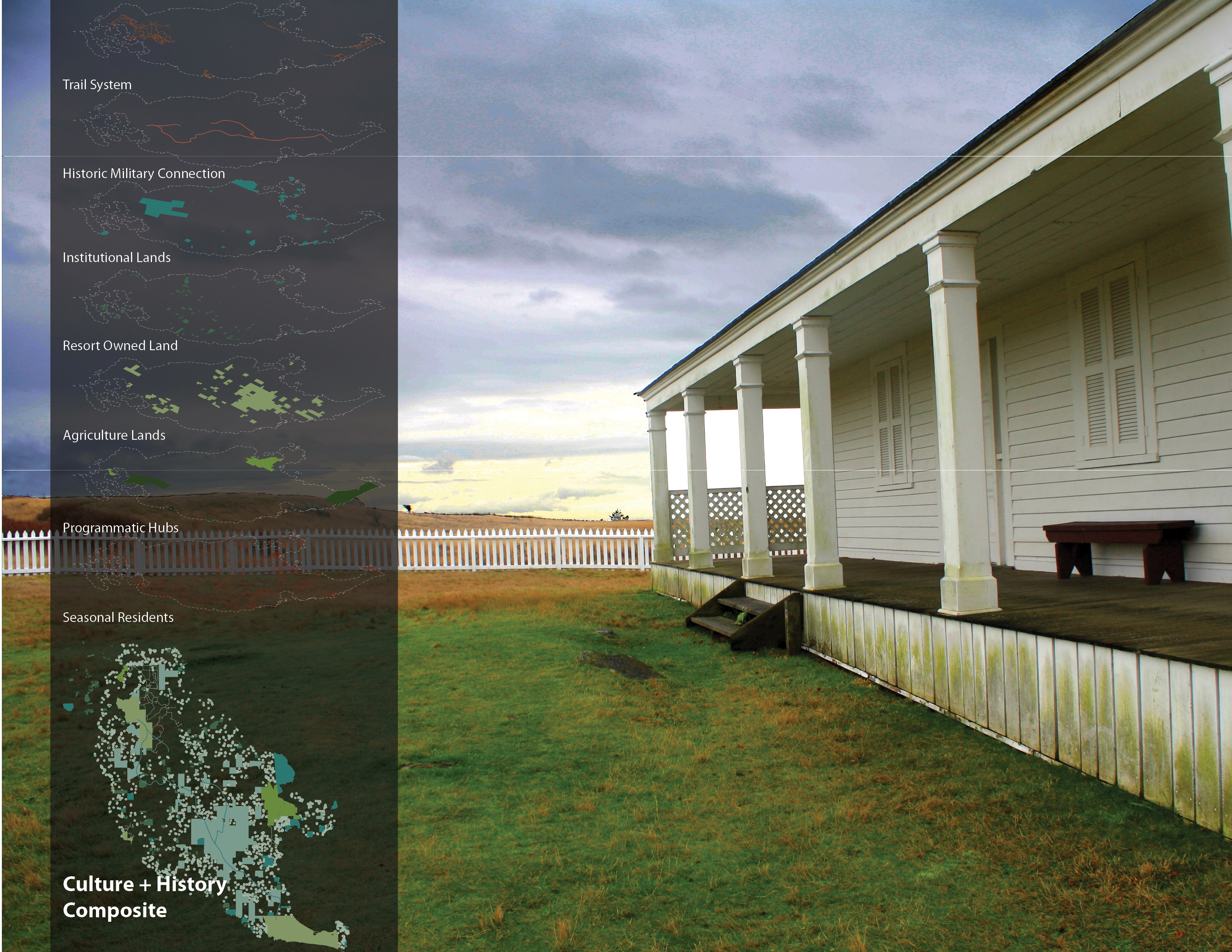
The site of Peaceful Arbitration of the Northwest Boundary Dispute in 1872 this Island holds significant value to the rest of the country. There is a rich history of the island that has spurred a wonderful local culture that can be harnessed to express art, ecology, and agriculture within this plan.
Download Hi-Res ImageImage: Joshua Brooks
Image 4 of 16
 Close Me!
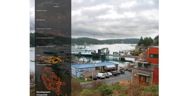
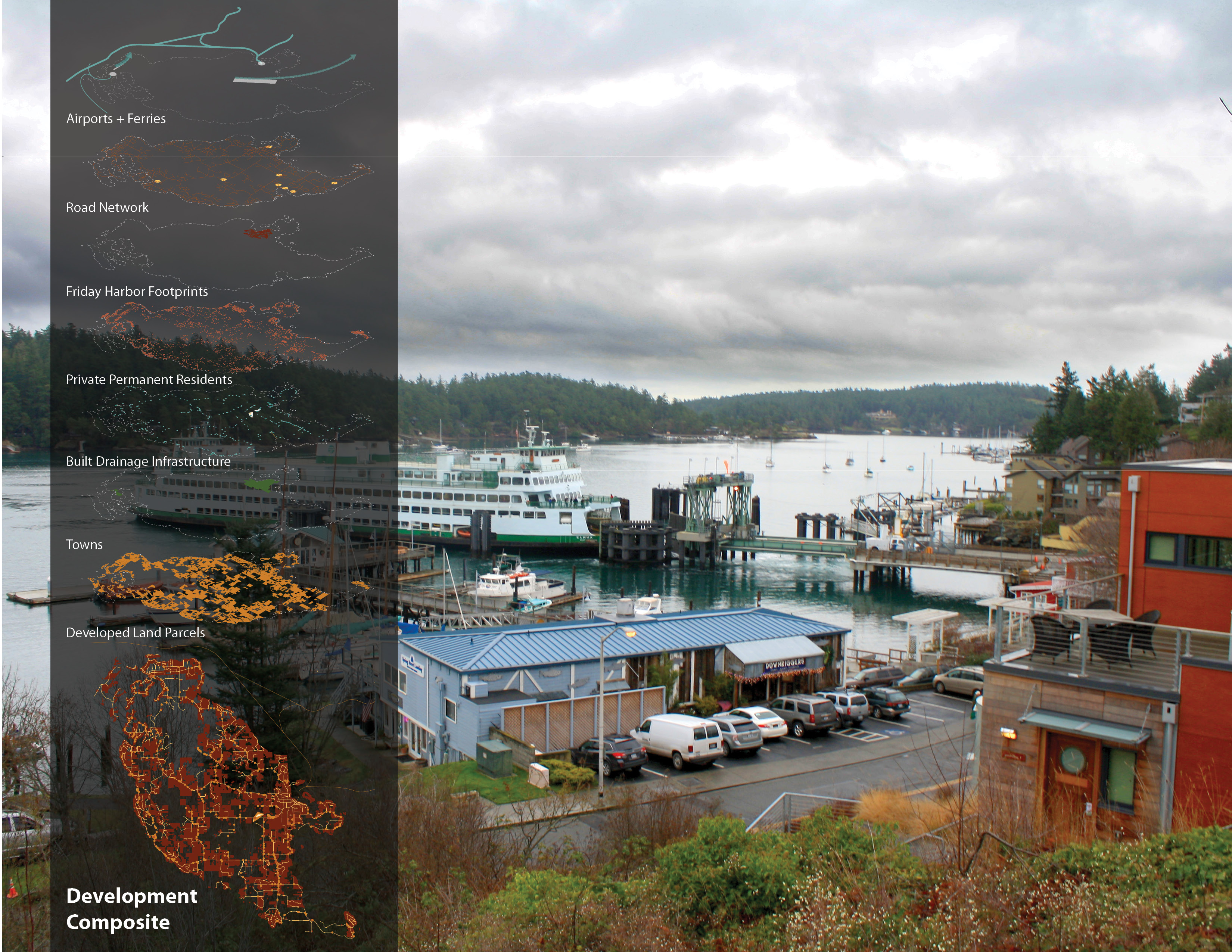
With the creation of Roche Harbor in 1943 the island has seen a growth of tourism industry centered on outdoor culture, bed and breakfast, and the water. Island population is expected to double in the next 30 years making a plan for the island a must.
Download Hi-Res ImageImage: Joshua Brooks
Image 5 of 16
 Close Me!
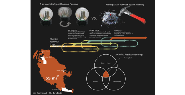
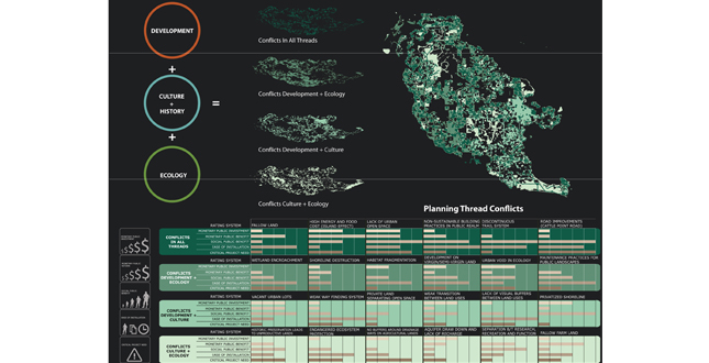
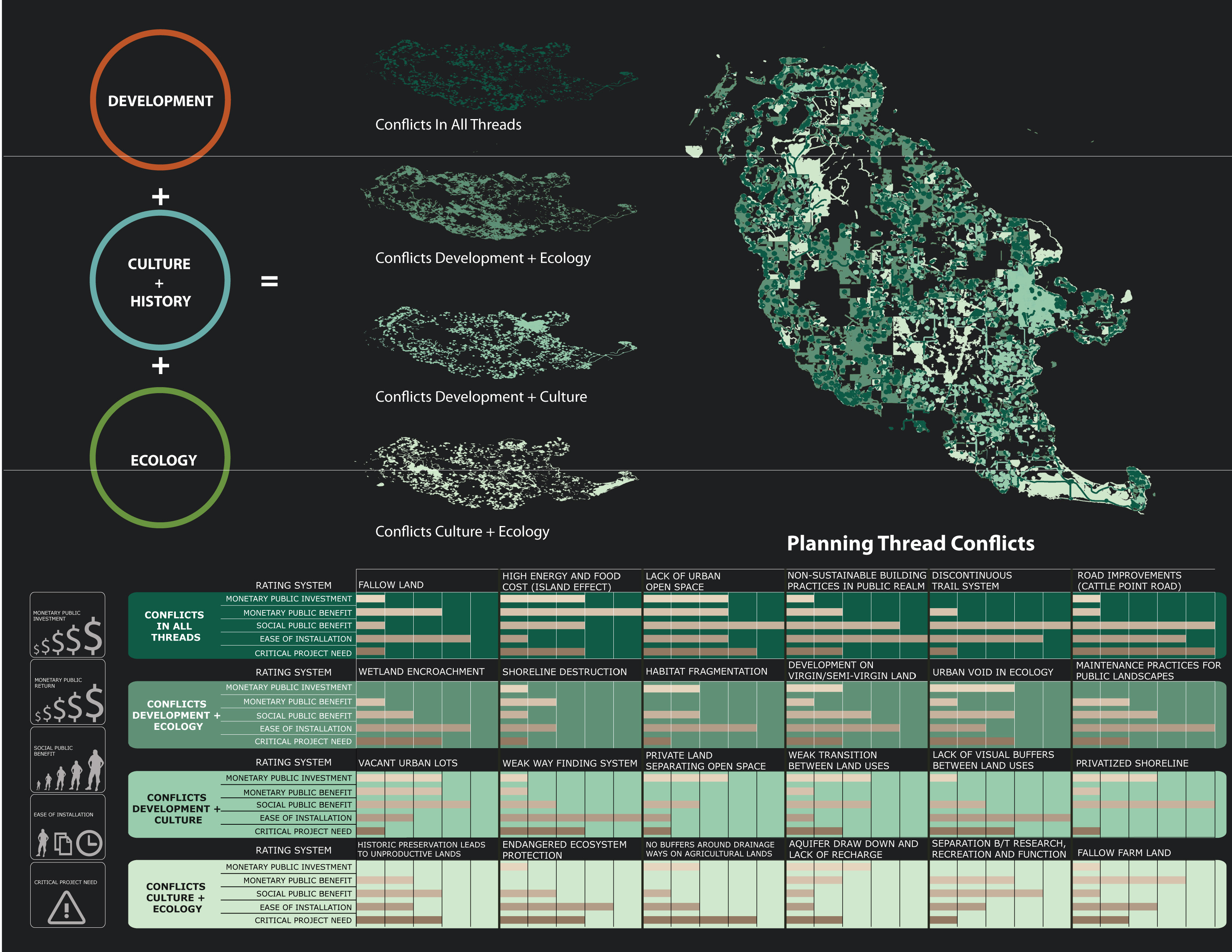
The three landscape threads were overlaid using GIS to get spatial conflicts across the island. Then using a set planning criterion each issue was weighted to solve how and when it would be solved over time.
Download Hi-Res ImageImage: Joshua Brooks
Image 6 of 16
 Close Me!
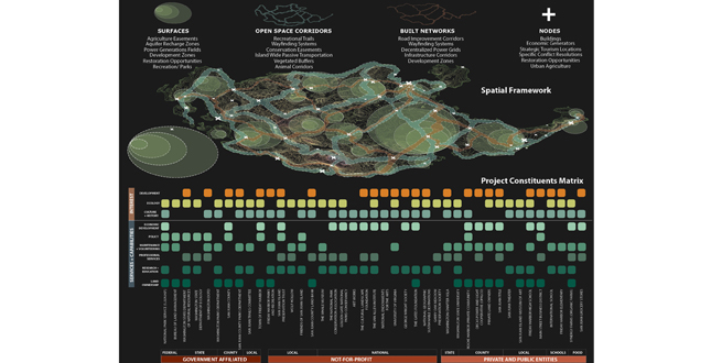
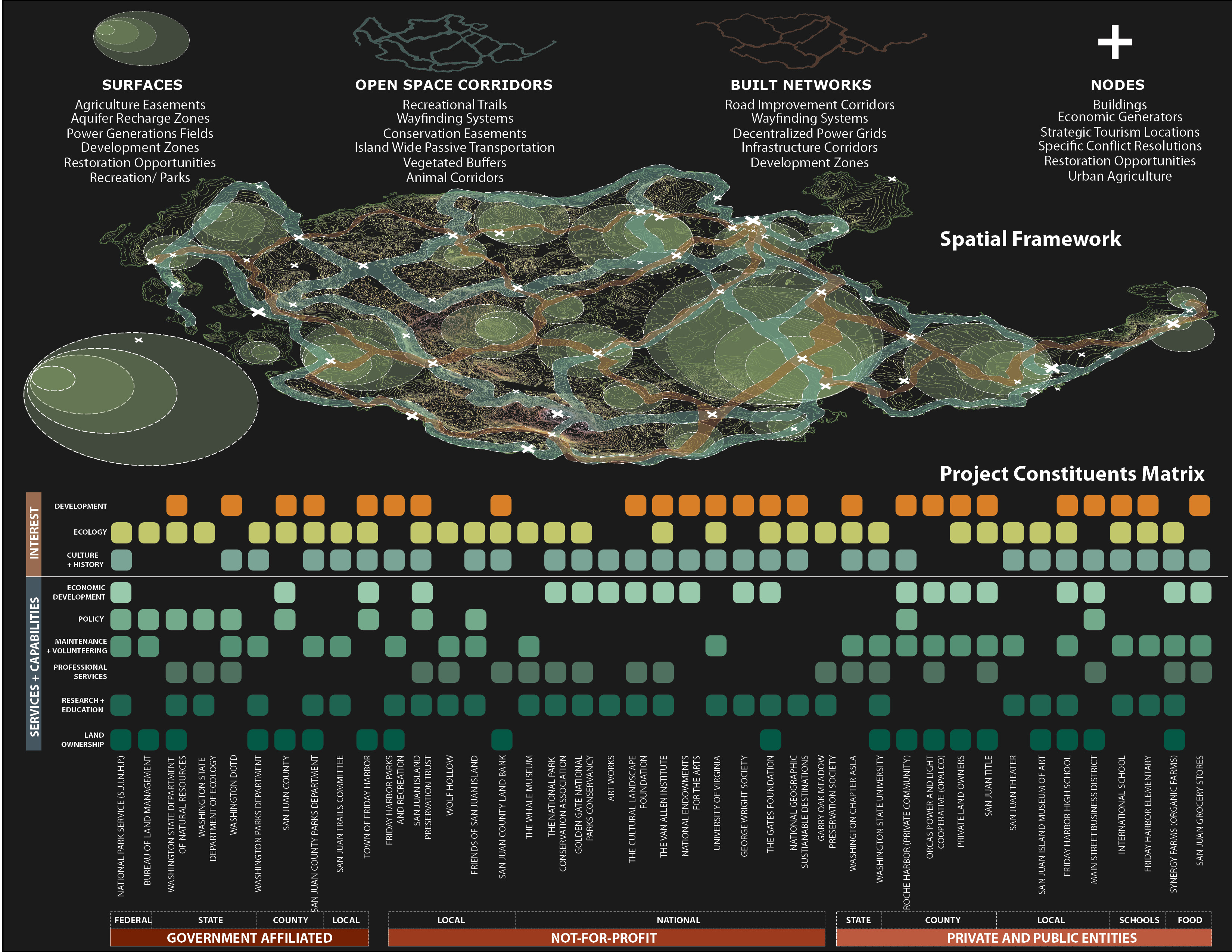
With the establishment of a spatial framework the constituents involved with this plan were analyzed to understand how they would play into realization of this project. With these two steps complete the development of the final process can begin.
Download Hi-Res ImageImage: Joshua Brooks
Image 7 of 16
 Close Me!
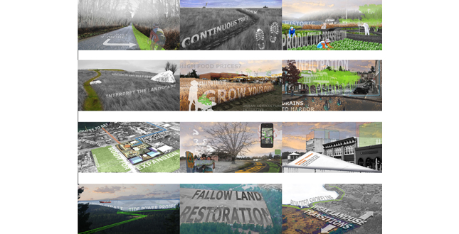
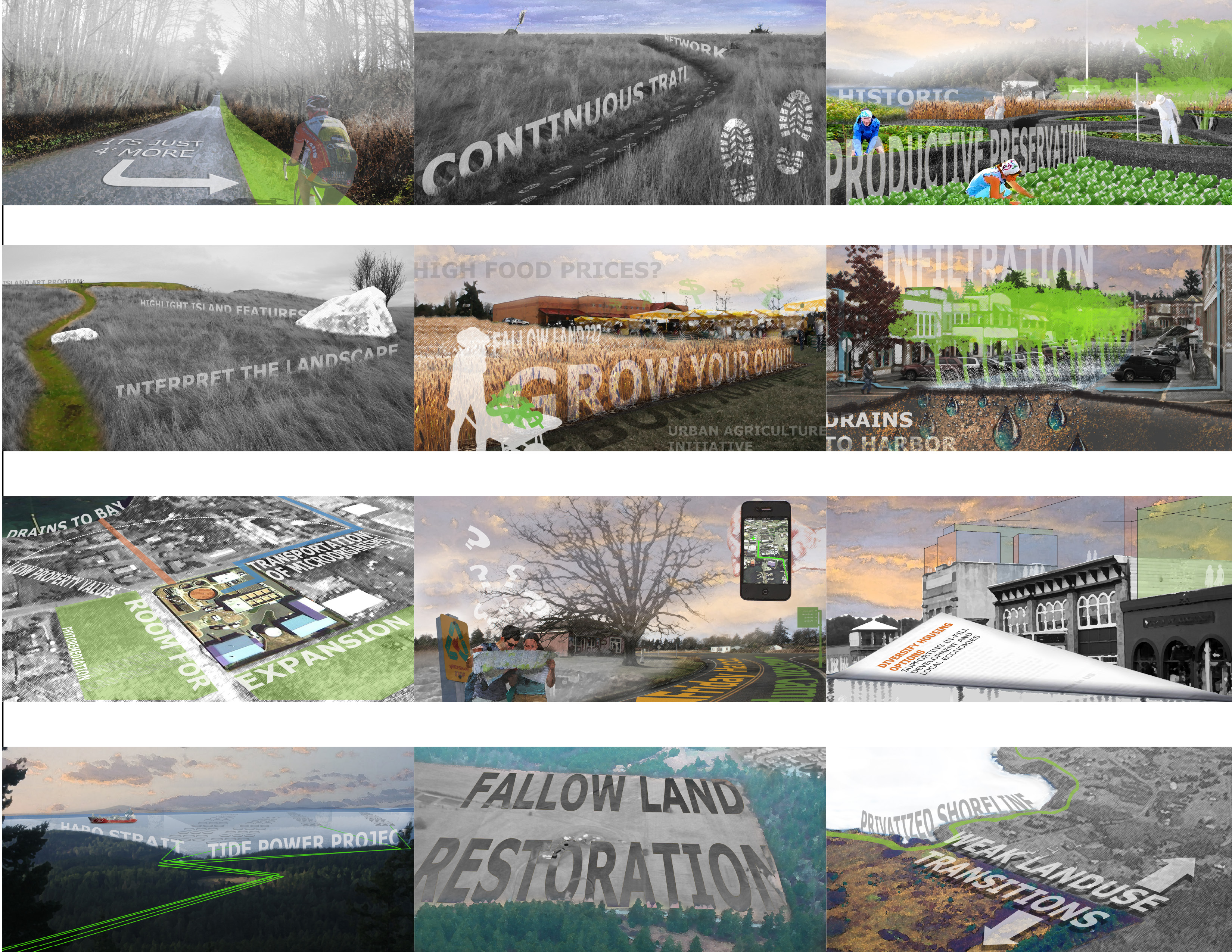
Conflict resolution vignettes became an easy way to demonstrate multiple ideas quickly. These drawings were used as design tools to further develop the contents of each of the pilot projects over thirty five years.
Download Hi-Res ImageImage: Joshua Brooks
Image 8 of 16
 Close Me!
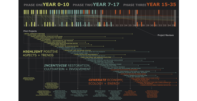
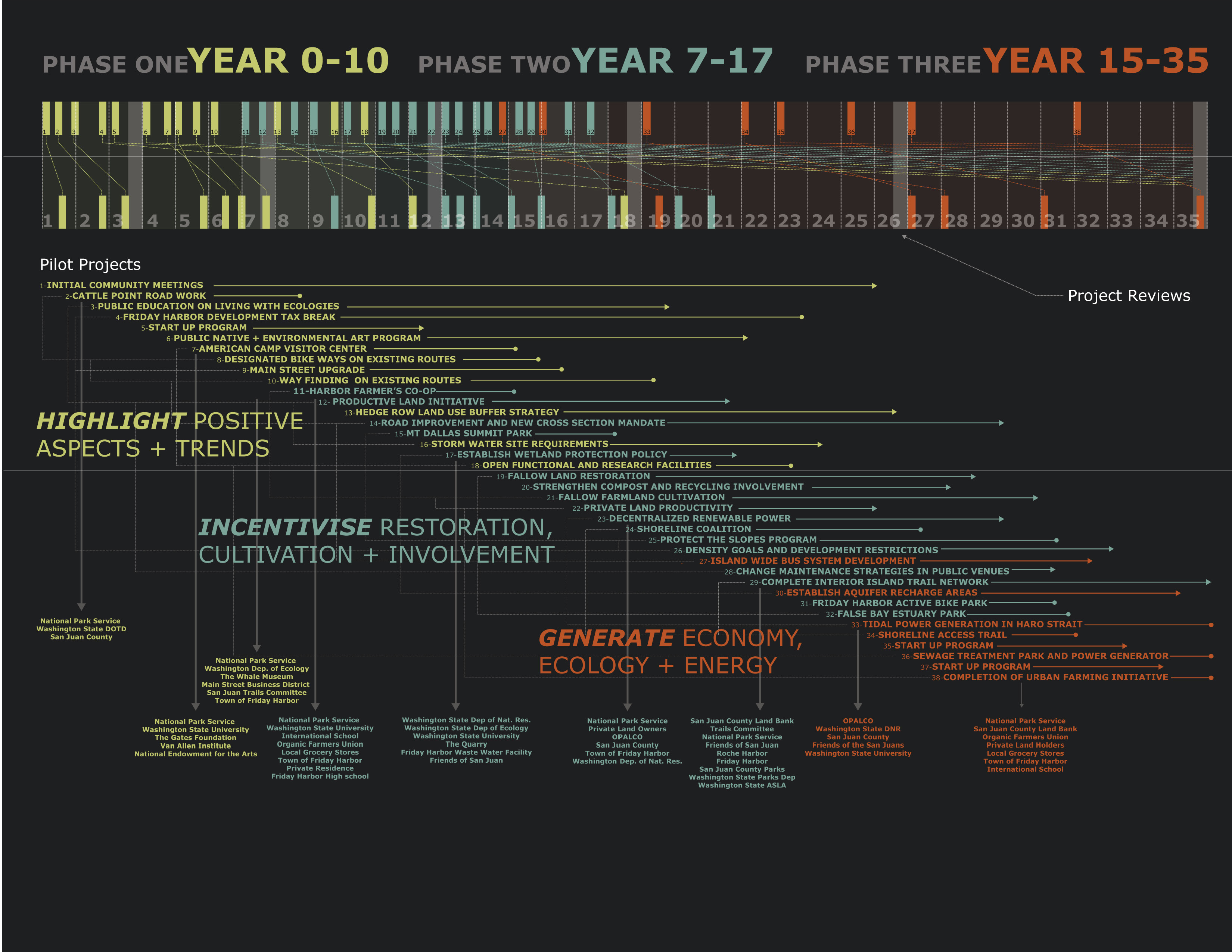
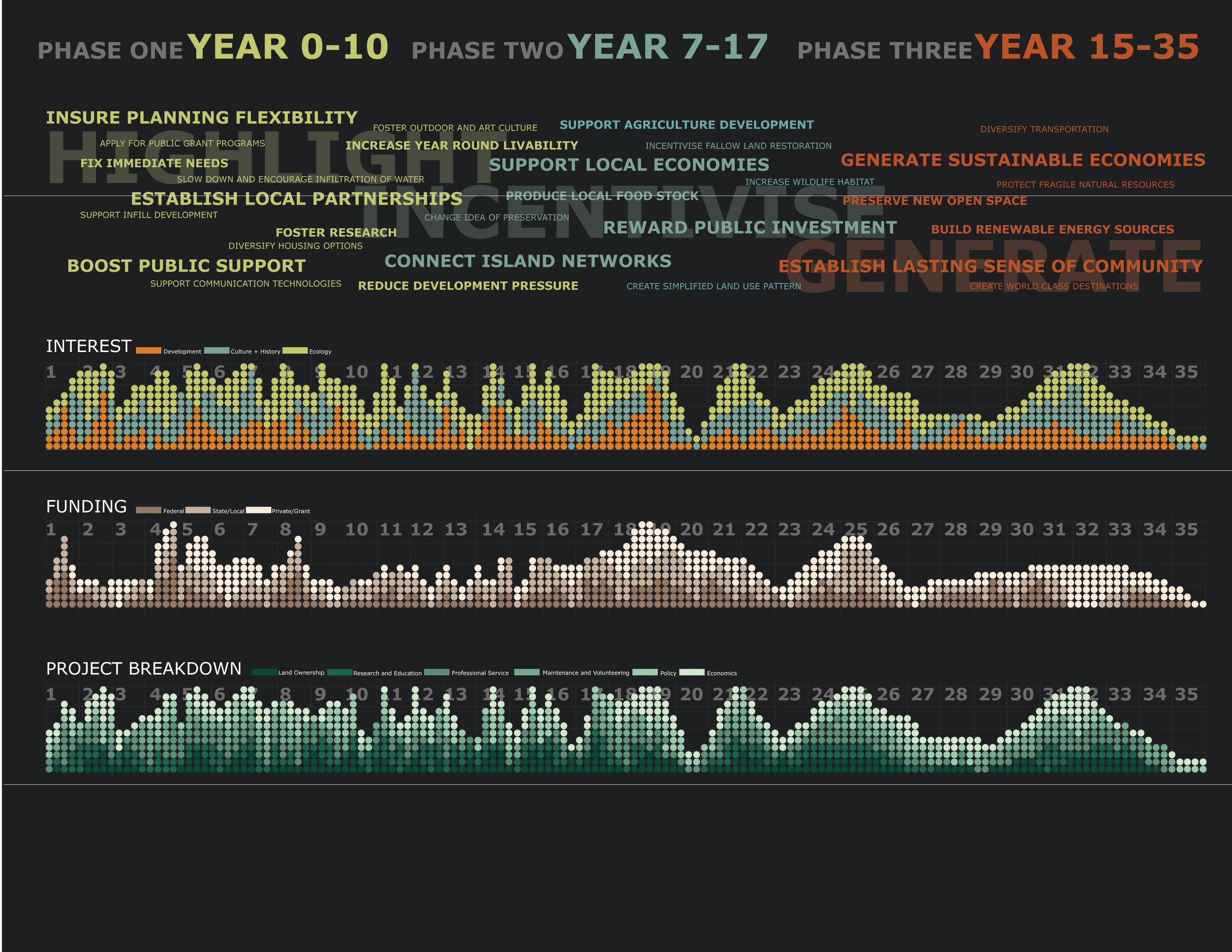
The action plan demonstrates how the catalytic projects would be spread across the thirty five year time frame and is centered on the three phases Highlight, Incentivize, and Generate. Constituents for each project were defined.
Download Hi-Res ImageImage: Joshua Brooks
Image 9 of 16
 Close Me!
The projects range from built works, funding strategies, and policy and are all part of the larger framework initiative established.
Download Hi-Res ImageImage: Joshua Brooks
Image 10 of 16
 Close Me!
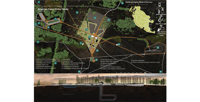
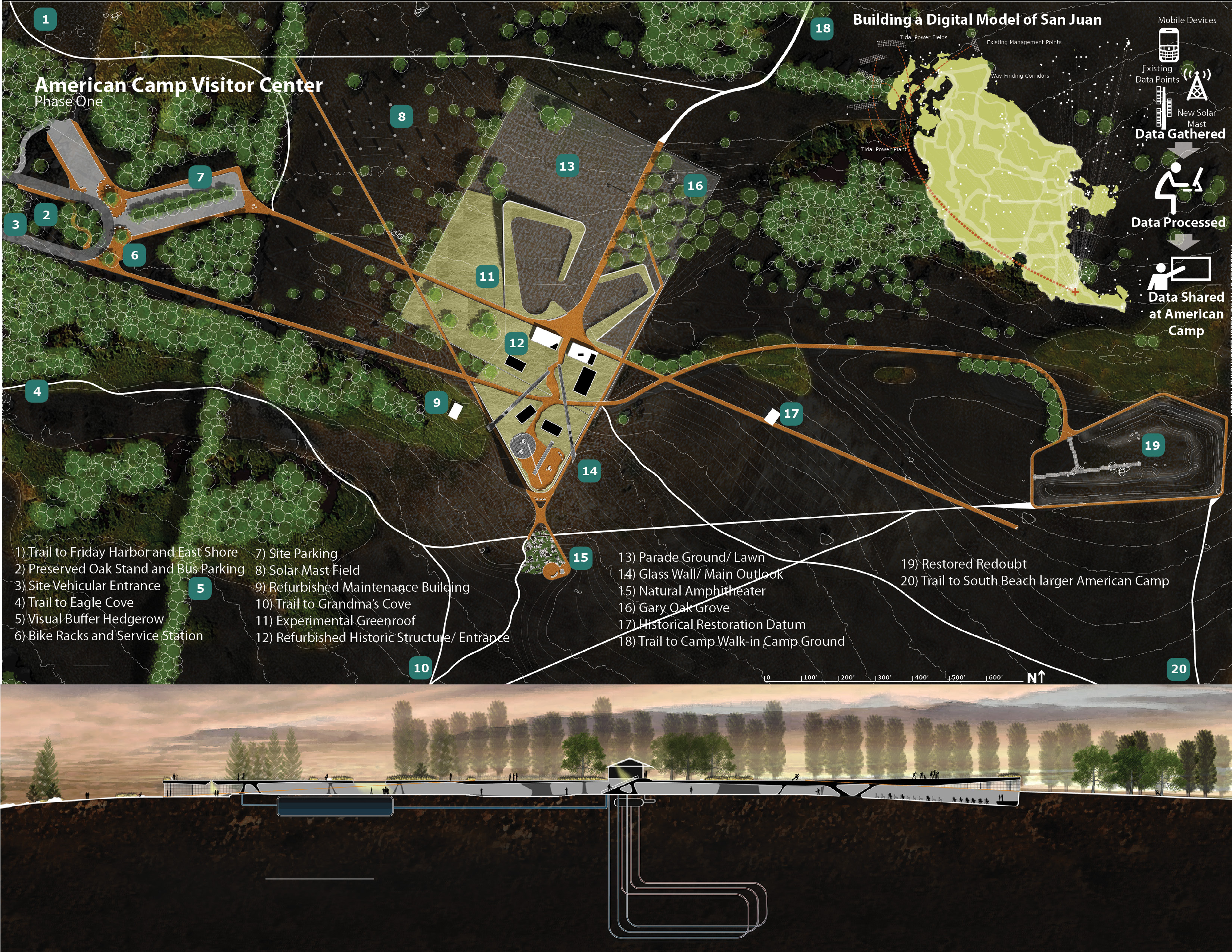
American Camp Visitor’s Center is among the first of the projects and represents a wedging of program, ecology, and research into a non-building that rest at the crest of the great meadow on the southern extent of the island.
Download Hi-Res ImageImage: Joshua Brooks
Image 11 of 16
 Close Me!
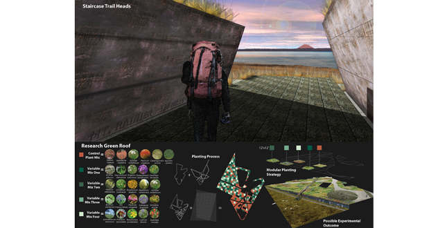
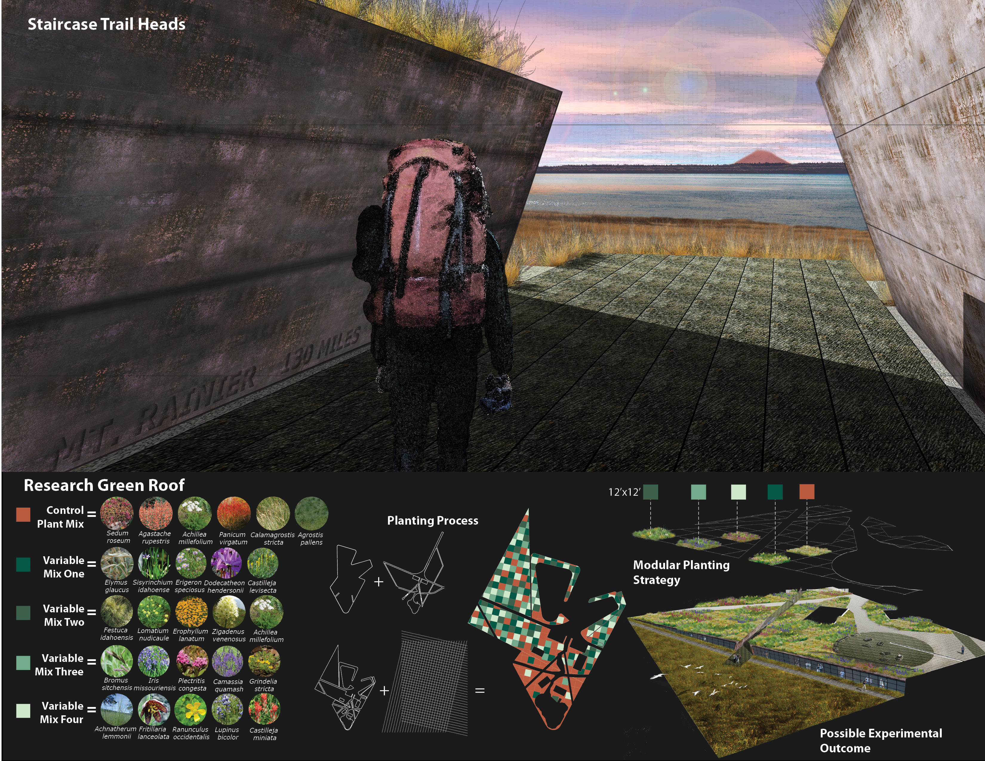
Along with being a new community amenity this building is also a starting point for the island wide trail system and a research green roof that brings the park visitor into direct contact with research.
Download Hi-Res ImageImage: Joshua Brooks
Image 12 of 16
 Close Me!
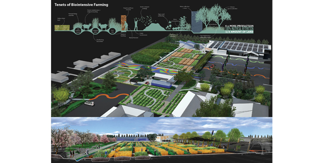
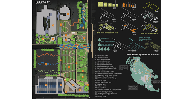
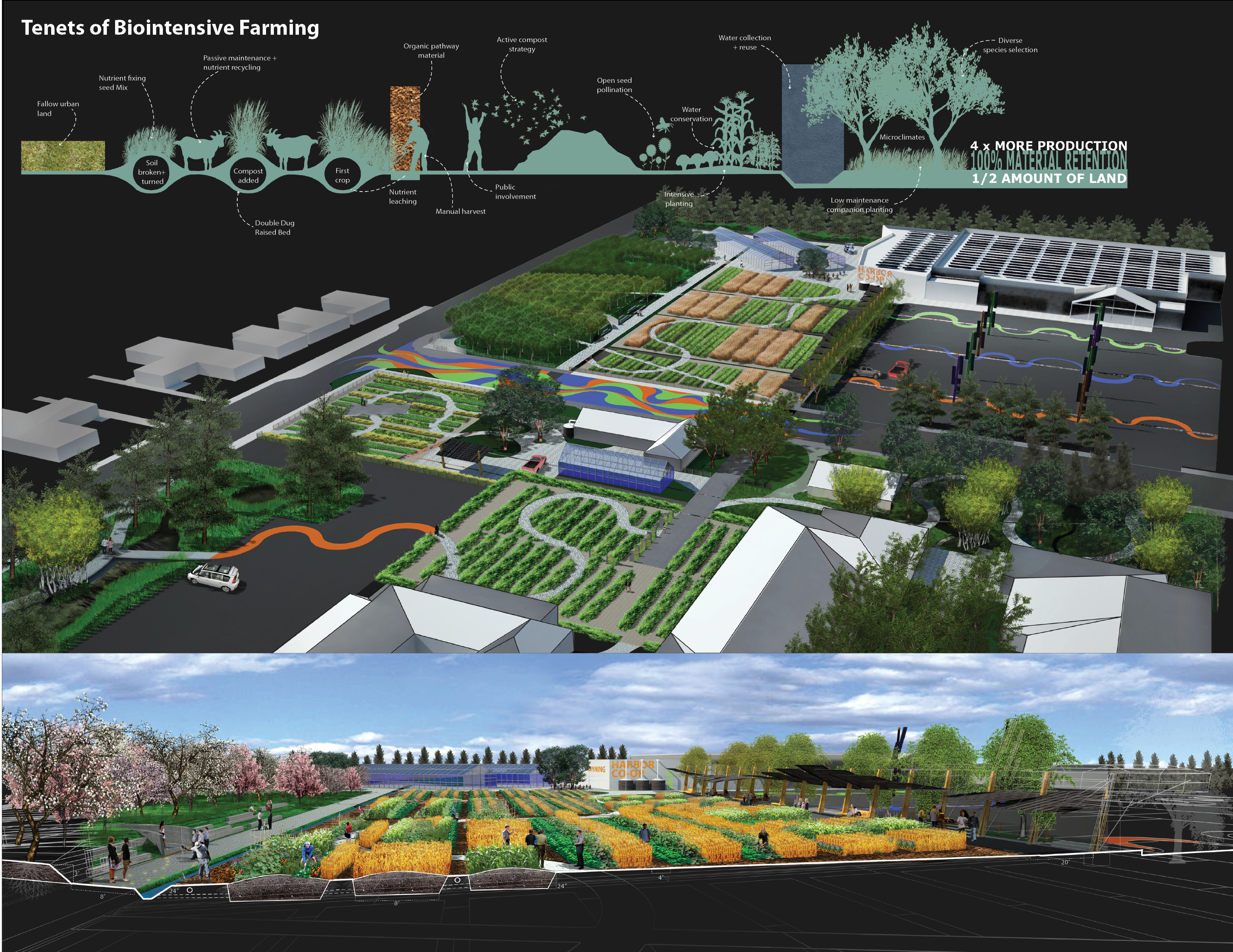
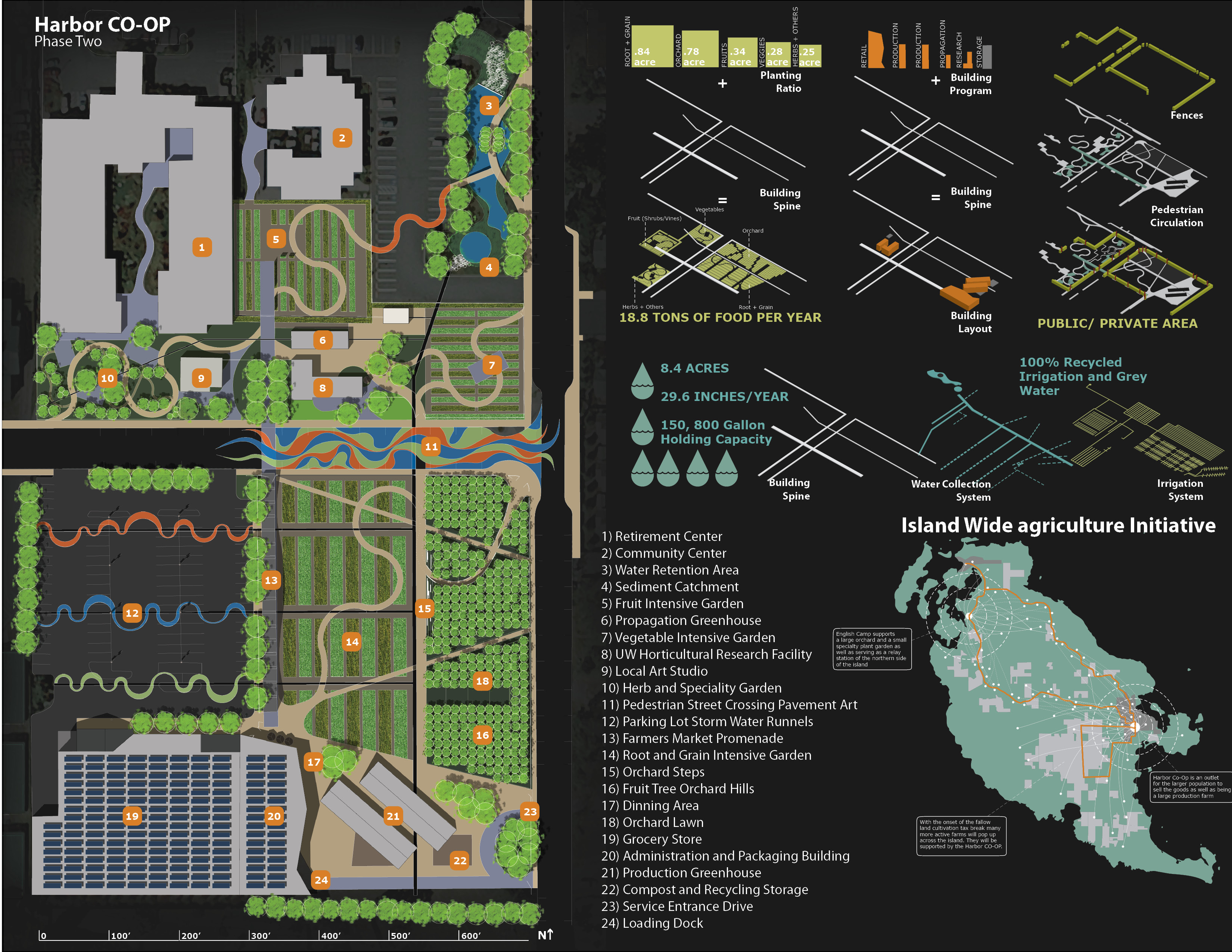
The Harbor CO-OP would serve as both an outlet and a catalyst for the island wide agriculture initiative. It is an eight acre biointensive farm close to downtown Friday Harbor and would be open to the public during the day.
Download Hi-Res ImageImage: Joshua Brooks
Image 13 of 16
 Close Me!
The location of the urban farm is due to the partnership between Friday Harbor Grocery Store, UW Horticultural Research Facility and the Friday Harbor Community Center. On site there is space for farmer’s markets, daily sales, and compost and recycling.
Download Hi-Res ImageImage: Joshua Brooks
Image 14 of 16
 Close Me!
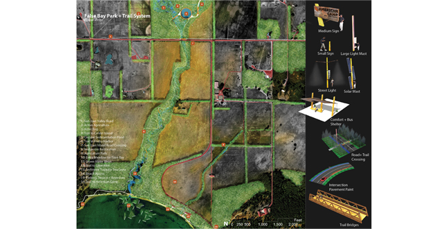
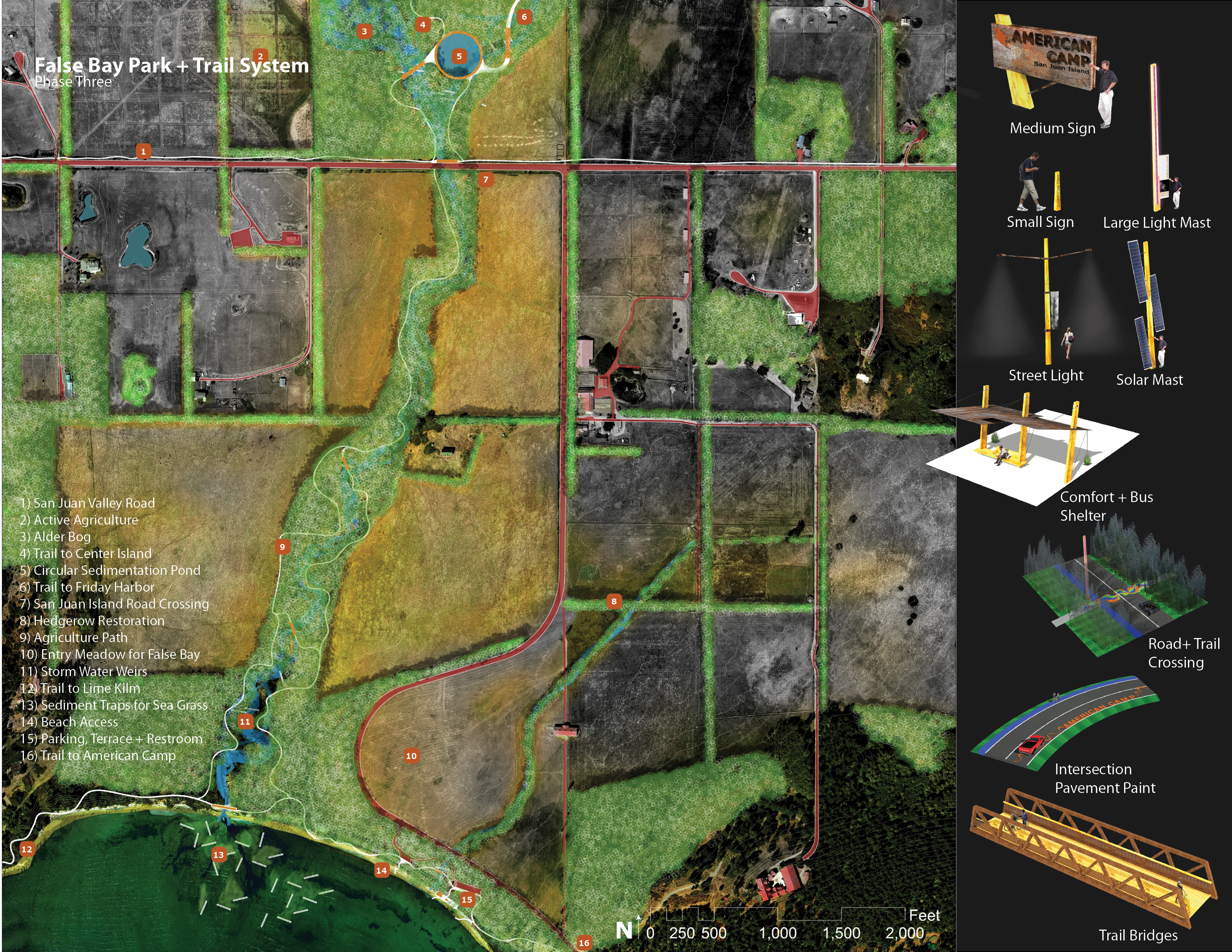
False bay Park is located on the largest estuary of the island and serves as a vital link in the open space network to the water. Extending northward is one of the many island trails and ecological corridors that will link the island.
Download Hi-Res ImageImage: Joshua Brooks
Image 15 of 16
 Close Me!
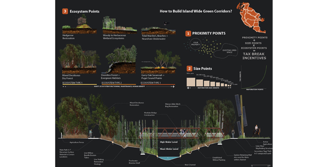
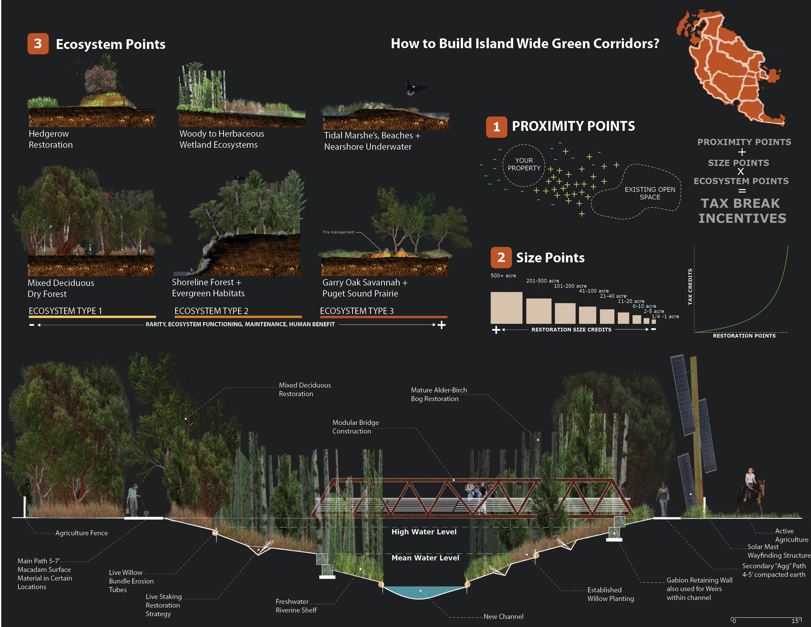
The creation of these island wide corridors will be rooted in the island residents. Through a system of tax breaks incentives based on an ecological equation and working with the local land bank people will be inclined to participate.
Download Hi-Res ImageImage: Joshua Brooks
Image 16 of 16
Project Statement
Microcosm of America employs general systems theory1 to a regional planning effort for San Juan Island and San Juan Island National Historic Park in Washington State. Focusing more closely on the relationship between parts and people a process oriented plan was created. By weighting culture, ecology, and development equally this project develops a framework agenda for the parks and the community to grow as one unit resulting in a more efficient growth pattern and a richer culture and ecology.
Project Narrative
Introduction
San Juan Island is a fifty five square mile glacial moraine located in the upper reaches of the Olympic Mountain rain shadow between Vancouver Island and Washington State. Layered atop a robust glacial landscape, the island supports a unique ecology of Puget Sound Prairie and Gary Oak Savannah along with other diverse ecosystems native to the Pacific Northwest. The island houses two National Park Units (roughly 2,000 acres combined) as well as 7,000 permanent residents and nearly 7,000 more seasonal residents that support the large tourism and resort based economy. Most of the permanent population lives in or near the towns of Friday Harbor and Roche Harbor and are largely responsible for the annual park visitation within San Juan Island National Park. The island is accessible only by ferry or plane; this limited access contributes to the rural atmosphere as well as the high food and energy prices. A shrinking agriculture presence, significant lands owned by the National Park Service (in celebration of the 1872 Northwest Boundary Dispute), as well the presence of an active land bank contribute to a very distinctive open space quality on the island. This unique place was selected by the National Park Service in 2011 as a place to experiment with the “National Park of the 21st century” as part of the student design competition Parks for the People.
Open System Planning + The End Goal
The story starts with a metaphor for traditional top-down planning and how an examination of systems theory can help unlock the potential of complexity. A snow globe is a closed system with no inputs or outputs and even when shaken it will return back to the steady state in which it was first created. A land use map for our anthropogenic-infused ecosystem can be represented by this metaphor. The early conception of this project utilized an open system approach and lead to the relationships between parts being more important than the parts themselves. People and process would be directly involved in the construction of the master plan and throughout the development of the project the question was how, rather than what. By creating a process driven master plan this project creates a three phased approach that (1) Highlights positive aspects and trends, (2) Incentivizes restoration, cultivation, and public involvement, and (3) Generates economy, ecology, and energy. What this project represents is a holistic vision for how nature, culture, and development can be thought of as one curated ecology upon San Juan Island. 2
Analysis
With systems theory one must first define the inputs and outputs of the system. The three landscape threads of ecology, culture/history, and development were analyzed through spatial data then configured into composite threads after ground observation were made. After overlaying the three spatial threads and weighting them with a series of planning criteria twenty four general conflicts were found and then organized into a spatial framework of zones, open space corridors, built networks, and nodes. Project constituents were then organized and analyzed in terms temporal patterns, historical presence and their interest and services in any future plan. This system analysis defines the starting point for the planning feedback loop and conceptual framework tailored directly to San Juan Island community and the National Parks on the island.
Planning
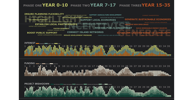
The creation of the thirty five year action plan was centered on the three phases Highlight, Incentivize, and Generate. The conceptual framework provided direction of policies, funding strategies, and built works that serve as catalytic projects in the larger initiative. Each step in the plan leads to a new step being taken so that planning flexibility is accounted for. The frame work agenda consist of five concepts: (1) connect island ecosystems through restoration easements, conservation policy, and a network of trails (2) increase year round livability by diversifying housing options and adding user amenities (3) support local agriculture and decentralized renewable energy production (4) structure an efficient transportation infrastructure with minimal disturbance to the existing system; and (5) foster island culture, art, research, tourism, local businesses, and natural and native history. These five main concepts and the planning feedback loop established insure project progression over time resulting in a vision for a world class destination and a unique place to live.
Design
Design serves an integral role in informing the larger vision. Pilot projects played a very important part in decisions being made at all scales and across the larger plan. With thirty four pilot projects identified and allowance for planning flexibility, each project informs the next step. By moving through the design process with each pilot project, organization and understanding of the relationships between the projects and the larger whole is apparent. This process highlighted areas to make policy and where to seek funding. Even in dealing with built works at various scales this project always considers how each piece fits into the larger process whether it serves as a catalyst for research, tourism and ecologically based design; offers an outlet for the local agriculture economy; stimulates the creation of green corridors through tax breaks; or generates renewable power from near shore tides. These projects represent concepts related to each of the three phases and how they play into the larger planning agenda.
Implications
The implications of this systems-based design and planning exercise is that it offers San Juan Island and the National Park Units on the Island a much more thorough plan for development over the next thirty five years. This project will enhance quality of life, and the island’s local economy, ecological health, and cultural significance while serving as a model for how the National Park Services and gateway communities as well as rural communities across the country can plan infrastructure, development, and ecological systems to function together.
Additional Project Credits
San Juan Island National Historic Park
Mike Vouri
People of Friday Harbor and San Juan Island
LSU Landscape Architecture Classmates
Chad Caletka, Student ASLA and Mike Petty, Assoc. ASLA