


Honor Award
Sand Flows | Oyster Forms
Dasha Lebedeva, Student ASLA, Graduate, University of Virginia
Faculty Advisors: Kristina Hill and Kathleen John-Alder, ASLA
 Close Me!
Construction:
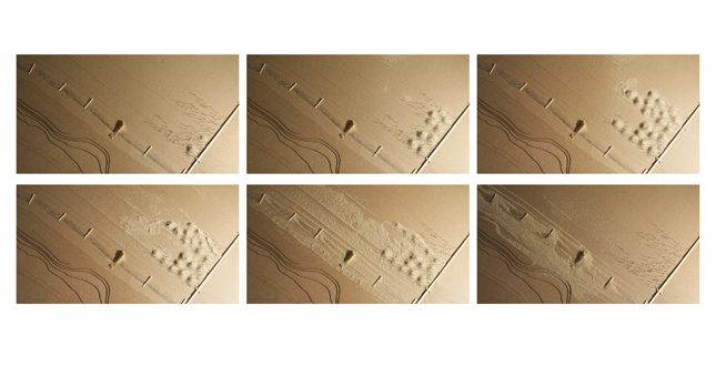
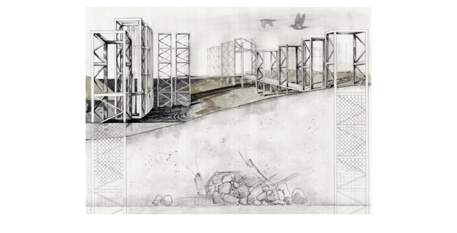
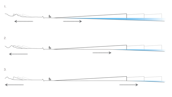
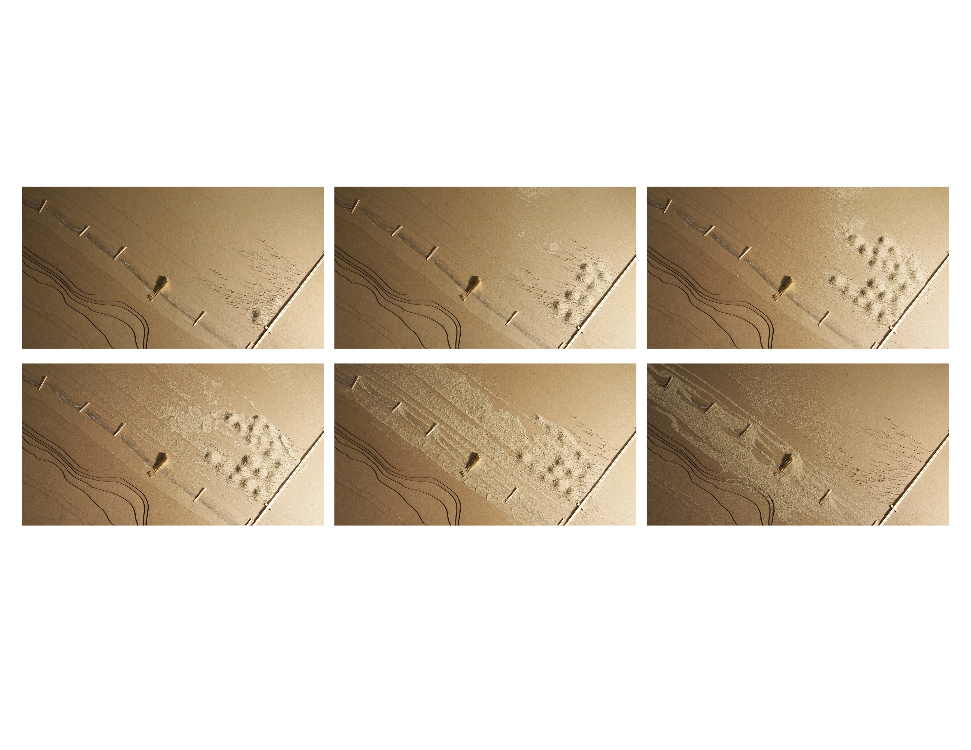
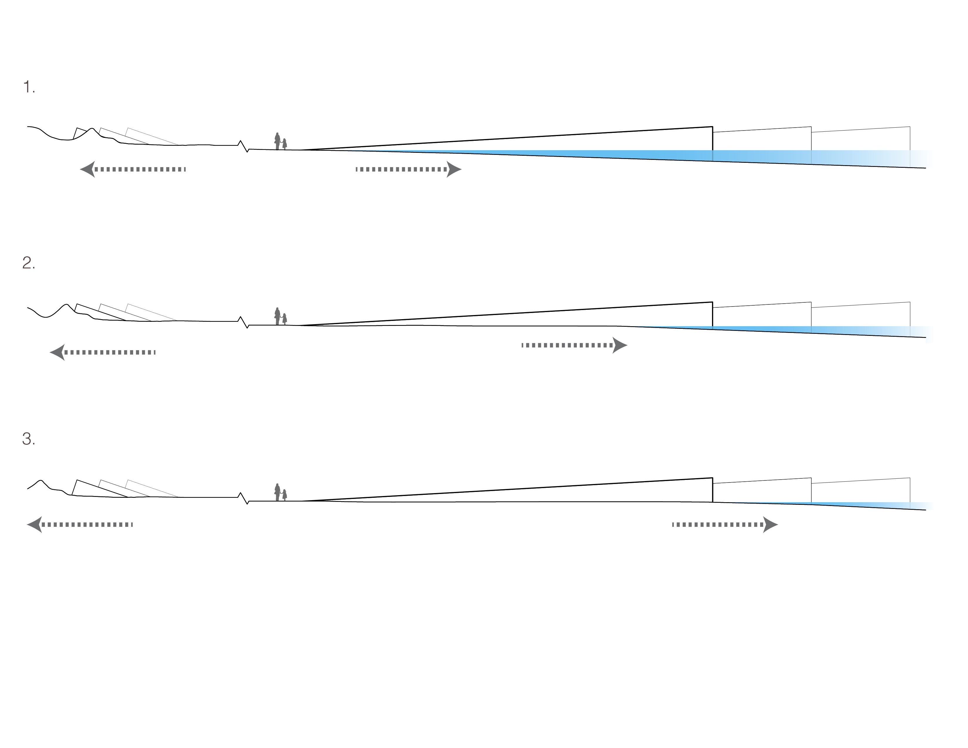
YEAR 1: after the scaffolding structures and sand gauge are built, the dredge boats are guided to the area to drop off sand YEAR 2: the dredged sand continues to accumulate off shore YEAR 3: the sand engine is completed Erosion and Accretion: YEAR 4: with no new sand arriving, the islands begin to gradually erode with the forces of waves and wind YEAR 9: as the sand erodes from the sand engine it accumulates gradually on shore, minimizing disruption to existing ecosystems YEAR 14: the thickened edge is registered by the sand gauge, which acts as a marker of this dynamic process
Download Hi-Res ImageImage: Dasha Lebedeva
Image 3 of 11
 Close Me!
Construction:
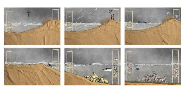
YEAR 1: as the islands are formed through the depositing of dredged sand, dunes begin developing and provide habitat for birds, such as the American Oystercatcher YEAR 2: some of the islands are accessible to humans for recreation and observation of wildlife YEAR 3: sand engine is completed and the dunes begin to shift Erosion and Accretion: YEAR 4: as the islands erode, underwater oyster scaffolding is exposed YEAR 9: oysters begin to colonize the exposed surfaces and new habitat is created YEAR 14: submerged aquatic grasses and oysters have been able to colonize the sheltered areas among the scaffolding structures
Download Hi-Res ImageImage: Dasha Lebedeva
Image 4 of 11
 Close Me!
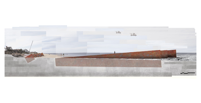
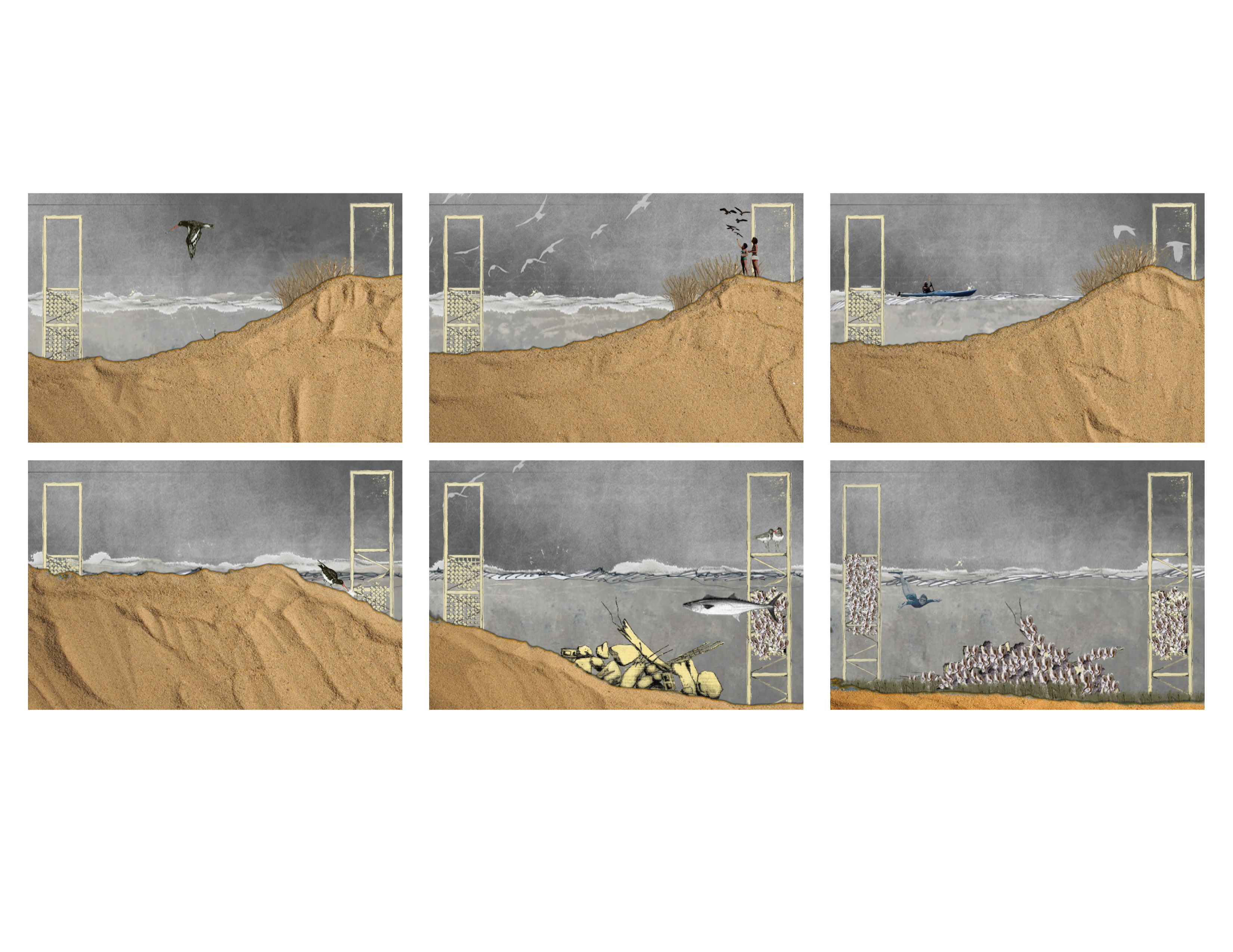
Once the sand erodes, steel towers and buried rubble are revealed and form a new, protected habitat for artificial oyster reefs.
Download Hi-Res ImageImage: Dasha Lebedeva
Image 5 of 11
 Close Me!
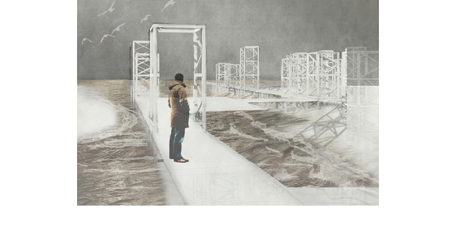
The walkways provide access to portions of the islands from which natural processes can be observed.
Download Hi-Res ImageImage: Dasha Lebedeva
Image 6 of 11
 Close Me!
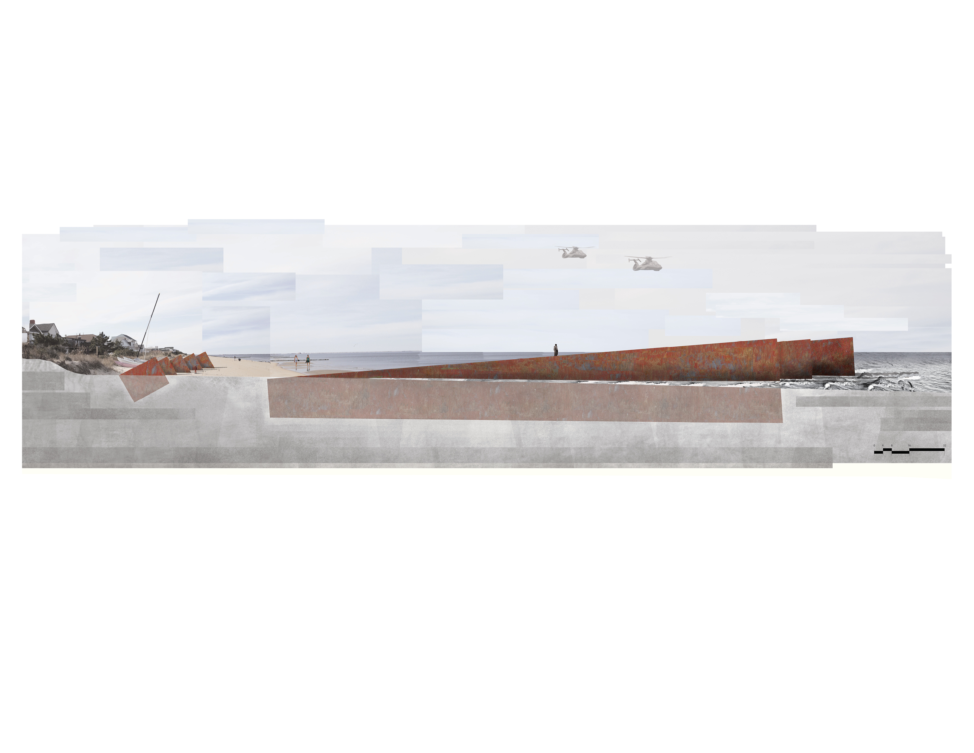
As the sand erodes from the islands, the scaffolding structures remain as a marker of the areas where sand will be replenished to start the process anew.
Download Hi-Res ImageImage: Dasha Lebedeva
Image 7 of 11
 Close Me!
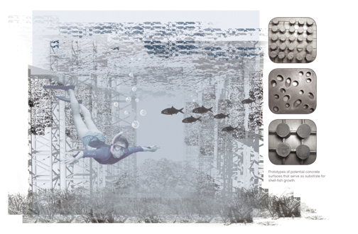
Underwater, the scaffolding catalyzes growth of oysters and submerged aquatic grasses and creates opportunities for recreation.
Download Hi-Res ImageImage: Dasha Lebedeva
Image 8 of 11
 Close Me!
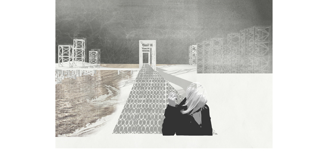
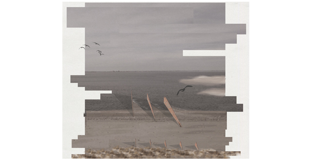
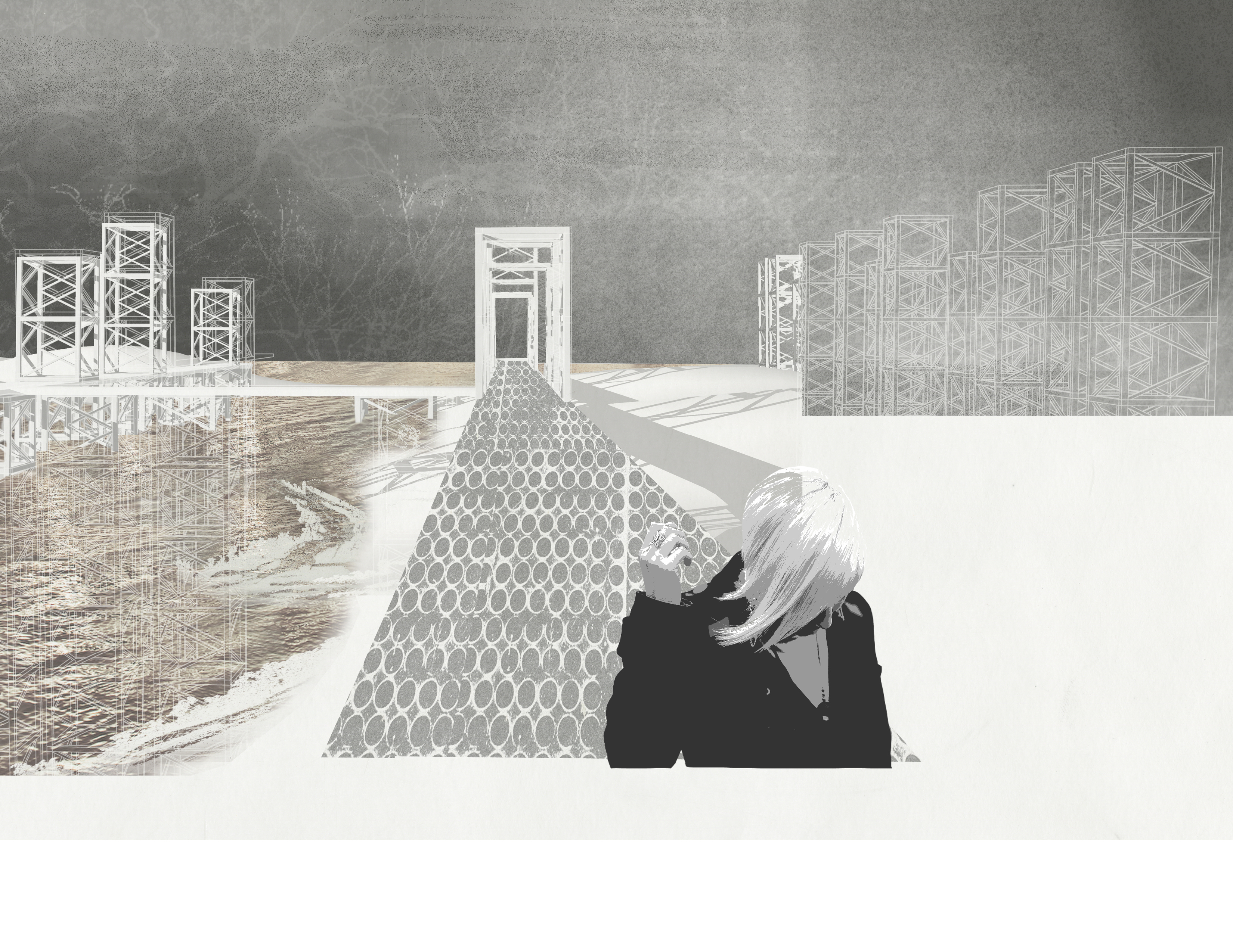
Corten steel structures on the beach allow visitors to register the processes of sand accretion and tidal fluctuation.
Download Hi-Res ImageImage: Dasha Lebedeva
Image 9 of 11
 Close Me!
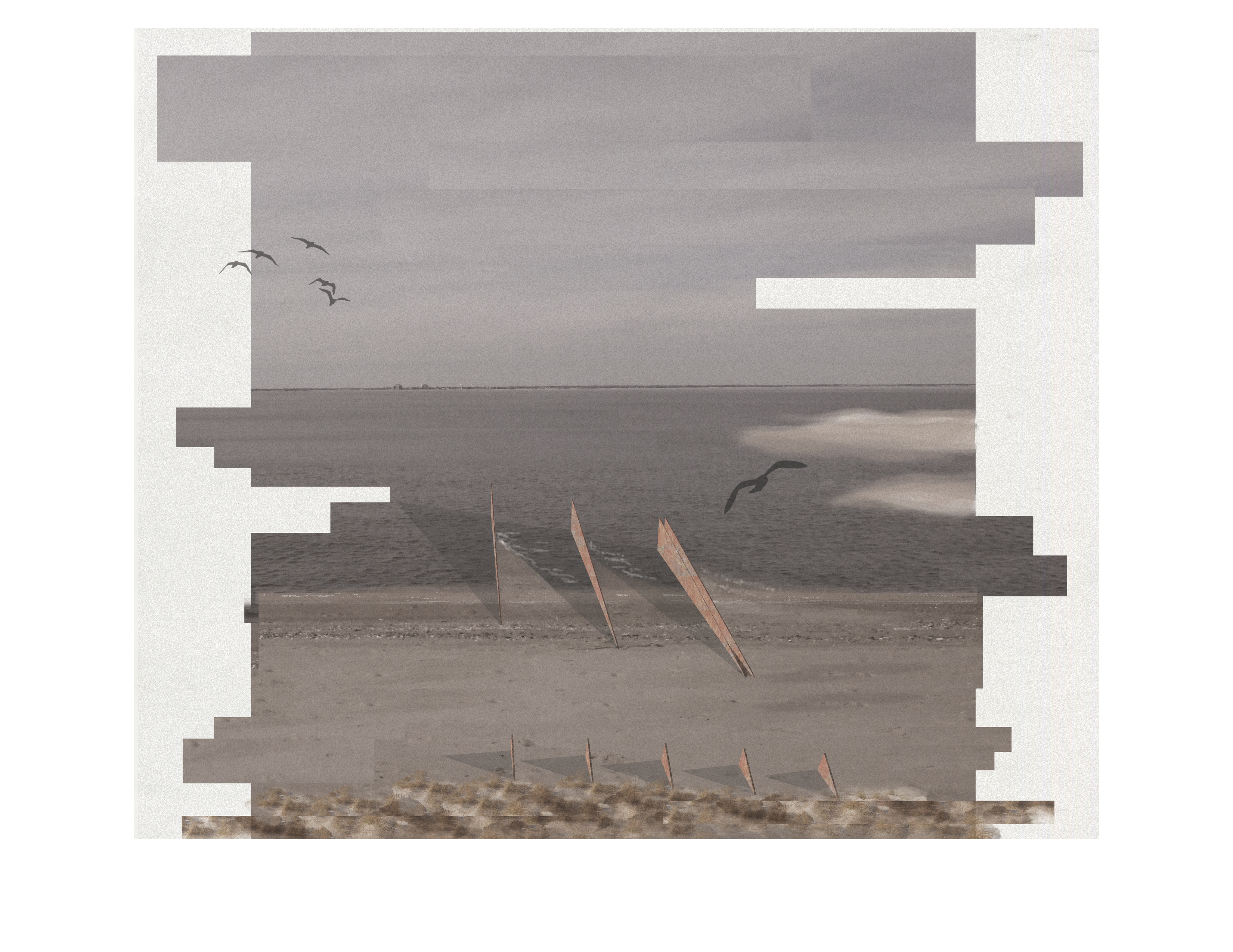
The set of structures at the dune line registers the growth of the dunes horizontally and vertically. As the beach thickens, the water appears to recede out to the furthest steel fin. Daily fluctuations in water levels and sand movement are registered in the corrosion patterns of the steel.
Download Hi-Res ImageImage: Dasha Lebedeva
Image 10 of 11
 Close Me!
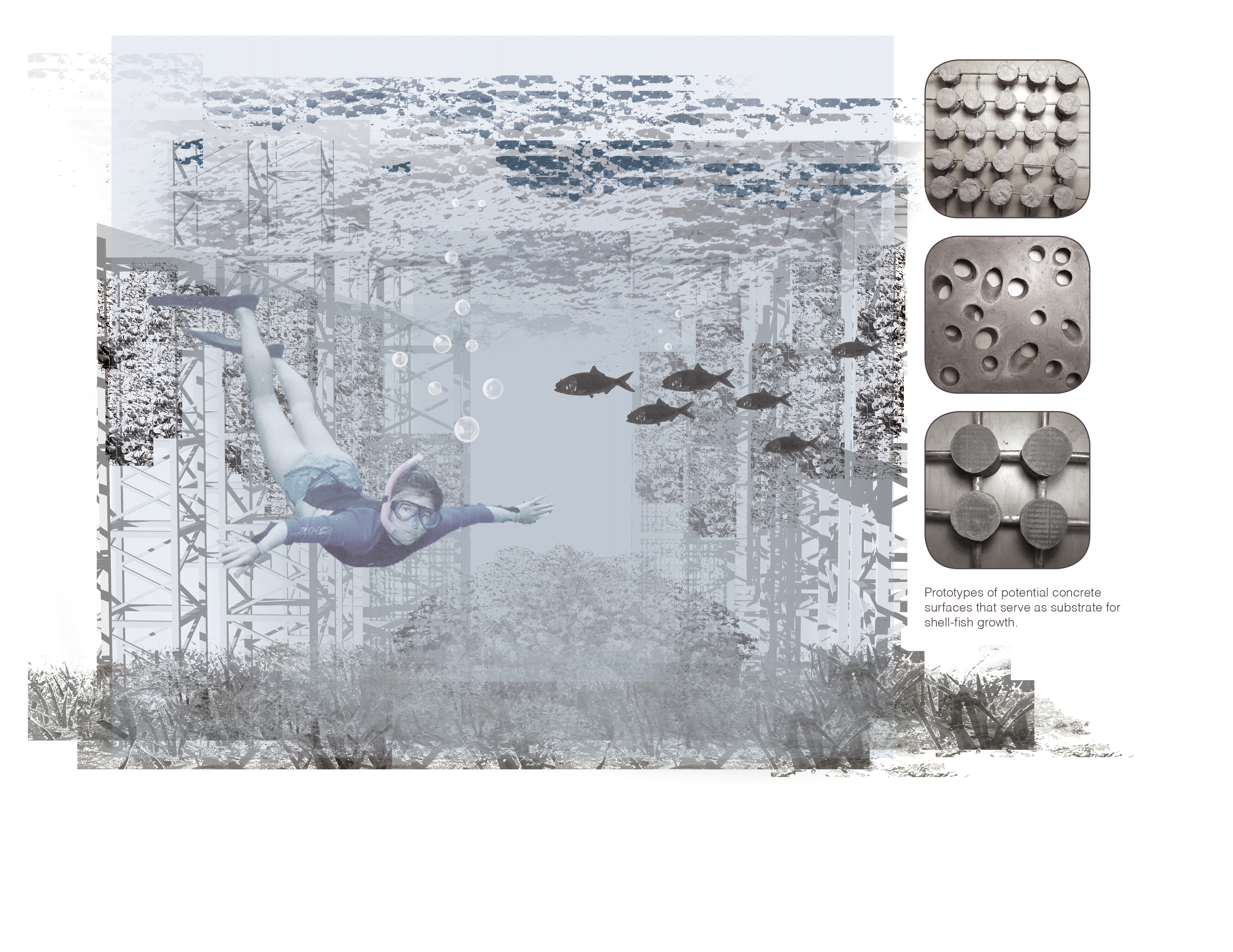
The sand gauge references the industrial character of the Norfolk area and serves as an additional attraction at the beach.
Download Hi-Res ImageImage: Dasha Lebedeva
Image 11 of 11
Project Statement
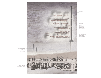
This proposal layers three systems: a “sand engine” that thickens the beach over time, scaffolding structures that serve as substrate for oyster growth and support a network of walkways, and a “sand gauge” on the shore that registers the accretion of sand and the cycle of coastal processes.
Project Narrative
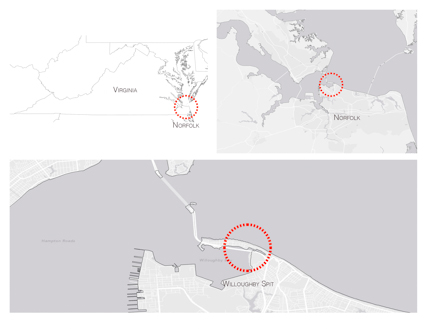
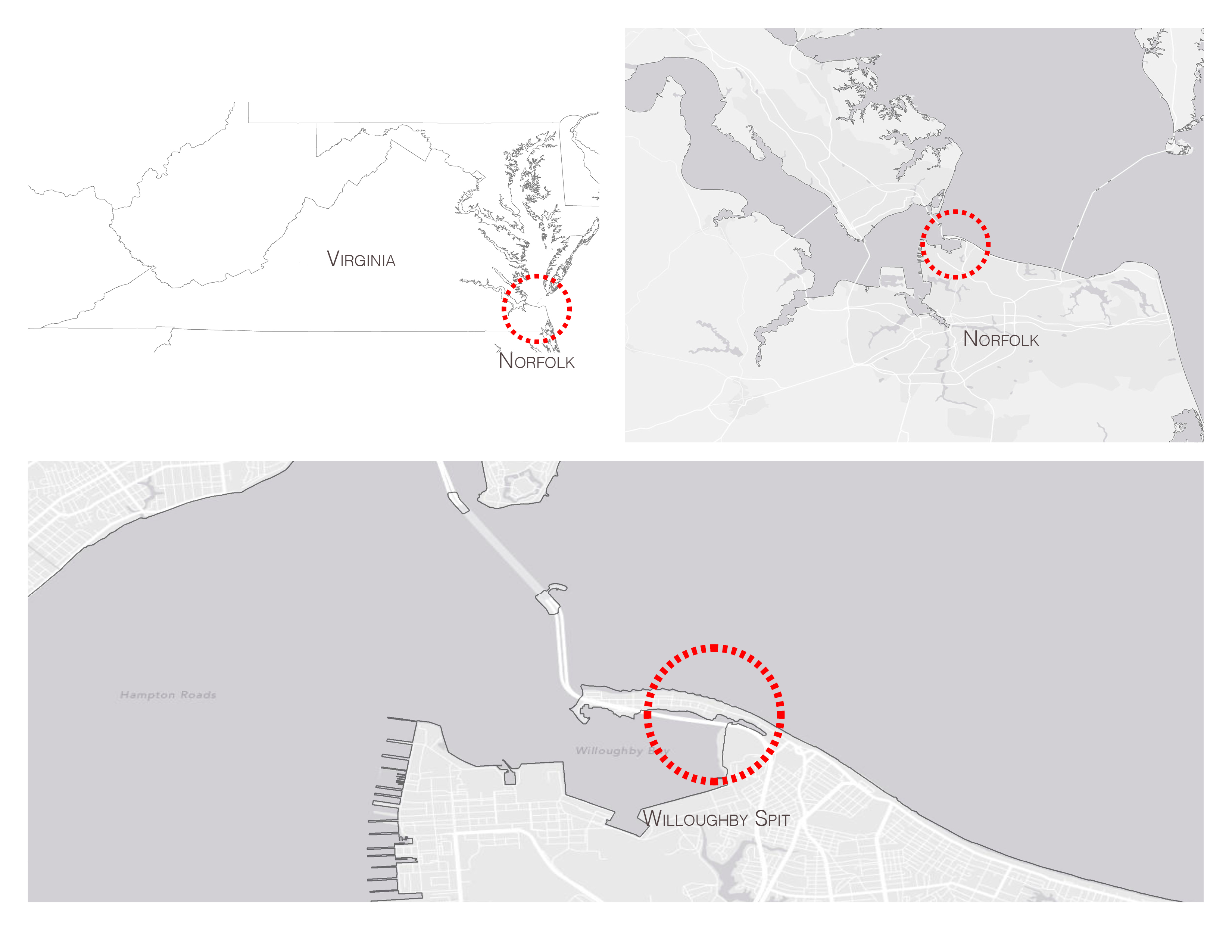
Sited at Willoughby Spit in Norfolk, Virginia the project aims to buffer the coastline and to address Chesapeake Bay’s water quality issues by catalyzing the growth of oysters and other mollusks that filter excess nutrients and suspended particles from the water, improving conditions for sea-grasses, and providing a food source for marine birds and animals. As the sand erodes from the sand engine and accumulates on shore, a set of structures, the sand gauge, on the beach marks the process. They register the horizontal and vertical growth of the dunes and the shoreline, as well as the daily fluctuations in water levels.
At the southern end of the Chesapeake Bay, the Norfolk coastline faces many environmental challenges. Nitrogen and phosphorus pollution from agricultural runoff, sewage, stormwater and air pollution in combination with rising water temperatures are causing algae blooms and dead zones that kill fish and submerged aquatic grasses. Mollusk reefs provide a food source for marine birds and animals, filter excess nutrients and suspended particles from the water, improve conditions for sea-grasses, and buffer the coastline from storm events and sea level rise. However, globally, over 85% of oyster reefs have been lost due to human impacts such as dredge fishing, overharvesting, and habitat loss.
To address these challenges, this design layers three systems: a “sand engine” that will replenish the sand on the beach, scaffolding structures that serve as substrate for oyster growth and support a network of walkways and towers for recreation and, on the shore, a “sand gauge” of steel insertions that marks the accretion of sand.
Current reef restoration techniques aim to provide a surface for oyster spat to attach to, including piles of bags filled with oyster shell, bundled wood, bamboo covered in cement, gabion baskets filled with shell and rock, oyster shell mats, and modular concrete structures. Some are also combined with Fish Attractant Devices (FAD) that provide shelter for small fish.
The porous, concrete scaffolding proposed in this project is designed to function as an artificial reef that will catalyze the growth of oysters and create protected habitat for submerged aquatic grasses and fish. A network of towers built using repurposed shipping cranes from the area’s ports support this concrete scaffolding underwater. Sand from the area’s dredging activities is piled between the structures to form the sand engine. Over the course of fifteen years the sand slowly erodes, exposing the concrete oyster substrate. This system is continually changing and allowing people to experience the shore up close and in different ways. The islands shift with the wind and the tides, human access becoming, at times, partially restricted, depending on the fluctuations of water levels and the accretion and erosion of sand. As portions of the sand erode, the underwater scaffolding blooms with sea grasses and mollusks, attracting birds and animals and allowing people to observe them from walkways or kayaks.
As the sand erodes from the sand engine and accumulates on shore, a set of structures on the beach marks the process. Steel insertions are placed at the water’s edge and a corresponding, smaller set at the dune line. These steel walls are spaced so that as the beach thickens, the change can be registered horizontally, as the water recedes out to the furthest structure, as well as vertically, as the sand and tidal fluctuations leave marks on the steel surface. The set of structures at the back of the beach similarly registers the growth of the dunes. These installations serve as a marker of time and natural processes, provide shade, and break up the continuity of the long beach line.
The combination of these design elements not only ameliorates some of the environmental issues facing the coast of Norfolk, but also alters the way visitors to this area experience the coastal processes around them. By registering change and focusing attention on otherwise unnoticed processes, such as the erosion and accretion of sand, the growth of mollusks and aquatic grasses, and the formation of dunes, people begin to understand this ecosystem more closely and develop a sense of stewardship for it.