The Golden Horseshoe lies to the east of Breckenridge, Colorado.
It became the focus of intense mining activity in the mid-1800s, from
dredge boats turning over entire riverbeds to men digging shafts into the
hillsides. Mining defined the landscape for many decades, and we can still witness its effects in the tailings piles
and lodgepole monoculture that define the site. The road network that developed during the mining era was a
chaotic and redundant labyrinth, which has subsequently evolved into a system
of recreational trails used today by runners, mountain bikers, cross-country
skiers, off-road vehicles, and snowmobiles. Due to the history of the area and a lack of management funding,
however, the current trails are degraded and desperately need maintenance and
consolidation. My project attempts to convey the immense recreational possibilities that exist within the Golden
Horseshoe by looking at trails and their management not as a mundane, static
structure, but rather as an evolutionary organism that intervenes in and draws
its excitement from the ever-changing world around it. I hope to make officials in charge of the
area, as well as local users, eager to work toward a consolidated trail system
that is more fun for more people, while generating less harmful environmental
impacts.
I presented this project to a studio jury composed of several design critics, as well as trail managers
from the Town of Breckenridge, which was co-sponsoring our studio. I tailored the presentation to appeal to an
audience not necessarily steeped in academic theories-I wanted fundamentally to
communicate the joy and thrill of discovering a landscape through the
experience of traveling a trail. To create a system that can deliver this joy and thrill requires innovative maintenance
regimes and consideration of the users' ideal experiences. I decided that the critical element in
evoking excited reactions to my project would be enabling people to see on a
macro-scale how the system needs to change and then taking them on simulated
trips through a series of potential trail evolutions.
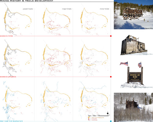
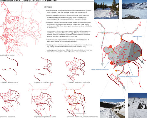
To show macro-scale network alterations, I used GIS data and aerial photography to create a series
of digital maps (images 1 and 2), comparing historic and existing conditions
with future possibilities that are not so specific as to seem unrealistic but
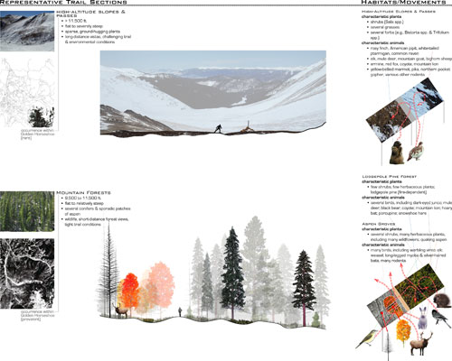
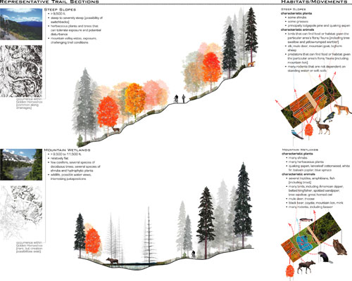
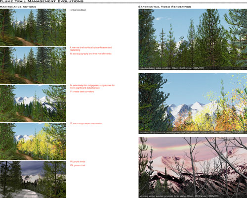
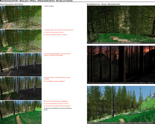
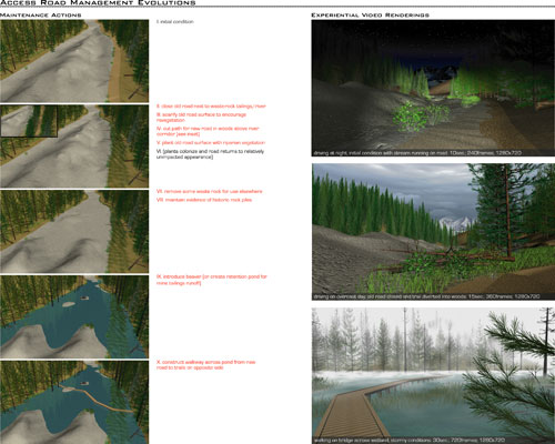
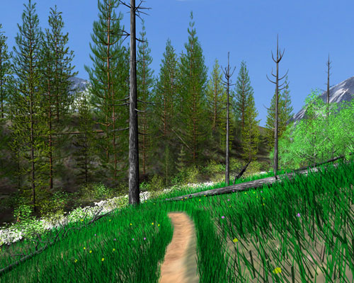
not so vague as to seem hollow. Zooming to the level of individual trails, I made a number of idealized trail sections
and schematic depictions of habitats and ecological flows (images 3 and 4). These portray both human experiences and landscape
characteristics. Recognizing, however, that two-dimensional representations could never capture the feeling of riding
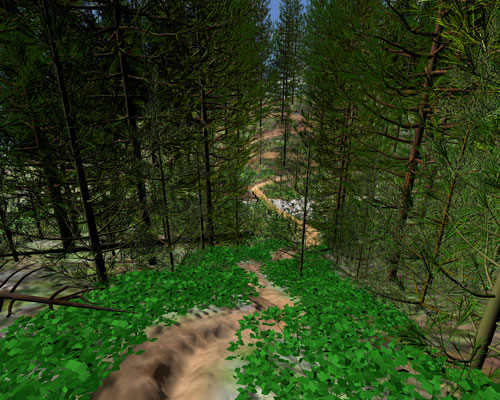
through a meadow on a mountain bike, for instance, I built nine three-dimensional
digital models (three iterations each of three separate trails) and used these
models to render videos that simulate the experience of passing along trail in
the Golden Horseshoe. (Images 5, 6, and 7 depict the maintenance actions that would actuate my proposal; images 8, 9,
and 10 are high-resolution perspectives rendered from the three "backcountry
gulch trail" iterations.) My PowerPoint presentation follows the progression described above, and I showed each video
simulation with Quicktime Player (on a separate plasma screen) after using PowerPoint
slide transitions to demonstrate how the trails evolve.
I hope the exhilaration that I feel when I go trail running or mountain biking will captivate the
audience as it captivates me, invigorating them to revolutionize our approaches
to trail management.
|