| Narrative Summary
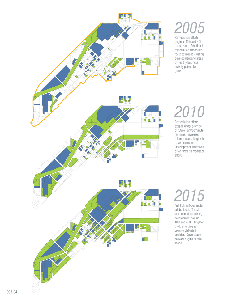
Our project site is located in Denver, Colorado north of
downtown in a historic but fading industrial area known as River
North. River North is bounded by I-70 to the north and I-25 to the
west with Brighton Boulevard serving as a major thoroughfare and
the South Platte River a potential resource and amenity. Currently
Denver has plans to expand its commuter and lightrail network through
the Fastracks program. One component of this plan is the east corridor
rail line which runs from downtown Denver to Denver International
Airport. Five new commuter rail stations are planned along this
corridor, including one in River North. The corridor includes some
of the most polluted landscapes in the nation and is littered with
greyfields and brownfields of various size and levels of toxicity.
This presented us with a unique opportunity for landscape architectural
response due to the number and nature of forgotten, poisoned and
ignored spaces and the changes set to come.
Two major goals were established to direct our thought process.
First, we wanted to prepare the land for a change to come due to
the development of the new commuter rail line. Secondly, we intended
to find a new solution for dealing with the polluted landscape that
is deeply rooted in the ideas of radical gardening.
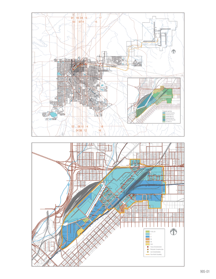
We began by collecting map data including land use, zoning, roads,
railroad, hydrology, parcel information, and demographics. We collected
environmental data such as EPA brownfield studies and soil samples.
Given the nature of the environmental data, we focused further efforts
on gathering information on remediation technologies. We also consulted
with experts in the fields of remediation, development, and planning.
Another layer of our data collection involved an examination of
historic photographs and maps of the area. Finally, we visited the
site frequently and collected data in the form of photographs, sketches,
and notations.
From this research we concluded that remediation had to play an
integral part in this project. Thus, we began analyzing the traditional
approaches to the mitigation of polluted sites and were continuously
searching for new ways of working within that framework that are
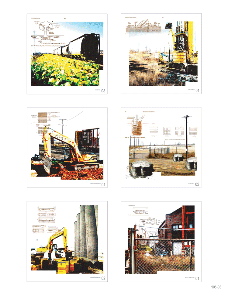
more ecologically sensitive. We found four major categories of remediation
techniques currently in use to mitigate contaminated sites, including:
- treatment
- containment
- excavation and disposal
- natural attenuation
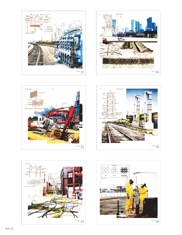
More specifically, treatment includes processes such as bioremediation,
phytoremediation, and the many detailed treatments like vapor extraction
and air sparging. Containment refers to capping or lining the site
and also solidifying and stabilizing the soil. Excavation and disposal
is the removal of contaminated soils on or off site. And finally,
natural attenuation is the process in which the landscape is left
alone and natural processes clean it up over time. Our analysis
included an examination of how these techniques work scientifically,
function, and impact the landscape.
As we studied the remediation technologies, we supplemented
our analysis with a series of mappings. These mappings took two major
forms. The first series of mappings were recordings. Recordings
are mappings of contextual data which we organized using GIS. The
recordings were compiled at two scales: 1”=4000’ and
1”=500’. The recording at 1”=4000’ overlaid
data for the analysis of the entire county of Denver and provided
an overview of the east corridor rail line. The recording at 1”=500’ focused
on the River North area providing a more detailed examination
of the site.
The second series of mappings were speculations. Speculations are
more intuitive, a cognitive type of mapping. Speculations overlaid
image, text, and diagram providing a fuller understanding of the
nature of each remediation technology and its impact in the landscape.
Speculations were also used to explore how specific sites might
evolve over time.
After analyzing remediation technologies and site conditions, we
felt it was imperative to choreograph an implementation strategy
for remediation that was directly woven into the future plans for
development. The most important component of this project was the
creation of a new zoning type as an enabling device for change.
The zoning code is written as follows.
ARTICLE IV. ZONE DISTRICTS
DIVISION 23. X ZONE
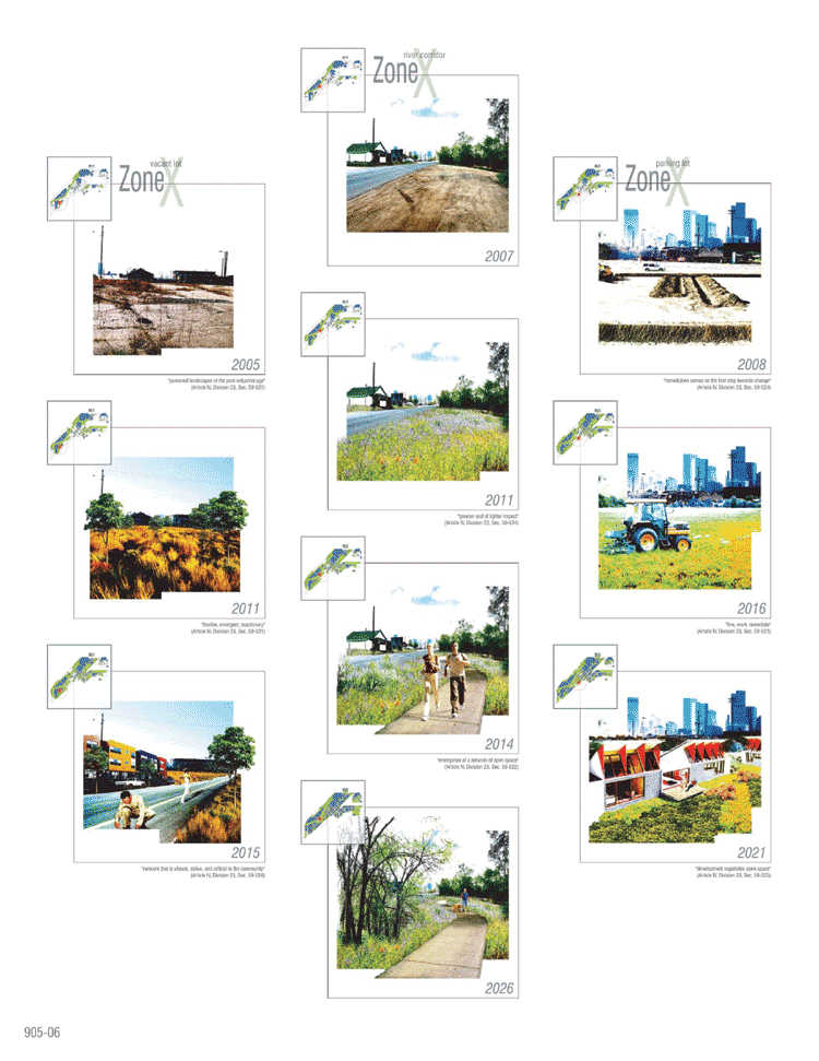
Sec. 59-521. Description of district.
The X zone is intended to be an alternative to conventional master
planning that is flexible, emergent, and reactionary allowing
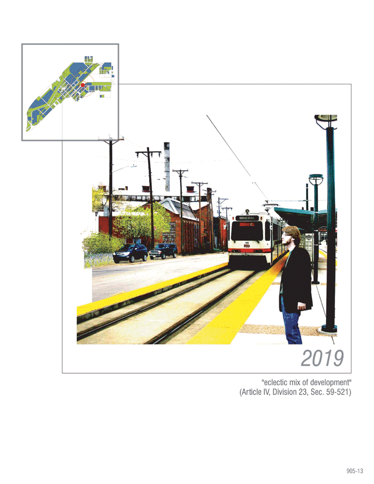
for a mix of uses that create an eclectic community. The X zone has been developed
as a tool for working with “other”
landscapes, the forgotten, poisoned landscapes
of the post-industrial age. This zone is meant to serve
as a catalyst for remediation and development in an alternative
way. It allows for an eclectic mix of development,
rooted in the ideas of radical gardening, and based
on the idea of live, work, remediate .
Sec. 59-522. Purpose.
The X zone allows a response to the landscape and its conditions
that promotes the emergence of a network of open space as an
integral component of development. The nature of the land provides an opportunity
for this to occur because of the need for
remediation. By incorporating “green”
remediation technologies, landscapes may be easily
incorporated into the open space network and made accessible to
the community . The pollution of the landscape determines the outcome
of development.
Additionally, the X zone is designed to promote an eclectic mix
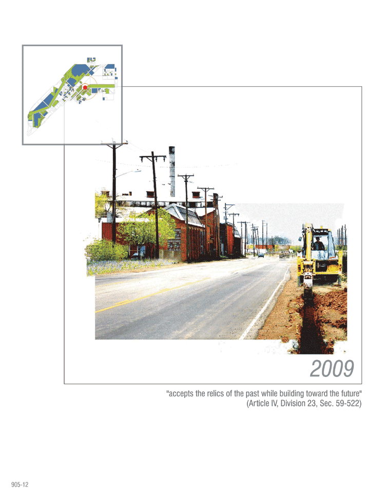
of development that accepts the relics of the past while
building towards the future.
Sec. 59-523. Permitted uses.
The X zone district permits open space, residential, mixed use,
commercial, and industrial uses, however, location is determined
by adjacencies and will be reviewed by a committee consisting of
business owners and residents.
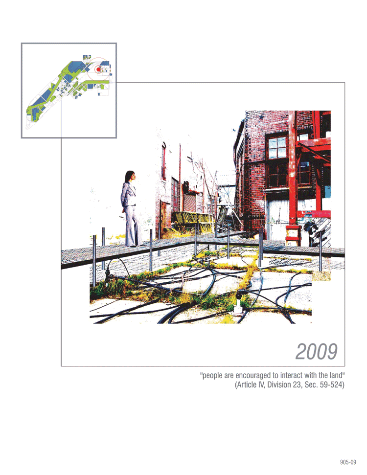
Sec. 59-524. Remediation/Open Space
Remediation serves as the first step towards change.
The sites of remediation are the foundation of the open space network.
The sites that are most contaminated are remediated to an acceptable
level and remain as open space. These open space sites create a
network that is vibrant, active, and critical to the community.
The sites of least contamination serve as residential development
areas where a higher density of development is tolerated. Remediation
technologies are implemented according to levels and types of contamination;
however, incentives encourage remediation techniques that are “greener” and
of lighter impact on the land. As remediation
is being implemented, people are encouraged to interact
with the land.
Tax increment financing (TIF) is used in urban renewal areas. This
allows tax revenues generated by redevelopment to be rolled back
into the area to help finance the project. The new tax revenue that
is created finances additional remediation efforts and open space
development.
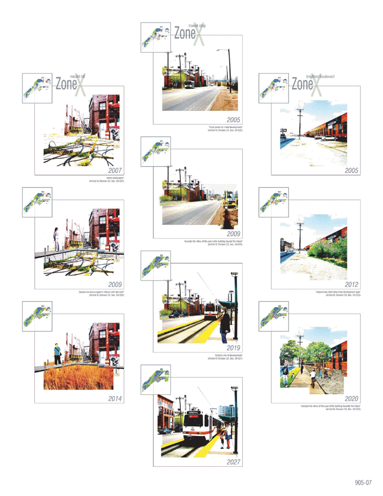
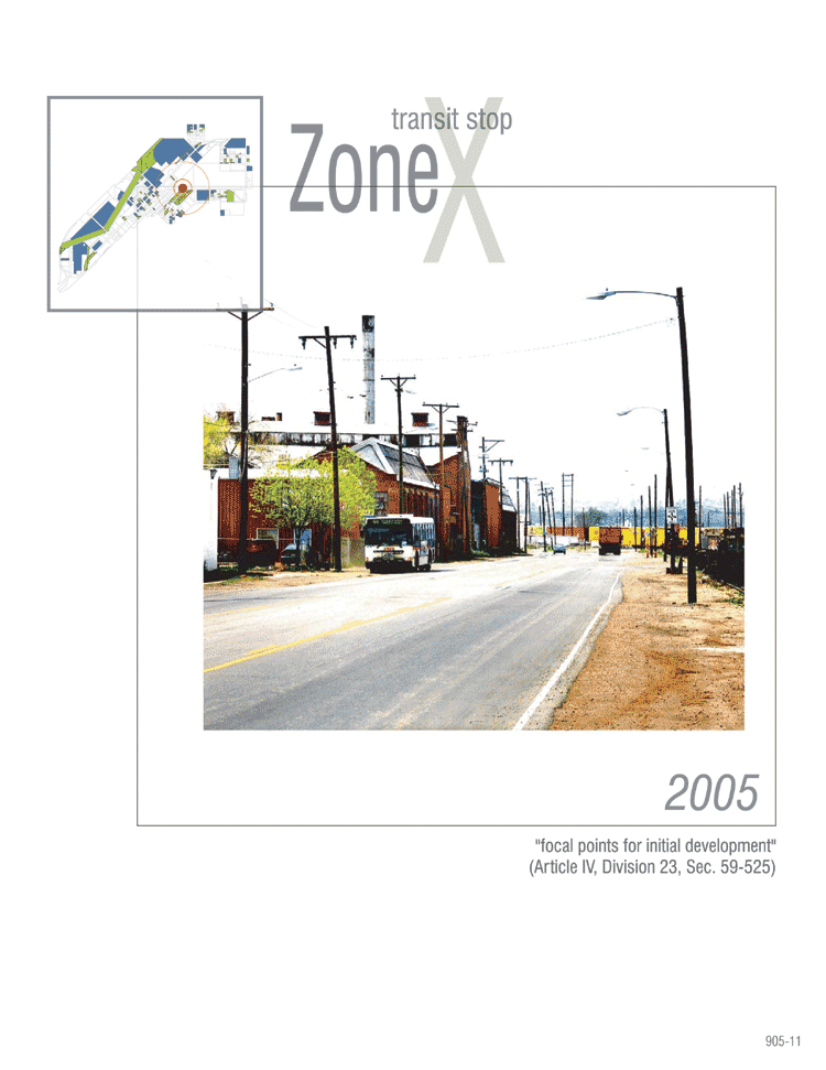
Sec. 59-525. Development.
Development negotiates open space and is based
upon levels of contamination. Residential units are located in areas
of least contamination. Historic buildings, thriving businesses,
and the rail station also serve as focal points for initial
development. All development must be located adjacent to
existing development and compatible uses to create high density
areas. Adjacencies shall determine development type.
For example, incompatible uses such as industrial and residential
are not located adjacent to one another.
Transfer of development rights shall be used as a incentive where
the most contaminated sites are left as open space while allowing
development at a higher density in less contaminated areas.
1Radical gardening is a kind of middle operation
inhabiting a space between the seemingly oppositional pairs of culture
and nature. The difference between the traditional version of gardening
and the radical version is that the latter sets out to intentionally
complicate the hierarchical structures beyond recognition, aimed
at deforming, reforming, and eventually transforming the practice
of landscape into a higher form of itself. (Anthony Mazzeo 2005)
2The idea of a new form of community in which remediation
is incorporated into everyday life as a result of re-inhabiting
a post-industrial landscape.
3“Green” remediation
technologies refer to methods that are of lighter impact on the land and
more environmentally
sensitive. These technologies include but may not be limited to
phytoremediation and bioremediation.
|