.webp?language=en-US)


Green Convergence—Resilient Corridor for Jaipur
Chaoming Li, Student ASLA; Xuefei Yang
This project uses extensive modeling of the existing architectural typologies for this corridor project in Jaipur, India. The site is dealing with a lack of infrastructure to manage waste and water. Students modeled the urban fabric, and introduced sections that clearly illustrate the proportions of their proposed interventions. They discussed different typologies and introduced not only relevant design elements but also provided for each one a different device that addresses systems like rooftop water collection, the need for more facilities, and even an innovative pavilion that serves as a social gathering place and also a water collection point. It’s well-thought out at all different scales.
Awards Jury
-
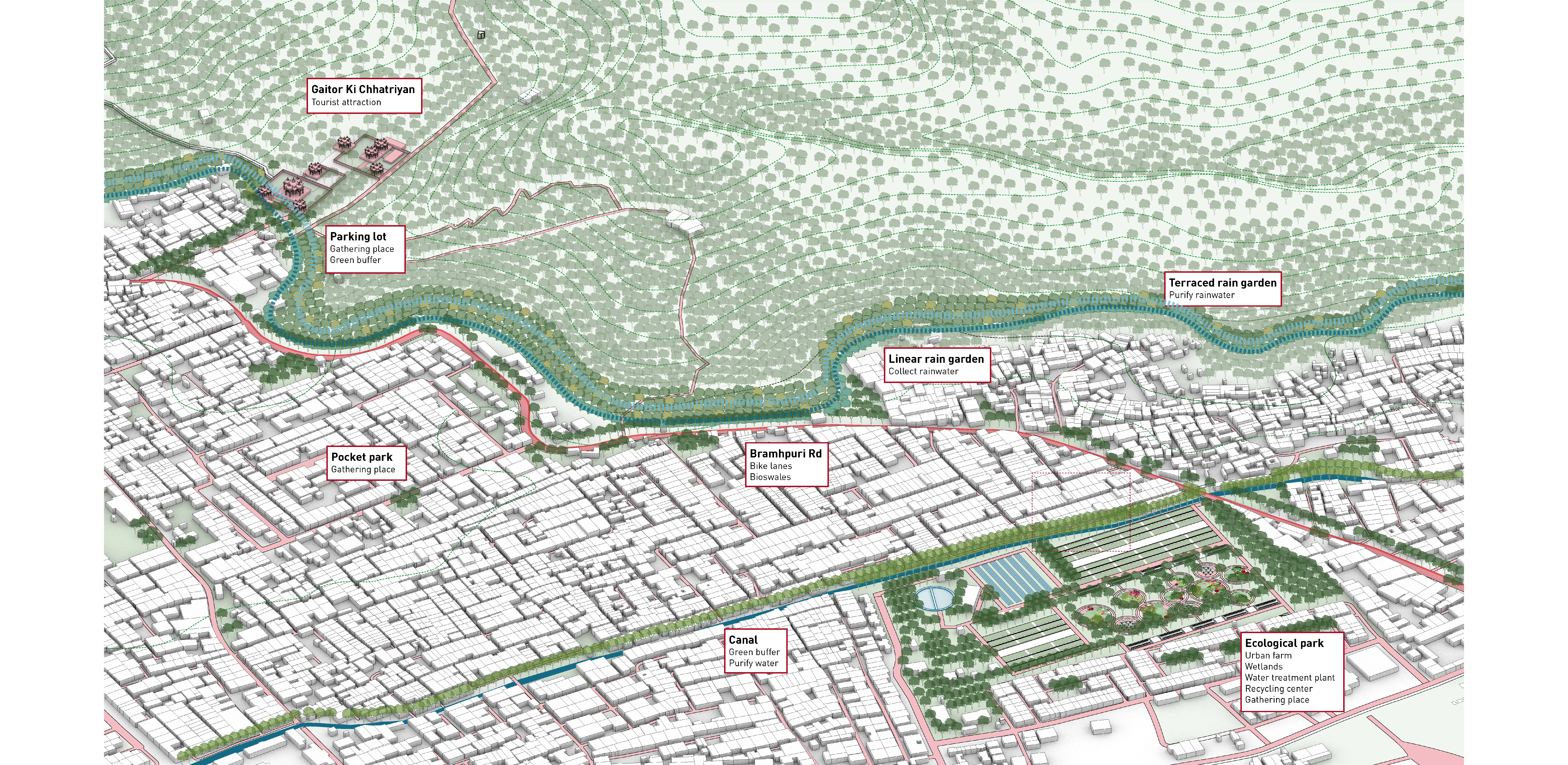
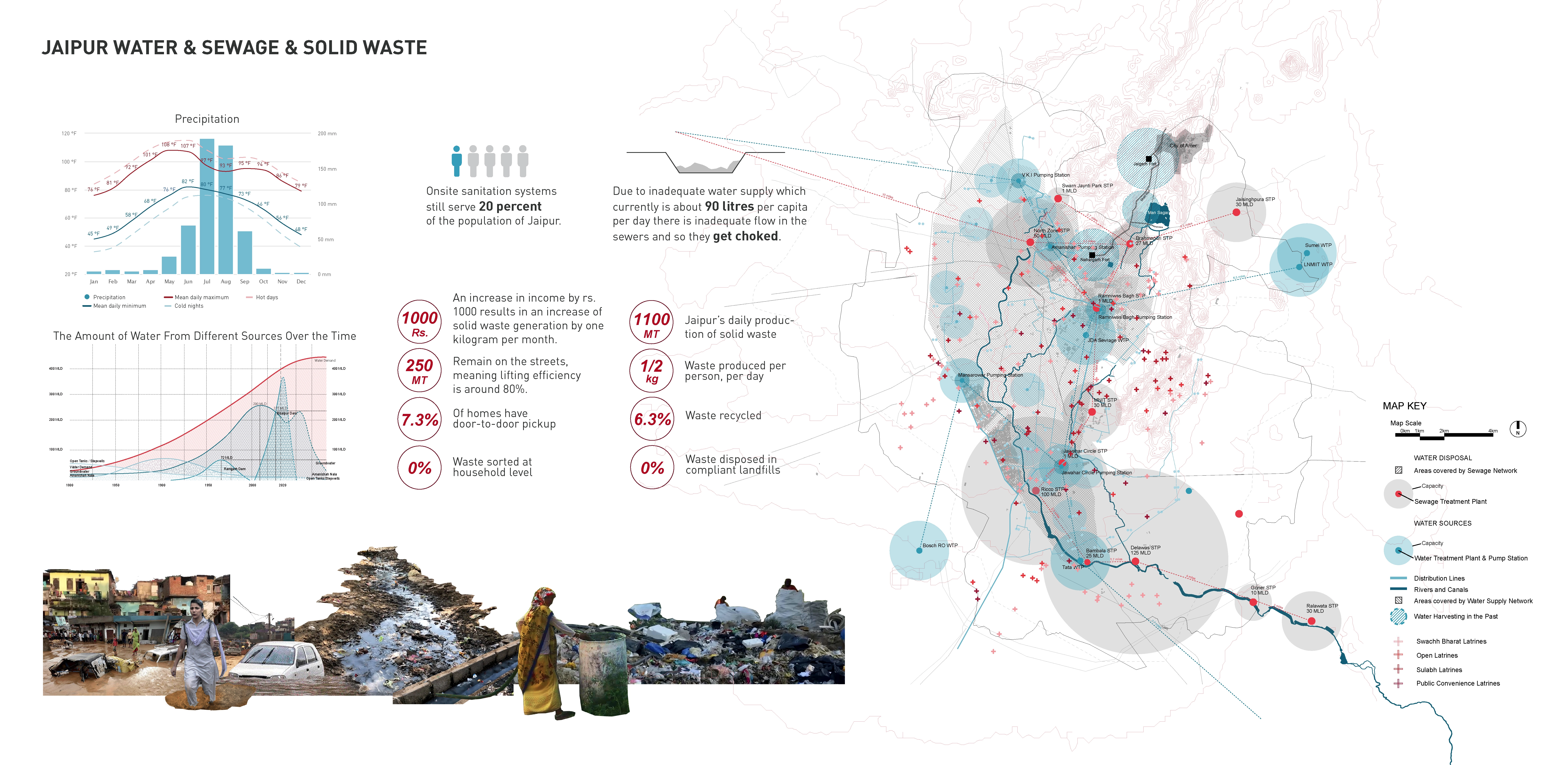
Jaipur, the capital and the largest city of the Indian state of Rajasthan, has faced many of the problems associated with population growth in its rapid development, such as water shortages, untreated sewage and heavy solid waste pollution. The site we are working with is along Mount Rd, an important road between Aravalli Hills and slums, connecting the northern and southern part of the city. By creating an ecological corridor with a circulatory system for both water and waste, we collect and decentralize solid waste and waste water from the surrounding slums, including creating rain gardens to collect and purify runoff, establishing underground sewage system to reuse, building infrastructures to meet residents daily needs, etc. Upon enhancing city resiliency through combining different system into one and increasing area of green space, we also consider its potential economic value, such as tourism and food production, which is also one of the biggest potential focal points of Jaipur.
-
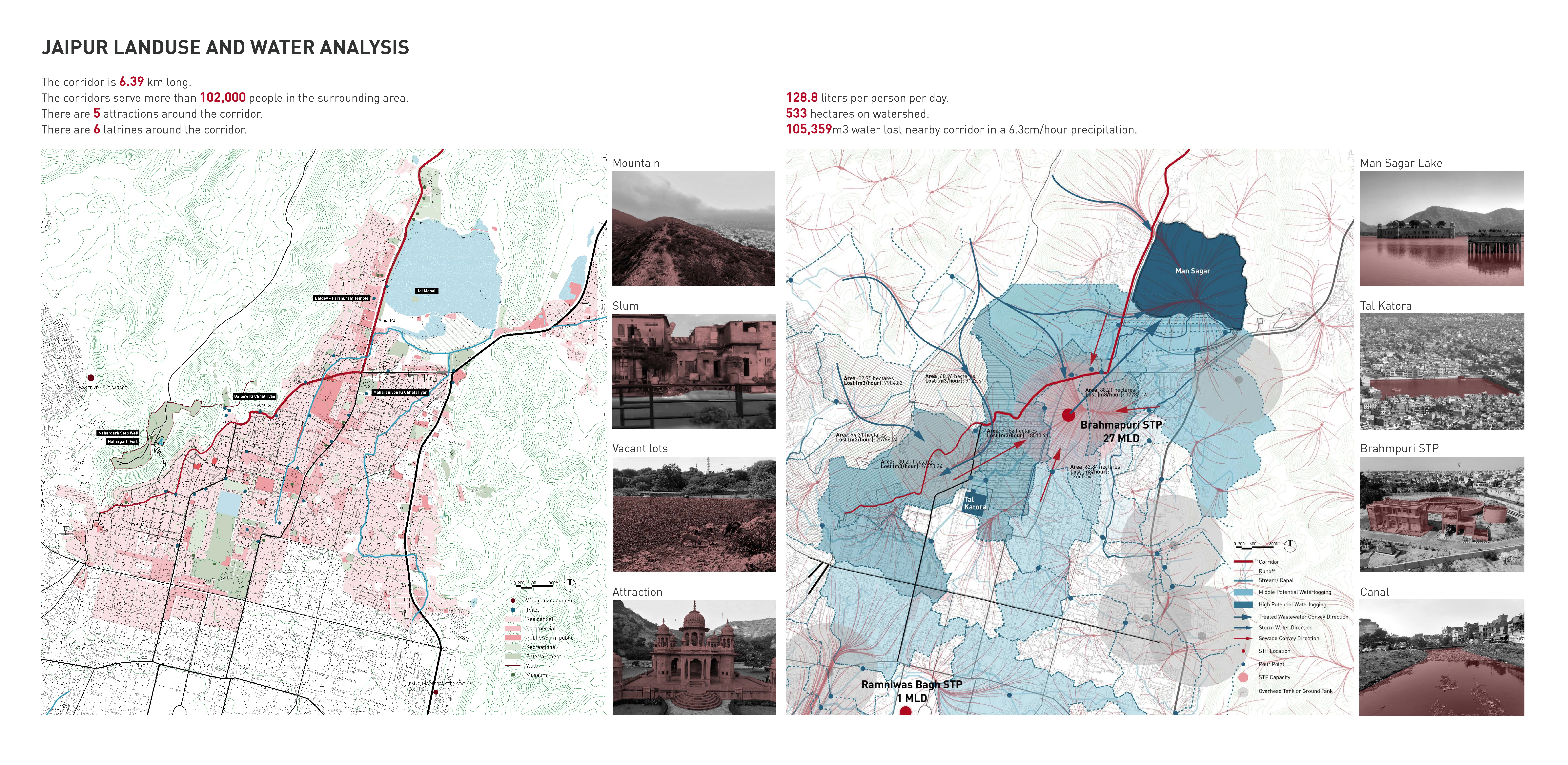
Background and Conditions Jaipur has faced many of the problems associated with population growth in its rapid development, such as water shortages, untreated sewage and heavy solid waste pollution. Groundwater, as the main water resources for people's daily life, has not been adequately replenished. Sewage is discharged directly into open space. The efficiency of solid waste collection and management is low. The site we are working with is along Mount Rd, an important road between Hills and slums, connecting the northern and southern part of the city.
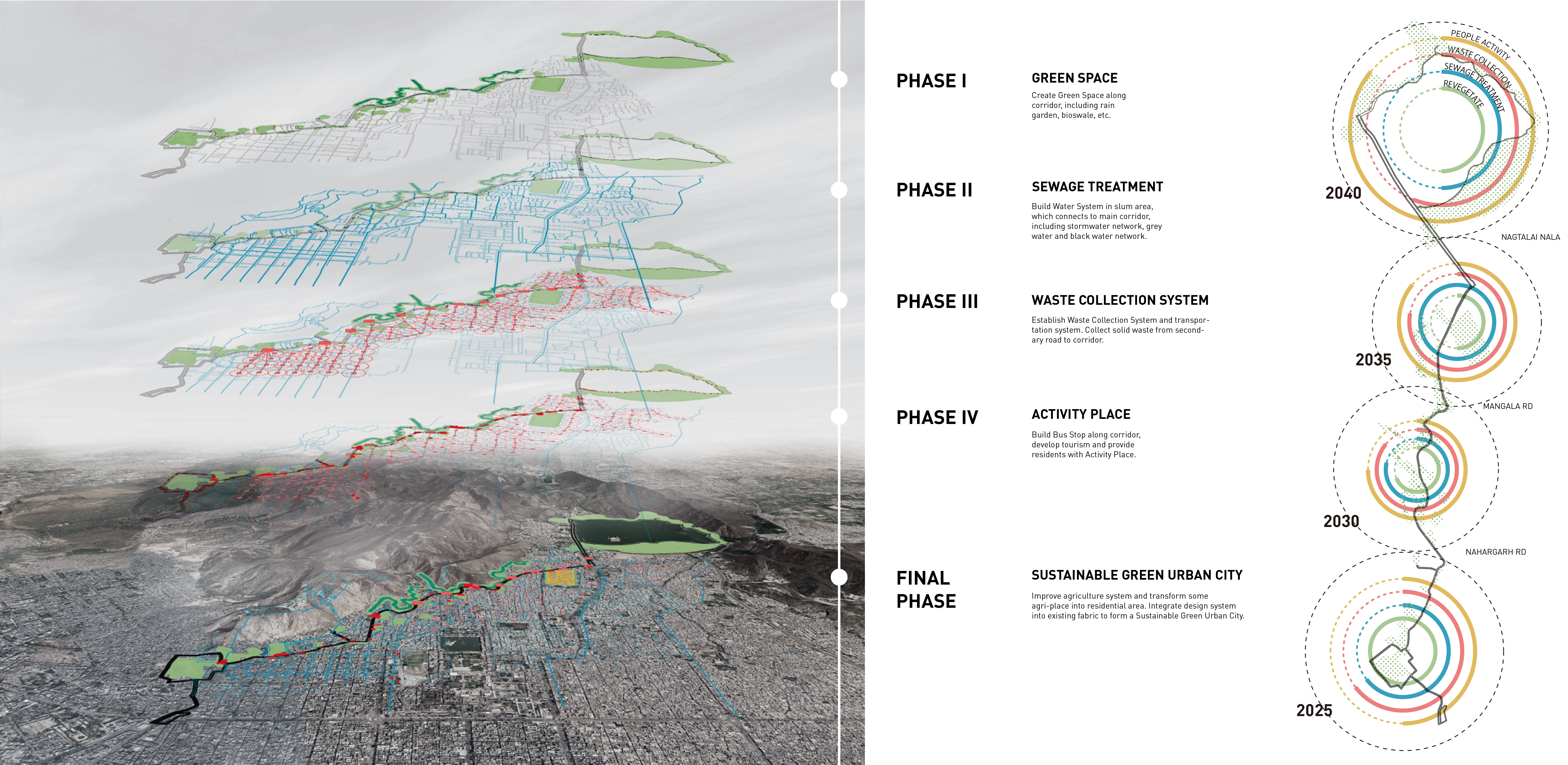
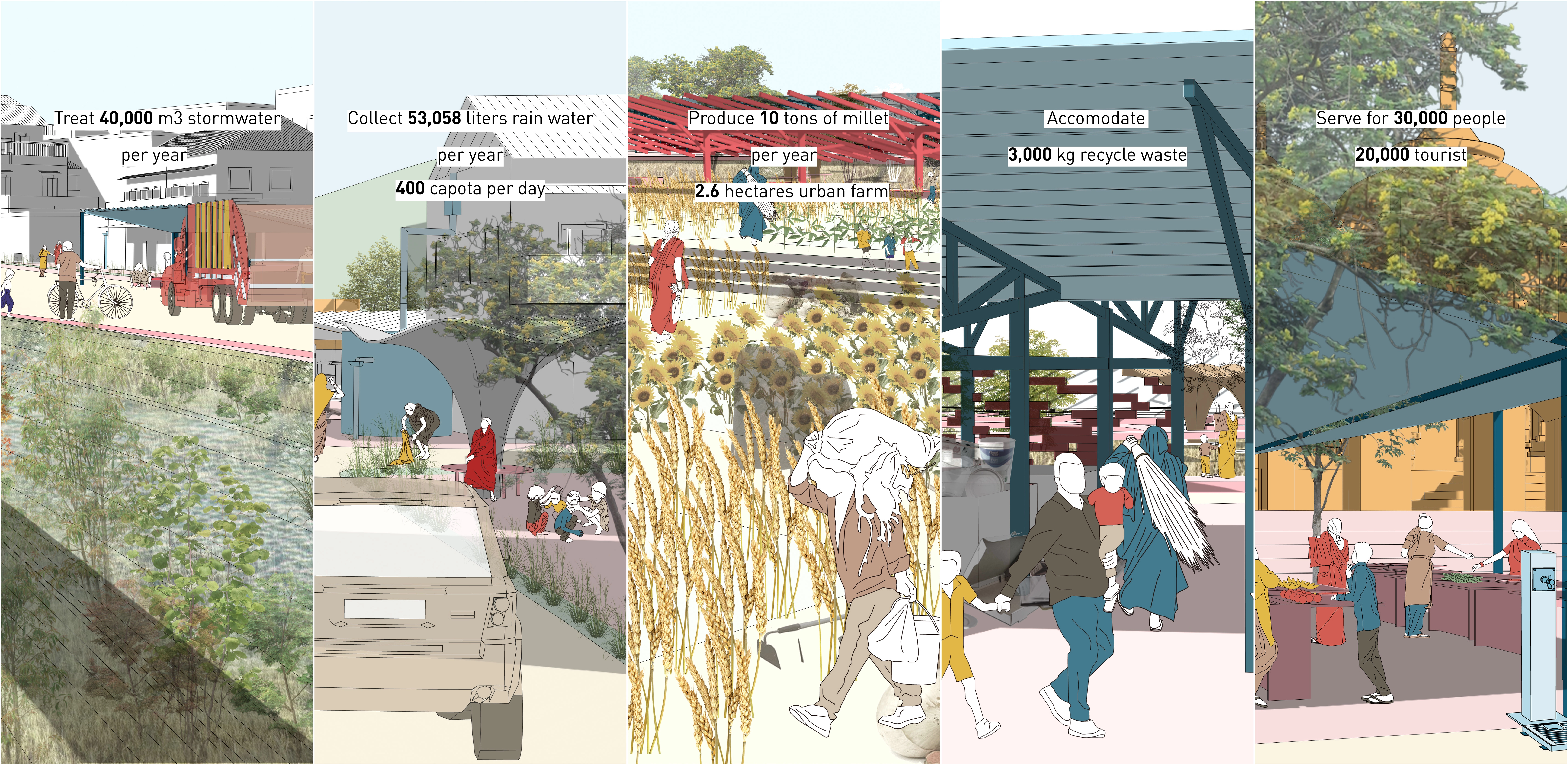
The planned corridor length is 6.39 km, starting from the Metro station in the southwest and ending at Man Sagar Lake in the north, which goes through slums, attractions and commercial districts. The corridor is going to serve not only serve the surrounding population of more than 100,000, but also serve the visitors. There are two main types of water that come toward the corridor which are stormwater from hillside and sewage water from urban city. We find several pour points and water logging places through runoff analysis. The water lost nearby corridor can supply 500,000 people per day. According to the water accumulation places, pour points, water flow direction, we decide our strategies for collecting, transporting, purifying, etc.
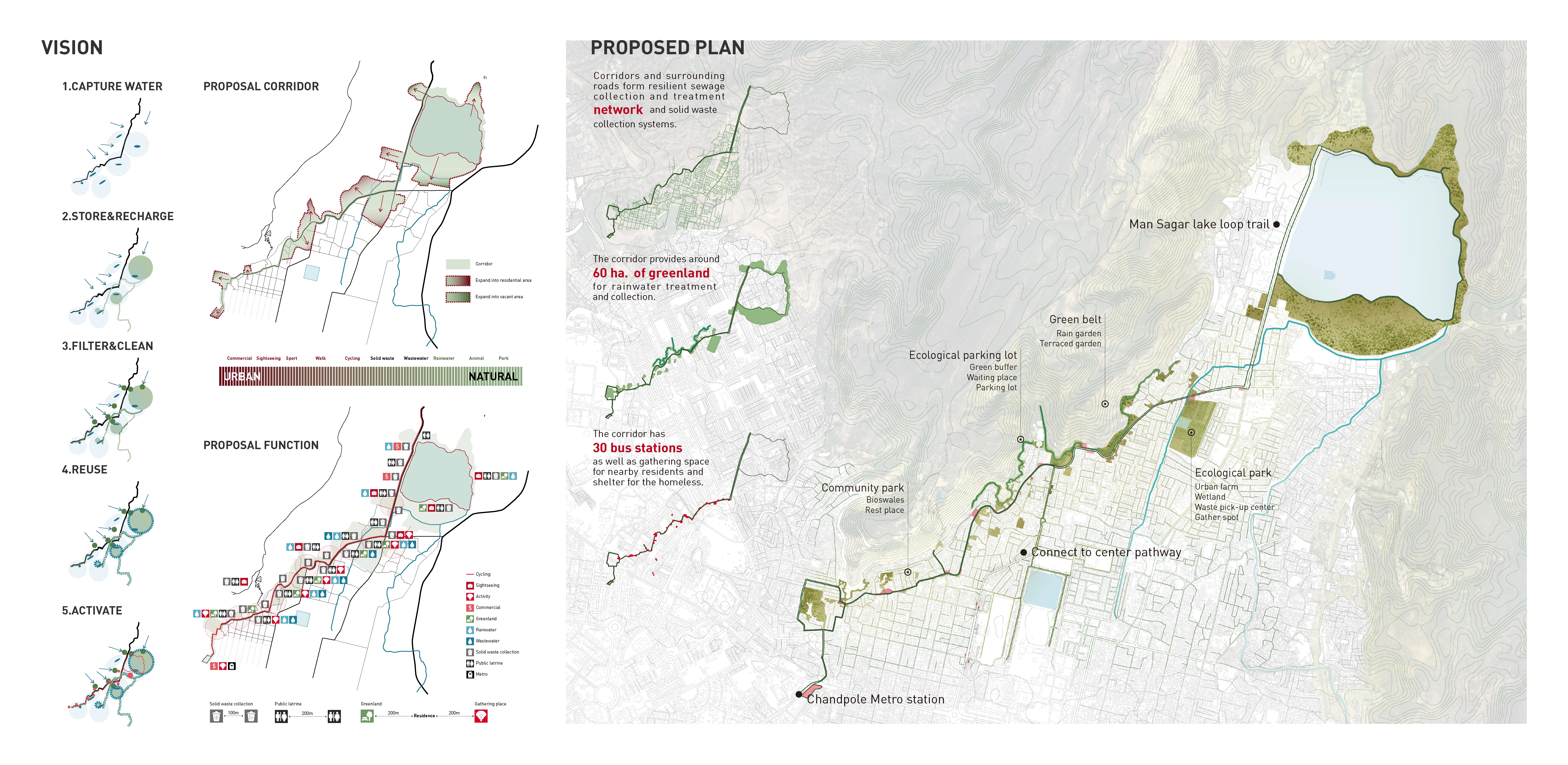
Phasing Strategy The corridor is formed by the following five steps. Step 1 is capture water from community and mountain. Step 2 is store water in the surrounding open area and recharge groundwater. Step 3 is filter and clean water with planting filters. Step 4 is reuse purified water and cycled back for irrigation and household water. Step 5 is activate the vacant land by combining social activities.
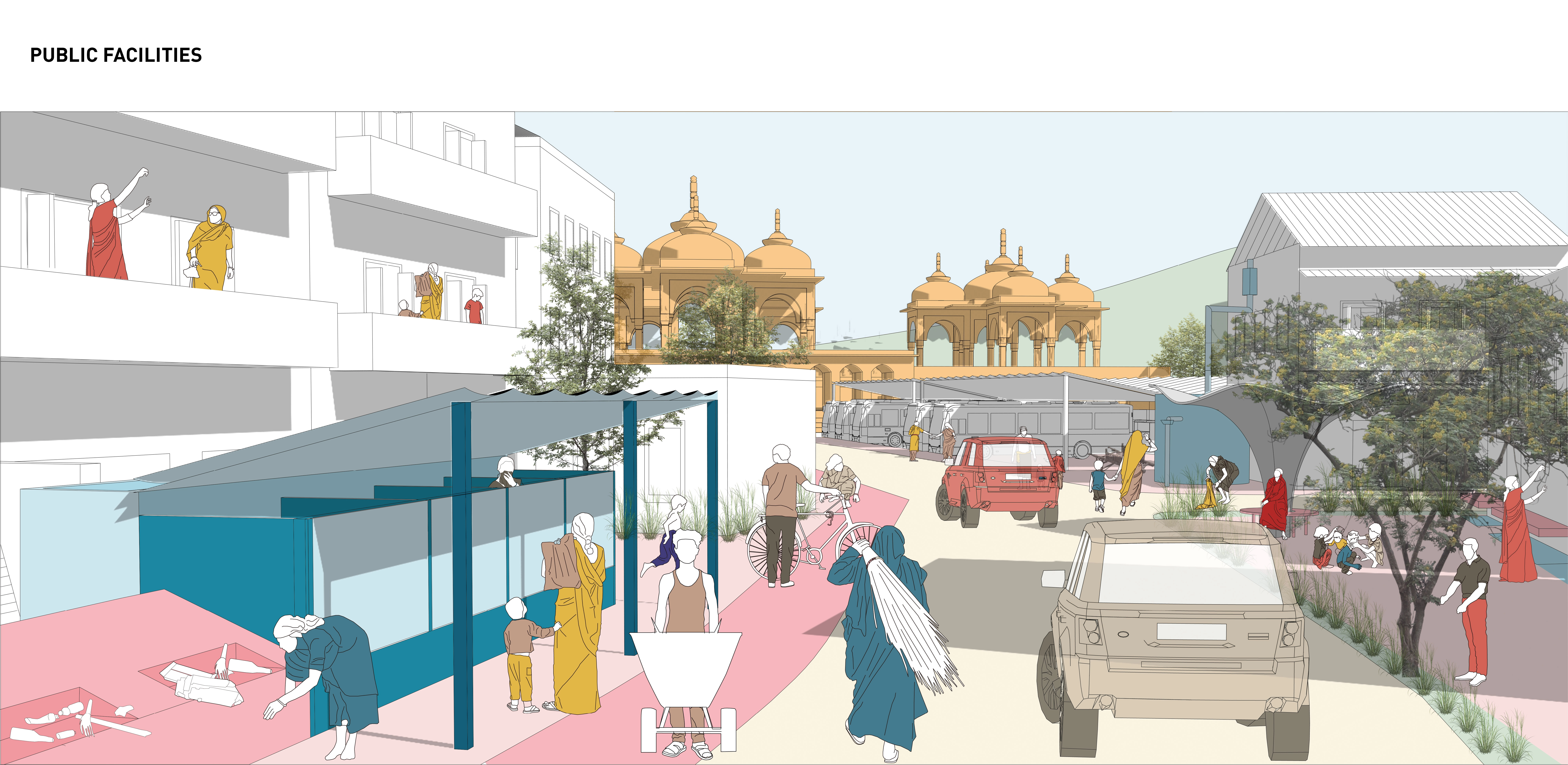
According to analysis of the direction of runoff and accumulation, some parts of the corridor are extended to the interior of the residential area, while some existing green space or open space were transformed to ecological parks. In terms of the function of the corridor, first of all, we added bike lanes and green sidewalks to the original main road. Secondly, along the corridor, we placed waste collection bins every 100 meters and public latrines every 200 meters, and reformed the water pipe system to provide basic needs for people's Daily life. Finally, the green space system is established, and different types of activities are added, so that people can reach surrounding green space or gathering place within 10 minutes. The corridor is a resilient sewage collection and treatment network and solid waste collection systems. It aims to creates 60 hectares of green space to collect and treat stormwater.
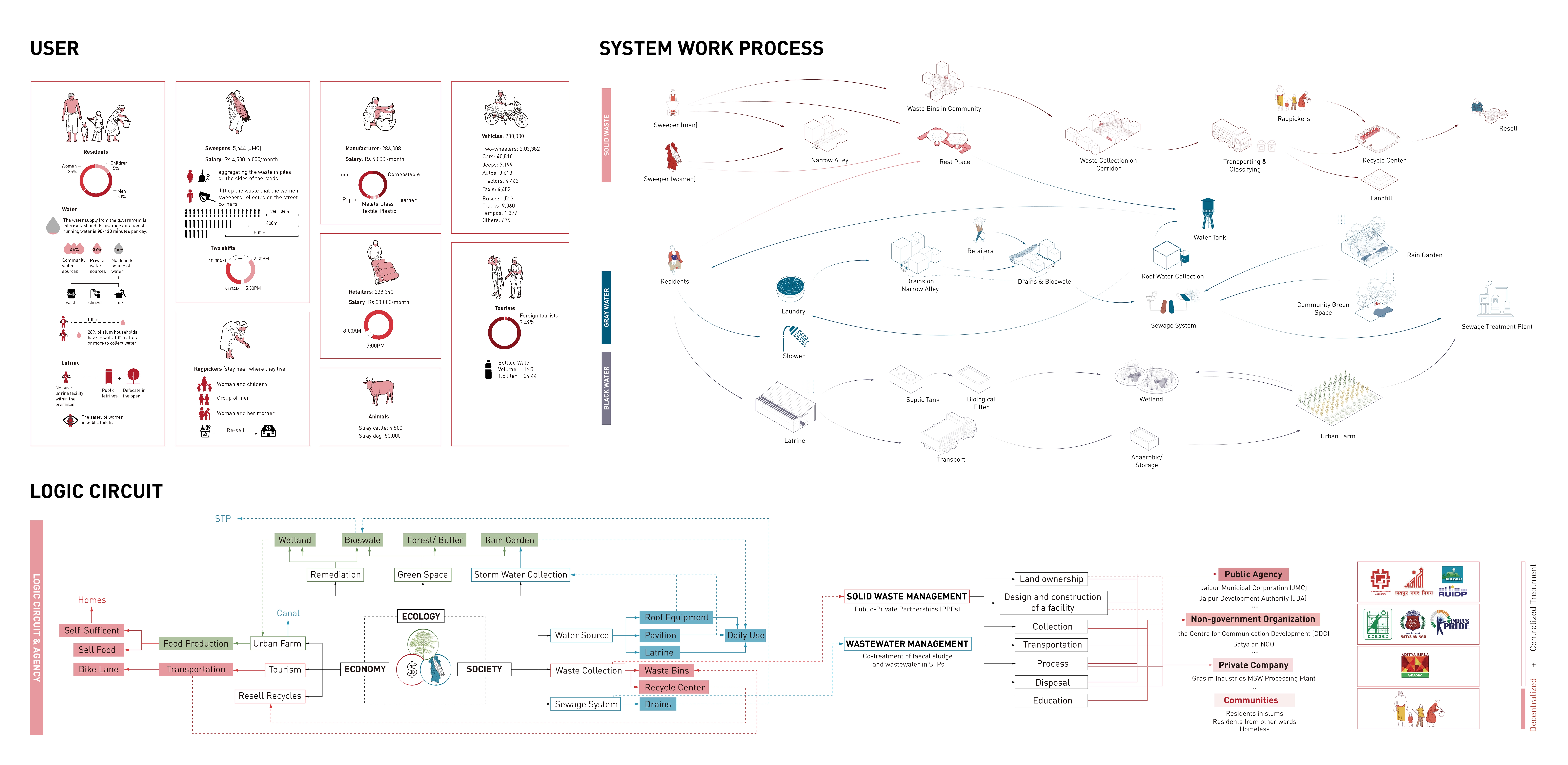
Framework We propose that the corridor could realize ecological, economic and social values, meet the needs of residents for water resources and infrastructure in their daily life, and create a sustainable development model. In addition to existing agents, we also include new agents to be able to participate in the community. The current methods are all centralized treatment and lack of public participation. Therefore, we adopt more decentralized treatment and let all residents participate in this process, which contributes to social equity..
Design Outcomes According to the different areas condition along the corridor, we have 4 types of design.
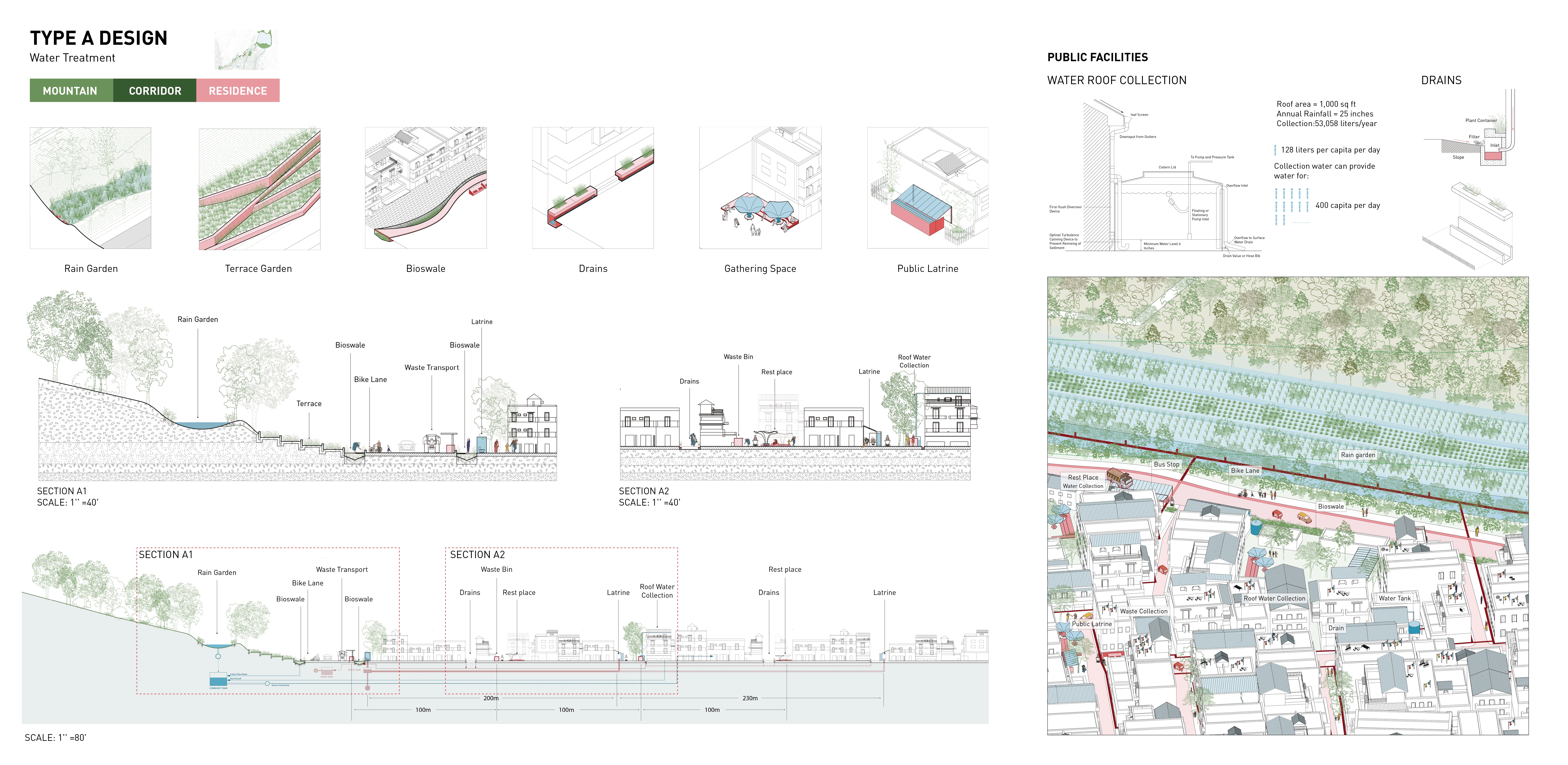
Type A: Between Hill and Residential Area: Water Treatment System
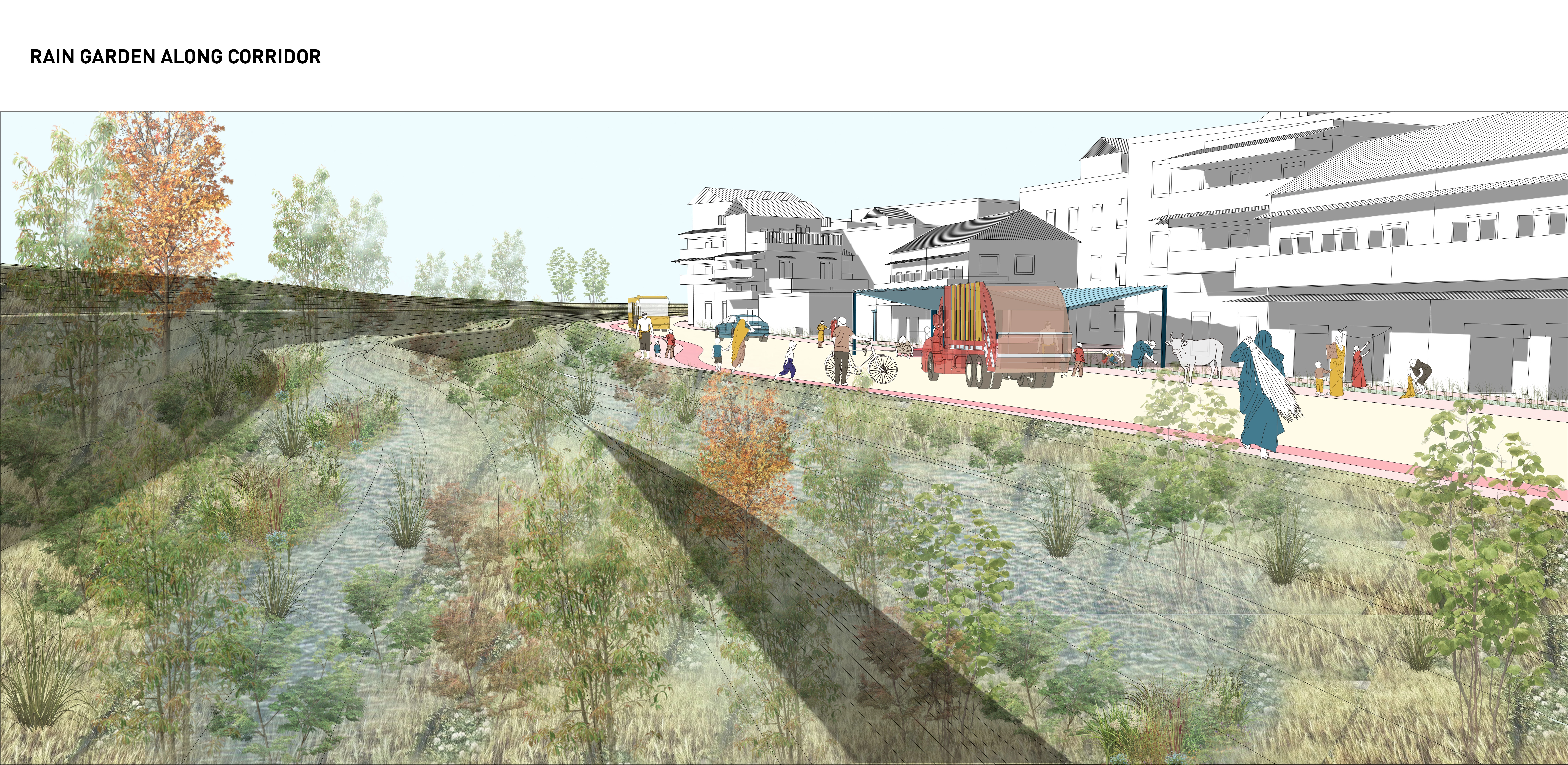
The first one is for the place that in the middle of the mountain and residential area. Focus on collecting stormwater and reuse treated gray water through creating rain garden, bioswale, water roof collection and more completed drain system.
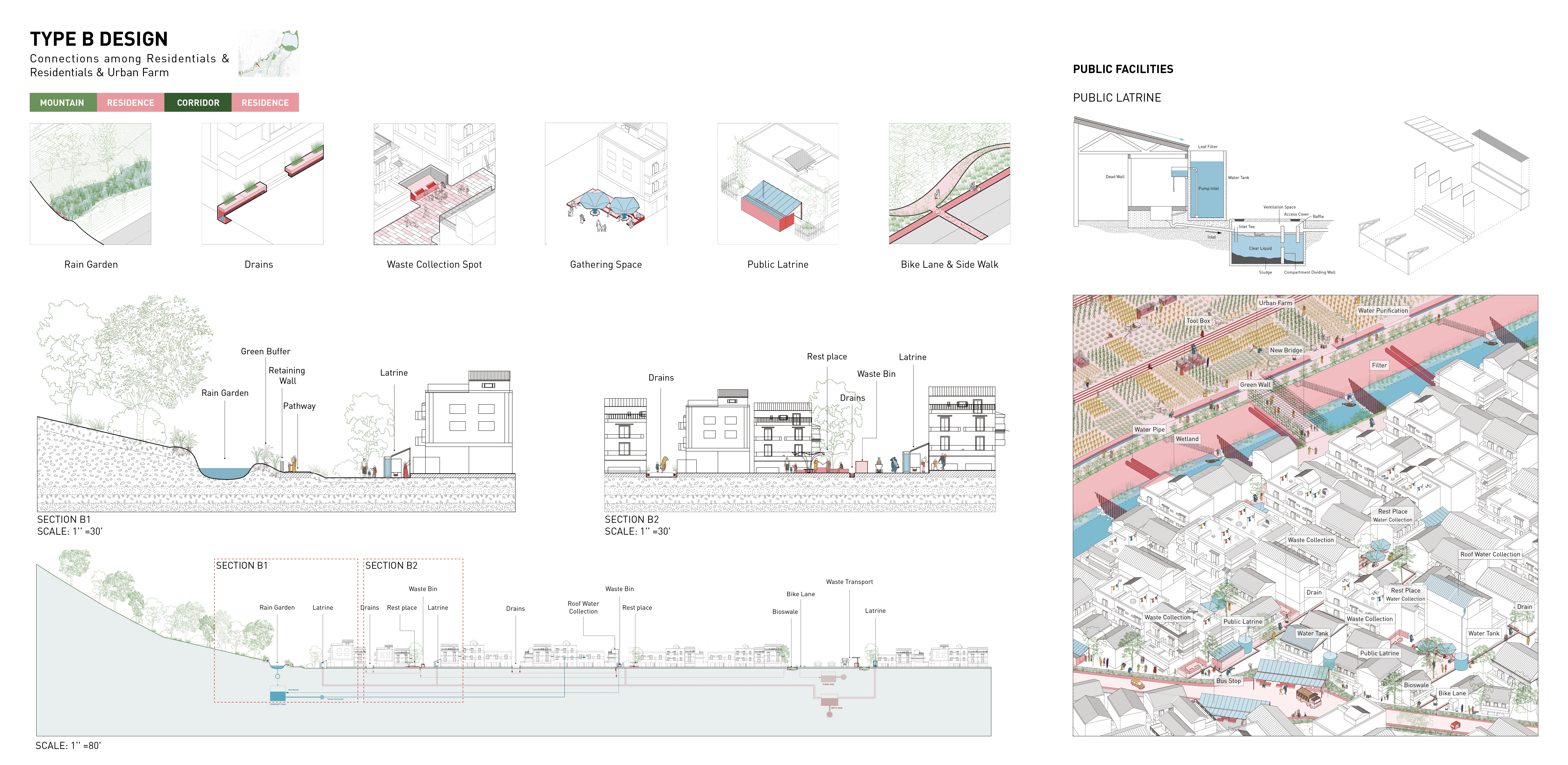
Type B: Between Residential Area and Urban Farm: Infrastructure and Recreation
The second one is between two sides of residential areas and urban farm. Focus on enhancing walkability along the corridor and provide serving facilities such as public latrine, waste bins and activity places.
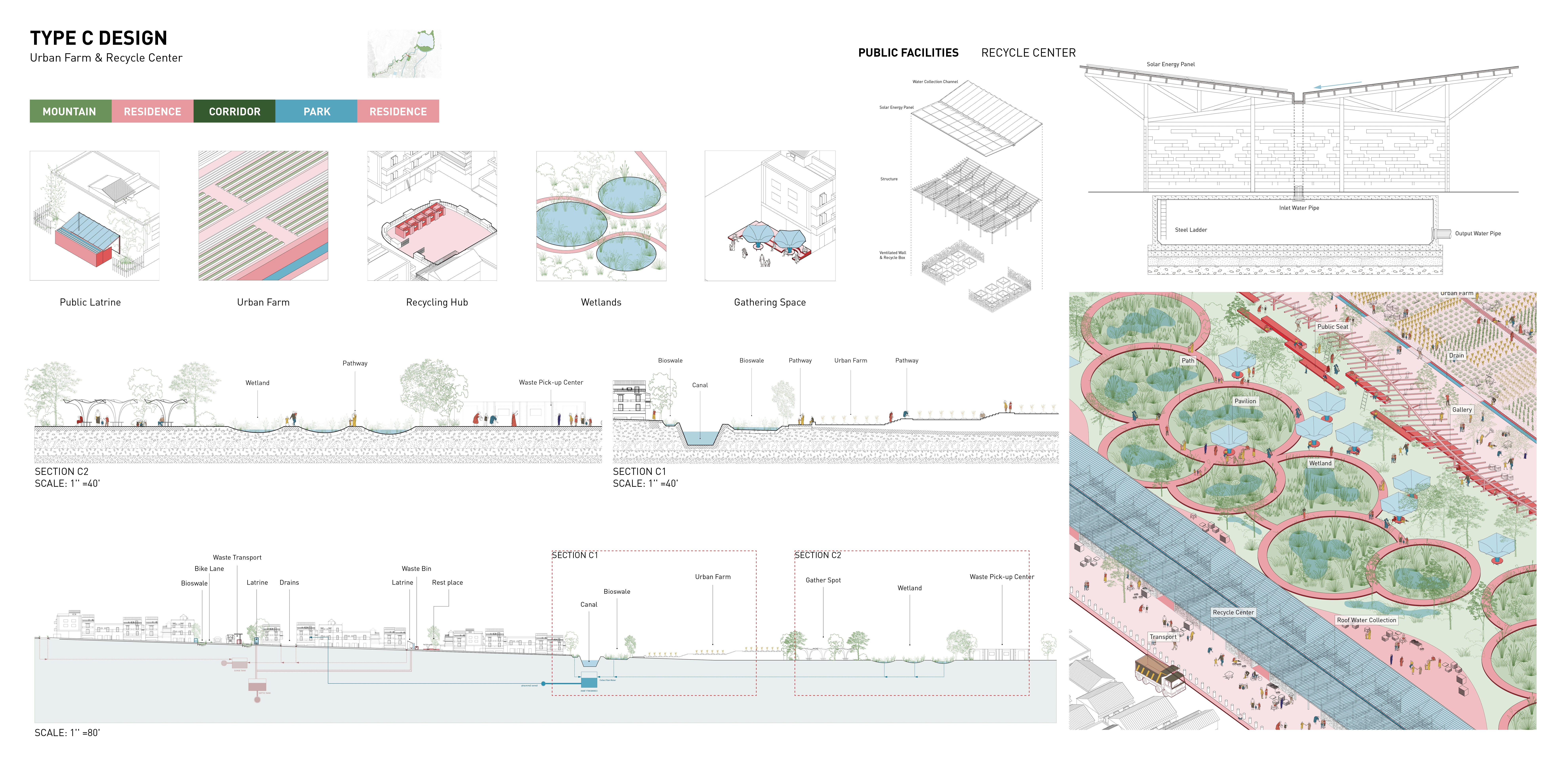
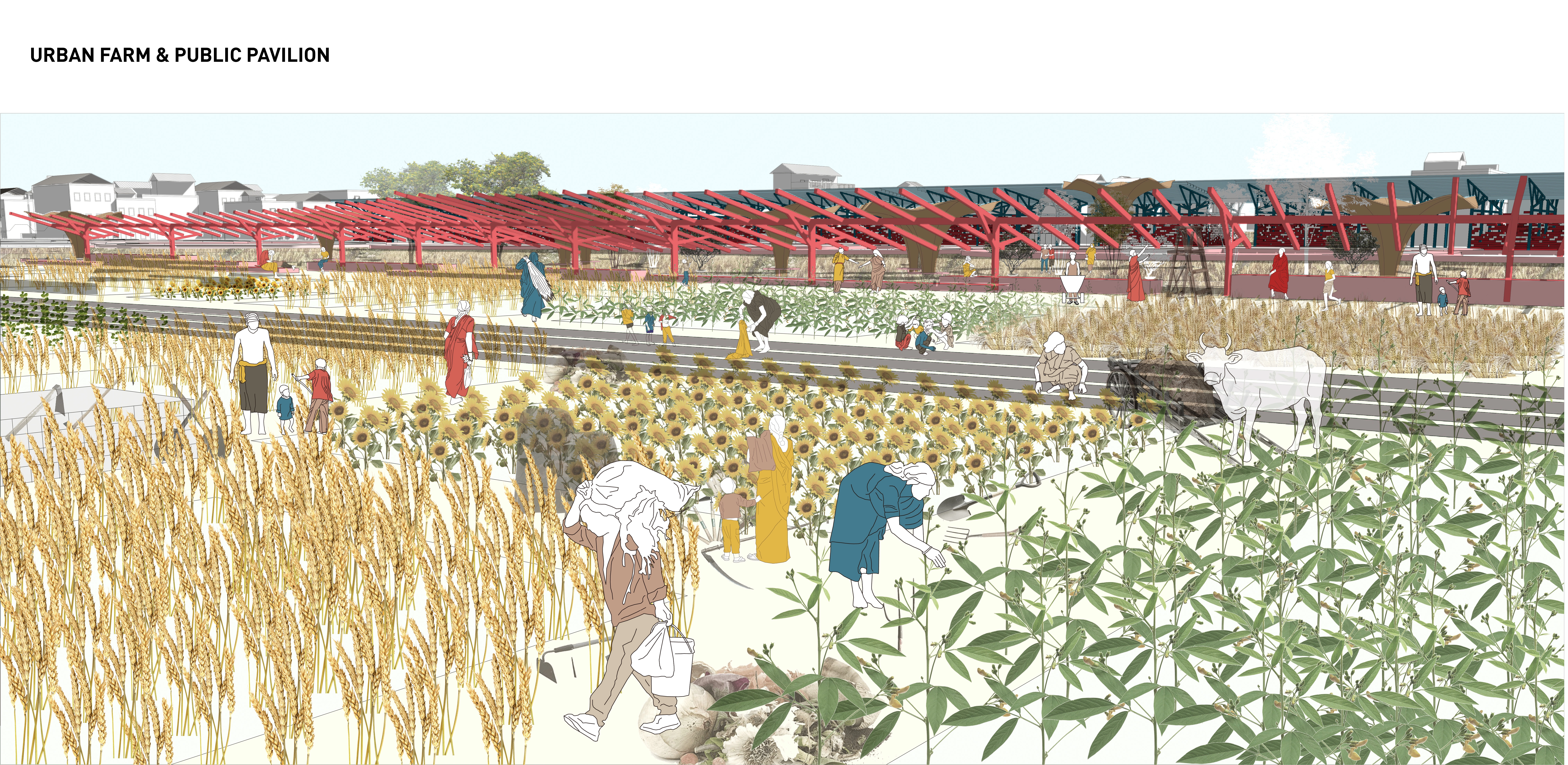
Type C: Between Canals and Vacant Space: Food Production and Ecology
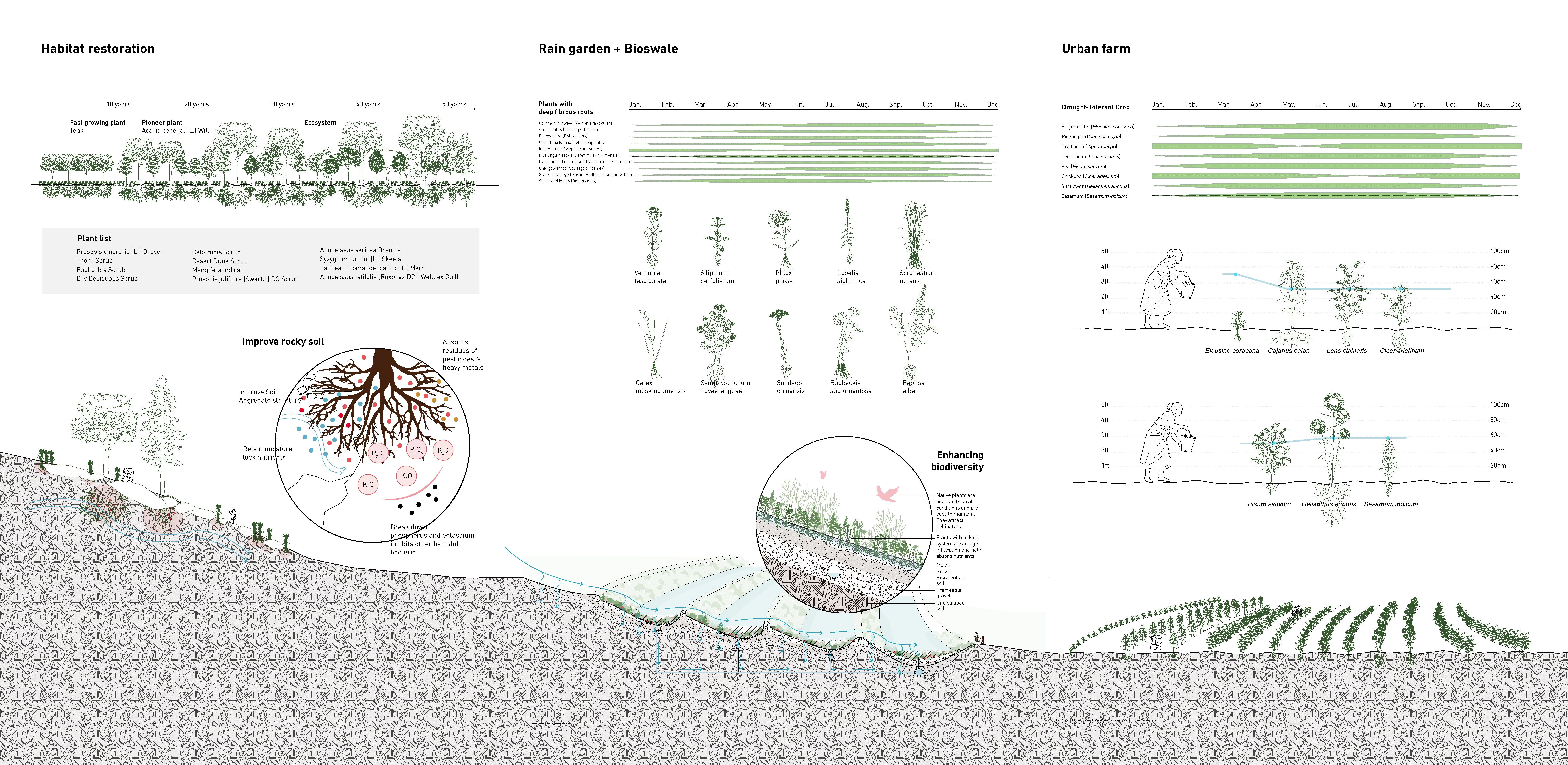
The third one is for that canals and large open spaces on both sides of the corridor. We also use this site as a central ecological park, including wetlands and bioswales, to collect rainwater and sewage for purification. Including a terraced urban farm inside the park, irrigating crops with the purified water from the corridors and providing fresh vegetables to the surrounding residents. The ecological park aims at forming a self-cycling system, including the recycle of solid waste, collection of water in the corridor, the treatment of water in wetland and the reuse of purified water by farms, so as to create ecological and economic value. The proposed recycle center, where recyclable waste collected by trucks can be delivered, and ragpickers and staff can conduct waste collection and resell them here.
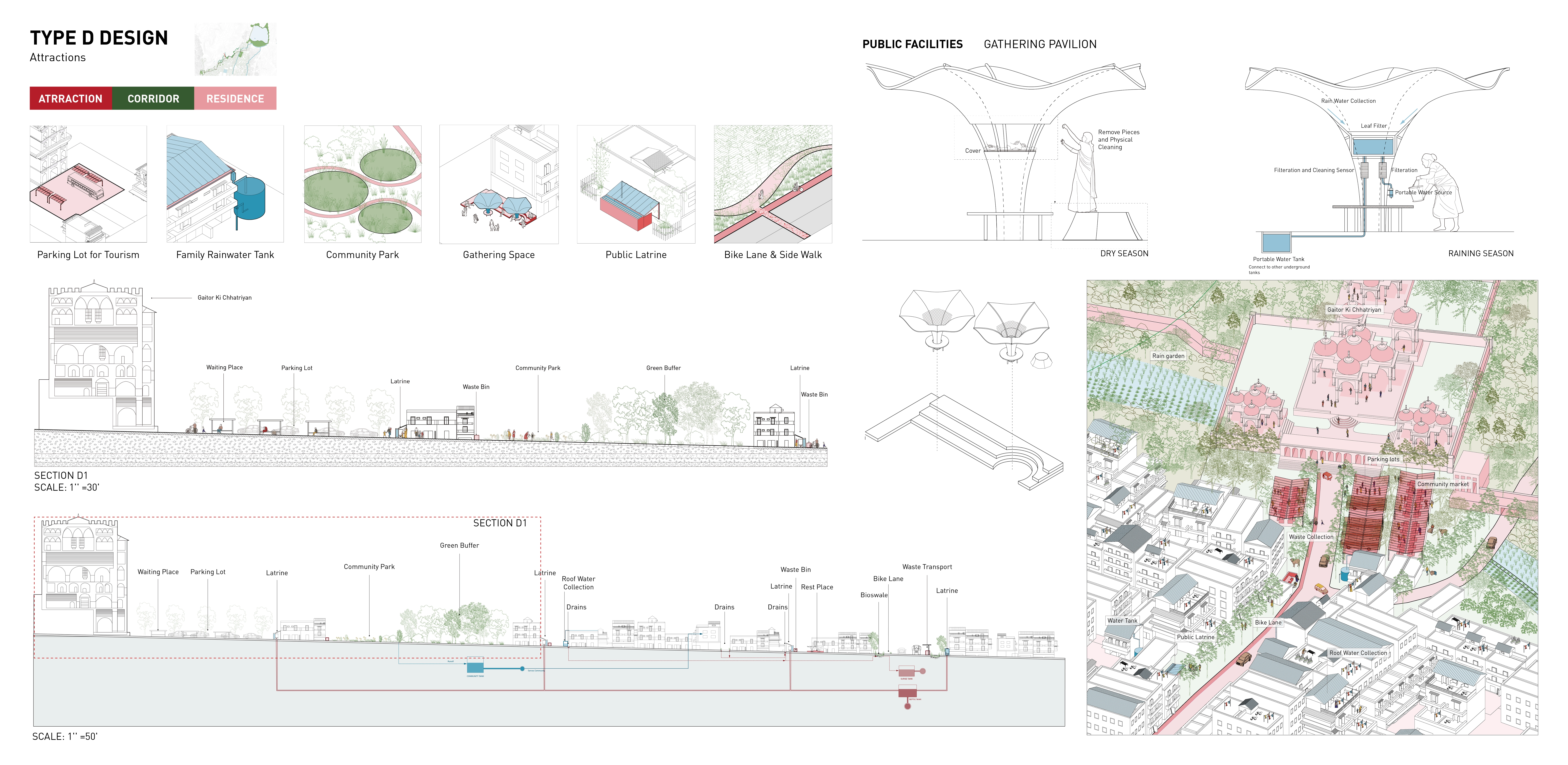
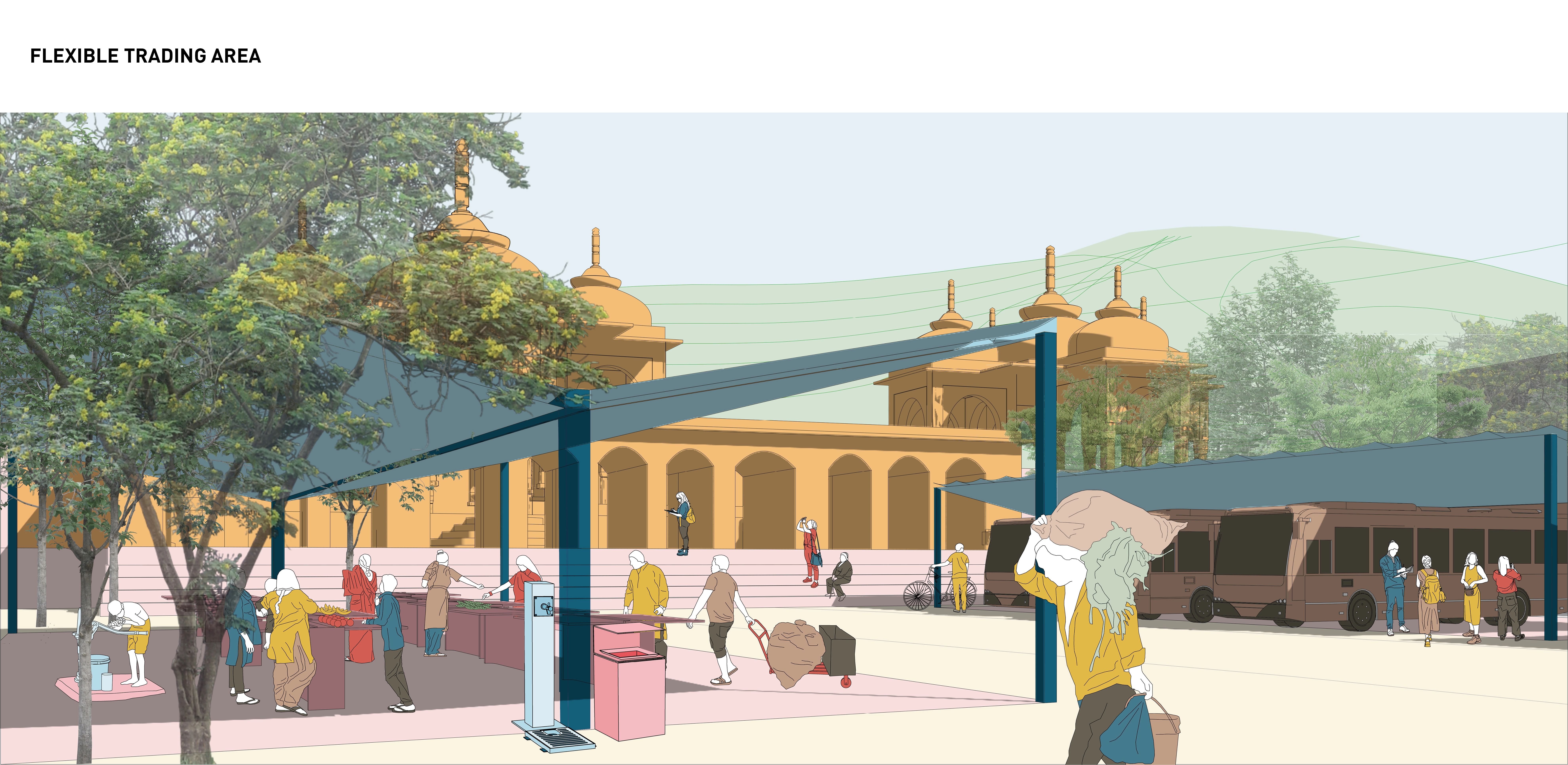
Type D: Beside Attractions: Reutilization and economy
Upon enhancing city resiliency through combining different system into one and increasing area of green space, we also consider its potential economic value, such as tourism and food production, which is also one of the biggest potential focal points of Jaipur. So the last type of design is about transforming the parking lot of the attraction into a place for gathering and trading which has some rest areas with canopies and can be used as a small market for the surrounding slums. Planting Strategy In the above design, various types of plants are used to treat water or retain water. The first type of plant is crop grown on urban farms. Due to the drought and insufficient water supply in the city, we use the drought-tolerant crops, and the water demand is basically less than 60cm a year. The rain garden at the foot of the mountain remove up to 80% of nutrients and sediments from the rainwater runoff by planting deep-rooted plants, and rainwater runoff is filtered through a terraced design, and finally collected in the pipes of the corridor. In addition to purifying rainwater, rain gardens grow native plants that create biodiversity. Because the hills of Jaipur are covered with rocks and rocky soil, we aim to improve the soil environment by planting fast-growing species and pioneer species first, and then planting native plants to form a diverse ecosystem.
Conclusion Overall, we propose to create a self-cycling system along the corridor to enhance the living environment in Jaipur. It’s not only the connection between communities, but also an identified combination of environmental elements that facilitate access and connections to focal points in the community so that people can connect with local resources like healthy food, parks and green spaces, shade, community, public facilities, etc. At the same time, the resilient corridor builds a foundation of social and economic development in the future.
-
- Common ironweed (Vernonia fasciculata)
- Cup-plant (Vernonia fasciculata)
- Downy phlox (Phlox pilosa)
- Great blue lobelia (Lobelia siphilitica)
- Indian grass (Sorghastrum nutans)
- Muskingum sedge (Carex muskingumensis)
- New England aster (Symphyotrichum novae-angliae)
- Ohio goldenrod (Solidago ohioensis)
- Sweet black-eyed Susan (Rudbeckia subtomentosa)
- White wild indigo (Baptisa alba)
- Finger millet (Eleusine coracana)
- Pigeon pea (Cajanus cajan)
- Urad bean (Vigna mungo)
- Lentil bean (Lens culinaris)
- Pea (Pisum sativum)
- Chickpea (Cicer arietinum)
- Sunflower (Helianthus annuus)
- Sesamum (Sesamum indicum)
- Calotropis Scrub
- Desert Dune Scrub
- Mangifera indica L
- Prosopis juliflora (Swartz.) DC.Scrub
- Thorn Scrub
- Euphorbia Scrub
- Dry Deciduous Scrub
Advertisement
Related Awards
Honor Award, Urban Design
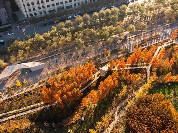
Urban Balcony Embracing Rewilded Nature
In a densely populated urban setting, this project unveils a rewilded natural area, revitalizing a former concrete waterway through innovative stormwater management. The design introduces a linear activity zone extending over four residential blocks, tailored for diverse social interactions. It underscores the vital role of landscape architecture in enriching the social and ecological aspects of urban living.