Recreation at the Intersection of Resilience – Advancing Planning and Design in the Face of Wildfire
Honor Award
Analysis and Planning
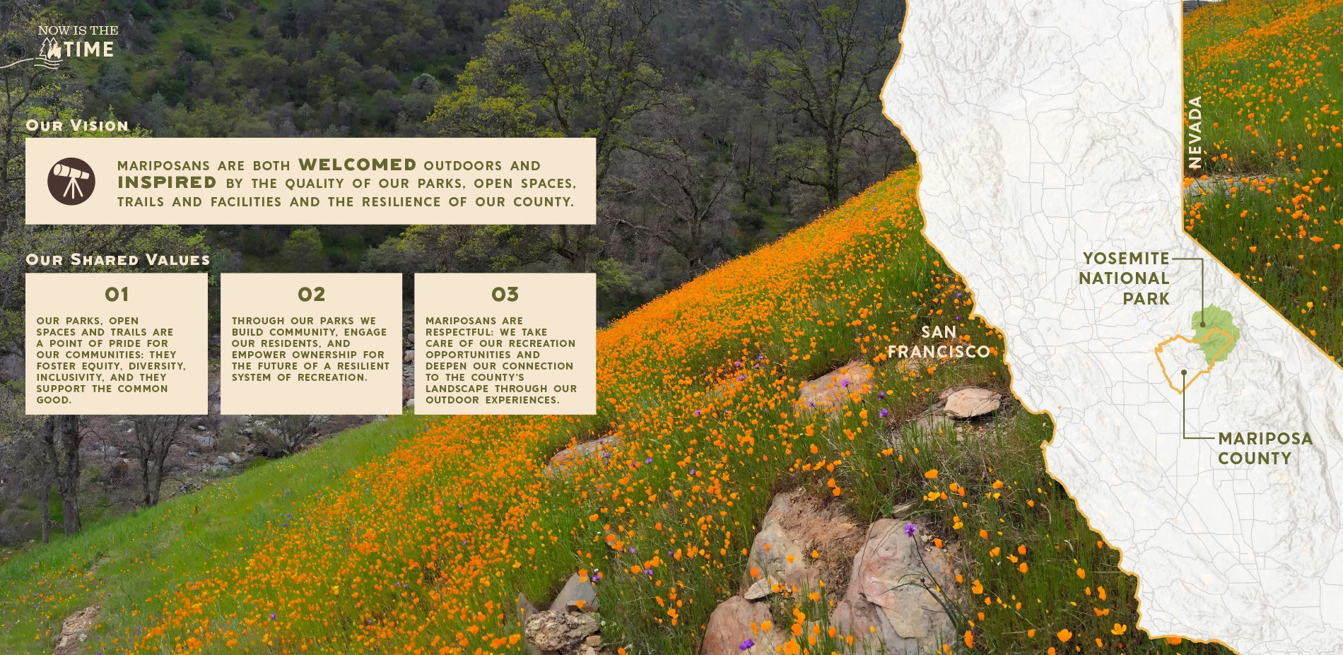
Mariposa County, California, United States
Design Workshop, Inc.
Client: Mariposa County, California
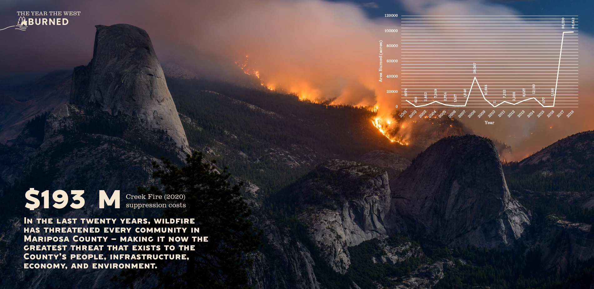

Faced with years-long droughts and extreme weather, Mariposa County in northern California has seen all of its communities threatened by wildfire over the last two decades, with climate change only increasing the likelihood of conflagrations. Looking ahead to the next 20 years, the county has enacted a vision that attempts to minimize future risks and build resiliency into communities surrounding Yosemite National Park to promote equitable—and above all, safe—recreation through trail design and management practices that reduce the risk of wildfire. Recognizing that trails used for recreation can also serve as fire suppression routes and fuel breaks, the plan calls for strategic trail deployment throughout the county to ensure near-term enjoyment and long-term resilience.
- 2021 Awards Jury
Project Credits
Mikey Goralnik (Client), Mariposa County Team
Stephanie Grigsby, ASLA (Principal), Design Workshop, Inc.
Carly Klein (Project Manager), Design Workshop, Inc.
Lindsay Kageyama (Project Designer), Design Workshop, Inc.
Bria Fast (Project Planner), Design Workshop, Inc.
Molly Mowery, Wildfire Planning International Team
Kelly Johnston, Wildfire Planning International Team
Steve Frisch, Sierra Business Council Team
Simone Corderry-Cotter, Sierra Business Council Team
Justine Quealy, Sierra Business Council Team
Project Statement
Within the past twenty years, every community in Mariposa County, California, has been threatened by major wildland fires. Counter to most recreation system plans, which prioritizes active recreation to positively improve public health conditions, the Mariposa County Recreation and Resiliency Plan insists that recreation planning must extend beyond basic park needs to address critical issues of wildfire and climate change on public lands, equipping its civic leaders with multilayered planning and design tactics to address resiliency.
Clear goals and strategies enabled planners to achieve the co-benefits of integrating resiliency adaptation measures into parks, trails and open spaces. The resulting resilient recreation system can better withstand changing conditions while continuing to provide critical services. The Plan supports Mariposa County’s ability to increase physical and social resilience by minimizing risks to public health, safety, and economic disruption, and maximizes protection of the most vulnerable so that they survive and thrive after climate-related events like wildfires.
Project Narrative
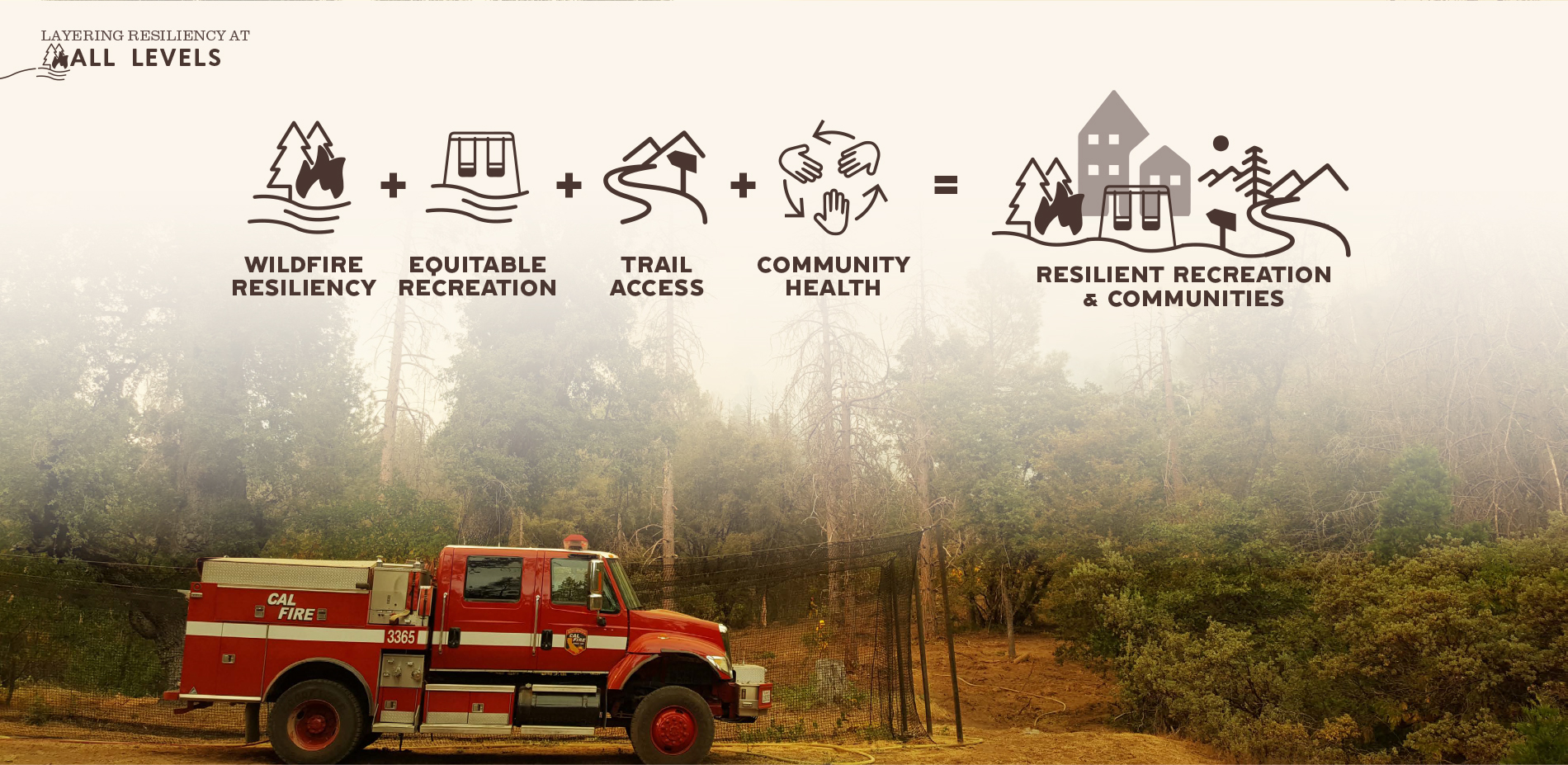
LAYERING RESILIENCY AT ALL LEVELS
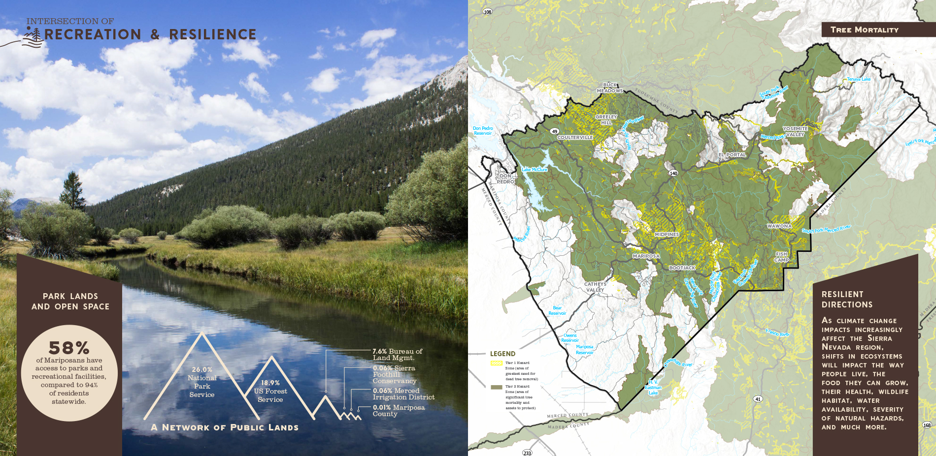
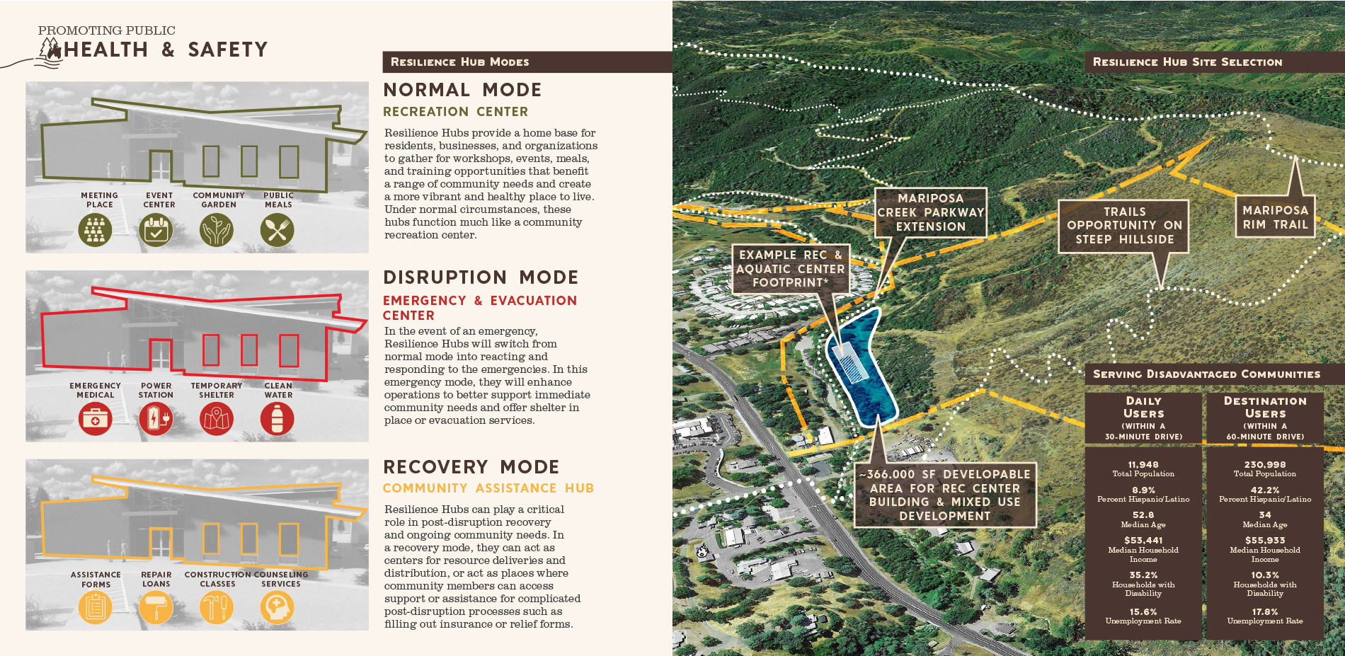
Mariposa County, home to Yosemite National Park and over 18,000 residents, looks to lead with innovation in the face of a changing climate—taking bold actions to protect economy, quality of life, and all people. In action, resilience planning includes addressing chronic stressors and acute shocks such as increasing temperatures, shifts in precipitation events, inadequate access to parks, wildfires, floods and disease outbreaks in design, operations and maintenance.
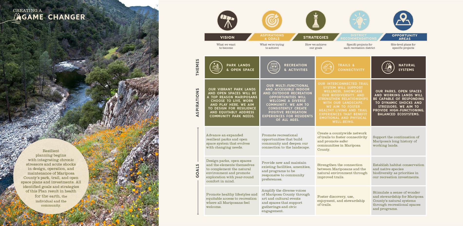
The Mariposa Recreation and Resiliency Master Plan is a 20-year vision that sets the direction for the County to model climate resilience and to support its role as a desirable place to live and recreate. The Plan will help Mariposa County to grow equitably and sustainably, and address one if its greatest risks—wildfire. In the planning process, the landscape architects investigated how Mariposa’s system of parks, open spaces and trails can fulfill the dual roles of recreation infrastructure to support community-wide health as well as wildfire resilience. The plan delivered strategies for how future investments can augment these efforts.
Building resilience is not just about designing for a different future. Landscape architects are called to action to make decisions differently to plan for a changing and uncertain future. As stressors of climate change and shocks of natural hazards undermine the health, safety and vibrancy of communities, all social systems must contribute to achieve resilient communities. Landscape architects and local plans often influence park system plans that support development and maintenance of parks and recreation amenities. These plans fundamentally pertain to a community’s landscapes and the ways that residents and users engage with and relate to them. As such, they are an opportunity to apply a resiliency framework and align decisions with wider climate change adaptation and risk reduction objectives.
GAME CHANGER
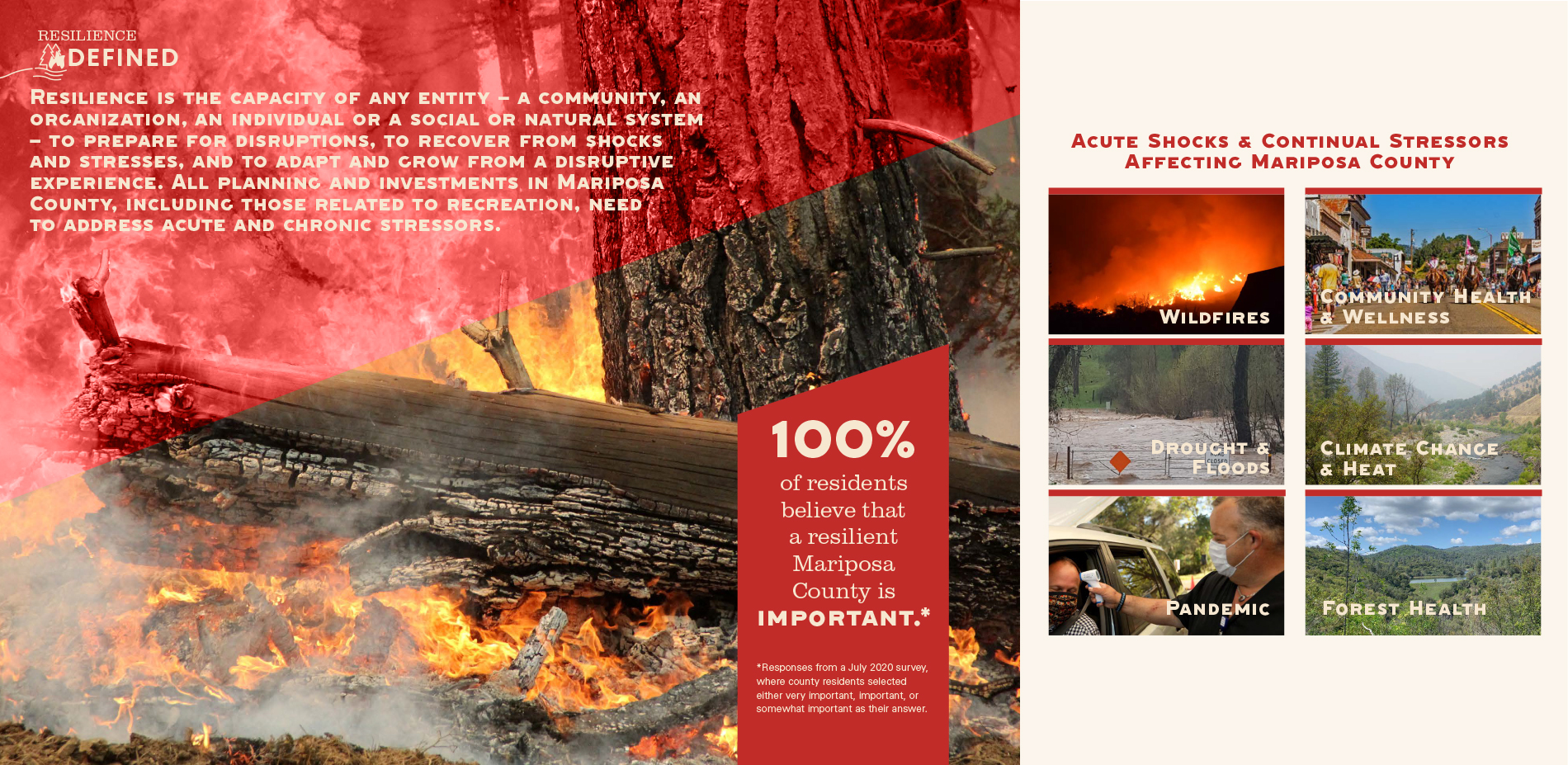
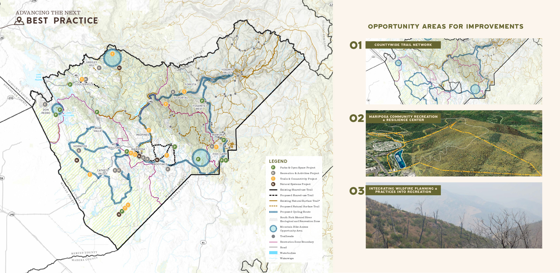
The recreation and resiliency plan for this rural Sierra and Central California county advances the next best practice in recreation planning. It establishes Mariposa County as both a resiliency leader and celebrated place to recreate. The urgency to plan for natural disasters is clear. Locally in Mariposa County, 100 percent of residents believe resiliency is important. Now, and in the years to come, the focus of recreation planning must be ‘how’ landscape architects can approach recreation planning differently. How can a plan address the intersection of recreation and resilience? How can a system confront climate change impacts? How can community health and equity continue to be promoted? The Mariposa Plan is the first of its kind to consider ‘how.’ The result is a plan that advances strategies that leverage parks, trails and open space to reduce the risk of wildfire and supporting disaster response activities.
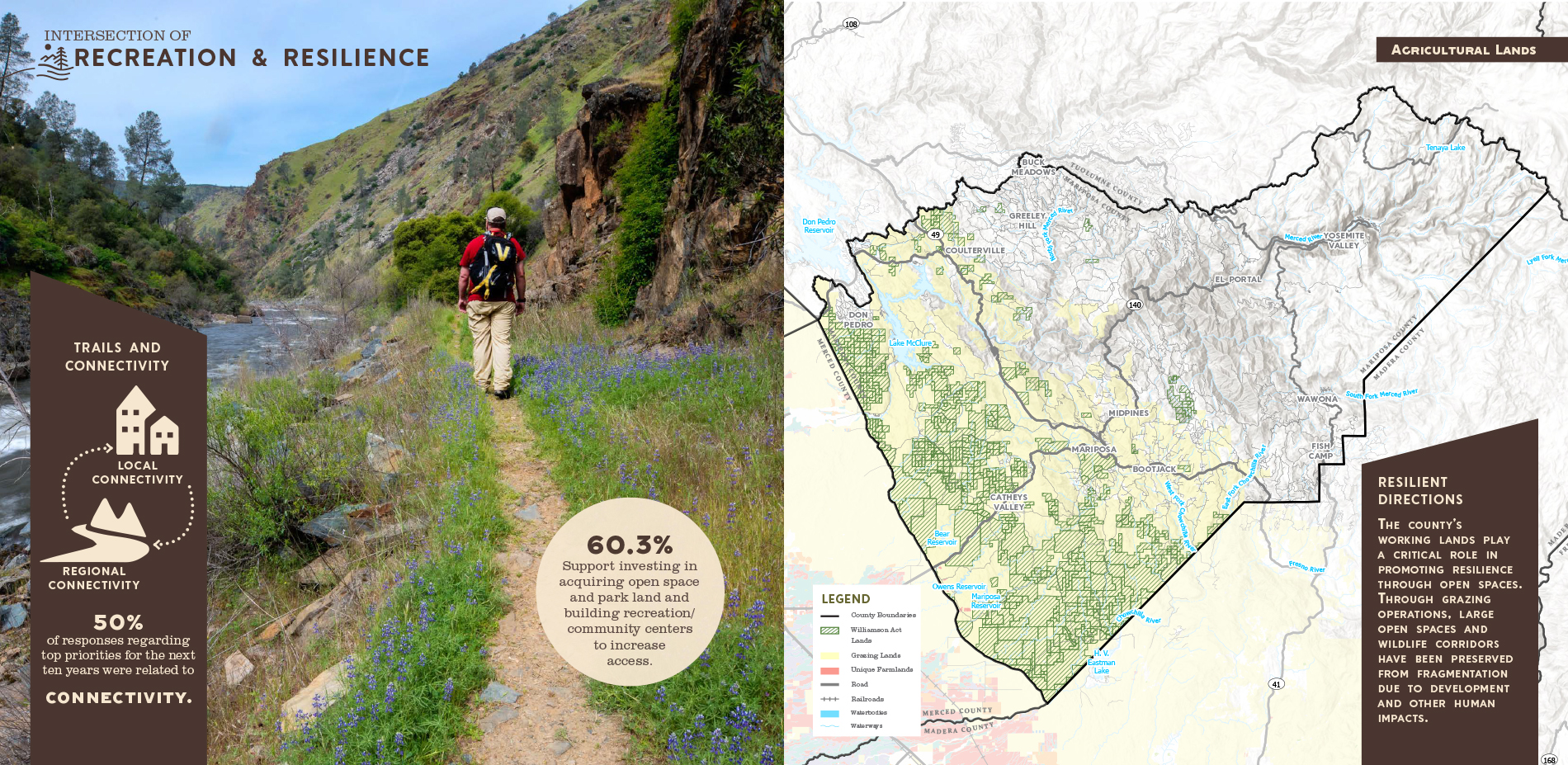
The goals, guiding policies and actions envisioned within the Mariposa County Recreation and Resiliency Plan represent an innovative re-crafting of recreational opportunities to achieve more diverse offerings while adapting to climate challenges. The Plan reflects the desire of the residents of Mariposa County to have and maintain high quality parks, trails and recreation facilities for use by a growing base of residents and visitors. It represents a desire to leverage funding to enhance recreational opportunity across the amenity-rich rural landscape and acknowledges growing visitation from neighboring central valley counties and beyond. Finally, the Plan is designed to integrate resiliency in every action to support the diverse needs of a new generation of recreational users.
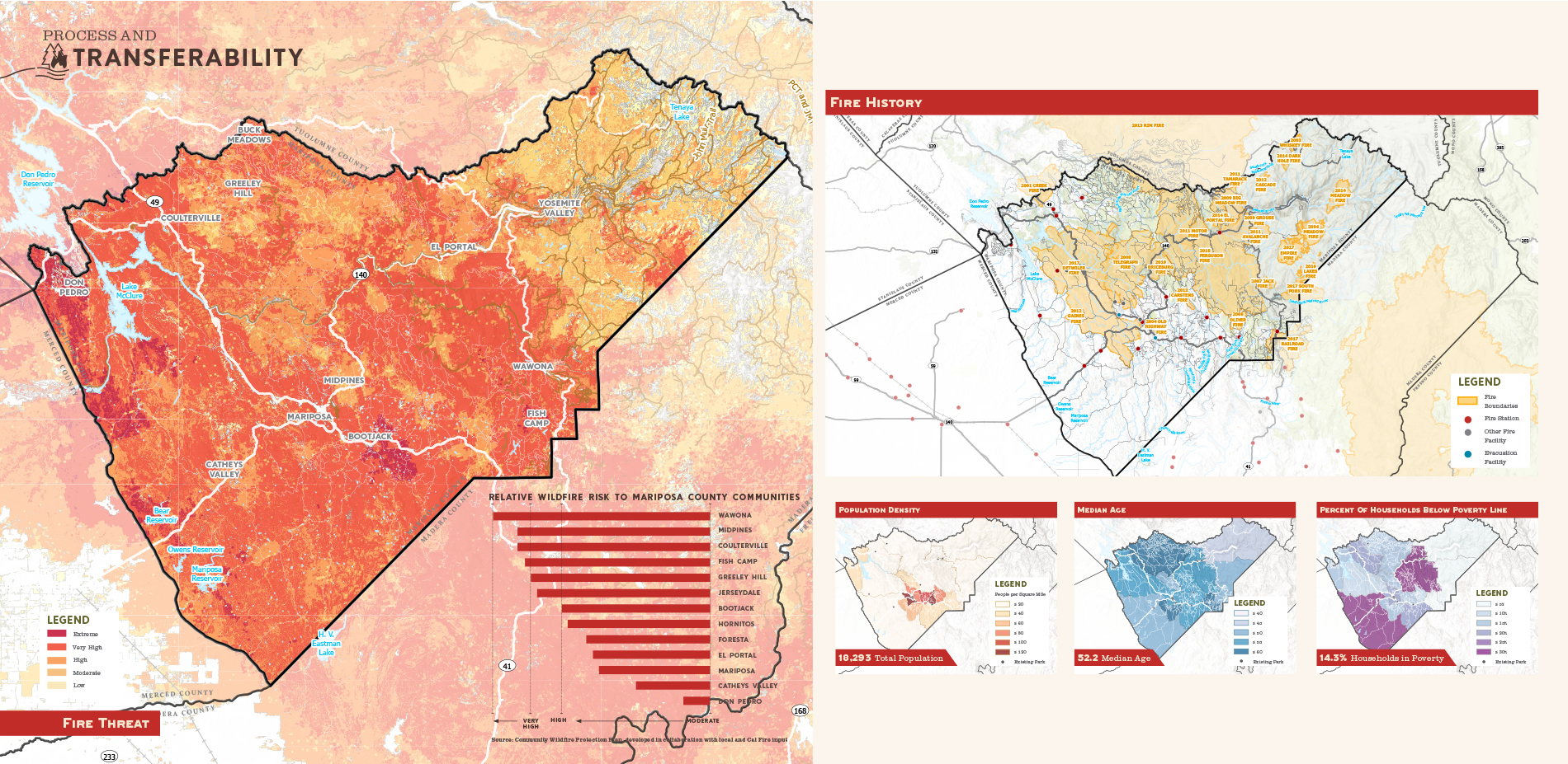
USING RISK AND VULNERABILITY DATA TO INFORM DECISION-MAKING
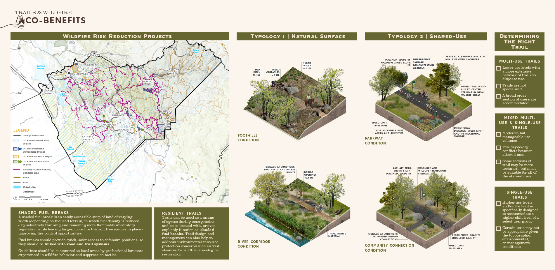
The components and methodology of the Plan provide a framework for other landscape architects and communities interested in advancing resilient systems of recreation offerings. The Plan’s foundation relied on local data to understand the community context; analyze environmental threats like flood zones, previous wildfire activity, tree mortality areas, and climate projections for the Sierra Nevada region; and identify the county’s most vulnerable populations to protect from climate change-induced disasters. Like many communities, various demographic groups in Mariposa are disproportionately exposed to risks of natural disasters—in this case, wildfire. The landscape architects reviewed population density, median age, Latinx populations, households living below the poverty line, households with children, elderly households, and existing utility corridors.
Data drove decision-making, resulting in a countywide Plan that creates a basis for more equitable access to park space and recreational opportunities while simultaneously reducing exposure to wildfire risk through trail design and development and construction of new parks and facilities. Rather than remain static in recommendations, the planning process engaged key partners who are committed to maintain the Plan’s relevance as new lessons in the area are learned and best practices are adapted. These partners can help to assist in identifying plausible alternative states for climate-sensitive projects into the future. Implementation of the plan is carried out through effective partnerships with regional and local agencies and organizations.
RESILIENT PLANS REQUIRE RESILIENCY IN OUTREACH
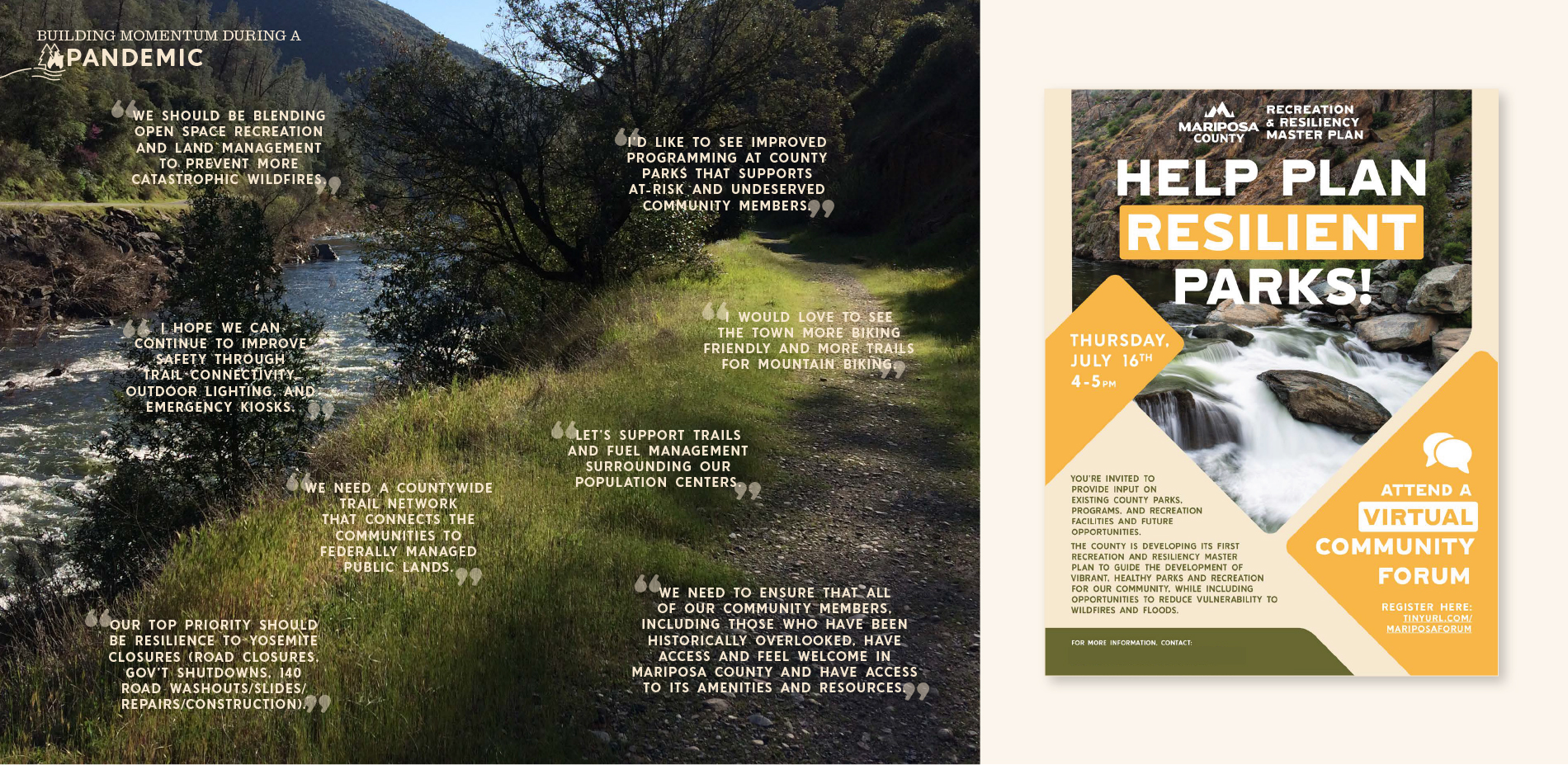
In March 2020, stay-at-home orders swept across the country. The landscape architects faced two options: postpone outreach or adapt it despite the unknowns of COVID-19. Adopting the stance that the planning and stakeholder engagement process needed to model adaptive and resilient approaches in the face of a global pandemic, the team changed course and rolled out a suite of digital engagement tools. An ESRI Story Map was constructed on an online platform to develop a shared understanding of recreation and resilience in the county. This interactive website was launched in the summer through a virtual community forum; advertised via social media, email lists, and Mariposa’s county website; and updated with the Plan’s progress. Following the forum, an initial survey was distributed to determine recreation needs, local challenges faced, and opportunities to improve recreation and increase resilience.
Critical to the success of the planning process was the Steering Committee, made up of stakeholders and County staff actively working toward improving public health, addressing climate change, boosting the local economy and increasing recreation opportunities. Using the digital engagement tool, Mural, which substituted an in-person atmosphere with a virtual whiteboard, this group crafted the vision in a virtual workshop facilitated by the landscape architect. This tool was used to establish the Plan goals and recommendations for each recreation district. In the final Steering Committee meeting, ten potential priority recreation and resiliency projects were identified. The final public survey was hosted to determine the opportunities with the greatest potential to impact recreation and resilience in Mariposa County. Respondents were asked to rank the level of impact each project would have on three categories: recreation access and opportunities, community health and wellness, and resilience. This process revealed community consensus around three key projects that blend recreation and resilience, and provided opportunities to achieve Mariposa’s public health, economic development, landscape conservation, and climate change adaptation goals.
FACING THE REALITY OF WILDFIRE
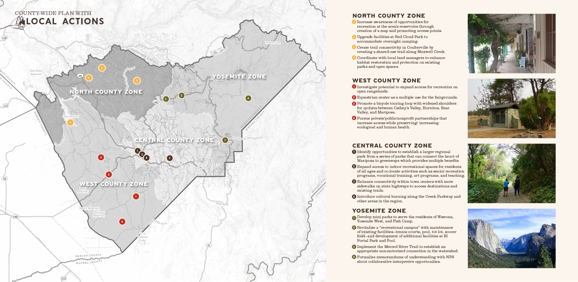
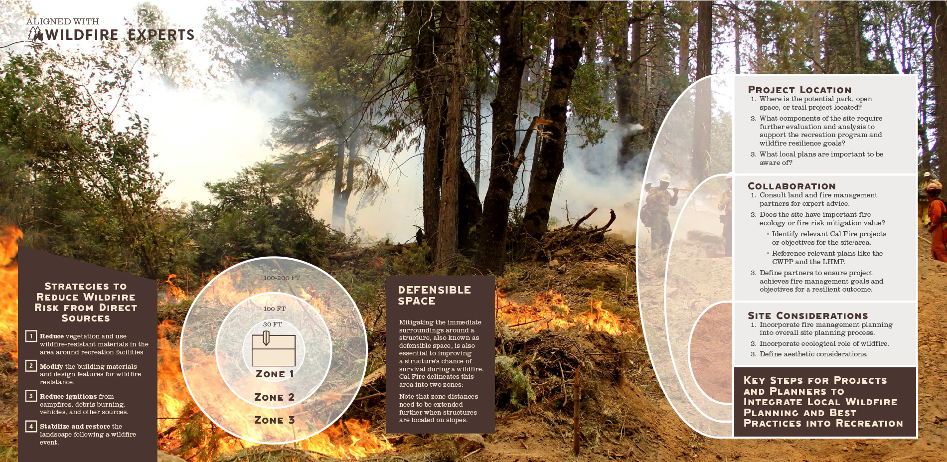
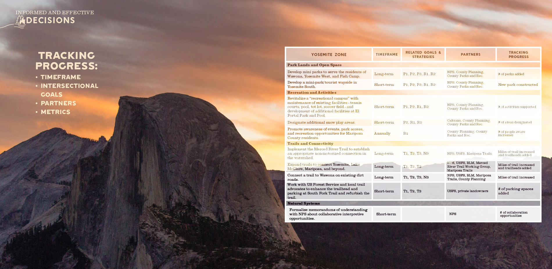
To activate implementation, the Plan establishes a checklist for monitoring ongoing planning, design and implementation of recommendations that mitigate wildfire risks and promote recreation and physical activity, community events, environmental education, habitat restoration. Specific recommendations reflect the needs and opportunities of each recreation zone given their respective size, population distribution, land ownership and level of service. To mobilize these priority projects, partnerships will be critical. Metrics, such as the acres of landscapes with reduced risks, miles of shaded fuel breaks and reintroduction of cultural burning as part of landscape management, were established to monitor the success of each outcome.
Potential funding mechanisms were earmarked to address development and operation costs. The successful implementation of the Plan is contingent upon improving existing facilities, acquiring funding for new facilities, and supporting operation and maintenance. An aggressive and strategic campaign combining multiple sources of funding will be required to maximize funds and fulfill Plan objectives. New and creative methods for financing Mariposa County’s planned improvements and facilities will be made available as there are significant opportunities to scale up funding sources to meet the co-benefits of recreation and resilience.