.webp?language=en-US)


The 606
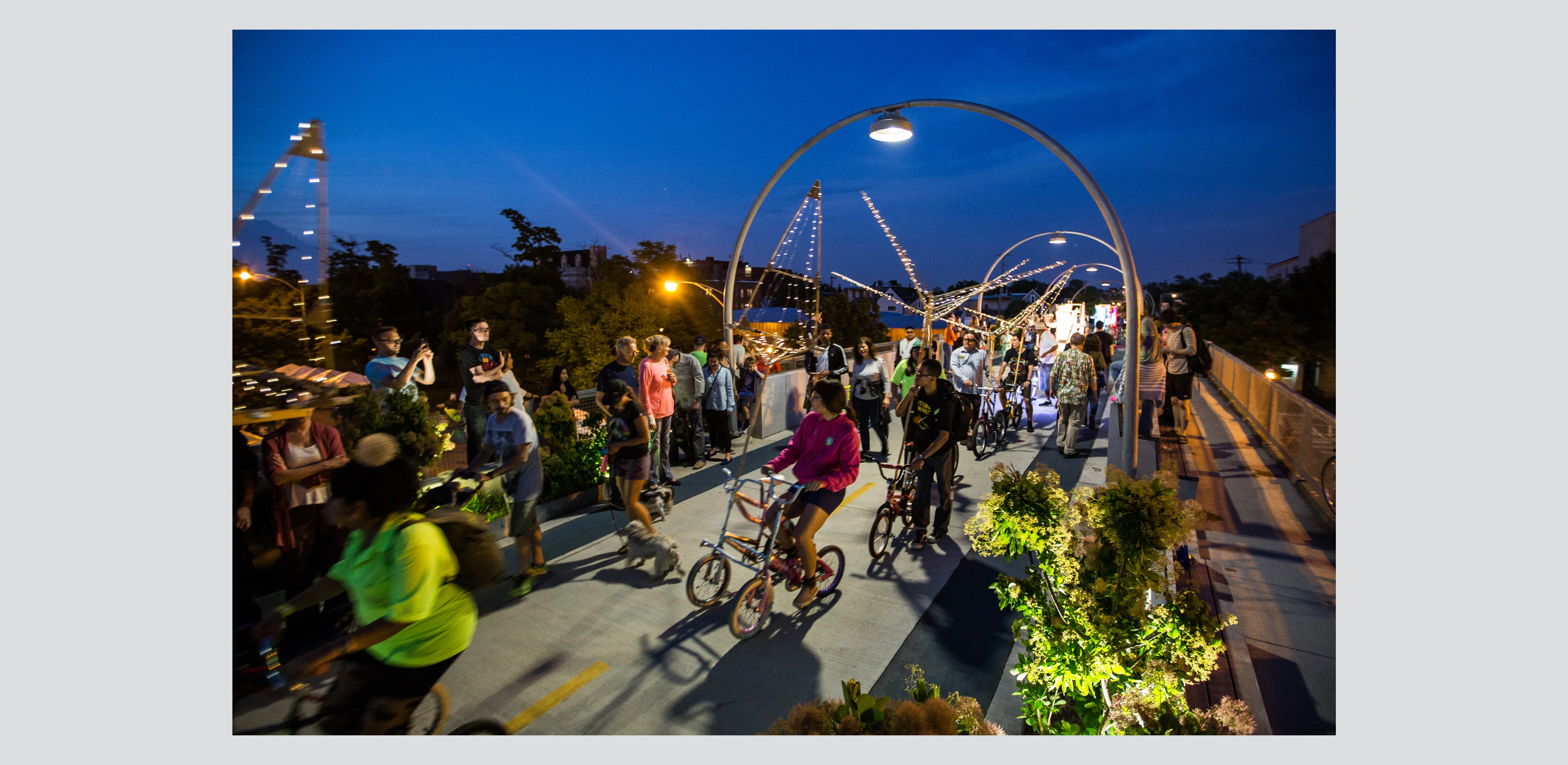
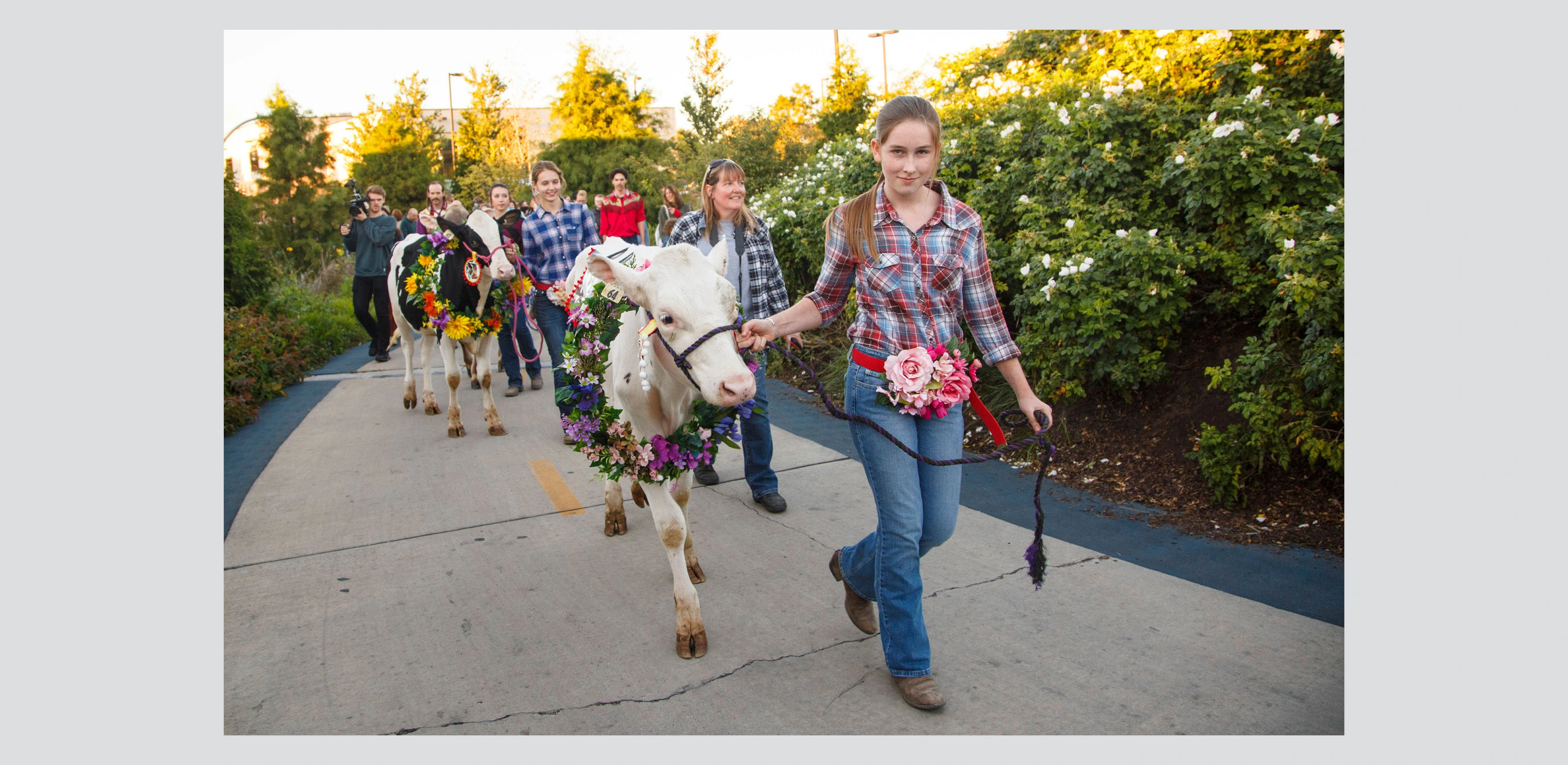
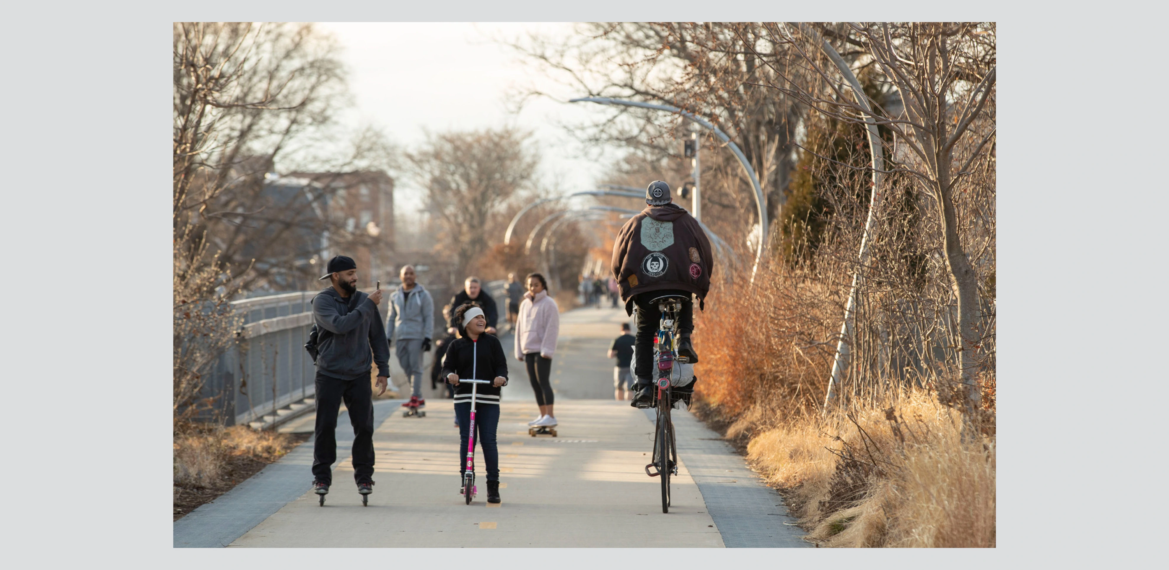

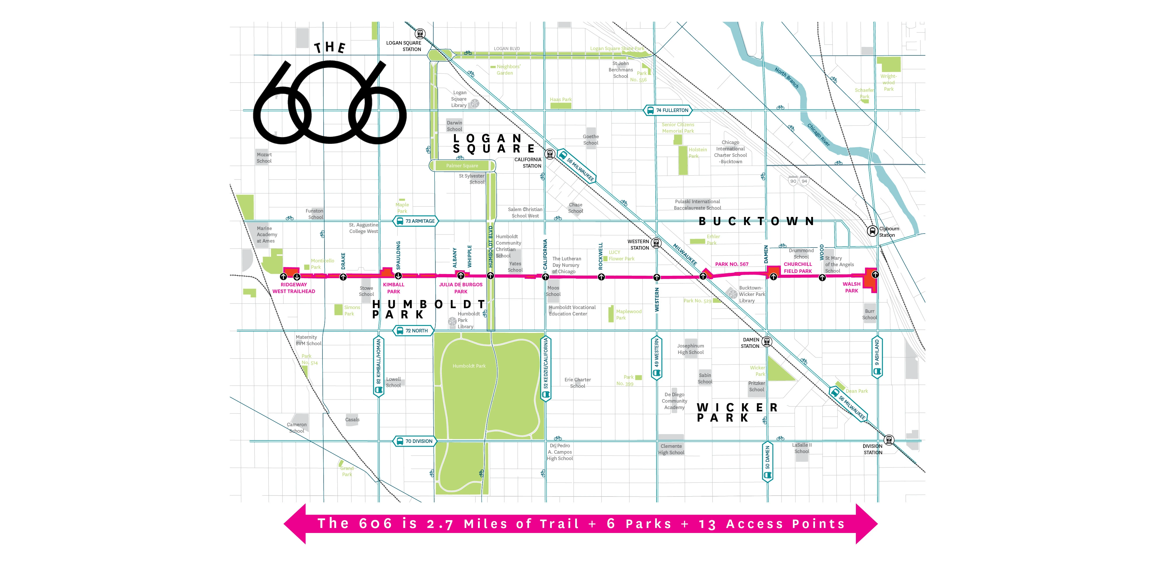

Many cities are rediscovering that their decommissioned railways retain utility as linear parks; proposed in the late 1990s as a possible bicycle trail, the 606 in Chicago replaces rail with a 2.7-mile planted promenade suitable for all manner of recreation. Accessible to some 80,000 residents drawn through four access parks within communities adjacent to the route, the 606 features a 14-foot pathway with dense native plantings along both sides that reflect various microclimates. Familiar parks department fixtures help to reinforce its recreational identity, and abundant ramps and stairways—key requests from constituents—shift perceptions of a formerly blighted piece of infrastructure from imposing to inviting.
Awards Jury
-
2.7 miles of elevated trail
39 railroad bridges
6 access parks
13 access points
More than 1 million annual visitors
$95 million project budget
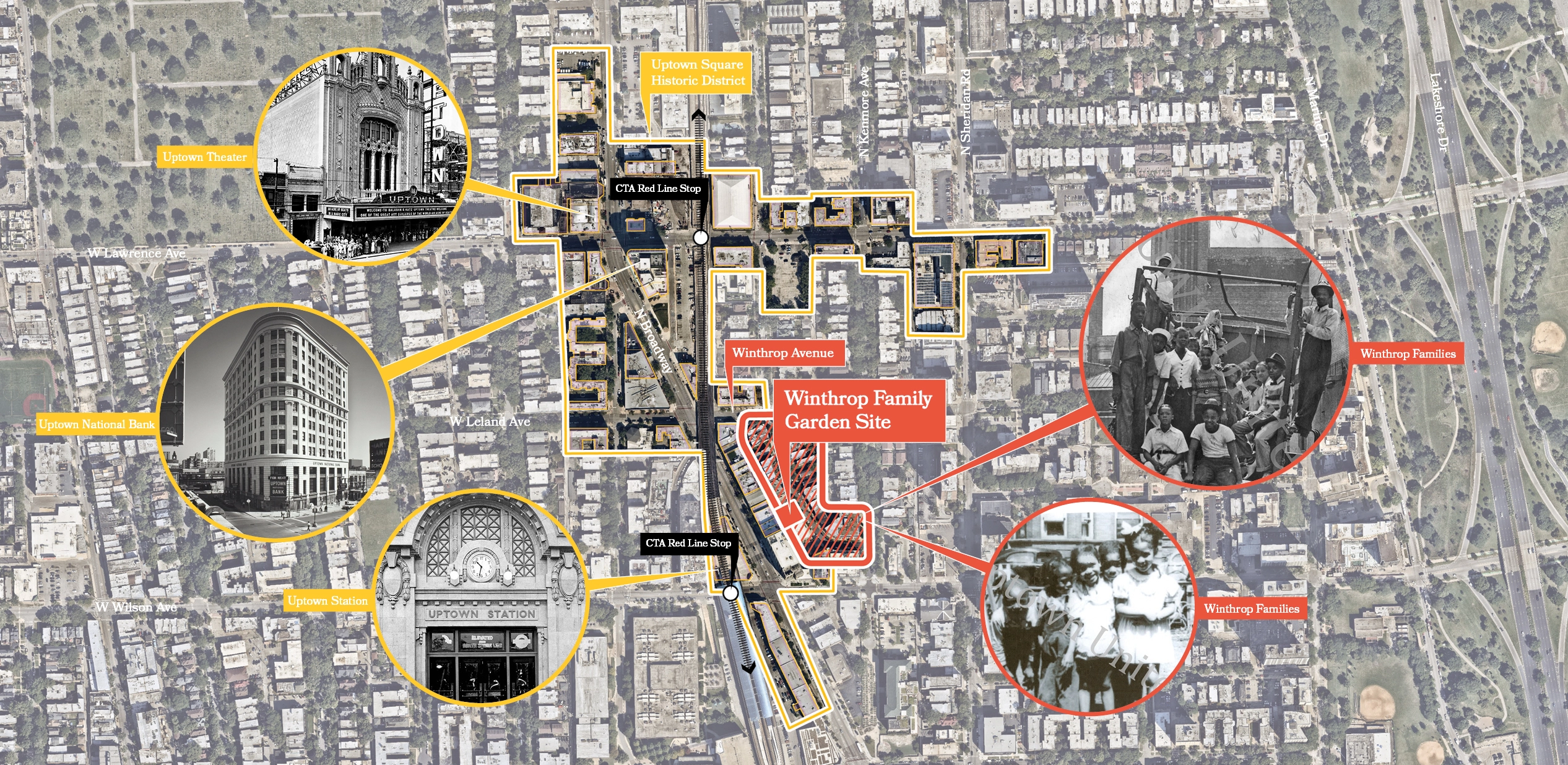
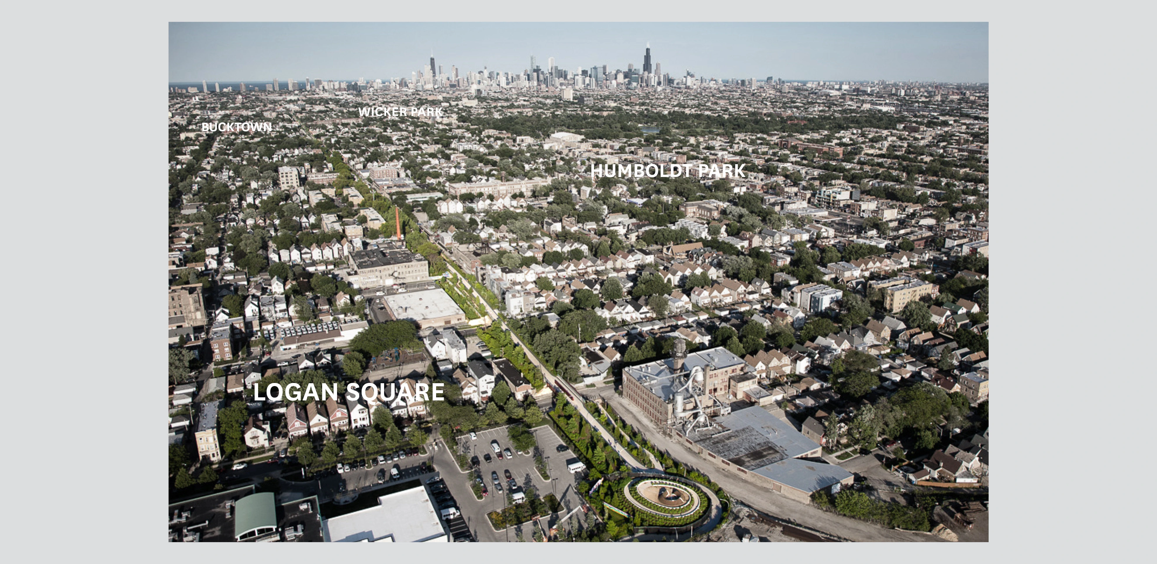
Connecting 4 neighborhoods: Logan Square, Humboldt Park, Bucktown, and Wicker Park
Less than a 10-minute walk from home for 80,000 residents, including 20,000 children -
Chicago’s 606, also known as the Bloomingdale Trail, is a 2.7-mile-long linear park built on an abandoned elevated rail line. The landscape architects converted the unused line into a richly planted walking, running, and cycling trail, a six-year process that involved removing decaying structural elements and adapting the 39 railroad bridges. In addition to transforming the trail itself, the landscape architects created or extended “access parks” at street level and seven additional access points to connect the project to the Wicker Park, Bucktown, Humboldt Park, and Logan Square neighborhoods. First envisioned by neighborhood advocates in 1998, the 606 is community-driven and locally oriented. The landscape architects were co-authors of the urban design Framework Plan, and then became the lead designers on the project. The team worked closely with the city government, the Trust for Public Land, the Friends of the Bloomingdale Trail nonprofit, and the surrounding communities to turn the ambitious plans for Bloomingdale Trail into an enduring, environmentally sustainable, and universally accessible urban amenity.
Chicago Roots
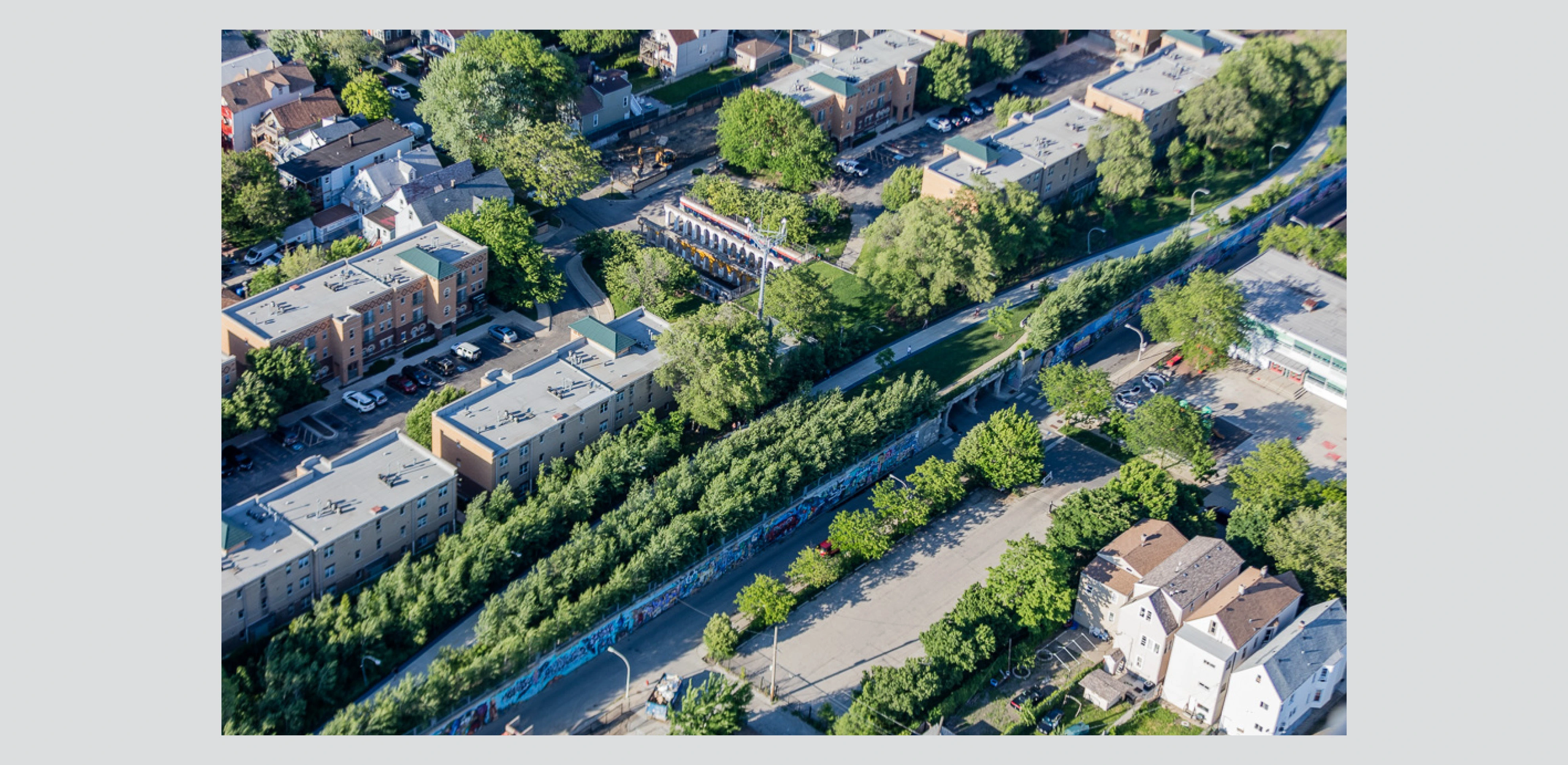
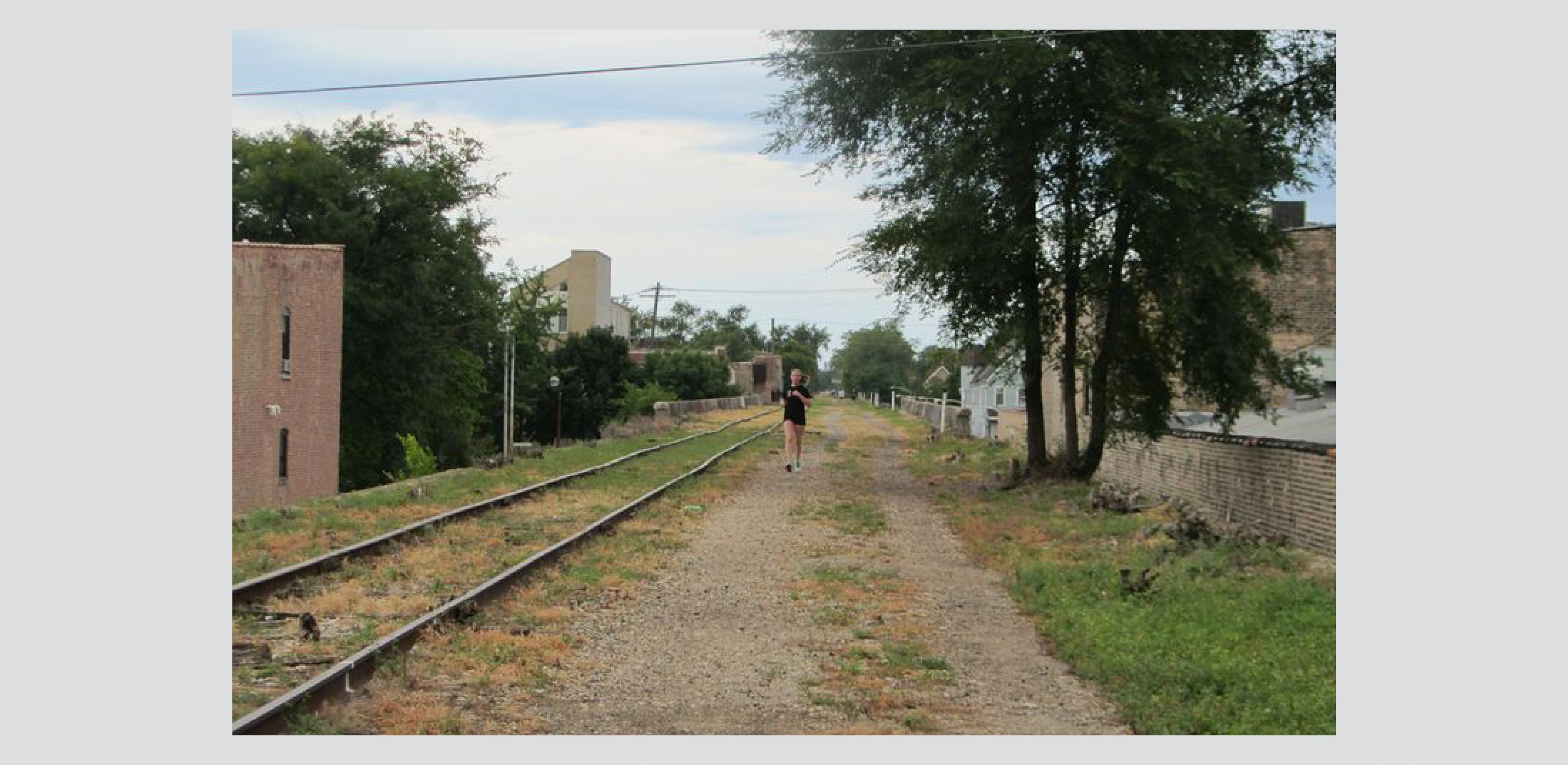
The project is firmly rooted in Chicago’s physical history. After the Great Fire of 1872, tracks were laid along Bloomingdale Avenue to help facilitate reconstruction. The Bloomingdale Line was elevated in 1913 to avoid the dangers of street-level rail traffic. The railway company built monumental concrete abutments, 7 feet wide at the base and 16 feet high, to retain the massive amounts of crushed rock and soil on which the tracks would rest. This fill supported the railway along most of its length, while engineered overpasses spanned major streets.
By the mid-1990s, industry had left the increasingly residential area and volunteer flora colonized the underused rail line. The communities along the line created an impromptu path with unparalleled views of the city, but occasional train use continued. In 2001, all freight traffic ended on the line. In 2003, the City’s Department of Planning and Development held public meetings to determine how to bring new open space to the area. The idea of converting the Bloomingdale Line into a park was born.
Two Decades of Advocacy
The nonprofit Friends of the Bloomingdale Trail was founded in 2003 to build on the momentum that had started in the surrounding communities. The group assumed a prominent role in laying out the vision for an integrated trail and park system that would later be renamed “the 606,” reflecting the shared start to the zip codes of the neighborhoods it connects. This grassroots organization built community support and partnered with The Trust for Public Land to serve as the client, raise funds and manage the project through construction.
Throughout the planning and design process, the Friends group convened multiple meetings between neighborhood constituents and the design team, including a three-day charrette. In response to the range of requests from the community, client, and funders, the landscape architects developed a series of design strategies that integrated connectivity, strategic planting, accessibility, and recycled infrastructure into the repurposing of the historic rail line.
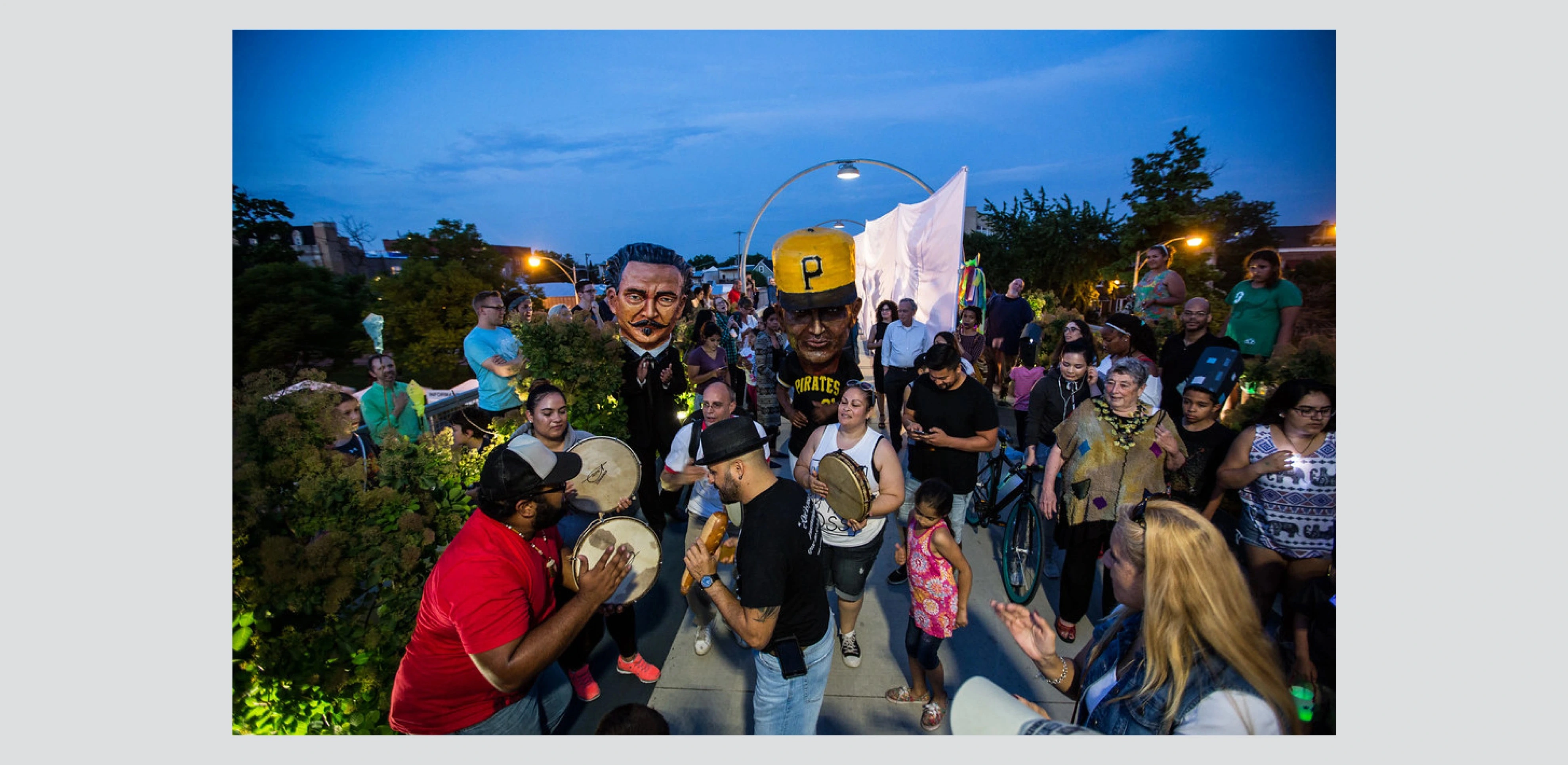
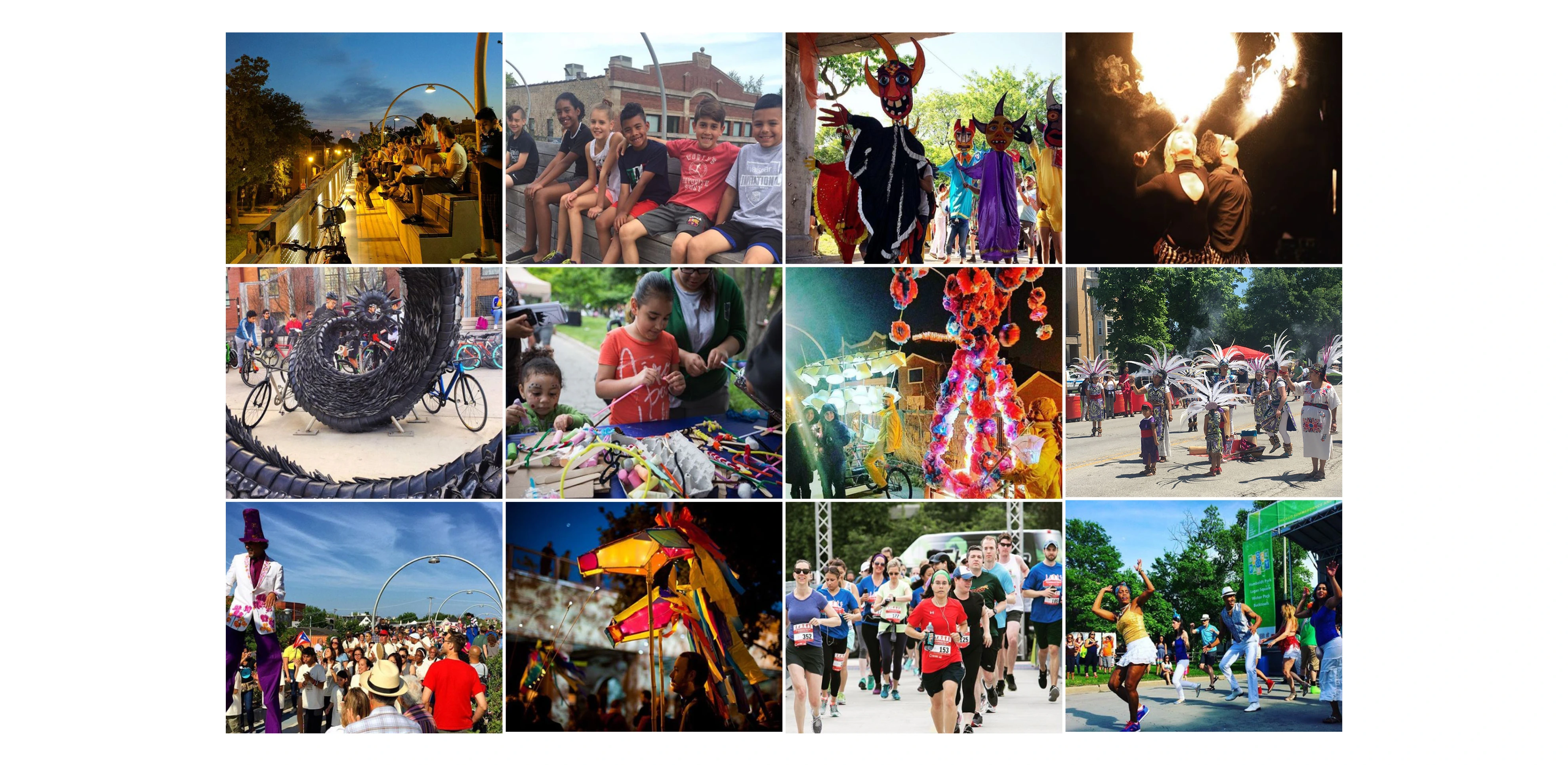
The final design was developed from 2006 to 2014. The park opened to the public in June 2015. By 2018, more than 1 million people, most of them Chicago residents, were using the trail each year.
Connectivity
The 606 offers cyclists and pedestrians the rare opportunity to traverse the city uninterrupted, with connections to major vehicular intersections, bus routes, the CTA Blue Line, and historic Humboldt Boulevard provided via ramps. The access point at Humboldt Avenue, near the midpoint of the trail, links 606 users to a major north/south greenway and to 200-acre Humboldt Park to the south. The project received a substantial TIGER grant from the U.S. Department of Transportation, in recognition of its importance as a transportation corridor.
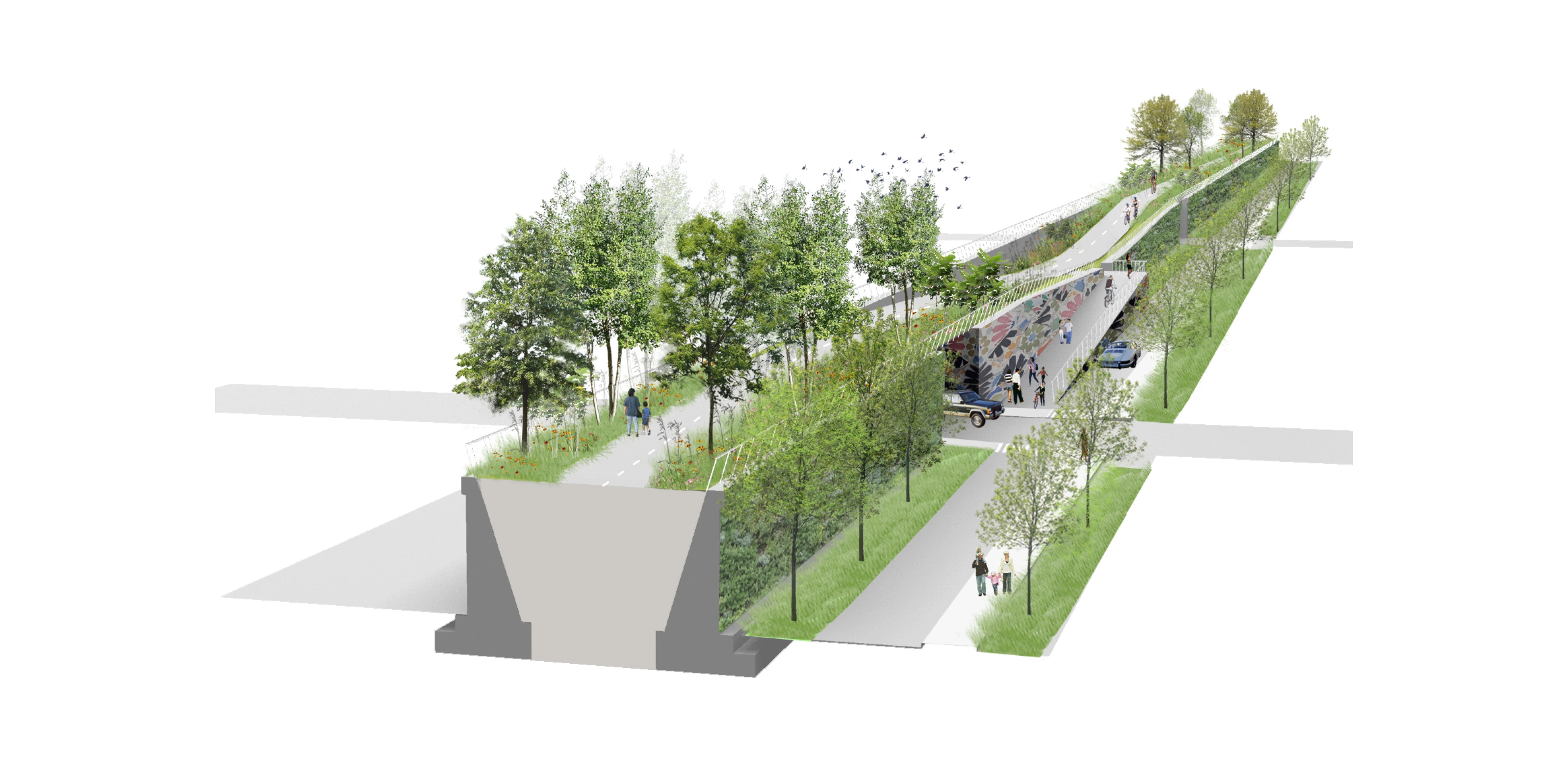
The elevated structure is mostly 30 feet wide and gets as wide as 60 feet at the western end. To comfortably accommodate bikers and pedestrians traveling in both directions, the landscape architects made the trail itself 14 feet wide. Like passing lanes on highways, higher-speed bicycling lanes are located along the median, with walking paths on the outside edges of the trail adjacent to lush planting.
Strategic Planting
Early meetings with the city demonstrated that neighborhoods surrounding the Bloomingdale Line were starved for public green space. Their desire to turn the Bloomingdale Line into a park led to the strategy of densely planting the edges of the elevated rail line itself while also creating or expanding four “access parks” that reach out into adjacent communities.
Continuity and variety drove the project’s planting strategy. Certain elements are repeated for the full length of the 606. Tall evergreens serve as sentries at every entrance. A layer of grasses and sedges provides year-round texture along the entire trail, as do burr oaks. Artists left their mark on the horticulture. For example, Amelanchier was planted in locations determined by conceptual artist Frances Whitehead to reflect the different microclimates along the trail. Within this overall framework, specific episodes of intensive planting, such as the Poplar Thicket, Urban Savanna, Sumac Tunnel, and Gingko box, create needed variety along the long, narrow site.
At key moments, the landscape architects cut into the structure and lowered the existing grade of the trail. This concept reduced the burden on access ramps and parks and revealed the uniqueness of the existing structure, which, unlike other elevated rail lines, is a solid object rather than a continuous bridge. It also introduced variety into the experience of what would otherwise have been a perfectly flat site.
Accessibility
After falling into disuse, the Bloomingdale Line became a major impediment to circulation. At street level, it was a thick, concrete wall that cut through northwest Chicago. Its elevation and separation from everyday activity made it a magnet for unwelcome uses. Making the 606 inviting rather than imposing was a primary design goal. This was accomplished by providing as many access ramps and stairs as possible, responding to a central piece of input from the community. The high degree of accessibility strengthens the urban impact of the project, which now gives 80,000 residents, including 20,000 children, public green space less than a 10-minute walk from home.
Four of those access points are part of new parks. These “access parks” are essential elements of the 606, creating spacious landscapes impossible on the trail itself. Each of the parks is tailored to the needs of its specific community. Julia de Burgos Park and Playground (.5 acres) and Walsh Park (2.18 acres) already existed as public spaces but were expanded and modified to connect to the 606. Park No. 567 (.33 acres) is a new neighborhood park that was created specifically to provide access and community space on both sides of the trail, including a leisurely winding path on one side and a grand staircase on the other. Churchill Field Park (1.4 acres) adds a sloped, earthen berm to connect an existing park, dog run, and baseball field to the new trail.
Recycled Infrastructure
The landscape architects decided early on to spend as little money as possible rebuilding superfluous structural elements. Instead, decaying sections of the concrete embankments were simply removed. This approach made the park more financially feasible and less repetitive than it might have been, since interventions were based on specific site conditions rather than an overall design vision.
A Recognizable Park
As part of their effort to turn a barricade and nuisance into a welcoming public space, the landscape architects outfitted the access parks with familiar elements: standard Chicago Parks Department lights, benches, trashcans, and fences. Along the trail itself, a more modern aesthetic prevails, with custom lighting and galvanized steel rails. This duality reflects the 606’s hybrid nature as a both a transportation route and a welcoming neighborhood amenity. What was a derelict barrier to circulation is now a lush transit connection and a proven asset to the city. -
- Gullivar Shepard - MVVA
- Andrew Gutterman - MVVA
- Emily Vogler - MVVA
- Aisling O’Carroll - MVVA
- Jack Ohly - MVVA
- Jason Siebenmorgen - MVVA
- Collins Engineering - Structural and Civil Engineering
- Milhouse Engineering and Construction - Civil Engineering
- Frances Whitehead - Artist
- Primera Engineers - Electrical Engineering
- Domingo Gonzalez Associates - Lighting Design
- Craul Land Scientists - Soil Science
- WC3 Irrigation Design - Irrigation Design
- EJM Engineering - Transportation Engineering
- Wang Engineering - Geotechnical Engineering
- Jacobs Ryan - Local Landscape Architect
- Marj Halprin Consulting - Public Relations
- Construction Cost Systems - Cost Estimating
- Transystems - Construction Engineer
- Walsh Construction - General Contractor
-
Furniture
- Standard Chicago Park District Bicycle Racks, Trash and Recycling Receptacles, and Drinking Fountains
- Custom Concrete and Timber Benches and Concrete Seat Walls
Fences/Gates/Walls
- Custom Galvanized Steel Guardrails, Handrails, and Privacy Screens
-
- American Aspen
- Autumn Brilliance Serviceberry
- Autumn Gold Ginkgo
- Burkwood Viburnum
- Burr Oak
- Dawn Redwood
- Eastern Redbud
- English Oak
- Fastigiate English Oak
- Fastigiate White Pine
- Grace Smoke Tree
- Hetz Wintergreen Arborvitae
- Kentucky Coffee Tree
- Korean Spice Viburnum
- Morton Bayberry
- Northern Catalpa
- Southern Bush Honeysuckle
- Spring Grove Arborvitae
- White Pine
- Winter King Hawthorn
Advertisement
Related Awards
Honor Award, Urban Design
Urban Balcony Embracing Rewilded Nature
In a densely populated urban setting, this project unveils a rewilded natural area, revitalizing a former concrete waterway through innovative stormwater management. The design introduces a linear activity zone extending over four residential blocks, tailored for diverse social interactions. It underscores the vital role of landscape architecture in enriching the social and ecological aspects of urban living.