Affecting Change to Avoid Disaster: Communicating Effective Wildfire Planning Strategies
Honor Award
Communications
City of Fontana, California, United States
Design Workshop, Inc.
Client: Wildlife Planning International
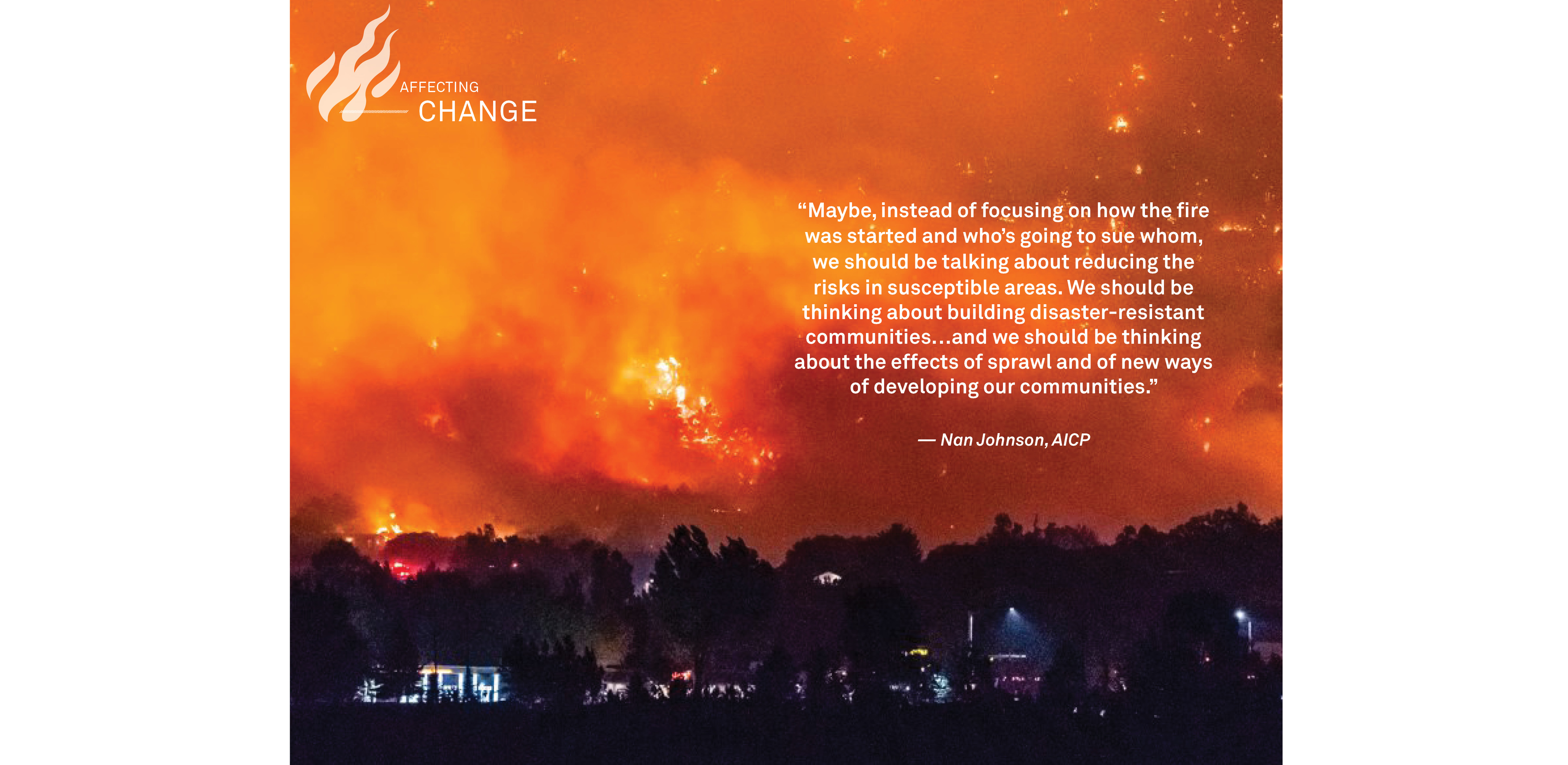

With a rise in wildfires in the western American states comes the necessity for better preparedness for communities at risk of losing their homes, and better suppression and mitigation strategies for the landscape architects who design them. A compendium of easy-to-navigate educational graphics enables landscape architects to introduce these wildfire mitigation approaches during early stages of community development so that public officials may understand potential land use impacts and prepare more holistic responses. Armed with this visual toolbox of strategic risk-reduction methods, landscape architects are empowered to initiate conversations that would trade vulnerability for resilience.
- 2020 Awards Jury
Project Credits
Anna Laybourn, AICP, Principal in Charge
Carly Klein, PLA, AICP, Project Manager
Colten McDermott, Hong Gao, Zoey Zhang, Supporting Team Members
Molly Mowery, Ben Yellin, Kelly Johnston, Wildfire Planning International Team Members
Project Statement
In 2018, over 52,000 wildfires burned 8.5 million acres in the United States. As development sprawls into the Wildland Urban Interface, more communities face loss of life and property. Traditional wildfire suppression and mitigation techniques are not 100% effective, challenging communities to explore additional ways to mitigate, or reduce, risk and impacts. Landscape architects have the potential to collaborate with their communities and civic leaders – who may need technical wildfire expertise, financial support and/or resources – to improve land use planning to guide development decisions and create safer places to live.
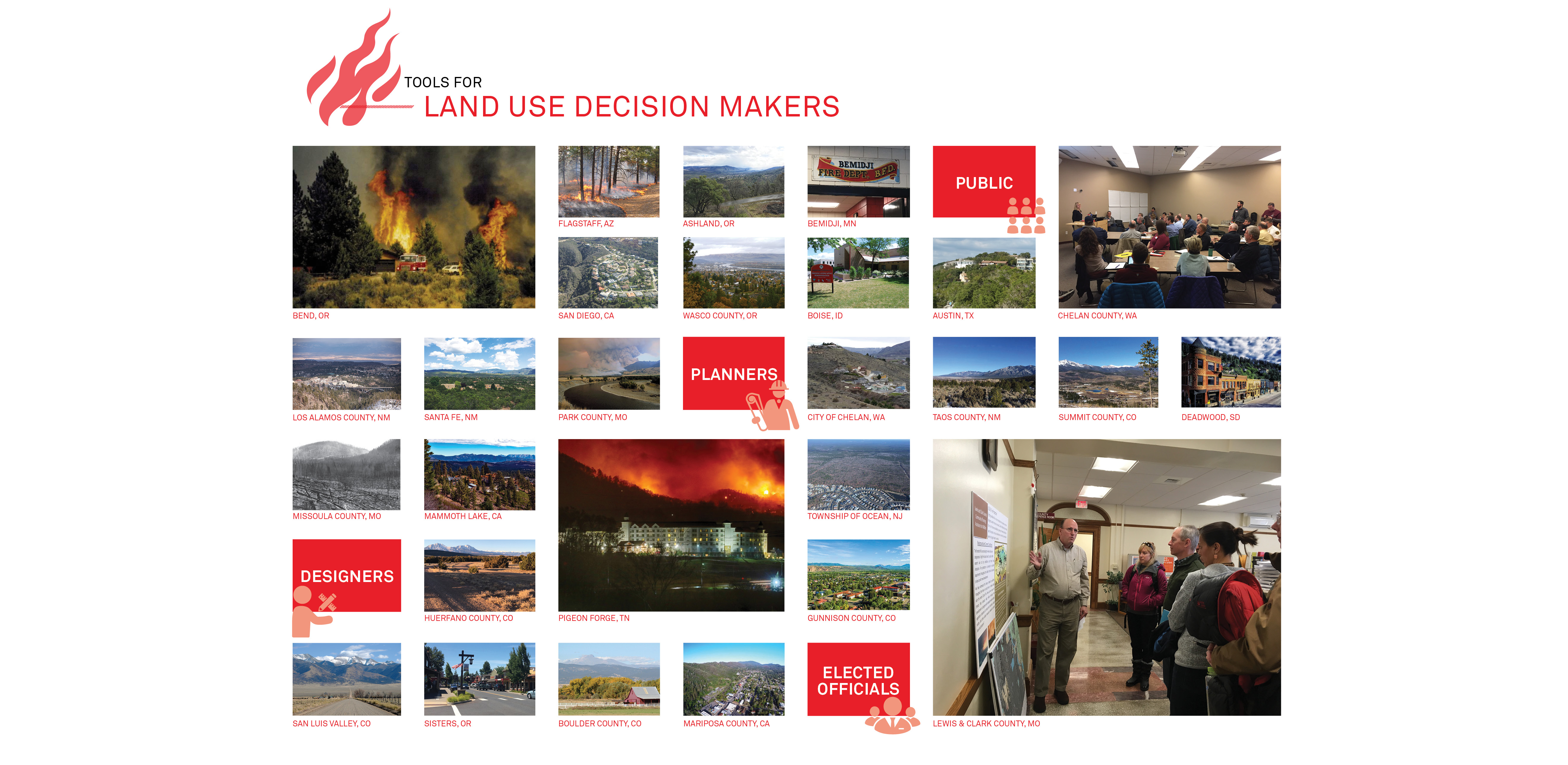
Addressing this call to action, Community Planning Assistance for Wildfire (CPAW) offers free technical services to empower communities at-risk with effective policy and regulatory solutions. To communicate wildfire planning concepts with elected officials and the general public, CPAW engaged the landscape architect to redefine the communication of their technical concepts into an easily understandable, graphically rich asset library. The suite of visual communication tools have supported adoption of new policies across multiple jurisdictions, geographies and fire regimes, illustrating a potential to affect change.
Project Narrative
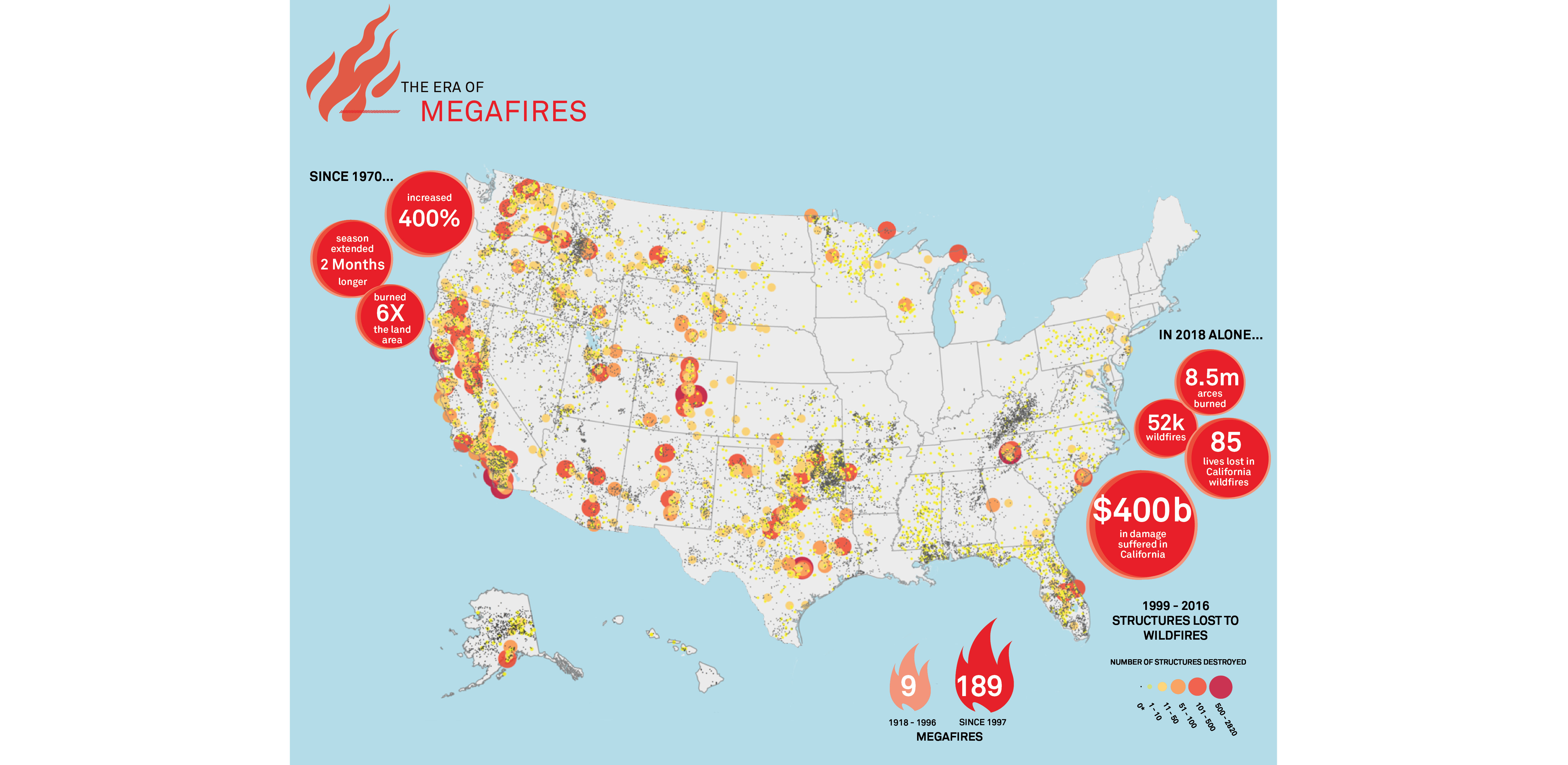
THE AGE OF MEGAFIRES
Since 1970, wildfires have increased 400% in the United States. 189 megafires – defined as wildfires over 100,000 acres – have occurred since 1997, as compared to only 9 between 1918 and 1996. The impact of megafires has been felt most in the west, although they can occur anywhere when favorable weather conditions meet an ignition source. Experts, including Dr. Paul Hessburg of the U.S. Forest Service’s Pacific Northwest Research Station, caution the rise of highly destructive megafires and predict that we are facing a fire regime unprecedented in the last 10,000 years.
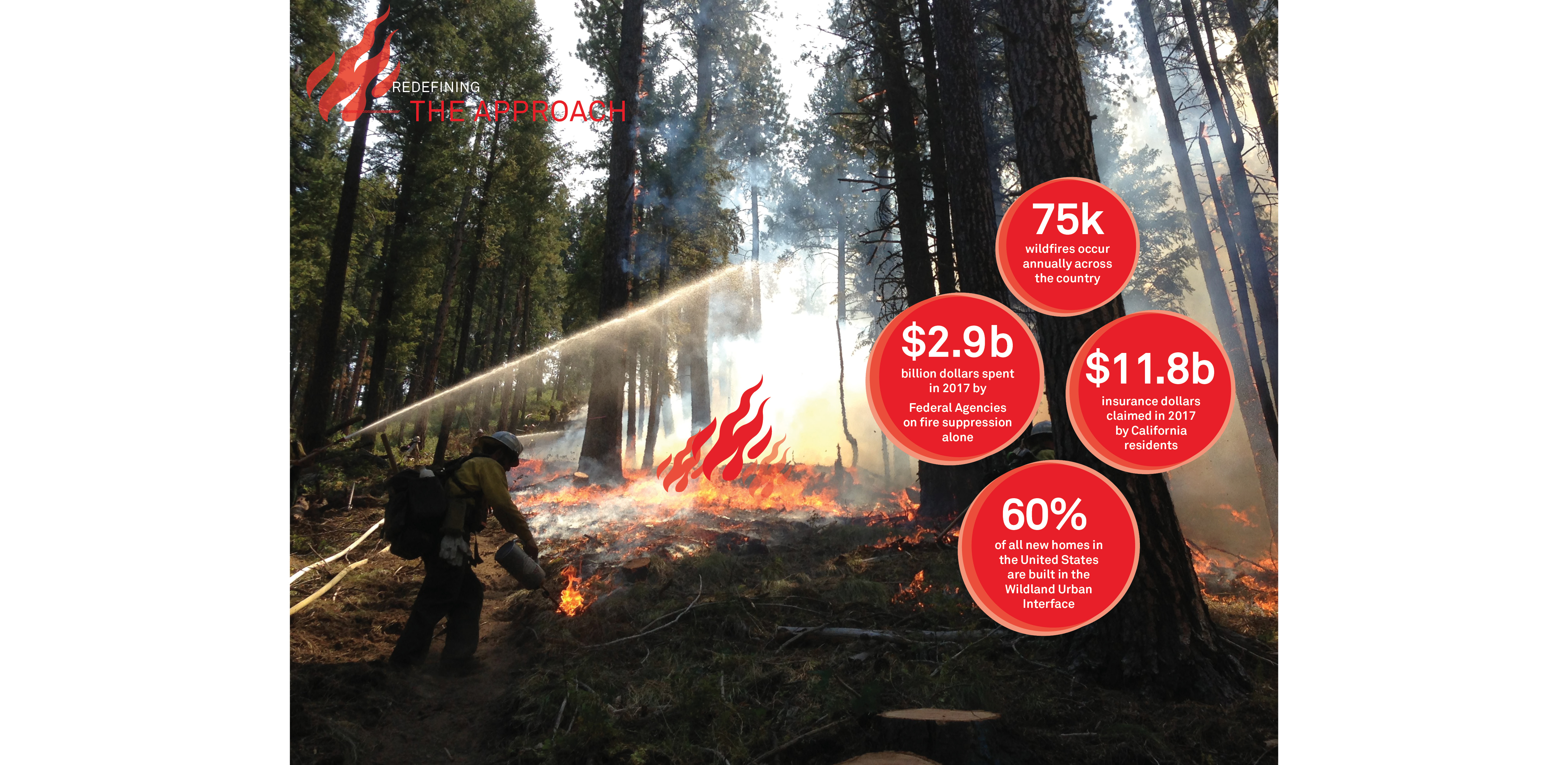
At the same time, development in areas that are most at-risk to wildfires, known as the wildland urban interface (WUI), has experienced dramatic growth. According to the International Code Council, an estimated 60 percent of all new homes in the United States are built in the WUI, placing lives and properties. The effects of the 2017 California fires alone resulted in $11.8 billion in insurance dollars claimed. As these trends collide, the residual effect leaves communities, federal agencies and insurers with increased suppression costs, loss of life and property.
REDEFINING THE APPROACH
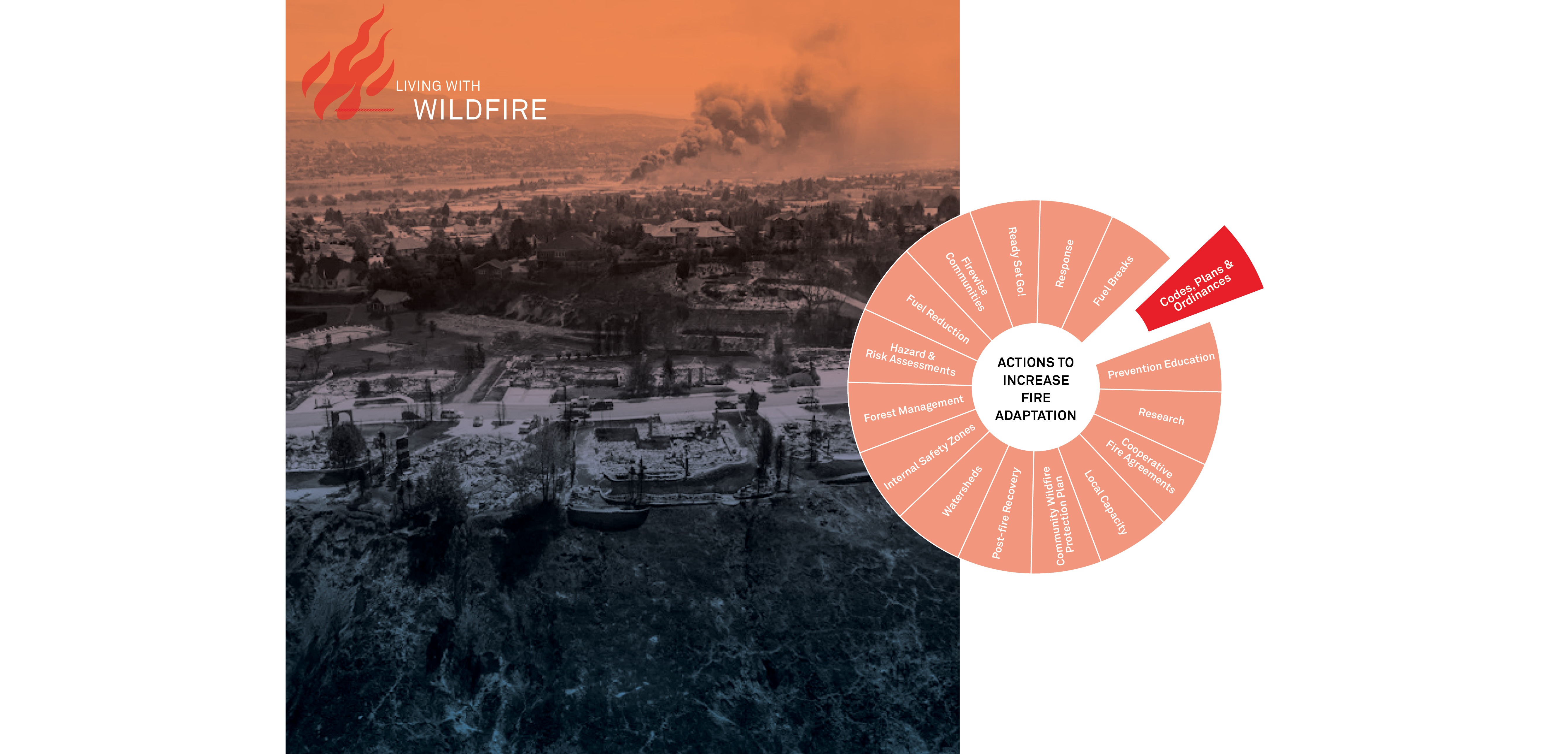
It is unrealistic – both physically and fiscally – to expect firefighters to suppress every fire. It is also counteractive to the naturally occurring process that supports healthy and balanced ecosystems. However, most states and communities are not required to consider wildfire hazard as part of their land use decisions. Instead, many programs have traditionally focused on other strategies to reduce wildfire risk such as voluntary homeowner education. Communities recognize that suppression and fuel mitigation alone are not enough to prevent disasters, and often want to understand what more can be done through land use policies or regulations.
A CALL TO ACTION
These factors represent a call to action for landscape architects, planners and allied professionals to assist communities in reducing wildfire impact. By better integrating planning and design into the community development process, we can minimize impacts to local infrastructure, watersheds, housing and economies, and allow for a more effective suppression response. Established in 2015 by an independent nonpartisan research group and a wildfire planning organization, Community Planning Assistance for Wildfire (CPAW) works with communities to reduce wildfire risks and costs through improved land use planning at the municipal and county levels. Funded by the USDA Forest Service and private foundations, CPAW’s team of foresters, land use planners, economists, and wildfire risk modelers collaborate with local planners, designers, fire personnel, foresters, and other stakeholders in selected communities. Their efforts seek to integrate wildfire mitigation into the development planning process, provide recommendations and risk assessments, and facilitate peer-to-peer learning exchanges and capacity building at no cost to the community.
COMMUNICATING RISK
In 2018, CPAW engaged the landscape architect – a former firefighter for the Bureau of Land Management – to fulfill a growing need to clearly communicate effective wildfire planning and design concepts, mitigation policies and regulations. The effort would move far beyond typical defensible space diagrams depicting single homesites on flat landscapes, which are often overtly general and ignore specific development changes. Instead, the landscape architect sought to combine proven CPAW best practices, scientific data and her own, real-world personal experiences to craft a distinct library of assets that translates technical concepts into three-dimensional visual resources related to land use, vulnerability and mitigation.
INTENDED USE AND DISTRIBUTION
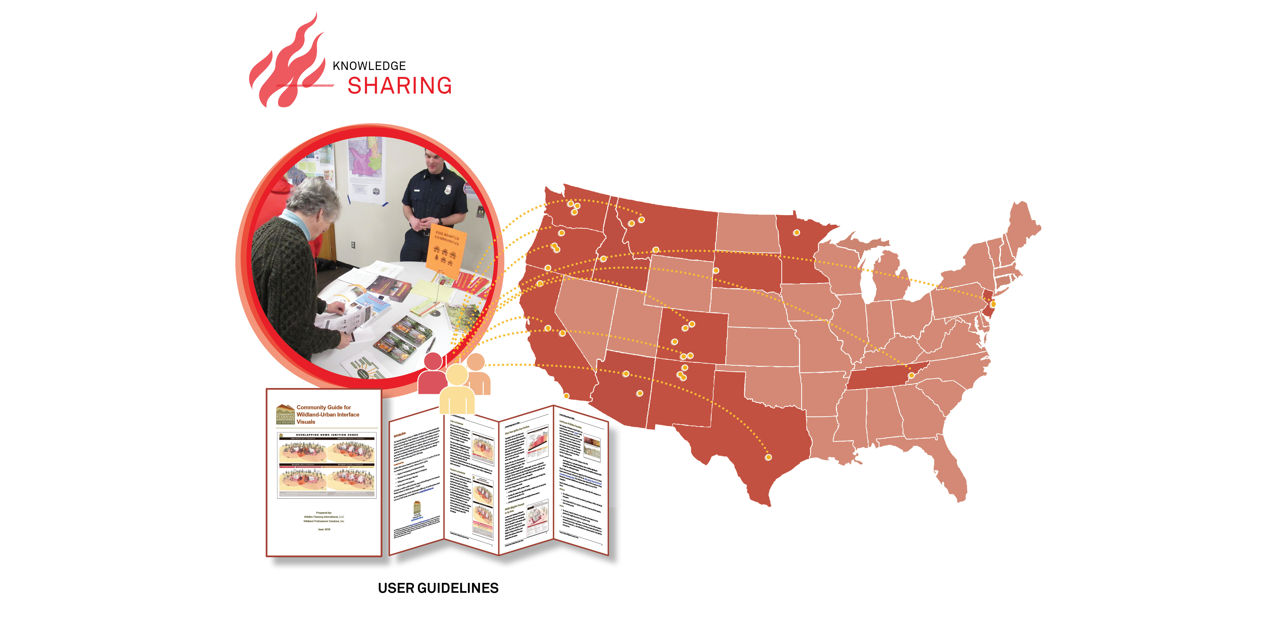
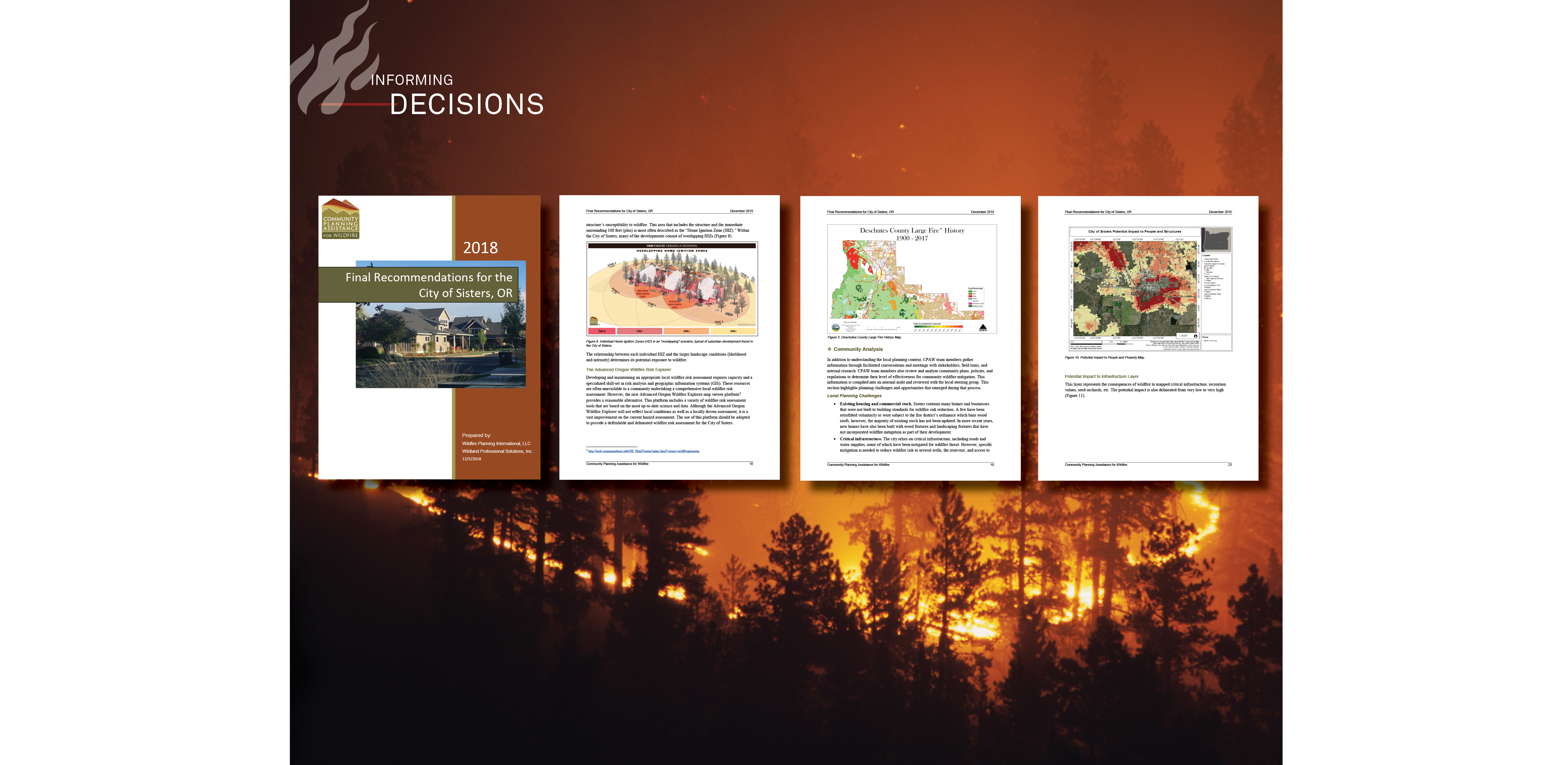
Listening to the concerns of each community, the CPAW process engages key stakeholders and local decision-makers in developing recommendations tailored to meet the site-specific needs and resources of communities. The visuals were intended to be used to educate audiences in all regions in current and future communities that partake in the program, and as a resource that could be incorporated into municipal codes and regulations. To date, CPAW has assisted 26 communities across the Midwest and Western regions. Understanding the program’s geographic and demographic reach, the message balanced technical accuracy to remain relevant to communities in a variety of environments.
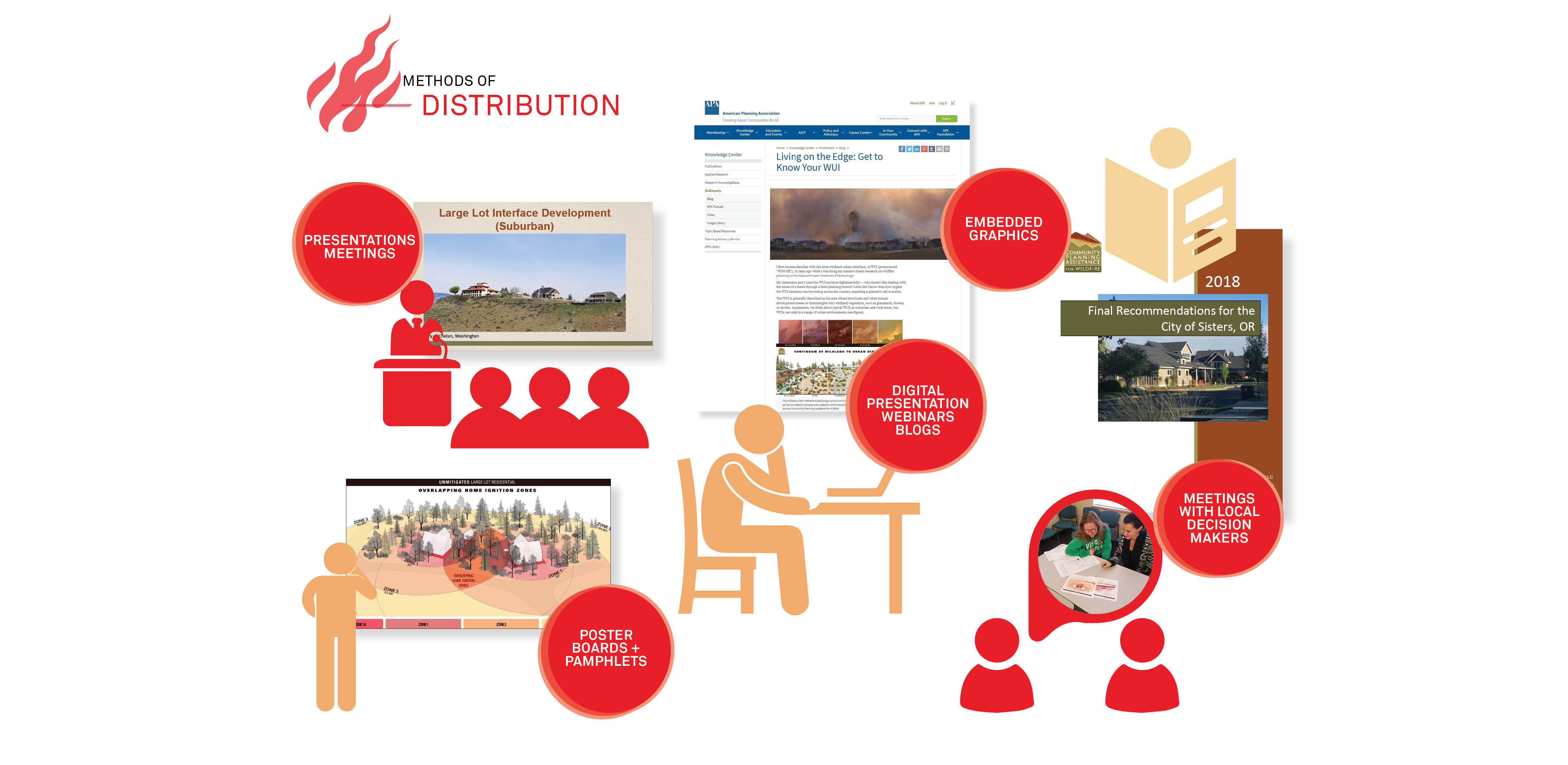
With the goal of improving regulations and policy, the landscape architect sought to understand how, when and where CPAW would distribute information and discussed how such information could eventually be incorporated into local guiding documents, such as a comprehensive plans. Visuals were then formatted for such settings, and in multiple formats and medium, to ensure effective and consistent communication. These formats include presentation trainings for professional audiences (planners, designers, building officials, developers); public workshops and meetings; project websites; pamphlets; and webinars. Each visual is supported by a narrative outlining practices, formatted as both a checklist and called out through labels, to support distribution in multiple methods.
COMMUNICATION TO DRIVE ACTION
The visuals seek to drive home the importance of collective land use and design decisions at a community scale, not just individual homeowner actions. As such, the graphics communicate the considerations at multiple scales, linking together the relationships of our built environment at the site, neighborhood, city and regional scales.
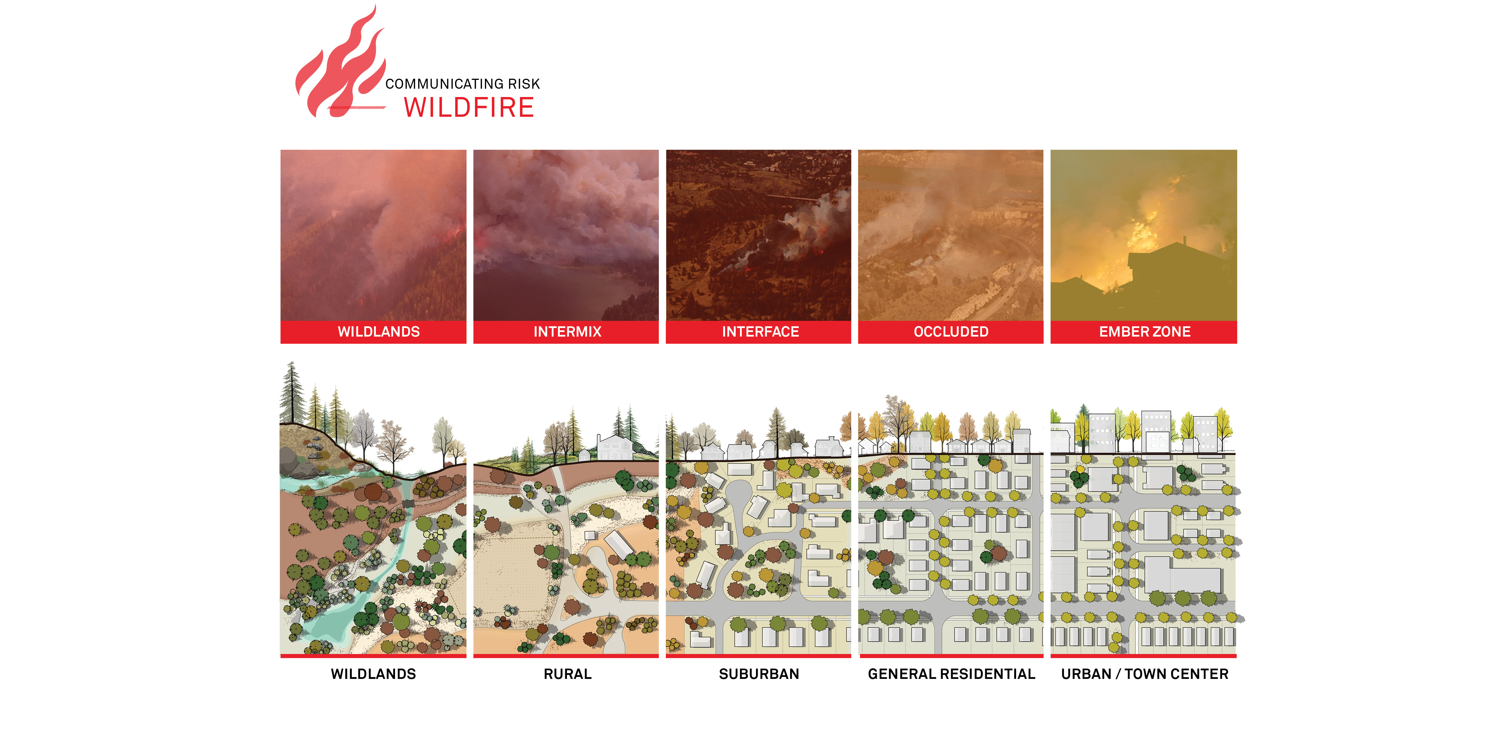
‘Continuum of Wildland to Urban Densities’ places elements of the built environment in a useful order, from most rural to most urban. The Continuum illustrates the relationship between wildfire-prone areas in increasingly dense built environments, from the least dense wildlands to the densest urban core and conveys how wildfire can affect any of these densities if conditions allow.
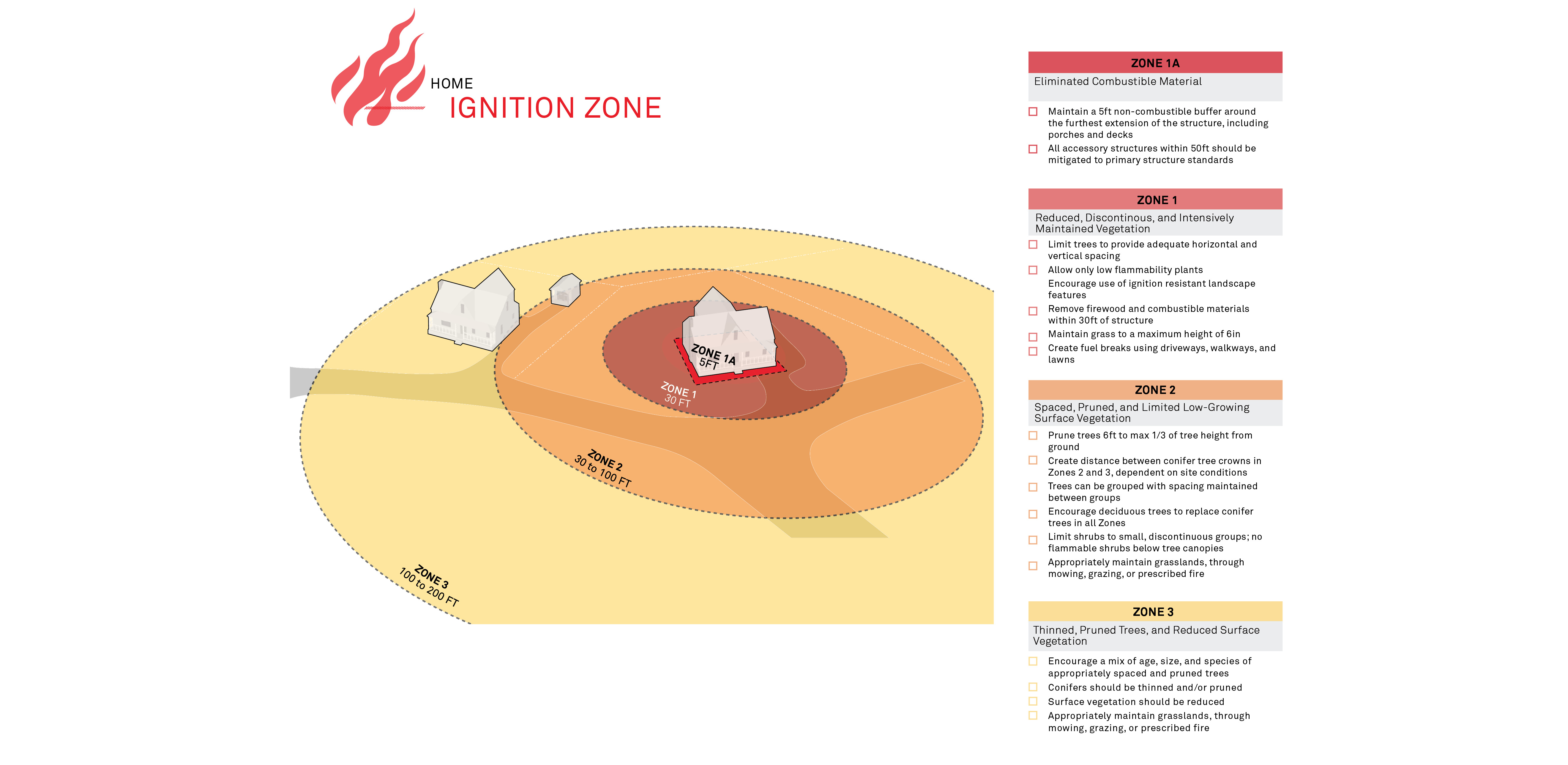
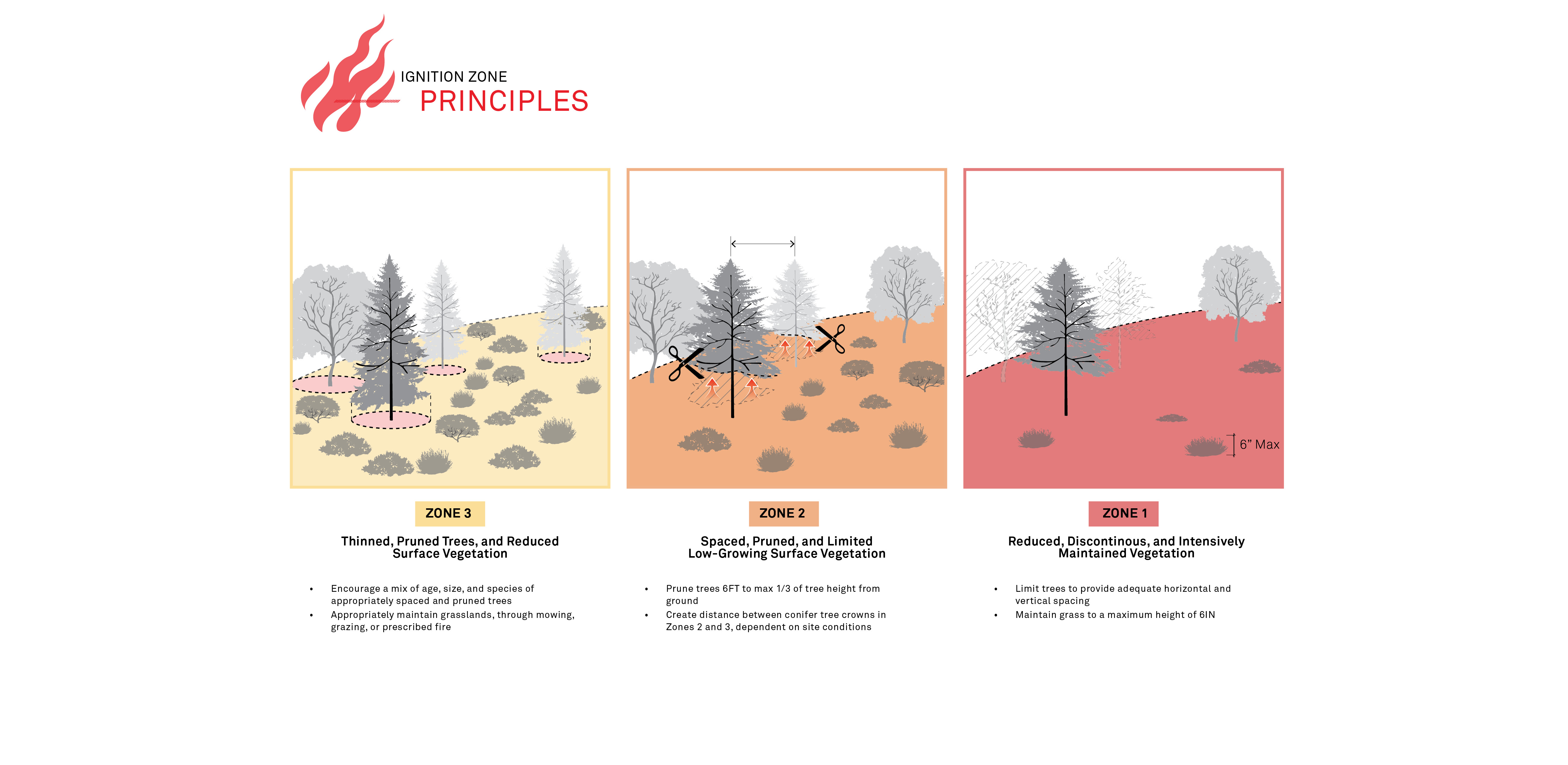
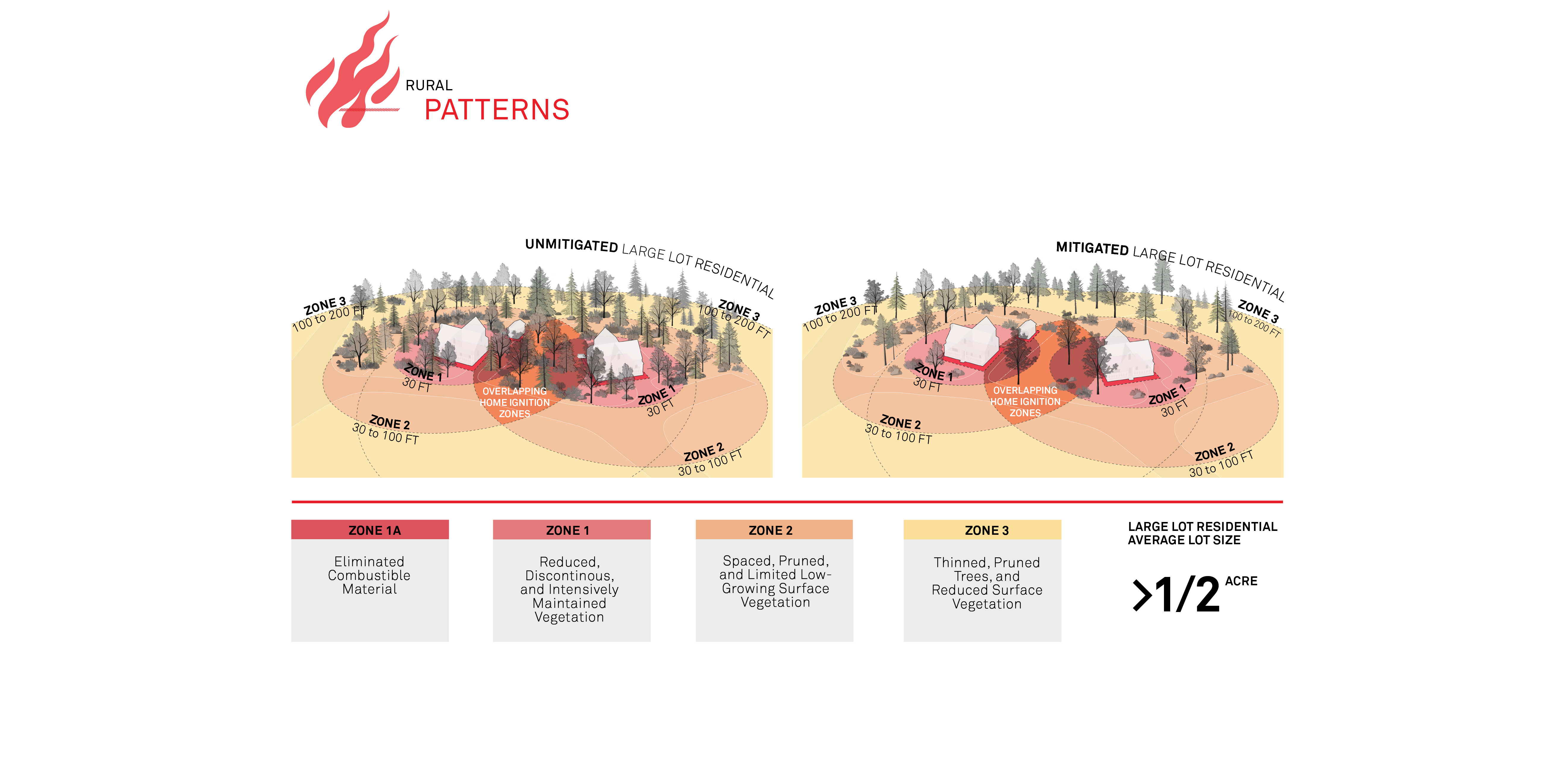
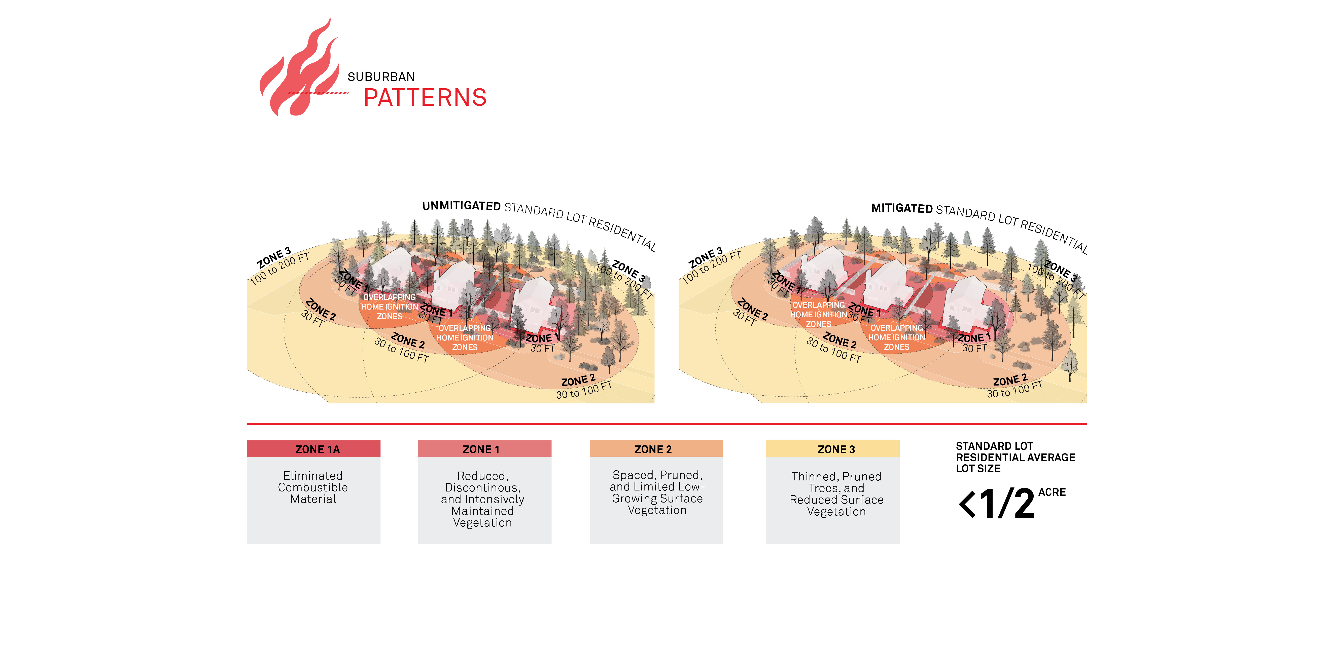
The ‘Home Ignition Zone’ series include successive visuals that depict how planning concepts and mitigation practices may be applied to various development patterns, influenced by lot size, density, setback requirements, and topography. Best practices often illustrate one homesite on a flat landscape. However, fire behavior changes with overlapping Home Ignition Zones due to multiple homesites. To depict foundational site planning and design concepts that consider both natural and built environments, the landscape architect illustrated differences between Home Ignition Zone mitigation practices for rural to suburban development patterns.
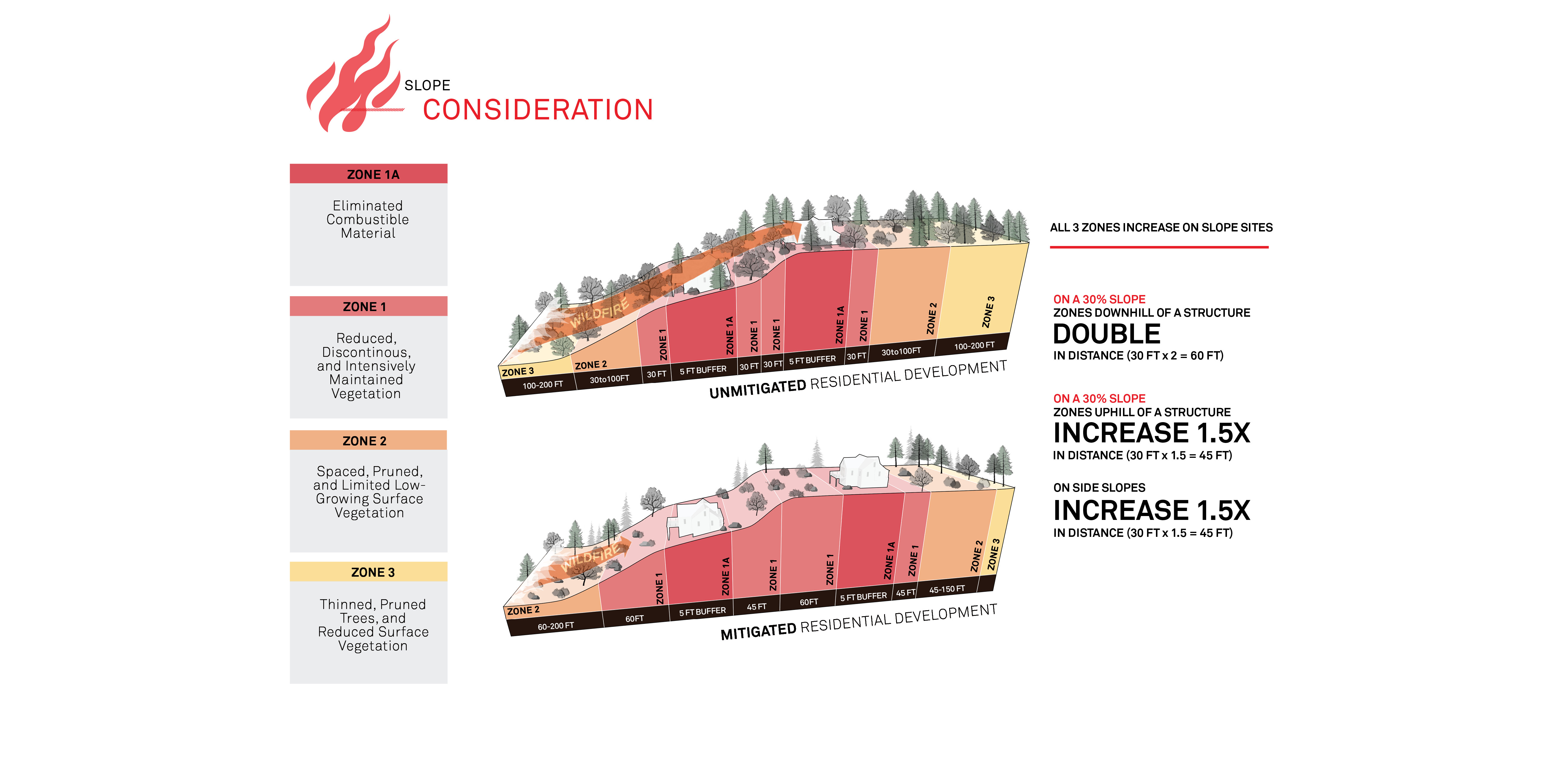
‘Slope Home Ignition Practices’ depicts the required extension of Home Ignition Zones, structure setbacks considerations, and adjusted building height limitations with consideration to steep slopes.
‘Wildfire Mitigation Concepts for the Home’ zooms into the scale of the individual home to address practices that decrease susceptibility during a wildfire to embers and direct flame.
TOOLS TO EMPOWER DECISION-MAKERS
Our nation’s ongoing wildfire challenge requires multi-pronged collaborations between public-private entities. Addressing this critical need, the foundational series initiated with this library of visuals has resulted in the adoption of effective policies and regulations across multiple jurisdictions, illustrating how landscape architects may meaningfully contribute to safer and more resilient places to live. To further engage within allied professionals, the visuals have been used to educate a broader audience of planners and designers through blogposts and social media.