.webp?language=en-US)


Remix: Imagine the Resilient Future for Peddocks Island in 100 Years
Lingyi Xu, Student ASLA; Yi Yang; Songyi Zheng
This 100-year proposal takes the long view of the effects of climate-change-induced sea-level rise and examines a variety of strategies to promote resilience for historic Peddocks Island in Boston Harbor, an important home for wildlife and a major recreational asset within Harbor Islands National Park. To combat the dramatic levels of erosion and habitat destruction that are expected, this plan for intervention through the remainder of this century is informed by considerable research and model studies, and envisions new landforms, a floating wave-energy generator, and grassy berms with a mix of seagrasses to contribute to a long-term strategy of protection, adaptation, and renewal.
Awards Jury
-
Boston Harbor Islands National and State Park served as the most significant recreational space in Eastern Massachusetts. As the most popular destination for locals and tourists, the park system also served as a significant ecological habitat for local wildlife, especially migratory birds and marine animals.
Facing the challenge of climate change and sea level rise, the historical remnants and precious habitats of Boston Harbor will be gradually submerged by the water. At his moment of history, a phasing strategy needs to be taken into consideration as simply persevering or protecting the island in the current situation will not sustain the island in the future.
A bold projection of necessary transformations is applied in order to reinvent the Boston harbor island parks itself as a recreational area or to serve as a national park by enhancing its existing characteristics, amplify the opportunities for education. Throughout the project, we intend to trace into a thorough look at its past and projecting a new responsible, innovative identity into the future.
-
Overall Intro
For the past 30 years, global sea level has continued to rise due to the current climate change. As guardians of the city, Boston Harbor Islands served not just as protection that keeps the city from a massive wave strike, but also as the 'Boston's backyard,' with unprecedented visitation.
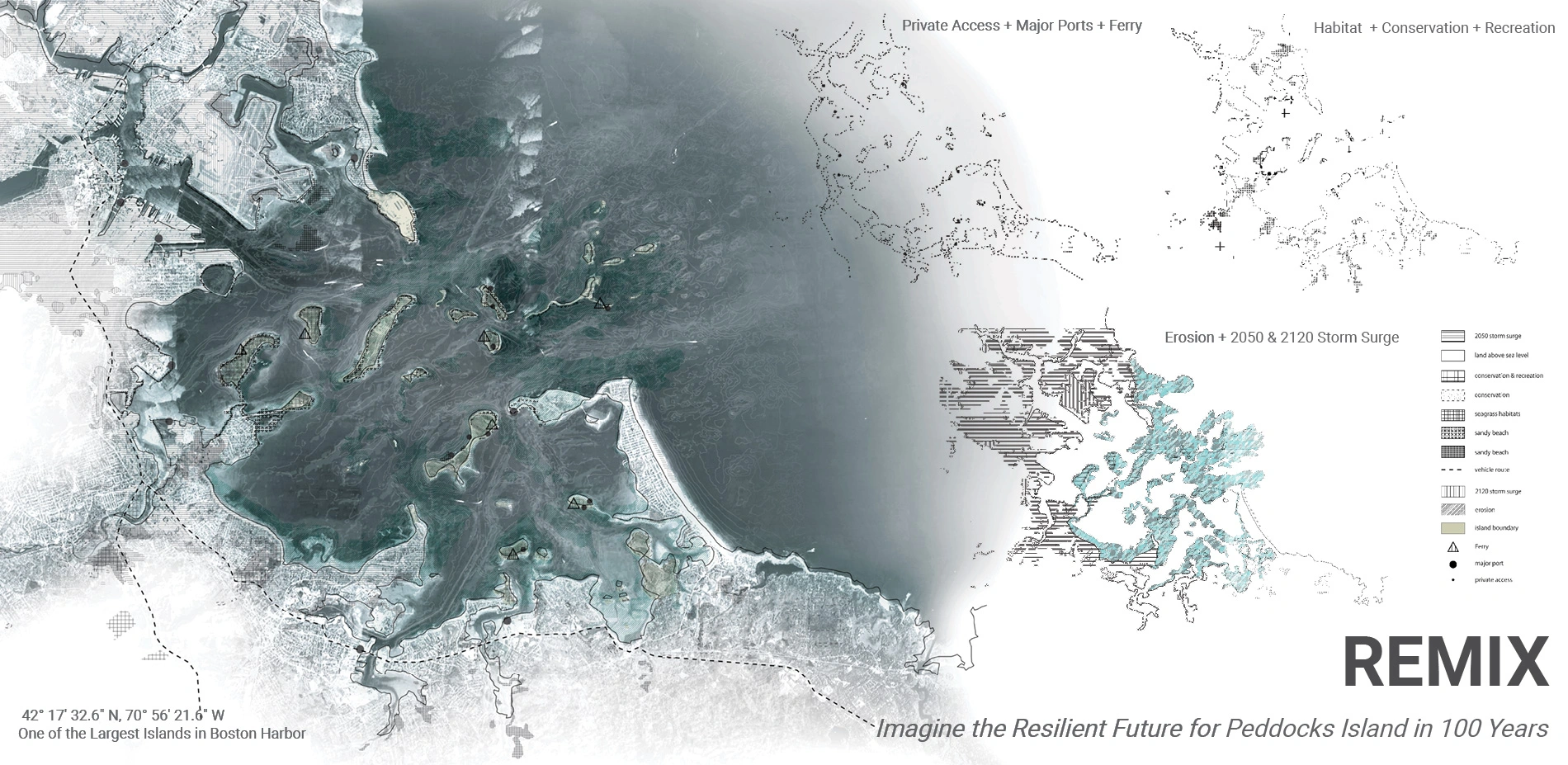
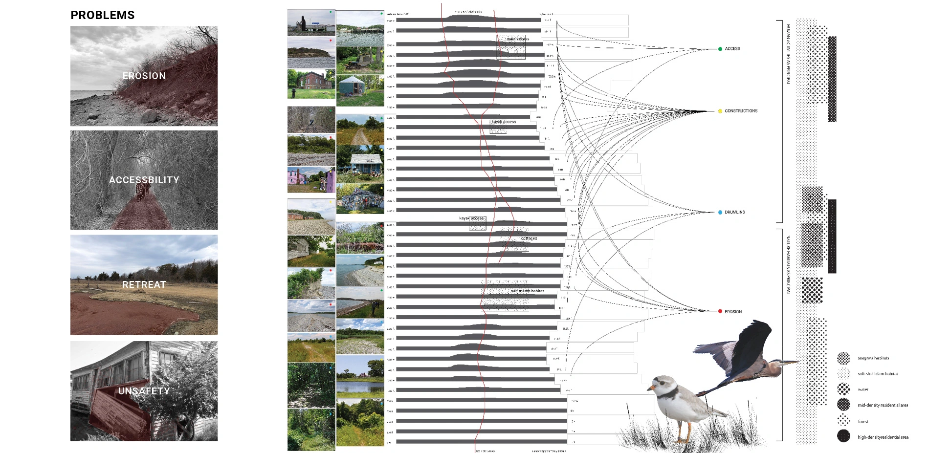
Chosen as a targeted site, Peddock Island is one of the largest and most diverse islands in the Boston Harbor. As part of the National Recreation Area, it suffers from severe erosion and habitat destruction throughout history. Researched in the scope of accessibility, erosion, future sea-level and habitat in the context of the large Boston Harbor, the Peddock Island was found under the harbor erosion zone and would be largely affected by the storm surge in 2050 and after. Especially, storms are expected to intensify over the next century. At least one Saffir-Simpson category-2 hurricane should be expected to travel up to the recreation area by 2100. Therefore, how to sustain the island under climate change becomes the challenge in the near future.
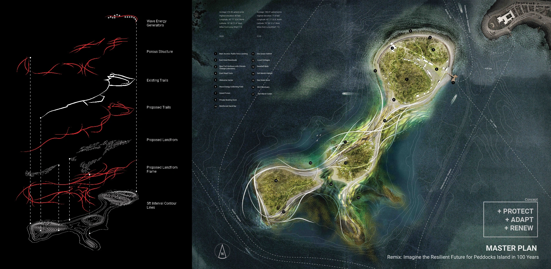
INTRO TO PEDDOCKS ISLAND
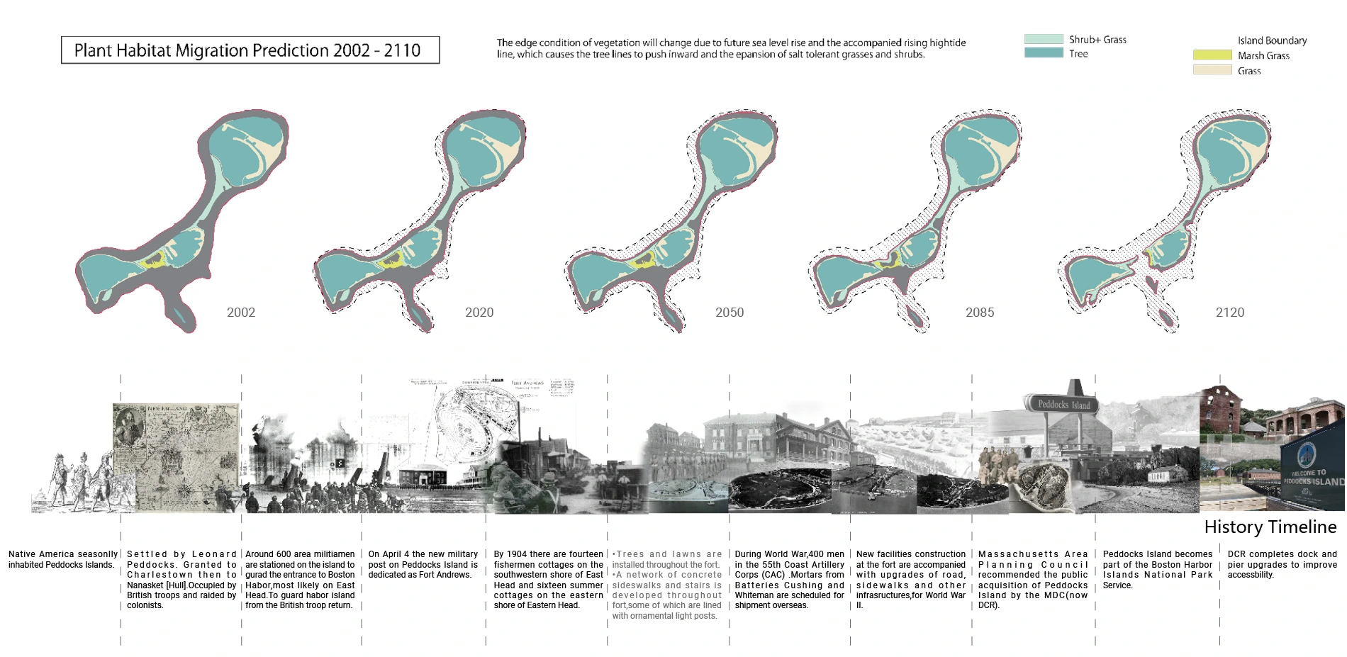
Peddocks Island itself features five drumlins – two on East Head, and one each on Middle Head, West Head, and Princes Head. The drumlins are connected by low-lying sand and gravel bars called tombolos that can be flooded during high tides. The island's highest point is the south drumlin on East Head, at 123 feet above mean low water. Peddocks Island is dominated by dense forests and long stretches of sandy beach, with smaller areas of dry scrublands and marshes. It has the second largest number of plant species of the harbor islands, around half of which are exotics such as Norway maple. On East Head are remains of concrete armament batteries, masonry support buildings, and grassy parade ground at Fort Andrews, a long-closed military post that represents the country's military history in the harbor. Enclaves of modest vernacular cottages dot the island, especially on Middle Head, and tell of long-standing connections to families of immigrant fishermen, working-class residents, and summer vacationers.
ISSUE STATEMENT
During the site visit, several significant problems were discovered as continued erosion, seasonal changes of accessibility on the island, demolition of constructions, and retreat of vegetated habitat. Under the effect of climate change, all these concerns will be intensified within a 100yr vision.
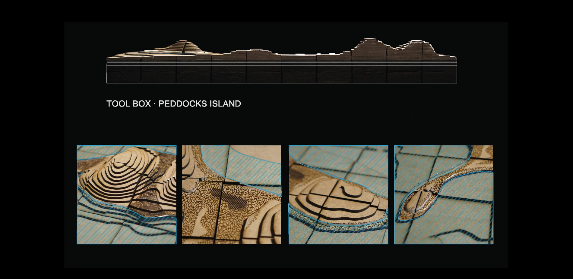
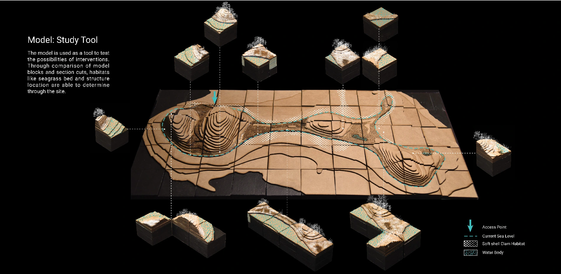
MODEL: STUDY TOOL
The model is used as a tool to test the possibilities of interventions. Through comparison of model blocks and section cuts, habitats like seagrass bed and structure location are able to determine through the site.
CONCEPT INTRO
The design intention is to generate a new existence of the island while enhancing its resiliency throughout time. The strategy of protect - adapt - renew will be applied to different scenarios to achieve the gradual transformation of the landform and construction of the biome.
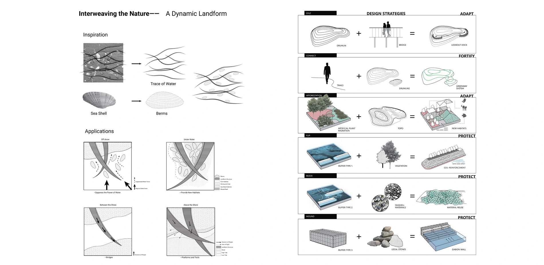
STRATEGY + LANDFORM
A total of five different actions, which are connected - flip - block - mound - stilt were applied to the site. By remixing materiality, texture, structure, and contour, new forms were generated to achieve the protect and adapt stage of the site. Meanwhile, a novel landform is extracted from the morphology of fragments like seashells and rocks, and their traces from overwash. The typologies of the new landform provide a dynamic service that harnesses the existing potential of the site and enhance its resiliency in different environmental conditions.
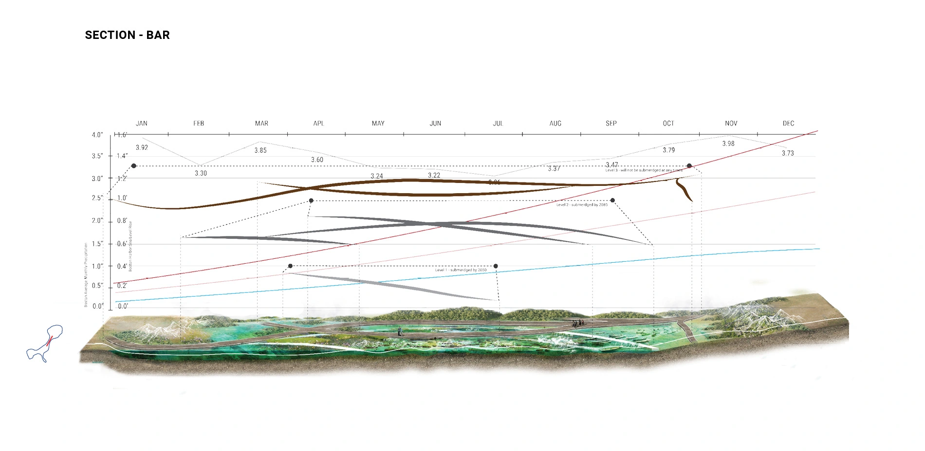
SEA LEVEL VS. LANDFORM - SECTION 1
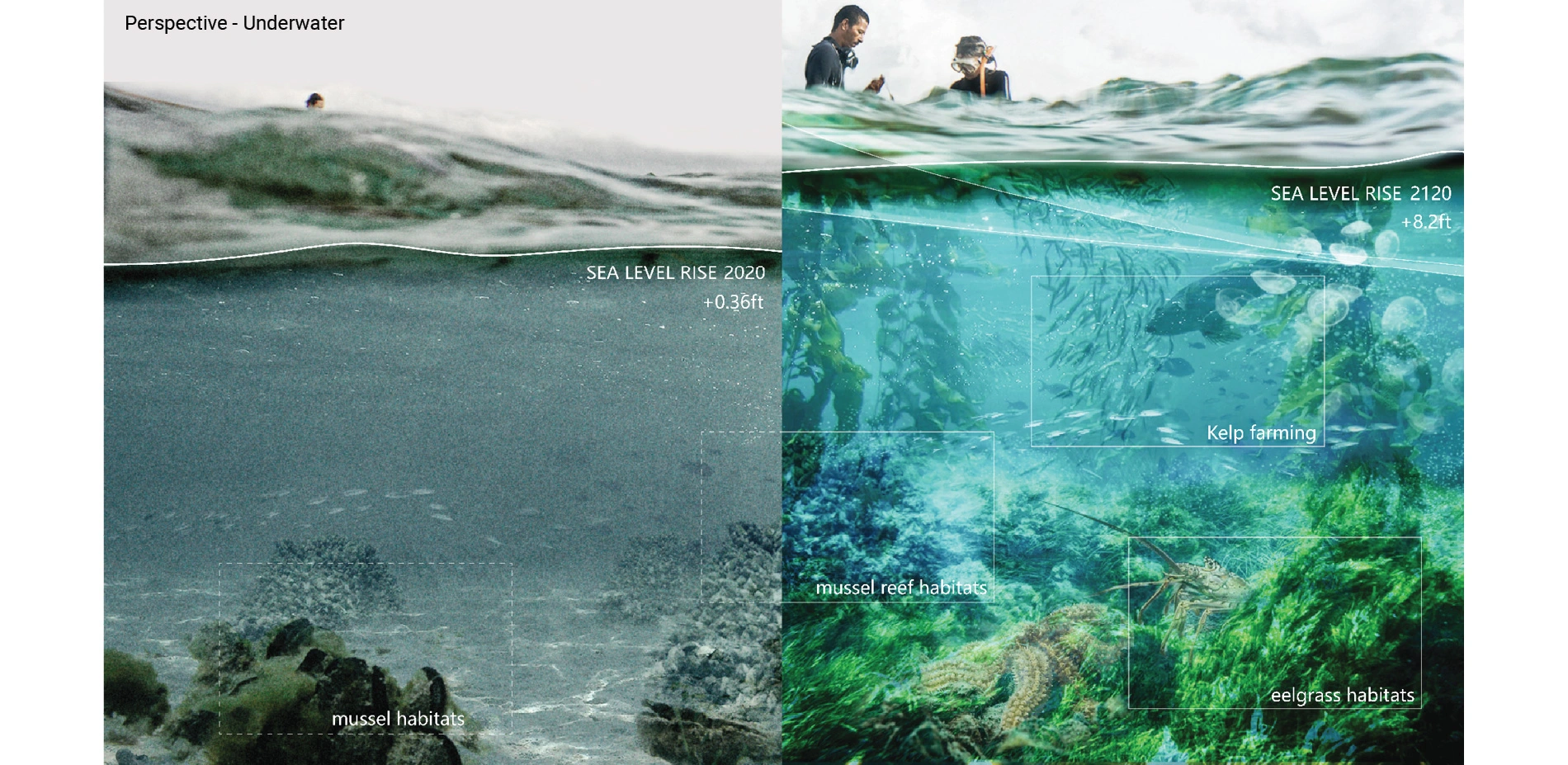
Current scientific models by NOAA indicate a higher sea level and an expectation for more intense storms in the future. Sea level is rising around Boston Harbor Islands National Recreation Area, and the sea-level projections by the year 2100 for Boston range from 0.9 ft to 5.22ft, which is greater than the global average rate prediction.
The new trail system will be accommodated to future water levels, taking consideration of the rising sea level, future storm surge, and tidal effect.
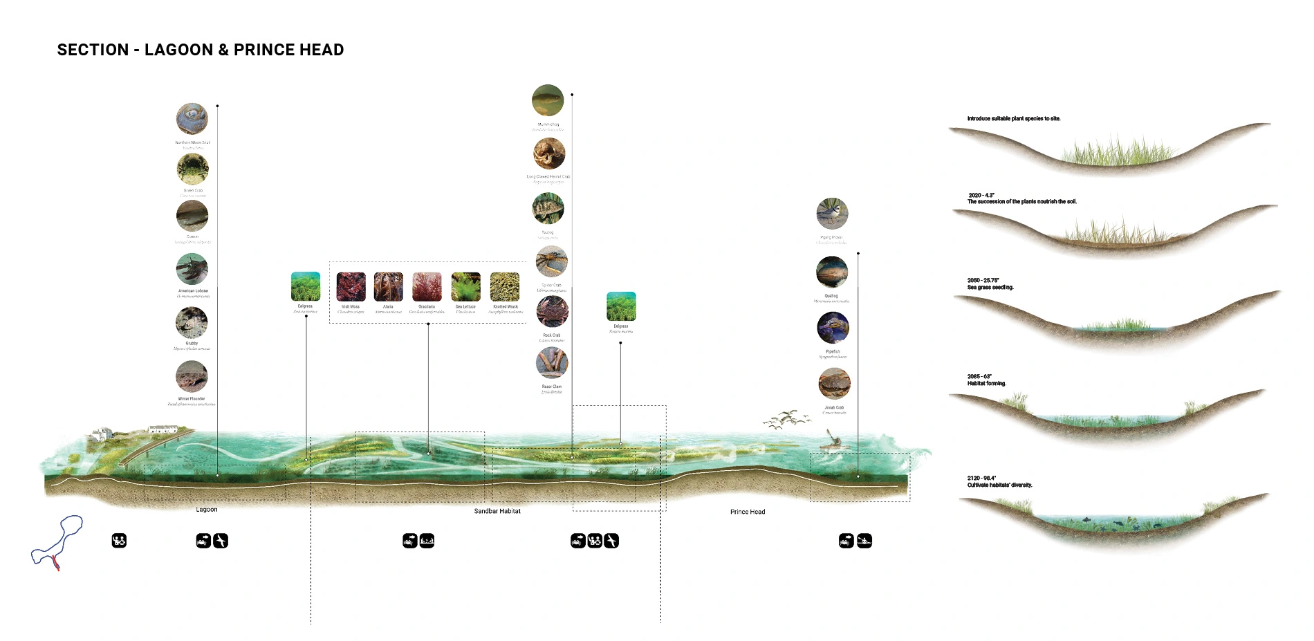
HABITAT VS. LANDFORM - SECTION 2
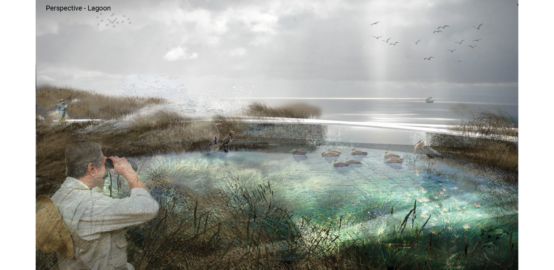
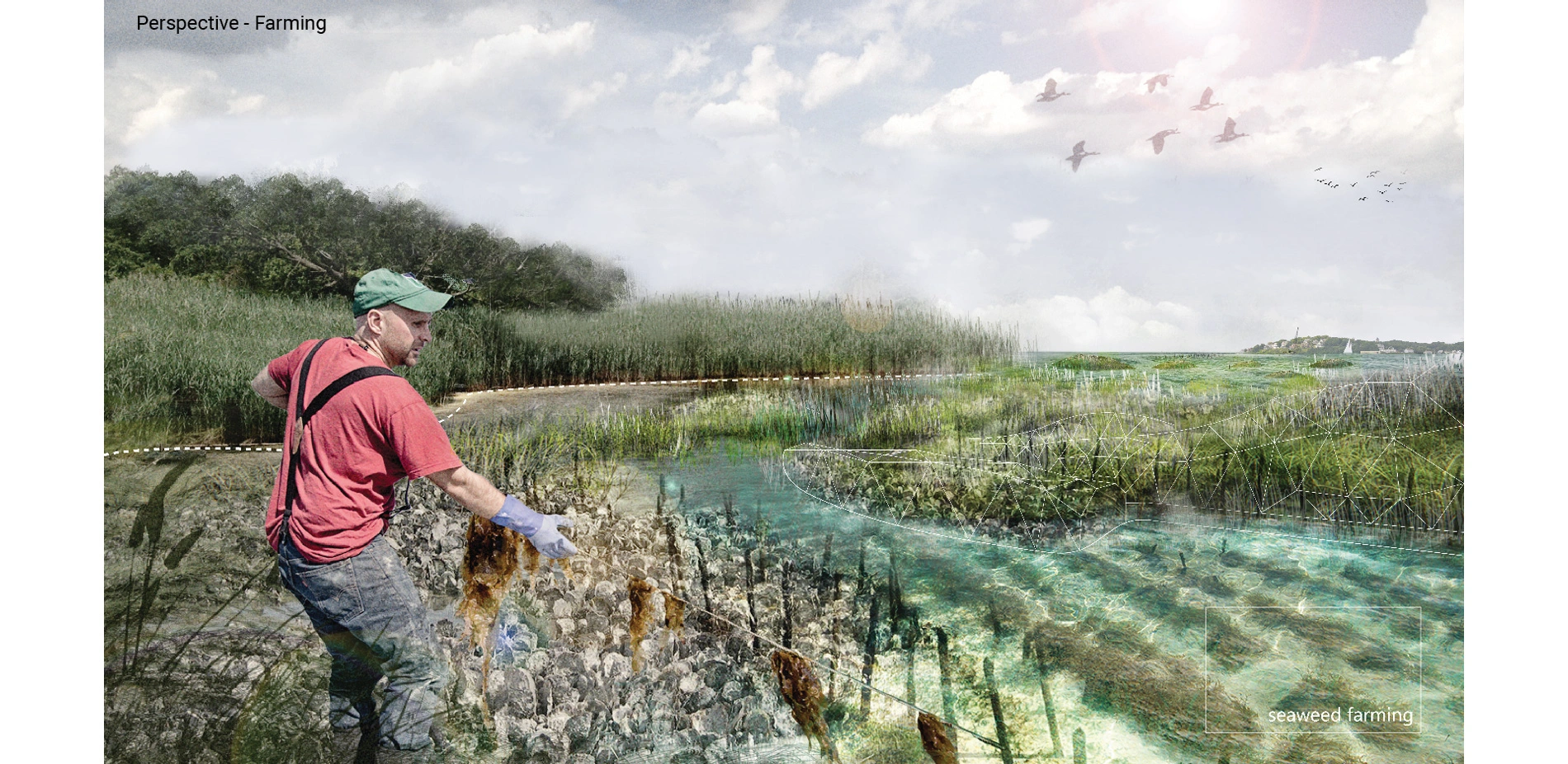
Seagrasses provide many essential services to people as well, but many seagrass meadows have been lost because of human activities. The new habitats are composed of grassy berm colonies that propagate the growth of seagrasses, which provide shelter and food to a diverse community of animals. Productive landscape as seaweed farming, at the same time, can be implemented next to the berms in order to associate with the culture of immigrant fishers in the 1900s, and provide locals with organic food resources.
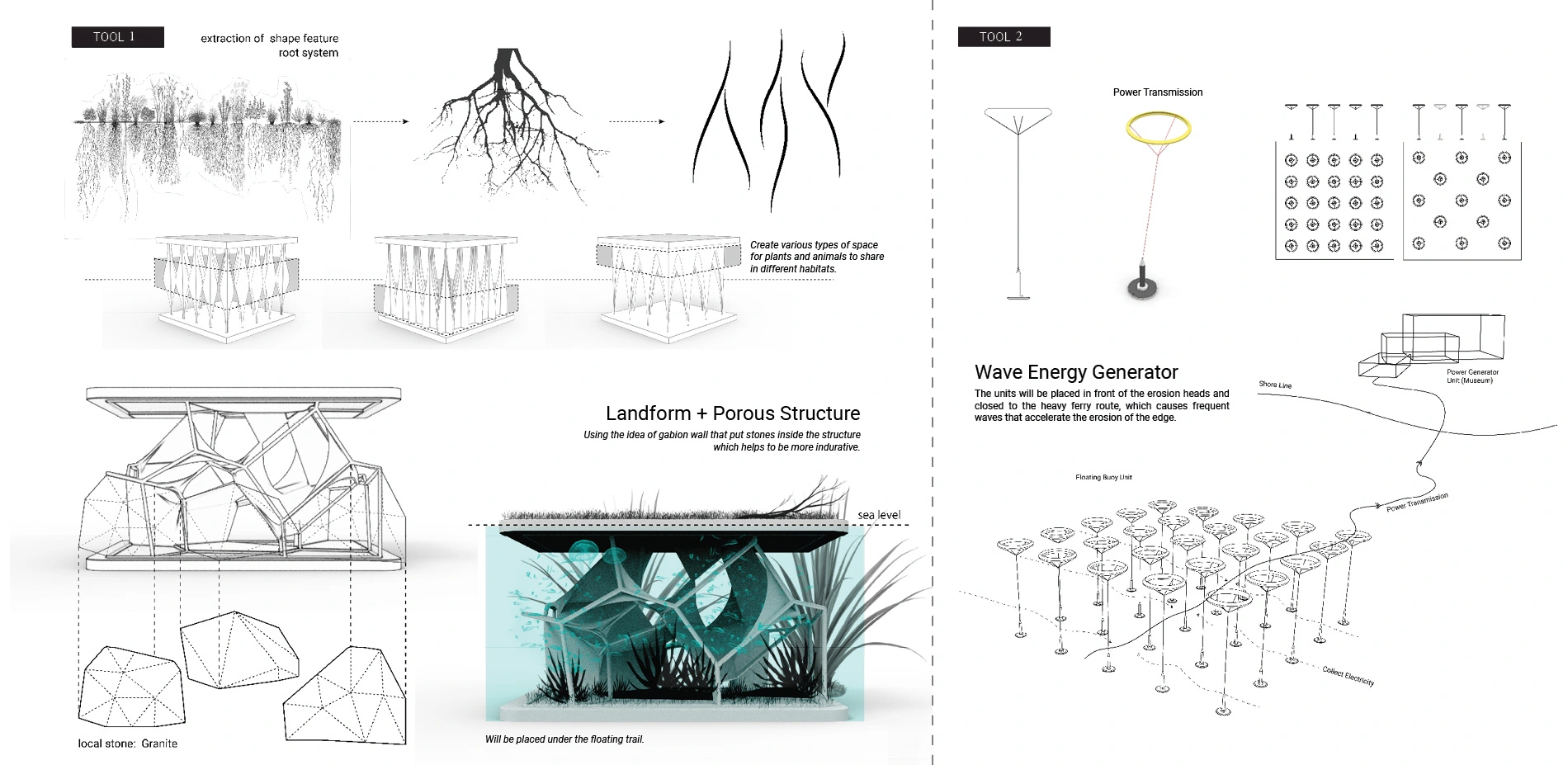
TOOL 1
Tools have been developed to further support the performance of the landform. This is the floating wave energy generator. The units will be placed in front of the erosion heads and closed to the heavy ferry route, which causes frequent waves that accelerate the erosion of the edge.
TOOL 2
Extracting the shape from the plants' root system, the porous structure, which will be placed under the floating trail, helps trapping sediments and the gradual construction of sandy habitats.
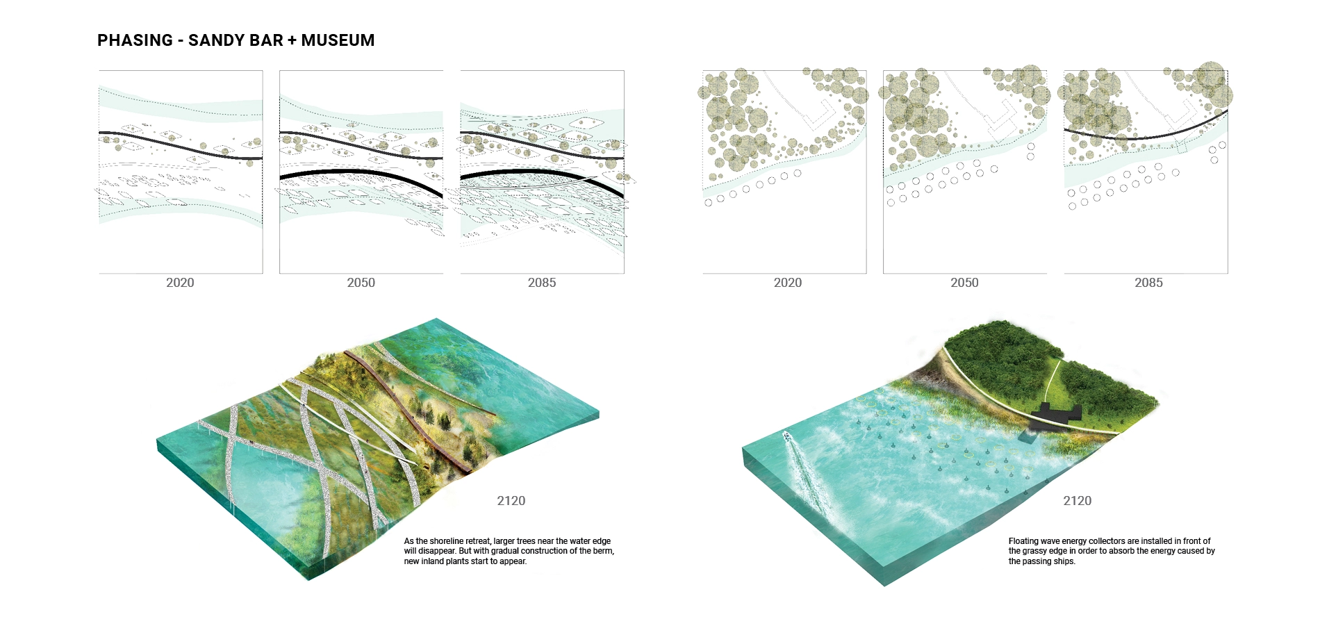
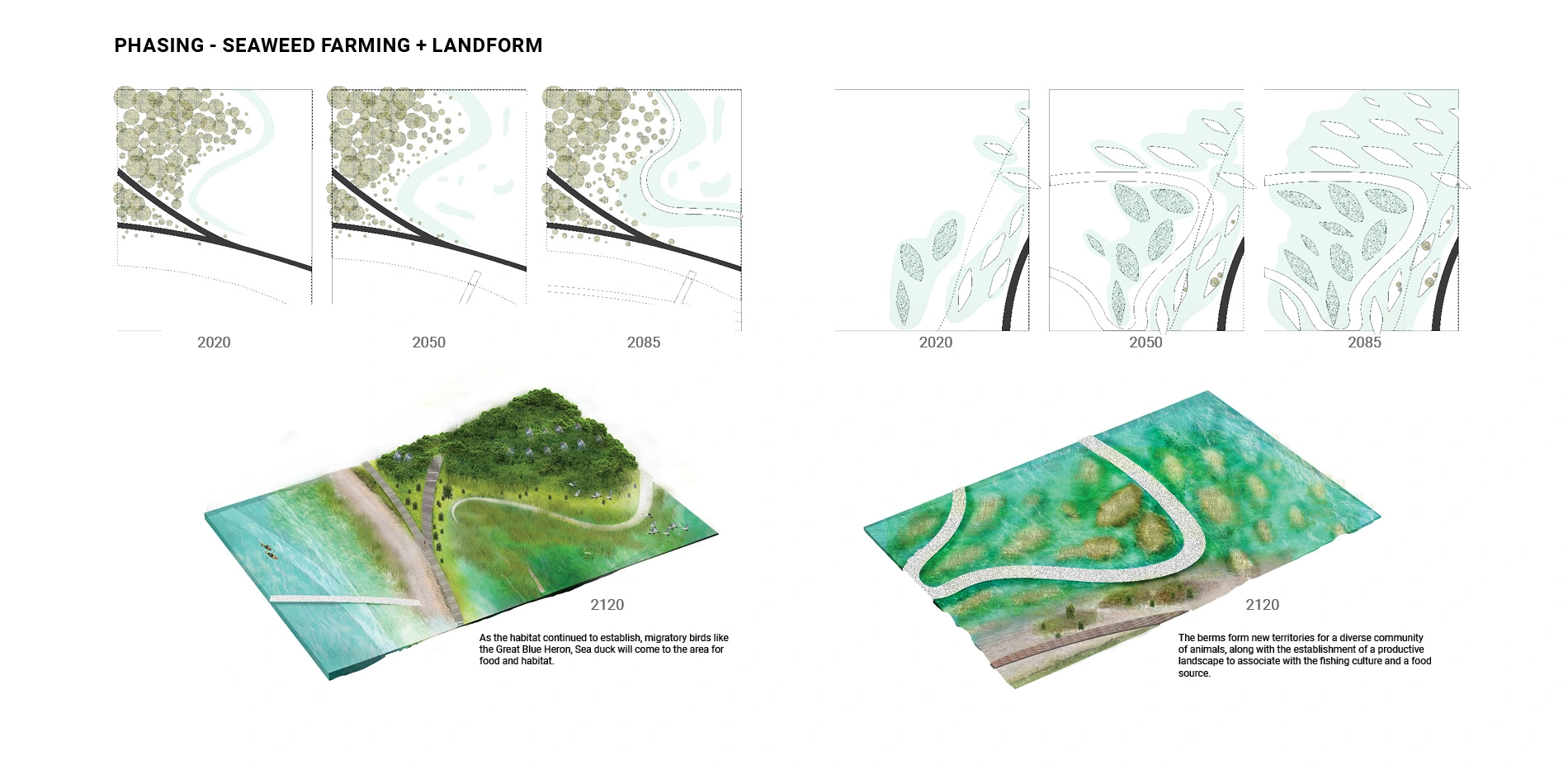
PHASING 1: the construction of buffers + wave energy collectors
The future scenario was built upon the phasing from previous years. As the shoreline retreat, larger trees near the water edge will disappear. However, with the gradual construction of the berm, new inland plants start to appear. Salt-tolerant grasses are cultivated on the water edge and expand inward and outward to stabilize the eroding edge. On the museum side, floating wave energy collectors are installed in front of the grassy edge in order to absorb the energy caused by the passing ships.
Phasing 2: salt marsh enhancement + productive landform
In the future, the salt marsh will directly connect to the sea due to the sea level rise. The water edge is reinforced by beach grasses and seagrasses. As the habitat continued to establish, migratory birds like the Great Blue Heron, Sea duck will come to the area for food and habitat.
Advertisement
Related Awards
Award of Excellence, General Design
A Floating Forest: Fish Tail Park in Nanchang City
In Nanchang, within the Yangtze River floodplain, we revitalized a heavily degraded 126-acre landscape into a floating forest that manages stormwater, restores habitats, and provides diverse recreational spaces—all within a limited budget and a short timeline. This innovative urban nature model strengthens the district’s identity and spurs surrounding development. Fish Tail Park offers a scalable solution for flood-prone regions, seamlessly integrating flood resilience, ecological restoration