.webp?language=en-US)


Community, Agriculture and Karez
Waiyee Chou, Student ASLA
With significant threats to the cultural heritage of the Turpan Prefecture of Xinjiang, China, arising from desertification, acid rain, soil salinization, agriculture, and tourism, this comprehensive plan offers design-based strategies for the region’s varied landscapes that include sand dunes, mountains, fields, deserts, and the intricate, ancient, culturally indispensable karez system of groundwater distribution. Relying on in-depth, explorations of heritage, place, and human and animal life, this study, although regional in scale, promises to restore the ancient connections between people, nature, and landscape in contemporary life.
Awards Jury
-
This project investigates how cultural heritage can be conserved within the Turpan Prefecture of Xinjiang, China in which the karez heritage agrosystem intersects with other types of landscape based heritage. With the agricultural techniques of Turpan recognized as a Nationally Important Agricultural Heritage System, and with Turpan's karez wells on the nomination list for World Heritage inscription, there is opportunity to rethink how cultural heritage is managed through ecological approaches, setting an integrated framework for addressing both ecological and cultural heritage management.
-
Background
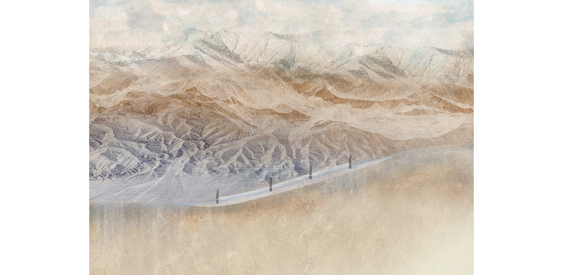
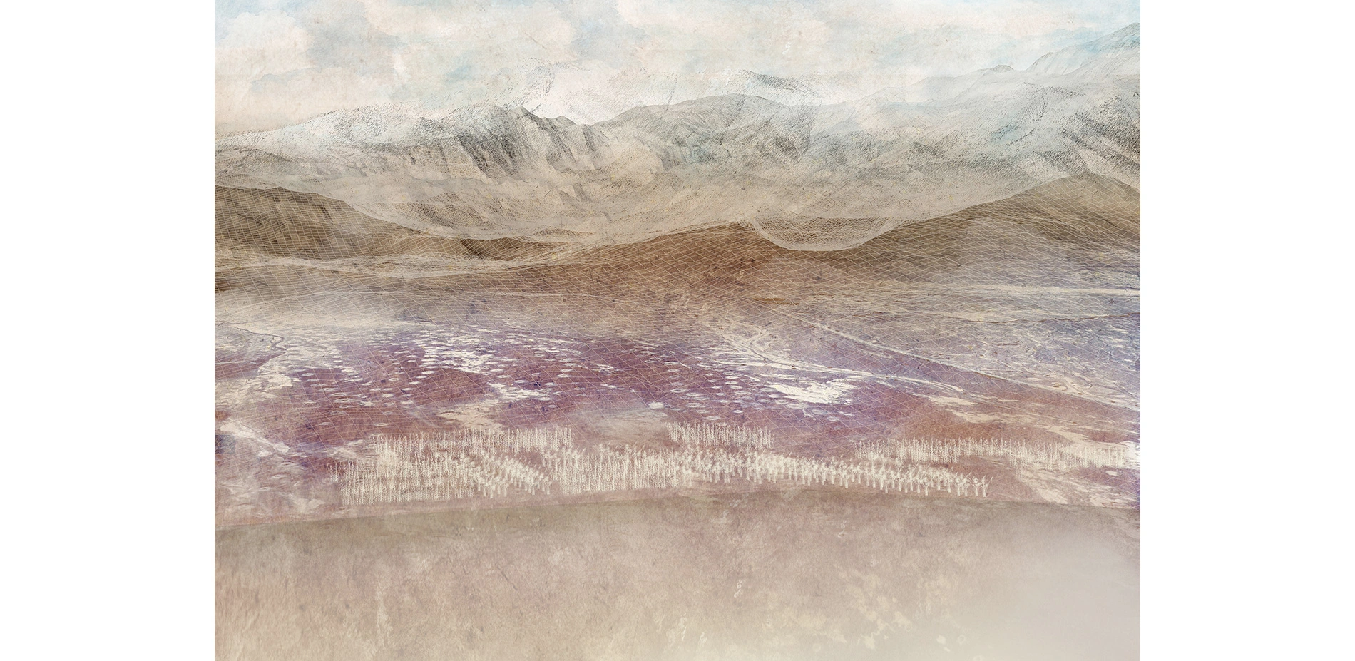
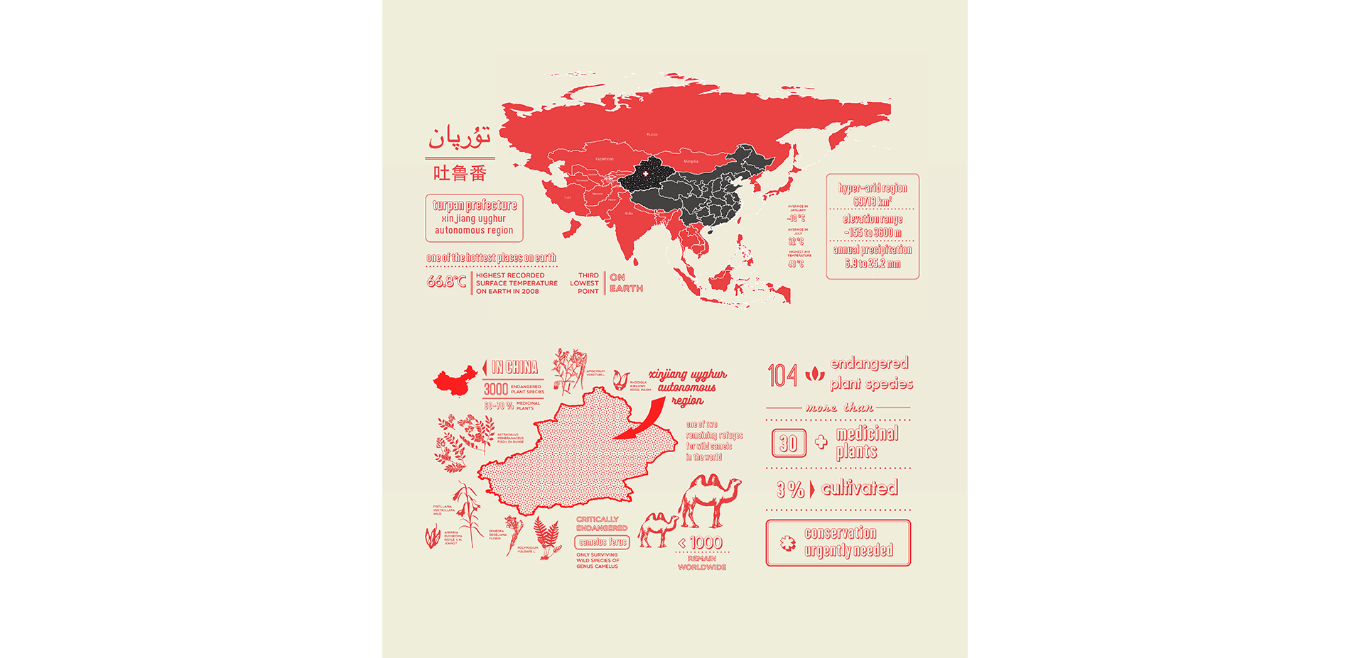
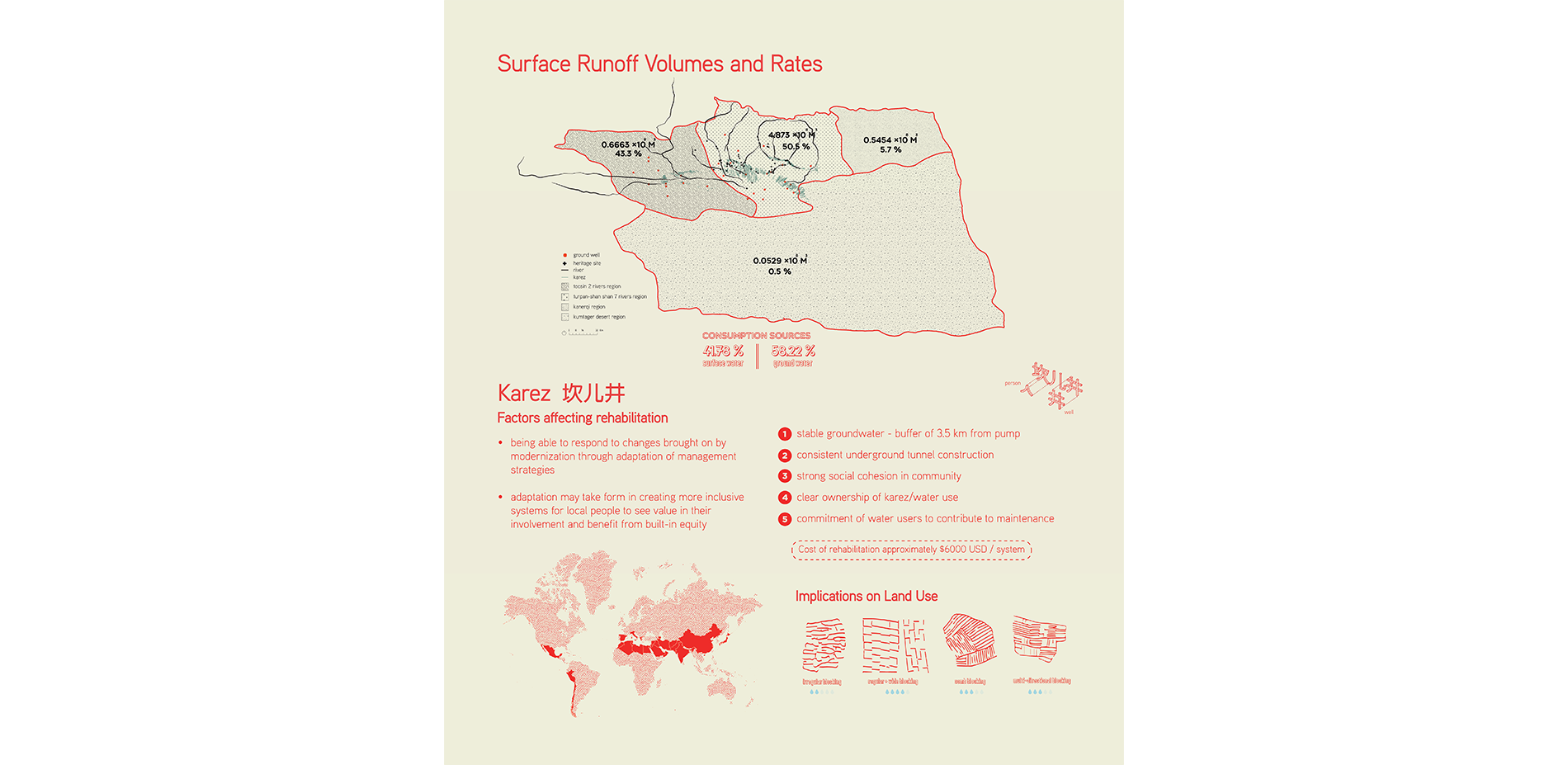
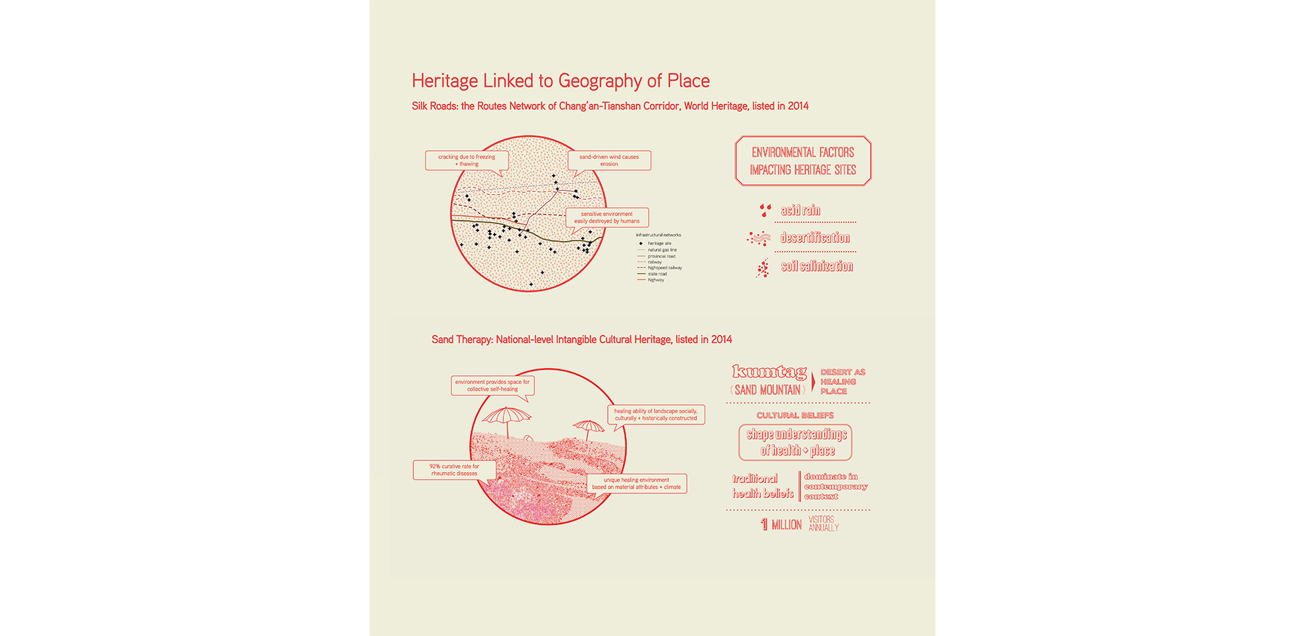
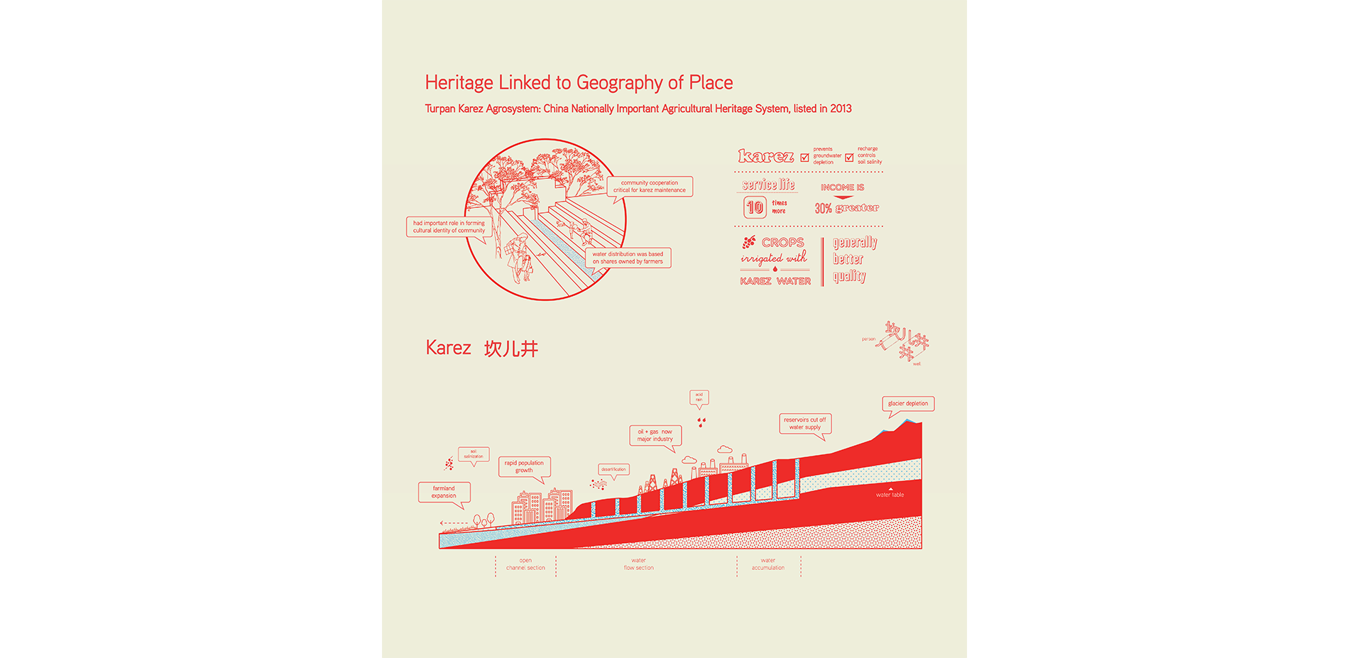
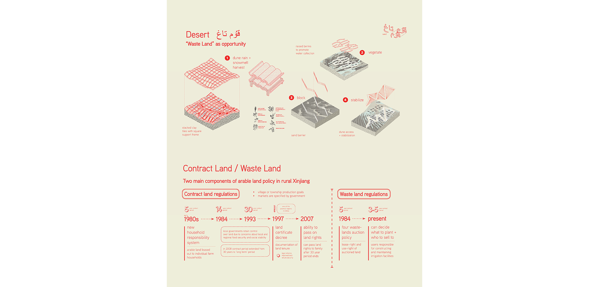
Turpan Prefecture is recognized as an area with serious ecological degradation, which is viewed as a threat to its local heritage. A combination of natural-environmental and social-economic factors, such as desertification, acid rain, soil salinization, agricultural activities and tourism have been identified as contributors to ecological and heritage degradation, in which 75% of heritage sites in the region are threatened. Agricultural activity is identified as having major impact, and the need to change the approach to which water is managed within Turpan was recognized by the World Bank, which identified that use of water resources in the area was not sustainable, causing increasing ecological degradation. Turpan's Kumtag Desert is also home to the critically endangered Camelus Ferus, the only surviving wild camel species, and is one of the last remaining habitats for wild camels in the world. Coupled with the region's dilemma of disappearing plant species, in which over 30 of the 104 endangered species are harvested for medicinal use, conservation of living species has been identified as urgently needed, especially with only 3% of medicinal plants responsibly harvested through cultivation.
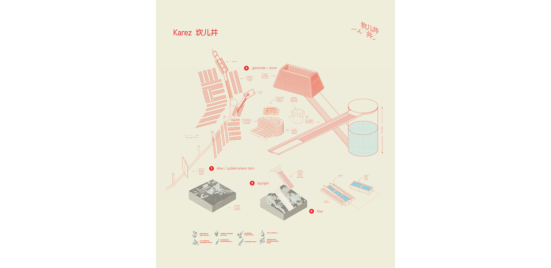
Approximately 50,000 households rely on Turpan's karez system as a source for drinking water, in which restoring this water system offers an opportunity for local communities to take part in creating a new trajectory for community based resource management, rooted in local culture and the sharing of traditional ecological knowledge for human survival in an ecologically fragile region, where water resource concerns are exacerbated by rapid development of commercial agriculture and population growth.
The continued practice of heritage based rituals, researched through anthropological, ethnographic and medicinal sciences were investigated to offer insight into how the dynamics of mediating heritage identities exist for culture and how design can contribute to enabling the continued practice of heritage within the landscapes in which local traditions are rooted in. Cultural practices with heritage designation were investigated; wherein their intrinsic ties to landscape and defined spatial geographies were examined to understand how Turpan operates and can be sustained as a place for living and healing.
Following the investigation into how heritage is practiced locally and obtaining local understandings of human relationships with place, design based strategies for the conservation of cultural heritage and endangered species were explored through a multi-scalar approach, operating at a regional level while incorporating the interests and needs of individuals at a local community level.
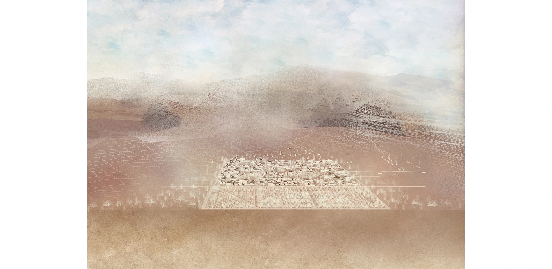
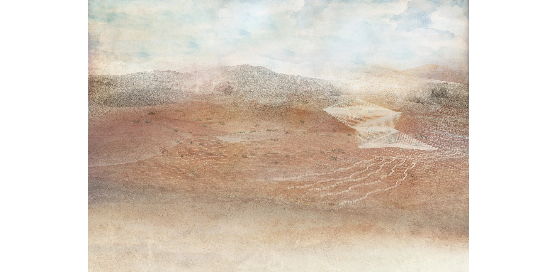
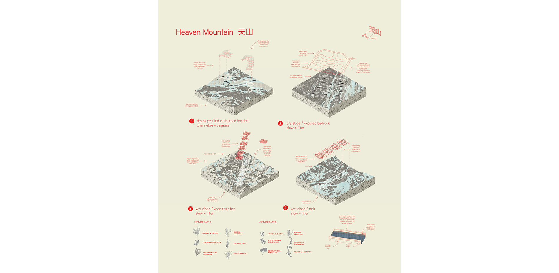
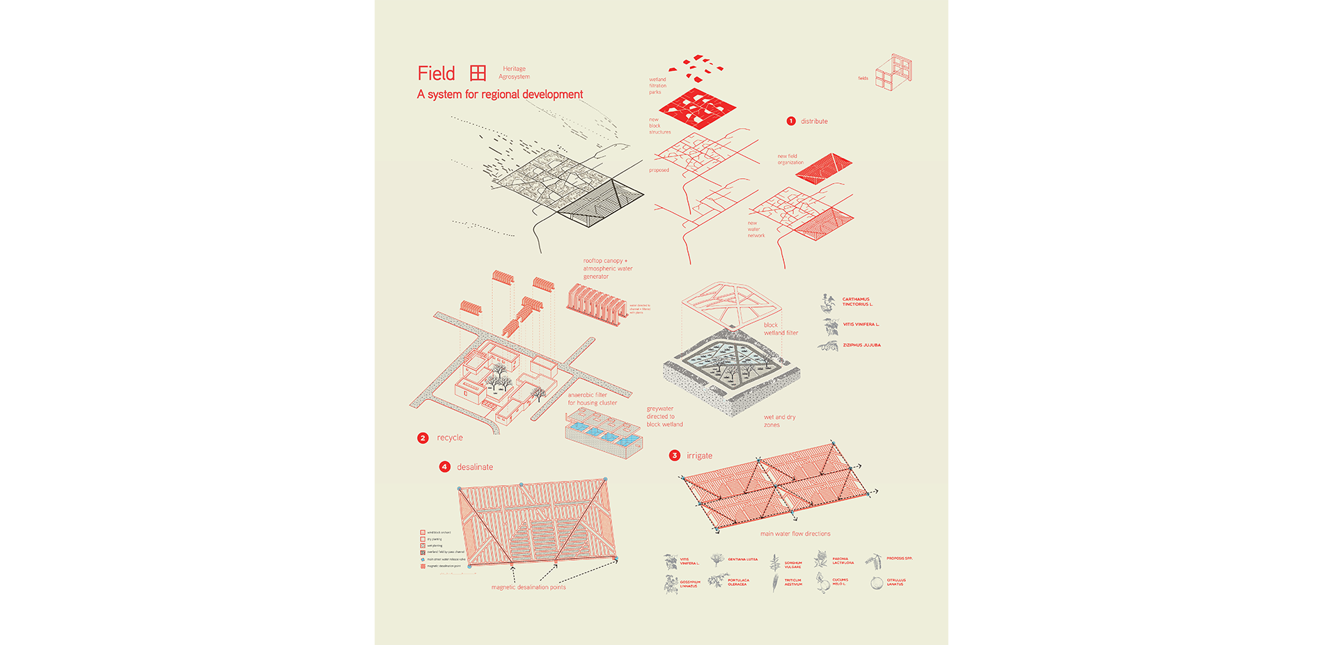
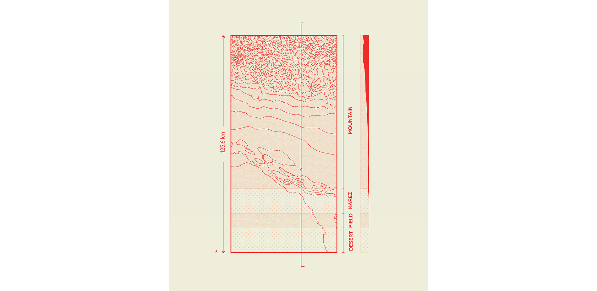
Heritage sites within and in proximity to agricultural areas were investigated to identify how environmental conditions were impacting specific sites, focusing on water resource management. Based on these findings, information about heritage site characteristics, types of degradation impacts, and potential strategies for improvement were compiled to better understand relationships between various heritage sites and opportunities for intervention that could be combined with the restoration of Turpan's karez system.
Key information to collect was encompassed within the following categories and themes:
1. Understanding heritage and how its value is assessed
Utilizing a landscape biography approach to research, a wide range of historical and environmental data, such as karez network growth was collected to better understand what heritage consists of and what influenced its creation. Findings from this approach were used for reflection on the values-based conservation approach used for heritage designation. Insight into this conservation approach and its associated values assisted with aligning design decisions with heritage conservation goals.
Data on Turpan Basin's ecology, geography, and other tangible characteristics of place were analyzed through regional, site-specific perspectives on land use management, community organization, along with social and cultural knowledge. Sources used to enable analysis with this approach included place-based narratives in the form of place names, paintings, cartographic materials, and academic writing from varied fields. The landscape biography method enabled the synthesis of a myriad of data types to derive information about physical, cultural and social contexts throughout time
2. Environmental perceptions: visualizing geography, traditional knowledge and land management practices
Investigating how Turpan's karez environments have been and continue to be represented, through examining artifacts of historical and didactic texts, along with painting and written language as a form of visual representation enabled understandings of these environments through multiple modes of cultural expression. These understandings assisted with revealing discourse on traditional ecological knowledge and how it can be incorporated into adaptive management processes in addition to assisting with evaluating and determining what aspects of TEK can be applied to landscape based design strategies.
3. The physical environment: past, present and future
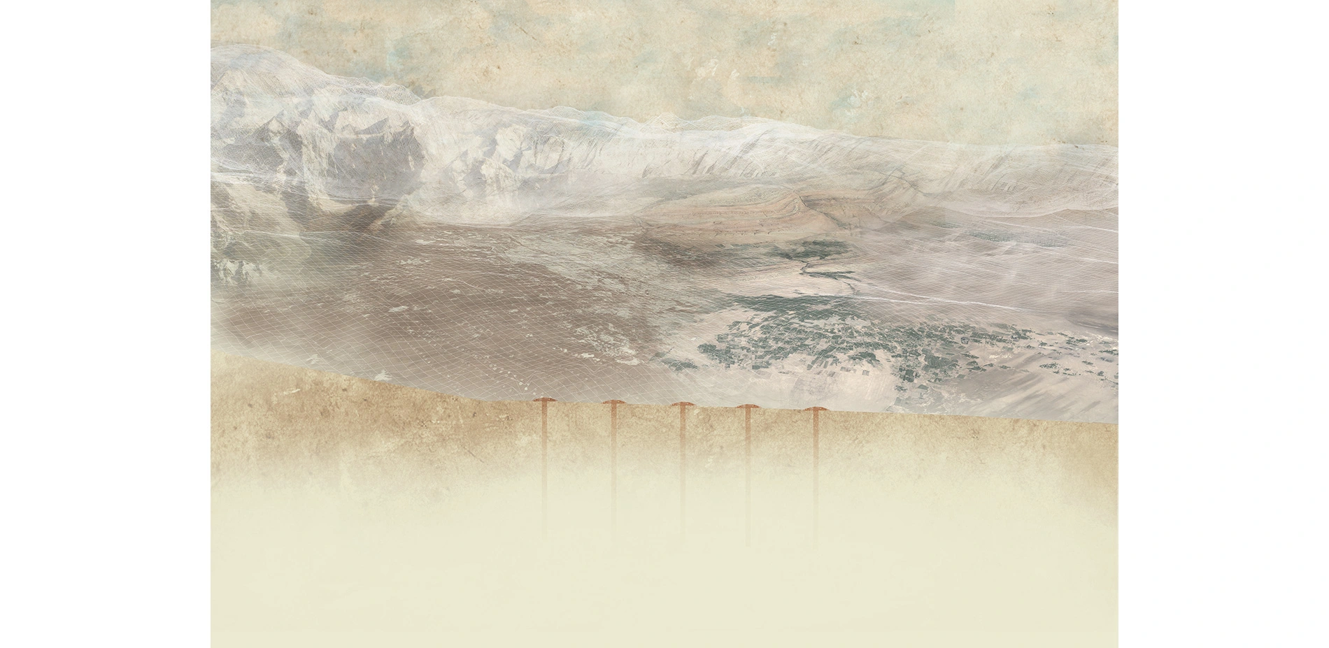
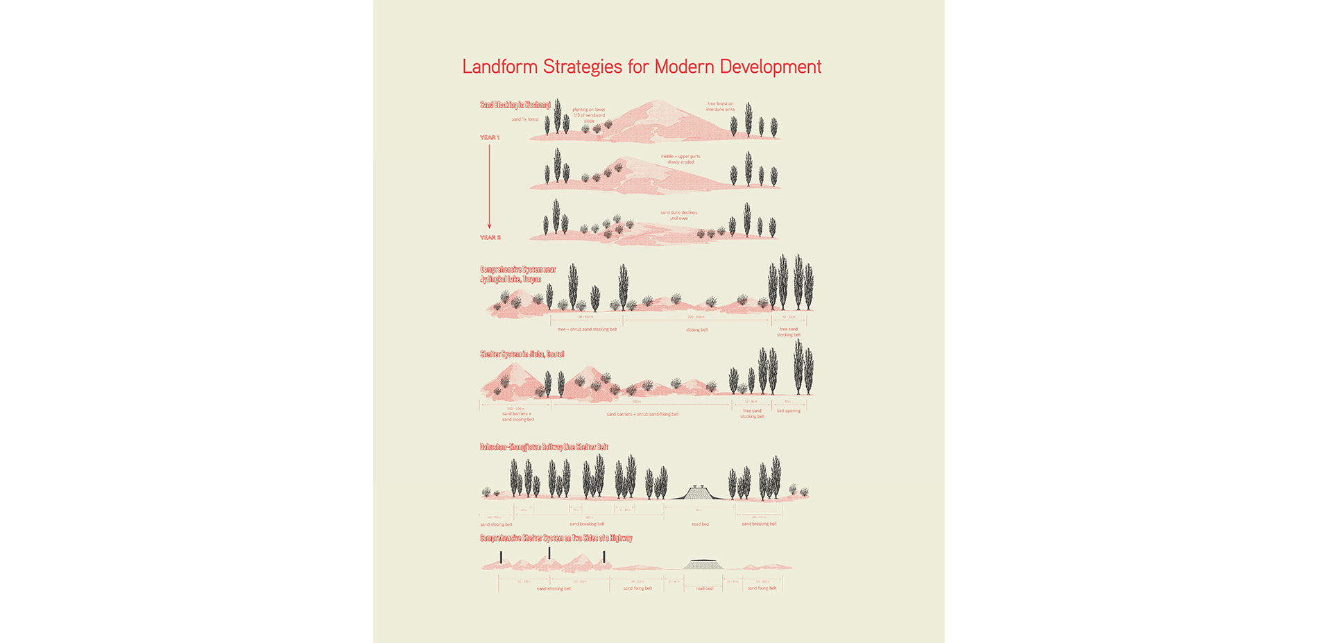
Cartographic data on heritage sites and regional characteristics of the study area were utilized to investigate factors causing ecological degradation. The use of GIS mapping and hydrological analysis aided in the formation of a design proposal to improve ecological conditions and mitigate agricultural impacts on heritage sites. An analysis of how communities and landscapes were spatially composed based on the distribution of karez water from other areas of the world also assisted with devising spatial design strategies based on researched landform patterns.
Exploring opportunities for climate change adaptation to assist with the conservation of heritage was made possible through investigating UNESCO's case studies on Climate Change and World Heritage. UNESCO's existing framework for the protection of heritage and the development of its Strategy for Action on Climate Change for managing heritage were beneficial sources to reflect upon.
Research Outcomes
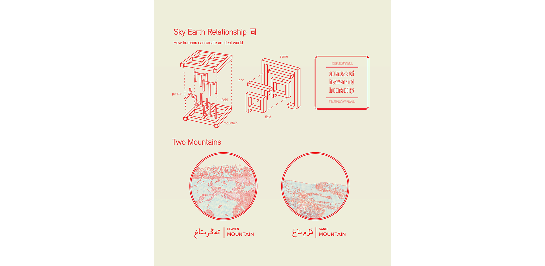
With the negotiation of heritage comes a dualism in the significance of heritage, whereby a dichotomy between meanings, revelations, and relationships exist between those directly engaged in ritualistic practices of culture and those who observe as consumers of culture. Cultural heritage designations may create definitive understandings of people, place and associated rituals. Duplicity within the concept of landscape as visual ideology within the realm of cultural geography positions landscape as serving symbolic functions, yet is considered duplicitous as an operative way of seeing. Landscape is mentioned to conceal truth to the material conditions that forge visions of unity with nature, existing as representations, resonating with the way in which cultural narratives about landscape-based heritage are also composed within the study area. Building on this notion, investigations into how nature is defined and understood within a local context has been an integral step in understanding the construction of heritage based ideologies and assessing which landscape based rituals should be carried over into design based strategies.
The aforementioned concept of landscape within cultural geography is of particular relevancy to the designation of landscape based cultural practices in question, such as sand therapy as intangible heritage, understood as a part of traditional medicinal knowledge yet also existing in parallel as a spirituality based ritual. Recognizing that complex relationships exist between socio-cultural processes and the ontology of heritage objects, the distinctions between what is human and non-human is regarded as less distinct than what they are made to appear within heritage law. Anthropologists such as Armstrong-Fumero suggests the creation of a subset of tangible heritage objects subject to human actions, enabling claims to contiguity of existing relationships. However, within contemporary China, humanistic notions of landscape prevail, in which people are also considered components of landscape within nature. Creating standardized definitions of heritage continues to be a challenge, whereby an approach focusing on local understandings of what landscape is composed of and how nature is defined can yield indications as to what are essential components to cultural based landscape rituals for embracing within spatial design strategies.
Advertisement
Related Awards
Honor Award, Research
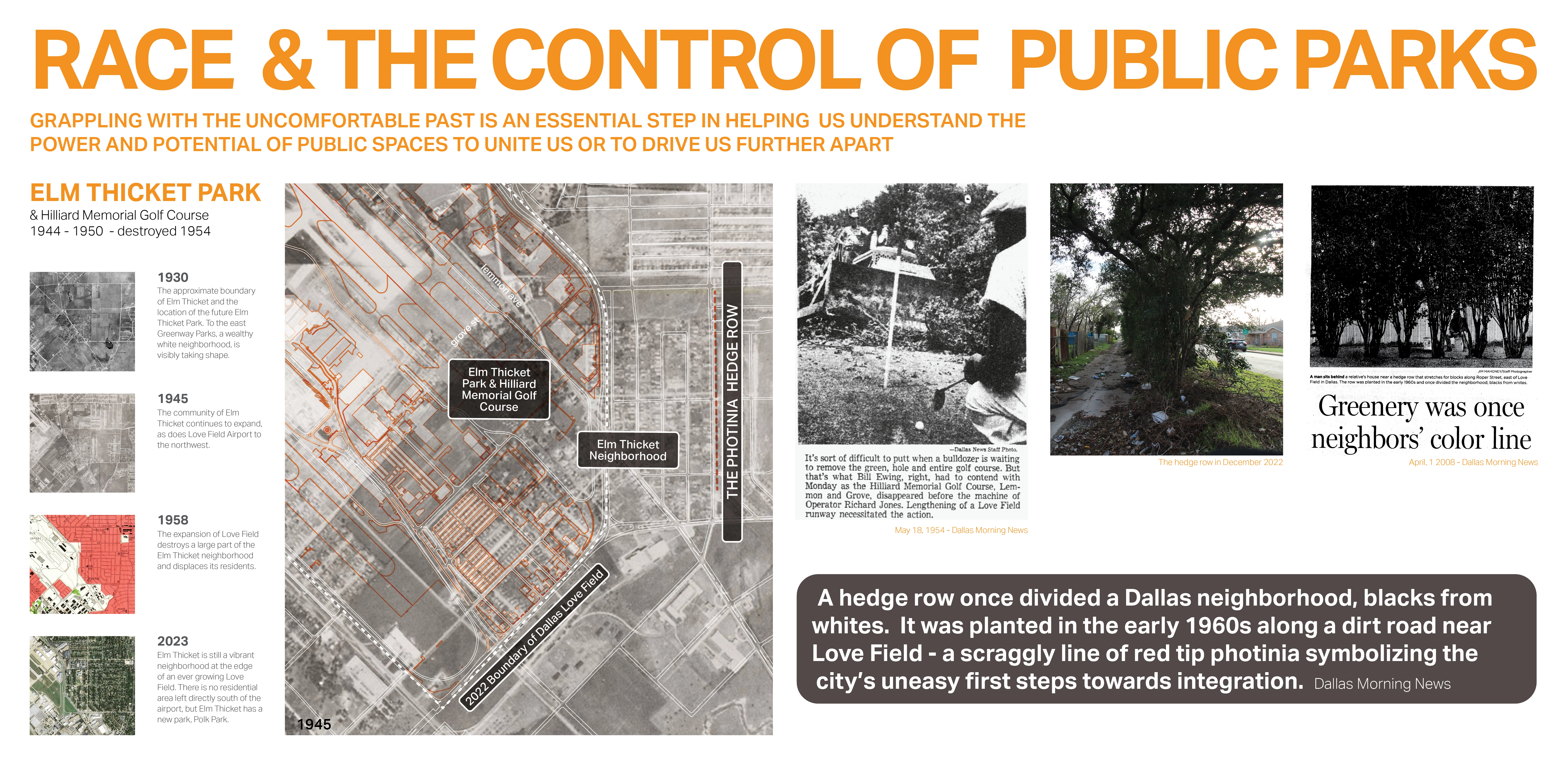
Race and the Control of Public Parks
This research uses a century long historical analysis of the public park system in Dallas, Texas, USA to uncover the physical and psychological ways in which public landscapes and the works of landscape architects have segregated urban spaces and how we might fight against these design practices. Through reframing past practice this work seeks to create a method for informing design thought and practices that seek to create a more just built environment.