.webp?language=en-US)


Confronting an issue of enormous scale with equally enormous stakes, the designers created a series of interactive tools to help raise public understanding about the myriad issues and risks inherent in the 1,110-mile Dakota Access Pipeline project. Using interactive online maps, exhibitions, videos, and social media, the creators applied a landscape architecture perspective to identifying threats to people, wildlife, and landscapes, and to offering alternatives to a potentially catastrophic enterprise. Authoritative and persuasive, this invaluable tool demonstrates the power of visualization to raise public awareness and validates the role of landscape architects in bringing clarity and constructive engagement to complex environmental and cultural issues.
Awards Jury
-
A series of interactive maps on the Dakota Access Pipeline route that illustrate the effects it will have on adjacent communities and beyond, as well as outlining opportunities for alternatives to fossil fuels along the DAPL route including wind and solar. Our strategy was to combine landscape architecture strategies with visual representation and community outreach practices to increase awareness on the critical issues associated with the environment, land use and human rights.
-
Starting with a belief that there is a social responsibility in terms of decision making concerning the use, allocation and preservation of resources, our goal was to combine landscape architecture with visual representation and community outreach practices to increase awareness on issues associated with the environment, land use and human rights. The intent was to understand the social and environmental ramifications of the proposed Dakota Access Pipeline in order to educate the public about a critical issue of our time, and its far reaching consequences. In this challenging time, effective and innovative landscape architecture should harness our unique ability to communicate complex issues championing community-driven design and ecological planning to progress positive change.
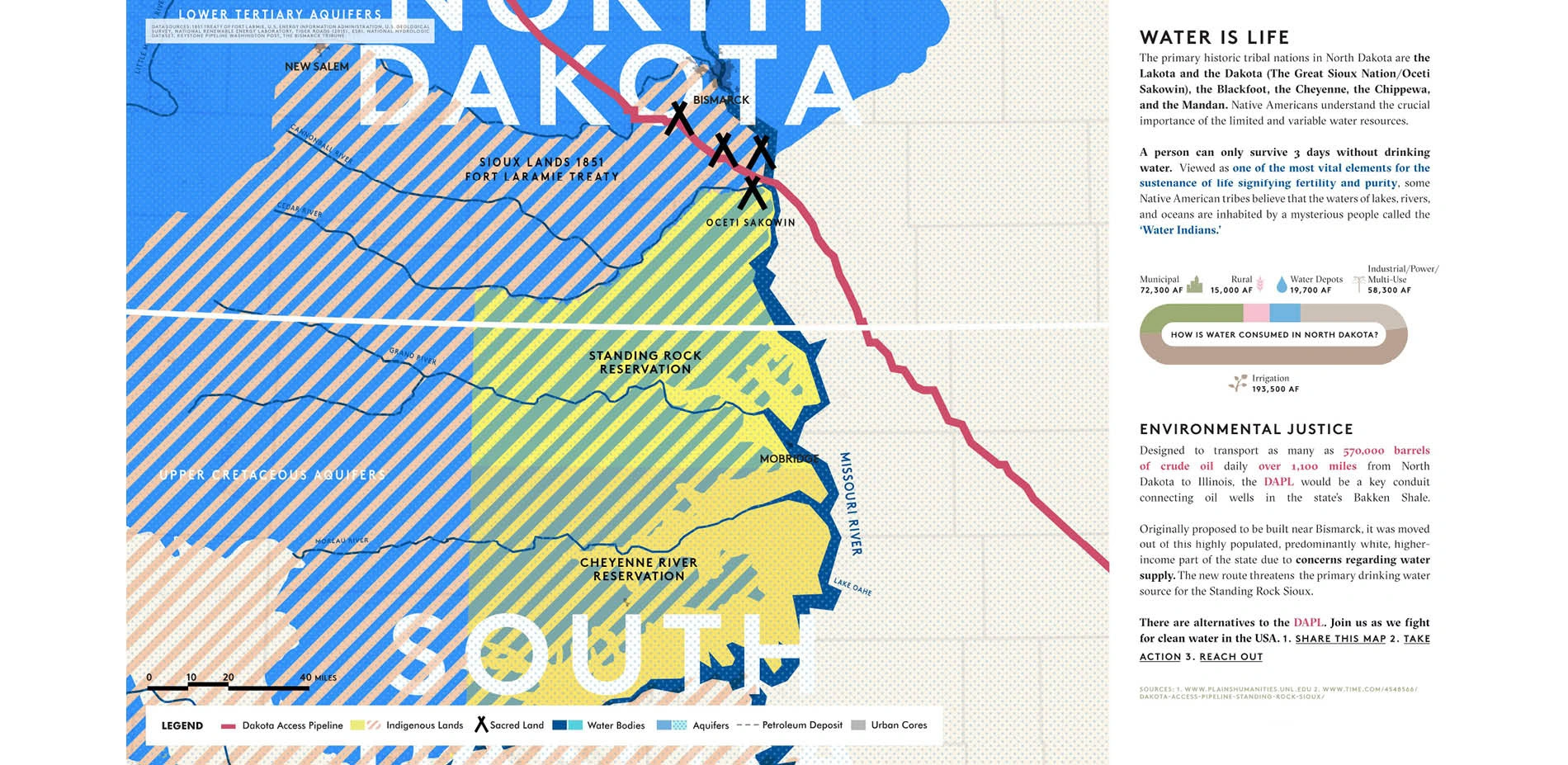
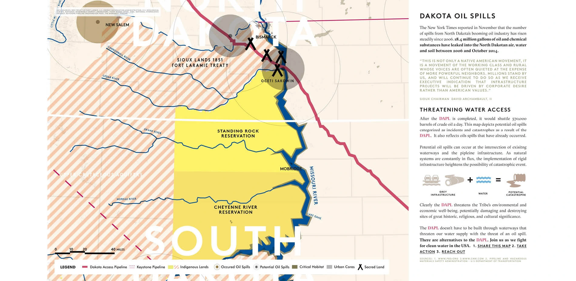
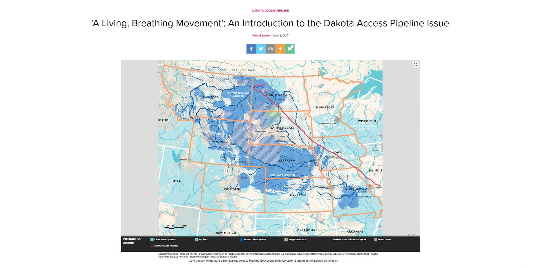
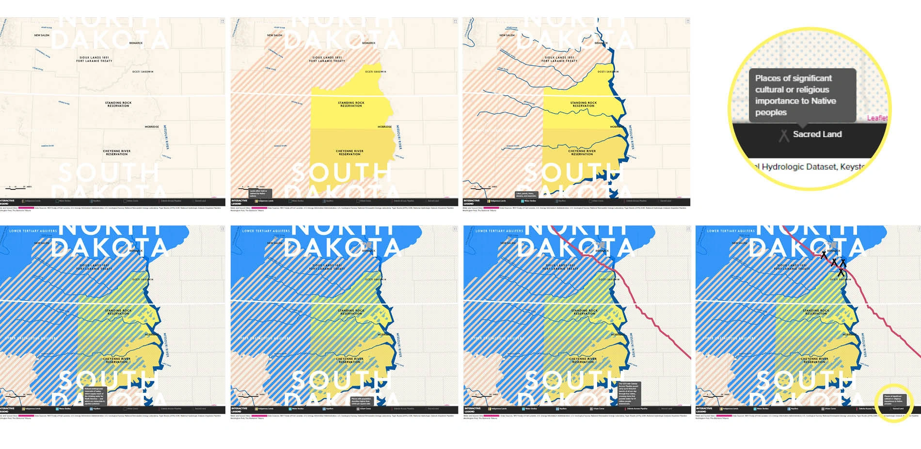
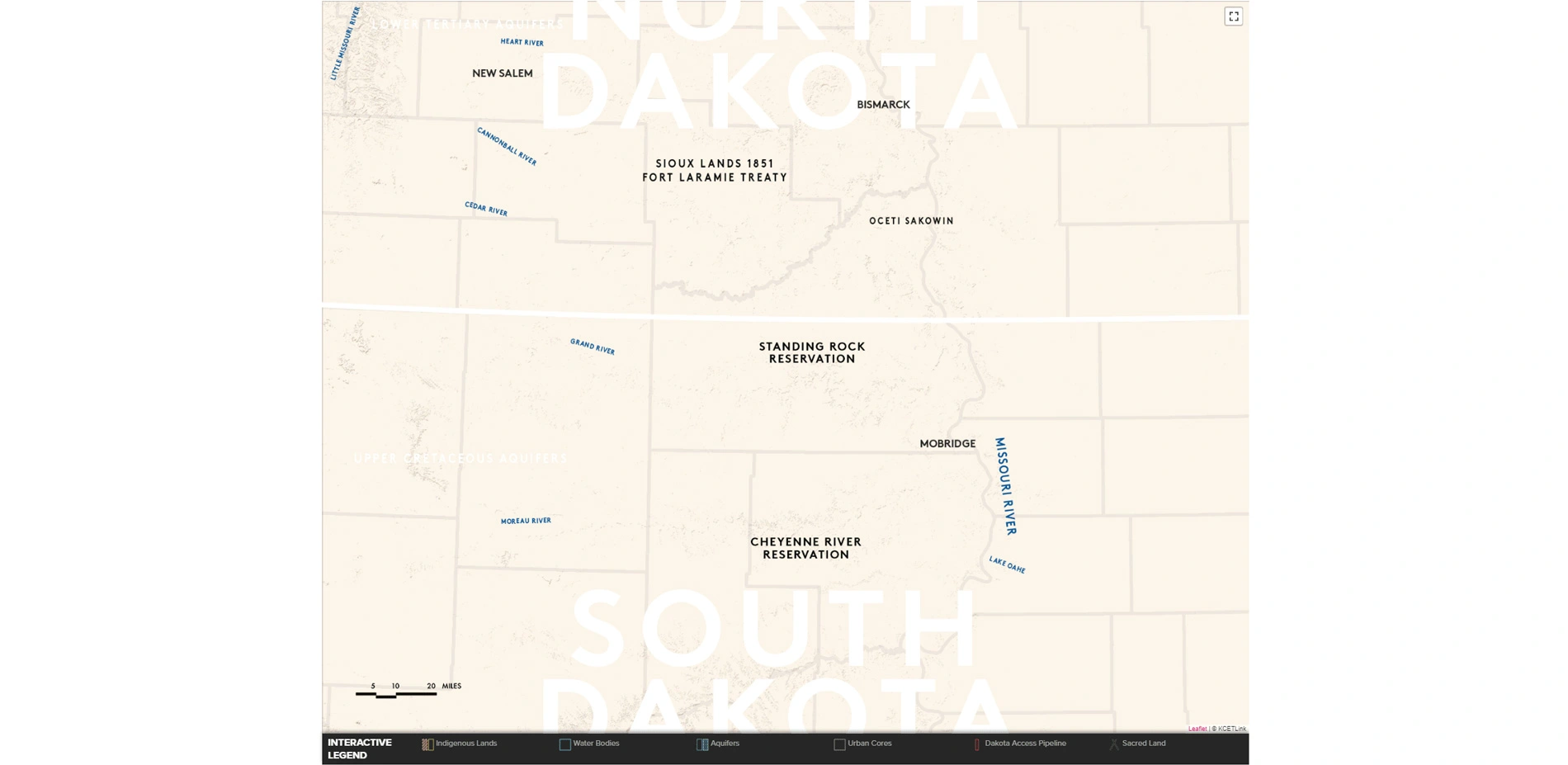
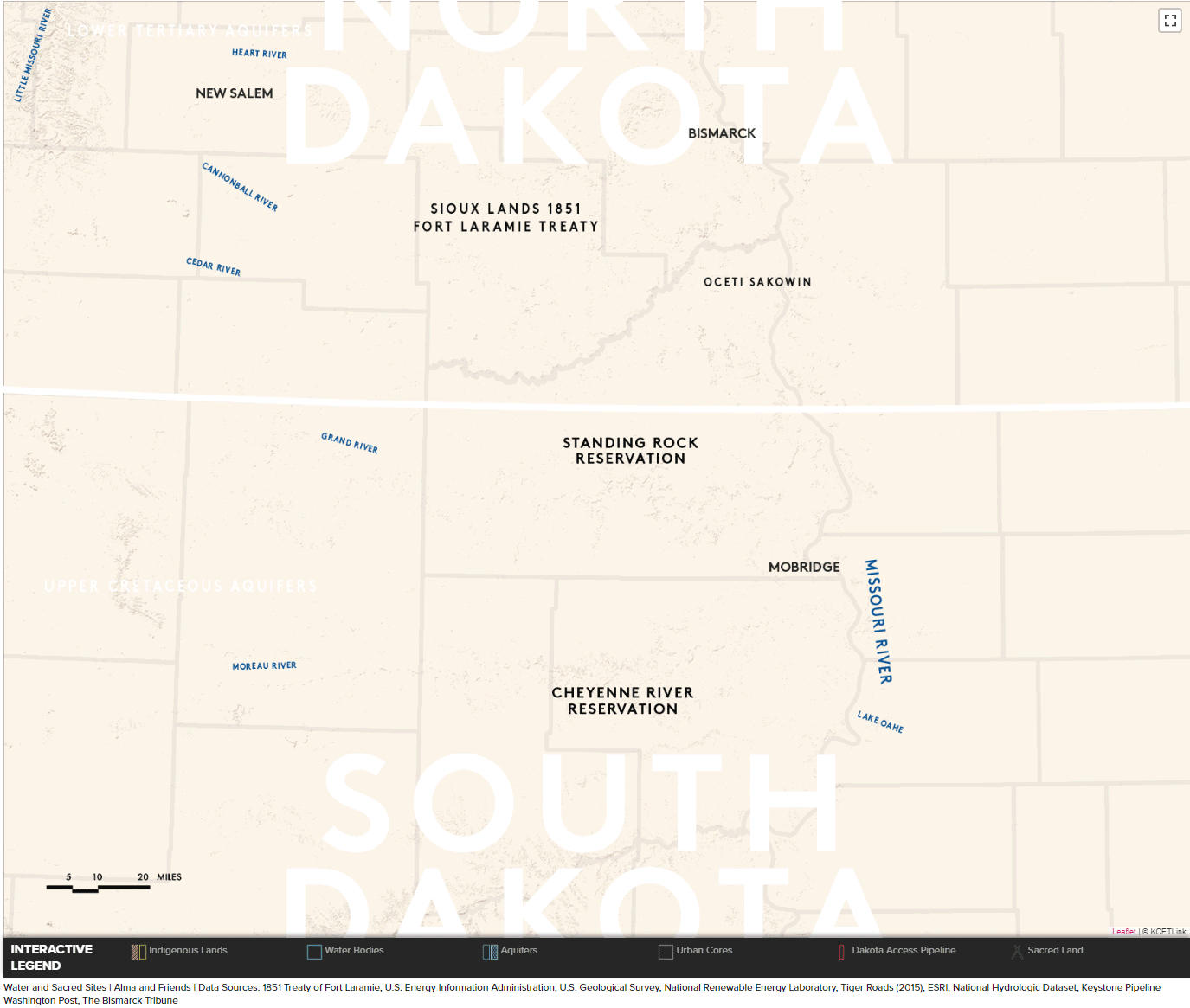
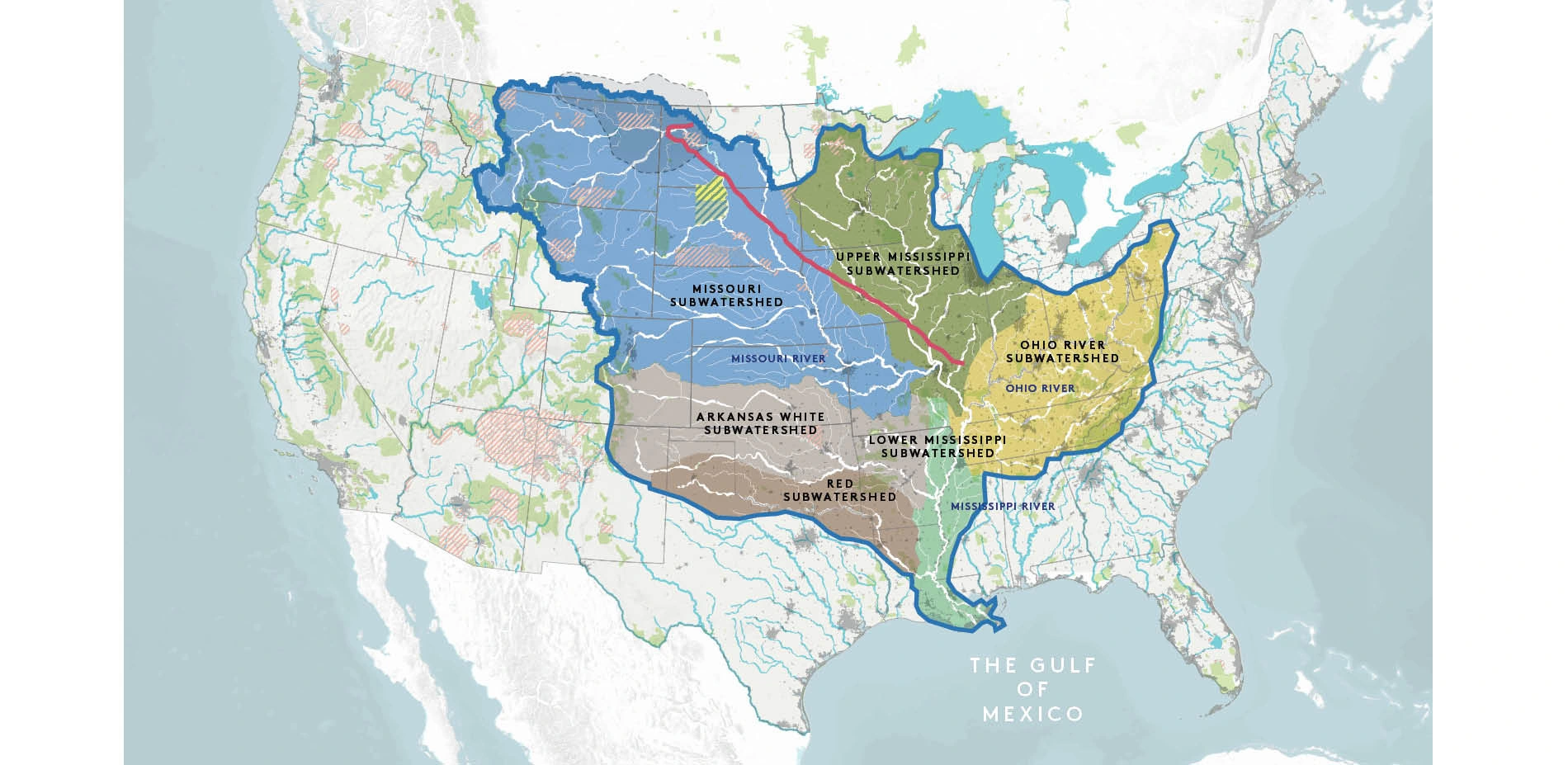
Construction of the $3.8 billion Dakota Access Pipeline (DAPL) began in July 2014. Originating in the Bakken oil fields in northwestern North Dakota, the proposed 1,172-mile long pipeline is poised to transport 450,000 barrels of Bakken crude oil per day to Patoka, Illinois, before being shipped to refineries on the Gulf Coast. The pipeline will cross Lake Oahe, Lake Sakakewea and the Missouri River, among many other streams and rivers. This route directly crosses the Standing Rock Reservation's main water source, and passes through — and has thus destroyed — Native burial grounds and sacred sites.
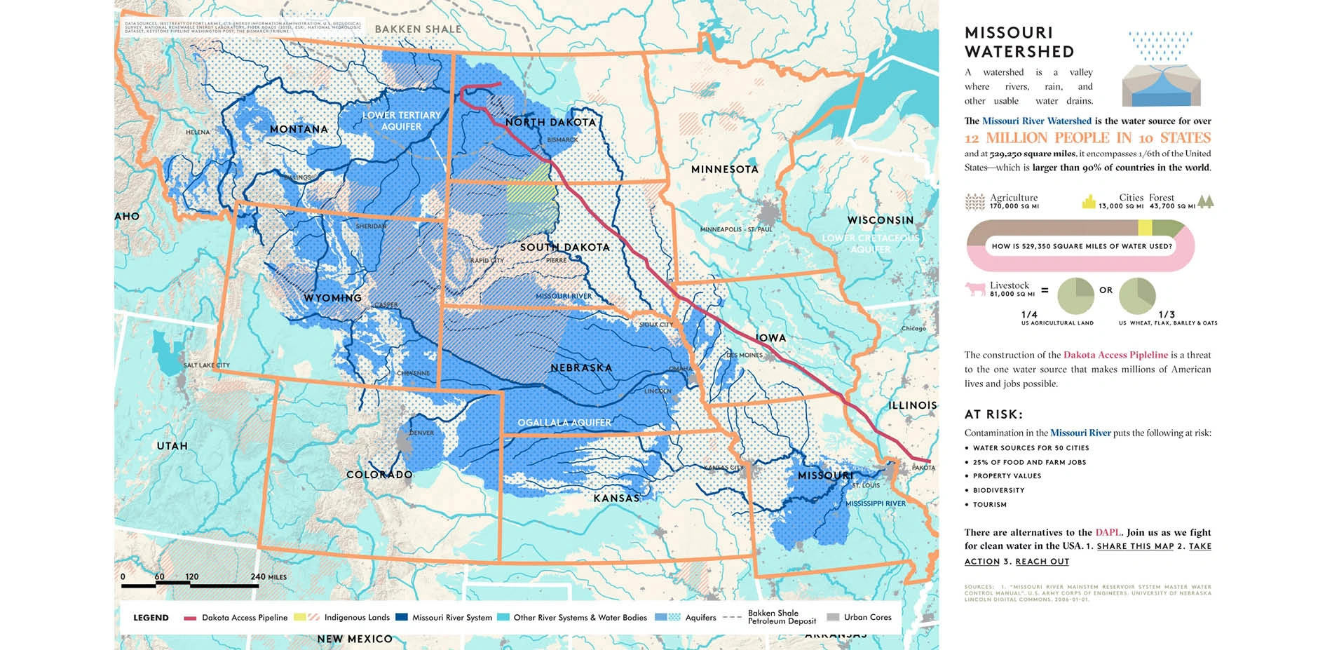
In addition to the desecration of an indigenous nation's sacred and historical sites, the pipeline continues to pose a very real threat to the water supply of the Sioux as well as polluting the Missouri River, a main artery of the Mississippi River which could affect as many as 12 million people. There is a high likelihood of the pipeline leaking because of its potential interaction with existing infrastructure. If the pipeline were to ever leak or break and pollute local waterways, the Army Corps would be in breach of the Clean Water Act. This research and analysis is the beginning of an effort to educate about the potential catastrophic consequences of the Dakota Access Pipeline construction and provoke ideas for alternative sustainable energy solutions.
Exhibits to better educate the public about current, complex and catalytic issues
Data analysis, mapping techniques, and design thinking were combined to create exhibits that included a 10-page press kit that was completed in 2016. This spurred a collaborative website featuring interactive maps and associated stories and videos in 2017, as well as a Facebook page and Instagram account.
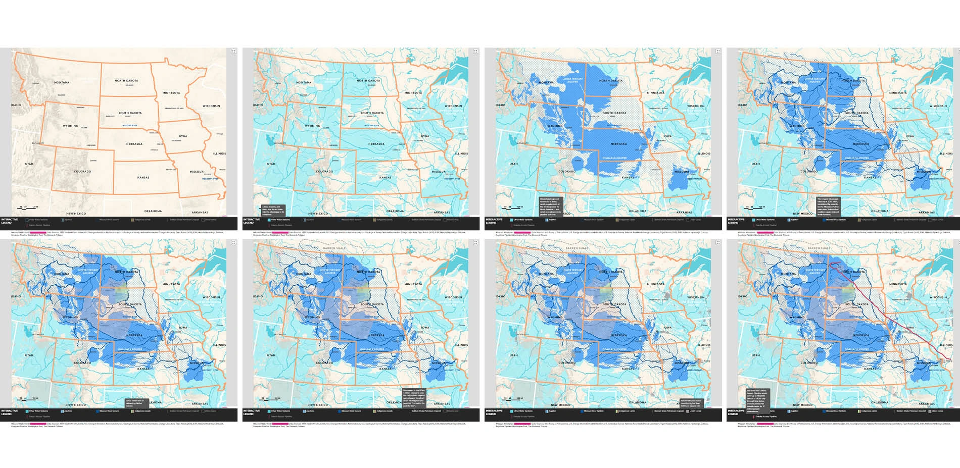
The series of print and interactive maps were created to illustrate the Dakota Access Pipeline route and the potential effects it could have on adjacent communities and beyond, as well as outlining opportunities for alternatives to fossil fuels along the DAPL route including wind and solar. The locations and scale of these maps included: Standing Rock Reservation spanning North and South Dakota, the length of the Missouri River and the Mississippi Watershed.
While the focus was on Standing Rock, the scope included the length of the Missouri River Watershed (529,250 square miles) and the Mississippi Watershed (1.2 million square miles) to illustrate the upwards of 12 million people that could be negatively affected by this pipeline.
The team investigated context and site-appropriate information in the creation of seven maps including the following:
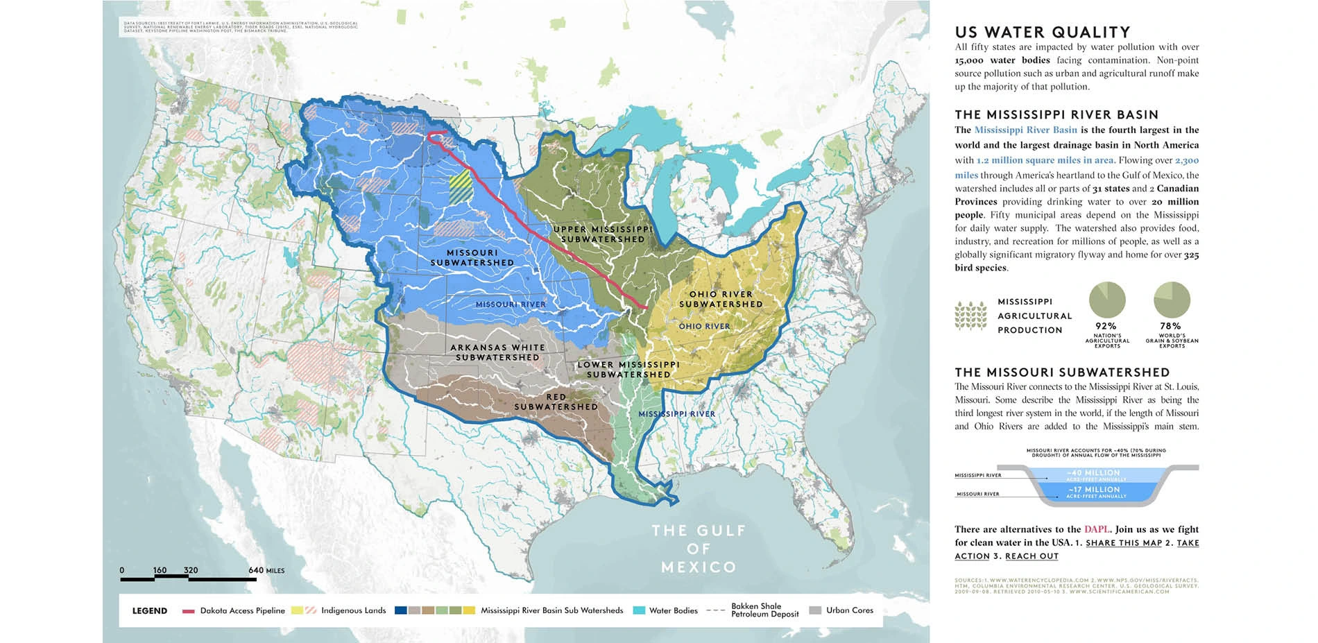
1) US WATER QUALITY:
The Mississippi River Basin is the fourth largest in the world flowing through America's heartland to the Gulf of Mexico. Critically important to 31 states and 2 Canadian Provinces it provides drinking water for over 20 million people and is a globally significant migratory flyway and home to over 325 bird species.
2) MISSOURI WATERSHED:
As a water source for over 12 million people in 10 states the Missouri Watershed is larger than 90% of the countries in the world. If disturbed 25% of farm jobs would be lost, property values would decrease, biodiversity in the region would diminish and the water source for 50 cities could potentially be contaminated.
3) WATER IS LIFE:
Water is viewed as one of the most vital elements for the sustenance of life. Previously proposed to be built near Bismarck the DAPL was re-routed because of concerns regarding water supply yet no apparent environmental assessments were completed for the new location proposed within the Sioux territory.
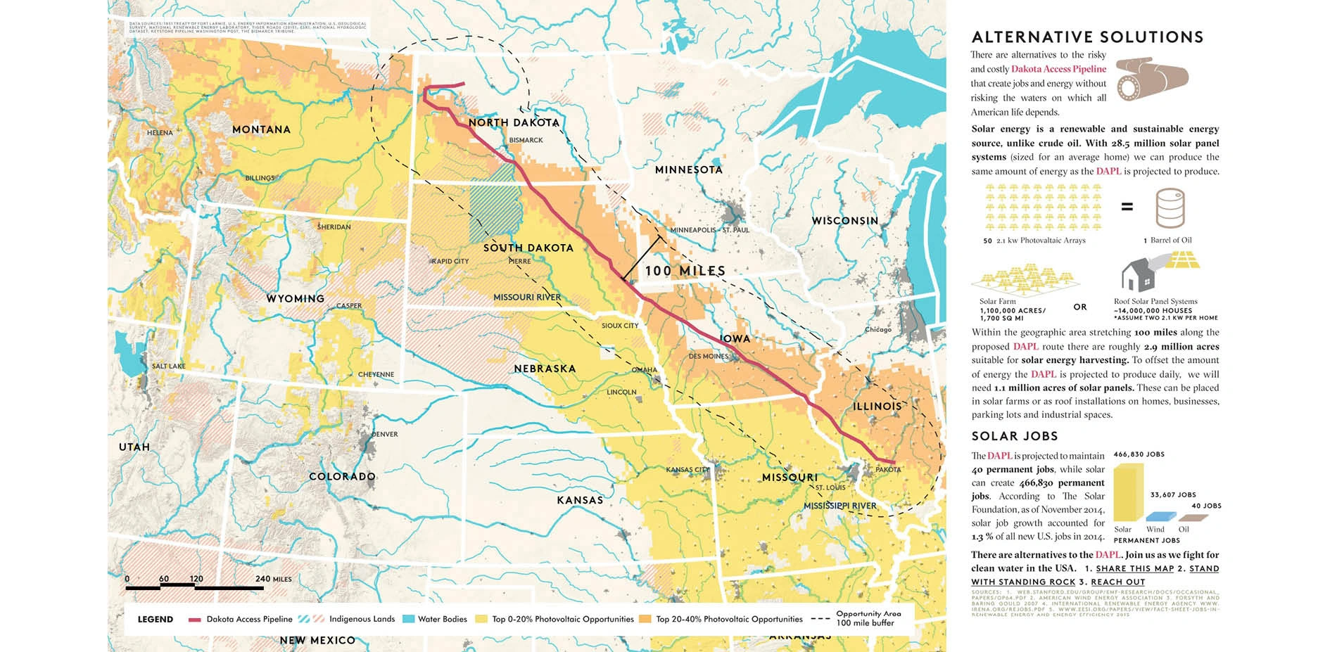
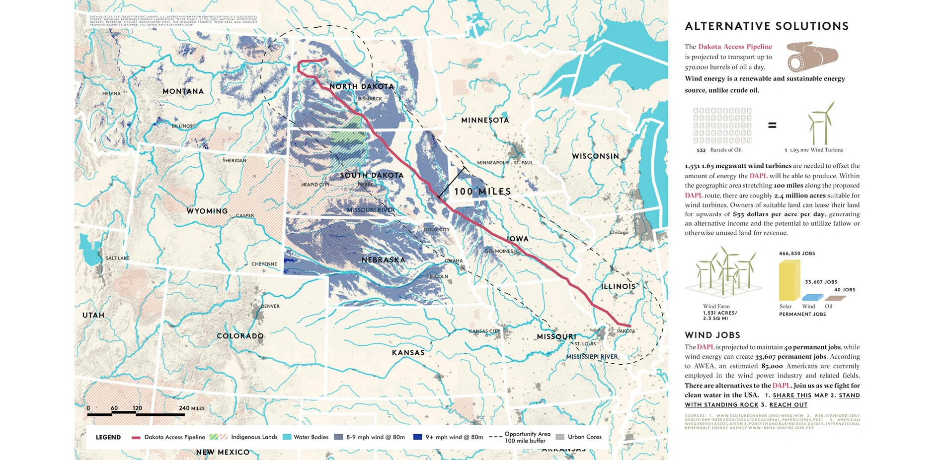
4) SOLAR ALTERNATIVE SOLUTIONS:
There are alternatives to the DAPL that create jobs and energy without risking the water supply of the Standing Rock Sioux. The DAPL is projected to maintain 40 permanent jobs while the 1.1 million acres of solar needed to offset the daily projections for the route could potentially create 466,830 permanent jobs.
5) WIND ALTERNATIVE SOLUTIONS:
Only 1,531 1.65-megawatt wind turbines are needed to offset the amount of energy the DAPL will produce. Owners of suitable land, roughly 2.4 million acres, could potentially lease their land for upwards of $55 per acre per day. Wind energy will also create nearly 33,607 permanent jobs 840 times the amount created by the DAPL.
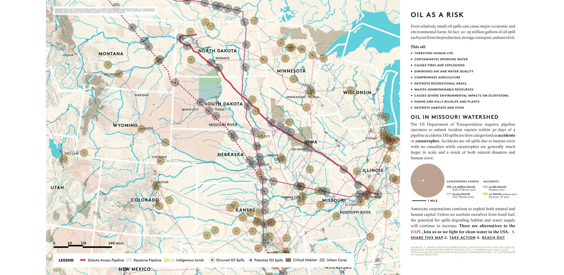
6) OIL AS A RISK:
Oil spills regardless of size can cause major economic and environmental harm. Potential spills can occur at the intersection of existing waterways and the pipeline infrastructure. As natural systems are constantly in flux, the implementation of rigid infrastructure heightens the possibility of catastrophic events.
7) DAKOTA OIL SPILLS:
According to a New York Times report 18.4 million gallons of oil and chemical substances have leaked into the North Dakotan air, water and soil between 2006 and 2014. The DAPL threatens the health of the Missouri Watershed and the health of the existing population if built in the proposed location.
-
Advertisement
Related Awards
Honor Award, Communications
The Community First Toolkit: A Framework for Equitable Public Spaces
Communities across North America have faced uneven development for decades. The Community First Toolkit (CFT) provides a visionary, adaptable framework for public realm advocates to directly tackle infrastructural racism and embed equity at all stages of the design process.