
.webp?language=en-US)


The Cleveland Flats Connections Plan: Connecting a Missing Link
The extremely thorough and coherent Flats Connections Plan creates an open space and trail network in Cleveland that leverages the unique conditions of its historically industrial neighborhood to revitalize the riverfront and build connections to surrounding communities. The plan functions at a multiplicity of urban scales, and draws on underutilized and vacant sites to invigorate the riverfront, improve sustainability, and allow access to park space for previously isolated communities. The plan transforms slag heaps, rail infrastructure, and challenging topography into a dynamic public realm rooted in equity, connectivity, and resilience.
Awards Jury
-
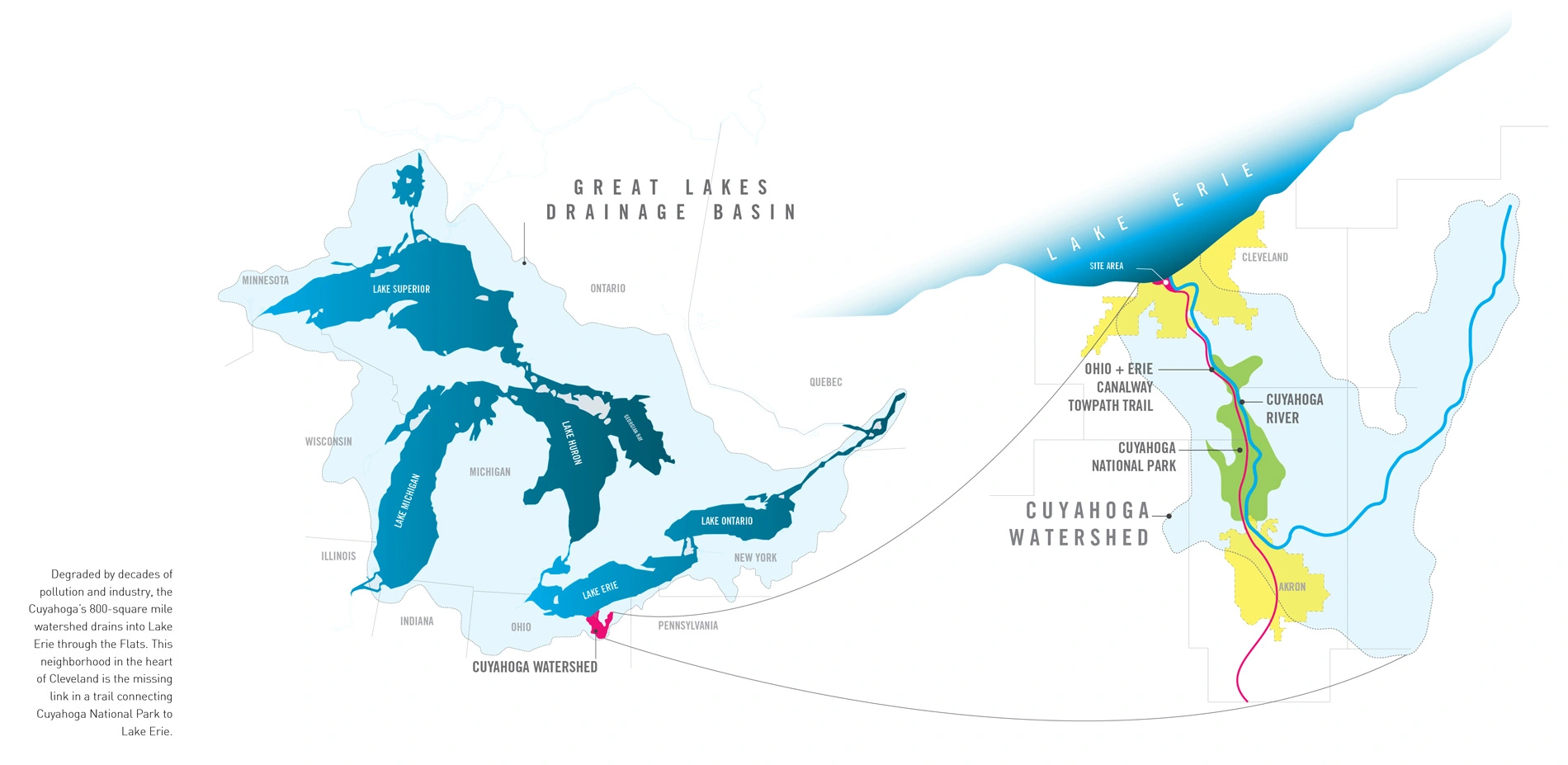
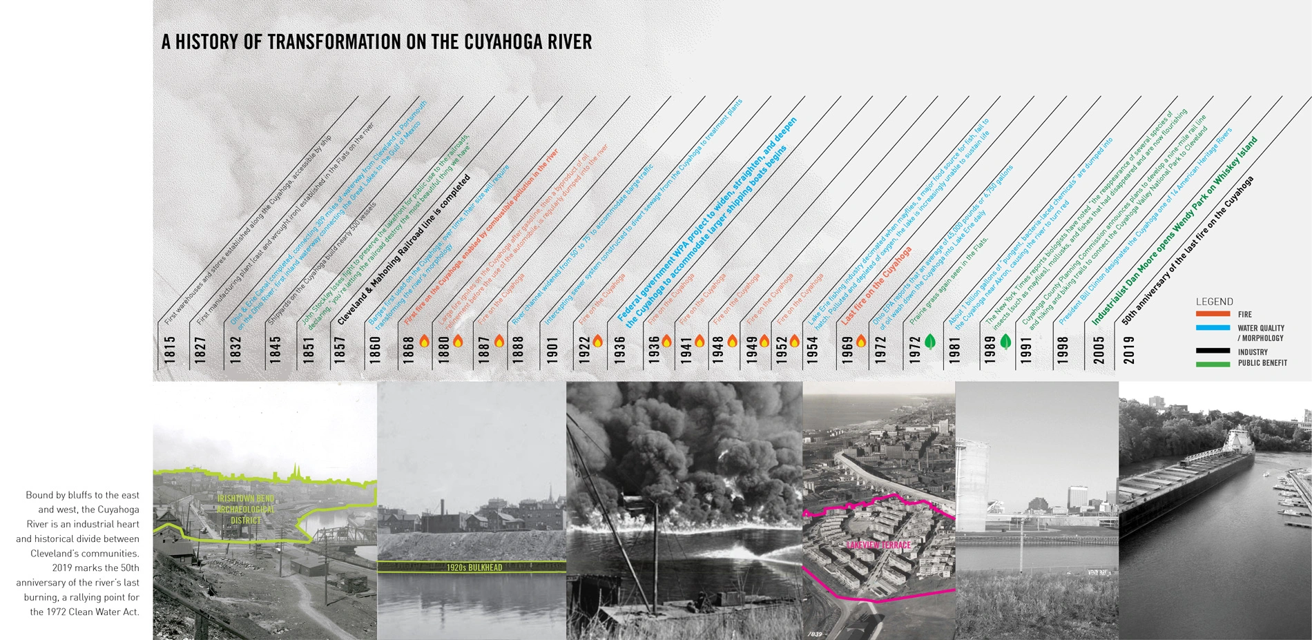
The Cuyahoga River, famous for combusting throughout its industrial history, drains into Lake Erie through the Flats, a low-lying neighborhood in the heart of Cleveland. Bound by bluffs to the east and west, the Cuyahoga has historically divided communities: industrial, rail, and highway infrastructure associated with the river's function as a regional shipping corridor has landlocked the Flats from its waterfronts, created barriers among communities, and for decades degraded their waterways by pollution and industrial use.
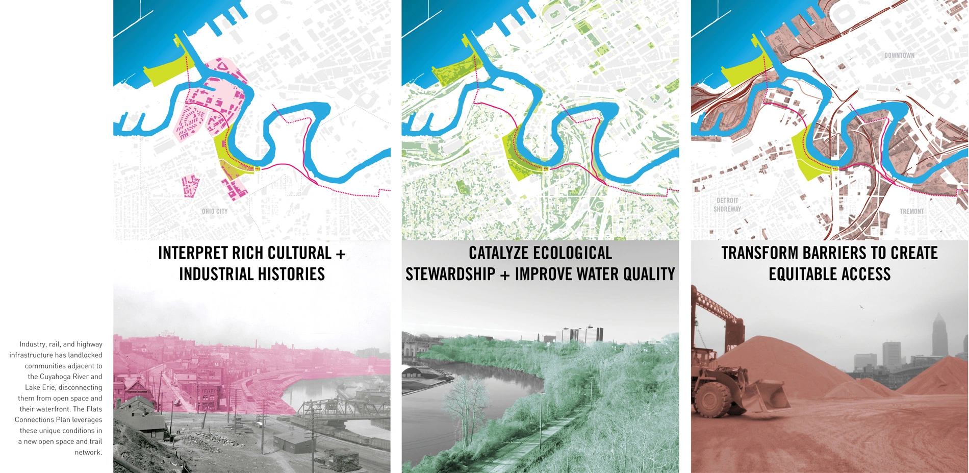
The Flats Connections Plan is an open space and trail network that leverages the unique conditions of the neighborhood to revitalize the riverfront and connect it to surrounding communities and to the region. Part of a rich industrial history, the Plan also looks to the present and future, working with neighbors, local organizations, and city officials to incorporate their values and concerns into a vision for the future of the Flats. The Flats Connections Plan interprets the rich cultural and industrial histories of the neighborhood's diverse communities, catalyzes ecological stewardship, improves water quality, and transforms barriers for equitable access.
-
Introduction
The Cuyahoga River, famous for combusting throughout its industrial history, has an 800-square mile watershed that drains into Lake Erie and the Great Lakes Drainage Basin through the Flats, a low-lying neighborhood in the heart of Cleveland. Two centuries of industrial activity manipulated the morphology of the river, fixing a once-dynamic oxbow river into an armored shipping channel. Bound by bluffs to the east and west, the Cuyahoga has historically divided communities; industrial, rail, and highway infrastructure associated with the river's role as a regional shipping corridor has disconnected the Flats from its waterfront, created barriers among communities, and for decades degraded their waterways by pollution and industrial use. In 1969, the tenth and final fire on the ecologically decimated Cuyahoga River was a rallying point for passing the 1972 Clean Water Act.
Throughout the 1960s-70s, the Cuyahoga Metropolitan Housing Authority (CMHA) expanded their affordable housing offerings within the Flats neighborhood. Although these towers offered views of the downtown skyline and Lake Erie, they were also contiguous with polluting industrial facilities along the river and landlocked by adjacent infrastructure. As industry vacated the Flats in the latter part of the 20th Century, a wild, largely uninhabited landscape emerged, both along the river on vacant industrial sites and within the neighborhood's abandoned railroad right-of-ways. Simultaneously, the City of Cleveland committed to improving the water quality of the river and providing recreational access via regional trail connections on the Ohio & Erie Canal Towpath Trail that could, when completed, connect Cuyahoga Valley National Park to Lake Erie – if not for the missing link within the Flats neighborhood.
A consortium of diverse local stakeholders retained the design team to investigate potential open space and trail connections to bridge this gap in access, with the goal of uniting the Flats with its waterfront and linking the region to Lake Erie along the Cuyahoga and through the heart of Cleveland. The Cleveland Flats Connections Plan is an open space and trail network that leverages the unique history of the Flats neighborhood to revitalize the riverfront and connect to surrounding communities and to the region. Part of a rich history, the Plan also looks to the present and future, working with neighbors, local organizations, and city officials to incorporate their values and concerns into a vision for the Flats. The Flats Connections Plan interprets the rich cultural and industrial histories of the neighborhood's diverse communities, catalyzes ecological stewardship, improves water quality, and transforms barriers for equitable access.
Plan Components
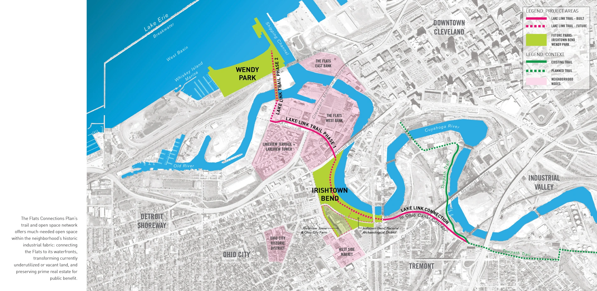
The Flats Connections Plan provides much-needed open space within the Flats neighborhood, transforming underutilized and vacant sites and preserving land along the river that would be prime real estate for public benefit. The Plan includes analysis, engagement, and conceptual designs for three major components: the Lake Link Trail, Irishtown Bend, and Wendy Park.
Interpreting rich cultural and industrial histories.
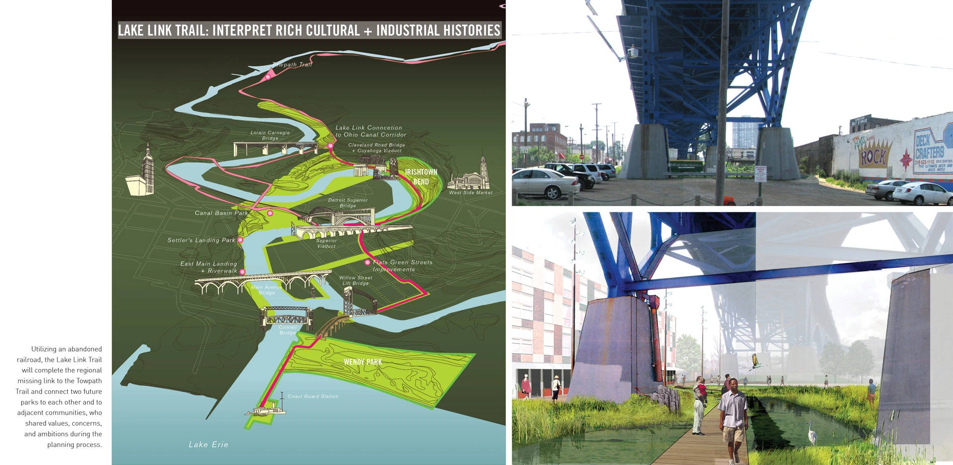
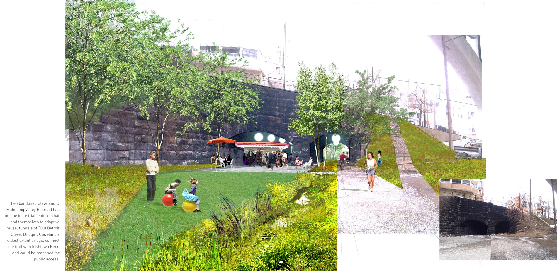
The Lake Link Trail utilizes the abandoned right-of-way of the City's first rail line. The design team identified the historic Cleveland & Mahoning Valley Rail as an opportunity to link Lake Erie to trail connections of the Ohio & Erie Towpath Trail, through the Flats. The railway's extant voids in the urban fabric, vacant and overtaken by ruderal vegetation, have a unique and sublime character. The railway links important historic resources throughout the Flats, including unique site features and industrial relics that can be adapted for new public uses. It directly connects the two key park opportunities identified in the Plan, Irishtown Bend and Wendy Park. The Lake Link Trail builds on the unique qualities of the historic railway with new neighborhood open space amenities, opening to the public the fantastic views, river access, and the surreal industrial riparian edge of the Cuyahoga.
Catalyzing ecological stewardship.
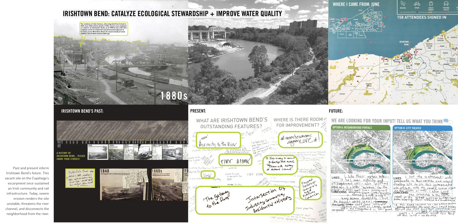
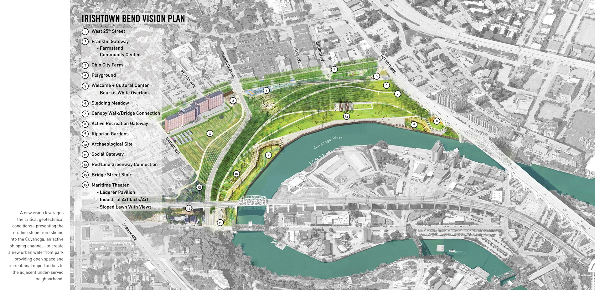
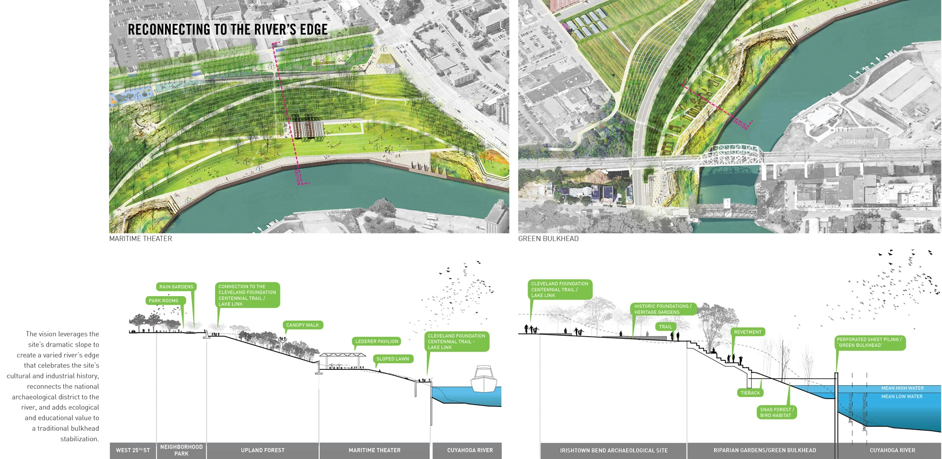
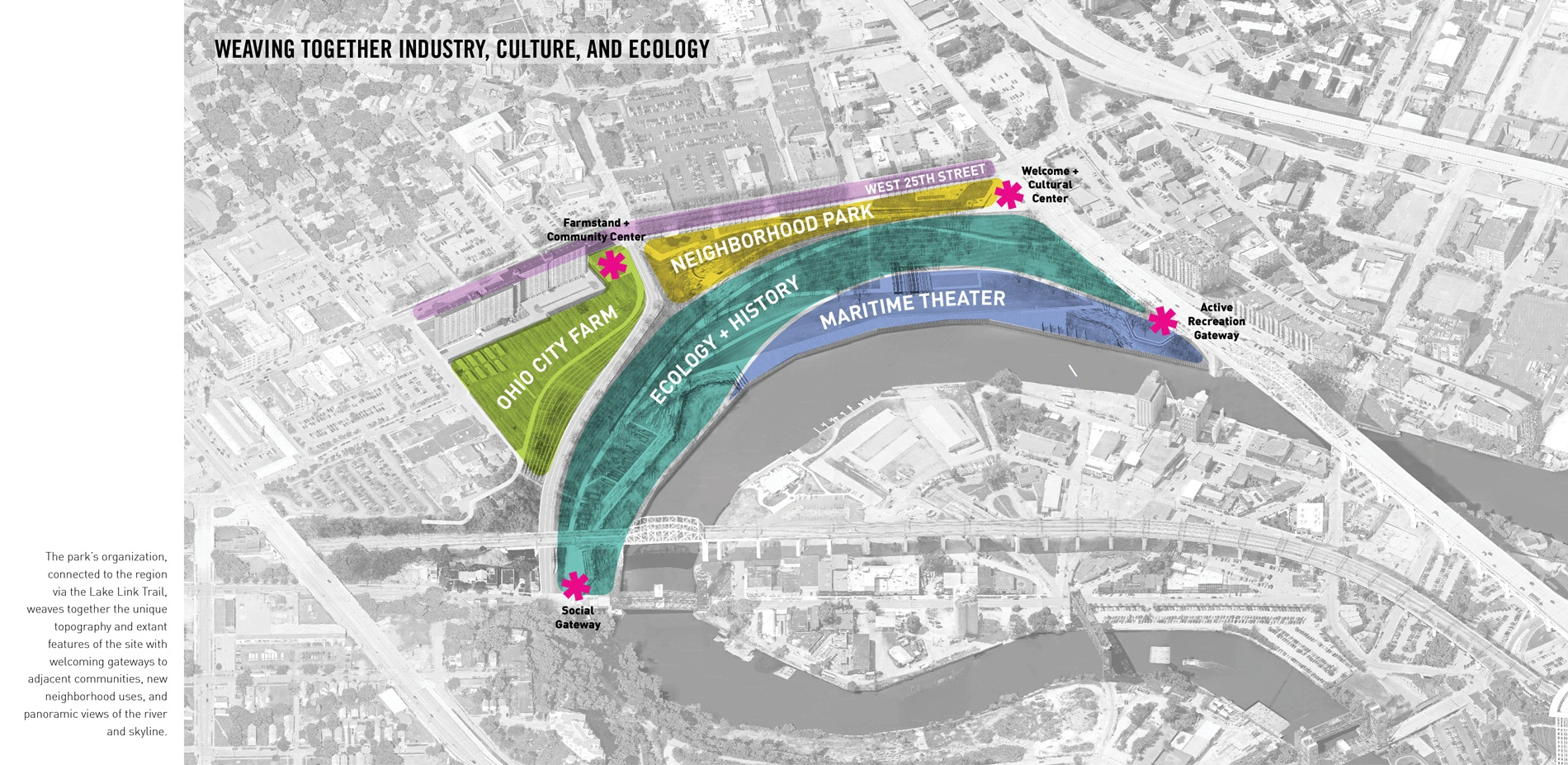
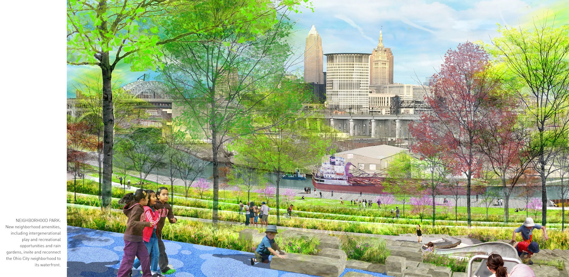
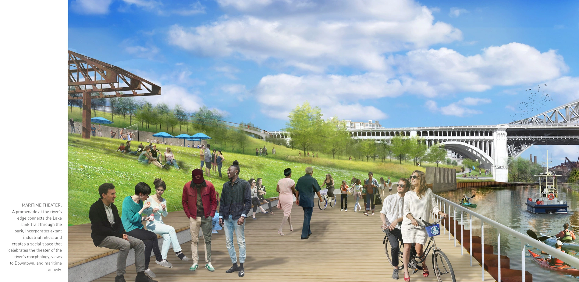
Irishtown Bend is a 34-acre vacant site on the steep banks of the Cuyahoga, rendered unstable by severe erosion that threatens the stability of the hillside and river channel. The Irishtown Bend Archaeological District, once a thriving neighborhood of Irish immigrants, is listed on the National Register of Historic Places. The site borders Riverview Tower, a 1960s senior housing community, and includes Ohio City Farm, an urban farm that provides affordable food to the neighborhood and employment opportunities for immigrants to Cleveland. Irishtown Bend also includes unique remnants of the river's industrial history. The vision for the park weaves together these current and historic uses in a new riverfront park that provides recreational and open space opportunities, connects the neighborhood to its waterfront, and celebrates the site's history and ecological potential. Together with Wendy Park, Irishtown Bend helps to improve water quality by treating site runoff and increasing habitat. A green bulkhead provides new fish spawning habitat along the shipping channel, supported by riparian gardens with focused public access that also create habitat for migratory birds and an opportunity for immersion in nature within the river's industrial landscape. Welcoming gateways to the site along the Lake Link Trail invite neighbors and regional visitors into the park to experience its panoramic views.
Transforming barriers for equitable access.
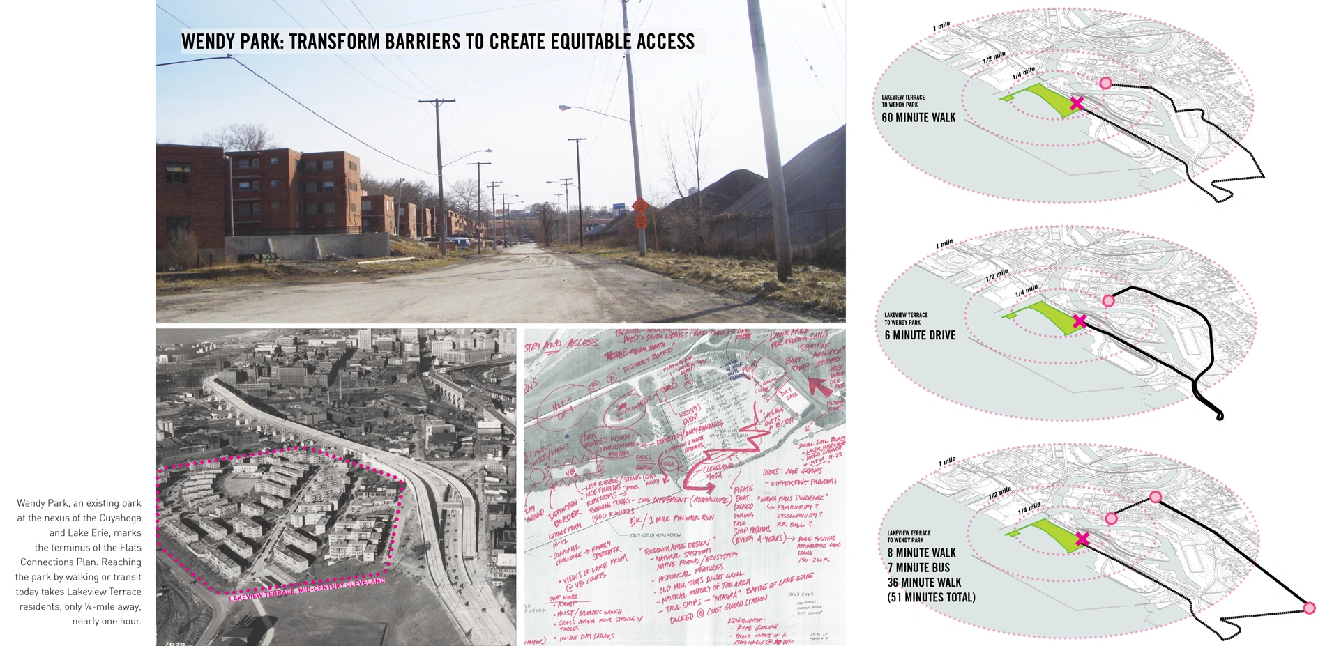
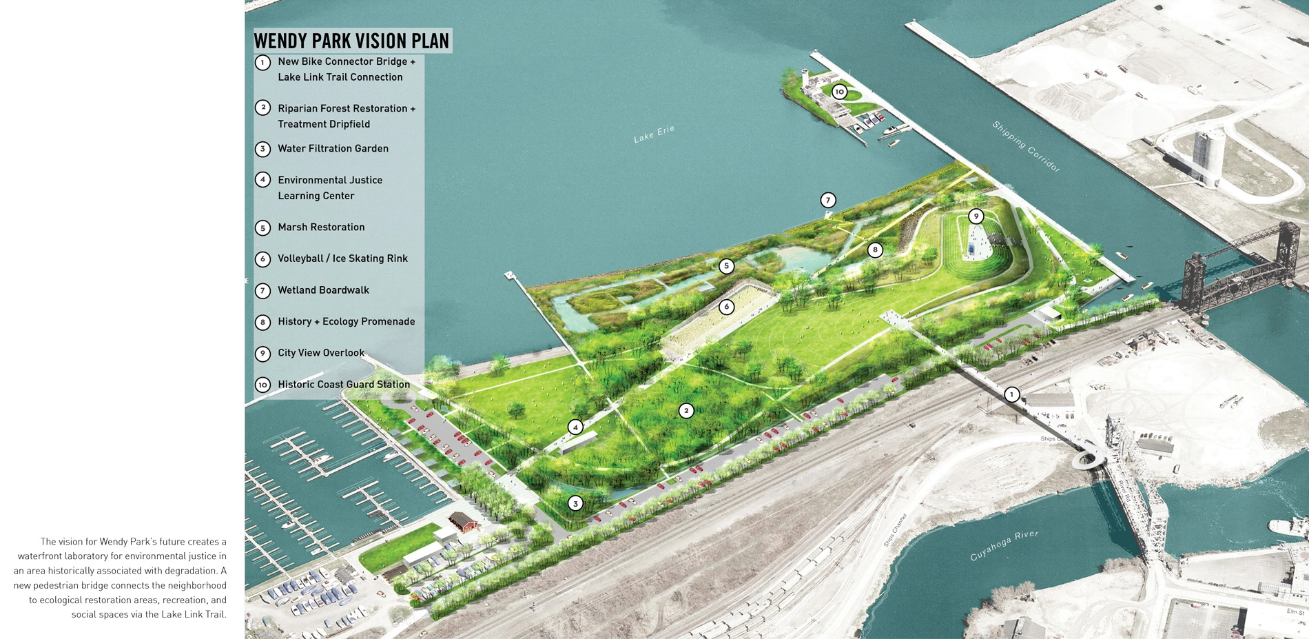
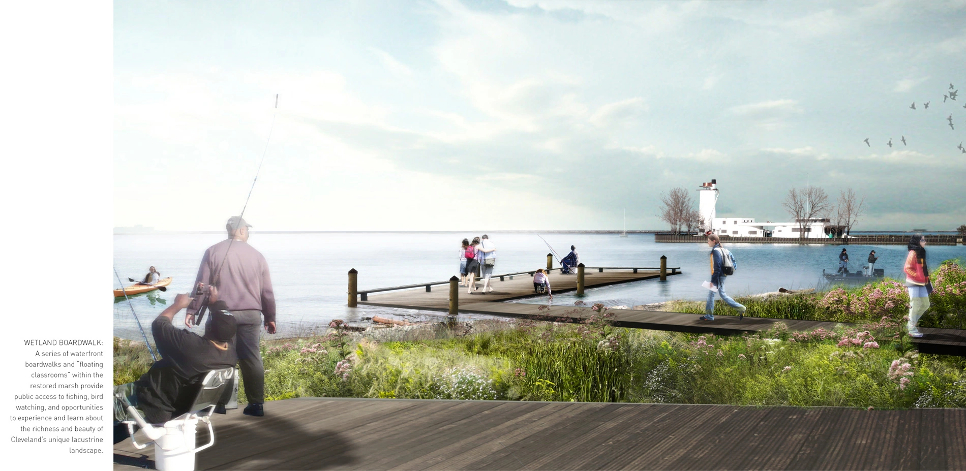
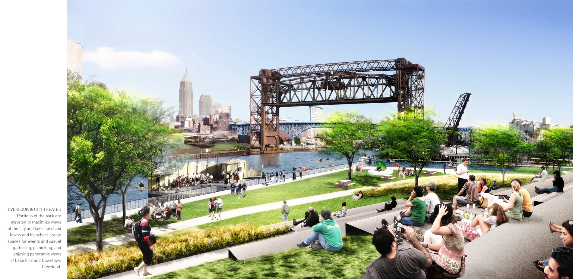
Wendy Park is an existing park that terminates the Flats Connections Plan at the nexus of the Cuyahoga and Lake Erie. Today, the park is disconnected from the Flats and does not acknowledge the unique ecological potential of its location. Wendy Park is located a quarter-mile from Lakeview Terrace, a 1930s federal public housing project, but is separated from this community by slag heaps and railroad infrastructure: to get to Wendy Park takes over an hour walking, and 50 minutes by transit today. The park's immediate vicinity is home to the highest concentrations of children under five and seniors in the Ohio City neighborhood. The vision for the park's future creates a laboratory for environmental justice in an area historically associated with degradation. An eight-minute walk on the Lake Link Trail across a new pedestrian bridge connects the neighborhood to new marsh restoration areas, a Learning Center, recreation opportunities, and new social spaces that celebrate the park's lacustrine landscape and downtown views. The vision includes a management plan.
The three site areas have each included an extensive public process, ranging from small stakeholder conversations to large public meetings, that was foundational to the development of the Flats Connections Plan. Engaging the diverse communities of the Flats to review and discuss site analysis, concept alternatives, and plans for the three site areas, the design team incorporated how people currently use and appreciate these sites, their concerns about safety and access, and their wishes for the future into the Plan. The process also provided opportunities to illuminate and record histories and stories about the neighborhood by soliciting input on local and regional history, industry, ecology, and culture. Equitable design requires creative partnerships, and this ten-year process has brought together many stakeholders – engaged citizens, local non-profits, private business, design firms, public agencies, and federal funding initiatives.
Lessons and Next Steps
Portions of the Flats Connections Plan are already underway. Phases 1-2 of the Lake Link Trail are constructed, and the pedestrian bridge to Wendy Park is funded and will soon begin construction. These opportunities have enabled the City of Cleveland to reinvest countywide tax money into urban landscapes that were previously derelict, and support regional goals for connectivity and recreational amenity.
The Plan has cultivated appreciation and investment in the public value and potential of Cleveland's riverfront open spaces. This multi-year effort has forged innovative partnerships, identified opportunities to preserve real estate for public benefit, and developed a framework for stewardship of the abandoned industrial landscapes of the Flats, through a simple but transformative premise: create new, equitable public access for neighborhood's communities, connecting a missing link.
-
- CMG Landscape Architecture (Landscape Architect)
- Scott Cataffa, Willett Moss (Lead Designer)
- Lauren Hackney
- Phoebe White
- Calder Gillin
- Erik Prince
- Michael Ruffing, Cleveland Public Library
-
Product Sources:
- N/A
Advertisement
Related Awards

Honor Award, Analysis & Planning
A Cultural Approach: The Fort Peck Tribes Hazard Mitigation Plan
In collaboration with the Fort Peck Assiniboine and Sioux Tribes, EPA, and FEMA, the Fort Peck Tribes Hazard Mitigation Plan (HMP) adopts a culturally responsive approach to hazard mitigation planning that features connection to place.

