
.webp?language=en-US)


Pyro-Diversion: Planning for Fire in the San Gabriel Valley
Sarah Toth, Student ASLA
It’s proactive and understands the challenges and does a really good job of communicating this challenge in a proactive way, treating it as an opportunity.
Awards Jury
-
Wildfire management requires the deployment of strategies developed to acknowledge the delicate balance of ecological systems among expanding communities within the wildland urban interface (WUI). Pyro-diversion: Planning for Fire in the San Gabriel Valley responds to the ecological and anthropological needs of southern California by implementing a novel set of landscape strategies used to slow down, but not suppress, wildfires along the foothills of the Angeles National Forest. Vegetative and topographic treatments create a "fire-ready" landscape designed to keep communities safe while embracing the essential ecological process of fire and debris flows.
Pyrodiversion displays an opportunity for landscape architects to design with ecological systems in a field traditionally occupied by foresters, the federal government, and local fire management agencies. Landscape architecture operates at the crossroads of ecology and human habitation where site-specific community planning strategies can protect the health, safety, and welfare of communities.
-
Fire in the Wildland Urban Interface
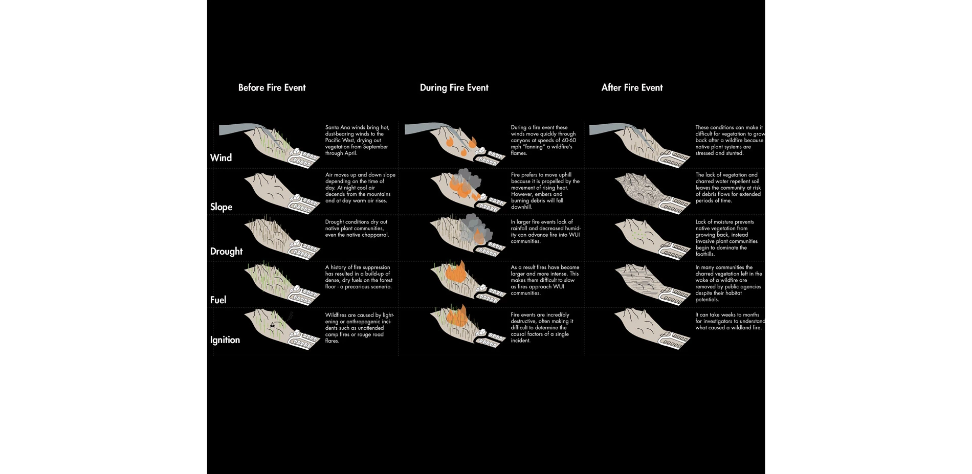
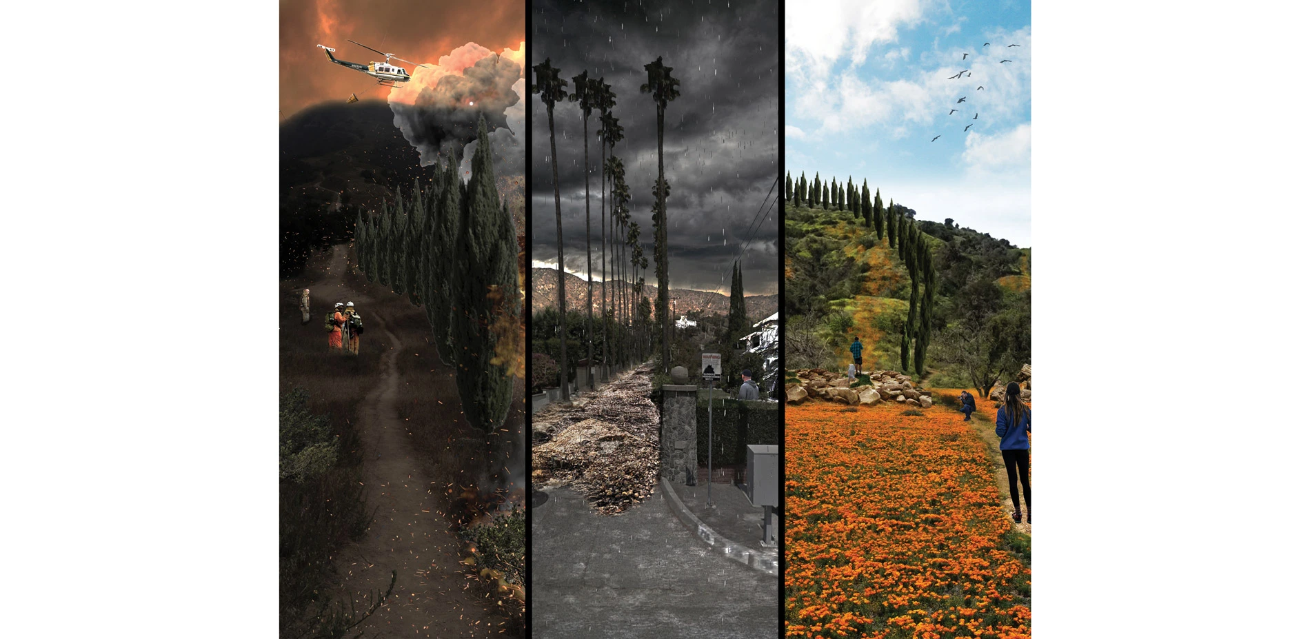
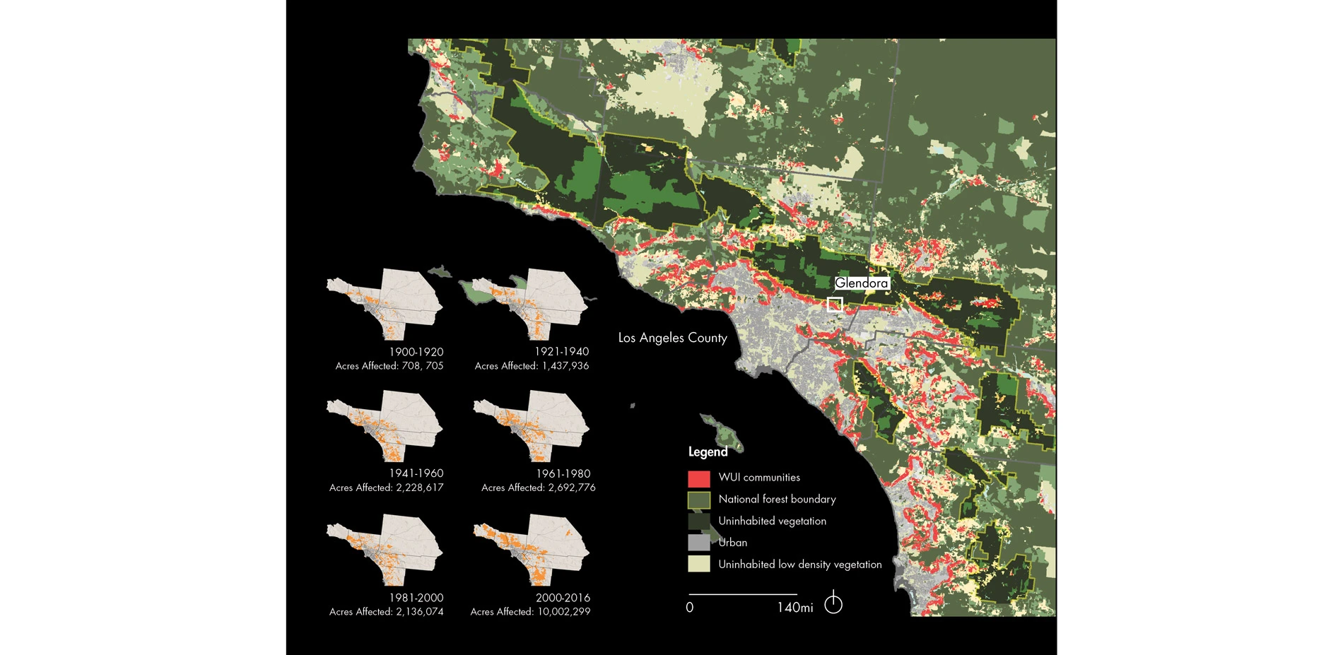
Wildfires are exceptional ecological events that are both destructive and enlivening in their wake. These conflicting qualities which define wildfires are influenced by a variety of environmental and anthropogenic factors including topography, vegetation, fuel accumulation, and human settlement. These factors demand the development of both regional and localized fire management tactics, however federal and state funded agencies continue to deploy blanket strategies within the wildland urban interface (WUI) where communities are most at risk of fire. These strategies are often destructive to non-human communities, which rely on fire disturbance, thus limiting the ecological benefits experienced after a fire event. Rather than fighting to prevent fire, we must design "fire-ready" landscapes which infiltrate communities and slow down fire to minimize their threat to private property.
Challenging Conventional Fire Management in Southern California
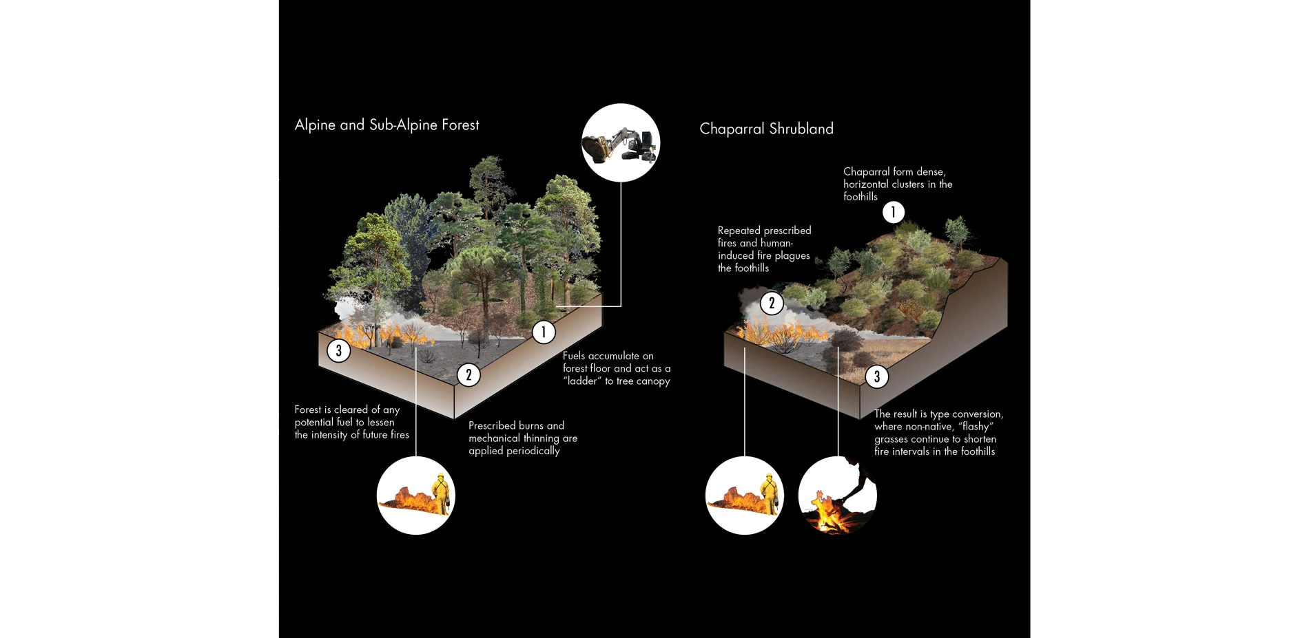
The current fire regimes within California are dissimilar to its well-documented history of fire events. In particular, southern California is experiencing more fire events than it has historically largely due to increased urbanization in the foothills. Not only have they become more numerous, but their size and intensity have increased as well, creating a particularly difficult fire management challenge. Yet, the United States Forestry service and local fire agencies continue to practice prescribed burning and mechanical thinning within shrubland ecosystems which respond negatively to these treatments developed for woodland forests. A new set of phased strategies is required to respond to the region's diverse shrubland communities populating the foothills of southern California.
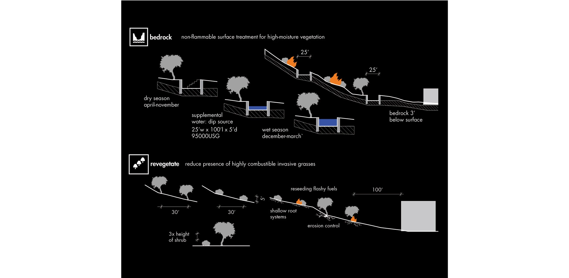
These new phased strategies were developed in response to the topographic and vegetative conditions unique to the foothills. The steep slopes of the Angeles National Forest are inhabited by a diverse assemblage of chaparral and sage shrub species. Federal and local fire management teams have orchestrated prescribed burns and mechanical thinning to reduce the risk of fire in the foothills. However, this treatment results in disturbance, particularly in type conversion, where these native, fire-adapted species are replaced by invasive grasses. The destructive combination of prescribed burns and shorter intervals between fire events results in the colonization of these opportunistic species which serve as flashy fuels for future fires.
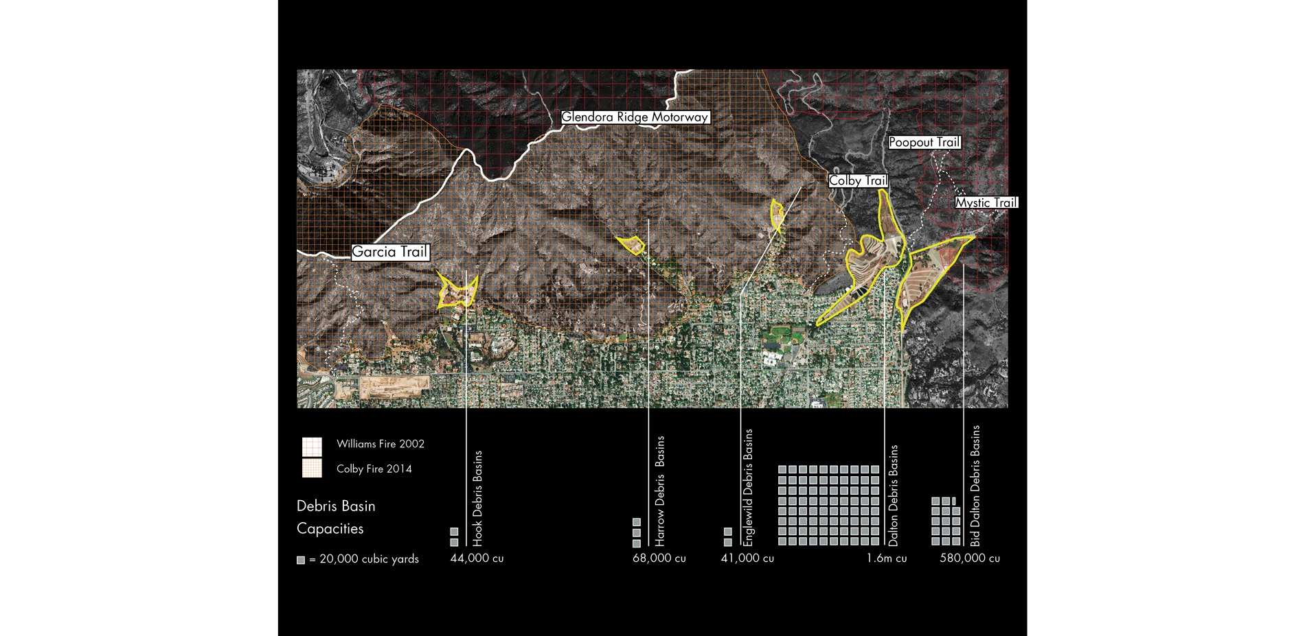
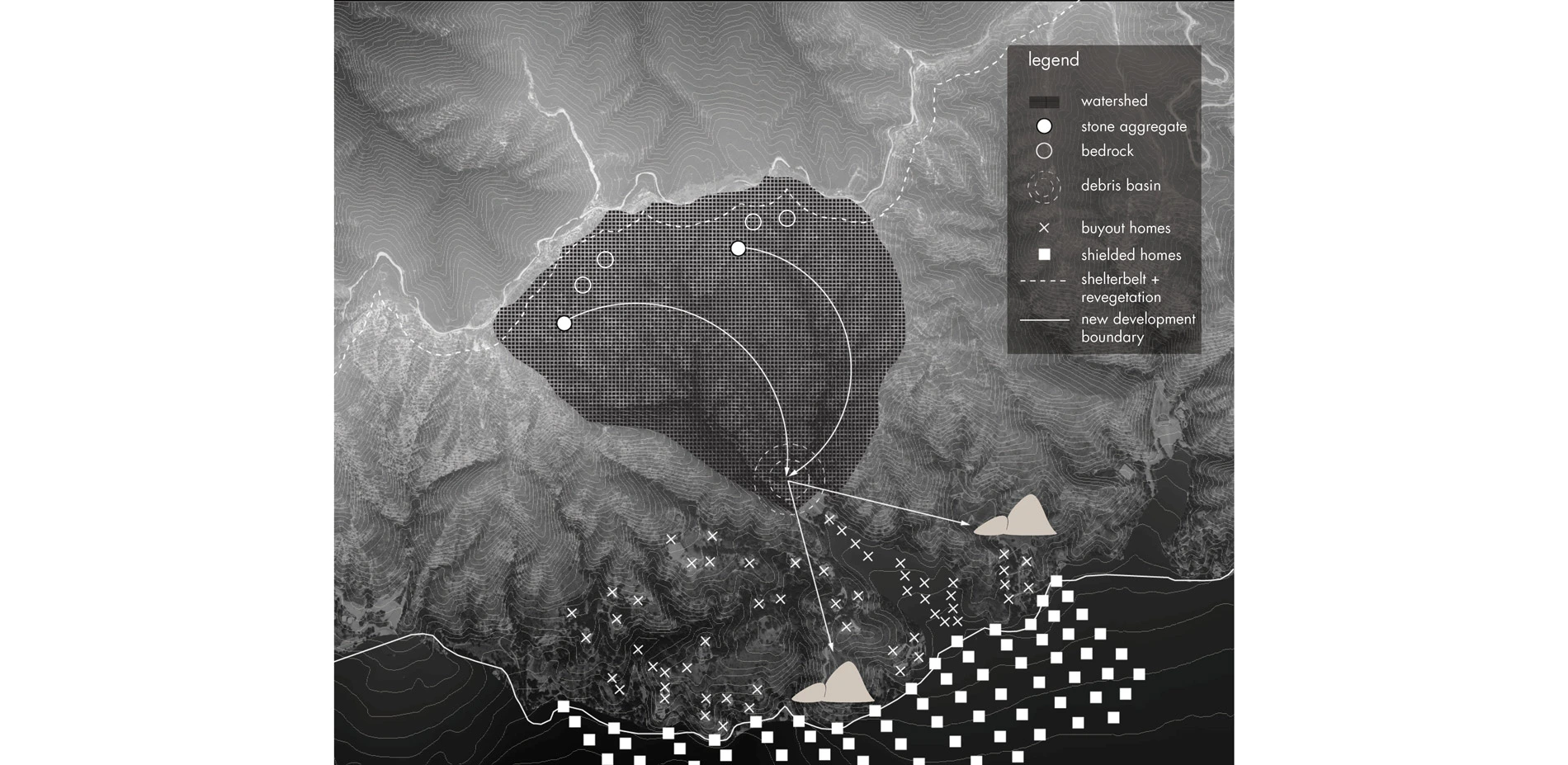
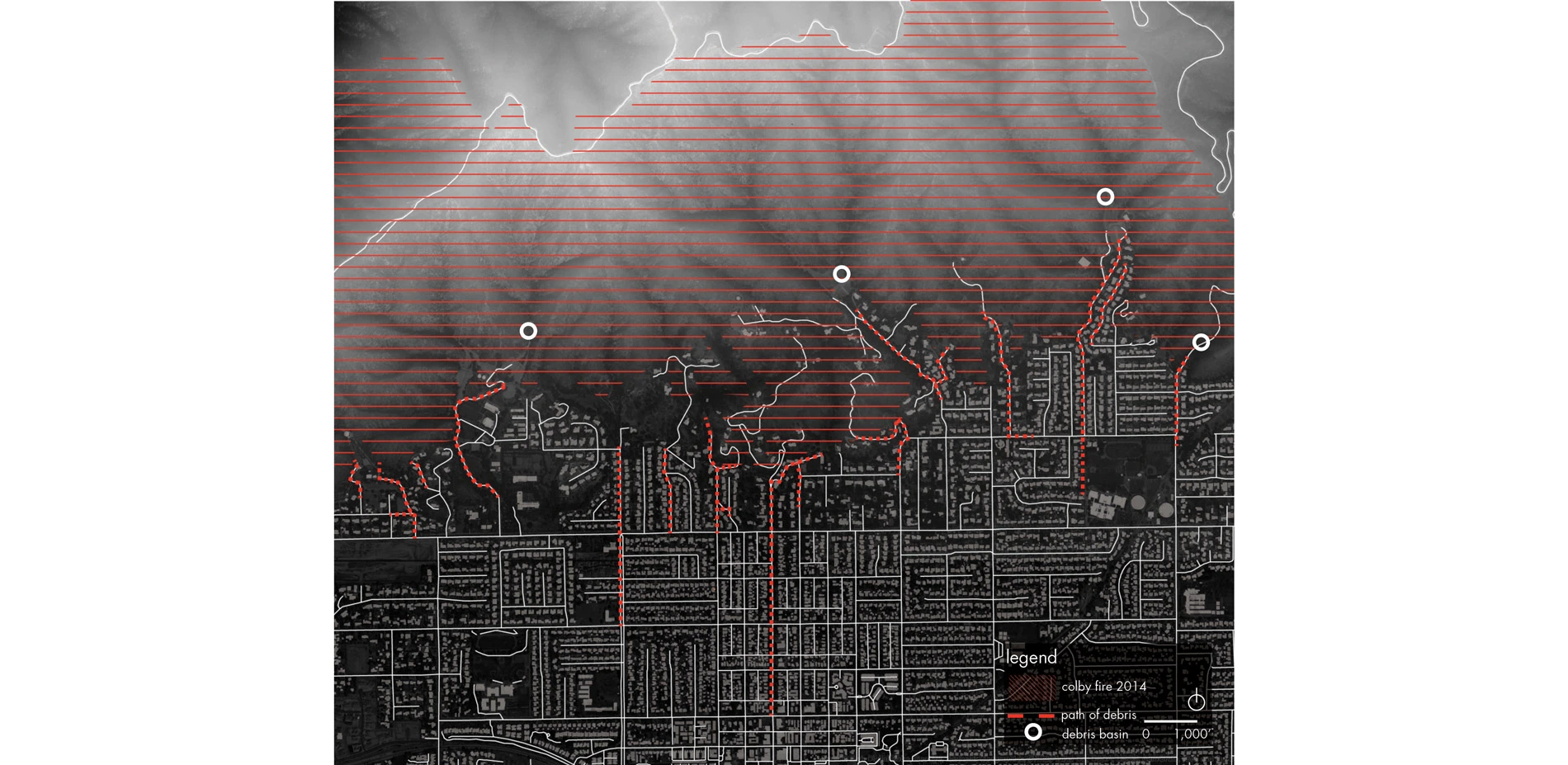
This novel assembly of landscape treatments complement existing foothill fire infrastructure, such as fire roads and debris basins, so as to work in tandem with current well-performing management strategies. These massive infrastructural devices function as catchments for sediments traveling downslope. Debris basins accommodate development along the San Andreas fault, the site of several national forests bordered by dense suburban communities. Debris flows are a common destructive occurrence following a fire event, when hillsides become hydrophobic due to an impenetrable subsurface layer of wax produced by the burning of chaparral species. These structures are strategically located in foothill valleys prone to flows, quickly followed by the reassuring developer's promise of safety and security.
A "Fire-Ready" Landscape Response
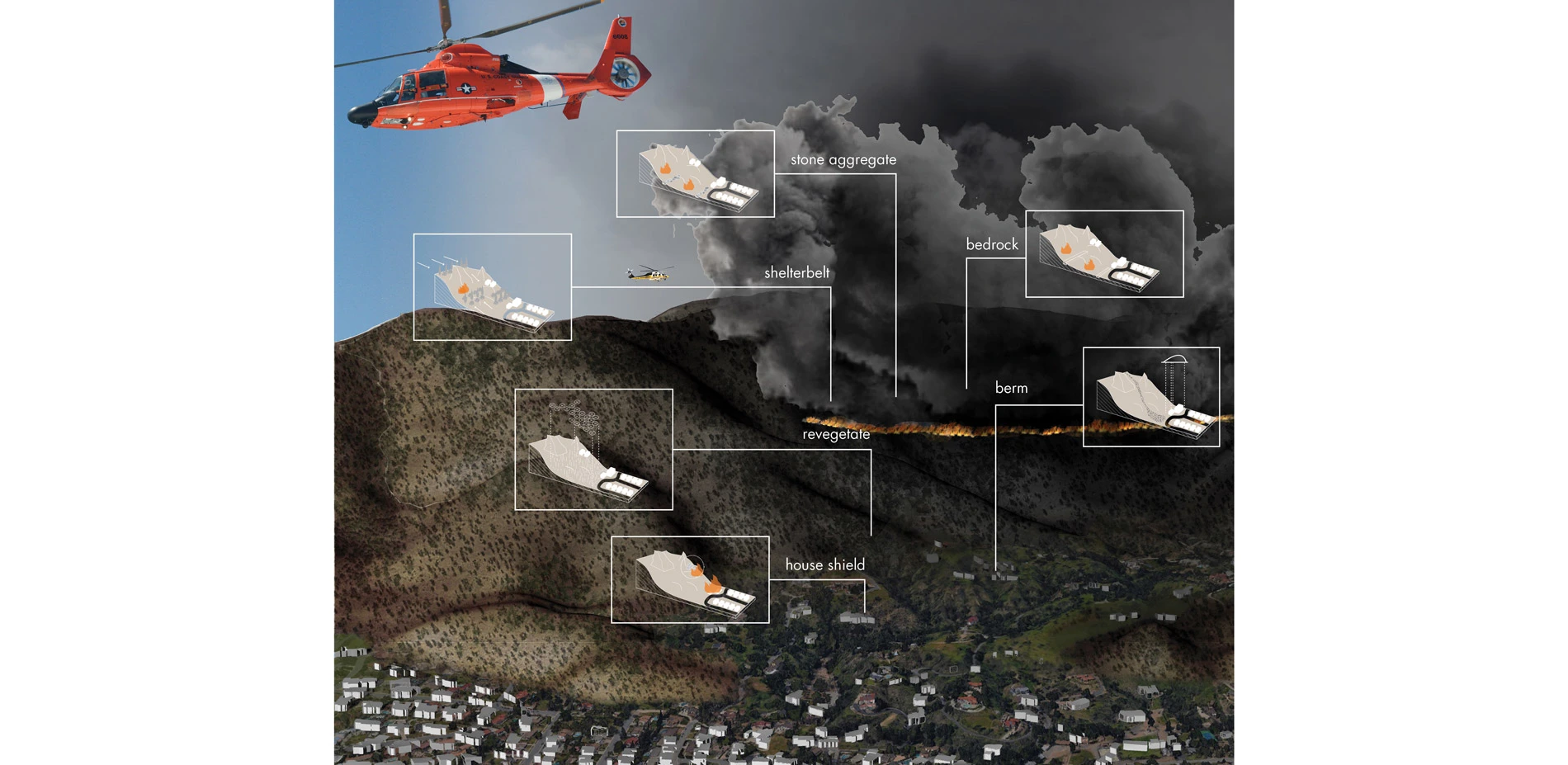
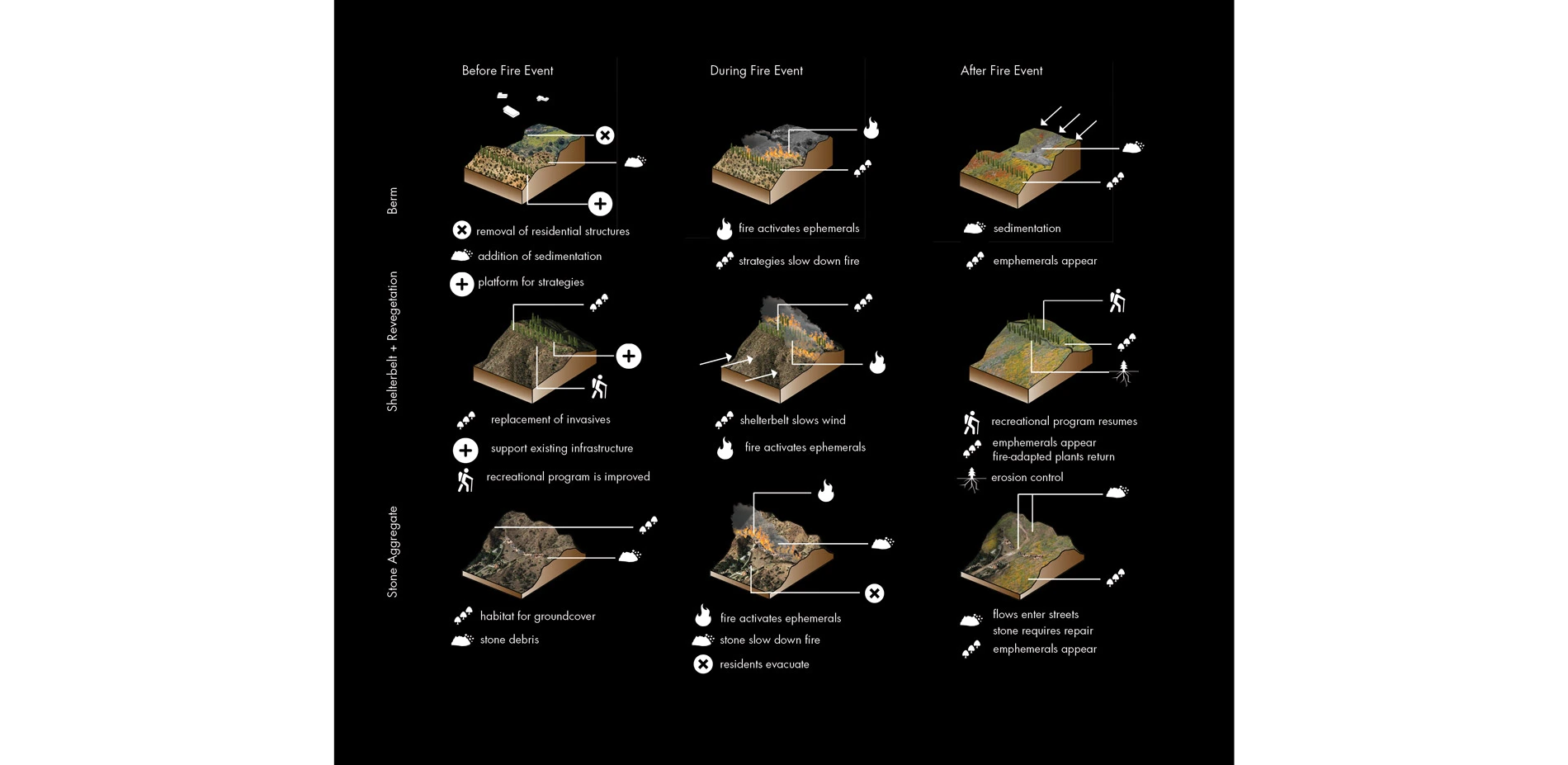
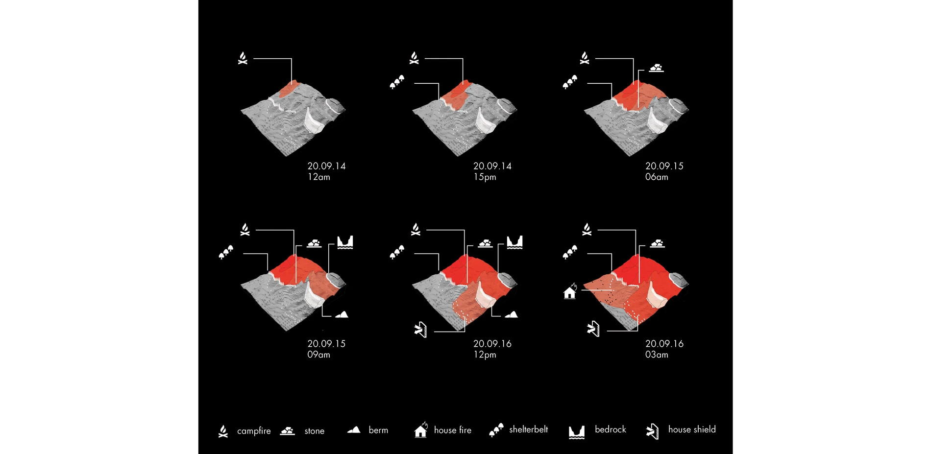
The first fire management phase occurs across the face of the foothills. It is comprised of vegetative and topographic landscape treatments meant to slow down or redirect fire, not prevent or suppress it. These strategies respond to the rich ecology of the foothills, the extreme dynamism of its terrain, and the vulnerability of human communities:
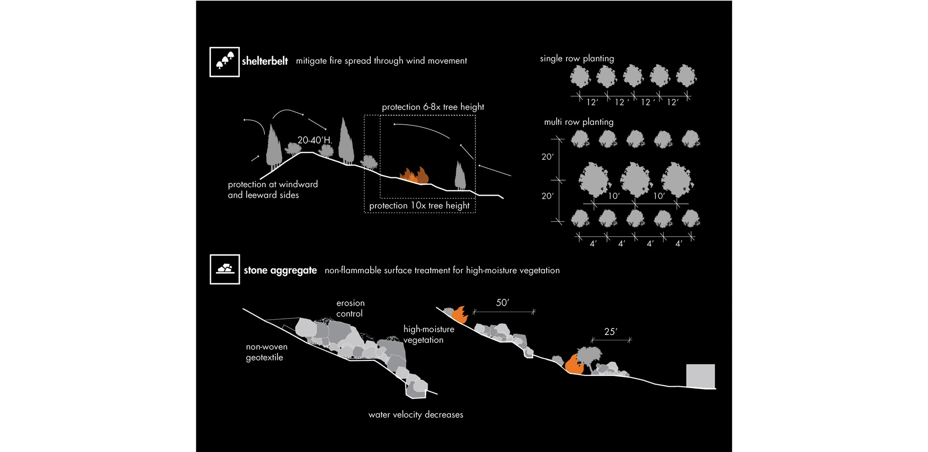
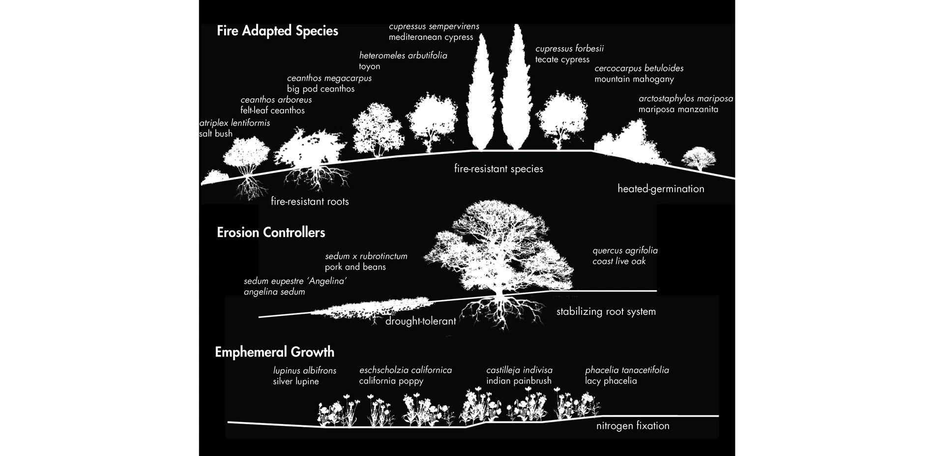
-Along fire roads, shelterbelt planting and revegetation of roadsides with fire-resistant and fire-adapted native plant material will provide reinforcement and improve the road's recreational qualities.
-Excavation of the region's shallow soil profile exposes granite bedrock to provide an alternative firebreak where soil is repurposed lower in the foothills.
-The deposition of large stone aggregate sifted from debris basins serves as an additional permanent firebreak where drought-resistant, native ground cover can inhabit.
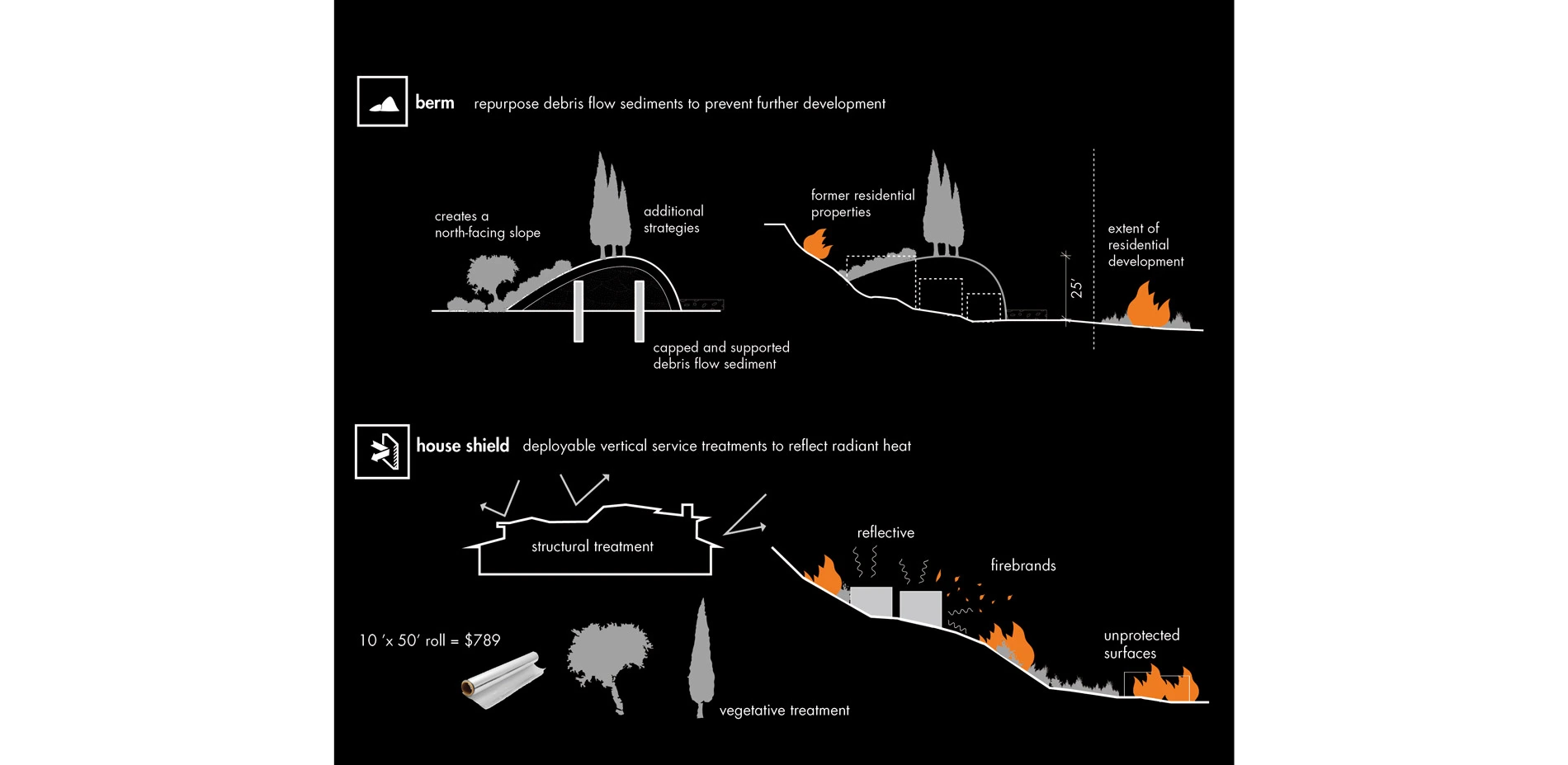
-Debris basin sediment is used to berm along the base of the foothills, relocating critically at-risk homes and serving as a platform for the massing of additional strategies.
-Fire-resistant house shields are given to homeowners within a mile of the base of the foothills to be deployed prior to an impending fire event and reused in the future.
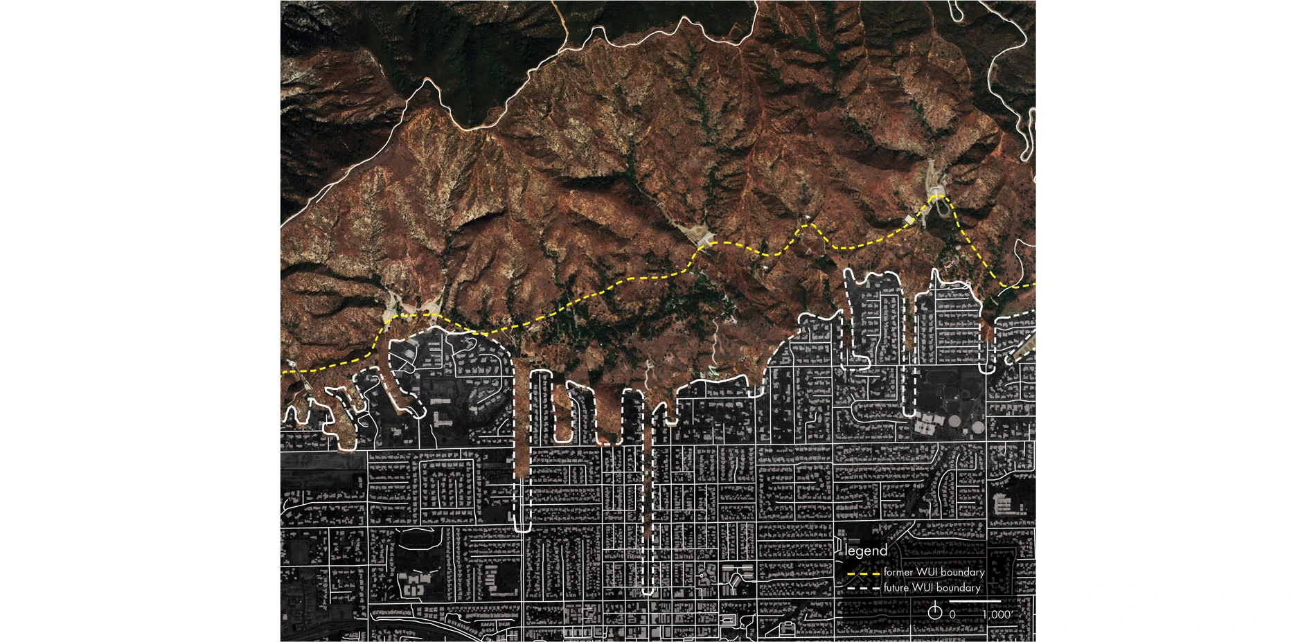
Redrawing the WUI Boundary
The second phase introduces sediment thruways into foothill communities along the paths of past debris flows. The reinstitution of these flows into the wash provides fire management crews with improved access to the foothills. Access has been a persistent emergency response issue, as many foothill communities are designed for seclusion, privacy, and exclusivity. Thruways also serve as a connection to existing recreational trails and provide increased habitat for native, fire-adapted vegetation. This expands the widely used recreational program of national forests by connecting to adjacent park lands and city centers.
The unceasing sediment flows are used in conjunction with foothills strategies as a way to make communities safer. Fire planning in southern California must acknowledge that suppression is not the answer. These strategies distributed throughout a larger community planning initiative within the WUI enables landscapes to recover after a fire and/or debris flow event. These communities have the potential to become less vulnerable following the adoption of these strategies which have been designed to improve residents ability to live with wildfires.
These layered strategies do not seek to prevent fire, but rather create a "fire-ready" landscape which responds to the ecological and anthropologic needs of foothill communities. The unpredictable nature of fire can not be addressed with a single management solution. It requires a more flexible, site-specific set of landscape treatments set within the foothills and adjacent communities. The rigid policy-driven lines demarking the wildland urban interface begin to blur while preparing at-risk communities for these essential ecological events.
Advertisement
Related Awards

Honor Award, Analysis & Planning
A Cultural Approach: The Fort Peck Tribes Hazard Mitigation Plan
In collaboration with the Fort Peck Assiniboine and Sioux Tribes, EPA, and FEMA, the Fort Peck Tribes Hazard Mitigation Plan (HMP) adopts a culturally responsive approach to hazard mitigation planning that features connection to place.

