
.webp?language=en-US)


Developing with Water: A Landscape-driven Regulatory Framework
Meikang Li, Student ASLA
I was impressed by the interaction with experts and the decision to go to the site.
Awards Jury
-
This project initiates from questioning the limitations of planning at the scale of a site. Based on a close reading of a masterplan document, it proposes a methodology to test planning documents and a new approach to improve the planning decisions.
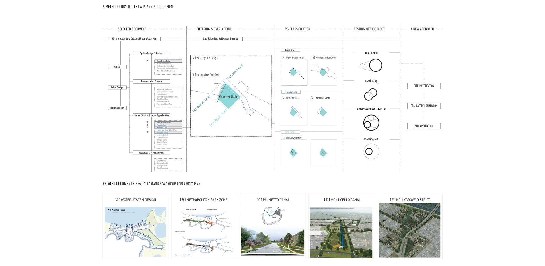
This project selects to test the 2013 Greater New Orleans Urban Water Plan and focuses on the segment of the Hollygrove District. The Hollygrove District is one of the neighborhoods that are dealing with post-Katrina impact of blighted and vacant properties. With the background of expertise globalization, this project critiques a situation that ignores site conditions and alerts the mis-opportunity behind generalized decisions of community revitalization planning projects through a series of proposed site-scale investigation methods. With an understanding of local policies, building types and development potentials, this project proposes a landscape-driven regulatory framework that builds a positive relationship between future development and water management, which envisions a repopulated neighborhood with power to resist future flooding risk.
-
Background: New Orleans and the Urban Water Plan
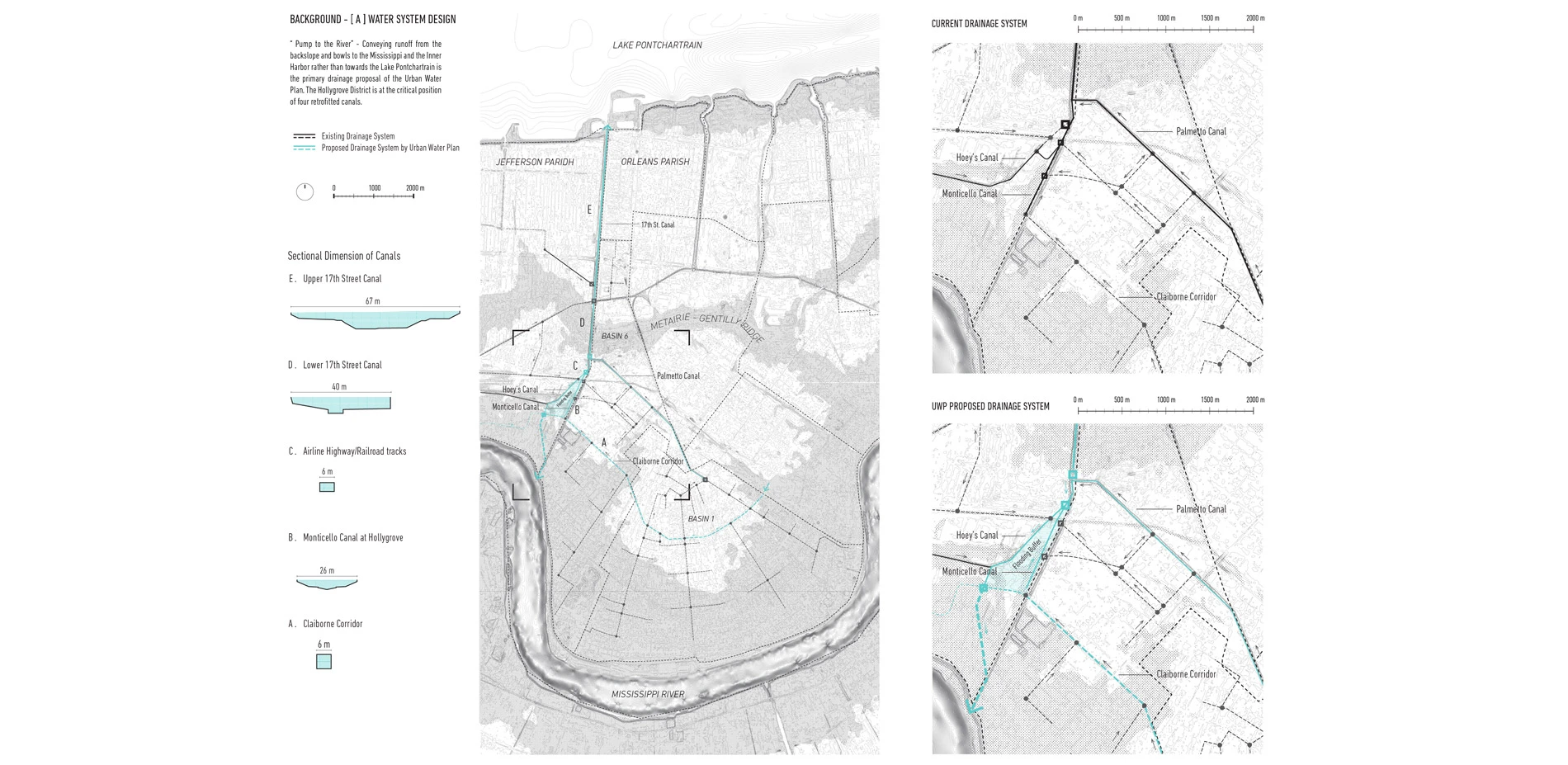
The city of New Orleans is known as an 'impossible but inevitable city'. Located at the confluence of the Mississippi and Gulf Mexico, the city has resisted a harsh environment for more than 200 years. The city highly relies on forced engineered drainage systems to keep dry, which becomes the primary cause of subsidence in the region. The drainage systems, such as floodwalls, levees, drainage canals and pumping stations, have formed a unique 'water landscape'. However, the 'water landscape' has never forged a 'water culture'. The water infrastructures separate the water body as public assets from residents' daily life, and the city creates an illusion for its residents of living on a dry land. However, in 2005, the engineered protection collapsed during the Hurricane Katrina. Nearly 2000 people died. People started to move out of the city leaving behind thousands of blighted and vacant properties.
In 2006, with the background of expertise globalization, New Orleans firm Waggonner & Ball Architects initiated Dutch Dialogues workshops, which brought together experts from the Netherlands and Louisiana to place water issues. Following the workshops, in 2013, the Greater New Orleans Urban Water Plan was reported. It proposed an improved water management system and urban landscape for the metropolitan area of New Orleans and has received large amount of grants for implementation in pilot districts.
5 Years after the Report: Interviews with Local Professionals
With questions in mind about the practice of the Urban Water Plan, I visited the city of New Orleans and interviewed three local professionals: David Waggonner, the partner of the Waggonner & Ball Architects; Hilairie Schackai, who was a director of Community Initiatives and Education, and she helped and participated the process of the Urban Water Plan; Aron Chang, who was a senior designer and planner at the Waggonner & Ball Architects, and was one of the team leaders of the Urban Water Plan. The progress of the Urban Water Plan is not as smooth as I expected. They told me about many practical obstacles encountered in the actual progress. For instance, the fragmented water-related institutions as well as the lack of public education on storm water management have resulted insufficient funding supports and community engagements.
Investigation: Issues of the Planning Report
The Urban Water Plan was completed in cooperation of international water experts. However, its promoting progress did not go smoothly. Are there any unnoticed limitations of the planning report? In order to answer my doubts, I select one neighborhood, the Hollygrove, to investigate closely.
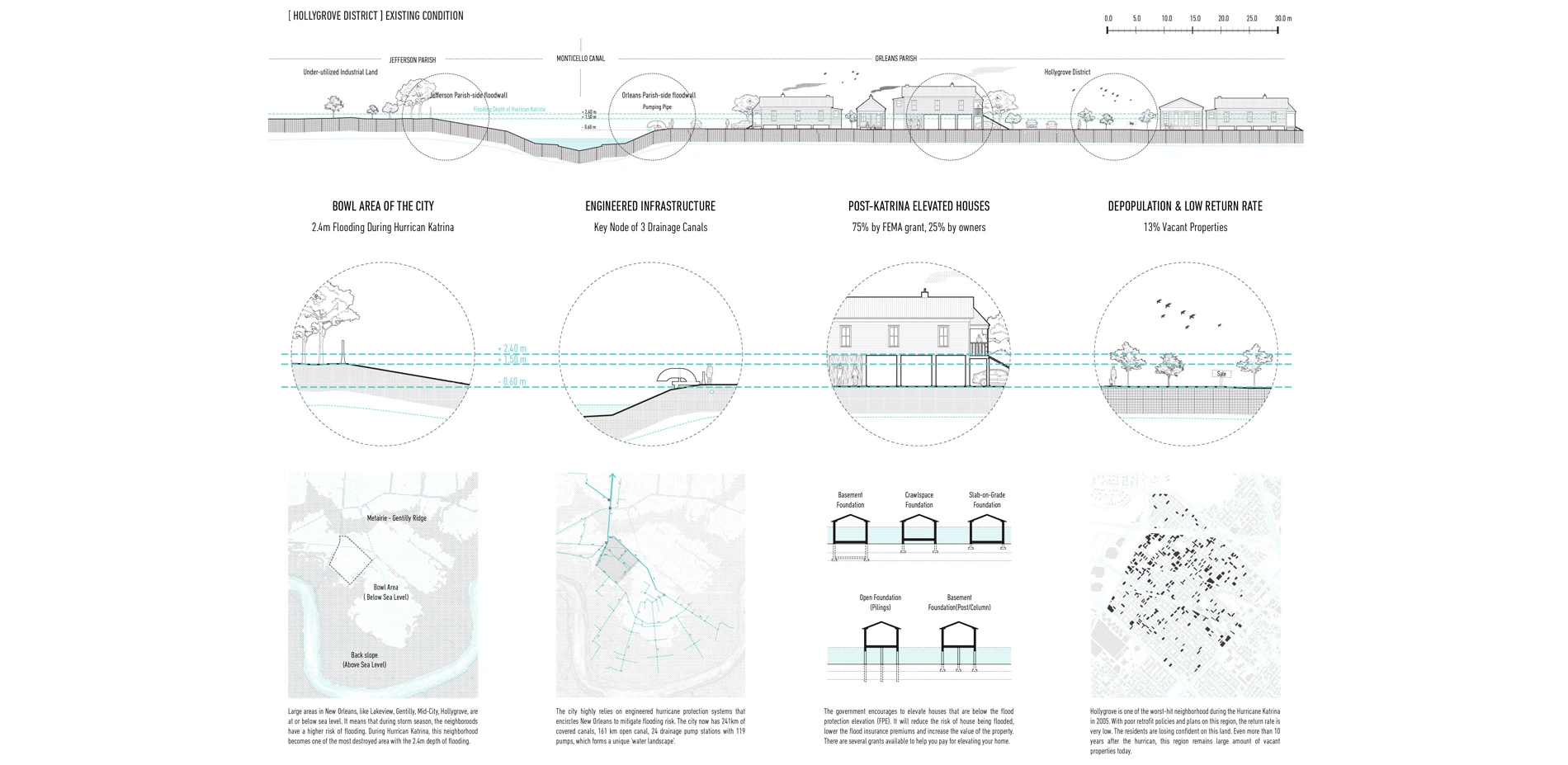
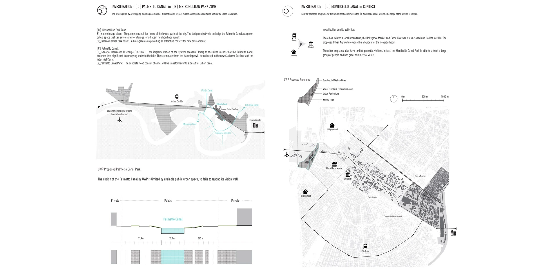
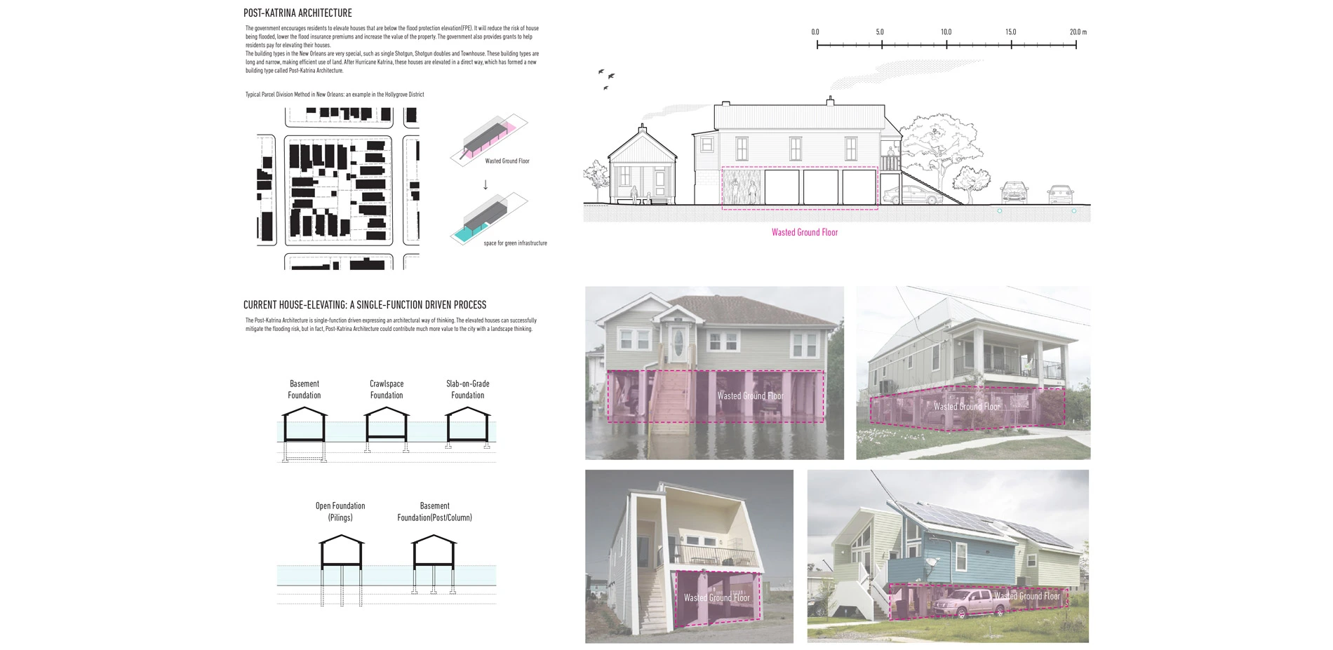
The Hollygrove District is one of the neighborhoods that are dealing with the post-Katrina impact of blighted and vacant properties. It locates at the bowl area of the city with a higher risk of flooding and at the critical intersection of four drainage canals. Residents are encouraged by government to elevate their house to mitigate flooding risk.
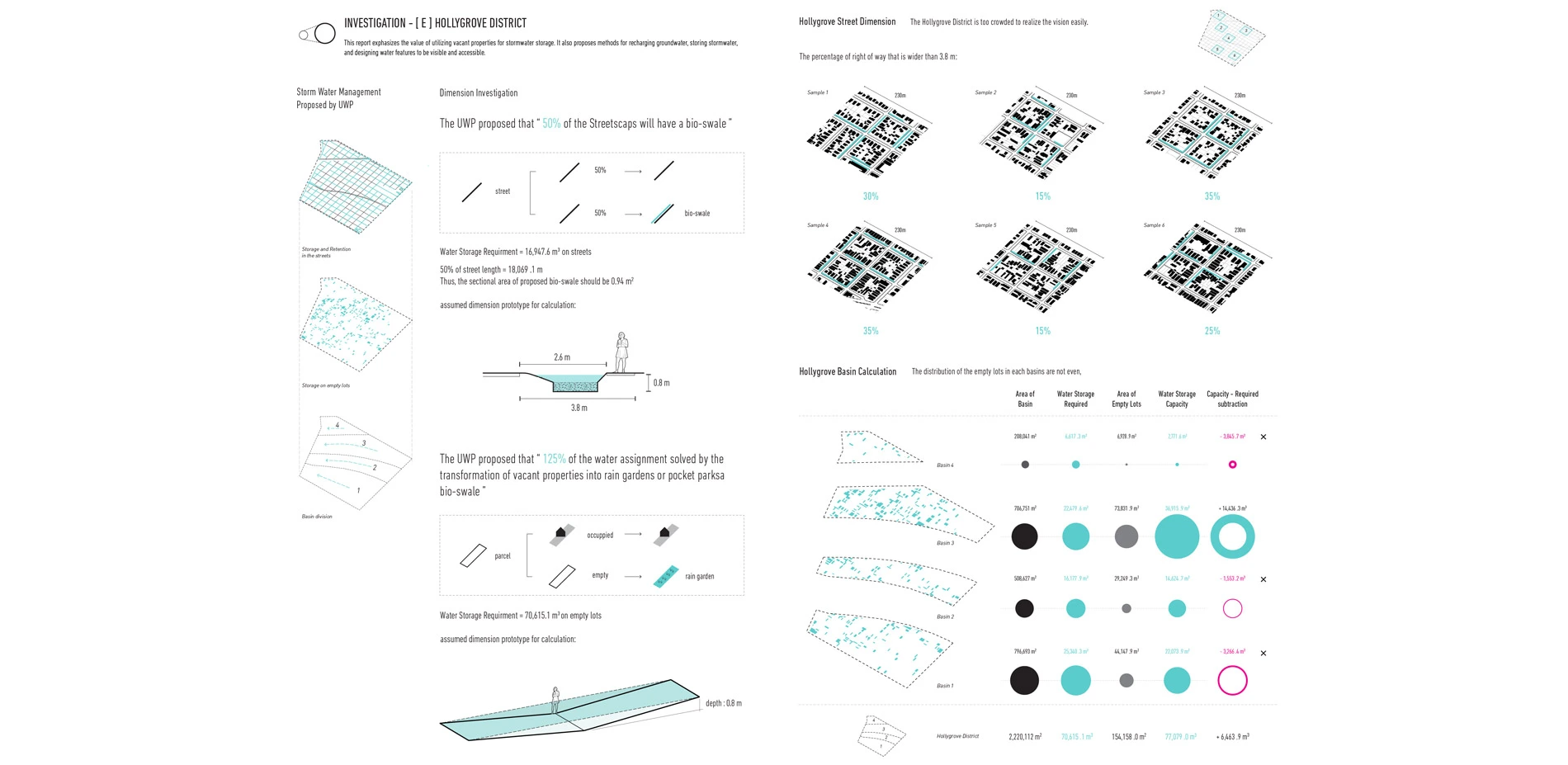
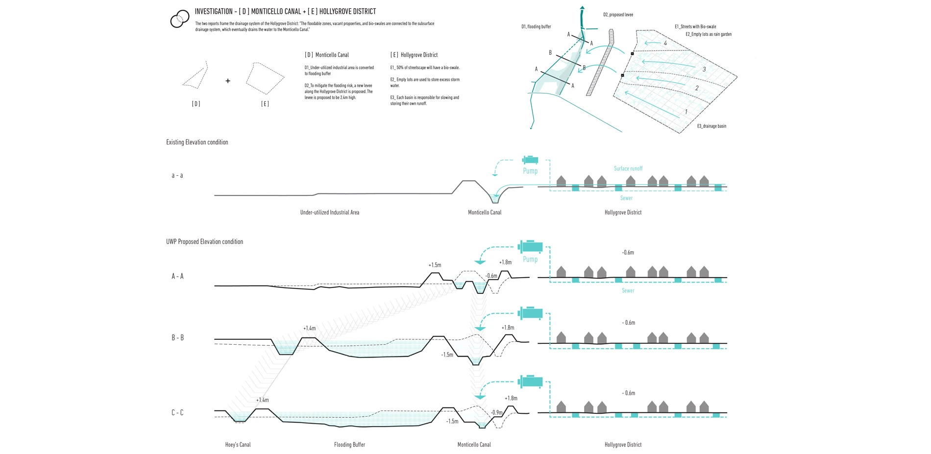
By methods of Zooming In, Combing, Cross-scale Overlapping and Zooming out to test the documents in the Urban Water Plan, I found that the Urban Water Plan simplified site conditions, and the universally applicable strategies missed and limited the economical and social potential of the site:
- The proposed water storage strategies do not fit local conditions very well. The neighborhood is too crowded to implement the infrastructures. Moreover, the maintenance of the proposed rain gardens and bio-swales would become a huge and unnecessary burden for current residents.
- A new levee was proposed along the Monticello Canal to eliminate the elevation difference between the industrial area and the neighborhood. But this would also block the surface water runoff to the canal and worsen the regular flooding issue, which means that the government has to invest more budget on the local pumping stations.
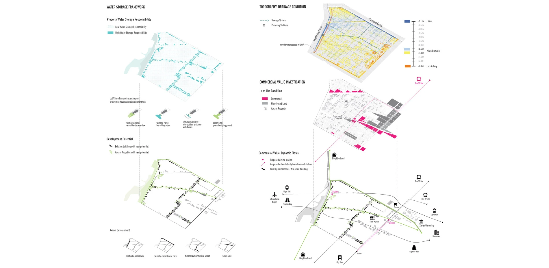
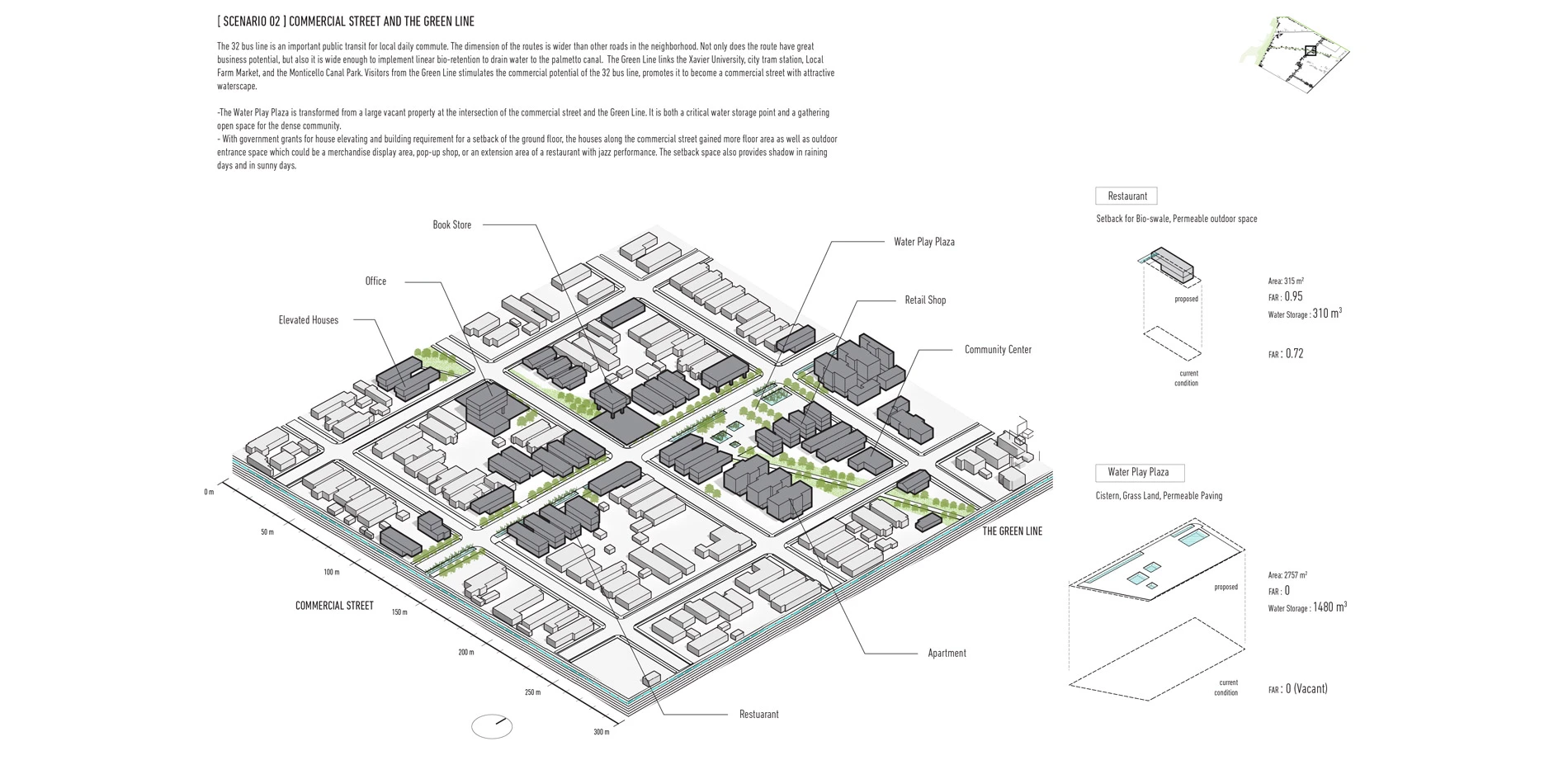
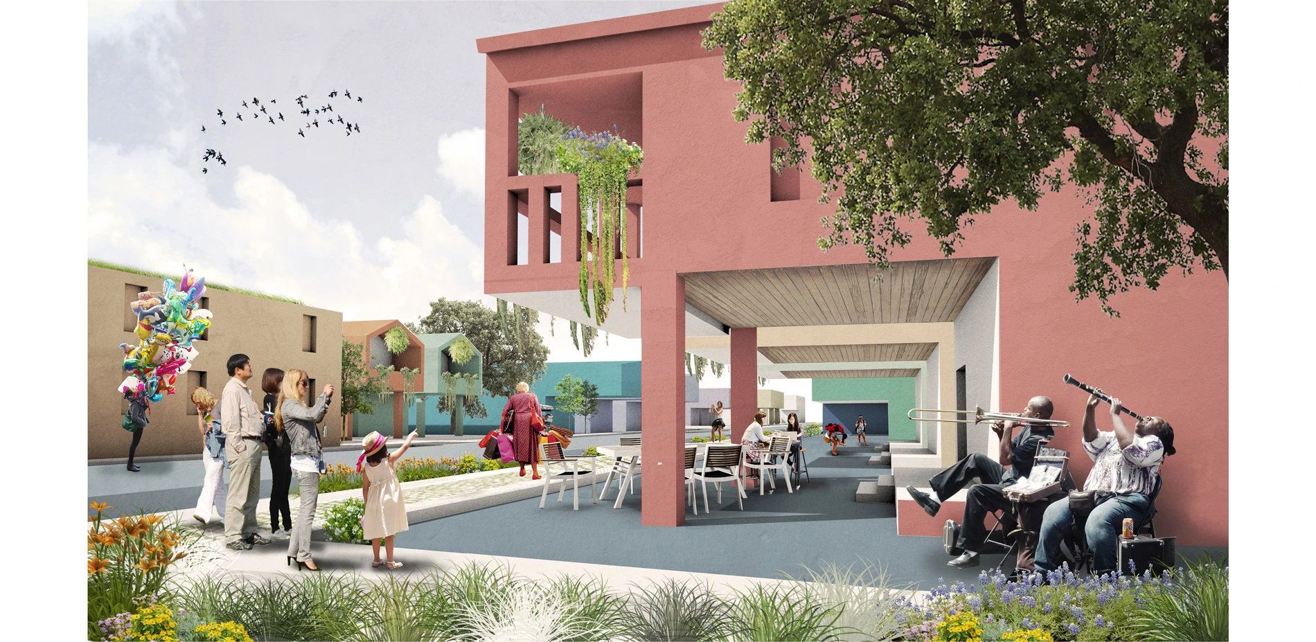
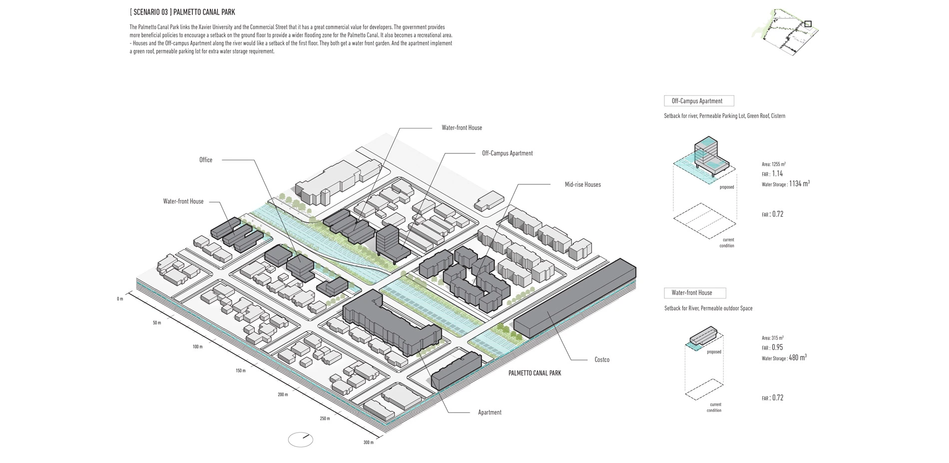
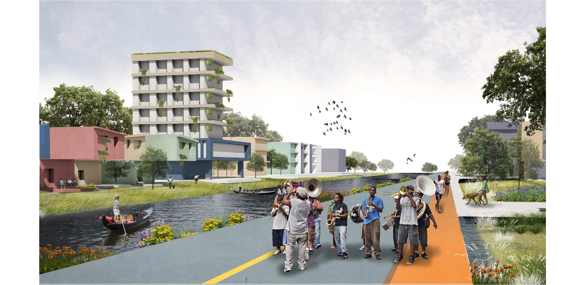
- The Palmetto Canal planning appears twice in the report. The Palmetto Canal locates in one of the lowest part of the city that it should have a high responsibility to store water. However, in the design section, the proposal shows a limitation to fulfill the storage potential.
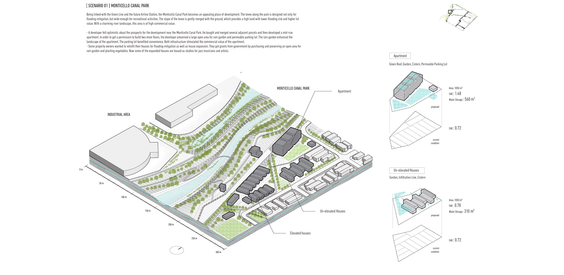
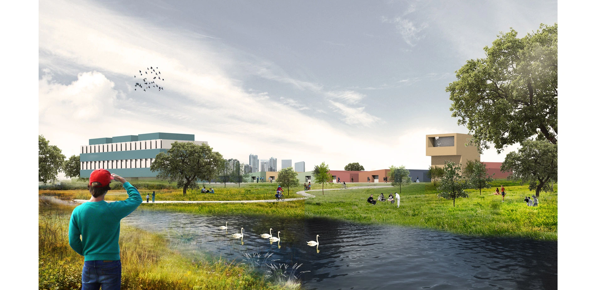
- The proposed Monticello Canal Park exaggerated the burden on the district. The programs are proposed based on a generalized understanding of a wetland park. It fails to attract the most valuable visitors and limits its potential on social and economic value for the neighborhood.
Site Investigation: The Uniqueness and Potential
The government encourages residents to elevate houses that are below the flood protection elevation(FPE). It will reduce the risk of house being flooded, lower the flood insurance premiums and increase the value of the property. The government also provides grants to help residents pay for elevating their houses.
The building types in the New Orleans are very special, such as single Shotgun, Shotgun doubles and Townhouse. These building types are long and narrow, making efficient use of land. After Hurricane Katrina, these houses are elevated in a direct way, which has formed a new building type called Post-Katrina Architecture.
The Post-Katrina Architecture is single-function driven expressing an architectural way of thinking. The elevated houses can successfully mitigate the flooding risk, but in fact, Post-Katrina Architecture could contribute much more value to the city with a landscape thinking.
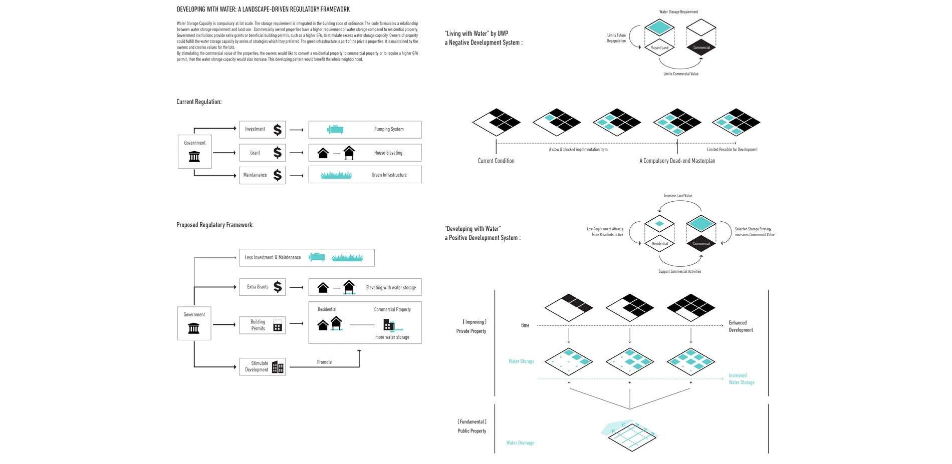
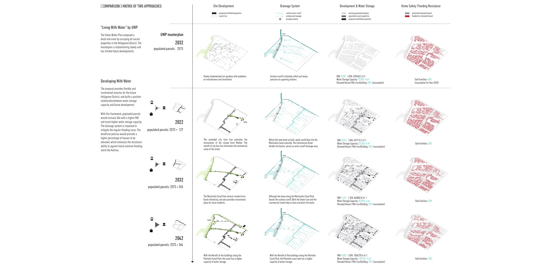
Developing with Water: A Landscape driven regulative framework
Different from "living with water" proposed by the Urban Water Plan, the "developing with water" is a framework that indicates a dynamic process and a positive relationship between future development and water management.
This framework suggests that: The water storage requirement is integrated in the building code of ordinance. The code quantifies the storage requirement according to specific land use. Commercially owned properties have a higher requirement of water storage compared to residential property. Government institutions would provide extra grants or beneficial building permits, such as a higher GFA, to stimulate extra water storage capacity.
Owners of property could fulfill the water storage capacity by series of personally preferred strategies. For instance, office building might prefer implementing a permeable parking lot, while a restaurant might prefer a rain garden to attract customers. The green infrastructures enhance the value of the properties and are owned and maintained by the owners.
With future development of the site, the commercial value of properties might increase, then the owners would consider converting a residential property to a commercial property, or to requesting a higher GFA building permit. As a higher water storage requirement would be required, the developing process would benefit the whole neighborhood.
Vision
The landscape-driven framework provides flexible and incremental scenarios for a future Hollygrove District. With this framework, populated parcels would increase 364 with a higher FAR of site and much higher water storage capacity. The drainage system is improved to better mitigate the regular flooding issue, lessening the load on already overtaxed storm water system and reducing subsidence. The beneficial policies would promote a higher percentage of houses to be elevated, which enhances the resistance ability to against future extreme flooding event like Katrina.
The city of New Orleans is one of the most important cities in the U.S. with tremendous commercial and cultural value. I hope the landscape-driven framework could provide an opportunity to repopulate the region, which benefits the preservation of local culture and employment growth, rebuilding people's confident on the land.
-
- Many thanks to my advisor Prof. Jane Wolff for her guidance and support, Thanks for their great help, David Waggonner, partner of the Waggonner & Ball Architects; Hilairie Schackai, director of Community Initiatives and Education Aron Chang, Co-director of the Ripple Effect
Advertisement
Related Awards

Honor Award, Analysis & Planning
A Cultural Approach: The Fort Peck Tribes Hazard Mitigation Plan
In collaboration with the Fort Peck Assiniboine and Sioux Tribes, EPA, and FEMA, the Fort Peck Tribes Hazard Mitigation Plan (HMP) adopts a culturally responsive approach to hazard mitigation planning that features connection to place.

