.webp?language=en-US)


‘Korea Remade’: A Guide To the Reuse of the DMZ and Hinterlands Towards Unification
Xiwei Shen, Student ASLA; Jiawen Chen, Student ASLA; Siyu Jiang, Student ASLA
I think it’s one of the more beautifully illustrated, comprehensive studies. Extremely thorough in giving us an understanding of the place and the profound issues that affect it.
Awards Jury
-
This project is a studio coursework. The unification process on the Korea Peninsula is currently the focus of political, cultural and media attention around the world. The 'Korea Remade' project investigates landscape planning and design concerns and offers creative and practical approaches to aid in, and advance the unification processes.
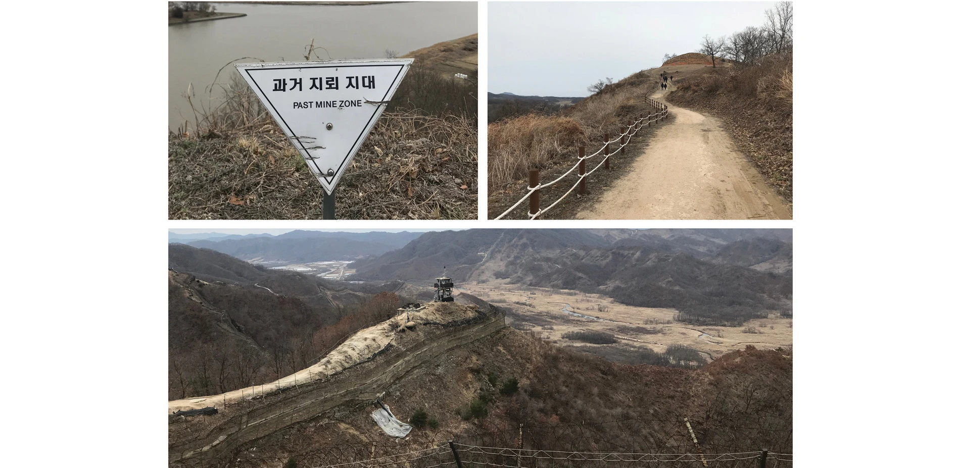
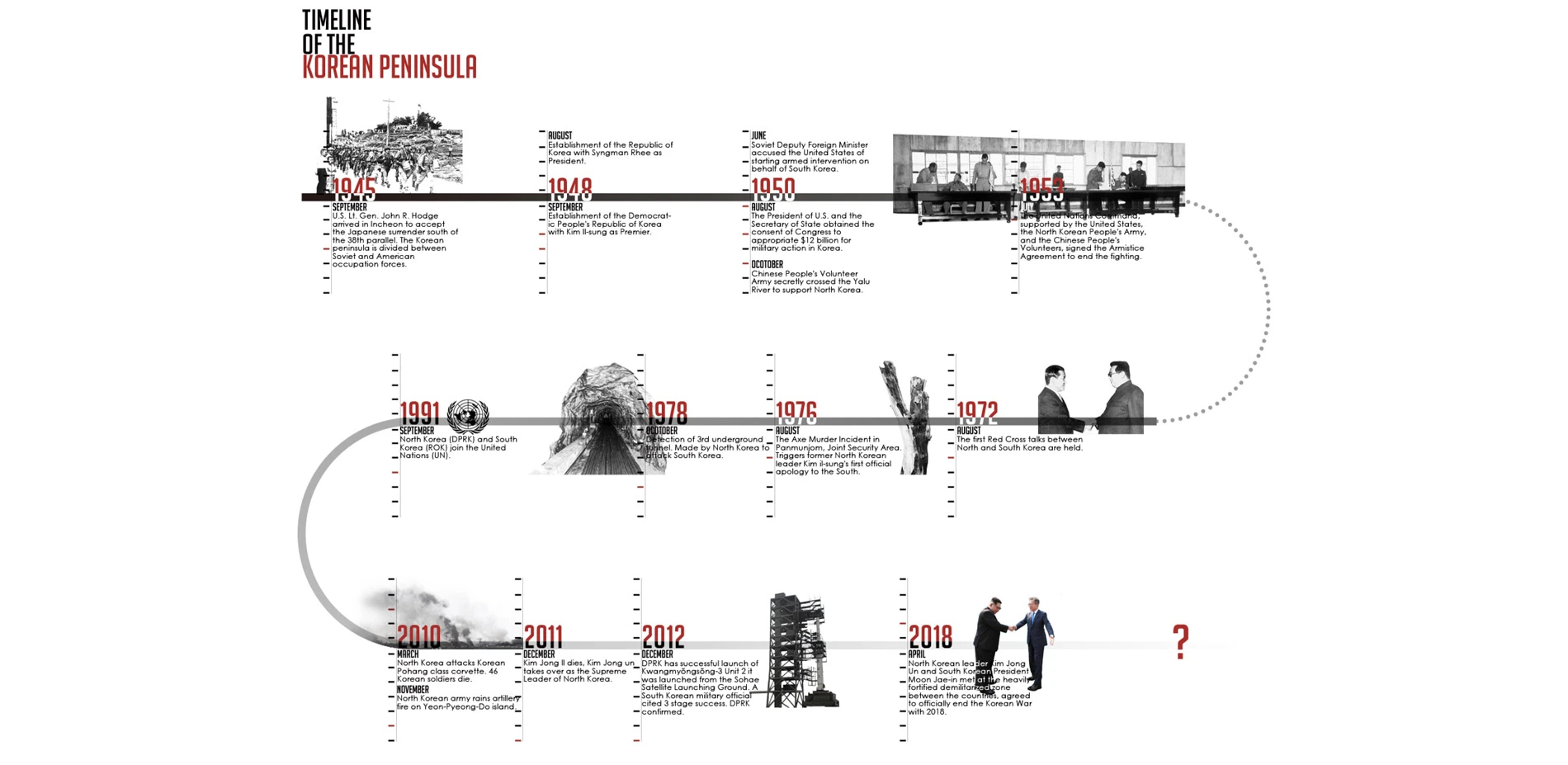
In 1945, the Korean Peninsula was divided into divided territories with standing armies on either side of the 38th Parallel. Recently in 2018, the North Korea and South Korea leaders met at the heavily fortified demilitarized zone (DMZ) established after 1953 between the countries and agreed to officially end the Korean War (1950- 53). As landscape designers, we wanted to use landscape architecture and design approaches as a medium to help the process of unification through programs, infrastructure and remaking the landscape of the peninsula.
The Demilitarized Zone (DMZ) is the boundary between South and North Korea, it is a 2.5 miles wide and a 150miles long corridor. What could this site be used during unification and post-unification? How can landscape design help the unification process?
-
Purpose:
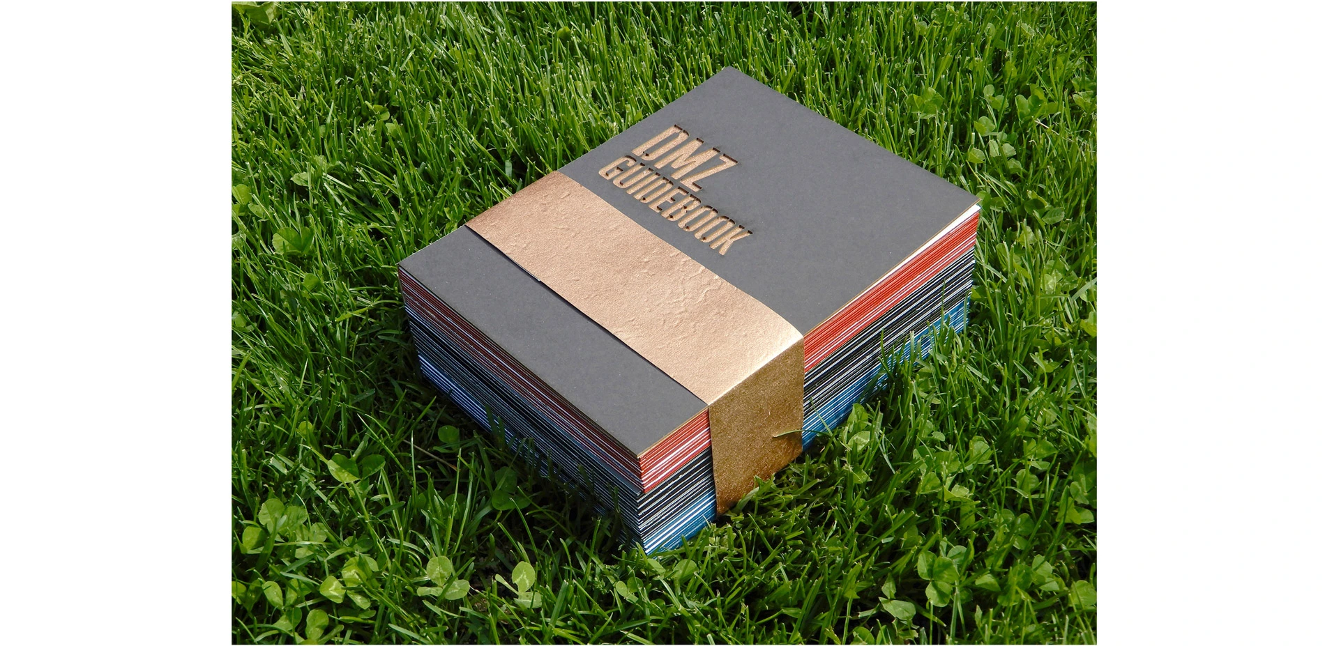
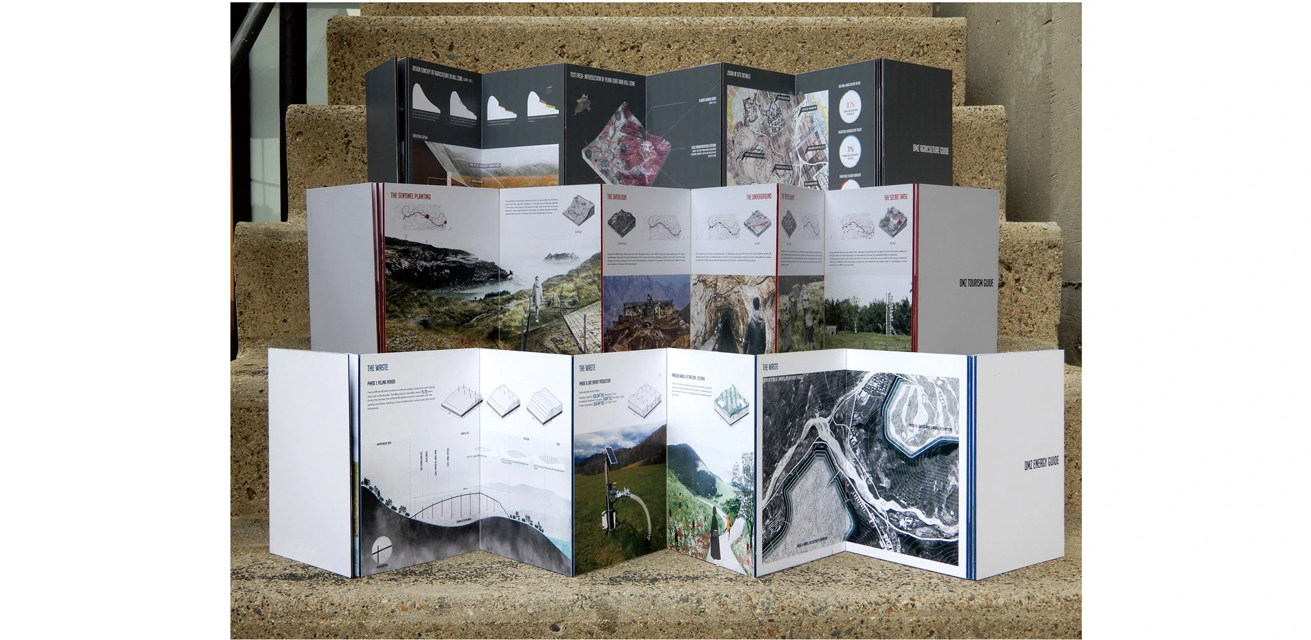
As part of the studio course we undertook a field trip to Korea DMZ and Hinterlands and talked to local residents and planners to address key aspects that could help the unification process. Food Security, DMZ Tourism and Energy Development were established s main themes to investigate. These three categories were developed in the studio with a final product of a 'guide book' to aid future residents, officials and visitors to the region. The structure of each book follows:
- Problem Analysis: The reasons that the topic could help the unification process.
- Site Generation: Appropriate areas in which develop the proposal.
- Design Toolkits: Prototypes of various strategy models.
The objective of the three 'guide books' is to engage the audience to adopt the strategies and inspire local residents to remake their landscape and land.
Audience:
The guide books are highly accessible to a wide of audiences, including citizens, visitors, and government planners. DMZ Agriculture Guide focuses on local farmers and government planners. DMZ Tourism Guide focuses on local visitors as well as from overseas. DMZ Energy Guide focuses on government planners.
Messages:
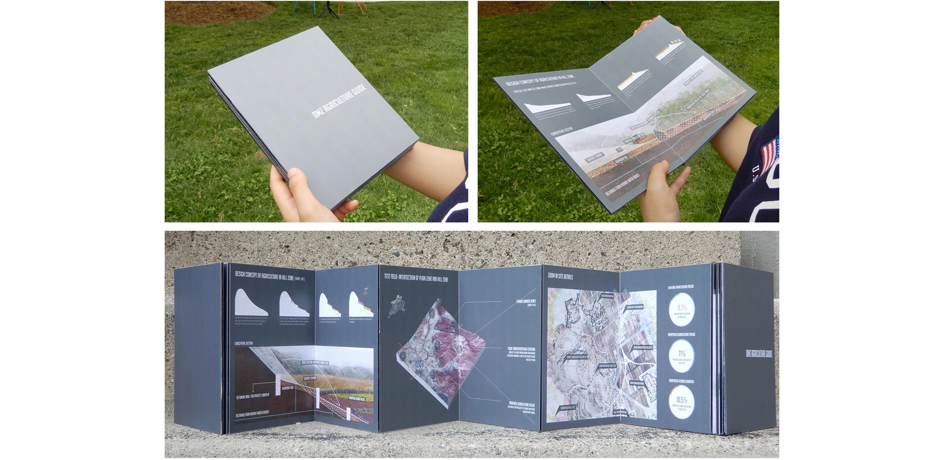
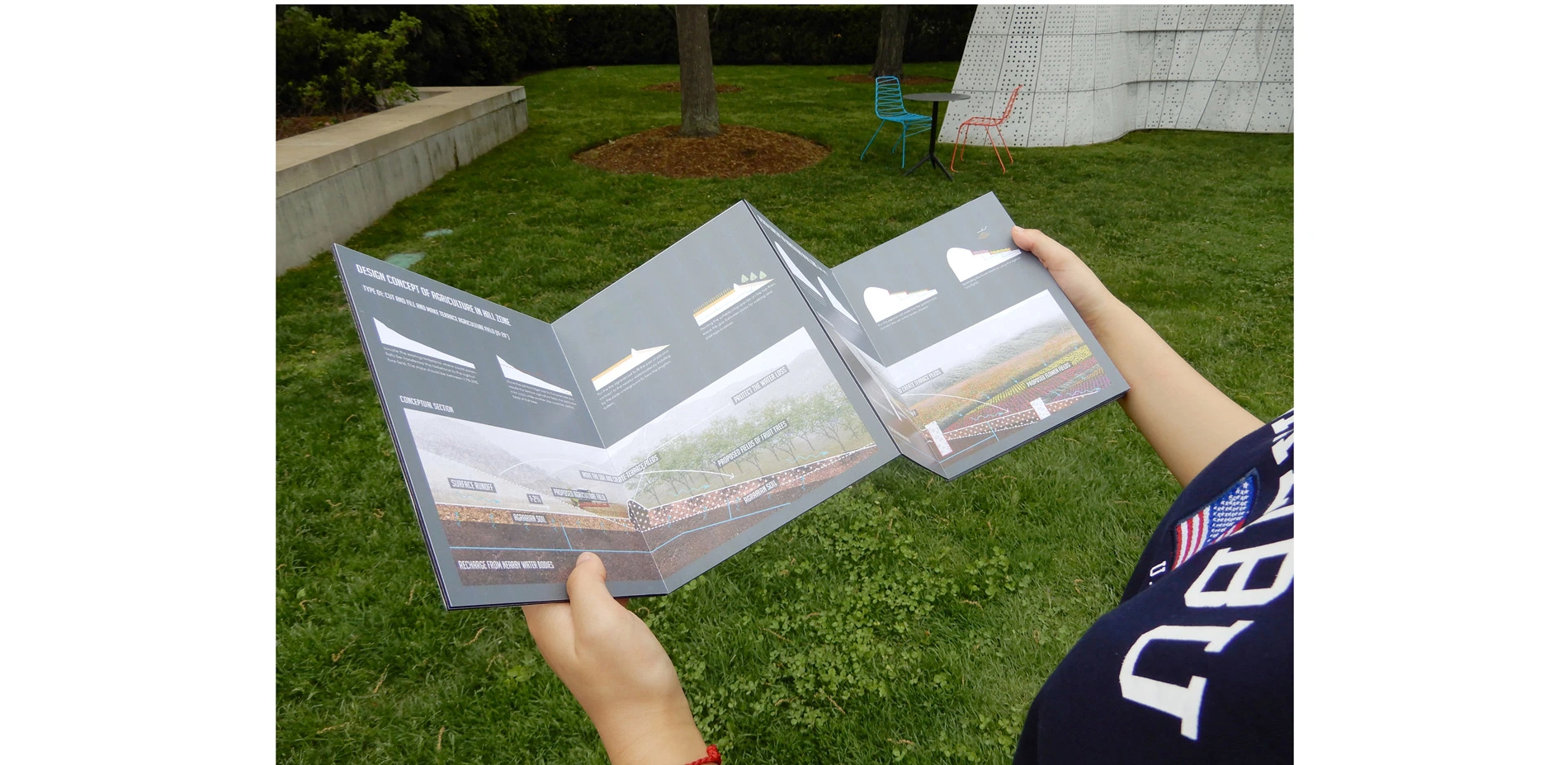
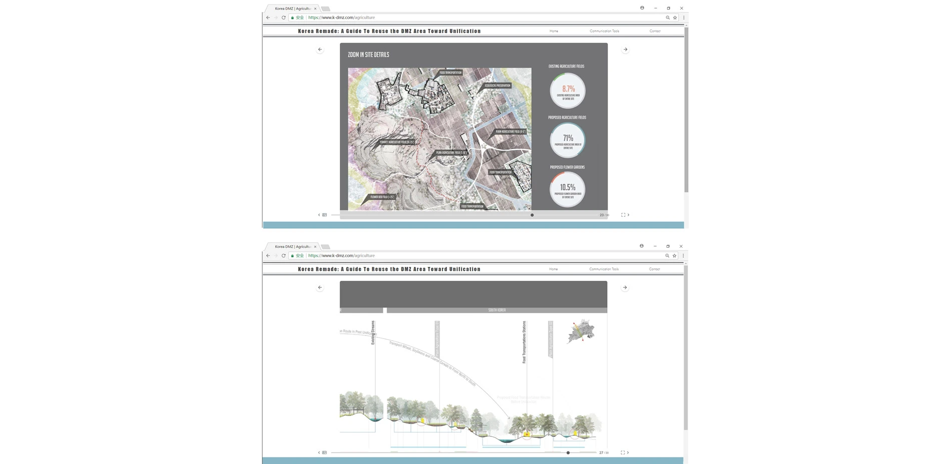
DMZ Agriculture Guide: Aims at improving food security as part of the unification of the Korea Peninsula and in using the resulting landscape as a medium to reflect local culture. Food security is one of the important concerns that will affect the development of the entire Korea Peninsula, especially within the current North. Cherwon (South Korea) and Pyonggang (North Korea) are two main existing agriculture zones that are close to the DMZ. These are 4.5 kilometers wide zones that cross the DMZ between the two cities and could be fully developed by agriculture. The connected Agriculture Zones could be reformed as a main agriculture zone of the entire Peninsula. This zone has a rich hydrologic system and varied elevation changes. The Northern Part is steeper than the South and soils are different. The Guide Book proposes two types of agriculture: Plain Agriculture Fields and Terraces Fields.
For Plain Agriculture Fields, the proposed design method uses the existing natural zones that are always filled with rainfall water seasonally. The annual rainfall, as well as the surface runoff from surrounding areas, provides sufficient water to support irrigation needs.
For Terrace Agriculture Fields, those are the special agriculture types built on the elevated areas. Since North Korea does not have sufficient suitable agriculture land, they have placed many agriculture fields on the hills. To expand the existing agriculture zones in North, the terrace agriculture fields are classified by the slope. The proposed design develops three conditions to establish agriculture fields base on the existing slopes. These are; 0-‐5", 6-‐10" and 11-‐20". The slopes above 20" may not suitable for agriculture however it can be used for flower gardens. These areas cannot only produce colorful and beautiful landscapes but also increases income for local farmers.
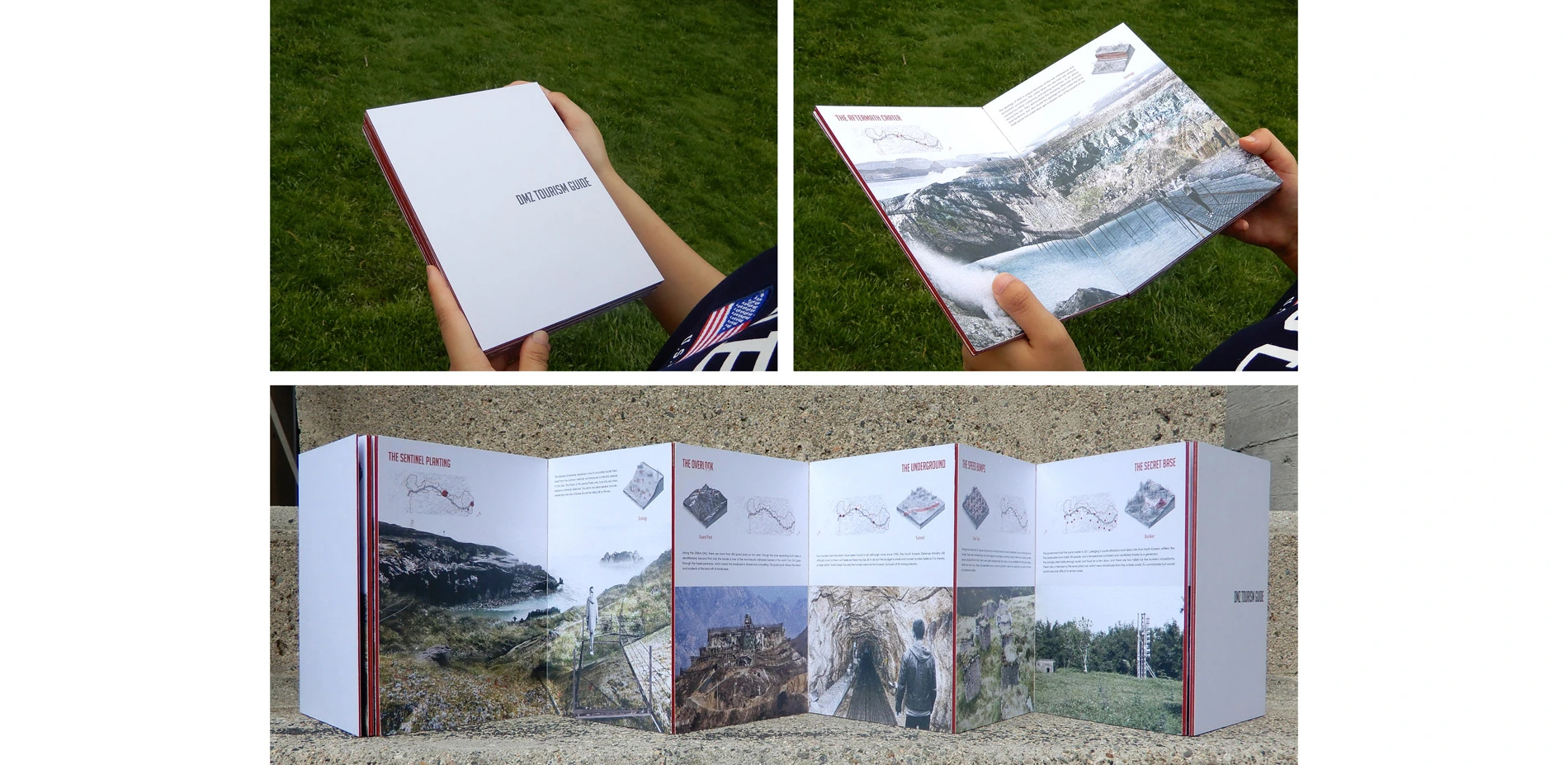
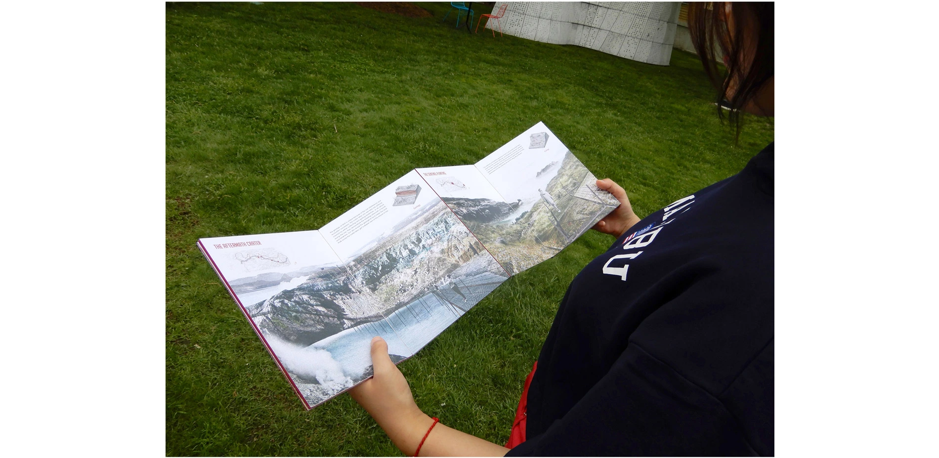
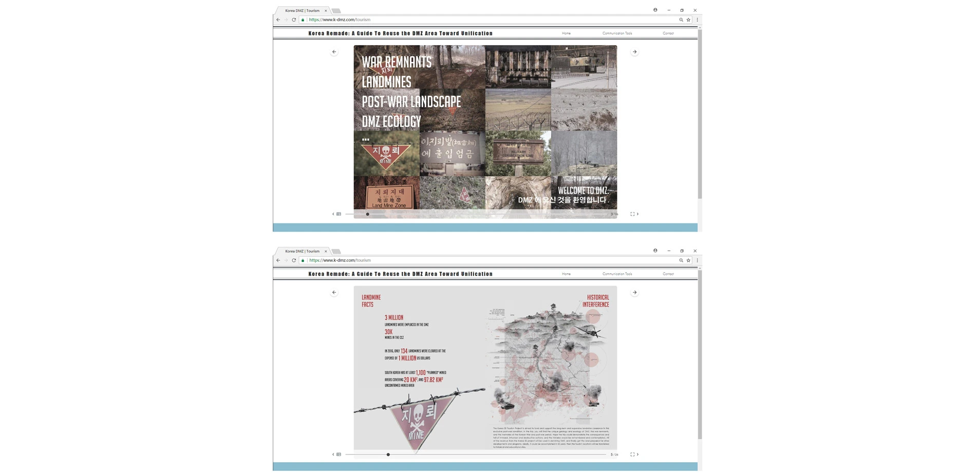
DMZ Tourism Guide: For unification, the many millions of landmines need to be cleared before any development can occur. There are about 3 million mines embedded in the DMZ, while in 2016, only 134 mines were cleared at the cost of 1 million US dollar. In order to support this expensive and long-‐term process, The proposed design it to introduce Dark Tourism to this exclusive post-‐war condition. Dark Tourism is defined as tourism traveling to places that are historically associated with human suffering and deep tragedy. Dark Tourism locations, such as the former Chernobyl Nuclear Facility in Ukraine and the camps of the Second World War in Germany and Poland, demonstrate the consequences and toll of immoral, inhuman and destructive actions. However, at the same time, Dark Tourism generates and provides the means and resources to address the future occupation of such places.
The contents of the Dark Tourism in DMZ would use the unique geology and ecology as media, and make use of the remnants of the war (such battlefield ruins, incursion tunnels, watchtowers, and tank traps) to preserve the memories. Since the sites of Dark Tourism are relatively tiny and scattered, it requires little investment and land at the beginning. As time goes on, the revenue of Dark Tourism could fund the general landmine clearance, and finally get the land prepared for other developments and programs. Ideally, it could be accomplished in 50 years, and the Dark Tourism locations will be transferred into historical and educational sites. It is a temporal program for the region that aims to truly dissolve the physical buffer zone towards complete unification.
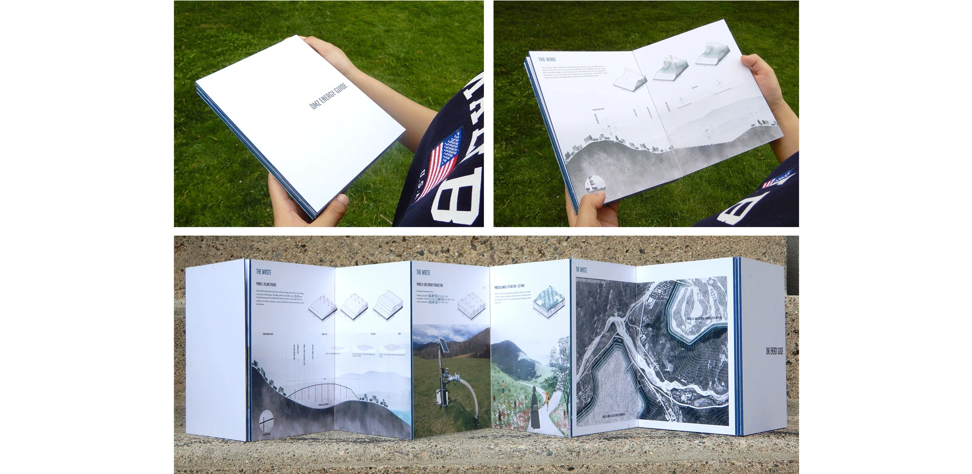
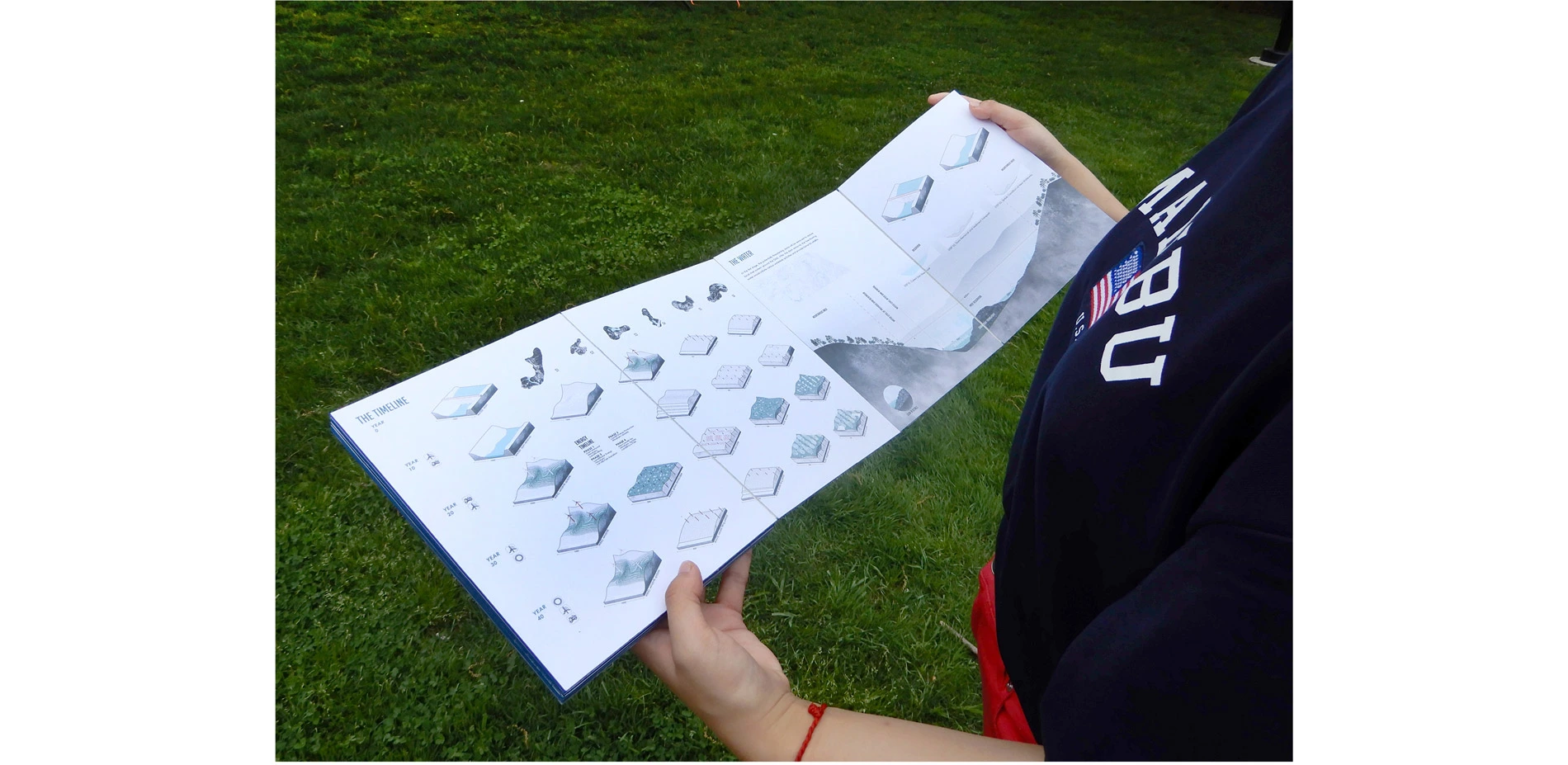
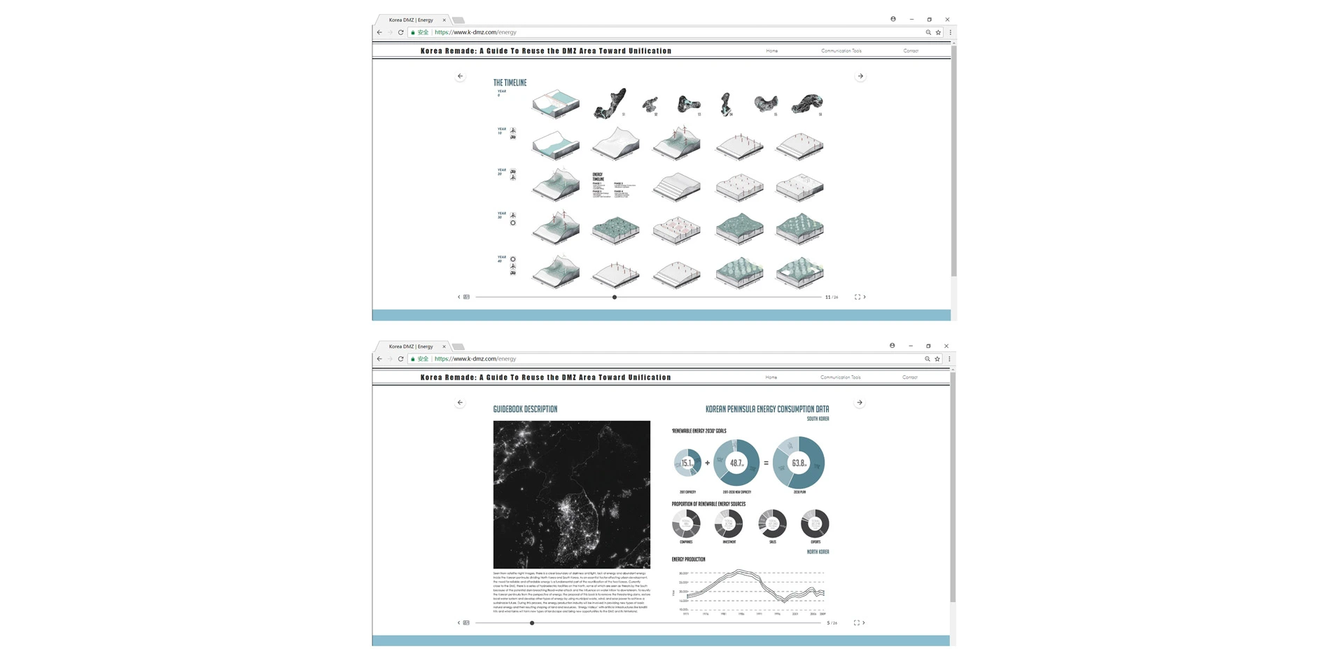
DMZ Energy Guide: Seen from satellite night images, there is a clear boundary of darkness and light, lack of energy and abundant energy inside the Korean peninsula dividing North and South Korea. As an essential factor affecting urban development, the need for reliable and affordable energy is a fundamental part of the reunification of the two Koreas. Currently close to the DMZ, there is a series of hydroelectric facilities on the North, some of which are seen as threats by the South because of the potential dam breaching/flood-‐water attack and the influence on water inflow to downstream. To reunify the Korean peninsula from the perspective of energy, the proposal of this book is to remove the threatening dams, restore local water system and develop other types of energy by using municipal waste, wind, and solar power to achieve a sustainable future. During this process, the energy production industry will be involved in providing new types of basic natural energy and their resulting shaping of land and resources. 'Energy Valleys' with artificial infrastructures like landfill hills and wind-‐farms will form new types of landscape and bring new opportunities to the DMZ and its hinterland.
Distribution Methods:
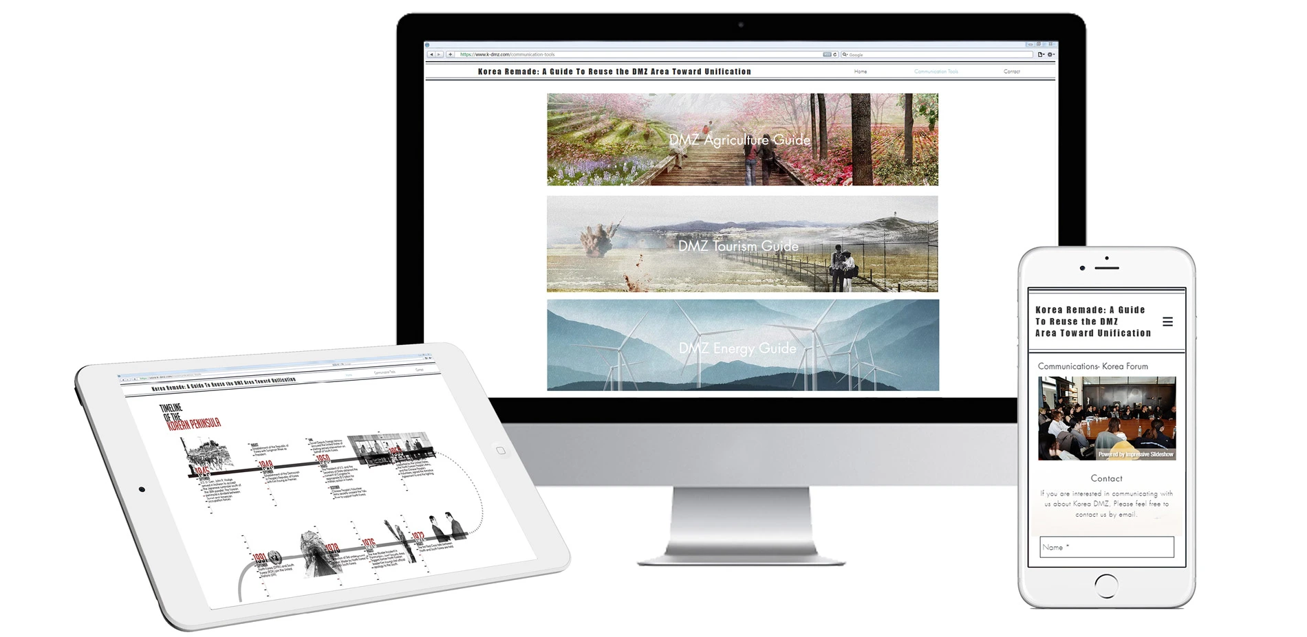
- An exclusive Website (www.k-dmz.com), the digital version books were already published online.
- Hard copy of the DMZ Guidebook.
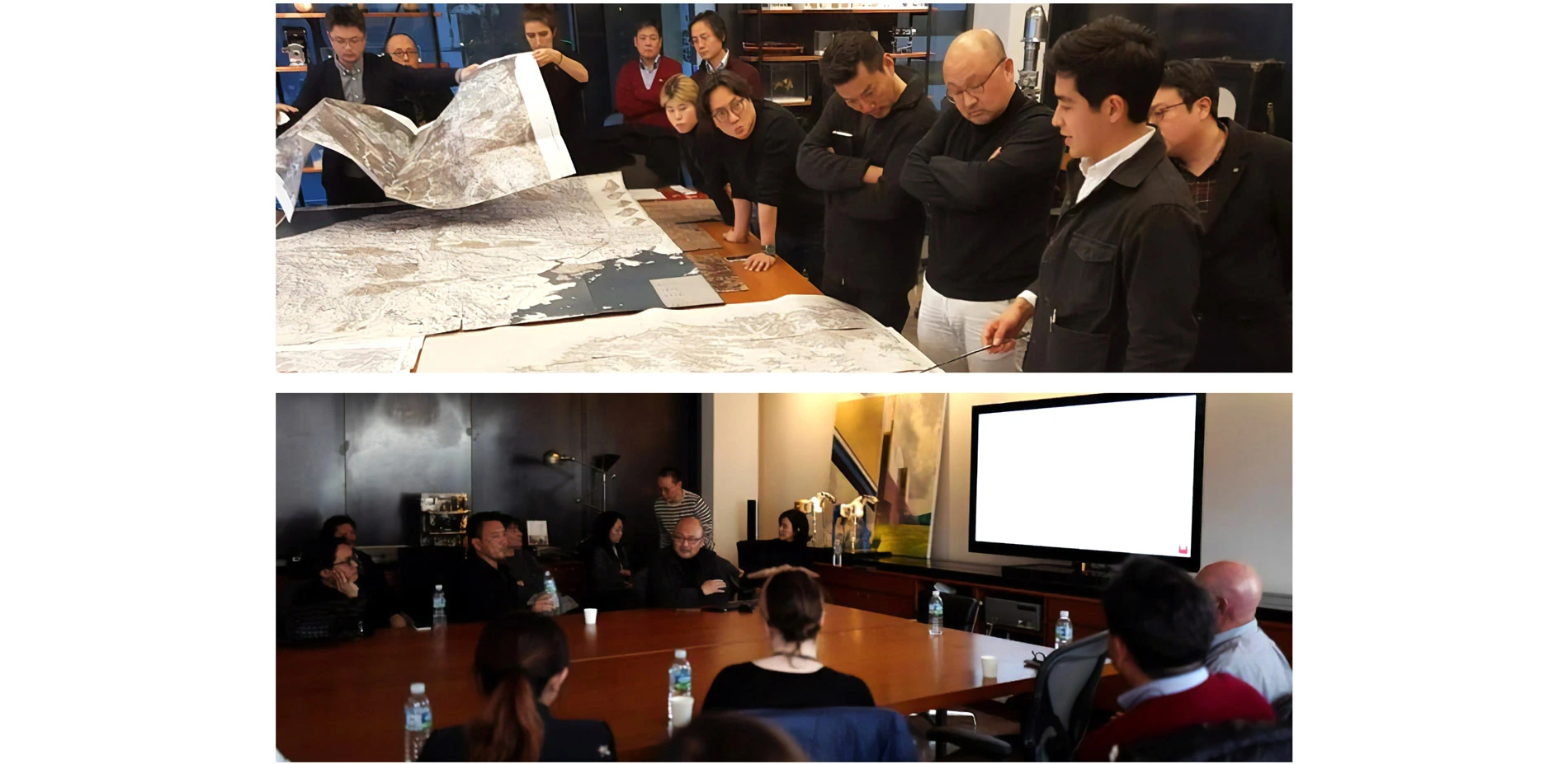
- Korea DMZ Design Forum on March 23th, 2018, Seoul
- Upcoming International Exhibition of proposed work in South Korea in August 2018.
Advertisement
Related Awards
Honor Award, Communications
The Community First Toolkit: A Framework for Equitable Public Spaces
Communities across North America have faced uneven development for decades. The Community First Toolkit (CFT) provides a visionary, adaptable framework for public realm advocates to directly tackle infrastructural racism and embed equity at all stages of the design process.