
.webp?language=en-US)


Iowa Blood Run Cultural Landscape Master Plan
The fact that this project demonstrates that they went in consultation with the various tribes and reached an outcome that everyone collectively agreed on and was excited about is really significant.
Awards Jury
-
The Landscape Architects facilitated the creation of an "entirely different dialogue" between groups culturally connected to the landscape and those positioned to guide the formation of a unique bi-state park. Through a process that fostered teamwork and collaboration, the project brought together representatives of descendant Indigenous communities, local farmers, landowners, residents, economic specialists, historians, naturalists, and other stakeholders, to find common ground and develop an inspirational plan for the future of Blood Run (Xe). The interdisciplinary team conducted rigorous qualitative and quantitative research that provided a basis for a shared understanding among diverse project participants. The resulting Cultural Landscape Master Plan provides a comprehensive framework for establishment of a bi-state park that respects, preserves, protects, and emphasizes the unique heritage of the study area; strengthens appreciation of regional American Indian heritage, local history, current community activities, and natural resources; while fostering understanding, use, and enjoyment through education, interpretation, and compatible recreation. In addition, the process cultivated a community dedicated to the implementation of the plan and a structure to facilitate their long-term involvement.
-
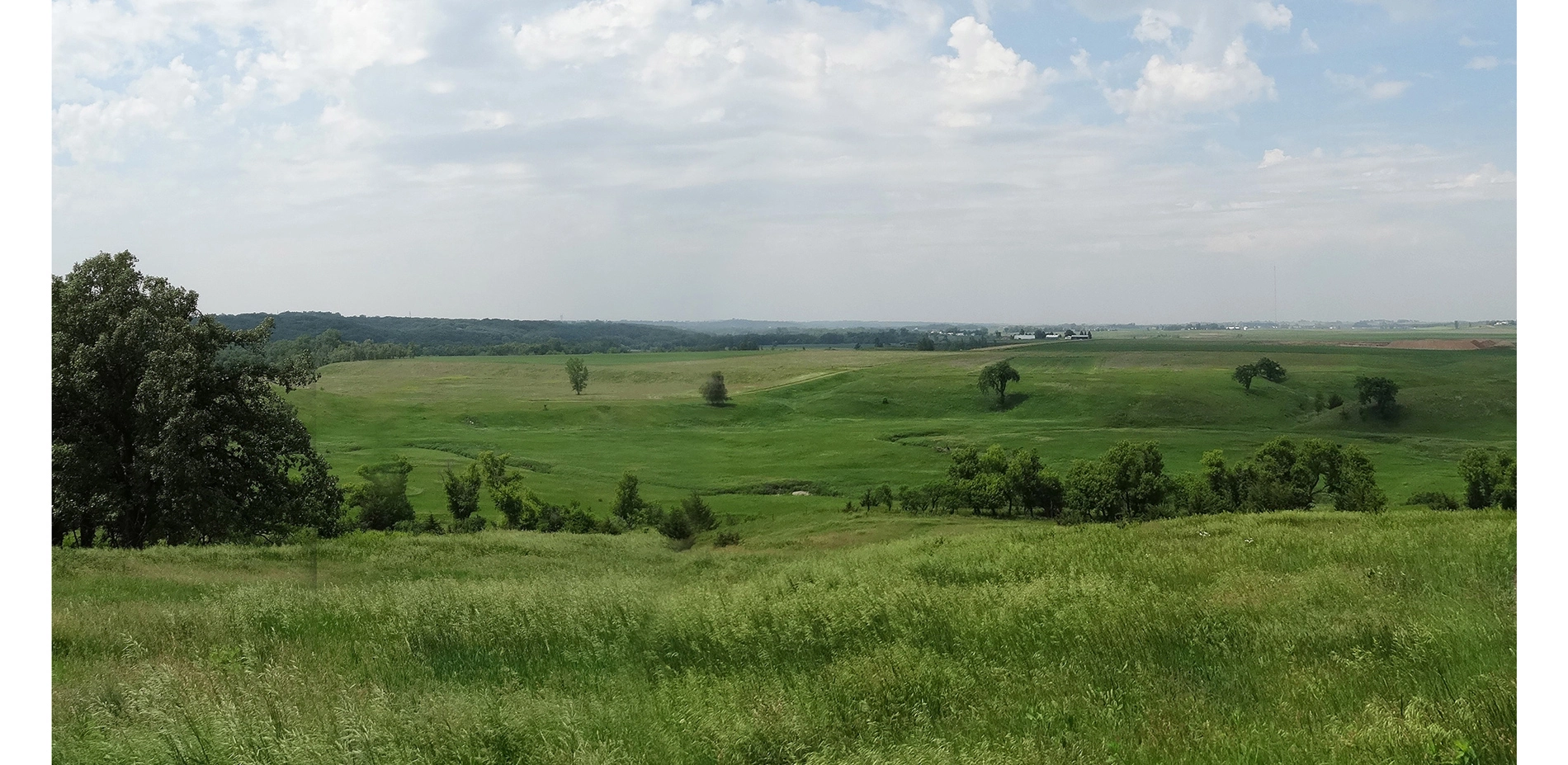
The Cultural Landscape Master Plan (CLMP) provides an inspirational guide for future use, interpretation, and management, of the National Historic Landmark (NHL). Blood Run (Xe) is the largest known and most complex site of the American Indian Oneota tradition, intensively occupied from about A.D. 1500 until ca.1714. Numerous earthen mounds and other significant features are still visible on the landscape. Below ground is an astonishingly well-preserved archaeological record. Multiple American Indian tribes maintain strong cultural connections to Xe today.
The Landscape Architect applied a cultural landscape approach to the Master Plan. This initialized with facilitation of a highly collaborative process including diverse stakeholders to develop a vision, goals and guiding principles for the project. Careful attention was paid to building a community of people culturally connected to the landscape that will continue to work together. Most importantly, we listened: to the people whose passionate connections to this place provide the basis of its significance; and to the landscape itself that exudes a spiritual sense of place that washes over as visitors walk into its spaces that have served as home, food, and shelter, for people for over 1500 years. The resulting plan provides a structure for protecting Xe from harm while welcoming people to come to walk, and listen, and learn.
The vision directs the Master Plan to guide development of Xe as a place that respects, preserves, protects, and emphasizes the unique heritage of the study area; fosters appreciation of the regional Oneota tradition, local history, the current community, and natural resources; and enhances understanding, use, and enjoyment through education, interpretation, and compatible recreation.
Nine project goals were developed and endorsed jointly by all project participants:
- Develop a comprehensive master plan which incorporates the perspectives of all stakeholders by integrating concerns of Native American Nations, local, state, and federal interest groups, and interested individuals in the planning process.
- Provide guidance for the future management of the study area to include a formal advisory group of representative stakeholders.
- Analyze current site conditions and evaluate historic landscape characteristics.
- Provide guidance for the understanding, management, and protection of natural and cultural landscape resources.
- Provide recommendations for use, activities, and their locations within the study area.
- Provide recommendations for enhanced education and interpretation.
- Provide recommendations for protection of documents, artifacts, and sacred items associated with the study area.
- Integrate environmental sensitivity and sustainability into site development and educational and interpretive programs.
- Identify opportunities to partner with local, regional, and national entities.
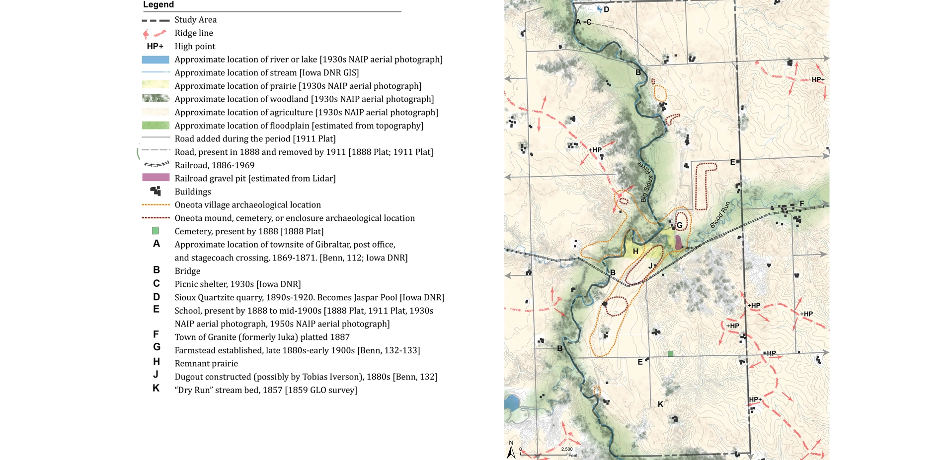
Historical research utilized primary and secondary sources to develop a rich account of the physical changes to the landscape beginning with its geological formation through its current condition. The report includes a detailed chapter on the history of the site, including diagrams illustrating landscape conditions at key time periods. Emphasis is placed on the period from ca. 1500 to ca. 1750, the height of occupation by the Oneota Culture, and period of significance for the NHL. The dense settlement included about 10,000 people. Trade extended primarily along the Big Sioux and Missouri Rivers. During the expansion of the US, agriculture, railroads, roads, villages, and farmsteads changed the landscape. For over a century (beginning 1851), the area has been a rural farming community. Detailed documentation of historic site conditions indicates locations of features that are difficult to see on the ground today. Mounds, pitted boulders, and stone circles were clearly evident in the 1880s. Team archaeologists helped project participants understand how to protect these sites.
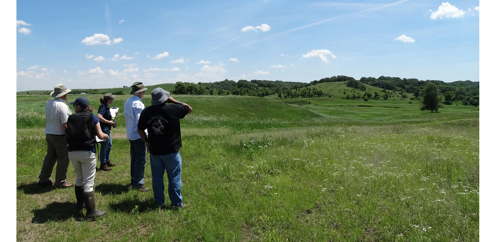
Interviews with descendant American Indians contributed a broad understanding of the meaning of the landscape to their communities today. Xe is a sacred site to the Omaha Tribe of Nebraska, the Ponca Tribe of Nebraska, the Ioway Tribe of Kansas and Nebraska, the Ioway Tribe of Oklahoma, the Otoe-Missouria Tribe of Indians, and the Ponca Tribe of Oklahoma. Representatives of these communities were included throughout the project process to ensure their cultural perspectives informed recommendations.
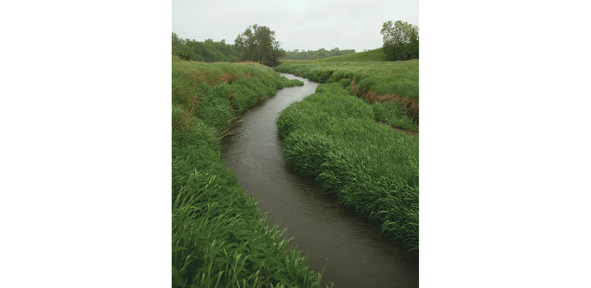
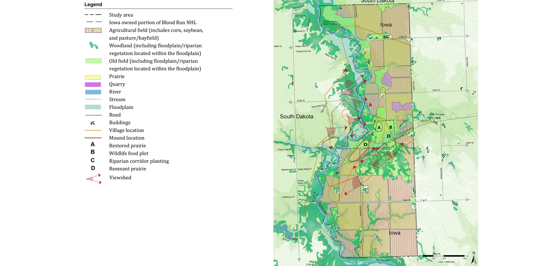
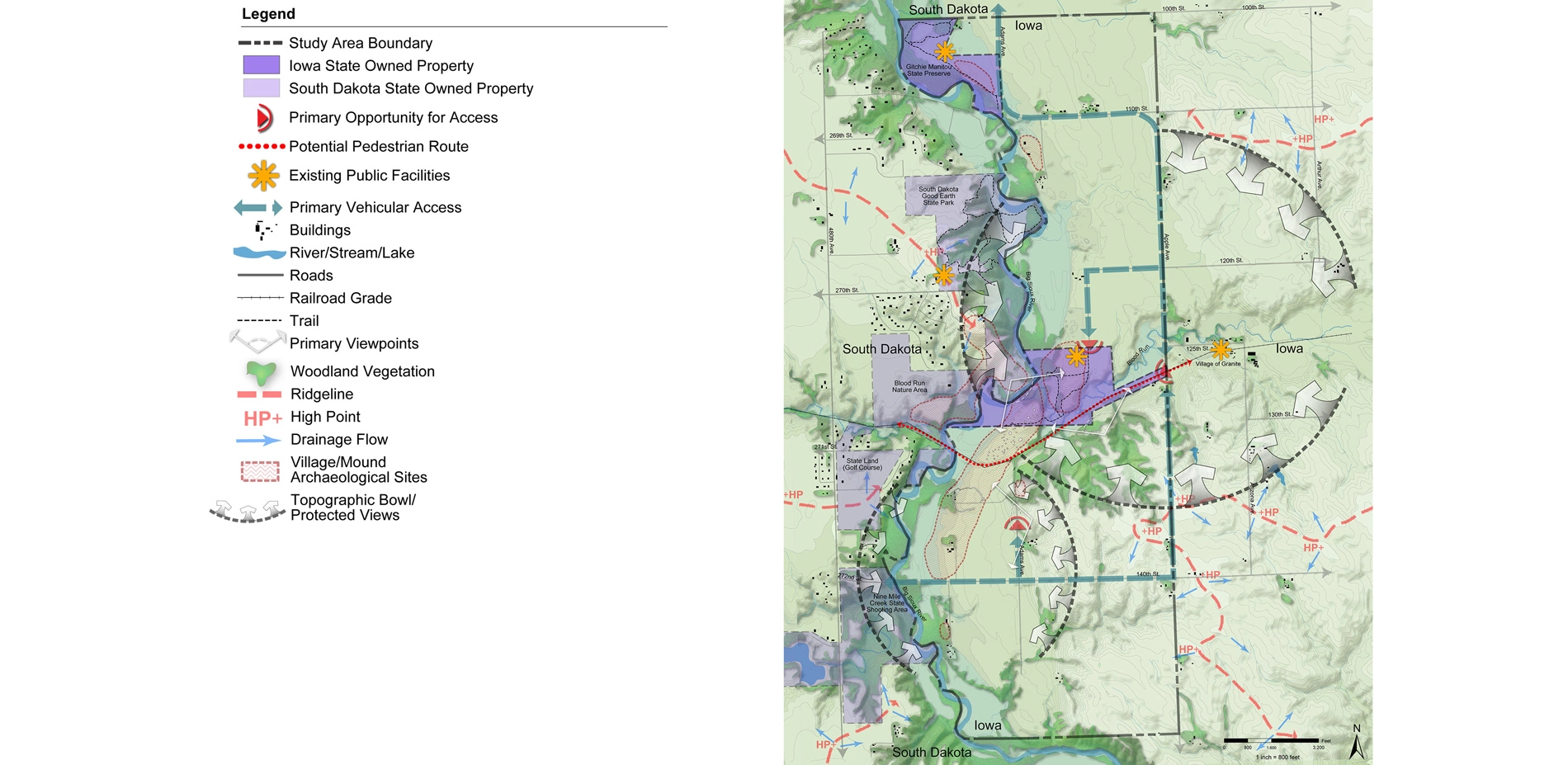
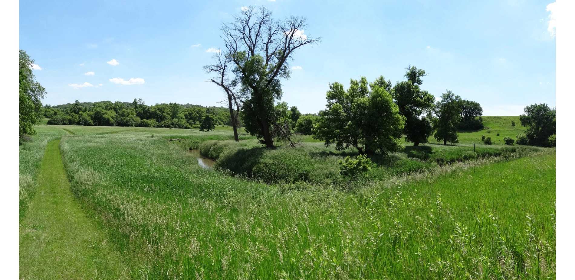
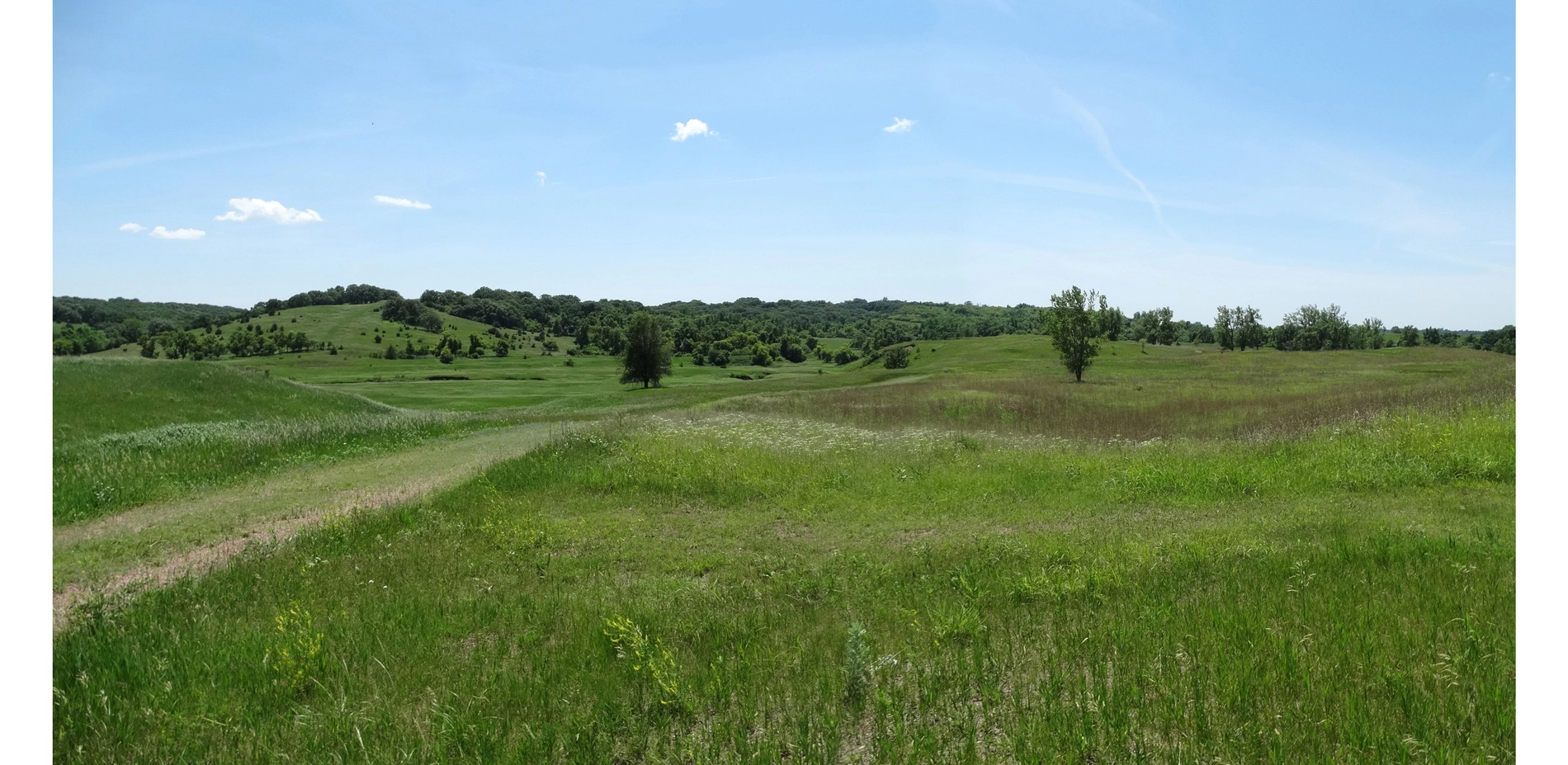
A thorough analysis of integrity was conducted based on federal guidelines for cultural landscapes. The bluffs of the Big Sioux River rise 150' above the village site. The creek terraces display compelling topography associated with American Indian farming, settlement, and mound building. Pitted boulders are found on slopes near village sites. Existing vegetation is dominated by agricultural fields. Woodlands are on steep slopes and floodplain riparian vegetation is along waterways. Small areas of remnant and restored prairie are also present.
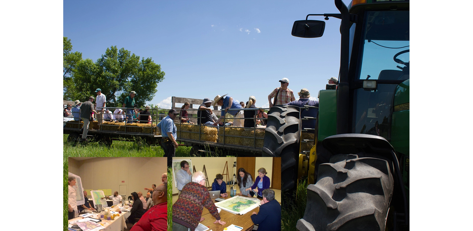
Project participants were brought together in multiple ways to integrate their knowledge in recommendations and foster a spirit of camaraderie among stakeholders that continues today. Visiting the landscape together created powerful connections and supported goodwill. Focus group meetings built trust and provided opportunities to thoughtfully discuss differences in opinions and develop solutions. A combination of focus group activities and large group discussions engaged participants and resulted in a solid agreement for recommendations.
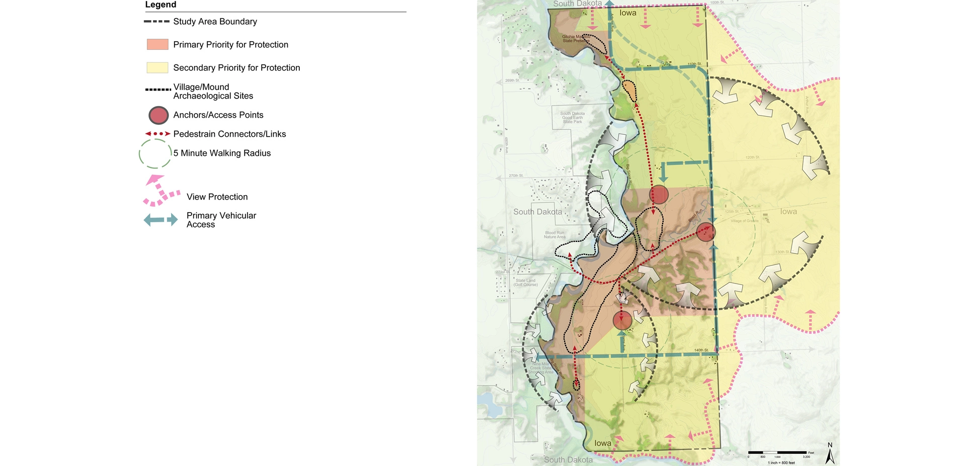
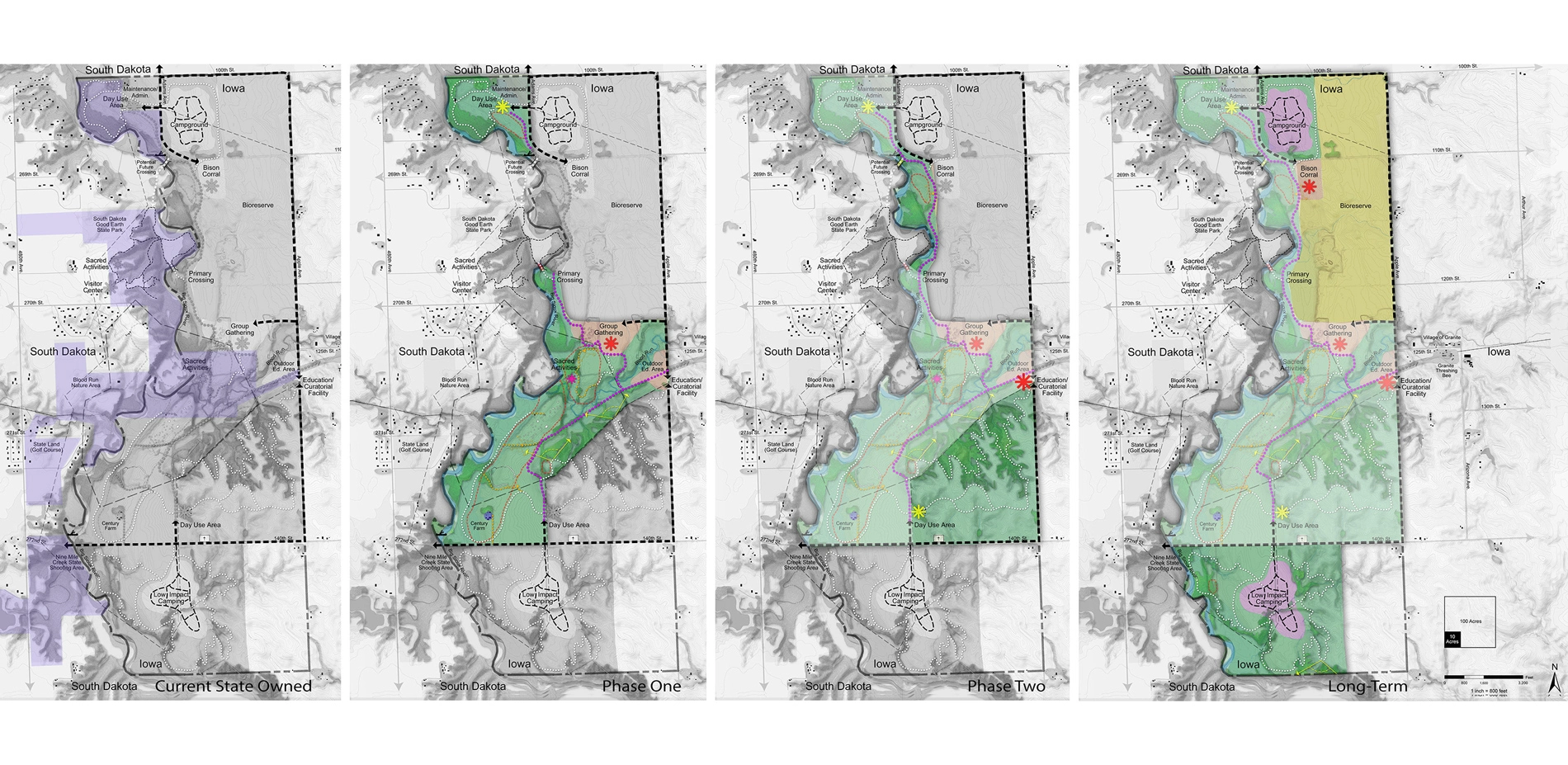
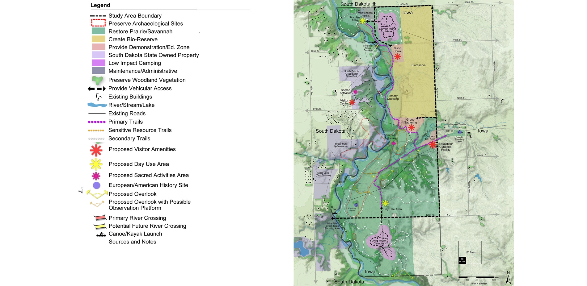
The Landscape Architects used varied methods to help all participants understand the complex research findings. A site capacity diagram illustrates opportunities and constraints. This helped project participants understand key features and needs, and places where protective measures, such as view shed protection, stormwater management, and property acquisition, may be applied to improve environmental quality. A Site Framework Plan identifies zones of natural and cultural resource protection, as well as primary opportunities for program elements including visitor services and circulation routes. The consultant utilized three-dimensional technology to help participants visualize solutions for specific areas. An abandoned railroad and river bridging opportunities were studied using sections and distance data. The information provided a basis for development of concepts by participants during a multiple-day design charrette.
The plan includes detailed guidance for a wide range of recommendations and a phased approach for implementation. Recommendations include preservation treatments for mounds and other significant sites, interpretive and hiking trails, an educational and curatorial facility, an outdoor educational demonstration area, facilities for group gatherings, picnics, day use, research, camping, and maintenance/ administration. Consideration of long-term resiliency, water quality, and cultural connections, resulted in recommendations to restore indigenous plant communities as part of a bio-reserve that may include a bison herd.
Tribal representatives identified areas for sacred activities to be cared for and used by tribes. Protection of significant sites and use of areas for spiritual activities by tribes are addressed. Visitor orientation includes cues in the landscape will help visitors know when they are in sensitive areas. Interpretive information explains behaviors that are appropriate and respectful.
The report describes three primary interpretive themes important to the site, and identifies key facilities needed to support interpretation and education. Opportunities to link interpretation and education topics to the landscape are identified along proposed trail routes.
The state of Iowa is moving forward to implement the Master Plan. Phase one includes forming an advisory commission including Tribal representatives and other stakeholders, purchasing land, preserving sensitive areas, and establishing sites for spiritual activities, trails, and interpretive information. The states of Iowa and South Dakota, representatives of five tribal nations, and the local community have all indicated that the report has great value to guide the future of Xe. They have also commended the process as successful in bringing together representatives of diverging opinions and facilitating development of a common vision. It is being used by designers as an example of how to integrate Indigenous knowledge into planning for significant landscapes.
A main value of the project process is the effect it had on the people involved. By connecting with each other and Xe, we were inspired to create a guide for the future while establishing lifelong affinity with each other and this amazing landscape.
-
Landscape Architect of Record/Firm
- Quinn Evans Architects (team included Brenda Williams, ASLA, Stephanie Austin, Ruth Mills, Steve Jones, AIA, Alyson Steele, AIA, and Julia Siple, AIA)
Consulting Team
- Lunde Williams, LLC (now with MSA) (team included Dan Williams, ASLA)
- Iowa Office of the State Archaeologist (team included Lara Noldner, John Hedden, Mary de la Garza, Elizabeth Reetz, and Melody Pope)
- Coolfire Conservation, LLC (team included Paul West)
Tribal Representatives
- Ponca Tribe of Nebraska (Randy Teboe, Director of Cultural Affairs and Shannon Wright, THPO)
- Iowa Tribe of Kansas and Nebraska (Lance Foster, THPO)
- Omaha Tribe of Nebraska (Marisa Miakonda Cummings and Thomas Parker, THPO)
- Otoe-Missouria Tribe of Oklahoma (Galen Springer, THPO)
- Iowa Tribe of Oklahoma (Bobby Walkup, Tribal Chair and Eagle McClellan)
- Ponca Tribe of Oklahoma (Earl Howe III, Chair and Paula Mendoza)
Stakeholders
- State Historical Society of Iowa Board of Trustees (Bill Bartine, Chair)
- Iowa Natural Heritage Foundation (Joe McGovern, Executive Director)
- Keep Iowa Beautiful (Gerald Schnepf, Executive Director)
- Lyon County Economic Development (Steve Simons)
- Lyon County Historical Society (Jim Zangger, Byron Schrick, George Shurr)
- Blood Run Advisor (Dale Henning)
- South Dakota State Parks (Doug Hofer, Al Nedved, Jim Henning, Dennis Williams, Jeff Van Meeteren, Eric Vander Stouwe)
- National Park Service (Vergil Noble, Rachel Franklin-Weekly)
- Preservation Iowa
- Iowa Tourism Office, Shawna Lode
- And many dedicated individuals who care deeply about Blood Run
- Iowa Department of Natural Resources (team included Todd Coffelt, Michelle Wilson, John Pearson, Frank Rickerl, Pat Schlarbaum, and Kevin Pape)
- State Historical Society of Iowa (team included Jen Bancescu, Doug Jones, Susan Kloewer, and Steve King)
- Iowa Office of the State Archaeologist (team included John Doershuk)
- The Lyon County Conservation Board (team included Craig Van Otterloo, Emily Ostrander)
Advertisement
Related Awards

Honor Award, Analysis & Planning
A Cultural Approach: The Fort Peck Tribes Hazard Mitigation Plan
In collaboration with the Fort Peck Assiniboine and Sioux Tribes, EPA, and FEMA, the Fort Peck Tribes Hazard Mitigation Plan (HMP) adopts a culturally responsive approach to hazard mitigation planning that features connection to place.

