.webp?language=en-US)


A Colorado Legacy: I-25 Conservation Corridor Master Plan
I’m thrilled to see a landscape architect at the heart of a politically and financially complex issue like this, one that seems to really have significant momentum toward being implemented.
Awards Jury
-
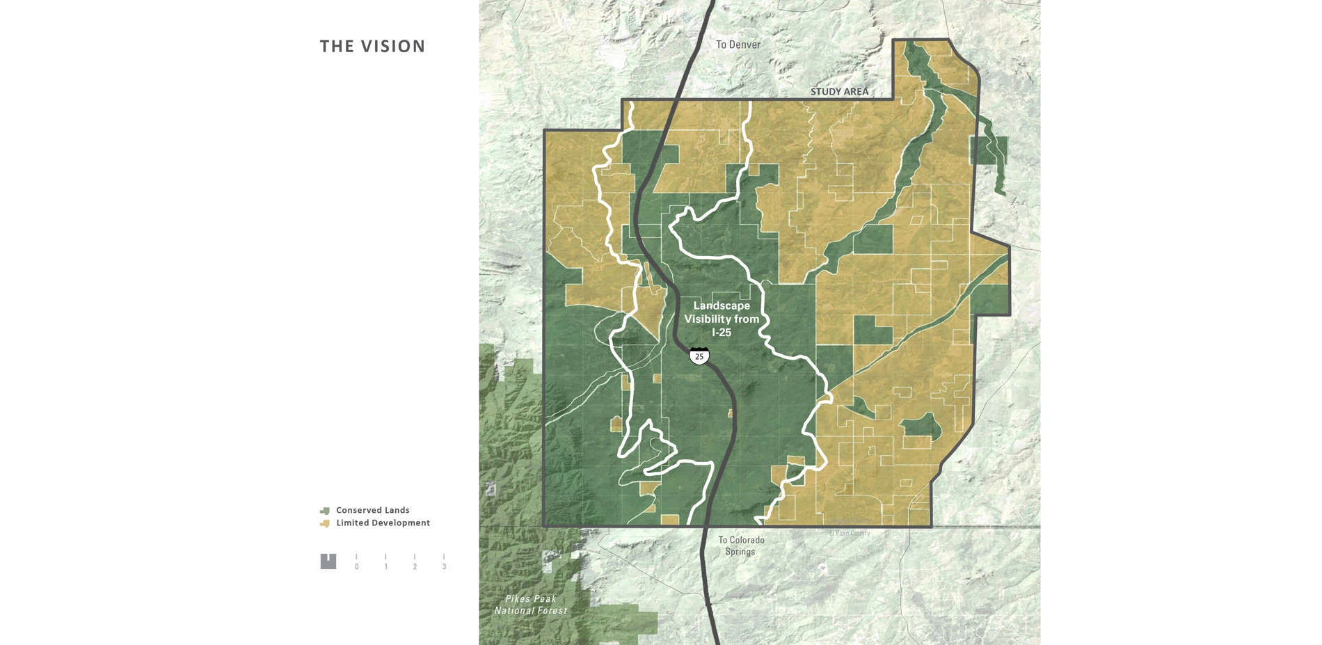
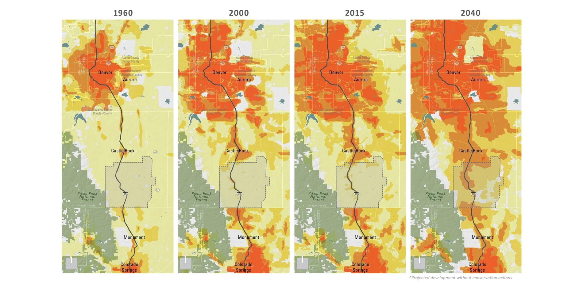
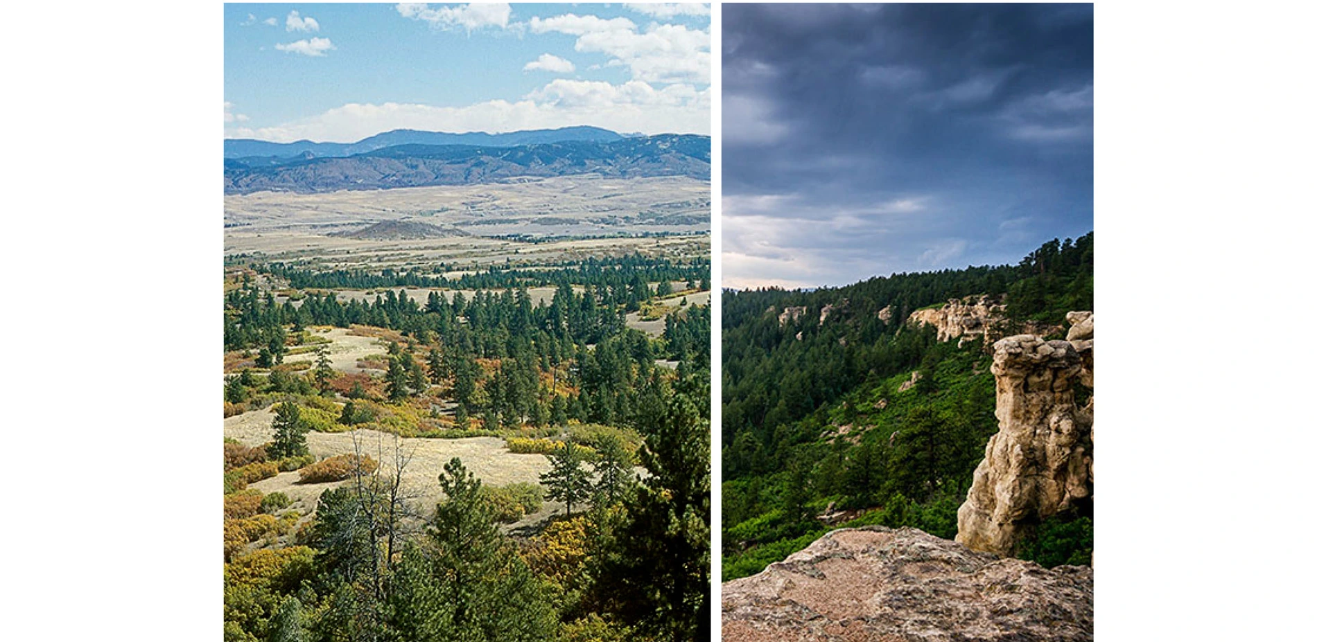
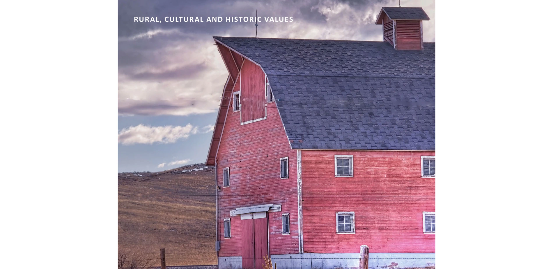
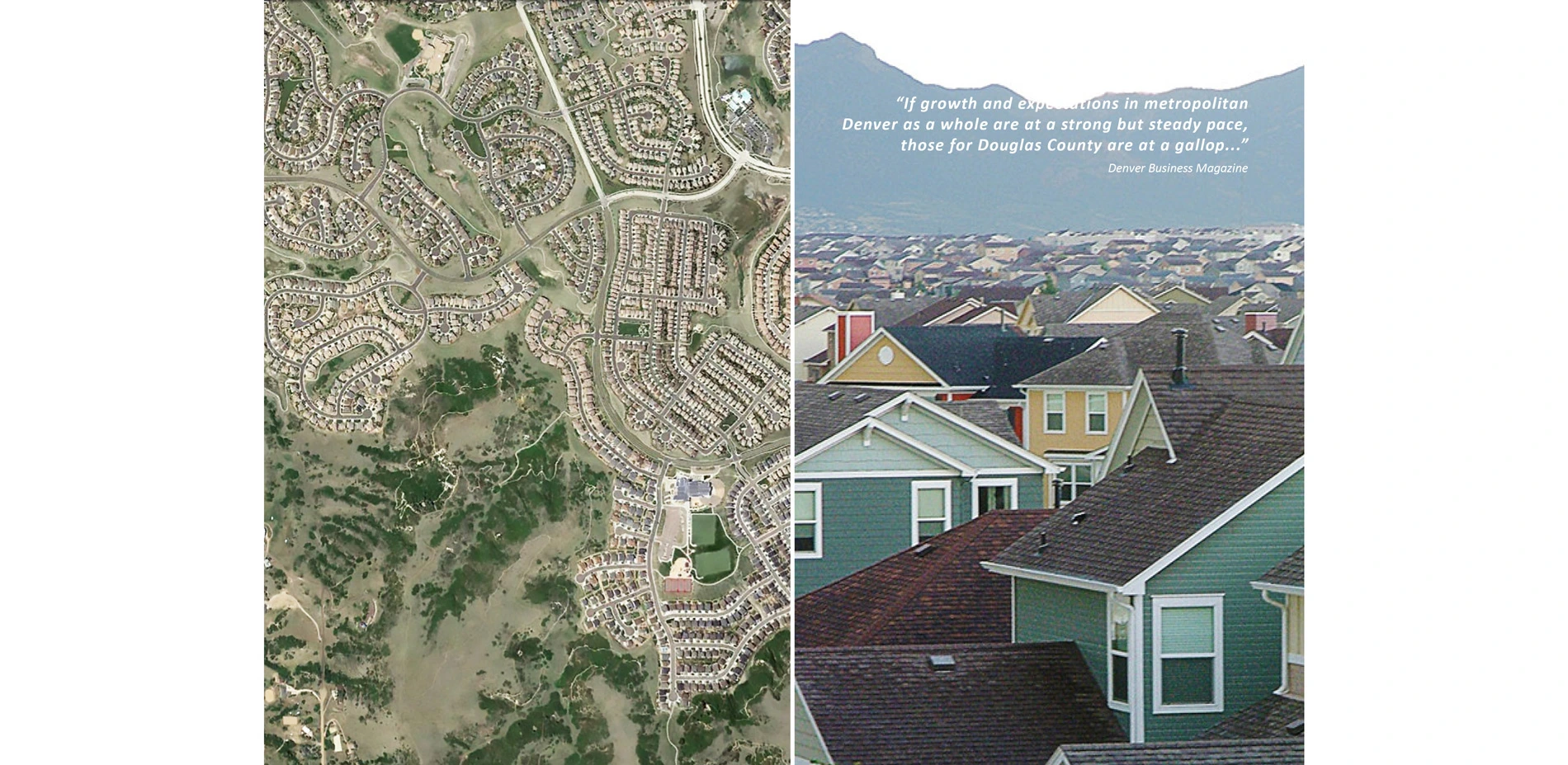
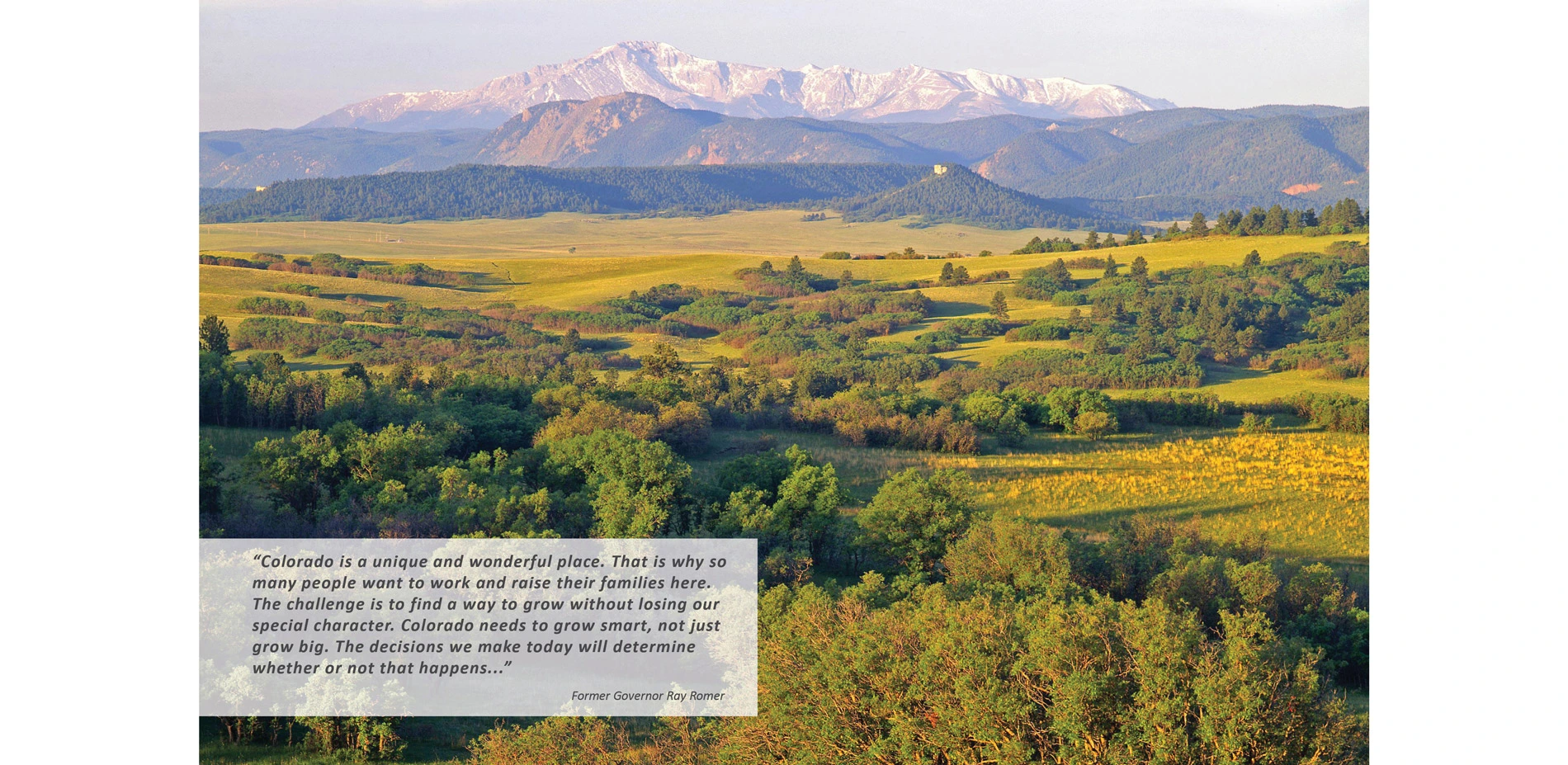
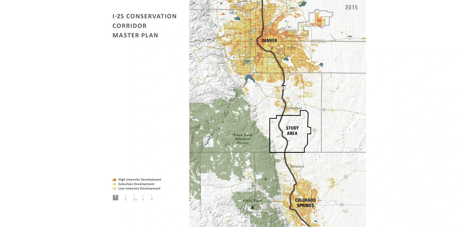
Over 73,000 vehicles travel the Front Range corridor between Colorado Springs and Denver on any given day. This area is growing fast. Population is increasing at a clip of 1,000 per-month and construction continues to change the skyline. South of Castle Rock, however, sweeping views of the mountains emerge amidst a pristine foreground of rolling grasslands, mesas and historic ranches. This unique 17-mile stretch of Interstate 25 lies undeveloped following the implementation of the I-25 Conservation Corridor Master Plan, the result of a strong strategic vision coupled with unprecedented cooperation among conservation organizations, government entities and private landowners.
The Conservation Fund, in collaboration with the landscape architect, initiated a strategy to engage residents and government officials in conserving open lands to forever protect scenic vistas, water quality, wildlife, clean air and recreational opportunities along the corridor. Devised to offer solutions to the surrounding uncontrolled sprawl, the plan leveraged unique planning methods and limited development strategies to achieve what had been previously considered impossible: preservation of over 100,000 acres of open space along Colorado's Front Range.
-
"If growth expectations in metropolitan Denver are strong, Douglas County's are at a gallop. With the coming explosion along Denver's southern I-25 Corridor and development in Colorado Springs, commercial and real estate developers are positioning themselves in Douglas County along the Corridor." - Denver Business Magazine
Context
Preserving land and scenic resources in Colorado, particularly along the Front Range, has proved virtually impossible for many cities and counties. This is due to rapid growth, high costs of public land acquisition, infrastructure policies that encourage sprawl and a unique exception in state law that allows subdivision of 35-acre parcels without adherence to zoning or other regulations. This exemption ensures that any traditional form of planning can be overturned by any property owner.
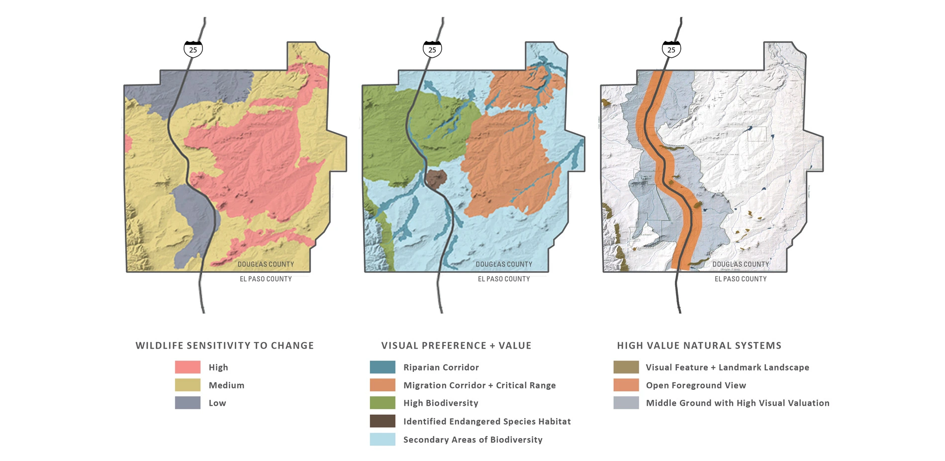
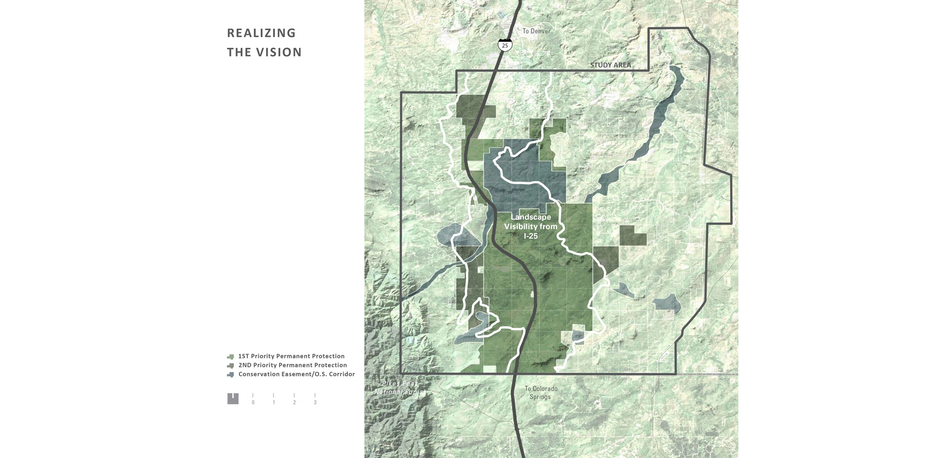
Prompted into action by record and uncontrolledgrowth along the I-25 Corridor, environmental groups, land trusts, local communities, Douglas County, and state agencies formed an unusual coalition to create a regional conservation vision. A multi-disciplinary planning team, under the leadership of the landscape architect, worked with limited resources to create a unique set of analysis tools to identify areas of significant natural and scenic resources most vulnerable to development. Critical attributes of the landscape were analyzed, including scenic view corridors, topography, land cover, natural hazards, land value, zoning, land ownership, view characteristics, wildlife habitat and migrations, ground water availability, recreational trends, heritage sites and the status of development commitments. Once these attributes were analyzed and the significant resources understood, the team developed an initial vision for the permanent preservation of an area of significant open space marking a large-scale transition from prairie to peak between the expanding cities of Denver and Colorado Springs.
Next, a citizen survey was conducted to determine if area residents agreed with the vision. Feedback was overwhelming: residents placed a high priority on preserving open space, particularly lands where critical wildlife habitat and stream corridors were present. Even Colorado's governor weighed in, suggesting that the region under consideration is "…one of the most gorgeous examples of Colorado's natural heritage." Because his support for the vision was so palpable, the planning team was able to engage many state agencies to help implement the vision. With the public and the governor's office on board, the planning team sought to develop additional support for the I-25 Corridor Master Plan and gained commitments from a variety of agencies and communities needed to formulate a cohesive effort.
Conservation Methods
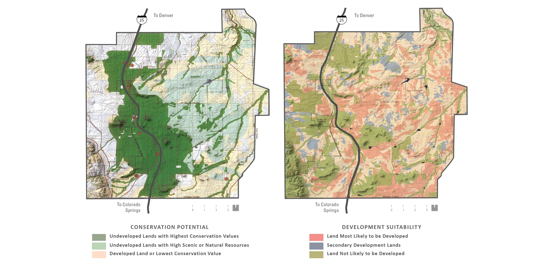
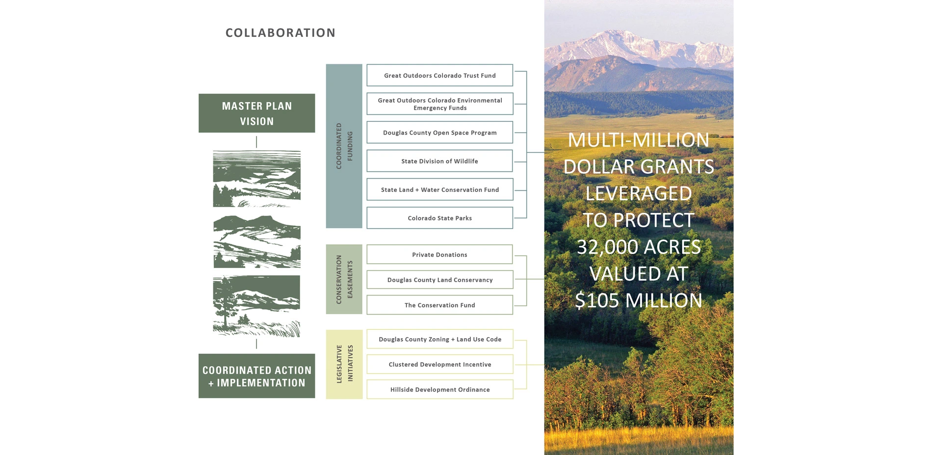
With support for the vision secured, urban growth analysis models were utilized to forecast locations throughout the corridor deemed likely to be developed first. These locations were then matched against areas with significant natural and scenic resources. The resulting investigation revealed both potential conflicts and preservation priority areas. It also directed the initial recommendation of permanent protection of a core area of 25,000 acres via acquisition or through the establishment of conservation easements, a measure which would effectively remove all development rights from a property while maintaining recreational and existing agricultural uses. The resulting tax benefit to landowners for placing an easement on their property was embraced by the public, ultimately influencing the land use outcome and making easements direct solutions for implementation.
In addition to permanent conservation of the core area, a second group of targeted conservation sites were identified for the establishment of limited clustered development on sites where impact to resources was minimal. For this scenario to be successful, however, it was imperative that the team highlight the benefits of open space to the development community. Emphasizing that preserving additional land effectively increased the value of the adjacent developed land, the team was ultimately able to measurably reduce the total number of residential units proposed for the corridor and minimize the amount of open space that needed to be purchased.
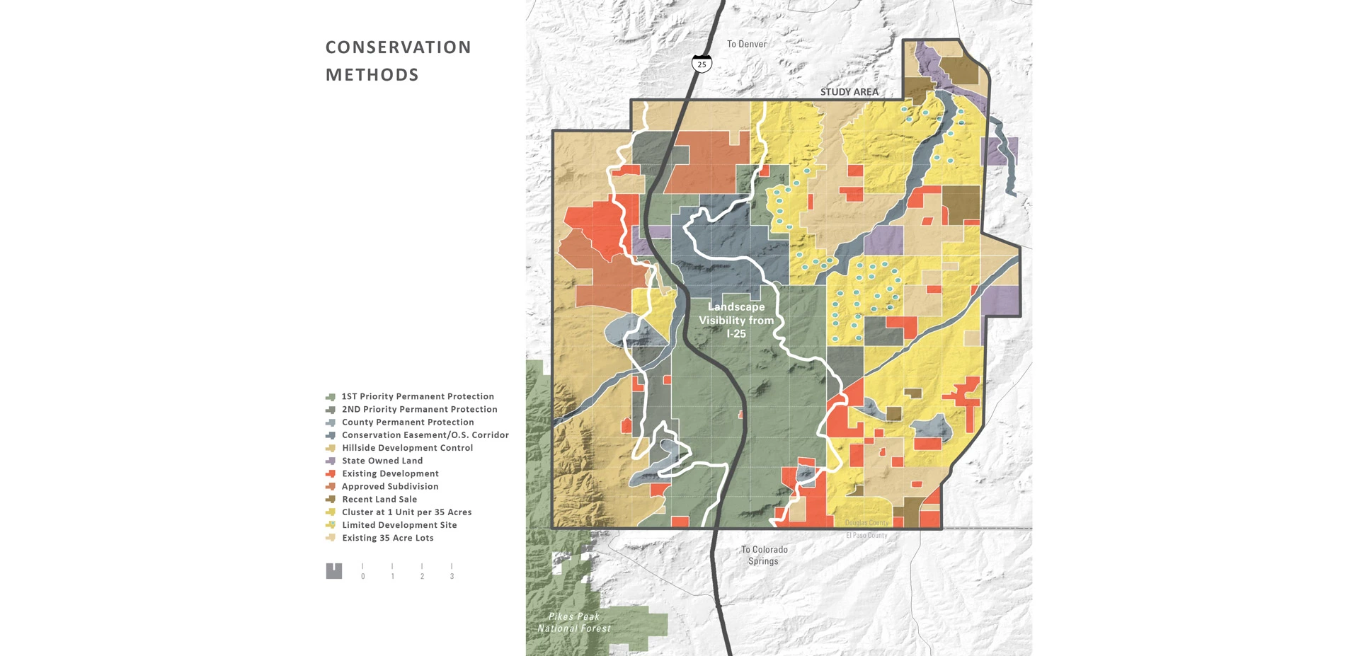
Beyond conservation easements and clustered development scenarios, the team employed policy recommendations to conserve the highest quality lands and allow for sensitive development in the future. Funding was allocated to areas where it would be most effective, forming the basis for informed decision making, consensus building and negotiation. Importantly, while the plan succeeded in encouraging developers to consider the value of scenic and natural resources in subdivision planning, it was also instrumental in convincing conservationists that appropriate development can support land preservation.
Achieving Success
Despite being armed with a vision, public support and a plan for future preservation, the plan's success was curtailed due to the lack of County regulations directing location, type and pace of development.
The team's refocused implementation of the planning efforts by securing a multi-million dollar grant from the Great Outdoors Colorado Trust Fund to allow for the immediate acquisition of parcels identified as priority conservation lands. Additional fund-raising facilitated the purchase of areas zoned for dense development, drastically decreasing the proposed densities. The team also proposed that all future development plans for land in the corridor purposely cluster and site houses out of public view, and place any remaining land in permanent conservation easements, ultimately preserving both open space and views in perpetuity.
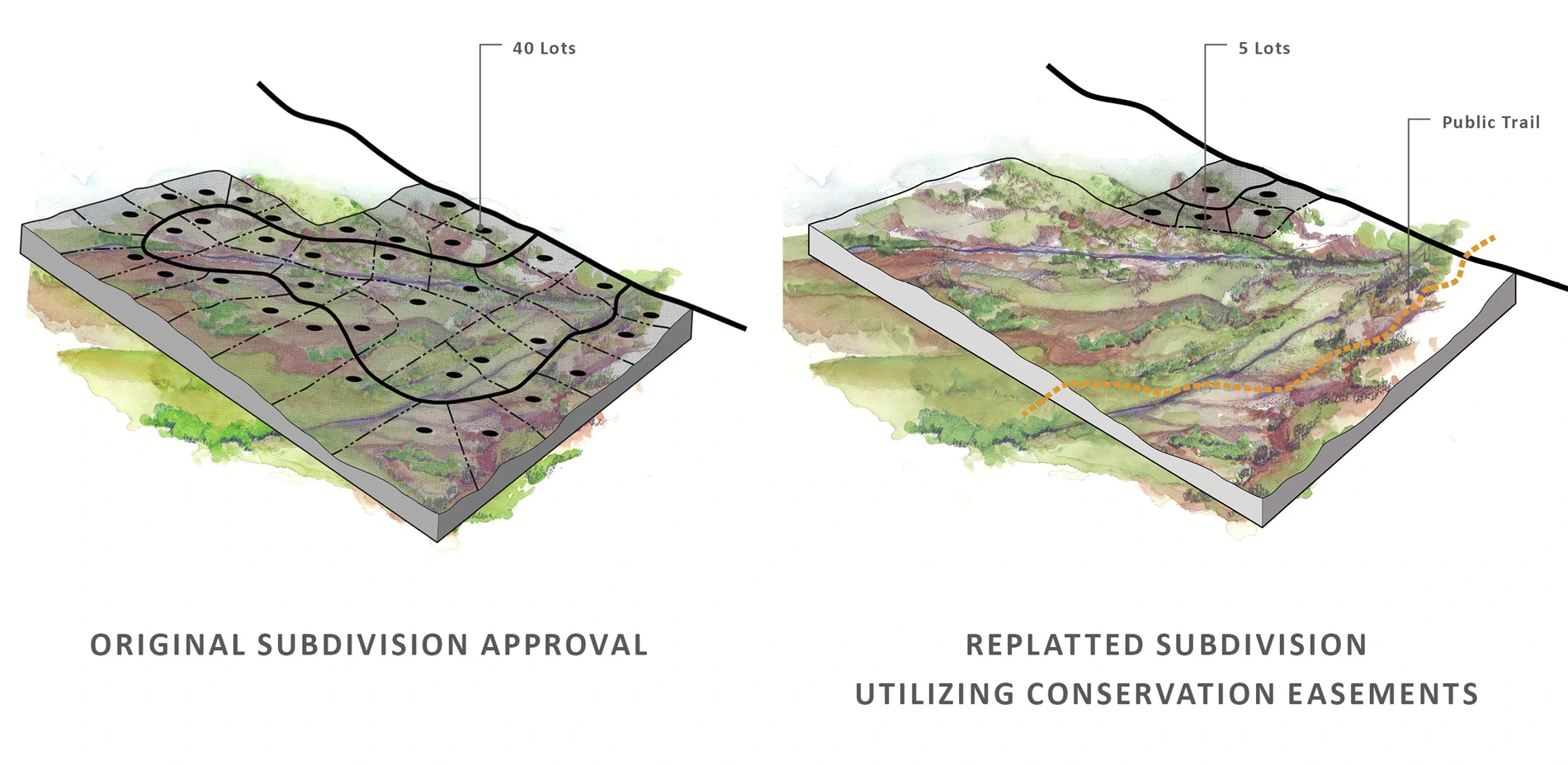
The complexities inherent in land transactions increased as the planning team transitioned from "vision planning" to implementation. In a final push to complete the vision, The Conservation Fund intervened to secure a 1,300-acre property that provided the best public view of Pikes Peak along the corridor. The urgency of the conservation effort was highlighted by the fact that roads and infrastructure construction for 40 houses was already underway. Using napkin sketches created by the landscape architect illustrating sensitively clustered residential lots, the developer was convinced to replat the property, effectively removing all residential lots from public view. This eleventh hour change ultimately proved the extraordinary conservation success of the Corridor Master Plan.
Implementation Takes Hold
The effectiveness of the I-25 Conservation Corridor Master Plan can be measured through its efforts to preserve a significant landscape in distress. Through rigorous analysis, a variety of innovative land conservation methods (including purchase of undeveloped lots, conservation easements, limited development strategies and zoning changes to clustered development) and the support and funding received from various state agencies, a quintessential Front Range landscape on the verge of irreparable change was preserved. To date, 32,000 acres of land originally appraised at over $105 million have been purchased and protected for less than 30 percent of market value. The plan, which not only set forth methods and strategies to achieve a vision for the preservation of remarkable open lands with unmatched natural and scenic resources, also outlined a regional process that permanently limits poor development practices in favor of responsible development combined with preservation of open space.
-
Lead Designer
- Richard Shaw, FASLA
Landscape Architect
- Design Workshop, Inc. - Aspen, Colorado
- Principal-in-Charge - Richard Shaw, FASLA
- Project Manager(s) - Suzanne Jackson, Sarah Chase
- Project Assistant - Sarah Horn
- GIS Technician - Carly Klein
Real Estate Counseling
- Hunsperger, Weston, Zink Ltd.
Project Input + Support
- Great Outdoors Colorado Trust Fund
- Gates Foundation
- Former Colorado Governor Roy Romer
- Douglas County (Board of County Commissioners, Open Space Advisory Committee, Planning Department, Town of Larkspur)
- Colorado Department of Natural Resources
- Colorado Division of Wildlife
- Colorado State Parks
- Colorado Open Lands
- Gates Corporation
- Mission Viejo Company
- Colorado Natural Heritage Program
- Colorado Department of Transportation
Advertisement
Related Awards

Honor Award, Analysis & Planning
A Cultural Approach: The Fort Peck Tribes Hazard Mitigation Plan
In collaboration with the Fort Peck Assiniboine and Sioux Tribes, EPA, and FEMA, the Fort Peck Tribes Hazard Mitigation Plan (HMP) adopts a culturally responsive approach to hazard mitigation planning that features connection to place.


Related Articles

Landscape Architecture Magazine
LAM Wins Five ASBPE Awards
Landscape Architecture Magazine earned national and regional honors for editorial excellence, publication design, and profile.
Jun 1 2026